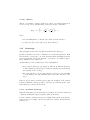
1
RGeostats Manual
D. Renard, F. Ors
June 20th , 2014
Abstract
This document constitutes the users manual for the package RGeostats.
It gives an overall presentation of the package, developed using R language. For a more detailed description of each function, the reader will
refer to its on-line documentation. Finally some tutorials are also available in the standard RGeostats distribution which enable the interested
user to run some examples on provided data sets. You should refer to the
Getting Started manual for installation of RGeostats package.
Part I
History of the RGeostats package
The Centre de Géostatistique of the Ecole des Mines de Paris spent several
years developing different commercial libraries or softwares in the past. Let us
mention:
• GEOSLIB : the first geostatistical library in FORTRAN
• BLUEPACK : a geostatistical package that lasted over 10 years and was
famous in most mining and oil companies over the world
• SIMPACK : a package dedicated to geostatistical stochastic simulations
• HERESIM : a package, developed jointly with Institut Français du Pétrole,
based on the Plurigaussian simulation technique
• ISATIS : the geostatistical toolbox, developed jointly and commercialized
by Géovariances
It is therefore a tradition for the Centre de Géostatistique to imagine, produce
and commercialize the algorithms developed by scientists so that practitioner
1
can apply these fancy techniques to the different fields in their own domain of
activity, without having to bother writing lines of code.
However, these packages do not allow the user to modify the code in order to
test new ideas or algorithms. This is the reason why, starting in late 1990’s,
some researchers started introducing some algorithms in the framework of the R
package. This was initiated with the GEFA package developed for the fisheries
community, which uses geostatistical techniques to forecast the fish density by
species and age. The user could benefit from all the advantages due to the large
number of contributors of R developers, combined to the procedures established
by the researchers of the Centre de Géostatistique.
As usual with writing packages using the R interpreted language, the GEFA
package needed to be strongly improved for improving the calculation speed.
This usually involves writing pieces of the package in using a compiled language
(such as C or C++).
For that reason, the package RGeoS was created in the year 2001 containing
a set of R objects to manipulate data, parameters and results. The package
RGeoS is based on a library of geostatistical code written in C (and C++)
called Geoslib.
Recently, the package RGeoS has been renamed RGeostats during the year
2014 to better explain its contents and avoid conflict with packages with similar
names.
The main characteristics of the RGeostats package is to perform geostatistical
operations simultaneously on several (p) variables in a space of any dimension
(n): we will designate this package as Rn -Rp package. However, some techniques
are not defined for any space dimension, nor any number of variables treated
simultaneously: a special test restricts their usage.
1
What is RGeostats ?
RGeostats is provided as a binary R package for Windows, Linux and Mac
platform . It provides:
• all the R procedures with the corresponding on-line help (use the command
?func_name to access the on-line help of the function func_name)
• the object library of the geostatistical code Geoslib
• some demonstration case studies: the user can run them using the command demo() with the available data sets.
Note that the source code corresponding to the Geoslib library is not available.
2
2
Who can use RGeostats ?
RGeostats can be downloaded by anyone.
RGeostats can be used free of charge in a non-commercial use.
3
The reference to RGeostats
When you use this software for publication, please use the following reference:
Renard D., Bez N., Desassis N., Beucher H., Ors F., Laporte F.
RGeostats: The Geostatistical package [version number].
MINES ParisTech.
Free download from: http://cg.ensmp.fr/rgeostats
4
Where can I find RGeostats ?
The package RGeostats must be downloaded from the web site of the Centre de
Géostatistique of the Ecole des Mines de Paris:
h t t p : / / cg . ensmp . f r / r g e o s t a t s
This site contains several directories, such as:
• the user community Board where you can:
– Download RGeostats package (according to the Operating System
where you want to use the package): this operation requires that you
register to the Board first
– Ask any question about any issue you may encounter
– Learn on how to use specific parts of the package by reviewing the
corresponding Tutorial
• the Documentation directory where you can find several case studies: each
case study contains:
– a PDF file where the case study is fully described
– the ASCII file(s) that are used in the case study: however, these data
sets are already contained in the distribution and can be loaded using
the data() procedure.
• the Demo directory where you can find several demonstration scripts
3
• the Function directory where you can find the on-line help for all functions
The package is provided for few platforms. For each platform, RGeostats is
provided as a single file in an archive format. The extension of the archive file
depends upon the platform:
• Windows 32 or 64 bits: file with extension zip
• LINUX 32 -bits: file with extension linux32.tar.gz
• LINUX 64-bits: file with extension linux64.tar.gz
• Mac: file with extension tgz
5
5.1
Installing the RGeostats package
Installing R
The package R must be installed first. R is a free software environment for
statistical computing and graphics. It compiles and runs on a wide variety of
UNIX platforms, Windows and MacOS. This package can be downloaded from
the site:
h t t p : / / c r a n . r−p r o j e c t . o r g
If available for your Operating System, it is easier to install directly the dedicated binary version. Otherwise, one can always download the source code,
configure it and compile it. Then please follow official information provided on
the site.
The installation requires the Administrator rights.
5.2
Required package
The package Rcpp is required and can be downloaded from the CRAN web site.
5.3
Additional contributions
Moreover, some additional contributions can be downloaded (from the same
site): such as maps and mapproj which are only necessary in some parts of the
package RGeostats and will be only needed upon request.
Each extension comes as an archive file.
4
5.4
Installing an additional contribution
When installaing a package, one may choose between:
• installing it as a permanent extension of R: this operation requires the
Administrator rights as the RGeostats add-on package is written on the
directory where R distribution is installed. The installation is performed
by typing:
R CMD INSTALL mypack
• installing it as a personal extension: this is the case when an extension
often varies. This installation does not require the Administrator rights.
The package is installed on a user’s dedicated directory (say my_dir ) by
typing:
R CMD INSTALL mypack −−l i b r a r y=my_dir
6
6.1
Getting started with RGeostats
Loading the package
You must first start R in a working directory. You may have one working
directory by project. You launch R by typing the corresponding command (or
clicking the corresponding icon on Windows for example)
Within the R session, you must load the RGeostats. If RGeostats has been
installed in the R distribution directory, simply type:
l i b r a r y ( RGeostats )
Otherwise type:
l i b r a r y ( RGeostats , l i b . l o c =/my_dir )
This information can be stored in a specific (hidden) file, called .First, which is
automatically started each time R is loaded in the working directory.
In order to create it, the best solution is to enter the R session and to define it
interactively by typing:
fix (. First )
The previous command launches a text editor. The name of the text editor can
also be parametrized in the .First file for future use.
The contents of the .First file could be something as :
5
. First
function ()
{
l i b r a r y ( RGeostats , l i b . l o c ="/my_dir " )
}
6.2
Additional information on RGeostats
When RGeostats is loaded successfully, the user can check the version of the
RGeostats package. This information may become usefull for further discussion
concerning the ability of the package to perform a given task or to describe a
mysfunctioning:
acknowledge ( " RGeostats " )
The following message is displayed (which may evolve with time):
Package RGeostats ( V e r s i o n :XX.X.X − Date :mm, dd , yy )
=================================================
G e o s l i b L i b r a r y ( V e r s i o n :XX.X.X − Date :mm, dd , yy )
Authors :
D i d i e r RENARD
( d i d i e r . renard@mines−p a r i s t e c h . f r )
N i c o l a s BEZ
( n i c o l a s . bez@ird . f r )
N i c o l a s DESASSIS ( n i c o l a s . d e s a s s i s @ m i n e s −p a r i s t e c h . f r )
Helene BEUCHER
( h e l e n e . beucher@mines−p a r i s t e c h . f r )
Fabien ORS
( f a b i e n . ors@mines−p a r i s t e c h . f r )
F l o r e n c e LAPORTE
Another interesting function (R standard) gives the position where the package
has been loaded by typing:
search ()
The following information is obtained in the R session (the contents depends
upon the R version, the user’s environment and the list of packages already
loaded):
[1]
[4]
[7]
[10]
" . GlobalEnv "
" package : s t a t s "
" package : u t i l s "
" Autoloads "
" package : RGeostats " " package : Rcpp"
" package : g r a p h i c s " " package : g r D e v i c e s "
" package : d a t a s e t s " " package : methods "
" package : b a s e "
The order of the loaded packages may vary depending on the user’s preferences.
It is easy to see that here RGeostats is loaded in position 2.
The user can then type the following command in order to get the list of all the
procedures included in RGeostats:
6
l s ( pos =2)
Another way to learn about each command (say my_command) is to ask for its
calling arguments by typing:
a r g s (my_command)
But obviously the best solution is to get the information on the command by
typing:
?my_command
The information can even be displayed in a more sophisticated manner is the
user has launched a HTML browser beforehand by typing the following command at least once in the R session:
help . s t a r t ()
Part II
Description of the Package
RGeostats
7
Organization
The RGeostats package offers a set of objects. They belong to classes according
to the S4 mechanism (defined in the methods package). Each geostatistical
procedure in RGeostats uses these objects as input arguments (together with
some additional parameters); some procedures produce one object as output.
Each class has some generic methods, some accessors and some specific utilities
attached. A generic method is a function which has an implementation for an
object of any class. An accessor is a specific function which gives access (read
or write) to the different items of the object of any class. A utility is a function
designed specifically to address an object of a given class.
8
Classes
The different classes of RGeostats are characterized by their names. To get
more information on objects of one class, the user can type the command:
c l a s s ? class_name
7
where class_name is the name of one of the previous classes: for example
class?db. The list of classes follows:
db: data base containing the input data or the output results
vario: experimental spatial characteristics calculated from data, such as experimental variograms, covariances, generalized variograms
model: model describing the spatial characteristics, such as the variogram, the
covariance or the generalized covariance model
neigh: set of parameters describing the selection of samples used for processing
a target point, called neighborhood.
anam: set of parameters used to transform a sampled variable from its initial
distribution to a gaussian standardized law, and vice-versa.
rule: the lithotype rule used to convert one or two gaussian random functions
into a categorical variable (facies) through thresholds
thresh: a set of intervals used to convert a variable into a categorical variable
or a set of indicators
polygon: a set of one or several polysets. Each polyset is a closed broken line
defined in 2-D.
tokens: a set of object definitions used for object base simulations
These major classes also use the following auxiliary sub-classes (that the user
should ignore):
vardir: a directional experimental variogram. Any object of the vario class is
a set of one or several objects of the vardir class.
melem: a basic covariance structure. Any object of the model class is a set of
one or several objects of the melem class.
polyset: a 2-D broken line. Any object of the polygon class is a set of one or
several objects of the polyset class.
9
Accessors
An accessor is an operator which enables the user to read or write one field of
an object belonging to a given class, using a simple syntax, without having to
know anything concerning the internal structure of the class. There are four
generic accessors, characterized by their symbol:
$: to read the value of a slot of an object (value read accessor)
8
$<-: to assign a value to a slot of an object (value write accessor)
[: to read the value of a slot of an object which is considered as an array (array
read accessor)
[<-: to assign a value to a slot of an object which is considered as an array
(array write accessor)
The accessors will be illustrated here using the example of the db class (which
will be described more exhaustively in subsequent paragraph).
An accessor is designed in order to question the dimension of the space in which
the db is established:
db$ndim
Another accessor gives access to the coordinates of the grid origin:
db$x0
Note that, as such an accessor is only valid in the case of a grid, it will return
an error is used for a db not organized as a grid.
An object of the db class stores the data values within the field items, which
consists in a data frame: the columns corresponds to the fields and the rows to
the samples. Therefore if we want to access to the value of the third variable
for the second sample, we should use the syntax:
db@items [ 2 , 3 ]
Instead, using the read accessor, we will use the equivalent accessor:
db [ 2 , 3 ]
10
Generic methods
Any object belonging to a class has a set of generic methods attached according
to the S4 mechanism. To get more information on these generic methods, use
the command:
methods ?method_name
where method_name corresponds to the name of the generic function. For
example:
methods ? p l o t
9
Some new generic functions and pseudo-generic functions have been added in
the RGeostats package.
Several generic methods are defined (the same method name can be used for
other objects belonging to other packages). These generic functions use their
first argument as a signature in order to decide upon the exact function that
will be triggered: this signature consists of an object of a given RGeostats class.
show: display the contents of an object belonging to a class
print: display the contents of an object belonging to a class. It may give similar
results as the show generic function, but is used sometimes differently for
specific printouts.
plot: displays the contents of an object belonging to a class
Some generic methods have been added, although they are specific to RGeostats
objects only:
ascii.write: dumps the contents of an object belonging to a class in an ASCII
file according to a specific format. The format is explained separately
together with the class description.
In the following example (where dbobj stands for an object of the class db) the
following command:
p l o t ( dbobj , . . . )
automatically launches the plot command for the db class (command db.plot).
Therefore, the previous command is exactly similar to:
db . p l o t ( dbobj , . . . )
This mechanism is essential in order to understand that the same generic function can have different arguments according to the object to which it is applied.
Finally, some additional functions have been added that can be considered as
pseudo-generic: the first argument cannot be an RGeostats (already existing)
object as we are precisely creating it. Instead, the user must provide the name
of the class as a signature. Otherwise the signature is asked interactively.
The following command gives an example of a pseudo-generic function used to
read an object of the class db from the ASCII file called myfile. The resulting
object will be stored in the RGeostats object called mydb:
mydb <− a s c i i . r e a d ( s i g n a t u r e=db , f i l e n a m e=m y f i l e )
Note that the command methods?method_name is not valid for the pseudogeneric commands. In the following, we will make no difference between generic
and pseudo-generic methods.
The following pseudo-generic methods have been added:
10
ascii.read: read the contents of an object belonging to a class from an ASCII
file according to a specific format.
digitize: digitize an object from a graphic plot
11
ASCII format
Each class has a method for reading or writing the contents of an object which
belongs to this class in an ASCII file. The format is obviously specific to each
class.
Several features are common to these methods, whatever the class:
• the values (numeric or alphanumeric) are separated by blank spaces. They
may be coded on any number of lines: the line change is not significant.
• an alphanumeric variable may not contain any blank, unless the variable
is enclosed within quotes.
• comments can be inserted anywhere: a comment starts with the # character and extends until the end of the line.
• a missing numeric value is replaced by the string -999. Note that the exact
spelling must be used (including the final decimal point).
12
Classes
This paragraph gives more information for each class of the RGeostats package.
It describes systematically:
• the different fields contained in an object of the class
• the syntax of the different accessors
• the generic functions
• the utilities
• the other functions, specific to each class, are merely described in this
manual. The user should refer to their on-line manual for more information.
11
12.1
Db
This class is used to store input data set or output results. It corresponds to a
set of columns (also called fields) defined on a set of samples. The variables are
numeric only and stored as real values (even if they can be printed in integer
format). The samples can be either organized as a regular grid or non organized
(set of isolated points).
12.1.1
Fields
The Db class contains the following slots:
flag.grid: tells if the data base is organized as a grid or not
ndim: Dimension of the space
If the data base is organized as a regular grid:
x0: array (dimension: ndim) which gives the coordinates of the grid origin
(lowest values for each coordinate)
dx: array (dimension: ndim) which gives the extension of the grid mesh in all
space direction
nx: array (dimension: ndim) which gives the number of grid nodes along each
axis
Note that if cells are attached to grid nodes ( in the case of the estimation of
the average target variable over blocks for example), each cell is conventionally
centered on the grid node.
The array of locators (dimension: number of fields). A locator is a specific
identifier followed by its rank (starting from 1). A locator indicates the role
that a given field for the data base plays. The list of identifiers follows:
• x: coordinate
• z: data variable (on which the actual calculations are processed)
• v: measurement error variance
• f: auxiliary variable used as external drift
• g: gradient components
• l : lower bounds for intervals
• u: upper bounds for intervals
12
• p: proportion for categorical variables (facies)
For example, the field attached to the locator ’x1’ gives the first coordinates of
the samples contained in the data base; locator ’f2’ gives the second external
drift. There is no limitation for the rank as RGeostats is designed for any
number of variables and any space dimension.
There are some other locators which can only be either present or absent (there
is no rank):
• w: weighting variable
• code: code variable
• sel: the selection
12.1.2
Accessors
These are the different read/write accessors of some attributes in the class:
db$flag.grid: the grid status
db$ndim: the space dimension
db$x0: the coordinates of the grid origin. If the data base is not organized as
a grid, NA is returned when reading, an error is issued when writing.
db$dx: the meshes of the grid. If the data base is not organized as a grid, NA
is returned when reading, an error is issued when writing.
db$nx: the number of grid meshes. If the data base is not organized as a grid,
NA is returned when reading, an error is issued when writing.
db$locators: the list of locators for the different fields of the data base.
db$names: the list of names for the different fields of the data base.
db$items: the set of values for the different fields of the data base (produced
as a data.frame)
db$nech: number of samples. It is not defined when writing.
db$natt: number of variables. It is not defined when writing.
These are the different read/write accessors of some arrays in the class:
db[i,j]: the value for the field j for the sample i
db[i,]: the values for all fields for the sample i
13
db[,j]: the values of field j for all samples
db[,]: all the values of the data base (gives the same result as the command
db[] or db$items)
Errors are issued if the rank of the field or the rank of the sample is erroneous.
12.1.3
Generic functions
db.digit: Digitize a point location from a graphic screen. If a data base is
passed as argument, return the characteristics of the sample (from a Regular Grid or the Set of Points) closest to the digitized point. This function
corresponds to the generic command digitize.
db.plot: Represent the contents of a data base graphically. This function corresponds to the generic command plot.
db.print: Print the contents of a data base. This function corresponds to the
generic command print.
db.read: Create a data base by reading an ASCII file according to the format
specific to RGeostats. This function corresponds to the generic command
ascii.read.
db.write: Write the contents of a data base into an ASCII file according to the
format specific to RGeostats. This function corresponds to the generic
command ascii.write.
12.1.4
Utilities
These utilities are specific to the Db class. They are merely described in this
manual. The interested user will use the on-line help for more information:
db.add: Add new fields. This command also allows the creation of new variables as the on-the-fly transformation of already existing variables: this
command is considered as the only transformation method within the
RGeostats package. It can also be used to specify the locators of the
newly created fields
db.compare: Calculate statistics (count, mean,variance, standard deviation,
minimum, maximum) between different variables within the same data
base.
db.create: Create a new data base, assigning its type (Regular Grid or Set
of Points) and defining its general characteristics (space dimension, grid
characteristics, number of points, ...).
14
db.delete: Delete an already existing data base.
db.edit: Edit the contents of the data base. This command does not include
any feature for adding a new variable: you should use the command db.add
beforehand.
db.extract: Retrieve one or several variables from a data base into a separate
data.frame structure.
db.getcol: Return the rank a variable within the data base, from its locator
type and rank.
db.getname: Return the name of a variable within the data base, from its
locator type and rank.
db.grid.init: Create a new data base, organized as a Regular Grid, tailored
from an already existing input data base. The new Grid covers the initial
data base in all the directions of the space.
db.grid.locate: Return the absolute grid node located close to a point whose
coordinates are given as input arguments.
db.indicator: Create new variables in the data base, corresponding to the
indicators of the variable (corresponding to a z locator), given the set of
threshold (passed as argument as an object belonging to the thresh class).
db.info: Return a list of data base characteristics
db.locate: Set the locator for one or several variables within a data base
db.normalize: Normalize a set of variables defined by their field numbers
within the data base
db.polygon: Use an input polygon to select the samples of the data base (Regular Grid or Set of Points) which are included within at least one of the
polysets constituting the Polygon (passed as argument as an object of the
polygon class)
db.projec: Apply the projection of a data base. The characteristics of the
projection must be defined beforehand using the command projec.define.
db.read.format: Create a data base organized as a Regular Grid by reading
the contents of an ASCII file, according to the format BMP or ZYCOR.
db.rename: Change the name of a variable within a data base
db.rule: Convert a numerical variable into a new categorical variable according
to a Lithotype Rule (passed as argument as an object of the rule class)
and a set of proportions (either passed as an argument if stationary or
contained in proportion variables of the data base otherwise).
15
db.selcombine: Combine the currently created selection to a selection already
existing within the data base using a logical operation (or, and, not, xand,
xor).
db.sel: Create a selection variable. This command also allows the creation of a
new selection as the on-the-fly transformation of already existing variables.
db.start: Attach a data base to be used by a C code. This function should only
be used prior to a call to C code which expects a data base: the data base
will be connected using the slot number returned by the function db.start.
db.stat: Calculate the statistics (count, mean, variance, correlation, minimum,
maximum, ...) or one or several fields of the data base.
db.thresh: Convert a numerical variable into a categorical variable using the
thresholding information (passed as argument as an object of the thresh
class).
db.write.format: Write the contents of a data base in an ASCII file, according
to one of the following formats: CSV, IRAP or ZYCOR (the two last
format are limited to Regular Grid data bases).
12.1.5
ASCII format
Format of the ASCII file for an object of the db class :
• A header line containing the list of locators (see the corresponding definition in the Fields paragraph)
If the object is a grid file, the header contains:
• the number of grid meshes in each direction
• the coordinate of the grid origin (lower left corner) in each direction
• the value of the grid mesh in each direction
The set of values:
• the set of real values corresponding to the different variables measured at
the samples. We usually consider one sample per line. The set of real
values is optional in the case of Grid Db.
16
12.2
Vario
The Vario class contains the information of the experimental variogram calculated from one or several variables contained in a data base. The term variogram
is generic as it covers the following structural tools:
• Variogram
• Covariance (Centered)
• Transitive Covariogram
• Madogram (Variogram of order 1)
• Rodogram (Variogram of order 1/2)
• Variogram of a Poisson-weighted variable
If the data base contains several variables (with locator z ), the corresponding
experimental structural tools are then multivariate: we obtain several crossvariograms instead of a variogram for example.
Finally, the experimental structural tools can be calculated in several directions:
samples are compared as long as they belong to a given direction, up to an
angular tolerance.
12.2.1
Fields
The Vario class contains the following slots:
calcul: the type of structural tool
by.sample: the way the calculations are performed. When set to TRUE, a
sample (seed) is selected and the corresponding sample-variogram is calculated by comparing the seed to any other sample according to distance
and angular selection criteria. The final variogram is obtained as the average of the sample-variograms. When set to FALSE, the variogram is
calculated in the classical way.
ndim: Space dimension.
nvar: Number of variables used for the calculation of the experimental structural tool.
opt.code: Option concerning the use of the code during the calculation of the
experimental structural tool:
0: samples are compared whatever the value of the code (if defined),
17
1: two samples can be compared if the code variable is defined and the difference of the code values (at samples) is smaller than the parameter
tolcode,
2: two samples can be compared if the code variable is defined and the
code values (at samples) are different
scale: Scale value
tolcode: Tolerance for code, used when opt.code is defined and equal to 1
means: Array of the means of the variables under consideration. They are used
for the Poisson variogram calculation
vars: Array of variances of the variables under consideration. They are used
for the graphic representations
vardirs: An array of direction variograms (see below).
The experimental directional variogram Vardir contains the following slots:
npas: Number of calculation lags for the calculation in a direction.
npatot: Number of calculation values. This number is equal to npas for symmetric structural tools (variogram) and equal to 2*npas+1 for asymmetric
structural tools (covariance).
pas: Lag value.
tol: Tolerance on the distances, defined as a percentage of the lag value.
flag.regular: Flag set to 1 if the lags are defined regularly as multiples of the
parameter pas. When set to 0, the lags are calculated using the parameter
breaks as thresholds on distances.
breaks: Array giving the thresholds applied on distances in order to derive the
lags.
codir: Vector defining the direction for experimental structural tool.
size: Dimension of the variogram arrays
sw: Array containing the weights attached to each variogram lag
hh: Array containing the average distance attached to each variogram lag
gg: Array containing the average value of the structural tool attached to each
variogram lag
18
12.2.2
Accessors
These are the different read/write accessors of some variables in the class:
vario$calcul: Type of calculation of the experimental structural tool.
vario$by.sample: Way the variogram calculation is performed.
vario$ndim: Space dimension.
vario$nvar: Number of variables.
vario$ndir: Number of directions for the calculation of experimental structural
tools (not allowed for writing)
vario$opt.code: Option concerning the use of the code during the calculation
of the experimental structural tool.
vario$tolcode: Tolerance for the use of the code during the calculations.
vario$means: Array of means of the variables.
vario$vars: Array of variances of the variables.
vario$vardirs: Array of directional variogram calculations (not defined for
writing).
These are the different read/write accessors of some variables in the Vardir class:
vardir$npas: Number of lags.
vardir$npatot: Number of calculated values.
vardir$pas: Lag value.
vardir$tol: Tolerance on distance.
vardir$flag.regular: Flag specifying if regular distances are considered or if
lags are calculated using thresholds defined using the breaks parameter.
vardir$codir: Direction definition vector
vardir$size: Dimension of the variogram arrays
vardir$sw: Array of weights (not defined for writing)
vardir$hh: Array of distances (not defined for writing)
vardir$gg: Array of variogram values (not defined for writing)
These are the different read/write accessors of some arrays in the class:
19
vario[i,j,k,l]: The experimental structural tool in the direction i, for the pair
of variables j and k and for the lag l. The output is a list composed of
three element: sw (weight), hh (distance) and gg (structural tool).
vario[i,j,k]: The experimental structural tool in the direction i, for the pair of
variables j and k, for all the lags. The output is a structure of class vardir.
vario[i]: The experimental structural tool in the direction i, for all pairs of
variables and for lags. The output is a structure of class vardir.
These are the different read/write accessors of some arrays in the class vardir :
vardir[i,j,k]: The experimental structural tool for the pair of variables i and
j and for the lag k. The output is a list composed of three element: sw
(weight), hh (distance) and gg (structural tool).
vardir[i,j]: The experimental structural tool for the pair of variables i and j,
for all the lags. The output is a structure of class vardir.
12.2.3
Generic functions
vario.plot: Represent the contents of a experimental structural tool graphically. This function corresponds to the generic command plot.
vario.print: Print the contents of an object belonging to the Vario class. This
function corresponds to the generic command print.
vario.read: Create a new Vario object by reading the contents of an ASCII file
according to a format specific to the RGeostats package. This function
corresponds to the generic command ascii.read.
vario.write: Write the contents of a Vario object into an ASCII file according
to a format specific to the RGeostats package. This function corresponds
to the generic command ascii.write.
12.2.4
Utilities
These utilities are specific to the Vario class. They will be merely described in
this manual. The interested user will use the on-line help for more information.
Note that the specific functions used to calculate the variograms in different
conditions will not be described in this paragraph:
vario.window: Return information on the graphic window containing the graphic
representation of an experimental variogram. This information essentially
concerns the extension of the window and its possible dilation.
vario.model.check: Check if an object of the class Model and an object of the
class Vario are compatible. This test relies on the space dimension and,
optionally, on the number of variables.
20
12.2.5
ASCII format
Format of the ASCII file for an object of the vario class:
• Dimension of the space
• Number of variables
• Number of directions where the experimental variogram is calculated
• Option for the code selection:
0: no selection performed on the code
1: samples are compared only if the distance between their codes is smaller
(or equal) than the tolerance for code selection
2: samples are compared only if their codes are different
• Tolerance for code selection (only used if the option for the code selection
is set to 1)
• Scaling factor (only used for the transitive covariogram)
For each direction, the following parameters:
• Flag for regular lags
• Number of lags
• Lag value
• Tolerance on the angles
• Direction coefficients: vector whose dimension is equal to the space dimension
• Direction increments defined as increments on the grid: vector whose dimension is equal to the space dimension
If the experimental variograms, the following information is dumped out for
each lag:
• the weight attached to the lag (usually the number of pairs)
• the average distance
• the variogram value
21
12.3
Model
The Model class contains the information of the structural model composed
of one or several basic structures. Note that the drift information (which is
usually attached to the Model definition) is not stored within an object of the
class Model.
The model is the necessary ingredient for geostatistical procedures such as kriging or simulations, as it describes the structural characteristics for any distance
and any direction in the space.
12.3.1
Field
An object of the class Model contains the following fields:
ndim: Space dimension
nvar: Number of variables
basics: An array of objects belonging to the class melem used to describe the
basic structures and described below.
An object of the class Melem contains the following fields:
vartype: Type of basic structure. In RGeostats, their is a large number of
basic structures available: however, not that all basic structures are not
available in any case: in particular, some of them are limited to certain
range of space dimension; others are not available depending on the degree
of intrinsicity of the model. The following list shows the available basic
structures together with their corresponding names:
Nugget Effect: nugget effect component
Exponential: exponential structure
Spherical: Spherical structure
Cubic: Cubic structure
Gaussian: Gaussian structure
Cardinal Sine: Cardinal Sine structure
J Bessel: Structure corresponding to the J Bessel function
K Bessel: Structure corresponding to the K Bessel function
Gamma: Gamma structure
Cauchy: Cauchy structure
Stable: Stable structure
Linear: Linear structure (used in intrinsic case or in cases with drift)
22
Power: Power structure
Order-1 GC: Generalized Covariance of order 1 (only used in the intrinsic case and in cases with drift)
Order-3 GC: Generalized Covariance of order 3 (only used for cases with
linear or higher degree drifts)
Order-5 GC: Generalized Covariance of order 5 (only used for cases with
quadratic or higher degree drifts)
Exp2dfact: Factorized structure with an Exponential in 2-D and an exponential along the third direction
Expfact: Factorized exponential structure
Reg1D: variogram with hole effect obtained from the residuals of a random function with a linear variogram to which a moving average is
subtracted
sill: Array of sills for the current basic structure. This is a square matrix, with
a dimension equal to the number of variables), which must be definite
positive. In the monovariate case, this sill is a single value for each basic
structure. The term sil l is generic as it contains any multiplicative coefficient, regardless of the fact that the covariance actually presents a genuine
sill: in particular, this parameter contributes to the slope value in the case
of linear variogram.
range: Range of the structure. The term range is generic as it corresponds
to a scaling factor for the distances, regardless of the fact that the covariance actually presents a genuine range: in particular, this parameter
contributes to the slope value in the case of linear variogram. Note that
the range actually corresponds to the practical range (rather than the
theoretical one).
param: Third parameter necessary for some special basic structures (such as
power model for example)
flag.aniso: Flag which tells if some anisotropy must be considered or not. This
flag, when FALSE, shortens the calculations and gains computing time.
aniso.rotmat: Array which gives the rotation matrix used in an anisotropic
case (flag.aniso = TRUE). Its dimension is equal to the space dimension.
aniso.coeffs: Array which gives the anisotropy coefficients that divides the
(isotropic) range in order to obtain the anisotropic range along each direction (after rotation).
For more information on the models, please refer to the Model Appendix.
23
12.3.2
Accessors
These are the different read/write accessors of some variables in the model class:
model$ndim: Space dimension.
model$nvar: Number of variables.
model$ncova: Number of basic structures (not available for writing).
model$basics: Array of objects of class Melem containing the characteristics
of a basic structure.
These are the different read/write accessors of some variables in the melem class:
melem$vartype: Type of the basic structure.
melem$sill: Array of sills (or slopes).
melem$range: Range or scale factor.
melem$param: Third parameter.
melem$flag.aniso: Flag telling if the anisotropy is required.
melem$aniso.rotmat: Anisotropy rotation matrix
melem$aniso.coeffs: Array of anisotropy coefficients.
This is the read/write accessor of an array in the class:
model[i]: The object of the melem class containing the basic structure i.
12.3.3
Generic functions
model.plot: Represent the contents of a model graphically. This function corresponds to the generic command plot.
model.print: Print the contents of an object belonging to the Model class.
This function corresponds to the generic command print.
model.read: Create a new object belonging to the Model class by reading the
contents of an ASCII file according to a format specific to the RGeostats
package. This function corresponds to the generic command ascii.read.
model.write: Write the contents of an object of the Model class into an ASCII
file according to a format specific to the RGeostats package. This function
corresponds to the generic command ascii.write.
24
12.3.4
Utilities
These utilities are specific to the Model class. They will be merely described
in this manual. The interested user will use the on-line help for more information. Note that the different specific functions used to fit the model will not be
described in this paragraph:
model.eval: Evaluate the Model for a given set of variables, a given direction
and a given set of distances.
model.extend: Convert a monovariate model into a multivariate one.
model.grid: Create a new grid with a variable containing the value of the
model evaluated at each grid node.
model.input: Define the model interactively.
model.pgs: Given the model of the underlying Random Gaussian variable and
an experimental variogram of indicators, evaluate the theoretical variogram according to the PGS method.
model.sample: Sample a model along the lags of an experimental variogram
specified in an object of the Vario class.
model.window: Return information on the graphic window containing the
graphic representation of a model. This information essentially concerns
the extension of the window and its possible dilation.
12.3.5
ASCII format
Format of the ASCII file for an object of the model class:
• Dimension of the space
• Number of variables
• Dimension of the field (used to build the stationary equivalent covariance
of generalized covariance)
• Radius of the convolution ball (only used for gradient calculation)
• Number of basic structures (covariance, variogram or generalized covariance)
• Number of basic drift functions
For each basic structure:
• the type (see the appendix for the list of basic structures)
25
• the range. In the anisotropic case, this value will serve as the reference
isotropic range.
• the third parameter (it must be provided even if not necessary for the
given structure)
For each basic drift function:
• the type (see the appendix for the list of the drift functions)
Per basic structure:
• the (square) matrix of sills which should be definite positive: its dimension
is equal to the number of variables
12.4
Neigh
The Neigh class contains the information of the neighborhood which defines the
selection of the active samples used in the estimation or the simulation of a
target site.
This neighborhood belongs to one of the following three characteristics:
• Unique neighborhood where all samples are systematically selected for
each target site
• Moving Neighborhood where only a selection of active samples is chosen
which moves with the location of the target site
• other neighborhoods which are defined specifically for some applications,
such as :
– Image Neighborhood used when processing information defined on a
Regular Grid
– Bench Neighborhood where all the samples belonging to a horizontal
slice (called a bench) are systematically selected for all the target
sites which belong to this slice.
12.4.1
Fields
An object of the class Neigh contains the following fields:
ndim: Space dimension
type: Type of neighborhood according to the following list:
26
0: Unique Neighborhood
1: Bench Neighborhood
2: Moving Neighborhood
The subsequent parameters are valid only in the case of Moving Neighborhood.
flag.sector: Specify if the Moving Neighborhood must be performed selecting
samples according to the sector to which they belong
flag.aniso: Specify if the Moving Neighborhood must be considered as anisotropic.
The distance from each sample to the target site must be converted into
an isotropic equivalent distance before the selection algorithm is applied.
flag.rotation: Specify if the Anisotropy of the Moving Neighborhood must be
rotated.
nmini: Minimum number of samples in the Neighborhood. If this number is
not reached, the target site is not processed.
nmaxi: Maximum number of samples in the Neighborhood. This value serves
for dimensioning the arrays.
nsect: Number of angular sectors (only if flag.sector is set to TRUE).
nsmax: Maximum number of samples selected per angular sector (only if flag.sector
is set to TRUE).
dmax: Maximum isotropic distance
coeffs: Array of anisotropic coefficients (only used if flag.aniso is set to TRUE)
rotmat: Rotation anisotropy matrix (only used if flag.aniso is set to TRUE)
The subsequent parameter is valid only in the case of Bench Neighborhood:
width: Width of the vertical bench
The subsequent parameters are valid only in the case of Image Neighborhood:
radius: Radius of the image neighborhood (defined in terms of grid nodes)
skip: Skipping ratio for the selection of the Image Neighborhood. For example,
in an Image Neighborhood in 2-D with a radius of 5, the number of grid
nodes contained in a Neighborhood is equal to 121. For a skipping ratio
of 1, all 121 samples are used; for a skipping ratio of 2, only 61 samples
are selected.
27
12.4.2
Accessors
These are the different read/write accessors of some variables in the neigh class:
neigh$ndim: Space dimension
neigh$type: Type of the Neighborhood:
0: Unique Neighborhood
1: Bench Neighborhood
2: Moving Neighborhood
neigh$flag.sector: Tells if the Moving Neighborhood search uses sectors
neigh$flag.aniso: Tells if the Moving Neighborhood uses anisotropic distance
neigh$flag.rotation: Tells if the anisotropy of the Moving Neighborhood is
defined in a rotated system
neigh$nmini: Minimum number of samples in the Moving Neighborhood
neigh$nmaxi: Maximum number of samples in the Moving Neighborhood
neigh$nsect: Number of angular sectors
neigh$nsmax: Maximum number of selected samples per angular sector
neigh$width: Width of the bench for Bench Neighborhood
neigh$dmax: Maximum isotropic distance
neigh$coeffs: Array of anisotropic coefficients
neigh$rotmat: Rotation matrix for the anisotropy
neigh$radius: Radius for the Image Neighborhood
neigh$skip: Skipping ratio for the Image Neighborhood
12.4.3
Generic functions
neigh.print: Print the contents of an object belonging to the Neigh class. This
function corresponds to the generic command print.
neigh.plot: Represent the contents of an object of the Neigh class graphically.
This function corresponds to the generic command plot.
neigh.read: Create a new object of the Neigh class by reading the contents
of an ASCII file according to a format specific to the RGeostats package.
This function corresponds to the generic command ascii.read.
neigh.write: Write the contents of an object of the Neigh class into an ASCII
file according to a format specific to the RGeostats package. This function
corresponds to the generic command ascii.write.
28
12.4.4
Utilities
These utilities are specific to the Neigh class. They will be merely described in
this manual. The interested user will use the on-line help for more information.
neigh.init: Create an object of the class Neigh according to one of the possible
types.
neigh.input: Create an object of the Neigh class interactively
12.4.5
ASCII format
Format of the ASCII file for an object of the neigh class:
• Type of Neighborhood:
0:
1:
2:
3:
Unique neighborhood
Bench neighborhood
Moving neighborhood
Image neighborhood
For the Unique Neighborhood, no other parameter is required.
For the Bench Neighborhood:
• Cross-validation flag: 1 to switch this option ON; 0 otherwise
• Width of the bench along the last space dimension (for example: along
the third coordinate in the 3-D case)
For the Moving Neighborhood:
• Cross-validation flag: 1 to switch this option ON; 0 otherwise
• Flag for a search using angular sectors
• Minimum number of samples below which the treatment is not performed
• Maximum number of samples in the neighborhood
• Number of angular sectors
• Maximum number of samples per angular sector
• Maximum isotropic radius of the neighborhood
For the Image Neighborhood:
• Cross-validation flag: 1 to switch this option ON; 0 otherwise
• Skipping ratio
• Radius of the Image Neighborhood (0: central node)
29
12.5
Anam
The Anam class describes the Gaussian Anamorphosis Transform which enables
the transformation of a variable from a raw (variable denoted Z ) to a )normalized) gaussian scale (variable denoted Y ), and vice-versa. This transform is
captured as a polynomial expansion using (a limited set of) Hermite polynomials. For the back transform (from gaussian to raw scale), the raw variable is
assumed to be bounded.
12.5.1
Fields
An object of the class Anam contains the following fields:
nh: Number of Hermite polynomials in the expansion
pymin, pymax: Practical bounds in the Gaussian scale
pzmin, pzmax: Practical bounds in the Raw scale
aymin, aymax: Absolute bounds in the Gaussian scale
azmin, azmax: Absolute bounds in the Raw scale
variance: Variance of the data (used to scale the Gaussian Anamorphosis
Transform)
psi: Array of coefficients of the Hermite polynomials
12.5.2
Accessors
These are the different read/write accessors of some variables in the anam class:
anam$nh: Number of Hermite polynomials
anam$pymin, anam$pymax: Practical bounds in the Gaussian scale
anam$pzmin, anam$pzmax: Practical bounds in the Raw scale
anam$aymin, anam$aymax: Absolute bounds in the Gaussian scale
anam$azmin, anam$azmax: Absolute bounds in the Raw scale
anam$variance: Variance of the data
anam$psi: Array of coefficients of the Hermite polynomials
This is the read/write accessor of an array in the Anam class:
anam[i]: The coefficient of the ith Hermite polynomial.
30
12.5.3
Generic functions
anam.print: Print the contents of an object belonging to the Anam class. This
function corresponds to the generic command print.
anam.read: Create a new object of the Anam class by reading the contents
of an ASCII file according to a format specific to the RGeostats package.
This function corresponds to the generic command ascii.read.
anam.write: Write the contents of an object of the Anam class into an ASCII
file according to a format specific to the RGeostats package. This function
corresponds to the generic command ascii.write.
12.5.4
Utilities
These utilities are specific to the Anam class. They will be merely described in
this manual. The interested user will use the on-line help for more information:
anam.fit: Fit the Gaussian Anamorphosis starting from a Raw variable.
anam.y2z: Transform a Gaussian variable into a Raw variable, using the Anamorphosis Transform function stored in an object of the Anam class.
anam.z2y: Transform a Raw variable into a Gaussian variable, using the Anamorphosis Transform function stored in an object of the Anam class.
12.5.5
ASCII format
Format of the ASCII file for an object of the anam class:
• Number of Hermite polynomials
• Minimum absolute value for Z
• Maximum absolute value for Z
• Minimum absolute value for Y
• Maximum absolute value for Y
• Minimum practical value for Z
• Maximum practical value for Z
• Minimum practical value for Y
• Maximum practical value for Y
31
• Flag for Storage of Calculation Results: if 1, the coefficients of the Hermite
polynomials are printed next
If calculations are dumped out:
• Calculated variance
• Coefficients of the Hermite polynomials : vector of dimension equal to the
number of Hermite polynomials)
12.6
Polygon
An object of the Polygon class contains one or several Polysets. A Polyset if a
2-D closed polyline which is used to:
• select samples lying within the Polyset
• delineate a domain where the average of the variable must be estimated
12.6.1
Fields
An object of the Polygon class presents the following fields:
sets: An array of objects belonging to the class Polyset used to describe the
basic closed polyline.
An object of the class Polyset contains the following fields:
x: Array of coordinates along X of the polyline vertices
y: Array of coordinates along Y of the polyline vertices
12.6.2
Accessors
These are the different read/write accessors of some variables in the Polygon
class:
polygon$npol: Number Polysets contained in the Polygon
polygon$surface: Surface of the Polygon
polygon$xlim: Minimum and maximum coordinates of the polygon along X
polygon$ylim: Minimum and maximum coordinates of the polygon along Y
This is the read/write accessor of an array in the Polygon class:
polygon[i]: The ith Polyset
polygon[i,j]: the 2-D coordinates of the jth vertex of the ith Polyset.
32
12.6.3
Generic functions
polygon.plot: Represent the contents of an object of the Polygon class graphically. This function corresponds to the generic command plot.
polygon.print: Print the contents of an object belonging to the Polygon class.
This function corresponds to the generic command print.
polygon.read: Create a new object of the Polygon class by reading the contents of an ASCII file according to a format specific to the RGeostats
package. This function corresponds to the generic command ascii.read.
polygon.write: Write the contents of an object of the Polygon class into an
ASCII file according to a format specific to the RGeostats package. This
function corresponds to the generic command ascii.write.
12.6.4
Utilities
These utilities are specific to the Polygon class. They will be merely described in
this manual. The interested user will use the on-line help for more information:
polygon.create: Create a new Polygon or add a new Polyset to an already
existing Polygon.
polygon.digit: Digitize one or several new Polysets from a plot, in order to
produce a new Polygon.
polygon.inside: Checks if a set of points (characterized by the vectors of first
two coordinates) belong to a Polygon or not.
polygon.projec: Apply the current projection to the vertices of a Polygon.
polygon.start: Attach a Polygon to be used by a C code. This function should
only be used prior to a call to C code which expects a Polygon: the
Polygon will be connected using the slot number returned by the function
polygon.start.
12.6.5
ASCII format
Format of the ASCII file for an object of the polygon class:
• Number of Polysets in the Polygon
For each Polyset:
• Number of vertices
• 2-D Coordinates of the polyset vertices
33
12.7
Thresh
An object of the Thresh class contains a set of threshold intervals. Each interval
is constituted by its two bounds, defined or not.
12.7.1
Fields
An object of the Thresh class presents the following fields:
nclass: Number of intervals
bounds: Matrix defining the lower and upper bounds of the intervals
12.7.2
Accessors
These are the different read/write accessors of some variables in the Thresh
class:
thresh$nclass: Number of intervals
thresh$bounds: Matrix of bounds
This is the read/write accessor of an array in the Thresh class:
thresh[i,j]: The jth bound of the ith interval. The argument i is limited to the
number of intervals (nclass) and the argument j is limited to 2
thresh[,j]: The vector of the jth bound for all intervals.
thresh[i,]: The bounds of the ith interval.
thresh[]: The matrix of bounds.
12.7.3
Generic functions
thresh.print: Print the contents of an object belonging to the Thresh class.
This function corresponds to the generic command print.
12.7.4
Utilities
These utilities are specific to the Thresh class. They will be merely described in
this manual. The interested user will use the on-line help for more information:
thresh.input: Define a new object of the Thresh class interactively.
34
12.8
Rule
An object of the Rule class contains the lithotype rule which enables the translation of a set of underlying random gaussian variables (GRF) into a categorical
variable presenting several facies.
The lithotype rule is represented for two GRFs: this 2-D space is subdivided
into as many rectangular areas as facies, which constitute a partition of 2-D.
Note that, to define the areas for n facies, it suffices to define n-1 edges (or
nodes).
12.8.1
Fields
An object of the Rule class presents the following fields:
nbnode: Number of nodes (equal to the number of facies - 1)
mode.rule: Type of Lithotype Rule definition:
0: Standard Lithotype Rule
1: Shift: the second GRF is a shifted version of the first GRF
2: Shadow: a shadow is applied to the first GRF
rho: Correlation between the two underlying GRFs (only used for standard
Lithotype Rule)
slope: Slope for the shadow calculation (only used for the shadow option)
dinf: Elevation of the plane where the shadow is calculated (only used for the
shadow option)
dsup: Maximum elevation above which the relief is truncated before calculating
its shadow (only used for the shadow option)
shift: Value for the shift (only used for the shift option)
nodes: Array for the characterization of the nodes
The array nodes provides the definition of the nbnode nodes. They are defined
as a nested list. Each node corresponds to a vector of the following six values:
0: Type of the parent node
1: Rank of the parent node
2: Orientation with respect to the parent node
3: Type of the current node
35
4: Rank of the current node
5: Facies value
A node type may be one of the following values:
0: for a node defining a facies
1: for a node defining a threshold along the first GRF
2: for a node defining a threshold along the second GRF
The orientation (with respect to the parent node) is:
1: if the current node concerns values of the GRF smaller than the threshold
corresponding to the parent node
2: if the current node concerns values of the GRF larger than the threshold
corresponding to the parent node
12.8.2
Accessors
These are the different read/write accessors of some variables in the Rule class:
rule$nbnode: Number of nodes
rule$mode.rule: Type of Lithotype Rule
rule$rho: Correlation coefficient between the two underlying GRFs
rule$slope: Slope (for the Shadow Lithotype Rule)
rule$dinf: Plane elevation (for the Shadow Lithotype Rule)
rule$dsup: Relief truncation (for the Shadow Lithotype Rule)
rule$shift: Shift (for the Shifted Lithotype Rule)
rule$nodes: Array defining the node characteristics
12.8.3
Generic functions
rule.print: Print the contents of an object belonging to the Rule class. This
function corresponds to the generic command print.
rule.plot: Represent the contents of an object of the Rule class graphically.
This function corresponds to the generic command plot.
36
rule.read: Create a new object of the Rule class by reading the contents of an
ASCII file according to a format specific to the RGeostats package. This
function corresponds to the generic command ascii.read.
rule.write: Write the contents of an object of the Rule class into an ASCII file
according to a format specific to the RGeostats package. This function
corresponds to the generic command ascii.write.
12.8.4
Utilities
These utilities are specific to the Rule class. They will be merely described in
this manual. The interested user will use the on-line help for more information:
rule.input: Define a new object of the Rule class interactively.
12.8.5
ASCII format
Format of the ASCII file for an object of the rule class:
• Mode used for the definition of the Lithotype Rule:
0: Standard option
1: Shift Rule definition
2: Shadow Rule definition
• The correlation coefficient between the two underlying gaussian random
functions (only used in the standard case)
The next parameters are only used for the "Shadow" option (although they
must be defined anyway):
• The slope of the shadow
• The lower truncation value
• The upper truncation value
The next parameters are only used for the "Shift" and the "Shadow" options
(although they must be defined anyway):
• The shift value along X
• The shift value along Y
• The shift value along Z
37
The rest of this file contains the definition of the different nodes used to define
the Lithotype Rule. We must first define:
• The number of subsequent nodes
Per node, we must define:
• The type of the parent node
• The rank of the parent node
• The orientation of the parent node
• The type of the node:
0: Facies)
1: Threshold along Y1
2: Threshold along Y2
• The rank of the new node (starting from 1)
• The rank of the facies
12.9
Tokens
An object of the Tokens class contains the characteristics of the families of
tokens used when performing an Object Based Simulation. Each family of
tokens contain a variable number of parameters depending on its type, as well
as its proportion.
12.9.1
Fields
An object of the Tokens class presents the following fields:
nbtokens: Number of token families
nbparams: Total number of parameters describing the geometry of the tokens
types: List of the token types
props: Array giving the proportion for each token family. These proportions
should add up to 1.
mean: Array of centers for the parameters defining the geometry of the tokens
stdev: Array of radii for the parameters defining the geometry of the tokens.
38
12.9.2
Generic functions
token.print: Print the contents of an object belonging to the Token class. This
function corresponds to the generic command print.
12.9.3
Utilities
These utilities are specific to the Tokens class. They will be merely described in
this manual. The interested user will use the on-line help for more information:
token.input: Define a new object of the Token class interactively.
13
The graphics
This paragraph gives the general information on the graphics used in RGeostats.
A first remarks is that each graphic page contains several scenes by default: some
applications may only use one figure (plot of a db) but other applications benefit
from this multiple scenes behavior (plot a multivariate variogram or model). The
technique used for this multiple scenes (i.e. split.screen) is incompatible with
the other multi-screen procedure such as mfrow.
The multiple scene organization is compatible with another split of the screen already defined by the user. For this sake, all the graphic procedures of RGeostats
provide the reset parameter:
• if reset=TRUE (default value), any graphic will first erase any already
existing page subdivision
• if reset=FALSE, the current page subdivision is kept and the current
graphic (which may itself be subdivided) is produced in the current scene.
39
Appendices
14
Model definition
The package RGeostats offers a list of basic structures that can be used in order
to construct a Model. Each basic structure is now described with its exact
formula.
We recall that:
• the basic structure includes covariances, variograms or generalized covariances
• a covariance is a particular variogram (bounded), a variogram (and therefore a covariance0 is a particular generalized covariance
• a basic structure is valid for certain space dimensions
• in all subsequent formulae, the value h defines the modulus of the (isotropic)
distance: therefore, this distance is always positive
• some covariance use a practical range which corresponds to the distance
beyond which the covariance reaches 95% of the sill value
14.1
14.1.1
List of the Basic structures
Nugget Effect
This is a covariance, defined for any space dimension:
C(h) = C0 δ(h)
where:
• C0 is the sill
• δ(h) is a function which returns 1 if h = 0, and 0 for strictly positive
distance
40
14.1.2
Exponential
This is a covariance, defined for any space dimension:
h
C(h) = C × exp −
a/s
where:
• C is the sill
• a is the (practical) range
• s = 2.995732
14.1.3
Spherical
This is a covariance, defined up to the third space dimension:
"
3h 1
C(h) = C × 1 −
+
2a 2
3 #
h
a
where:
• C is the sill
• a is the range
14.1.4
Gaussian
This is a covariance, defined for any space dimension:
C(h) = C × exp −
where:
• C is the sill
• a is the (practical) range
• s = 1.730818
41
h
a/s
2 !
14.1.5
Cubic
This is a covariance, defined up to the third space dimension:
35h3
7h5
3h7
C(h) = C × 1 − 7h2 +
−
+
4
2
4
where:
• C is the sill
• a is the range
14.1.6
Cardinal Sine
This is a covariance, defined for any space dimension:
C(h) = C ×
sin
h
a/s
h
a/s
where:
• C is the sill
• a is the (practical) range
• s = 20.371
14.1.7
J-Bessel
14.1.8
K-Bessel
14.1.9
Gamma
This is a covariance, defined for any space dimension:
"
C(h) = C ×
#
1
1+
h α
a
where:
• C is the sill
• a is the range
• α is the (positive) exponent defined as the third parameter
42
14.1.10
Cauchy
This is a covariance, defined for any space dimension:
C(h) = C ×
1
1+
α
h 2
a
where:
• C is the sill
• a is the range
• α is the (positive) exponent defined as the third parameter
14.1.11
Stable
This is a covariance, defined for any space dimension:
α h
C(h) = C × exp −
a
where:
• C is the sill
• a is the range
• α is the exponent defined as the third parameter which lies within [0; 2]
14.1.12
Linear
This is a variogram, defined for any space dimension:
γ(h) = C ×
h
a
where:
• C is the multiplicative coefficient (also called sill in the interface)
• a is the scale factor (also called range in the interface)
43
14.1.13
Power
This is a variogram, defined for any space dimension:
α
h
γ(h) = C ×
a
where:
• C is the multiplicative coefficient (also called sill in the interface)
• a is the scale factor (also called range in the interface)
• α is the exponent defined as the third argument which must lie within
[0; 2]
14.1.14
Order-1 GC
This is a generalized covariance defined for an intrinsic random function, defined
for any space dimension:
h
γ(h) = C ×
a
where:
• C is the multiplicative coefficient (also called sill in the interface)
• a is the scale factor (also called range in the interface)
14.1.15
Order-3 GC
This is a generalized covariance defined for a first order random function (it
needs a first order polynomial drift), defined for any space dimension:
3
h
K(h) = C ×
a
where:
• C is the multiplicative coefficient (also called sill in the interface)
• a is the scale factor (also called range in the interface)
44
14.1.16
Spline GC
This is a generalized covariance defined for a first order random function (it
needs a first order polynomial drift), defined for any space dimension:
K(h) = C ×
2 h
h
ln
a
a
where:
• C is the multiplicative coefficient (also called sill in the interface)
• a is the scale factor (also called range in the interface)
14.1.17
Order-5 GC
This is a generalized covariance defined for a second order random function (it
needs a second order polynomial drift), defined for any space dimension:
K(h) = C ×
5
h
a
where:
• C is the multiplicative coefficient (also called sill in the interface)
• a is the scale factor (also called range in the interface)
14.1.18
Cosinus
This is a covariance, defined for a one dimension space:
C(h) = C × cos
where:
• C is the sill
• a is the period
45
2πh
a
14.1.19
Triangle
This is a covariance, defined for a one dimension space:
h
C(h) = C × 1 −
× δ (h < a)
a
where:
• C is the sill
• a is the range
• δ(f ) is a function which returns 1 if f is true and 0 otherwise
14.1.20
Cosexp
This is a covariance, defined for a one dimension space:
h
2πh
× exp −
C(h) = C × cos
α
a/s
where:
• C is the sill
• a is the (pratical) range
• s = 2.995732
• α is the period
14.1.21
Exp2dfact
This is a covariance, defined for any space dimension:
Y
h2D
hi
C(h) = C × exp −
×
exp
a2D /s
ai /s
where:
• C is the sill
• a is the (practical) range
• s = 2.995732
• h2D refers to the distance in the 2-D plane
• hi refers to the distance in any subsequent space dimension
46
14.1.22
Expfact
This is a covariance, defined for any space dimension:
Y
hi
C(h) = C ×
exp −
ai /s
where:
• C is the sill
• a is the (practical) range
• s = 2.995732
• hi refers to the distance in any space dimension
14.1.23
Reg1D
This is a covariance, defined for 1 dimension only:
h
h
1 + 6a
C(h) = C × 1 − 3 ha 1 − 2a
h
h
C(h) = C × −2 + 3 ha 1 − 2a
1 − 6a
C(h) = 0
h < 0.5
0.5 < h < 1
h>1
where:
• C is the sill
• a is the range
• h refers to the distance in 1 dimension
14.1.24
Pentamodel
This is a covariance, which corresponds to the spherical model calculated in R7 ,
after fourth order "montée" (upscaling)
h
C(h) = C × 1 −
22
3
h 2
a
+ 33
h 4
a
h
− 77
2
a
C(h) = 0
where:
• C is the sill
• a is the range
• h refers to the isotropic distance
47
5
+
33
2
h 7
a
−
11
2
h 9
a
+
5
6
h 11
a
i
h<1
1<h
14.1.25
Spline-2
This is a generalized covariance defined for a first order random function (it
needs a second order polynomial drift), defined for any space dimension:
K(h) = C ×
2 3 !
h
h
1−2
+
h<a
a
a
where:
• C is the multiplicative coefficient (also called sill in the interface)
• a is the scale factor (also called range in the interface)
14.2
Anisotropy
This paragraph describes the way RGeostats handles the anisotropy.
We first recall that a model is a combinaison of several basic structures. Each
basic structure corresponds to one of the structures listed and illustrated in the
previous paragraph. Each basic structure (at least the ones which require a
range definition) can be anisotropic.
Traditionally, two sorts of anisotropies can be distinguished:
• the geometric anisotropy: the ranges are different in different directions,
so that a simple stretch of the space (in the relevant direction) would bring
the structure back to isotropy.
• the zonal anisotropy: in one given direction of the space, the variability
(corresponding to the sill) is smaller than in any other direction of the
space.
First, let us note that both anisotropies require the definition of the rotation
system in which the anisotropy will be expressed: we will then speak of the
main anisotropy (orthogonal) directions.
14.2.1
Geometric anisotropy
When the main anisotropy directions have been defined, the geometric anaisotropy
consists in defining the ranges along these different directions.
For the covariance evaluation, the generic formula (defined in the previous paragraph) is used. For example, the isotropic spherical covariance is defined in the
2-D space as:
48
"
3h 1
+
C(h) = C × 1 −
2a 2
3 #
h
a
where:
• C is the sill
• a is the (isotropic) range
We now consider the anisotropic spherical covariance considering that the main
anisotropy directions coincide with the main axes of the system (otherwise, we
must simply perform the rotation beforehand). The ranges are defined in the
two main anisotropy directions (therefore along X and Y), denoted as ax and
ay .
The value
h
a
of the general formula must be replaced by the weighted distance:
s
14.3
hx
ax
2
+
hy
ay
2
Zonal anisotropy
When the main anisotropy directions have been defined, we must defined the
direction in which the variable shows no variability: say the Y direction for
example. Then it can almost be considered as a geometric anisotropy where the
range along the Y direction is set to a large arbitrary distance.
However, it is not trivial to enter such as a large distance. For that reason, in the
interactive way to input a model (function model.input), it suffices to set conventionally the anisotropy range, in the Y direction, to NA. The range printed
as N/A in the anisotropy direction confirms that this direction corresponds to
the zonal anisotropy main direction.
49
Count of Basic structures [1,NA] : 1
1 - Nugget Effect
2 - Exponential
3 - Spherical
4 - Gaussian
5 - Cubic
6 - Cardinal Sine
7 - J-Bessel
8 - K-Bessel
9 - Gamma
10 - Cauchy
11 - Stable
12 - Linear
13 - Power
14 - Order-1 GC
15 - Cosexp
16 - Exp2dfact
17 - Expfact
Rank of the basic structure [1,17] : 2
Sill [0.000000,NA] : 1
Anisotropy (Def=n) [y,n] : y
Anisotropy rotation (Def=n) [y,n] : n
Anisotropic Ranges(1) [0.000000,NA] : 1
Anisotropic Ranges(2) [0.000000,NA] : NA
...
Model characteristics
=====================
Space dimension = 2
Number of variable(s) = 1
Number of basic structure(s) = 1
Number of drift function(s) = 1
Number of drift equation(s) = 1
Covariance Part
--------------- Exponential
Range = 1.000
Sill = 1.000
Anisotropy =
[,1] [,2]
[1,] 1.000 N/A
Total Sill = 1.000
Drift Part
---------Universality Condition
50
When reading model from an ASCII file using the model.read procedure, the
range in the Y direction should be set to NA again. But the NA string cannot
be read: instead, it must be replaced by the conventional string “-999.0”, as
demonstrated in the following ASCII file (corresponding to the model entered
interactively above);
Model
2 1 0.000000 0.000000 # General parameters
1 # Number of basic covariance terms
1 # Number of drift terms
2 1.000000 0.000000 # Covariance characteristics
1 # Anisotropy Flag
1.000000 -999.0 # Anisotropy Coefficients
0 # Anisotropy Rotation Flag
0 # Drift characteristics
1.000000 # Matrix of sills
14.4
Model demonstration
A special demonstration script is provided (in the standard demo command)
which enables the user to visualize the aspect of the different basic structures.
The procedure generates graphic windows where all the basic structures (which
correspond to covariances or variograms) are displayed (4 by page).
It suffices to launch the demonstration script by typing:
demo ( RGeostats . model )
The script generates the following pages if variogram models:
51
Figure 1: Model demonstration: Page #1
Exponential
0.0
0.0
0.4
0.4
0.8
0.8
Nugget Effect
0.0
0.2
0.4
0.6
0.8
1.0
0.0
0.2
0.6
0.8
1.0
0.8
1.0
Gaussian
0.0
0.0
0.4
0.4
0.8
0.8
Spherical
0.4
0.0
0.2
0.4
0.6
0.8
1.0
0.0
52
0.2
0.4
0.6
Figure 2: Model demonstration: Page #2
Cardinal Sine
0.0
0.0
0.4
0.4
0.8
0.8
1.2
Cubic
0.0
0.2
0.4
0.6
0.8
1.0
0.0
0.2
0.6
0.8
1.0
0.8
1.0
K−Bessel
0.0
0.00
0.04
0.4
0.08
0.8
0.12
J−Bessel
0.4
0.0
0.2
0.4
0.6
0.8
1.0
0.0
53
0.2
0.4
0.6
Figure 3: Model demonstration: Page #3
0.4
0.0
0.0
0.4
0.8
Cauchy
0.8
Gamma
0.0
0.2
0.4
0.6
0.8
1.0
0.0
0.2
0.6
0.8
1.0
0.8
1.0
Linear
0.0
0.0
0.4
0.4
0.8
0.8
Stable
0.4
0.0
0.2
0.4
0.6
0.8
1.0
0.0
54
0.2
0.4
0.6
Figure 4: Model demonstration: Page #4
0.4
0.0
0.0
0.4
0.8
Order−1 GC
0.8
Power
0.0
0.2
0.4
0.6
0.8
1.0
0.0
0.2
0.6
0.8
1.0
0.8
1.0
Triangle
0.0
0.0
0.5
0.4
1.0
1.5
0.8
2.0
Cosinus
0.4
0.0
0.2
0.4
0.6
0.8
1.0
0.0
55
0.2
0.4
0.6
Figure 5: Model demonstration: Page #5
Exp2dfact
0.0
0.0
0.4
0.4
0.8
0.8
1.2
Cosexp
0.0
0.2
0.4
0.6
0.8
1.0
0.0
0.2
0.6
0.8
1.0
0.8
1.0
Reg1D
0.0
0.0
0.4
0.4
0.8
0.8
1.2
Expfact
0.4
0.0
0.2
0.4
0.6
0.8
1.0
0.0
56
0.2
0.4
0.6
Figure 6: Model demonstration: Page #6
Spline−2
0.0
−0.25
0.4
−0.15
0.8
−0.05
Pentamodel
0.0
0.2
0.4
0.6
0.8
1.0
0.0
0.2
0.6
0.8
1.0
0.4
0.0
0.0
0.4
0.8
Wendland1
0.8
Storkey
0.4
0.0
0.2
0.4
0.6
0.8
1.0
0.0
57
0.2
0.4
0.6
0.8
1.0
Figure 7: Model demonstration: Page #7
0.0
0.4
0.8
Wendland2
0.0
15
0.2
0.4
0.6
0.8
1.0
Projections
The package RGeostats handles the projections. In fact, the different classes and
methods of this package are connected with a projection system, which itself
is based on the mapproj and mapproject packages. The projection parameters
are saved in the RGeostats Environment File, until they are either cancelled or
modified.
58
Contents
I
History of the RGeostats package
1
1 What is RGeostats ?
2
2 Who can use RGeostats ?
3
3 The reference to RGeostats
3
4 Where can I find RGeostats ?
3
5 Installing the RGeostats package
4
5.1
Installing R . . . . . . . . . . . . . . . . . . . . . . . . . . . . . .
4
5.2
Required package . . . . . . . . . . . . . . . . . . . . . . . . . . .
4
5.3
Additional contributions . . . . . . . . . . . . . . . . . . . . . . .
4
5.4
Installing an additional contribution . . . . . . . . . . . . . . . .
5
6 Getting started with RGeostats
II
5
6.1
Loading the package . . . . . . . . . . . . . . . . . . . . . . . . .
5
6.2
Additional information on RGeostats . . . . . . . . . . . . . . . .
6
Description of the Package RGeostats
7
7 Organization
7
8 Classes
7
9 Accessors
8
10 Generic methods
9
11 ASCII format
11
59
12 Classes
11
12.1 Db . . . . . . . . . . . . . . . . . . . . . . . . . . . . . . . . . . .
12
12.1.1 Fields . . . . . . . . . . . . . . . . . . . . . . . . . . . . .
12
12.1.2 Accessors . . . . . . . . . . . . . . . . . . . . . . . . . . .
13
12.1.3 Generic functions . . . . . . . . . . . . . . . . . . . . . . .
14
12.1.4 Utilities . . . . . . . . . . . . . . . . . . . . . . . . . . . .
14
12.1.5 ASCII format . . . . . . . . . . . . . . . . . . . . . . . . .
16
12.2 Vario . . . . . . . . . . . . . . . . . . . . . . . . . . . . . . . . . .
17
12.2.1 Fields . . . . . . . . . . . . . . . . . . . . . . . . . . . . .
17
12.2.2 Accessors . . . . . . . . . . . . . . . . . . . . . . . . . . .
19
12.2.3 Generic functions . . . . . . . . . . . . . . . . . . . . . . .
20
12.2.4 Utilities . . . . . . . . . . . . . . . . . . . . . . . . . . . .
20
12.2.5 ASCII format . . . . . . . . . . . . . . . . . . . . . . . . .
21
12.3 Model . . . . . . . . . . . . . . . . . . . . . . . . . . . . . . . . .
22
12.3.1 Field . . . . . . . . . . . . . . . . . . . . . . . . . . . . . .
22
12.3.2 Accessors . . . . . . . . . . . . . . . . . . . . . . . . . . .
24
12.3.3 Generic functions . . . . . . . . . . . . . . . . . . . . . . .
24
12.3.4 Utilities . . . . . . . . . . . . . . . . . . . . . . . . . . . .
25
12.3.5 ASCII format . . . . . . . . . . . . . . . . . . . . . . . . .
25
12.4 Neigh . . . . . . . . . . . . . . . . . . . . . . . . . . . . . . . . .
26
12.4.1 Fields . . . . . . . . . . . . . . . . . . . . . . . . . . . . .
26
12.4.2 Accessors . . . . . . . . . . . . . . . . . . . . . . . . . . .
28
12.4.3 Generic functions . . . . . . . . . . . . . . . . . . . . . . .
28
12.4.4 Utilities . . . . . . . . . . . . . . . . . . . . . . . . . . . .
29
12.4.5 ASCII format . . . . . . . . . . . . . . . . . . . . . . . . .
29
12.5 Anam . . . . . . . . . . . . . . . . . . . . . . . . . . . . . . . . .
30
12.5.1 Fields . . . . . . . . . . . . . . . . . . . . . . . . . . . . .
30
12.5.2 Accessors . . . . . . . . . . . . . . . . . . . . . . . . . . .
30
12.5.3 Generic functions . . . . . . . . . . . . . . . . . . . . . . .
31
12.5.4 Utilities . . . . . . . . . . . . . . . . . . . . . . . . . . . .
31
12.5.5 ASCII format . . . . . . . . . . . . . . . . . . . . . . . . .
31
60
12.6 Polygon . . . . . . . . . . . . . . . . . . . . . . . . . . . . . . . .
32
12.6.1 Fields . . . . . . . . . . . . . . . . . . . . . . . . . . . . .
32
12.6.2 Accessors . . . . . . . . . . . . . . . . . . . . . . . . . . .
32
12.6.3 Generic functions . . . . . . . . . . . . . . . . . . . . . . .
33
12.6.4 Utilities . . . . . . . . . . . . . . . . . . . . . . . . . . . .
33
12.6.5 ASCII format . . . . . . . . . . . . . . . . . . . . . . . . .
33
12.7 Thresh . . . . . . . . . . . . . . . . . . . . . . . . . . . . . . . . .
34
12.7.1 Fields . . . . . . . . . . . . . . . . . . . . . . . . . . . . .
34
12.7.2 Accessors . . . . . . . . . . . . . . . . . . . . . . . . . . .
34
12.7.3 Generic functions . . . . . . . . . . . . . . . . . . . . . . .
34
12.7.4 Utilities . . . . . . . . . . . . . . . . . . . . . . . . . . . .
34
12.8 Rule . . . . . . . . . . . . . . . . . . . . . . . . . . . . . . . . . .
35
12.8.1 Fields . . . . . . . . . . . . . . . . . . . . . . . . . . . . .
35
12.8.2 Accessors . . . . . . . . . . . . . . . . . . . . . . . . . . .
36
12.8.3 Generic functions . . . . . . . . . . . . . . . . . . . . . . .
36
12.8.4 Utilities . . . . . . . . . . . . . . . . . . . . . . . . . . . .
37
12.8.5 ASCII format . . . . . . . . . . . . . . . . . . . . . . . . .
37
12.9 Tokens . . . . . . . . . . . . . . . . . . . . . . . . . . . . . . . . .
38
12.9.1 Fields . . . . . . . . . . . . . . . . . . . . . . . . . . . . .
38
12.9.2 Generic functions . . . . . . . . . . . . . . . . . . . . . . .
39
12.9.3 Utilities . . . . . . . . . . . . . . . . . . . . . . . . . . . .
39
13 The graphics
39
14 Model definition
40
14.1 List of the Basic structures . . . . . . . . . . . . . . . . . . . . .
40
14.1.1 Nugget Effect . . . . . . . . . . . . . . . . . . . . . . . . .
40
14.1.2 Exponential . . . . . . . . . . . . . . . . . . . . . . . . . .
41
14.1.3 Spherical . . . . . . . . . . . . . . . . . . . . . . . . . . .
41
14.1.4 Gaussian . . . . . . . . . . . . . . . . . . . . . . . . . . .
41
14.1.5 Cubic . . . . . . . . . . . . . . . . . . . . . . . . . . . . .
42
14.1.6 Cardinal Sine . . . . . . . . . . . . . . . . . . . . . . . . .
42
61
14.1.7 J-Bessel . . . . . . . . . . . . . . . . . . . . . . . . . . . .
42
14.1.8 K-Bessel . . . . . . . . . . . . . . . . . . . . . . . . . . . .
42
14.1.9 Gamma . . . . . . . . . . . . . . . . . . . . . . . . . . . .
42
14.1.10 Cauchy . . . . . . . . . . . . . . . . . . . . . . . . . . . .
43
14.1.11 Stable . . . . . . . . . . . . . . . . . . . . . . . . . . . . .
43
14.1.12 Linear . . . . . . . . . . . . . . . . . . . . . . . . . . . . .
43
14.1.13 Power . . . . . . . . . . . . . . . . . . . . . . . . . . . . .
44
14.1.14 Order-1 GC . . . . . . . . . . . . . . . . . . . . . . . . . .
44
14.1.15 Order-3 GC . . . . . . . . . . . . . . . . . . . . . . . . . .
44
14.1.16 Spline GC . . . . . . . . . . . . . . . . . . . . . . . . . . .
45
14.1.17 Order-5 GC . . . . . . . . . . . . . . . . . . . . . . . . . .
45
14.1.18 Cosinus . . . . . . . . . . . . . . . . . . . . . . . . . . . .
45
14.1.19 Triangle . . . . . . . . . . . . . . . . . . . . . . . . . . . .
46
14.1.20 Cosexp . . . . . . . . . . . . . . . . . . . . . . . . . . . .
46
14.1.21 Exp2dfact . . . . . . . . . . . . . . . . . . . . . . . . . . .
46
14.1.22 Expfact . . . . . . . . . . . . . . . . . . . . . . . . . . . .
47
14.1.23 Reg1D . . . . . . . . . . . . . . . . . . . . . . . . . . . . .
47
14.1.24 Pentamodel . . . . . . . . . . . . . . . . . . . . . . . . . .
47
14.1.25 Spline-2 . . . . . . . . . . . . . . . . . . . . . . . . . . . .
48
14.2 Anisotropy . . . . . . . . . . . . . . . . . . . . . . . . . . . . . .
48
14.2.1 Geometric anisotropy . . . . . . . . . . . . . . . . . . . .
48
14.3 Zonal anisotropy . . . . . . . . . . . . . . . . . . . . . . . . . . .
49
14.4 Model demonstration . . . . . . . . . . . . . . . . . . . . . . . . .
51
15 Projections
58
62
List of Figures
1
Model demonstration: Page #1 . . . . . . . . . . . . . . . . . . .
52
2
Model demonstration: Page #2 . . . . . . . . . . . . . . . . . . .
53
3
Model demonstration: Page #3 . . . . . . . . . . . . . . . . . . .
54
4
Model demonstration: Page #4 . . . . . . . . . . . . . . . . . . .
55
5
Model demonstration: Page #5 . . . . . . . . . . . . . . . . . . .
56
6
Model demonstration: Page #6 . . . . . . . . . . . . . . . . . . .
57
7
Model demonstration: Page #7 . . . . . . . . . . . . . . . . . . .
58
63