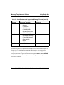
1
Using DelphNav™
User’s Manual
based on DelphMap™ software through version 2.10
June 2004
Copyright © 2004
Triton Elics International, Inc.
All rights reserved. Printed in the U.S.A.
This software is copyrighted and licensed for use on
one computer per copy. Triton Elics International
grants permission to the purchaser to make a limited
number of copies of the program for backup
purposes. Additional reproduction of the programs or
this manual is a violation of the copyright law.
The licensee is bound by the terms and conditions set
forth in the Software License Agreement and
Limited Warranty that accompanies this document.
The following are trademarks of Triton Elics
International, Inc.:
TriPort™, Q-MIPS™, VISTA™, TrakMap™,
TriCAS™, ROVFlight™, SeaFlight™, A-B™,
Bathimagery™, and Convert CD™
The following are registered trademarks of Triton
Elics International, Inc.:
Isis® Sonar, Delph Seismic®, Delph
Seismic®+Plus
The following are copyrights of their respective
companies or organizations:
•
•
WinRT Registry: BlueWater Systems
HawkEye, Imagine 128: Number Nine Visual
Technology Corp.
The following are trademarks and/or registered
trademarks of their respective companies or
organizations:
•
•
•
•
•
•
•
ArcView: Environmental Systems Research
Institute, Inc.
AutoCAD: Autodesk, Inc.
EXB-8500, EXB-8505XLI, EXB-8500C,
EXB-8205: EXABYTE Corporation
Windows, Windows NT, Windows 95, MS-DOS:
Microsoft Corporation
Adaptec AHA 1505 and AHA 2940: Adaptec,
Inc.
Klein 5000, Klein 2000, Klein 595: Klein Associates, Inc.
DF-1000: EdgeTech
•
Echoscan, Echotrac: Odom Hydrographic Systems, Inc.
•
ADS-640, GSP-1086, EPC-9082: EPC Labs, Inc.
•
Sentinel Scribe: Rainbow Technologies North
America, Inc.
•
mach64: ATI Technologies, Inc.
•
HYPACK: Coastal Oceanographics, Inc.
•
International Business Machines
•
1200C, DesignJet 650C: Hewlett-Packard
•
1086, 8300, 980x plotters: EPC
•
TDU 1200, 850, 2000 plotters: Raytheon
•
195 (same as Dowty 195, Ultra 195 and Ultra
200): Waverley
•
InstallShield: InstallShield Corporation
All other brand or product names mentioned in this
manual are trademarks or registered trademarks of
their respective companies or organizations.
Triton Elics International Offices
Triton Elics International, Inc:
125 Westridge Drive
Watsonville, California 95076, USA
831-722-7373 (voice); 831-722-1405 (fax)
WEB PAGE: http://www.tritonelics.com
E-MAIL: [email protected]
TRITON ELICS INTERNATIONAL
SOFTWARE LICENSE AGREEMENT AND LIMITED WARRANTY
SOFTWARE LICENSE AGREEMENT
LIMITED WARRANTY
By opening this package, you agree to be bound by the terms of
this Agreement, which include the software license and the limited warranty. This Agreement applies to you and any subsequent licensee of this software program. If you do not accept or
agree to the terms of this Agreement, do not open this sealed
package. Promptly return the unopened package to TRITON
ELICS for a refund. However, no refund or replacement will be
given if the sealed envelope containing the SOFTWARE Sentinel and Manual has been opened or if any of the components of
the product (including the software sentinel) are missing. Grant
of license for the software product and full title and ownership
of the hardware product shall not transfer to the Buyer until the
purchase price, plus any interest or fees resulting from late payments or pre-arranged terms, has been received in full by the
Seller.
TRITON ELICS warrants that (a) the SOFTWARE will perform substantially in accordance with the accompanying written materials for a period of one (1) year from the date of
shipment and (b) any hardware accompanying the SOFTWARE
will be free from defects in materials and workmanship under
normal use and service for a period of one (1) year from date of
shipment.
1. GRANT OF LICENSE: TRITON ELICS grants you the right
to use the enclosed TRITON ELICS software product in the
manner provided below.
YOU MAY:
• Use one copy of the TRITON ELICS software products identified above on a single computer.
• Make one (1) copy of the program in machine-readable form
solely for backup purposes, provided that you reproduce all
proprietary notices.
• Transfer the SOFTWARE and user documentation on a permanent basis provided you retain no copies and the recipient
agrees to the terms of this Agreement.
YOU MAY NOT:
• Reverse engineer, decompile, modify or disassemble the
SOFTWARE except to the extent such foregoing restriction is
expressly prohibited by applicable law.
• Remove any proprietary notices, labels, or marks on the program, documentation, or program disk.
2. UPGRADES. SOFTWARE and documentation upgrades are
provided free of charge for one year from the date of shipment.
If the SOFTWARE is an upgrade, you may use or transfer the
SOFTWARE only in conjunction with upgraded product. You
may use that upgraded product only in accordance with this
License.
3. COPYRIGHT. The SOFTWARE (including any images,
“applets,” animations, video, audio, music, and text incorporated into the SOFTWARE) is owned by TRITON ELICS and is
protected by United States copyright laws and international
treaty provisions.
4. TECHNICAL SUPPORT. Technical Support is available by
phone, fax, modem, Triton Elics bulletin board service or Internet free of charge during warranty period. MARISAT charges
are invoiced at cost plus twenty percent.
5. EXPORT RESTRICTIONS. You agree that neither you nor
your customers intends to or will, directly or indirectly, export
or transmit the SOFTWARE or related documentation and
technical data to any country to which such export or transmission is restricted by any applicable U.S. regulation or statute,
without the prior written consent, if required, of the Bureau of
Export Administration of the U.S. Department of Commerce, or
such other governmental entity as may have jurisdiction over
such export or transmission.
CUSTOMER REMEDIES. TRITON ELICS’s entire liability
and your exclusive remedy shall be, at TRITON ELICS’s
option, repair or replacement of the SOFTWARE or hardware
that does not meet TRITON ELICS’s Limited Warranty. Warranty service is F.O.B. TRITON ELICS’s Watsonville facility.
All shipping and insurance costs are paid by buyer. On-site Customer Service and Warranty Repair (including travel hours,
transportation, lodging and meals) may be provided by TRITON ELICS, at its own discretion, to Buyer at cost plus twenty
percent. However, actual labor hours to provide this service or
repair will be free of charge to Buyer. This Limited Warranty is
void if failure of the SOFTWARE or hardware has resulted
from accident, abuse, or misapplication. Any replacement
SOFTWARE or hardware will be warranted for the remainder
of the original warranty period or thirty (30) days, whichever is
longer.
NO OTHER WARRANTIES. Except for the above express limited warranties, TRITON ELICS makes no warranties,
expressed, implied, statutory, or in any communication with
you, and TRITON ELICS specifically disclaims any implied
warranty of merchantability or fitness for a particular purpose.
TRITON ELICS does not warrant that the operation of the program will be uninterrupted or error free. Some states/jurisdictions do not allow the exclusion of implied warranties, so the
above exclusions may not apply to you. This limited warranty
gives you specific legal rights. You may have others, which vary
from state/jurisdiction to state/jurisdiction.
NO LIABILITY FOR CONSEQUENTIAL DAMAGES. To the
maximum extent permitted by applicable law, in no event shall
TRITON ELICS be liable for any damages whatsoever (including, without limitation, damages for loss of business profits,
business interruption, loss of business information, or any other
pecuniary loss) arising out of the use of or inability to use this
TRITON ELICS product, even if TRITON ELICS has been
advised of the possibility of such damages. Because some states/
jurisdictions do not allow the exclusion or limitation of liability
for consequential or incidental damages, the above limitation
may not apply to you.
U.S. GOVERNMENT RESTRICTED RIGHTS. The SOFTWARE and documentation are provided with RESTRICTED
RIGHTS. Use, duplication, or disclosure by the Government is
subject to restrictions as set forth in subparagraph (c) (1) and
(ii) of the Rights in Technical Data and Computer Software
clause at DFARS 252.227-7013 or subparagraphs (c) (1) and (2)
of the Commercial Computer Software—Restricted Rights at 48
CFR 52.227-19, as applicable. Manufacturer is Triton Elics
International, Inc., 125 Westridge Drive, Watsonville, CA
95076. If you acquired this product in the United States, this
Agreement is governed by the laws of California. If this product
was acquired outside the United States, then local law may
apply.
Contents
CHAPTER 1
2004.06.28
Using DelphNav™ (Survey Control Panel) . . .
1
DelphNav Overview (Survey Control Panel) . . . . . . . .
Setting Up Serial Ports. . . . . . . . . . . . . . . . . . . . . . . . . .
Serial Server . . . . . . . . . . . . . . . . . . . . . . . . . . . . . . . . . .
1
Setting the Path to the Server . . . . . . . . . . . . . . . . . . . . . .
7
Setting Up the Server . . . . . . . . . . . . . . . . . . . . . . . . . . . .
7
Special Considerations for Working with Serial Server . .
9
Other Error Messages . . . . . . . . . . . . . . . . . . . . . . . . . . . .
9
3
7
Message Templates and Options . . . . . . . . . . . . . . . . .
Making or Using a Survey Plan . . . . . . . . . . . . . . . . .
14
Drawing Lines Independently of Each Other . . . . . . . . .
16
Drawing Duplicate Lines . . . . . . . . . . . . . . . . . . . . . . . .
18
Drawing Points . . . . . . . . . . . . . . . . . . . . . . . . . . . . . . . .
19
Creating An Object Manually. . . . . . . . . . . . . . . . . . . . .
20
Importing Objects From an ASCII File . . . . . . . . . . . . .
22
Importing Coordinates in Latitude and Longitude . . . . .
24
Creating a Channel . . . . . . . . . . . . . . . . . . . . . . . . . . . . .
27
Editing Channel Bathymetry . . . . . . . . . . . . . . . . . . . . .
32
Modifying Line Properties . . . . . . . . . . . . . . . . . . . . . . .
34
Using Delph Nav™
11
v
Conducting a Survey . . . . . . . . . . . . . . . . . . . . . . . . . .
Starting a Survey — Navigation Reception . . . . . . . . . .
Quality Control of a Survey — Data Display Windows
Line Selection and Use of the Helmsman Display. . . . .
Logging Navigation Data . . . . . . . . . . . . . . . . . . . . . . . .
Data Display Windows . . . . . . . . . . . . . . . . . . . . . . . . .
Single Beam Profile Display . . . . . . . . . . . . . . . . . . . . .
Alarm Display . . . . . . . . . . . . . . . . . . . . . . . . . . . . . . . .
Helmsman Display . . . . . . . . . . . . . . . . . . . . . . . . . . . . .
Data Display . . . . . . . . . . . . . . . . . . . . . . . . . . . . . . . . . .
Compass Display . . . . . . . . . . . . . . . . . . . . . . . . . . . . . .
An Example of Survey Planning in DelphNav. . . . . .
Importing a DXF file with Coastline (or Other) Data . .
Importing an ASCII Line File . . . . . . . . . . . . . . . . . . . .
Creating a Channel . . . . . . . . . . . . . . . . . . . . . . . . . . . . .
Computing a Volume Difference
Using a Channel Design. . . . . . . . . . . . . . . . . . . . . .
Special Navigation Interfaces . . . . . . . . . . . . . . . . . . .
ATS Server . . . . . . . . . . . . . . . . . . . . . . . . . . . . . . . . . . .
vi
Using Delph Nav™
35
35
37
39
43
47
47
49
50
50
50
50
51
64
67
70
72
73
2004.06.28
CHAPTER 1
Using DelphNav™ (Survey
Control Panel)
DelphNav Overview (Survey Control Panel)
DelphNav, embodied collectively in DelphMap™ as the Survey Control Panel, is a
fully functional navigation package. It can receive and display up to two different sources
of positioning information (for example, GPS, RTK, ATS, USBL, User-Defined) in addition to data from single-beam echo sounders, multibeam echo sounders, motion sensors,
and auxiliary sensors (for example, gyros, depth sensors). Interfaces exist for Posidonia
and TrackPoint II SBL/USBL-type systems.
Multiple window options are available for both primary and secondary navigation sources.
These windows include a compass display, a helmsman display, text displays showing the
status of incoming data strings, and a variety of alarm warnings. A Profile display for single-beam echo sounders supports dual frequency systems. X-Y graphs may be opened for
other information types arriving in the system (for example, Pitch, Roll, Heave).
Data output is in the form of a user-defined ASCII string.
DelphNav supports full survey planning. Lines may be specified either graphically on the
screen or through the insertion of individual waypoints. Parallel and perpendicular lines
can easily be created relative to a single reference line. Lines may be selected for navigating with reference to the helmsman display, and line direction can be reversed such that
the vessel's offset from the line (port/starboard) remains intuitive to the helmsman.
2004.06.28
1
DelphNav Overview (Survey Control Panel)
Using Delph Nav
To run DelphNav
1. Start DelphMap (Delphmap.exe) and select the Survey Control Panel option from
the View menu (View → Survey Control Panel; Figure 1).
2. Click Project → New Project or Project → Open a Project.
3. Select the folder you want to work in and the name of your project.
Your DelphMap project file either opens if it already exists, or is created if new. You
are now ready to set up your serial ports and survey lines.
Survey Control Panel (circled here)
FIGURE 1. Initial DelphMap screen with multiple window views
2
CHAPTER 1: Using DelphNav™ (Survey Control Panel) 2004.06.28
Using Delph Nav
Setting Up Serial Ports
Setting Up Serial Ports
Serial ports are set up in DelphNav to track and log navigation data along with any
other relevant ancillary sensor information (e.g., gyros, depth sensors, velocity sensors,
etc.). Ports may also be allocated for the output of ASCII strings derived from incoming
data.
Message templates can be assigned to ports to clarify which information strings hold
higher precedence (e.g., in the case of two navigation strings) or to exclude fields within
an information string (e.g., NOVTG to exclude speed information from a NMEA string).
To make basic serial port configurations in DelphNav
1. In the Survey Control Panel, click the Serial Port Setup icon (Figure 1; the
icon shown here to the right).
The system displays the Serial Port Data Acquisition Settings dialog box
(Figure 2), with COM1 as the initially displayed tab. Additional serial port
choices appear as additional tab choices on the top row. Initially, red Xs appear on the
numbered serial port tabs, indicating no templates have yet been assigned to the ports.
A second row of tabs below the top row is associated with the selected System type.
These tabs can be used to configure Offsets, Geodesy, or Shape parameters associated with the particular System. For systems other than Navigation, only the Offset
tab is available, whereas for Output, a Settings tab is offered.
• System
One of eight data types may be assigned to the selected serial port: Navigation, Motion Sensor, Aux. Sensor, Single Beam, Scanning Sonar,
User Defined Input, Output, or No template.
• Offsets
Allows offset distance of the sensor from a given reference point to be
specified.
• Geodesy This relates to the Projection and Datum of the incoming navigation
string. Unprojected geographic coordinates are the default input settings.
2004.06.28
CHAPTER 1: Using DelphNav™ (Survey Control Panel)
3
Setting Up Serial Ports
• Shape
Using Delph Nav
This relates to the object shape to be displayed in DelphMap for the particular navigation type. If two navigation strings are being received
(e.g., vessel position and towfish position, or GPS position and Automatic Tracking System (ATS) position), a different shape can be allocated to each navigation type.
• Settings / User DefinedOptions specific to the Output and User Defined Input
system types. User specifies the information types either sent or
received over a serial port.
2. Select the COM port tab you wish to setup, click the System tab, and choose a system
type. When you choose a system type, the icon for that system also appears on the
serial port tab.
FIGURE 2. Serial port data acquisition settings dialog box
4
CHAPTER 1: Using DelphNav™ (Survey Control Panel) 2004.06.28
Using Delph Nav
Setting Up Serial Ports
3. Specify any additional options to be applied to the incoming string in the lower righthand panel of the settings dialog box. For example, in the case of navigation from two
different sources arriving on two different COM ports, designate which navigation system should be used as the Primary source by typing the command MASTER into the
options text box. By default the lowest numbered serial port is assumed to contain the
Primary navigation. This default can be overridden by typing MASTER in the higher
numbered serial port’s options text box. A button showing which COM port has been
allocated as Master will be apparent on the Systems panel of the Survey Control Panel
(Figure 3). This button may be toggled on the GUI to designate which navigation
string (or COM port) is assigned as Master.
FIGURE 3. Vessel and towfish positions
A master serial port has the following implications that influence data acquisition:
• Navigation stored within the XTF file created by DelphNav relates to the COM
port defined as Master.
2004.06.28
CHAPTER 1: Using DelphNav™ (Survey Control Panel)
5
Setting Up Serial Ports
Using Delph Nav
• Information output from DelphNav relates to the navigation string declared as
Master.
• Data Display and Compass windows may be opened for either or both navigation
input strings, with the Master string denoted by an “M” in the window menu bar
(an “S” denotes the Secondary or Slave string).
A more complete description of available message templates and associated options is
provided in the Message Templates and Options section of this manual.
4. Click OK in the Serial Port Data Acquisition Settings dialog box to register your serial
port configuration choices.
5. In the Survey Control Panel, click the Serial Port Linkup button (shown
here at the right).
The Serial Port Linkup icon turns green to show that it is active.
If no image or vector files have been loaded to define the survey area (Projection and Datum) DelphMap will prompt you for this information. The Shape objects
selected for the navigation systems should appear in the DelphMap window shortly
after the Serial Port Linkup button turns green.
Remember to activate and configure the relevant
serial ports in the Serial Server program!
6
CHAPTER 1: Using DelphNav™ (Survey Control Panel) 2004.06.28
Using Delph Nav
Serial Server
Serial Server
In order to keep the input and output requests from different applications from clashing
when they access data from the same COM port, TEI has developed a Serial Port Server
program, called SERIALSRV.EXE, to manage the process. Currently Delph Seismic,
DelphSeismicPlus, and DelphNav use this program when reading data from a serial port in
real time. The server program launches automatically upon selecting the Serial Port
Linkup button.
Setting the Path to the Server
If you are recording navigation data with DelphNav for the first time, a dialog box will
open upon selecting the Serial Port Linkup button that requests the location of the SERIALSRV.exe program. The location should be C:\{Windows Folder}\TEIdlls (e.g.,
C:\WINNT\TEIdlls). Once this path and file have been selected, the information is stored
in a .INI file and the server will launch automatically during subsequent sessions.
Setting Up the Server
Once the Serial Server GUI has launched, COM ports may be set up to receive and
view data (Figure 4).
To pick a port in the Serial Server Settings dialog box, click the appropriate number and
then select the Setup button (note that the port must not be activated through the On
option). This opens the standard Windows COMx Properties dialog box, enabling you to
set the parameters for the port (baud rate, data bits, parity, stop bits, and flow control).
2004.06.28
CHAPTER 1: Using DelphNav™ (Survey Control Panel)
7
Serial Server
Using Delph Nav
3
GUI on top
GUI minimized
FIGURE 4. Serial Server Settings dialog for selecting COM ports
An error message will be generated if the port is already busy through another application
or if that port is not present on the particular system in use. Click OK when the parameters
have been set correctly to return to the Serial Server dialog box.
After setting the parameters in the COM port properties dialog box and returning to the
Serial Server dialog box, activate the port by selecting the ON box.
Proper reception of the incoming data string can be checked through the Spy button.
Selection of the Spy button displays a sample of the relevant data in the dialog box window. If no data appear in this window, check the settings for the port and/or the activity of
the sensor sending the data. Another possible fault source may be the serial cable.
Once these steps have been completed, the server has been setup and the COM port
parameters will be remembered the next time you start DelphNav and attempt a Serial Port
Linkup.
Note that the Serial Server program must be left running throughout the survey. The GUI
associated with the program can either be minimized as an icon in the System Tray of the
Windows Task Bar (the normal operating mode; Figure 5), or it can be specified as
remaining on top of all other windows (GUI on top, Figure 4).
8
CHAPTER 1: Using DelphNav™ (Survey Control Panel) 2004.06.28
Using Delph Nav
Serial Server
FIGURE 5. Serial Server GUI minimized as icon in system tray
If the GUI is minimized in the System Tray (Figure 5), left-clicking the icon restores the
serial server dialog box. Right-clicking the icon enables you to make changes to the serial
setup without restoring the full dialog box.
Special Considerations for Working with Serial Server
As of the Fall 2000 release of TEI software, SERIALSRV.EXE is installed in a folder
called C:\{Windows Folder}\TEIdlls, where {Windows Folder} is the main
folder for the Microsoft Windows operating system (Windows 95, NT, 2000, etc.).
Once the path to the server has been chosen during startup and the serial server has been
started, two INI files are created: SERIALSRV.INI and SERIALDLL.INI. These files
can be found in the C:\{Windows Folder}.
If a previous version of SERIALSRV.EXE has been started from some place other than
C:\{Windows Folder}\TEIdlls, then one of two error messages is likely to occur:
“SERIALDLL.DLL was previously loaded from an unexpected folder.”
or
“Server Launch FAIL: Launch it manually.”
Other Error Messages
If your computer system finds certain older copies of some TEI DLLs, other error messages can result. For example, you might see the message, Missing Entry Points
in Dynamic Link Library. In general, the solution to all these problems is as follows:
2004.06.28
CHAPTER 1: Using DelphNav™ (Survey Control Panel)
9
Serial Server
Using Delph Nav
1. Shut down Serial Server if it is running: Click the serial server icon in the system tray
next to the system clock, and then click the X in the top right corner of the Serial
Server Settings box to close it.
2. Use Explorer to find and delete the two INI files SERIALSRV.INI and
SERIALDLL.INI.
3. Check that the only copies of the following files are those that are in the
C:\{Windows Folder}\TEIdlls folder:
• SERIALSRV.EXE
• SERIALDLL.DLL
• MPX_LLNE.DLL
• TEIGUIEXT.DLL
• TEIMAP.DLL
• TIMETAG.DLL
• LXTOOLS.DLL
• MPX_MAIN.DLL
• MPX_COUNTRY.DLL
4. Restart the application (Delph Seismic or DelphMap) and, when prompted, locate the
file SERIALSRV.EXE.
10
CHAPTER 1: Using DelphNav™ (Survey Control Panel) 2004.06.28
Using Delph Nav
Message Templates and Options
Message Templates and Options
A number of pre-defined message templates exist for parsing information arriving at a
serial port from a particular system/sensor. Those templates are shown in Table 1.
TABLE 1. Input Systems and Supported Message Formats
System
Navigation
Single Beam
2004.06.28
Message Template
•
•
•
•
•
•
NMEA0183
NR202K
Nav_Delph
ATS
Posidonia
TrackPoint II
•
•
•
•
•
•
•
•
•
•
SB_NMEA
SB_Deso
Marimatech_Deso25
EchoTrac_Deso25
EchoTrack_DBS
Knudsen_Deso20
Knudsen_$PKEL
Knudsen_Elac
Raytheon 719
Fansweep
Comments
← $GPGGA, $GPGLL, etc.
← Accepts Grid coords
← Launches ATS Server
← Requires Beacon #
← Standard-EC format
CHAPTER 1: Using DelphNav™ (Survey Control Panel)
11
Message Templates and Options
Using Delph Nav
TABLE 1. Input Systems and Supported Message Formats (cont’d)
System
Message Template
Motion Sensor
•
•
•
•
•
•
•
NR230
Seatex
TSS (Tss1)
TSS (Simrad)
TSS ($PRDID)
Octans (Photonetics)
EZ-COMPASS
Aux. Sensor
•
•
•
•
•
•
Heading (NMEA)
KVH (HDM Message)
Time (ZDA Message)
Egg 866/876
OSP
DQI
Scanning
Sonar
Comments
← Depth sensor
• MS1000
Upon selecting a message template, additional options associated with that template may
be entered in the box below the template field. For example, in the case of the NMEA0183
template type, all commands associated with NMEA strings in Isis are supported in
DelphNav. So if the navigation string contains undesirable or redundant NMEA types, you
can specify DelphNav to ignore the information through the NOGLL, NOVTG, NOHDG,
etc. A complete list of the available options that can be applied to incoming NMEA messages appears in Table 2.
12
CHAPTER 1: Using DelphNav™ (Survey Control Panel) 2004.06.28
Using Delph Nav
TABLE 2.
Message Templates and Options
Options applicable to incoming NMEA messages
Message Description
Template
Options
Navigation
GGA
NOGGA
NOCLOCK
Navigation
GLL
NOGLL
NOCLOCK
Statistics
GST
Statistics
GSA
Heading
HDT
Heading
HDM
Speed
VTG
Time
ZDA
NR203 Position
PDAS
NR230 Attitude
PSER
NR230 Attitude
A.
NMEA Depth
DBS
NMEA Depth
DBT
NMEA Depth
DPT
$PKEL Depth
PKEL
TSS Attitude
PRDID
OCTAN Attitude
PHTRH
2004.06.28
NOHDT
NOVTG
CHAPTER 1: Using DelphNav™ (Survey Control Panel) 13
Making or Using a Survey Plan
Using Delph Nav
Making or Using a Survey Plan
A Survey Plan is essentially a set of lines over which the survey will be run. The Survey Planning Editor enables you to do the following tasks:
•
•
•
•
•
•
Draw lines along which the vessel can be navigated.
Draw points as individual waypoints towards which the vessel can steer.
Create an object or lines manually by typing coordinates into a spreadsheet.
Import objects or lines from an ASCII file.
Create a channel and associated cross lines at a user-defined interval.
Edit channel bathymetry or channel profiles along the defined survey lines.
The end result of any Survey Planning session is the creation of a Vector layer in
DelphMap. This Vector layer has a generic name of SurveyPlanning, which is linked to a
DDS_VOB file with a default name of {ProjectName}_Planning.DDS_VOB.
To set up the survey plan in DelphNav
1. If navigation acquisition was turned on, turn it off by disconnecting the Serial Port
Linkup (button must not be green). Verify the navigation acquisition status in the status bar. It should say, “Serial input: Off”.
2. If you have not already done so, create a new project (Project → New Project), then
select a location and name for your project.
3. In the upper left corner of the Survey Control Panel, click Start/Stop Survey Planning Editor. (icon is shown to the right).
If you have not yet opened or created a survey plan in DelphNav, a Survey
Planning Setup dialog box opens and prompts you to create a new survey
plan or open / import an existing one (Figure 6).
If creating a new survey plan, note that a default name is applied in accordance with
the Project name and directory location; this default name cannot be edited at this
stage.
14
CHAPTER 1: Using DelphNav™ (Survey Control Panel) 2004.06.28
Using Delph Nav
Making or Using a Survey Plan
FIGURE 6. Survey planning dialog (before a project is opened)
If no other imagery exists in the DelphMap window, DelphNav prompts you to choose
a projection for your project when you click Done. These Projection and Datum
parameters represent what will be displayed in DelphMap, and need not be identical to
the Projection and Datum of the incoming navigation. After specifying the Projection
and Datum, DelphNav will prompt you for the location of your working area if no
external navigation has been received by the program. This information is entered in
the form of a NW corner and E-W N-S extents in meters. Note that by right-clicking in
the text area of this dialog box the NW corner coordinates can be toggled between geographic and grid coordinates.
If you are opening or importing an existing survey plan, DelphNav prompts you to
select a file when you activate the Open/Import an existing survey planning radio button. If a new project was not created, then the new survey plan is stored in the Windows temporary folder (location depends on which Windows operating system you are
using). In Windows 2000, for instance, the location is…
C:\Documents and Settings\USER_NAME\Local Settings\Temp
…where login account is substituted for USER_NAME.
2004.06.28
CHAPTER 1: Using DelphNav™ (Survey Control Panel) 15
Making or Using a Survey Plan
Note:
Using Delph Nav
To change the folder where your survey planning and other DelphMap /
DelphNav-related files are saved, choose Project → Save As… and choose a
folder. This folder then becomes the default folder for the whole project.
Once a proper DelphMap project file has been opened or created, DelphNav displays
the Survey Planning Tools dialog box (Figure 7).
FIGURE 7. Survey planning tools dialog box
Drawing Lines Independently of Each Other
Lines along which to navigate may be entered either through a drawing tool, as coordinates in a spreadsheet, or by importing an ASCII file of coordinates. The first of these
methods, Draw lines, is explained next.
16
CHAPTER 1: Using DelphNav™ (Survey Control Panel) 2004.06.28
Using Delph Nav
Making or Using a Survey Plan
To draw lines for a survey plan
1. From Survey planning setup click the Draw lines button (icon shown to the
right), then use the title bar to drag the dialog box to one side. (
2. Use the coordinate display in the Distance Window to position the mouse
cursor at the start of the first survey line. Exact points need not be specified
at this stage because each coordinate associated with the points constructing the line
may be edited upon selecting the Save option.
3. Click at the required location, move the mouse cursor to the next point of the line, and
click again.
4. Continue in this manner drawing as many series of connected segments (or legs) as
you need.
5. When you have finished drawing the various legs of the line, right-click, and a menu
of choices is displayed (Figure 8). Choose the Save option.
FIGURE 8. Menu for acting upon drawn lines
At this time, you can edit the coordinates of the line. Figure 9 shows the Waypoint/
Profile Editing dialog box associated with the Save option. Note that DelphNav supports multiple line segments but not curved lines.
6. When you are satisfied you have correct coordinates click Save.
At this point the line will be added to the list of lines in the Survey Planning box.
2004.06.28
CHAPTER 1: Using DelphNav™ (Survey Control Panel) 17
Making or Using a Survey Plan
Using Delph Nav
7. Click the + sign to reveal the SOL EOL coordinates.
Note that the direction of the line (Start Point and End Point) corresponds to the order
in which the line points were entered using the mouse in step 3. Line direction may be
reversed at a later time if desired. A “Running Man” icon denotes the SOL and a “Stop
Sign” icon denotes the EOL.
8. You may continue adding lines anywhere in the working area. Note that clicking on the
line in the list will highlight the line in the main DelphMap window.
Drawing Duplicate Lines
Drawing parallel, perpendicular, or radial lines are options of the dialog shown in Figure 8. Upon selecting one of the Duplicate Line options, DelphNav will prompt you for
the number of lines to be drawn port or starboard of the selected line. Port and starboard
sides are determined by the direction in which the selected line was drawn. For example, if
the line was drawn from north to south, think of a vessel sailing 180º. Consequently, the
starboard side would be left of the selected line as displayed in the main DelphMap window.
To add duplicate lines to a survey plan
1. Bring up the Survey Planning setup dialog box, if it is not already displayed, but do not
click Draw lines. If the button is already depressed, disable the tool by left-clicking on
the button.
2. Move the mouse cursor over the line to which you want add parallel lines, and leftclick.
The line color will change to green with small edit boxes at each waypoint.
3. Right-click and choose one of the Duplicate options:
• Duplicate Parallel — generates lines to either side of the line at the “profile spacing.” Edit the Profile Spacing and Port/Starboard Profile Number fields if the
defaults are unacceptable. If the default line direction is not acceptable (i.e., parallel to the selected line) then this parameter can be modified by the Set Profile
Direction option.
• Duplicate Perpendicular — generates “cross lines” with control over length and
spacing. For multi-segment lines, perpendicular lines will be added to each segment. The Profile Spacing option is the same for Parallel lines: i.e., the distance
18
CHAPTER 1: Using DelphNav™ (Survey Control Panel) 2004.06.28
Using Delph Nav
Making or Using a Survey Plan
between the drawn perpendicular lines. The Port Length and Starboard Length
options are the lengths of the perpendicular line(s) to either side of the selected line
(with port and starboard orientation defined by the run direction of the selected
line). Note that the first perpendicular line added to the Survey Plan crosses the
selected line’s start coordinate.
• Duplicate Radial — generates radially spaced lines with options for the angle
between the lines and the number of lines port or starboard of the selected line's
end coordinate.
4. To finish, right-click and select Quit.
5. To close the Survey Planning setup, click Done.
DelphNav now prompts you with the question: Do you want to start data acquisition
now? The options are:
• Check the acquisition parameters — displays the serial port setup box.
• Yes — takes you into the online mode.
• No — returns you to the standard DelphNav window in offline mode.
After choosing either the Yes or No option listed above, the Survey Planning session is
complete.
6. Saving your project is recommended at this time.
Drawing Points
Waypoints may be added to a Survey Plain either by saving a Line as a set of points (as
opposed to the default of saving as a Profile) or with the Draw Points tool as discussed in
this next section.
To draw one or more points
1. In the Survey planning setup dialog box (Figure 7 on page 16), click on the
Draw points button (icon shown to the right).
2. In an area of interest in your imagery, click to establish a point.
The system marks the location in your imagery with a small, red box. At the
same time, the system displays the Waypoint / Profile Editing dialog box (Figure 9),
revealing the point's coordinates in Northings and Eastings. The values may be edited
at this stage, with the changes registered through clicking on the Apply button.
2004.06.28
CHAPTER 1: Using DelphNav™ (Survey Control Panel) 19
Making or Using a Survey Plan
Using Delph Nav
FIGURE 9. Typical data for an initial point established in imagery
3. If you want to include the current point in the imagery, click Save. A waypoint is
added to the Points listing of the Survey Control Panel window (select the Points tab to
view these waypoints).
4. Continue to add pairs of points (Northings and Eastings) for as many points as you
wish to appear in your imagery, clicking Save as each point is added.
Creating An Object Manually
With this survey planning tool, you can create a series of waypoints or object profiles
by specifying Northings and Eastings within the Waypoint/Profile Editing dialog box.
To create an object manually
1. Click the Create an object manually button (icon shown to the right).
The system displays the Waypoint/Profile Editing dialog box (Figure 10,
showing sample data).
20
CHAPTER 1: Using DelphNav™ (Survey Control Panel) 2004.06.28
Using Delph Nav
Making or Using a Survey Plan
2. Type in a pair of coordinates in the Northing and Easting fields of this dialog box.
Click Add to add the pair of Northing and Easting values spreadsheet. To delete a waypoint, select the Northing/Easting couplet from the spreadsheet list and click on
Remove.
3. Continue to specify new Northings and Eastings and Add them to the list until you
have as many paired points as you want. If any coordinates need to be modified, highlight the point of interest in the spreadsheet list; the corresponding Northing and Easting values will be shown in the edit fields at the top of the dialog box. Change the
coordinate values and then click the Apply button; the values associated with that
point will change in the spreadsheet list.
FIGURE 10. Waypoint/Profile editing dialog box, with sample data
4. When your list is complete, choose either the Waypoint(s) or Profile(s) import option.
5. Click Save to close the Waypoint / Profile Editing dialog box and register the Points or
Profile in the Survey Control Panel window and in DelphNav.
If you chose Waypoint(s) in the Waypoint / Profile Editing dialog box, the system
marks your imagery with crosses at the paired points. These waypoints are shown in
the Points window of the Survey Control Panel (select the Points tab).
2004.06.28
CHAPTER 1: Using DelphNav™ (Survey Control Panel) 21
Making or Using a Survey Plan
Using Delph Nav
If you chose Profile(s), the system joins the paired points in your imagery with line
segments. The “object” is registered as a line in the Survey Control Panel (select the
Lines tab).
manually
created
object
FIGURE 11. Example of a manually created object in imagery
Importing Objects From an ASCII File
In DelphNav you can import a survey plan or set of lines in ASCII format. The file
must be structured as follows:
For each survey line you should have at least two paired values: two or more Easting and
Northing pairs or two or more Latitude and Longitude pairs. A non-numeric character
(usually a space) must separate the paired navigation values.
22
CHAPTER 1: Using DelphNav™ (Survey Control Panel) 2004.06.28
Using Delph Nav
Making or Using a Survey Plan
Any line of text in your ASCII file that contains a non-numeric character is interpreted as
a separator of data, not data itself. Separators and data exist on their own lines of text. The
separator can be any string of text that’s meaningful to you. Separator lines should not be
consecutive; real data (one or more pairs of navigation coordinates on one or more lines)
must be the next line after a separator line. Data lines, however, can be consecutive and
contiguous (e.g, a series of waypoints within a survey line).
All lines must end with a <CarriageReturn>/<LineFeed> pair of control characters, in keeping with the DOS and Windows convention.
If there is only one point per object, the object is imported as a waypoint. If there are multiple points in an object, they are merged into a line object (with multiple waypoints).
As an example, importing the ASCII file shown in Figure 12 creates four lines and one
stand-alone waypoint. The characters SOL separating each object could be any other nonnumeric string. For the purposes of this function, numeric characters are defined to be:
0, 1, 2, 3, 4, 5, 6, 7, 8, 9, ., +, and - .
SOL
0398804.70 4833407.61
0399875.85 4834692.22
SOL
0398849.93 4833362.68
0399944.60 4834646.43
⎫
⎬ first survey line
⎭
⎫
⎬ second survey line
⎭
WAYPOINT
0399979.96 4834611.08
SOL
0398920.64 4833291.97
0400015.31 4834575.72
SOL
0400045.67 4834540.36
0398956.00 4833256.61
stand-alone waypoint (single data pair)
⎫
⎬ third survey line
⎭
⎫
⎬ fourth survey line
⎭
FIGURE 12. Sample ASCII data to be imported into DelphNav
2004.06.28
CHAPTER 1: Using DelphNav™ (Survey Control Panel) 23
Making or Using a Survey Plan
Using Delph Nav
Importing Coordinates in Latitude and Longitude
When importing coordinates in Lat/Long format, the following formats are supported:
• Decimal Degrees, DD.DDDDDD (e.g., 57.234567, 03.005678)
• Degrees Decimal Minutes, DD.MMDDD (e.g., 57.14074, 03.003407)
• Degrees Minutes Seconds, DDMMSS.SS (e.g., 571404.44, 030020.44)
Note:
No spaces are allowed. Positive longitudes are east, negative are west. Positive
latitudes are north, negative are south.
To import lines or points from an ASCII file into DelphNav
1. Click the Import objects from an ASCII file button (icon shown to the
right).
The system displays an Open dialog box.
2. Browse for and select the ASCII text file to be imported; click Open to
import it.
The system displays the ASCII importation setup dialog box (Figure 13).
In the example shown in Figure 13, the ASCII file only has Eastings and Northings,
and they are correctly arranged (Eastings first, then Northings) according to the default
import option of DelphNav. However, the default Positions, Descriptions, and Units
can be modified to accommodate different layouts or units (e.g., Latitude and Longitude in decimal degrees).
24
CHAPTER 1: Using DelphNav™ (Survey Control Panel) 2004.06.28
Using Delph Nav
Making or Using a Survey Plan
FIGURE 13. ASCII file importation setup dialog box
3. Click OK.
The next dialog box to open, the Input Projection Settings, allows you to specify the
Projection and Datum of the coordinates to be imported (e.g., UTM, Zone 19,
WGS84).
Note that in the example provided in Figure 13, two lines of non-numeric characters
occur between lines of waypoint coordinates (EOL and then SOL). Although the lines
still import correctly, the following error message will also be generated:
An error occurred while importing survey planning objects.
This message can be ignored if all lines are registered properly (check the Line listing
in the Survey Control Panel).
4. After specifying the Input Projection Settings, the lines and waypoints should be registered in the Survey Control Panel.
2004.06.28
CHAPTER 1: Using DelphNav™ (Survey Control Panel) 25
Making or Using a Survey Plan
Using Delph Nav
5. If you are finished with planning your survey, click Done to close the Survey Planning
setup dialog box.
Figure 14 shows the outline of a quay imported from a DXF file with five survey lines;
these lines are also listed in the Survey Control Panel window. Clicking the + sign
reveals the coordinates for each line.
FIGURE 14. Five survey lines imported from an ASCII file
26
CHAPTER 1: Using DelphNav™ (Survey Control Panel) 2004.06.28
Using Delph Nav
Making or Using a Survey Plan
Creating a Channel
The purpose behind creating a channel is to provide a reference surface to which a
DTM of the seafloor can be compared. This tool also sets up survey lines along which the
vessel can be navigated to acquire profile data across the designed channel.
A channel-design file contains two basic sets of line objects: length-wise borders (one for
each “side” of the channel) and a series of transverse lines (cross sections). These line
objects may be added to the DelphNav window by drawing them as lines, by inserting
coordinates manually in a spreadsheet, or by importing an ASCII file of coordinates. The
channel-design tool will lead you through this process as follows:
To create a channel design
1. Click the Create a channel button (icon shown to the right).
The system displays the Channel design procedure dialog box (Figure 15),
where you can import an existing channel or create a new one. The Channel design procedure dialog box first asks you to Create border line No 1
(either draw the line, insert manually, or import from an ASCII file). After you create
the first border, the system shows Create border line No 2 in blue text, and Create
border line No 1 displays in black text. Specify the second channel border at this
stage.
2004.06.28
CHAPTER 1: Using DelphNav™ (Survey Control Panel) 27
Making or Using a Survey Plan
Using Delph Nav
FIGURE 15. Channel design procedure dialog box
2. For the border currently being defined, click one of the three available buttons: Draw
lines (left icon), Waypoint profile editor (middle icon), or the Open icon (right icon).
• If you chose Draw lines, you can proceed to draw lines as previously explained in
‘Drawing Lines Independently of Each Other’ starting on page 16.
• If you chose Waypoint profile editor, you define your channel lines in terms of
Northings and Eastings (or latitude and longitude). This procedure is identical to
the one explained in ‘Creating An Object Manually’ starting on page 20.
• If you chose Open, you can import an existing ASCII file containing appropriate
coordinate data representing a line (at least two pairs coordinates) that you wish to
place in your current imagery. This procedure is identical to importing an ASCII
file, explained in ‘Importing Objects From an ASCII File’ starting on page 22.
3. If this is the first border being defined, repeat step #2 to define the second border.
If this is the second border being defined, the system makes available the text boxes in
the Cross sections portion of the dialog box (initially these text boxes were grayed
out).
28
CHAPTER 1: Using DelphNav™ (Survey Control Panel) 2004.06.28
Using Delph Nav
Making or Using a Survey Plan
4. In the available text boxes of the dialog box, either specify a value for the Distance
between the cross sections or the Number of cross sections to create; click
Finish.
The system displays the current state of the channel design (Figure 65) and opens a
Channel bathymetry dialog box (Figure 66). You use this dialog box to specify the
slope of your channel walls and the depth/slope of the channel as a whole.
FIGURE 16. Channel with borders and cross lines
The tabs at the bottom of the Channel bathymetry dialog box (Figure 17) correspond to the
cross lines of the channel, starting with zero.
2004.06.28
CHAPTER 1: Using DelphNav™ (Survey Control Panel) 29
Making or Using a Survey Plan
Using Delph Nav
Within this window four points define each cross line: two points for the top of the channel at each border intersection (Points A and D), and two points for the bottom of the
channel on each side of the wall (Points B and C).
Depth values may be entered for all of these points, thereby setting the depth of the channel surface beneath sea level and the height of the channel walls. The slope of the channel
walls is specified by the X-Offset parameters associated with Points C and D.
30
CHAPTER 1: Using DelphNav™ (Survey Control Panel) 2004.06.28
Using Delph Nav
Making or Using a Survey Plan
FIGURE 17. Cross line profile before channel definition
2004.06.28
CHAPTER 1: Using DelphNav™ (Survey Control Panel) 31
Making or Using a Survey Plan
Using Delph Nav
5. Progressively modify the Depth and X-Offset parameters associated with each of the
cross lines (each of the tab fields) until the channel shape has been adequately defined.
6. Click OK when completed.
Note:
After defining the profile shape for one cross line, the parameters can be automatically passed to the next profile (or to the previous profile) through selection
of the “Like previous” and “Like next one” buttons.
Editing Channel Bathymetry
If an imported or existing channel needs modifications, the Edit Channel Bathymetry
tool can be used.
To edit a channel
1. Click the Edit channel bathymetry button (icon shown to the right).
When you click the icon, the system opens the Channel bathymetry dialog
box like the one shown in Figure 66. The functions available here are the
same as those documented in the section called ‘Creating a Channel’
starting on page 27.
32
CHAPTER 1: Using DelphNav™ (Survey Control Panel) 2004.06.28
Using Delph Nav
Making or Using a Survey Plan
FIGURE 18. Cross line profile after channel definition
2004.06.28
CHAPTER 1: Using DelphNav™ (Survey Control Panel) 33
Making or Using a Survey Plan
Using Delph Nav
Modifying Line Properties
As stated at the beginning of this section, by default the vector layer inserted into
DelphNav and related to a survey plan is labeled SurveyPlanning. Properties related to
each vector component of the specified survey plan (lines and waypoints) can be modified
by right-clicking on the SurveyPlanning layer and selecting Properties.
FIGURE 19. Settings dialog box associated with Properties option
The dialog box in Figure 19 opens, and by selecting the Settings tab, various properties
associated with each vector object can be modified. For example, increasing the Size
parameter from the default of 3.0 m increases the font size of the label attached to that particular line.
34
CHAPTER 1: Using DelphNav™ (Survey Control Panel) 2004.06.28
Using Delph Nav
Conducting a Survey
Conducting a Survey
Upon completing a survey plan, and assuming all sonar and navigation equipment are
working properly, you should now be ready to commence surveying.
The following sections provide information on:
• connecting to serial ports to receive navigation and ancillary information
• various data display windows available when acquiring navigation data
• selection and arranging of lines for navigation using the Survey Control Panel and the
helmsman display
• recording of navigation data for later replay or export to another program (for example, Isis or DelphS)
Starting a Survey — Navigation Reception
A basic checklist before the start of any survey is:
1. Have all systems and system options been defined for the serial ports on which information is arriving?
2. Have the serial port parameters been configured properly in Serial Server?
3. Have all relevant serial ports been turned on in Serial Server?
4. Can you view the incoming information strings through the Spy option of Serial
Server?
5. Has a survey plan been created in DelphNav?
6. Has all associated background imagery (DXF, SHAPE, or GeoTiff files) been
imported to DelphNav?
If all this information is registered in DelphNav, then you should be ready to receive navigation to start the survey.
Establishing navigation reception in DelphNav is relatively straightforward: simply leftclick on the Serial Port Linkup button shown in Figure 20. If you haven’t imported any
background imagery into DelphNav or setup a survey plan, then DelphNav will lead you
through a series of dialog boxes to establish a Projection or Datum for the project.
2004.06.28
CHAPTER 1: Using DelphNav™ (Survey Control Panel) 35
Conducting a Survey
Using Delph Nav
After a short time the Serial Port Linkup button will turn Green and the Serial Setup button will become grayed-out (inactive). At this stage a symbol representing the boat position should appear in the main DelphNav window. The shape of that symbol will depend
on the Shape selected during Serial Port Setup.
Serial Port Linkup
Serial Port Setup
FIGURE 20. Starting navigation reception in DelphNav
36
CHAPTER 1: Using DelphNav™ (Survey Control Panel) 2004.06.28
Using Delph Nav
Conducting a Survey
Quality Control of a Survey — Data Display Windows
Figure 21 shows the various data display windows offered by DelphNav for providing
quality control on incoming data strings and to help position the vessel relative to a
selected survey line. Display windows include:
• Single Beam Profile Display: capable of displaying both high frequency and low frequency channels of a single beam echo sounder. Audible alarms may be set for an
operator-specified depth, with soundings below or above which cause the alarm to
trigger.
• Alarm Display: a large variety of alarm types may be specified in this window, with
both visual and audible notification when operator-specified parameters are exceeded.
Parameters related to the GPS, Heading, Attitude, and Single Beam data can be monitored.
• Helmsman Display: shows position of vessel relative to the operator-specified survey
line. Parameters monitored include distance from SOL/EOL, off-line distance, course
to next waypoint, and navigation data recording status.
• Data Display: provides a text overview of the incoming data strings. Raw values, statistics, and quality parameters may be viewed for navigation, attitude, and single beam
data. X-Y graphs can be generated for any parameter within this window.
• Compass Display: shows heading information based on incoming navigation string or
other sensor data (for example, True Heading if gyro information received).
Each of these display windows and their associated options will be discussed in detail later
in this manual.
2004.06.28
CHAPTER 1: Using DelphNav™ (Survey Control Panel) 37
Conducting a Survey
Using Delph Nav
FIGURE 21. Data display window options in DelphNav
38
CHAPTER 1: Using DelphNav™ (Survey Control Panel) 2004.06.28
Using Delph Nav
Conducting a Survey
Line Selection and Use of the Helmsman Display
When creating a Survey Plan (for example, first creating a line and then creating duplicates of that line), DelphNav adds line names to the Survey Control Panel window
(Figure 22). A number of options exist for manipulating these lines, including selecting a
line to navigate relative to the Helmsman Display, reordering lines within the list, reversing the run orientation, and deleting lines.
2004.06.28
CHAPTER 1: Using DelphNav™ (Survey Control Panel) 39
Conducting a Survey
Using Delph Nav
FIGURE 22. Line navigation options in DelphNav
Steering a vessel along a predetermined line is a basic necessity of practically any survey
and a core function of any navigation package. In DelphNav, the Helmsman Display window (Figure 23) is a key tool for navigating a vessel along a line. This window provides
visual information on vessel distance off the selected survey line, start of line (SOL) EOL
distance, and heading direction from waypoint-to-waypoint and vessel-to-waypoint (for
correcting off-line deviations).
40
CHAPTER 1: Using DelphNav™ (Survey Control Panel) 2004.06.28
Using Delph Nav
Conducting a Survey
FIGURE 23. Helmsman Display
The first step is to select the line along which you want to steer the vessel. In the Survey
Control Panel, an elongated box marks the line that has been selected as the navigation
line (Line 1 in Figure 22). If you wish to navigate along another line, simply select the
new line either by:
• left-clicking on a line object in the main DelphNav window, or
• left-clicking on a line name in Survey Control Panel.
In either case, the line in the DelphNav window should turn blue, and the corresponding
line name should be highlighted.
Next, click on the Select Line button (Figure 22). This will shift the elongated box from
the current navigation line to the highlighted line. In addition, the line object in the
DelphNav window should turn white. Note that the Select Line button only becomes
active if the Serial Linkup button is active (that is, you are receiving navigation data into
DelphNav).
In order for the Helmsman display to be correct in terms of off-line magnitude and direction, the lines must be run from SOL to EOL order. A green “running man” icon marks the
start of a line (SOL); a “stop sign” icon marks the end of each line (EOL). In order to
change any attributes of a line, in particular whether to reverse a line direction, the line of
interest must not be declared as the navigation line (that is, the elongated box must not be
around the line whose parameters require modification).
To reverse the line direction, select the line of interest and then click on the Reverse Line
Direction button in the Survey Control Panel. Note that the “running man” and “stop sign”
2004.06.28
CHAPTER 1: Using DelphNav™ (Survey Control Panel) 41
Conducting a Survey
Using Delph Nav
icons swap ends within the main DelphNav window. In addition, the box around the line
name in the Survey Control Panel changes from “red” to “green” and the text associated
with the “Way” field changes from Reverse to Normal.
Line ordering becomes important if the Automatic Logging option is selected. This option
is a part of the Settings dialog box, which can be launched from the lowermost button on
the Survey Control Panel (Figure 22 on page 40). When this option is activated, the logging of navigation is automated in the sense that recording is turned ON when the vessel is
a user-defined distance from the SOL, and turned OFF when the vessel moves an equal
distance beyond the EOL. Upon reaching the EOL and the cessation of recording, the next
line to navigate is the next line in the list. An additional feature with this option is to
PAUSE logging if the vessel exceeds a user-defined off-line distance.
Lines may be reordered using the UP or DOWN buttons in Survey Control Panel
(Figure 22 on page 40).
Lines may be removed from the Survey Plan with the Delete button
(Figure 22 on page 40).
A number of parameters that can be used as navigation and line steering aids reside in the
title bar of the Helmsman Display window. These include:
• Name = Name of line being navigated
• Head = Heading of the vessel; type of heading selected through Compass window
(default is True Course Over Ground) and text changes according to the type selected
• SOG = Speed Over Ground
• State = Recording state of the navigation (Recording/Pause/Waiting)
• SOL = Distance to/from start of line
• EOL = Distance to/from end of line
• CTW = Course to waypoint, or heading direction from current vessel position to active
waypoint (Figure 24)
• CTS = Course to steer, or heading direction from previous waypoint to active waypoint
(Figure 24)
• NCTS = Next course to steer, or heading direction from active waypoint to the next
waypoint if survey line consists of more than two waypoints (Figure 24)
42
CHAPTER 1: Using DelphNav™ (Survey Control Panel) 2004.06.28
Using Delph Nav
Conducting a Survey
Active
Waypoint
NCTS
CTW
CTS
FIGURE 24. Course information within Helmsman Display
Values associated with these parameters can assist in the navigation of the vessel. For
example, the CTW parameter indicates the course the helmsman should steer in order to
intersect the next waypoint (or end of line segment). The NCTS parameter informs the
helmsman of the next heading that must be attained in the case of a multi-segment line.
In addition to these text displays of heading direction, a graphical indication of off-line
distance and direction is shown in the main window of the Helmsman Display. In the
Figure 23 on page 41 example, the vessel is 13.5 meters to the starboard side of the
selected navigation line. The red indicator bar informs the helmsman that the vessel must
be turned to port to reduce the off-line distance.
Logging Navigation Data
DelphNav can record incoming navigation data as well as other ancillary information
(single-beam data, depth sensor data, motion sensor data, etc.) either in automatic mode or
manual mode.
2004.06.28
CHAPTER 1: Using DelphNav™ (Survey Control Panel) 43
Conducting a Survey
Using Delph Nav
The data are recorded in an XTF file separate from the sonar XTF file. The location of this
navigation XTF file is the directory under which the DelphNav project has been saved, or
by default in:
C:\Documents and Settings\USERNAME\Local Settings\Temp
(in the case of a New Project). The naming convention for these files is:
ProjectName_LineName_YYMMDD_HHMMSS.XTF
(that is, PortlandProject_L1_001204_092958.XTF)
As mentioned above, two modes exist for data recording: manual or automatic. In manual
mode, the operator selects the line to be navigated and then selects the Start Recording
button upon approach to the SOL (Figure 25). The vessel track color should change from
red to blue.
44
CHAPTER 1: Using DelphNav™ (Survey Control Panel) 2004.06.28
Using Delph Nav
Conducting a Survey
FIGURE 25. Navigation Logging Options in Survey Control Panel
If a single navigation XTF file is desired, then the operator may Pause Recording between
lines (Figure 25). If a navigation file per line is desired, then the operator should Stop
2004.06.28
CHAPTER 1: Using DelphNav™ (Survey Control Panel) 45
Conducting a Survey
Using Delph Nav
Recording at the EOL, and Start Recording at the beginning of the next line (after selecting the new line to navigate on the Survey Planning toolbar).
Automatic recording mode is activated through the Settings button at the bottom of the
Survey Control Panel (Figure 25). The Settings dialog box contains parameters to Start/
Stop logging a specified distance from the SOL and EOL, and to Pause logging a specified
distance off-line. Activation of the Automatic recording mode can either be set within this
dialog box (by checking the Automatic procedure option) or by clicking on the Automatic
Recording Mode button on the Survey Control Panel (Figure 25).
FIGURE 26. Settings Options for Automatic Navigation Logging
As mentioned previously, the line order as shown in the Survey Planning window is
important when surveying in Automatic recording mode because DelphNav sequentially
selects the next line to navigate based on this list. If a line is missed, or logging is Paused
along a line because the vessel wandered too far off-line, simply deactivate Automatic
mode, reorder the lines, and reactivate Automatic mode.
46
CHAPTER 1: Using DelphNav™ (Survey Control Panel) 2004.06.28
Using Delph Nav
Note:
Data Display Windows
The color of the vessel track should indicate the status of recording (red for no
recording, blue for recording).
All navigation files may be played back in DelphNav through selecting the Files tab
option of the Survey Planning window, opening the relevant XTF files, and selecting the
Play button. Options affecting the playback of such files appear in the Settings dialog box
shown in Figure 26 on page 46.
Data Display Windows
DelphNav provides a number of display windows for conducting quality control on
incoming data strings, in addition to the Helmsman Display window that can be used to
assist steering along a survey line. Each of these display windows will be presented in
detail in the following sections.
Single Beam Profile Display
The Single Beam Profile Display window (Figure 27) is capable of showing up to two
different sources of sounding data (for example, two different frequencies of an echo
sounder).
2004.06.28
CHAPTER 1: Using DelphNav™ (Survey Control Panel) 47
Data Display Windows
Using Delph Nav
FIGURE 27. Single Beam Profile window with alarm
Minimum and Maximum depths for the Y-axis on the profile display can be set with the
up/down buttons on the left side of the window, and the time-scale over which the profile
is built (the X-axis) can be adjusted by the slider bar beneath the profile display. The display of either beam can be toggled ON or OFF by the Show option on the right side of the
window. The current depth being received from the echo sounder is shown in the field
beneath the appropriate Beam label.
Two options are available within the View menu of the Single Beam Profile window:
• Alarm
• Alarm Settings
48
CHAPTER 1: Using DelphNav™ (Survey Control Panel) 2004.06.28
Using Delph Nav
Data Display Windows
These options open the panels shown below the main profile window in Figure 27. Parameters that may be specified include:
• Alarm Depth for each echo sounder source (shown as a blue horizontal line in the main
profile window)
• Activation/Deactivation of each alarm
• Activation/Deactivation for a sound attached to each alarm
• Alarm triggering when soundings become shallower or deeper than the specified
Alarm Depth
Alarm Display
A large variety of alarm types may be specified in this window, with both visual and
audible notification when operator-specified parameters are exceeded. Parameters related
to the GPS, Heading, Attitude, and Single Beam data can be monitored.
FIGURE 28. Alarm display types
2004.06.28
CHAPTER 1: Using DelphNav™ (Survey Control Panel) 49
An Example of Survey Planning in DelphNav
Using Delph Nav
Helmsman Display
This shows position of vessel relative to the operator-specified survey line. Parameters
monitored include distance from SOL/EOL, off-line distance, course to next waypoint,
and navigation data recording status.
Data Display
This provides a text overview of the incoming data strings. Raw values, statistics, and
quality parameters may be viewed for navigation, attitude, and single beam data. X-Y
graphs can be generated for any parameter within this window.
Compass Display
This shows heading information based on incoming navigation string or other sensor
data (for example, True Heading if gyro information received).
An Example of Survey Planning in DelphNav
The following section shows the progression of a worked example which demonstrates
the use of the various survey planning features in DelphNav. By following this example
you will learn how to:
•
•
•
•
50
Import a DXF file with coastline (or other) data
Import an ASCII file containing line (or other) data
Create a channel
Edit channel bathymetry
CHAPTER 1: Using DelphNav™ (Survey Control Panel) 2004.06.28
Using Delph Nav
An Example of Survey Planning in DelphNav
The data in this sample exercise is as follows:
• a DXF coastline file from Portland Maine (portland.dxf), which has metric coordinate information based on the UTM projection and the NAD27 datum
• a number of lines in an ASCII file based on UTM projection and the WGS1984 datum
(portland_lines.txt), with the coordinates in meters
We will assume that the navigation input will be from a GPS receiver with an output in latitude and longitude using the WGS84 datum. And that the final project requirement is for
a UTM projection in meters.
Importing a DXF file with Coast line (or Other) Data
Any information — such as coastlines, pipeline routes, or cable routes that could be
represented as line (vector) data — can be imported and displayed in DelphNav as a DXF
file.
To import a coastline data (or other data) as a DXF file
Important: DelphNav at this time only imports ASCII DXF files in the AutoCAD R12 format.
1. Click Project → Insert Layers and use the pull-down arrow to select ASCII AutoCAD
files (*.DXF).
The system displays an Open dialog box (Figure 29).
2004.06.28
CHAPTER 1: Using DelphNav™ (Survey Control Panel) 51
An Example of Survey Planning in DelphNav
Using Delph Nav
FIGURE 29. Open dialog box for importing a DXF file
2. When you select the file and click Open, a message appears (Figure 30):
FIGURE 30. Message before importing a DXF file
Because DXF files contain no projection information and because we do not yet have a
project open, we will need to supply this information.
52
CHAPTER 1: Using DelphNav™ (Survey Control Panel) 2004.06.28
Using Delph Nav
An Example of Survey Planning in DelphNav
3. Respond to the message by clicking OK in the message box.
The resulting dialog box asks you for the location where you want to store the
imported file. Internally DelphNav converts a DXF file into three files having these
extensions:
DDS_VOB, DDS_VTX and DDS_VLB
4. Browse to a suitable folder and click OK.
The system displays the Projection Settings dialog box shown in Figure 31. You now need
to supply DelphNav with appropriate input and output projections for your project.
FIGURE 31. Projection Settings before specifying projections
5. In the Projection Settings dialog box, click Change next to Input Projection.
2004.06.28
CHAPTER 1: Using DelphNav™ (Survey Control Panel) 53
An Example of Survey Planning in DelphNav
Using Delph Nav
6. Because this DXF file in our worked example is the coastline around Portland, Maine,
and because the coastline’s coordinates are UTM with NAD27 datum, select
Universal Transverse Mercator; then click Next.
At this point you need some idea of where Portland, Maine, is in terms of its navigation coordinates. It turns out the longitude of Portland, Maine, is around 70 degrees
West, and it is in the Northern Hemisphere.
7. Select Zone 19 (66W to 72W) and check the North Hemisphere radio button; click
Next and select North American Datum (1927); click Finish.
After a short pause the Projection Settings box re-appears and the system displays the
data relevant to your input projection settings (Figure 32).
FIGURE 32. Projection Settings box with input projection info
54
CHAPTER 1: Using DelphNav™ (Survey Control Panel) 2004.06.28
Using Delph Nav
An Example of Survey Planning in DelphNav
Now we need to setup the output (or working) projection for the project. Recall that we
want to use a GPS receiver having a data output in Lat/Long based on WGS84, and
that the project is required to be in the UTM projection.
8. In the Projection Settings dialog box, click Change next to Output Projection; select
Universal Transverse Mercator from the list, and click Next.
9. Check that the displayed Zone and Hemisphere are correct for Portland, Maine (it
should say Northern hemisphere and a longitude of approximately 70 degrees west,
which corresponds to Zone 19 in the Select UTM Zone and Hemisphere dialog of the
Output Projection settings box);
10.Select Zone 19 in the dialog box, then click Next.
The system displays the Select Datum dialog of the Output Projection settings box.
11. Select the datum for the output projection: WGS Datum (1984); then click Finish.
Note:
Observe that we were not obliged to use the North American Datum (1927) as
output, even though that datum was used as input. This demonstrates the program’s flexibility in allowing the operator to adapt the data to new needs.
After a short pause the Projection Settings box re-appears with the output projection
information now added to it. Figure 33 shows the data:
2004.06.28
CHAPTER 1: Using DelphNav™ (Survey Control Panel) 55
An Example of Survey Planning in DelphNav
Using Delph Nav
FIGURE 33. Projection Settings box with output projection info
12.Click OK after checking that everything is correctly entered. If you wish, you can click
Test to get a dialog box like the one shown in Figure 34.
56
CHAPTER 1: Using DelphNav™ (Survey Control Panel) 2004.06.28
Using Delph Nav
An Example of Survey Planning in DelphNav
FIGURE 34. Test Projection Settings dialog box
You can use this test feature to check whether the conversion from Lat/Long to grid
coordinates in either datum is being carried out correctly, or whether to make “spot”
conversions from Lat/Long to grid coordinates. For the former test, of course, you will
need to have a test conversion carried out by some independent means for comparison.
2004.06.28
CHAPTER 1: Using DelphNav™ (Survey Control Panel) 57
An Example of Survey Planning in DelphNav
Using Delph Nav
13.In the Projection Settings dialog box, click OK (either with or without doing Test).
After a few seconds of processing, DelphNav converts the DXF file, at which time the
following dialog box appears:
FIGURE 35. Layer-insertion dialog box prompting
By default the layer name will be the same as the DXF file name. In Figure 35 we have
changed portland to portland_coast. (This refinement of a name change is
optional; we chose to give it a new name for added clarity, to make it distinct from the
project name.) Note that the data from the DXF file are now referred as a “layer.”
14.Click OK.
After another brief pause, the imported file should appear. Figure 36 shows the worked
example at this stage of processing.
58
CHAPTER 1: Using DelphNav™ (Survey Control Panel) 2004.06.28
Using Delph Nav
An Example of Survey Planning in DelphNav
FIGURE 36. DXF “layer” imported into DelphNav
The area we are interested in is the box outlined in white near the center bottom of the
image. Figure 37 shows an area that has been enlarged by the zooming technique.
2004.06.28
CHAPTER 1: Using DelphNav™ (Survey Control Panel) 59
An Example of Survey Planning in DelphNav
Using Delph Nav
FIGURE 37. Zooming in the area of interest
15.If you wish to change the color of the displayed lines, right-click anywhere on the
portland_coast layer name (or on the green check mark) and select properties.
The system displays the Settings dialog box (Figure 38). Notice that the properties of
this layer include the files in the scrollable list.
60
CHAPTER 1: Using DelphNav™ (Survey Control Panel) 2004.06.28
Using Delph Nav
An Example of Survey Planning in DelphNav
FIGURE 38. Files (right-clicking “portland_coast” → “properties”)
16.In the Settings dialog box select the Settings tab.
The system displays color controls for managing a layer’s colors (Figure 39).
2004.06.28
CHAPTER 1: Using DelphNav™ (Survey Control Panel) 61
An Example of Survey Planning in DelphNav
Using Delph Nav
FIGURE 39. Settings tab for inspecting or changing a layer’s colors
17.Use the controls in this dialog box to set the color of the lines and the color and size of
the labels (if any); click OK.
The system closes the Settings dialog box, and the imagery displays in your newly
chosen colors. Figure 40 shows an example of this.
62
CHAPTER 1: Using DelphNav™ (Survey Control Panel) 2004.06.28
Using Delph Nav
An Example of Survey Planning in DelphNav
FIGURE 40. Imagery displayed in a new color
18.At this point it is a good idea to save your project: Click Project → Save (or click the
Save icon on the taskbar).
This will not only create a DMP (DelphMap Project) file containing all the references
to the various files that you have created, but saving the project also establishes the
default directory for creating subsequent layers and converted files.
2004.06.28
CHAPTER 1: Using DelphNav™ (Survey Control Panel) 63
An Example of Survey Planning in DelphNav
Note:
Using Delph Nav
DMP files do not contain the actual data files, just the links to the files used to
display your imagery. Consequently, if you move this project from its present
location/folder you will need to re-import the various files again, thereby updating the project’s links to the files.
This completes the importation of the DXF coastline file.
Importing an ASCII Line File
This series of tasks implements the general principles documented in ‘Importing
Objects From an ASCII File’ starting on page 22.
To import an ASCII line file
1. Open the project DMP file.
Assume in this case you have a project called portland.dmp, and it is located in
g:\Portland. In our example, the previously converted coastline around Portland,
Maine, is displayed. The line file we are going import is called LINES.TXT. The format of this file is as follows:
ELEMENT 1
xxxxxxx.xxE xxxxxxxx.xxN
xxxxxxx.xxE xxxxxxxx.xxN
ELEMENT 1 is a separator of data. In this case, the two lines that follow are represent
the start and end coordinates of a single line, respectively. To indicate a new survey
line, you would create another separator on its own line of text before introducing the
actual data, like this:
ELEMENT 2
xxxxxxx.xxE xxxxxxxx.xxN
xxxxxxx.xxE xxxxxxxx.xxN
You would repeat this format for each line in your survey.
A complete ASCII file might look like the data depicted in Figure 41.
64
CHAPTER 1: Using DelphNav™ (Survey Control Panel) 2004.06.28
Using Delph Nav
SOL
0398804.70 4833407.61
0399875.85 4834692.22
SOL
0398849.93 4833362.68
0399944.60 4834646.43
An Example of Survey Planning in DelphNav
⎫
⎬ first survey line
⎭
⎫
⎬ second survey line
⎭
WAYPOINT
0399979.96 4834611.08
SOL
0398920.64 4833291.97
0400015.31 4834575.72
SOL
0400045.67 4834540.36
0398956.00 4833256.61
waypoint (single data pair)
⎫
⎬ third survey line
⎭
⎫
⎬ fourth survey line
⎭
FIGURE 41. An example of importable ASCII data
The import routine considers a non-numeric character to be a separator, so any nonnumeric character can be used to separate both the pairs of eastings and northings and also
the pairs of coordinates denoting the start and end of a survey line. In this example, a
space delimits each easting and northing pair, and the strings ELEMENT n separate the
survey line data pairs.
2. Click the Start/Stop Survey Planning Editor icon.
In the Survey Control Panel, the Survey planning setup dialog box opens (Figure 42).
2004.06.28
CHAPTER 1: Using DelphNav™ (Survey Control Panel) 65
An Example of Survey Planning in DelphNav
Using Delph Nav
FIGURE 42. Survey planning dialog prompting for insertion
Note that by default you are opening a new survey planning file, and that the name of
the file selected for you in this case is called:
g:\portland\portland_Planning.dds_vob.
The survey planning file is created in the same folder where the project file
(portland.dmp) is stored.
3. Click Done.
As mentioned in the preliminary information appearing in ‘Making or Using a Survey
Plan’ on page 14, if you are creating a new survey plan, DelphNav prompts you to
choose a projection for your project when you click Done. If you are opening or
importing an existing survey plan, DelphNav prompts you to select a file when you
enable the Open/Import an existing survey planning radio button.
4. From the next dialog click on Import objects from an ASCII file and select the TXT
file containing the line data.
66
CHAPTER 1: Using DelphNav™ (Survey Control Panel) 2004.06.28
Using Delph Nav
An Example of Survey Planning in DelphNav
Creating a Channel
The steps that are needed to create a channel are:
1. Generate two lines defining the edges or border of the channel.
2. Generate the transverse lines defining the channel cross section.
To create a channel before a survey plan has been made
1. Click these icons in sequence:
• Start/Stop Survey Planning Editor →
• Create a new survey planning →
• Done →
• Create channel.
The system displays two dialog boxes open: the Survey Planning Setup (Figure 43, left
side) and the Channel design procedure (Figure 43, right side).
FIGURE 43. Survey planning setup with channel design dialog
2004.06.28
CHAPTER 1: Using DelphNav™ (Survey Control Panel) 67
An Example of Survey Planning in DelphNav
Using Delph Nav
2. Do one of the following:
• Click Draw Lines (left icon) if you want to graphically enter the line from the
DelphNav window.
• Click Edit channel (middle icon) if you want to enter the co-ordinates manually.
• Click Open file (right icon) if you have the coordinates in an ASCII file.
The following description is for the graphical (draw lines) method.
To graphically enter the line from the DelphNav window
1. After clicking the Draw Lines icon, click at the position on the chart where you want
the first border line to start, then click the position where you want the first border line
to end. You may click intermediate points if you wish.
2. When you have clicked your last point, right-click with the mouse and select Save.
The system displays the Waypoint/Profile editor dialog box.
3. In the Waypoint/Profile Editor dialog box you can edit the coordinates of your line if
you wish; then click Save.
In the Channel design procedure dialog box, the focus changes to Create border
line No. 2.
4. Repeat steps #1–#3 to create the second border line.
At this time the Distance between cross sections and Number of cross sections to
create become available in the Channel design procedure dialog box (Figure 44, overlaid on DelphMap’s main application window).
68
CHAPTER 1: Using DelphNav™ (Survey Control Panel) 2004.06.28
Using Delph Nav
An Example of Survey Planning in DelphNav
FIGURE 44. Channel being defined (with two dialog boxes overlaid)
5. Enter some appropriate values for the number of cross sections and distance between
cross sections and click Finish.
At this time the cross sections are drawn on the chart and then the Channel Bathymetry
dialog box opens. The first cross section is identified by a tab numbered 0.
6. Use the numbered tabs at the lower edge of the dialog box to select the section you
wish to work on; then enter the values in the offset and depth boxes. Figure 18 on
page 33 shows a graphical cross section of such a line so defined.
2004.06.28
CHAPTER 1: Using DelphNav™ (Survey Control Panel) 69
An Example of Survey Planning in DelphNav
Using Delph Nav
7. You can now use the numbered tabs at the bottom of the dialog box to move to the next
cross section, where you can either enter new channel data or use the Like previous or
Like next one buttons.
8. After entering the last cross section click OK to dismiss the dialog box.
This completes the channel creation routine. (Also see ‘To create a channel design
suitable for export to Bathy Pro™’ if you intend to go on to import that channel
design data into Bathy Pro™.)
To later edit a channel cross section, click the Edit channel bathymetry icon to display
and edit already existing channel cross sections. Through such editing, any of the values in
the boxes may be adjusted, including start and end coordinates.
Computing a Volume Difference Using a Channel Design
One of the most useful applications of a channel design file is to use it for computing
volumetric differences between data captured during your multibeam survey and your
channel design. The volumetric differences pinpoint areas that have not been dredged to
your desired depth of the designed channel. You can then use this information to dredge
the area of interest so that your dredging conforms to your channel design.
To arrive at that result you work with DelphNav and Bathy Pro™, by turns. In four steps,
here’s an overview of that process:
1. In DelphNav, create a channel design file (CHN) file and rename it with a TXT file
extension.
2. In Bathy Pro, import the channel design TXT file, select any processing options appropriate for it, and have Bathy Pro process it.
3. In DelphNav, import the DDS_VIF file created in Bathy Pro.
4. In DelphNav, compute a volumetric delta based on the channel design file and your
multibeam survey.
This section explains those tasks in detail.
To create a channel design suitable for export to Bathy Pro™
1. In DelphNav, do one of the following:
• Perform the procedure ‘Creating a Channel’ starting on page 27 or
70
CHAPTER 1: Using DelphNav™ (Survey Control Panel) 2004.06.28
Using Delph Nav
An Example of Survey Planning in DelphNav
• Perform the procedure ‘Creating a Channel’ starting on page 67.
2. In either of those referenced procedures, recall that the last step in creating the channel
design in DelphNav’s Channel bathymetry dialog box is to click the OK button.
When you click OK, the system automatically creates an ASCII file containing the
channel design data. By default, the location of that file is the same as the location of
the Survey Planning Editor. In Windows 2000 that location is…
C:\Documents and Settings\USERNAME\Local Settings\Temp
…where USERNAME represents the name of an actual user. That location contains a
file having all the X, Y, and Z values associated with the designed channel. Initially
this file is named:
NewProject_Planning_Channel_1.chn
3. Having created the channel design file, exit DelphNav.
4. Go to the above-mentioned folder and rename the file by changing its file extension
from CHN to TXT. (You can also rename the primary part of the file from
NewProject_Planning_Channel_1 to a name that reflects the nature of your
work. You may also want to move the file to a more convenient working directory for
additional work.)
To import the channel design TXT file into Bathy Pro™
1. Run Bathy Pro and right-click on the Project files folder.
2. Choose the Add XYZ ASCII file (Single Beam Data) option and specify the channel
design TXT file name.
3. While specifying the channel design file name, verify the following parameters for the
file:
• that input and output projections match the survey area, and
• that the grid resolution is comparable to what will be specified for the multibeam
survey.
4. Choose Bathy Processing → Process to process your data.
When you choose Process, the system automatically creates a DDS_VIF raster file
with the same primary name as the TXT file you imported.
5. Having created the DDS_VIF file, exit Bathy Pro.
2004.06.28
CHAPTER 1: Using DelphNav™ (Survey Control Panel) 71
Special Navigation Interfaces
Using Delph Nav
To import the DDS_VIF file into DelphNav
1. Run DelphMap again, choose Project → Insert Layers, locate the DDS_VIF file of
interest, and open the DDS_VIF file to import it.
By default the color table applied to this file will be gray-scale, but a more advantageous palette may be specified from GIS Tools → Color Palettes. The resulting dialog box offers data type options for sidescan sonar, bathymetry, and other data types.
2. From GIS Tools → Color Palettes select the Bathymetry data type and use the Jet
palette. Also see ‘Change the Color Palette Settings’ on page 28 of the Using
DelphMap technical manual for more information on color manipulation.
To compute a volumetric delta of channel ‘actual’ v. design
• For the procedure, see ‘Computing Volumetric Differences’ starting on page 114 of
the Using DelphMap technical manual.
Primary and secondary surfaces are selected from existing DDS_VIF files, with the output
being a user-defined volume layer. For example, the primary surface could be the channel
design raster layer and the secondary surface could be the processed multibeam data of the
seabed.
Accompanying this operation is an ASCII report having the suffix LOG, listing the volume
and surface area above and below the primary image.
Special Navigation Interfaces
DelphMap can work with a number of special navigation interfaces.
72
CHAPTER 1: Using DelphNav™ (Survey Control Panel) 2004.06.28
Using Delph Nav
Special Navigation Interfaces
ATS Server
The ATS (Automatic Tracking Station) Server converts raw position information from
the Geodimeter (horizontal angle, vertical angle, and slope distance) to geographic positions according to user-defined geodetic parameters. These converted positions are forwarded to DelphNav for display of vessel position relative to survey lines or other
physical features imported in the form of a DXF file.
2004.06.28
CHAPTER 1: Using DelphNav™ (Survey Control Panel) 73
Special Navigation Interfaces
74
Using Delph Nav
CHAPTER 1: Using DelphNav™ (Survey Control Panel) 2004.06.28
Index
A
drawing lines
ATS server
survey plan 17
Delph Nav 73
drawing parallel lines
duplicate parallel 18
duplicate perpendicular 18
duplicate radial 19
C
changing a layer’s colors
survey planning 62
Channel design procedure dialog box
drawing points
survey planning 28
survey planning 19
create a channel
duplicate parallel
survey planning 27
drawing parallel lines 18
create an object manually
survey planning 20, 22
duplicate perpendicular
drawing parallel lines 18
D
duplicate radial
Delph Map
drawing parallel lines 19
multiple window views 2
DXF
Delph Nav
Geodesy tab 3
Offsets tab 3
Serial Port Linkup icon 14
setting up serial ports 3
Shape tab 4
special navigation interfaces 72
importing 51
DXF “layer” imported into Delph
Map 59
DXF file and Delph Nav
input projection 53, 54
output projection 55, 56
test projection settings 57
ATS server 73
starting 2
survey plan 14
System tab 3
Draw points icon
survey planning 19
drawing independent lines
survey planning 16
2004.06.28
E
edit channel bathymetry
survey planning 32
Using DelphNav™
73
Index
G
S
Geodesy tab
Serial Port Linkup icon
Delph Nav 14
Delph Nav 3
setting up serial ports
Delph Nav 3
I
Shape tab
import objects from an ASCII file
SOL EOL coordinates
survey planning 23, 24
importing a DXF file
Delph Nav 4
survey planning 18
special navigation interfaces
Delph Nav 72
survey planning 51
input projection
DXF file and Delph Nav 53, 54
ATS server 73
Start/Stop Survey Planning Editor
icon 14
Survey Control Panel
window components 2
L
survey plan
Layer-insertion dialog box 58
drawing lines 17
setting up 14
specifying projection for 66
M
Survey planning
multiple window views
survey planning 58
Delph Map 2
O
Offsets tab
Delph Nav 3
output projection
DXF file and Delph Nav 55, 56
P
projections
specifying for survey plan 66
74
tools dialog box 16
changing a layer’s colors 62
Channel design procedure dialog box 28
create a channel 27
create an object manually 20, 22
Draw points icon 19
drawing independent lines 16
drawing points 19
edit channel bathymetry 32
import objects from an ASCII file 23, 24
importing a DXF file 51
Layer-insertion dialog box 58
SOL EOL coordinates 18
Waypoint/Profile Editor dialog box 21
System tab
Delph Nav 3
Using DelphNav™
2004.06.28
Index
T
test projection settings
DXF file and Delph Nav 57
W
Waypoint/Profile Editor dialog box
survey planning 21
window components
Survey Control Panel 2
2004.06.28
Using DelphNav™
75
Index
76
Using DelphNav™
2004.06.28