1
10
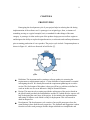
result. This process goes on until the project is ready to deliver. I found this process
very helpful to keep track of the requirements and implementation of the project.
Deployment: The actual deployment starts after the code is appropriately tested and
all other aspects of the project including documentation, has been taken care of. We
have created User Manual for the software.
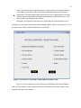
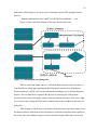
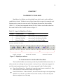
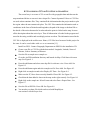
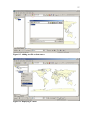
During the development of the Interactive World Map for Natural Disasters tool a
prototype was developed. Screen shots of the prototype follow. The screen in Figure 4.2 is of
the main screen which is launched when the tool is started.
Figure 4.2. Interactive world map: Natural Disasters main screen.
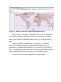
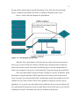
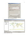
Figure 4.3 is the configured screen of Interactive World Map for Natural Disasters
with one of the disasters chosen which includes the labeled disaster and the country with a
menu bar showing various options.