1
Del.
Rev.
Date
Page
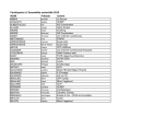
1.0.18 The system must allow management of a
centralized decision-making process
1.0.19 The system must be able to manage
resources with different access restriction
1.0.20 Back-end and front-end shall be
accessible only to specific authorised
resources/bodies
1.2.1
The system should classify users and
reflect decisional daily procedures
1.2.4
The system should give accurate location
of air vehicles including elevation.
1.2.7
The system should allow the use of
drones equipped with sensors
1.2.8
The system should give information about
resources' (includine fire-fighters) and
civilian's health.
Show as a minimum:
the territory
(physical, slopes, type of vegetation,
threatened assets, roads);
Show aas a minimum: information on fire
infrastructures (water points, guard
towers,
network firewalls,
access,
database extinguishing media);
Showing as a minimum:
information
about the resources (location, status) and
extinguishing tasks performed (location,
perimeter, areas, multimedia, etc.);
Showing as a minimum: Information on
digital layer to foster the possibility to turn
off or on information according to specific
needs and roles performed by the users.
The system should allow to know in real
time the position of on ground and air
forces and possible obstacles;
The system should allow to know in real
time the exact location and extension of
a fire, what are the risks and type of
building involved;
The system should allow to know in real
time where firefighting forces (aircrafts,
helicopters, on-ground team) are working.
The system should allow to know in real
time a real simulation of firefighting
operations
The system should be able to define the
Entire process extent of the fire and the
extent of the damaged land.
1.2.10
1.2.11
1.2.12
1.2.13
1.3.1
1.3.2
1.3.3
1.3.4
1.4.2
AF3- Advanced Forest Fire Fighting
D5.2.1
A
30/04/2015
21 of 45
C4I will have the crisis management
model intergated into it
Accsess can be defined by
administartor
Accsess can be defined by
administartor
Users will identify themselves upon
entering the system
The system will receive the location
of the different units from the
sensors or SA, and present it on the
map tool
The system can receive data from
all sensors (with accordance to the
defined AF3 interfaces)
The system will display the data
received from the different AF3
models to the user
Displayable on Map tool using
external sources for information
Displayable on Map tool using
external sources for information
Displayable on Map tool using
external sources for information
Displayable on Map tool using
external sources for information
Displayable on Map tool using
external sources for information
Displayable on Map tool using
external sources for information
Displayable on Map tool using
external sources for information
Displayable on Map tool using
external sources for information
(FFL)
The C4I will have tools that will
allow the user to measure the size
of the affected area or predicted
effected area (prediction by external
Grant Agreement no: 607276