1
GPSy Pro Operations Manual
You’ve now started to receive data from the GPS
unit. GPSy Pro is now acting as the conduit between
your Global Positioning Systems receiver and your
Macintosh. There is no limit what you can do with
this data — from trip planning with nautical charts
and digital mapping to Geographic Information
Systems (GIS); from land surveying to simply
finding your way home, GPSy Pro provides the
high-end GPS communications and GIS mapping
solutions you need.
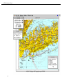
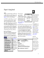
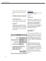
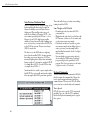
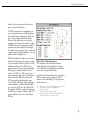
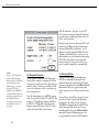
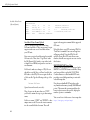
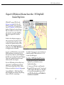
Back to the tutorial. Select “View World Map” from
the File Menu to open up the World Map window
(below). The World Map is provided as a quick way
to determine your GPS current
position. Your current position is
indicated by the red cross inside a
circle icon. Your current track heading is indicated by the green circle. If
your GPS unit is sending navigation
information about your next waypoint, that information may be
displayed as well.
10
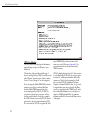
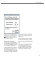
Drag the mouse inside the map, you’ll notice how it
will give the distance, bearing, and “great-circle”
routing from your startng point to destination. You
can also get magnetic declination information as
well. Moving the mouse to the information square
in the bottom left corner will bring up more data
about the image.
While the global resolution of the World Map is
high, it’s not adequate for local navigating. You’ll
most probably want to purchase or download highresolution digital maps of your local area.