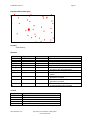
1
User Manual Published: August15, 2003 CanMap® Streetfiles Version 7.2 2003 DMTI Spatial Inc. Page 2 Table of Contents ™ ABOUT DMTI SPATIAL ............................................................................................... 4 Really Smart Spatial Solutions™ .....................................................................................5 DMTI Spatial™ Product & Service Portfolio ........................................................................5 Error Reporting & Wish List Services ................................................................................6 Contact Information.....................................................................................................6 ABOUT CANMAP® STREETFILES .................................................................................. 7 FILE DIRECTORY, STRUCTURE AND CONTENT ................................................................ 8 File Properties ...........................................................................................................8 File Naming Convention ...............................................................................................8 Points of Interest Directory ............................................................................................9 Streets Directory ........................................................................................................9 Topographic Directory................................................................................................ 10 Canada Directory ..................................................................................................... 10 USING CANMAP STREETFILES .................................................................................... 11 Viewing CanMap Streetfiles ......................................................................................... 11 APPENDIX A: GEOGRAPHIC AREA ABBREVIATIONS ....................................................... 12 Provinces and Territories ............................................................................................ 12 Topographic Coverage Areas....................................................................................... 13 APPENDIX B: CANMAP STREET TYPES AND DIRECTIONS .............................................. 14 Street Types ........................................................................................................... 14 Street Directions ...................................................................................................... 16 APPENDIX C: CARTOGRAPHIC ROAD CLASSIFICATIONS................................................. 17 APPENDIX D: DATA DICTIONARY ................................................................................. 18 CanMap Streetfiles Data Structure and Content ................................................................. 18 Area Code Boundaries (acb) ..................................................................................... 18 Building Footprints (bf) ............................................................................................ 19 Building Points (bp) ................................................................................................ 22 Bus Transit – Lines (btl) ........................................................................................... 24 Bus Transit - Points (btp) ......................................................................................... 25 Car Pool Lots (cpl) ................................................................................................. 26 Education (edu)..................................................................................................... 27 Expressway Casements (exc) ................................................................................... 28 Golf Courses (glf) .................................................................................................. 29 Health Care (hcr) .................................................................................................. 30 Primary Highway Casements (hpc) ............................................................................. 31 Major Roads and Highways (hrd)................................................................................ 32 Hydrographic Structures (hs) .................................................................................... 33 Secondary Highway Casements (hsc).......................................................................... 36 Highways (hwy)..................................................................................................... 37 Hydrography (hy) ................................................................................................... 38 Industrial and Resource (ir)....................................................................................... 39 Land Feature Labels (ll) ........................................................................................... 41 Canada\USA Roads Linkages (lnk) ............................................................................. 42 Local Road Casements (lrc) ...................................................................................... 43 Land Use (lu)........................................................................................................ 44 Municipality Amalgamation File (maf)........................................................................... 45 www.dmtispatial.com Proprietary and Confidential to DMTI Spatial Not to be disclosed 2003 DMTI Spatial Inc. Page 3 Major Roads Casements (mrc) .................................................................................. 47 Municipality Boundaries (mun) ................................................................................... 48 Other Transportation (ot).......................................................................................... 50 Physiography (ph).................................................................................................. 51 National and Provincial Parks (pk) .............................................................................. 52 Populated Placenames (ppn) .................................................................................... 53 Provincial Boundaries (prv) ....................................................................................... 54 Pipelines and Transmission (pt) ................................................................................. 55 Recreation and Amusement (ra)................................................................................. 57 Rail (rl) ............................................................................................................... 58 Roads (rds).......................................................................................................... 59 Roads Look Up Table (rds_lut) .................................................................................. 60 Regional Municipality Boundaries (rmn) ........................................................................ 61 Recreation and Amusement – Regions (rp) ................................................................... 62 Rail Stops (rs)....................................................................................................... 64 Rail Transit – Lines (rtl)............................................................................................ 65 Rail Transit - Points (rtp) .......................................................................................... 66 Trail Casements (tlc)............................................................................................... 67 Toll Booths (tol) ..................................................................................................... 68 Topographic Coverage Areas (top) ............................................................................. 69 Time Zones – Standard Time (tzs) / Daylight Savings Time (tzv) .......................................... 70 Vegetation (ve) ..................................................................................................... 71 National Water (wat) ............................................................................................... 72 Wetlands (we) ...................................................................................................... 73 Water Feature Labels (wl) ........................................................................................ 74 Highway Exits (xit)................................................................................................. 75 APPENDIX E: SUGGESTED CANMAP SUITE OF PRODUCTS LAYERING ............................. 76 Layering in MapInfo................................................................................................... 76 ArcView, ArcGIS Layering ........................................................................................... 77 Other CanMap layers ................................................................................................ 78 APPENDIX F: GEOGRAPHICAL PLACEMENT OF DATA..................................................... 79 Precision Codes ....................................................................................................... 79 APPENDIX G: JOINING RDS AND RDS_LUT DATA FILES................................................... 80 In MapInfo Format:.................................................................................................... 80 In ArcView Format: ................................................................................................... 80 In ArcGIS Format:..................................................................................................... 81 APPENDIX H: SHORELINED VS UNSHORELINED BOUNDARIES ......................................... 82 APPENDIX I: CENSUS SUBDIVISION BOUNDARIES AND DATA .......................................... 84 APPENDIX J: FORMAT SPECIFIC INSTRUCTIONS.................................................................. 85 ArcView and ArcGIS Users: .......................................................................................... 85 Shape Files .......................................................................................................... 85 CanMap Label Tool for ArcView 3.x............................................................................. 86 CanMap Identify Tool for ArcView 3.x .......................................................................... 88 MapGuide Users: ..................................................................................................... 89 Unique ID Field ..................................................................................................... 89 CanMap Data Set Configuration for MapGuide .............................................................. 89 www.dmtispatial.com Proprietary and Confidential to DMTI Spatial Not to be disclosed 2003 DMTI Spatial Inc. Page 4 About DMTI Spatial™ DMTI Spatial Inc. is Canada’s leading spatial solutions provider. We enable users to understand their customers, optimize resources, realize opportunities, maximize profitability and make more informed decisions through accurate products and innovative thinking. ® DMTI Spatial publishes precision built street map, rail and routing data (CanMap ), a detailed water layer, ™ and innovative geocoding and address management software (GeoPinpoint ). In addition, DMTI Spatial publishes a full range of positionally accurate geospatial data products including: enhanced points of interest (EPOI), census data and boundaries, postal geography, topographic maps, and US mapping data. As part of a complete business geographic solution, DMTI Spatial offers a wide range of GIS services, consulting, and software training. Established in 1994, DMTI Spatial is committed to setting the standard within the GIS industry for precision built spatial data and geocoding software products. At DMTI Spatial, we believe that our true strength comes from working closely with our customers and providing innovative solutions to meet their strategic business objectives. As Canada’s premier spatial solutions provider we pride ourselves with having worked with North America’s leading organizations to support their mission critical applications. DMTI Spatial works with large and small organizations representative of a wide variety of industries: • • • • • • • Agriculture Banking/Finance Consulting Education Emergency Services Engineering Environmental • • • • • • • Forestry Government Health High Technology Insurance Manufacturing Media • • • • • • Mining Real Estate Retail Telecommunications Transportation Utilities We are a member of the ESRI Canada Business Partner Program, and winner of the 2001 ESRI Worldwide New Business Partner of the Year Award. Strategic business partner of Tele Atlas North America, and winner of the Markham Board of Trade 2000 Award for Entrepreneurship and Innovation. Recipient of The Association of Canadian Map Libraries and Archives (ACMLA) 2002 Certificate of Appreciation. www.dmtispatial.com Proprietary and Confidential to DMTI Spatial Not to be disclosed 2003 DMTI Spatial Inc. Page 5 Really Smart Spatial Solutions™ Through the application of its products and services, DMTI Spatial has been involved with projects such as: location-based services, logistics planning, emergency dispatch, facilities management, data management, customer care, address management, land base development in support of network planning, and marketing/demographic analysis applications. DMTI Spatial can provide all of the components necessary for the acquisition, implementation, operation and maintenance of a successful GIS system within companies of all sizes. Through its product and service offering, DMTI Spatial can provide users with 5 key components: 1. Accurate, detailed and compatible data 2. Comprehensive maintenance program 3. GIS software 4. Consulting and services 5. Software training DMTI Spatial™ Product & Service Portfolio DMTI Spatial’s product & service offering includes: ® CanMap - Digital Map Data for Canada ® • CanMap Streetfiles ® • CanMap RouteLogistics ® • CanMap Rail ® • CanMap Major Roads and Highways ® • CanMap Parks ® • CanMap Water MultiNet™ - Digital Map Data for USA • Tele Atlas MultiNet™ Municipal Amalgamations • Municipality Amalgamation File (MAF) Business & Recreational Points of Interest • Enhanced Points Of Interest (EPOI) ™ 1996 Census Boundaries & Demographic Data • Enumeration Area (EA) • Census Subdivision (CSD) • Census Division (CD) • Census Metropolitan Area/Census Agglomeration (CMA/CA) • Census Tract (CT) • Federal Electoral Districts (FED) 2001 Census Boundaries • Dissemination Area (DA) • Census Subdivision (CSD) • Census Division (CD) • Census Metropolitan Area/Census Agglomeration (CMA/CA) • Census Tract (CT) • Federal Electoral Districts (FED) GeoPinpoint Suite • Canada’s Geocoding Solution • Modular Architecture • Windows Standalone Desktop Version • UNIX, Java Wrapper, ActiveX (DLL Version) GIS Software • Contour Modeling and Display • Demographic Profiling and Lifestyle Targeting • Geocoding and Mapping Software • Routing and Logistics Topographic Data and Base Maps • Canadian Atlas Map Bundle (CAMB) • Populated Placenames • National Topographic Data Base (NTDB) • 30 & 90m Digital Elevation Models (DEM) • Clutter Data Consulting and Services • Address Management Solution (AMS) • Application Development • Database Marketing • Data Conversion and Creation • Database Scrubbing • Geocoding Services • GIS Consulting • Technical Support Postal Geography & Data • Six-Digit Postal Code File • Enhanced Postal Code File • Forward Sortation Area (FSA) Boundary File www.dmtispatial.com Proprietary and Confidential to DMTI Spatial Not to be disclosed Error Reporting & Wish List Services DMTI Spatial is committed to building the best products possible for our customers. By using our data every day in your mission critical application you are our best product tester. Please let us know if you have found an error in any of our products so that we can make the correction for the next release. This is your opportunity to provide feedback directly to the DMTI Spatial Product Development Team. Please be as specific as possible so that we can improve our products quickly and accurately. To access the Error Reporting Web page please visit: http://www.dmtispatial.com/error_reporting.html or send an email to: [email protected] If you have an idea for a new product or an existing product enhancement, please submit your ideas to the Wish List Web page: http://www.dmtispatial.com/product_wish_list.html or send an e-mail to: [email protected] Over the coming months DMTI Spatial will keep you informed of new product releases, enhancements and strategic alliances. Our goal is to provide you with powerful knowledge based tools to help you attain and maintain your competitive advantage. Contact Information DMTI Spatial Inc. rd 625 Cochrane Drive, 3 Floor Markham, Ontario L3R 9R9 Canada Telephone: Toll Free: Fax: 905-948-2000 1-877-477-DMTI (3684) 905-948-9404 URL: Email: www.dmtispatial.com [email protected] © 2003 DMTI Spatial Inc. CanMap is a registered trademark of DMTI Spatial Inc. DMTI Spatial, Really Smart Spatial Solutions, Because Where Is What Matters and GeoPinpoint are trademarks of DMTI Spatial Inc. All rights reserved. Other products and company names mentioned herein may be trademarks of their respective companies. Mention of third-party products is for informational purposes only and constitutes neither a recommendation nor an endorsement. DMTI Spatial is an Authorized User and Distributor of selected Statistics Canada Computer File(s) under Licensing Agreement 6228. No confidential information about an individual, family, household, organization or business has been obtained from Statistics Canada. © Copyright, HER MAJESTY THE QUEEN IN RIGHT OF CANADA, as represented by the Minister of Industry, Statistics Canada 2003. Digital Topographic Data produced under License from Her Majesty the Queen in Right of Canada, with permission of Natural Resources Canada and The Queen in Right of Manitoba. 2003 DMTI Spatial Inc. Page 7 About CanMap® Streetfiles For the most up-to-date information regarding CanMap® Streetfiles please visit: http://www.dmtispatial.com/home.asp www.dmtispatial.com Proprietary and Confidential to DMTI Spatial Not to be disclosed 2003 DMTI Spatial Inc. Page 8 File Directory, Structure and Content File Properties Property Coverage Currency Level of Accuracy File Sizes Projection Datum Formats Description Nationwide Annual maintenance available Ranging from the National Topographic Data Base (NTDB) standard to sub-meter accuracy Please contact DMTI Spatial if you require this information All files are displayed as unprojected Longitude-Latitude All files are in NAD83 datum 1 ESRI and MapInfo File Naming Convention The general file naming convention for the CanMap suite of products is as follows: Geographic Area Abbreviation + File Content Abbreviation \CanMap\ON\Streets\ONhwy example: Product Directory CanMap Geographic Area Directory ON General Content Directory Streets Geographic Area 2 Abbreviation ON File Content Abbreviation hwy 1 Custom formats available upon request 2 Geographic Area Abbreviation Indicates the geographic coverage for each file. It is also used as the name of the Geographic Area Directory, which indicates the geographic coverage for all files contained within it. For a list of common Geographic Abbreviations and their descriptions, please refer to Appendix A entitled: Geographic Area Abbreviations. www.dmtispatial.com Proprietary and Confidential to DMTI Spatial Not to be disclosed 2003 DMTI Spatial Inc. Page 9 Directory Structure CanMap Streetfiles orders come organized in the following directory structure: Directory Name CanMap AREA Canada POI Streets Topo Description Product Directory Geographic Area Directory Canada Directory Points of Interest Directory Streets Directory Topographic Directory Points of Interest Directory Filename AREAcpl AREAedu AREAglf AREAhcr AREAppn AREAtol Description Car Pool Lots Education Golf Courses Health Care Populated Placenames Toll Booths Streets Directory Filename 1 AREAexc AREAhpc AREAhrd AREAhsc AREAhwy AREAlnk AREAlrc AREAmaf AREAmrc AREAmun AREArds AREArds_lut AREAtlc 1 Description Expressways Casements Primary Highways Casements Major Roads and Highways Secondary Highways Casements Highways Canada\USA Roads Linkages Local Roads Casements Municipal Amalgamations File Major Roads Casements Municipality Boundaries Roads Roads Lookup Table Trails Casements Casements not available in ArcInfo Interchange Format (*.e00) www.dmtispatial.com Proprietary and Confidential to DMTI Spatial Not to be disclosed 2003 DMTI Spatial Inc. Page 10 Topographic Directory Filename AREAbf AREAbp AREAhs AREAhy AREAir AREAll AREAlu AREAot AREAph AREApk AREApt AREAra AREArl AREArp AREArs AREAta AREAve AREAwe AREAwl AREAbtl 1 AREAbtp AREArtl 2 AREArtp Description Building Footprints Building Points Hydrographic Structures Hydrography Industrial and Resource Land Feature Labels Land Use Other Transportation Physiography National and Provincial Parks Pipelines and Transmission Recreation and Amusement Rail Recreation and Amusement - Regions Rail Stops Transportation Related Vegetation Wetlands Water Feature Labels Bus Transit – Lines Bus Transit – Points Rail Transit – Lines Rail Transit - Points Canada Directory Directory and File Name \CANADA\rmn \CANADA\wat \CANADA\prv \CANADA\top \CANADA\acb \CANADA\tzs \CANADA\tzv 3 \CANADA\Census\1996 \ Csd\Bdy\Data\ Description Regional Municipality(ies) National Water Provincial Boundaries for Canada DMTI Spatial Topographic boundaries for Canada Canadian Area Code boundaries Canadian Time Zones (Standard Time) Canadian Time Zones (Savings Time) 1996 Census Subdivision Boundaries and Data For file structure and content of each of the layers contained in CanMap Streetfiles, see Appendix D: Data Dictionary. 1 Transit lines and points available in selected major urban centers only Attention ArcInfo, ArcView, ArcGIS and MapGuide users: All 2 character Topographic file names listed above will be suffixed with a ‘p’ (point), ‘l’ (polyline), or ‘r’ (region) to indicate the object type contained in the file. For example, the hy (Hydrography) theme will be provided as hyp (containing points), hyl (containing lines), and hyr (containing regions) files. You may or may not receive all topographic files depending on whether or not they exist in your particular geographical area. 3 1996 Census Subdivision (CSD) Boundaries and Data are currently being provided free of charge. Please refer to the document Cen96CSD.pdf that is included in your shipment, for a full description and detailed file structure of all the CSD boundaries and data included in the Canada directory. See also Appendix I – entitled Census Subdivision Boundaries and Data 2 www.dmtispatial.com Proprietary and Confidential to DMTI Spatial Not to be disclosed 2003 DMTI Spatial Inc. Page 11 Using CanMap Streetfiles Viewing CanMap Streetfiles Packaged with CanMap Streetfiles are several custom viewing files: MapInfo Workspaces (*.wor); ArcView and ArcGIS Project Files (*.apr and *.mxd); or MapGuide Map Window Files (*.mwf). Located in the general content directory, these viewing files have been provided to maximize the ease of use of CanMap Streetfiles by opening and intelligently layering various data layers and displaying them based on appropriate viewing scales. If you wish to use CanMap Streetfiles without the aid of the viewing files, please refer to Appendix E: Suggested CanMap Suite of Products Layering. The *rds.wor viewing file offers a limited number of files for reference purposes only. In contrast, the *top.wor viewing file includes most of the files in the CanMap Streetfiles product for mapping and analysis. Included with the Bonus Canada directory is a Canada viewing file. Viewing Files (*.wor, *.apr, *.mxd, *.mwf) Filename AREArds AREAtop Canada Description Opens and zoom layers populated placenames, roads, major roads and highways, highways, municipality boundaries, regional municipality boundaries, national water, and provincial boundaries. Opens and zoom layers almost all of the CanMap files. Includes labeling of roads, major roads & highways, highways, populated placenames, municipality boundaries, regional municipality boundaries, provincial boundaries. Opens and zoom layers topographic coverage areas, regional municipality boundaries, provincial boundaries and national water for all of Canada. www.dmtispatial.com Proprietary and Confidential to DMTI Spatial Not to be disclosed 2003 DMTI Spatial Inc. Page 12 Appendix A: Geographic Area Abbreviations Provinces and Territories The Province/Territory column in the table below, contains the full names of the 13 Provinces and Territories of Canada. The Abbreviation column contains the Province and Territory abbreviations found in the CanMap suite of products and corresponds to the standard abbreviations used by Canada Post. These abbreviations represent valid Provinces and Territories for geocoding parsed data within GeoPinpoint™. The Code column contains the Statistics Canada Province and Territory Codes. Province/Territory Alberta British Columbia Manitoba New Brunswick Newfoundland and Labrador Nova Scotia Northwest Territories Nunavut Ontario Prince Edward Island Quebec Saskatchewan Yukon Territories www.dmtispatial.com Abbreviation AB BC MB NB NL NS NT NU ON PE QC SK YT Code 48 59 46 13 10 61 12 62 35 11 24 47 60 Proprietary and Confidential to DMTI Spatial Not to be disclosed 2003 DMTI Spatial Inc. Page 13 Topographic Coverage Areas Topographic Coverage Areas represent the 746 geographic regions in Canada for which topographic ® data is provided in the CanMap Streetfiles and CanMap RouteLogistics products. The following is a partial list of the geographic regions included within the topographic coverage areas file (CANtop). For a complete listing please refer to the CANtop file located in the Canada Directory. Topographic Coverage Area Abbreviation Province CALGARY CLGRY AB EDMONTON EDMNT AB VANCOUVER VNCVR BC VICTORIA VCTRA BC WINNIPEG WINPG MB FREDERICTON FRDTN NB SAINT JOHN STJON NB LABRADOR CITY LBDRC NL ST. JOHN'S STJHN NL HALIFAX HALFX NS YELLOWKNIFE YLKNF NT IQALUIT IQALT NU GTA ON HAMILTON NIAGARA HAMNG ON OTTAWA OTAWA ON CHARLOTTETOWN CHLTN PE HULL QC MONTREAL MNTRL QC QUEBEC CITY QBCTY QC REGINA RGNA SK WTHRS YT GREATER TORONTO AREA HULL WHITEHORSE Note: Please contact DMTI Spatial for information regarding the municipalities and/or regional municipalities that constitute each Topographic Coverage Area. www.dmtispatial.com Proprietary and Confidential to DMTI Spatial Not to be disclosed 2003 DMTI Spatial Inc. Page 14 Appendix B: CanMap Street Types and Directions Street Types The Street Type column in the table below contains the full name of each street type. Both English and ® French types are listed. The Abbreviaton column contains the street types found in the CanMap suite of products and represent valid street types for geocoding parsed data within GeoPinpoint™. All street types correspond to the standard abbreviations used by Canada Post. The Language column distinguishes between street types in English (E) and street types in French (F). Street Type Abbreviation Abbey Acres Allée Alley Autoroute Avenue Avenue Bay Beach Bend Boulevard Boulevard By-Pass Byway Centre Campus Cape Carr Carrefour Cul-de-sac Cercle Chemin Chase Circle Circuit Close Common Concession Côte Cour Cours Cove ABBEY ACRES ALLÉE ALLEY AUT AV AVE BAY BEACH BEND BLVD BOUL BYPASS BYWAY C CAMPUS CAPE CAR CARREF CDS CERCLE CH CHASE CIR CIRCT CLOSE COMMON CONC CÔTE COUR COURS COVE www.dmtispatial.com Language E E F E F F E E E E E F E E F E E F F E F F E E E E E E F F F E Street Type Abbreviation Crescent Corners Croissant Crossing Court Centre Dale Dell Diversion Downs Drive Échangeur End Esplanade Estates Expressway Extension Farm Field Forest Front Freeway Gate Gardens Glade Glen Green Grounds Grove Harbour Heath Highlands CRES CRNRS CROIS CROSS CRT CTR DALE DELL DIVERS DOWNS DR ÉCH END ESPL ESTATE EXPY EXTEN FARM FIELD FOREST FRONT FWY GATE GDNS GLADE GLEN GREEN GRNDS GROVE HARBR HEATH HGHLDS Proprietary and Confidential to DMTI Spatial Not to be disclosed Language E E F E E E E E E E E F E E E E E E E E E E E E E E E E E E E E 2003 DMTI Spatial Inc. Street Type Abbreviation Hill Hollow Heights Highway Île Impasse Inlet Island Key Knoll Landing Lane Line Link Lookout Limits Loop Mall Manor Maze Meadow Mews Montée Moor Mount Mountain Orchard Parade Parc Passage Path Pines Park Parkway Pathway Place Place Plateau Plaza Port Point Pointe HILL HOLLOW HTS HWY ÎLE IMP INLET ISLAND KEY KNOLL LANDNG LANE LINE LINK LKOUT LMTS LOOP MALL MANOR MAZE MEADOW MEWS MONTÉE MOOR MOUNT MTN ORCH PARADE PARC PASS PATH PINES PK PKY PTWAY PL PLACE PLAT PLAZA PORT PT POINTE www.dmtispatial.com Page 15 Language E E E E F E E E E E E E E E E E E E E E E E F E E E E E F E E E E E E E F E E E E F Street Type Abbreviation Private Promenade Quai Quay Ramp Rang Road Rond-point Range Ridge Rise Ruelle Row Route Rue Run Sentier Square Street Subdivision Terrace Thicket Townline Towers Trail Turnabout Terrasse Vale Via View Villas Village Vista Voie Walk Way Wharf Wood Wynd PVT PROM QUAI QUAY RAMP RANG RD RDPT RG RIDGE RISE RLE ROW RTE RUE RUN SENT SQ ST SUBDIV TERR THICK TLINE TOWERS TRAIL TRNABT TSSE VALE VIA VIEW VILLAS VILLGE VISTA VOIE WALK WAY WHARF WOOD WYND Proprietary and Confidential to DMTI Spatial Not to be disclosed Language E E F E E F E F E E E F E E F E E E E E E E E E E E F E E E E E E F E E E E E 2003 DMTI Spatial Inc. Page 16 Street Directions The Street Direction column in the table below contains the full name of each street direction. Both English and French directions are listed. The abbreviation column contains the street directions found in ® the CanMap suite of products and represent valid street directions for geocoding parsed data within GeoPinpoint™. All street directions correspond to the standard abbreviations used by Canada Post. The Language column distinguishes between street directions in English (E) and street directions in French (F). Street Direction Abbreviation East Est Nord NordEst NordOuest North NorthEast NorthWest Ouest South SouthEast SouthWest Sud SudEst SudOuest West E E N NE NO N NE NW O S SE SW S SE SO W www.dmtispatial.com Language E F F F F E E E F E E E F F F E Proprietary and Confidential to DMTI Spatial Not to be disclosed Appendix C: Cartographic Road Classifications The Carto column in the table below represents the cartographic classification for the roads in the CanMap suite of products. Carto Name 1 Expressway Description Expressways and 400 series highways, e.g. Highway 401, Don Valley Parkway 2 Primary Highway Primary Highway, e.g. Highway 7, Highway 11 Thick Red 3 Secondary Highway Secondary Highways Thick Orange 4 Major Road Major road or Arterial road, e.g. Bayview Ave Thick Black 5 Local Road Thin Black 6 Trail Subdivision road in a city or gravel road in a rural area Trails 20 Ferry Route Approximate travel route of Ferry Thin Dark Grey Dashed 21 Ferry Ramp Ferry Ramp Thin Dark Grey 22 Ice Road Approximate travel route of Ice Road Thin Dark Grey Dashed 23 Ice Ramp Ice Ramp Thin Dark Grey 24 Ferry Route/Ice Road Approximate travel route of Ferry/Ice Road Thin Dark Grey Dashed 25 Ferry/Ice Ramp Thin Dark Grey Ferry/Ice Ramp Appearance Teal and White Interleaved Thin Green 2003 DMTI Spatial Inc. Page 18 Appendix D: Data Dictionary CanMap Streetfiles Data Structure and Content Area Code Boundaries (acb) Location \Canada\ directory Structure Field Name AreaCode Prov Type Character Character Size 8 8 Description Area Code Province (Abbreviation). Records may contain multiple abbreviations in cases where area codes are shared between provinces. Content The Area Code Boundaries are based on CanMap Streetfiles Municipality Boundaries. They are useful for Call Center applications. It is recommended that the National Water file be layered on top of the Area Code Boundaries to provide a cartographically pleasing map. The following list contains the provinces and territories of Canada along with their telephone Area Codes: Province AB AB BC BC MB NB NL NS/PE ON ON www.dmtispatial.com Area Code 403 780 250 604 204 506 709 902 416/647 519 Province ON ON ON ON QC QC QC QC SK YT/NT/NU Proprietary and Confidential to DMTI Spatial Not to be disclosed Area Code 613 705 807 905/289 418 450 514 819 306 867 2003 DMTI Spatial Inc. Page 19 Building Footprints (bf) Location \Topo\ directory Structure Field Name Code Feature Category Type Decimal Character Character Size 11,0 76 40 Description Feature Code Feature Type Feature Category Content Code 106 107 108 109 111 112 113 114 115 116 117 118 119 120 120 121 122 123 Feature ARENA ARMOURY AUTOMOBILE PLANT BARN/MACHINERY SHED CEMENT PLANT CHEMICAL PLANT CHURCH CITY HALL COAST GUARD STATION COLLEGE COMMUNITY CENTRE CONVENT CORRECTIONAL INSTITUTE COURTHOUSE COURT HOUSE CUSTOMS POST DOME ELECTRIC POWER STATION www.dmtispatial.com Proprietary and Confidential to DMTI Spatial Not to be disclosed 2003 DMTI Spatial Inc. Code 124 125 126 127 128 129 130 131 132 133 134 135 136 137 139 140 141 142 143 144 145 146 146 147 149 150 151 152 153 154 155 156 157 158 159 160 161 162 163 164 165 166 167 168 169 170 171 172 Page 20 Feature FACTORY FILTRATION PLANT FIRE STATION FIRE/POLICE STATION FISH HATCHERY FISH PROCESSING PLANT GRAIN ELEVATOR HALL HIGHWAY SERVICE CENTRE HOSPITAL HOSTEL HOTEL KILN (TOBACCO) LUMBER MILL MEDICAL CENTRE MONASTERY MOTEL MUNICIPAL HALL MUSEUM NON-CHRISTIAN PLACE OF WORSHIP OBSERVATORY OIL/GAS FACILITIES BUILDING GAS AND OIL FACILITIES OTHER PARLIAMENT BUILDING PENITENTIARY PETROLEUM REFINERY PLANT POLICE STATION PULP/PAPER MILL RAILWAY STATION REFORMATORY SANATORIUM SATELLITE-TRACKING STATION SAWMILL SCHOOL SEMINARY SENIOR CITIZENS HOME SEWAGE TREATMENT PLANT SHIPYARD SHOPPING CENTRE SPORTSPLEX STEEL MILL TRADING POST UNIVERSITY WARDEN/RANGER STATION WATER TREATMENT PLANT WEIGH SCALE (HIGHWAY) www.dmtispatial.com Proprietary and Confidential to DMTI Spatial Not to be disclosed 2003 DMTI Spatial Inc. Code 172 174 175 176 177 178 179 585 585 618 1220 1220 11000 Page 21 Feature WEIGHT SCALE GREENHOUSE PENAL BUILDING LODGING FACILITIES INDUSTRIAL BUILDING RELIGIOUS BUILDING EDUCATIONAL BUILDING FORT: GENERIC/UNKNOWN FORT GREENHOUSE STADIUM STADIUM: GENERIC/UNKNOWN AIRPORT BUILDING www.dmtispatial.com Proprietary and Confidential to DMTI Spatial Not to be disclosed 2003 DMTI Spatial Inc. Page 22 Building Points (bp) Location \Topo\ directory Structure Field Name Code Feature Category Type Decimal Character Character Size 11,0 76 40 Description Feature Code Feature Type Feature Category Content Code 109 110 113 114 115 118 122 123 125 126 127 128 129 130 136 Feature BARN/MACHINERY SHED CABIN CHURCH CITY HALL COAST GUARD STATION CONVENT DOME ELECTRIC POWER STATION FILTRATION PLANT FIRE STATION FIRE/POLICE STATION FISH HATCHERY FISH PROCESSING PLANT GRAIN ELEVATOR KILN (TOBACCO) www.dmtispatial.com Proprietary and Confidential to DMTI Spatial Not to be disclosed 2003 DMTI Spatial Inc. Page 23 Code Feature 137 140 LUMBER MILL MONASTERY NON-CHRISTIAN PLACE OF WORSHIP OIL/GAS FACILITIES BUILDING OUTBUILDING PETROLEUM REFINERY RAILWAY STATION SAWMILL SEWAGE TREATMENT PLANT SHIPYARD STEEL MILL WARDEN/RANGER STATION WATER TREATMENT PLANT GREENHOUSE RELIGIOUS BUILDING CEMETERY LOOKOUT SHRINE 144 146 148 151 155 159 163 164 167 170 171 174 178 250 684 1119 www.dmtispatial.com Proprietary and Confidential to DMTI Spatial Not to be disclosed 2003 DMTI Spatial Inc. Page 24 Bus Transit – Lines (btl)1 Location \Topo\ directory Structure Field Name Route System Type 1 Type Character Character Character Size 100 100 20 Description Route name Transit System name Type (Mode) of Transit Available in selected major urban centers only www.dmtispatial.com Proprietary and Confidential to DMTI Spatial Not to be disclosed 2003 DMTI Spatial Inc. Page 25 Bus Transit - Points (btp) Location \Topo\ directory Structure Field Name Stop Route System Type www.dmtispatial.com Type Character Character Character Character Size 100 100 100 20 Description Stop name Route name Transit System name Type (Mode) of Transit Proprietary and Confidential to DMTI Spatial Not to be disclosed 2003 DMTI Spatial Inc. Page 26 Car Pool Lots (cpl) Location \POI\ directory Structure Field Name Name Location City Prov Exit_Num Direction Type Character Character Character Character Character Character Size 125 100 68 2 5 5 1 Character Character 2 15 Prec_Code POI_ID 1 Description Car Pool Lot name Car Pool Lot Location City (or closest Municipality) Province (Abbreviation) Highway Exit Number at Car Pool Lot Location Direction of Highway at Car Pool Lot Location Code indicating the positional accuracy or precision of the geocoded feature Unique ID For details please refer to the Appendix F: Precision Codes www.dmtispatial.com Proprietary and Confidential to DMTI Spatial Not to be disclosed 2003 DMTI Spatial Inc. Page 27 Education (edu) Location \POI\ directory Structure Field Name Name Type Char Size 125 1 Char Char Char 2 2 15 Prec_Code AttribCode POI_ID Description Educational facility name Code indicating the positional accuracy or precision of the geocoded feature Code to indicate the accuracy of the attribute data Unique ID Content Includes Elementary, High Schools, Colleges, Cégeps and Universities. www.dmtispatial.com Proprietary and Confidential to DMTI Spatial Not to be disclosed 2003 DMTI Spatial Inc. Page 28 Expressway Casements (exc) Location \Streets\ directory Structure Field Name Street Rds_Id www.dmtispatial.com Type Character Decimal Size 64 9,0 Description Street Title UniqueId of related Roads (rds) segment Proprietary and Confidential to DMTI Spatial Not to be disclosed 2003 DMTI Spatial Inc. Page 29 Golf Courses (glf) Location \POI\ directory Structure Field Name Name Type Char Size 125 1 Char 2 Char Char 2 15 Prec_Code AttribCode POI_ID Description Golf Course name Code indicating the positional accuracy or precision of the geocoded feature Code to indicate the accuracy of the attribute data Unique ID Content Includes both Private and Public golf courses as well as their locations, phone numbers and number of holes. www.dmtispatial.com Proprietary and Confidential to DMTI Spatial Not to be disclosed 2003 DMTI Spatial Inc. Page 30 Health Care (hcr) Location \POI\ directory Structure Field Name Name Type Char Size 125 1 Char Char Char 2 2 15 Prec_Code AttribCode POI_ID Description Health Care facility name Code indicating the positional accuracy or precision of the geocoded feature Code to indicate the accuracy of the attribute data Unique ID (link to main POI database) Content Includes Hospitals, Long-Term Care Centers, Nursing Stations, Outpatient Clinics and Community Health Centers. www.dmtispatial.com Proprietary and Confidential to DMTI Spatial Not to be disclosed 2003 DMTI Spatial Inc. Page 31 Primary Highway Casements (hpc) Location \Streets\ directory Structure Field Name Street Rds_ Id www.dmtispatial.com Type Character Decimal Size 64 9,0 Description Street Title UniqueID of related Roads (rds) segment Proprietary and Confidential to DMTI Spatial Not to be disclosed 2003 DMTI Spatial Inc. Page 32 Major Roads and Highways (hrd) Location \Streets\ directory Structure Field Name Street 1 Carto Left_Mun Right_Mun Left_Maf Right_Maf Left_Fsa Right_Fsa Left_Prv Right_Prv UniqueId 1 Type Character Decimal Character Character Character Character Character Character Character Character Decimal Size 69 3,0 68 68 70 70 3 3 2 2 9,0 Description Street Title Cartographic Road Classification Municipality Municipality Municipal Amalgamation Municipal Amalgamation Forward Sortation Area Forward Sortation Area Province (Abbreviation) Province (Abbreviation) Unique Identifier of Street segment For details please refer to the Appendix C: Cartographic Road Classifications www.dmtispatial.com Proprietary and Confidential to DMTI Spatial Not to be disclosed 2003 DMTI Spatial Inc. Page 33 Hydrographic Structures (hs) Location \Topo\ directory Structure Field Name Code Feature Type Decimal Character Size 11,0 76 Description Feature Code Feature Type Content Code 58 58 80 80 275 275 276 277 277 278 289 359 360 361 405 429 429 Feature BOAT RAMP BOAT RAMP: GENERIC/UNKNOWN BREAKWALL/BREAKWATER BREAKWATER: UNKNOWN CONDUIT: ABOVEGROUND, PENSTOCK CONDUIT: GROUND LEVEL, PENSTOCK CONDUIT: UNDERGROUND, PENSTOCK CONDUIT: ABOVEGROUND, OTHER CONDUIT: GROUND LEVEL, OTHER CONDUIT: UNDERGROUND, OTHER CONDUIT BRIDGE: GENERIC/UNKNOWN DAM DAM: OTHER DAM: SLUICE GATE DRYDOCK DYKE/LEVEE DYKE/LEVEE: UNKNOWN www.dmtispatial.com Proprietary and Confidential to DMTI Spatial Not to be disclosed 2003 DMTI Spatial Inc. Code 475 486 519 519 530 530 541 651 662 673 673 743 744 755 766 766 767 777 847 909 910 911 912 967 979 980 981 982 1033 1044 1044 1108 1108 1163 1174 1209 1209 1453 1503 1503 1514 1666 1667 1668 1669 Page 34 Feature EXPOSED SHIPWRECK FALLS FISH LADDER FISH LADDER: GENERIC/UNKNOWN FISH POUND FISH POUND: GENERIC/UNKNOWN FLOODED AREA IRRIGATION CANAL/DITCH KELP: GENERIC/UNKNOWN LOCK GATE: GENERIC/UNKNOWN LOCK GATE NAVIGABLE CANAL: ABANDONED NAVIGABLE CANAL: OPERATIONAL NAVIGATION BEACON NAVIGATION LIGHT NAVIGATIONAL AID: NAVIGATION LIGHT NAVIGATIONAL AID: NAVIGATION BEACON OBSTACLE IN WATER PERMANENT SNOW AND ICE: OTHER POND PARTITION: GENERIC/UNKNOWN POND PARTITION: FISH POUND POND PARTITION: RESERVOIR POND PARTITION: WASTE RAPIDS RESERVOIR: OPEN, DRINKING WATER RESERVOIR RESERVOIR: UNDERGROUND, DRINKING WATER RESERVOIR RESERVOIR: OPEN,DUGOUT RESERVOIR: OPEN,FILTRATION POND ROCK IN WATER ROCKY LEDGE/REEF ROCKY LEDGE/REEF: GENERIC/UNKNOWN SEAWALL SEAWALL: GENERIC/UNKNOWN SLIP SLUICE GATE SPRING SPRING: GENERIC/UNKNOWN WATER BODY: IRRIGATION CANAL WHARF WHARF: UNKNOWN WIND-OPERATED DEVICE: GENERIC/UNKNOWN LIQUIDS DEPOT/DUMPS: LIQUID WASTE, SEWAGE POND LIQUIDS DEPOT/DUMP: LIQUID WASTE, SETTLING POND LIQUIDS DEPOT/DUMP: LIQUID WASTE, UNKNOWN LIQUIDS DEPOT/DUMP: WATER, OTHER www.dmtispatial.com Proprietary and Confidential to DMTI Spatial Not to be disclosed 2003 DMTI Spatial Inc. Code 1670 1671 1681 1682 1683 1701 1702 1710 Page 35 Feature LIQUIDS DEPOT/DUMP: WATER, FILTRATION POND LIQUID DEPOT/DUMP: WATER, DRINKING WATER HAZARD TO NAVIGATION: ROCK IN WATER HAZARD TO NAVIGATION: EXPOSED SHIPWRECK HAZARD TO NAVIGATION: OBSTACLE IN WATER WATER DISTURBANCE: FALLS WATER DISTURBANCE: RAPID UNDERGROUND RESERVOIR: GENERIC/UNKNOWN www.dmtispatial.com Proprietary and Confidential to DMTI Spatial Not to be disclosed 2003 DMTI Spatial Inc. Page 36 Secondary Highway Casements (hsc) Location \Streets\ directory Structure Field Name Street Rds_ Id www.dmtispatial.com Type Character Decimal Size 64 9,0 Description Street Title UniqueId of related Roads (rds) segment Proprietary and Confidential to DMTI Spatial Not to be disclosed 2003 DMTI Spatial Inc. Page 37 Highways (hwy) Location \Streets\ directory Structure Field Name Street 1 Carto Left_Mun Right_Mun Left_Maf Right_Maf Left_Fsa Right_Fsa Left_Prv Right_Prv UniqueId www.dmtispatial.com Type Character Decimal Character Character Character Character Character Character Character Character Decimal Size 68 3,0 68 68 70 70 3 3 2 2 9,0 Description Street Title Cartographic Road Classification Municipality Municipality Municipal Amalgamation Municipal Amalgamation Forward Sortation Area Forward Sortation Area Province (Abbreviation) Province (Abbreviation) Unique Identifier of Street segment Proprietary and Confidential to DMTI Spatial Not to be disclosed 2003 DMTI Spatial Inc. Page 38 Hydrography (hy) Location \Topo\ directory Structure Field Name Code Feature Type Decimal Character Size 11,0 76 Description Feature Code Feature Type Content Code 371 372 1450 1451 1452 1454 1463 Feature DISAPPEARING STREAM: OTHER DISAPPEARING STREAM: SINKHOLE WATERBODY: INTERMITTENT/SLOUGH WATERBODY: IN STRING BOG WATERBODY: OTHER WATERBODY: FLOODED AREA WATERCOURSE: UNKNOWN www.dmtispatial.com Proprietary and Confidential to DMTI Spatial Not to be disclosed 2003 DMTI Spatial Inc. Page 39 Industrial and Resource (ir) Location \Topo\ directory Structure Field Name Code Feature Type Decimal Character Size 11,0 76 Description Feature Code Feature Type Content Code 34 34 347 348 417 418 695 695 707 708 709 788 788 793 898 923 1231 1242 1242 1435 1436 Feature AUTO WRECKER: GENERIC/UNKNOWN AUTO WRECKER CUT LINE: FIREBREAK CUT LINE: OTHER DUMP: ABANDONED DUMP: OTHER LUMBER YARD LUMBER YARD: GENERIC/UNKNOWN MINE: ABANDONED,N/A MINE: OPERATIONAL,OPEN-PIT MINE: OPERATIONAL,OTHER OIL/GAS FACILITIES GAS AND OIL FACILITIES: GENERIC/UNKNOWN OIL OR GAS FIELD: GENERIC/UNKNOWN PIT QUARRY STOCKPILE STOCKYARD STOCKYARD: GENERIC/UNKNOWN WASTE: OTHER, LIQUID WASTE: SETTLING POND,LIQUID www.dmtispatial.com Proprietary and Confidential to DMTI Spatial Not to be disclosed 2003 DMTI Spatial Inc. Code 1437 1438 1656 1657 1658 1659 1690 1691 1692 1693 1694 1697 Page 40 Feature WASTE: SEWAGE DISPOSAL POND,LIQUID WASTE: OTHER,SOLID SOLIDS DEPOT/DUMP: DOMESTIC, WASTE, ABANDONED SOLIDS DEPOT/DUMP: DOMESTIC, WASTE, OPERATIONAL SOLIDS DEPOT/DUMP: INDUSTRIAL, WASTE, UNKNOWN SOLIDS DEPOT/DUMP: INDUSTRIAL, STOCKPILE, UNKNOWN MINING AREA: UNKNOWN, UNKNOWN, UNKNOWN MINING AREA: PIT, OPEN PIT, OPERATIONAL MINING AREA: QUARRY, OPEN PIT, OPERATIONAL MINING AREA: MINE, OPEN, PIT, OPERATIONAL MINING AREA: MINE, UNKNOWN, ABANDONED MINING AREA: MINE, UNDERGROUND, OPERATIONAL www.dmtispatial.com Proprietary and Confidential to DMTI Spatial Not to be disclosed 2003 DMTI Spatial Inc. Page 41 Land Feature Labels (ll) Location \Topo\ directory Structure Field Name Name Code Feature Type Character Decimal Character Size 100 11,0 76 Description Feature Name Feature Code Feature Type Content Code 1851 1854 1855 Feature TOPONYM: PLACE TOPONYM: RELIEF TOPONYM: TRANSPORT www.dmtispatial.com Proprietary and Confidential to DMTI Spatial Not to be disclosed 2003 DMTI Spatial Inc. Page 42 Canada\USA Roads Linkages (lnk) Location \Streets\ directory Structure Field Name RDS_ID CAN_Street Prov USA_Street State Port_Entry Longitude Latitude www.dmtispatial.com Type Decimal Character Character Character Character Character Decimal Decimal Size 9,0 69 2 69 2 100 11,6 11,6 Description UniqueId of related Roads (rds) segment Canadian Street at Roads Linkage Province (Abbreviation) American Street at Roads Linkage State (Abbreviation) Port of Entry Name (where applicable) Longitude of Roads Linkage Latitude of Roads Linkage Proprietary and Confidential to DMTI Spatial Not to be disclosed 2003 DMTI Spatial Inc. Page 43 Local Road Casements (lrc) Location \Streets\ directory Structure Field Name Street Rds_ Id www.dmtispatial.com Type Character Decimal Size 64 9,0 Description Street Title UniqueId of related Roads (rds) segment Proprietary and Confidential to DMTI Spatial Not to be disclosed 2003 DMTI Spatial Inc. Page 44 Land Use (lu) Location \Topo\ directory Structure Field Name Category Type Character Size 40 Description Category of Landuse Content Landuse Categories: Commercial; Government and Institutional; Open Area; Parks and Recreational; Residential; Resource and Industrial; Waterbody. www.dmtispatial.com Proprietary and Confidential to DMTI Spatial Not to be disclosed 2003 DMTI Spatial Inc. Page 45 Municipality Amalgamation File (maf) Location \Streets\ directory Structure Field Name Name Prov Type Character Character Size 70 2 Type 1 Eff_Date Character Character 3 8 Description Municipality name 2 letter province abbreviation from Canada Post Census Subdivision type Date the municipality change comes into effect. Date appears in YYYYMMDD format. Content Municipality Type C CC CM COM CT CU DM HAM ID IGD IM Description City Chartered Community County (Municipality) Community Canton Cantons Unis District Municipality Hamlet Improvement District Indian Government District Island Municipality Code LGD Feature Local Government District 1 Null records indicate Census Subdivisions that have not changed www.dmtispatial.com Proprietary and Confidential to DMTI Spatial Not to be disclosed 2003 DMTI Spatial Inc. LOT M MD NH NL NV NVL P PAR R RC RDA RG RGM RM RV S-E SA SCM SET SM SUN SV T TI TL TP TR UNO V VC VK VL VN Page 46 Township and Royalty Municipalité Municipality District Northern Hamlet Nisga’a Land Northern Village Nisga’a Village Paroisse (Municipalité de) Parish Indian Reserve / Réserve indienne Rural Community Regional District Electoral Area Region Regional Municipality Rural Municipality Resort Village Indian Settlement / Établissement indien Special Area Subdivision of County Municipality Settlement Specialized Municipality Subdivision of Unorganized Summer Village Town Terre Inuite Teslin Land Township Terres Réservées Unorganized / Non-oraganisé Ville Village Cri Village Naskapi Village Village Nordique Please Note: The Municipality Amalgamation File is intended to be used as a supplementary Census Subdivision boundary with CanMap Streetfiles and CanMap RouteLogistics. Amalgamations are defined as a consolidation of two or more entire municipalities. Amalgamations are differentiated from annexations in that an annexation is the process of a given municipality incorporating one or more partial municipalities. The file contains: • Amalgamations from the 1996 census until Summer 2002 • New Census Subdivisions added in the 2001 census • Census Subdivision Type revisions from 1996 • Census Subdivision Name revisions from 1996 • Census Subdivision Code (PRCDCSD) revisions from 1996 • Additional amalgamations since Statistics Canada released their 2001 CSD using direct information from provinces and territories www.dmtispatial.com Proprietary and Confidential to DMTI Spatial Not to be disclosed 2003 DMTI Spatial Inc. Page 47 Major Roads Casements (mrc) Location \Streets\ directory Structure Field Name Street Rds_ Id www.dmtispatial.com Type Character Decimal Size 64 9,0 Description Street Title UniqueId of related Roads (rds) segment Proprietary and Confidential to DMTI Spatial Not to be disclosed 2003 DMTI Spatial Inc. Page 48 Municipality Boundaries (mun) Location \Streets\ directory Structure Field Name Name Prov Type Pop96 1 Pop_SqKm Dwell96 Shore_Area Type Character Character Character Decimal Decimal Decimal Decimal Size 68 2 3 11,0 11,1 11,0 20,5 Description Municipality name Province (Abbreviation) Municipality Type 1996 Population Population Density (per square kilometer) 1996 Dwelling count Actual land area in sq km (not including any part of the Municipality covered by water). This field can be used during land area 2 analysis Content Municipality Type B C CC CM COM CT CU DM HAM 1 2 Description Borough City Chartered Community County Community Canton Cantons Unis District Municipality Hamlet Based on 1996 population figures and land area in square kilometers All area figures were calculated using a Robinson projection www.dmtispatial.com Proprietary and Confidential to DMTI Spatial Not to be disclosed 2003 DMTI Spatial Inc. Code ID IGD LGD LOT M MD NH NT NV P PAR R RC RGM RM RV S-E SA SCM SET SM SRD SUN SV T TI TP TR UNO V VC VK VL VN www.dmtispatial.com Page 49 Feature Improvement District Indian Government District Local Government District Township and Royalty Municipality Municipality District Northern Hamlet Northern Town Northern Village Paroisse Parish Indian Reserve Rural Community Regional Municipality Rural Municipality Resort Village Indian Settlement Special Area Subdivision of County Municipality Settlement Specialized Municipality Subdivision of Regional District Subdivision of Unorganized Summer Village Town Terre Inuite Township Terres Réservées Unorganized Ville Village Cri Village Naskapi Village Village Nordique Proprietary and Confidential to DMTI Spatial Not to be disclosed 2003 DMTI Spatial Inc. Page 50 Other Transportation (ot) Location \Topo\ directory Structure Field Name Code Feature Name Type Decimal Character Character Size 11,0 76 100 Description Feature Code Feature Type Feature Name Content Code 46 335 1306 1307 1387 Feature BARRIER/GATE: OTHER CUT: GENERIC/UNKNOWN TRAIL: OTHER TRAIL: PORTAGE TURNTABLE: GENERIC/UNKNOWN www.dmtispatial.com Proprietary and Confidential to DMTI Spatial Not to be disclosed 2003 DMTI Spatial Inc. Page 51 Physiography (ph) Location \Topo\ directory Structure Field Name Code Feature Type Decimal Character Size 11,0 76 Description Feature Code Feature Type Content Code 239 239 394 394 451 451 574 731 1083 1084 Feature CAVE ENTRANCE CAVE ENTRANCE: GENERIC/UNKNOWN DRY RIVER BED DRY RIVER BED: GENERIC/UNKNOWN ESKER ESKER: GENERIC/UNKNOWN FORESHORE FLATS MORAINE: GENERIC/UNKNOWN SAND: OTHER SAND: UNDERWATER www.dmtispatial.com Proprietary and Confidential to DMTI Spatial Not to be disclosed 2003 DMTI Spatial Inc. Page 52 National and Provincial Parks (pk) Location \Topo\ directory The National and Provincial Parks file is derived from the CanMap Parks product. Structure Field Name PARK PARK_TYPE Type Char Char Size 68 40 PARK_CLASS Char 40 PROV Char 2 Description National or Provincial Park Name Defines park as being National, Provincial or Territorial Park designation – Wildlife, Recreation, Historical, Waterway, Natural Environment, Heritage, etc. Province (Abbreviation) Notes: Duplicate naming exists within the Canadian Parks system, below is a full listing of duplicates. Park Name Cypress Hills Provincial Park Duck Mountain Provincial Park Long Lake Provincial Park Long Point Provincial Park Mara Provincial Park Sandbanks Provincial Park Silver Lake Provincial Park Ten Mile Lake Provincial Park Tuktut Nogait National Park White Lake Provincial Park Wood Buffalo National Park www.dmtispatial.com Prov AB SK NS NS ON ON ON NS NU ON AB Prov SK MB AB ON BC NL BC BC NT BC NT Description Inter-Provincial Common Name Common Name Common Name Common Name Common Name Common Name Common Name Inter-Provincial Common Name Inter-Provincial Proprietary and Confidential to DMTI Spatial Not to be disclosed 2003 DMTI Spatial Inc. Page 53 Populated Placenames (ppn) Location \POI\ directory Structure Field Name Name Prov Longitude Latitude PPN_Code 1 Prec_Code Type Character Character Decimal Decimal Decimal Decimal Size 68 2 11,6 11,6 3,0 2,0 Mjr_City Captial Logical Logical - PRCDCSD Character 8 CSD_Name Character 68 CSD_Pop9 6 Decimal 11,0 Description Placename Province (Abbreviation) Longitude of Populated Placename Latitude of Populated Placename Populated Placename Code Code indicating the positional accuracy or precision of the geocoded feature Identifies cities with populations > 100,000 Identifies provincial capital cities and nation capital Census Subdivision (CSD) code in which the placename is located Census Subdivision (CSD) name in which the placename is located Census Subdivision (CSD) population (1996) in which the placename is located Content PPN_Code 100 1 2 3 4 www.dmtispatial.com Populated Placename Major City City Town Community (rural communities, hamlets, settlements) Urban or Suburban Community Proprietary and Confidential to DMTI Spatial Not to be disclosed 2003 DMTI Spatial Inc. Page 54 Provincial Boundaries (prv) Location \Canada\ directory Structure 1 2 Field Name Name Prov Pop96 1 Pop_SqKm Type Character Character Decimal Decimal Size 68 2 11,0 11,1 Dwell96 Shore_Area Decimal Decimal 11,0 20,5 Description Province name Province (Abbreviation) 1996 Population Population Density (per square kilometer) 1996 Dwelling count Actual land area in sq km (not including any part of the Province covered by water). This field can be used during land area 2 analysis Based on 1996 population figures and land area in square kilometers All area figures were calculated using a Robinson projection www.dmtispatial.com Proprietary and Confidential to DMTI Spatial Not to be disclosed 2003 DMTI Spatial Inc. Page 55 Pipelines and Transmission (pt) Location \Topo\ directory Structure Field Name Code Feature Type Decimal Character Size 11,0 76 Description Feature Code Feature Type Content Code 881 881 882 882 883 883 884 884 885 885 886 886 887 887 890 Feature PIPELINE: NATURAL GAS, ABOVEGROUND PIPELINE: NATURAL GAS ,ABOVEGROUND PIPELINE: NATURAL GAS,UNDERGROUND PIPELINE: NATURAL GAS, UNDERGROUND PIPELINE: OIL,ABOVEGROUND PIPELINE: OIL ABOVEGROUND PIPELINE: OIL UNDERGROUND PIPELINE: OIL,UNDERGROUND PIPELINE: SEWAGE/WASTE, ABOVEGROUND PIPELINE: SEWAGE/WASTE,ABOVEGROUND PIPELINE: UNKNOWN,ABOVEGROUND PIPELINE: UNKNOWN, ABOVEGROUND PIPELINE: UNKNOWN,UNDERGROUND PIPELINE: UNKNOWN, UNDERGROUND PIPELINE: MULTIUSE, ABOVEGROUND www.dmtispatial.com Proprietary and Confidential to DMTI Spatial Not to be disclosed 2003 DMTI Spatial Inc. Code 891 1318 1318 1330 1330 1331 1331 1332 1332 1398 1398 Page 56 Feature PIPELINE: MULTIUSE, UNDERGROUND TRANSFORMER STATION (ELECTRIC) TRANSFORMER STATION: GENERIC/UNKNOWN TRANSMISSION LINE: POWER,OTHER TRANSMISSION LINE: POWER, OTHER TRANSMISSION LINE: POWER, SUBMARINE TRANSMISSION LINE: POWER,SUBMARINE TRANSMISSION LINE: TELEPHONE,OTHER TRANSMISSION LINE: TELEPHONE, OTHER VALVE: GENERIC/UNKNOWN VALVE www.dmtispatial.com Proprietary and Confidential to DMTI Spatial Not to be disclosed 2003 DMTI Spatial Inc. Page 57 Recreation and Amusement (ra) Location \Topo\ directory Structure Field Name Code Feature Type Decimal Character Size 11,0 76 Description Feature Code Feature Type Content Code 607 1198 Feature GOLF DRIVING RANGE SPORTS/RACE TRACK: OTHER www.dmtispatial.com Proprietary and Confidential to DMTI Spatial Not to be disclosed 2003 DMTI Spatial Inc. Page 58 Rail (rl) Location \Topo\ directory The Rail file is derived from the CanMap Rail product. Structure Field Name Code Feature Type Decimal Character Size 11,0 76 Description Ntdb Classification Code Feature Type Content Code 935 962 963 Feature RAILWAY: ABANDONED RAILWAY: OPERATIONAL RAILWAY: OPERATIONAL, SIDETRACK www.dmtispatial.com Proprietary and Confidential to DMTI Spatial Not to be disclosed 2003 DMTI Spatial Inc. Page 59 Roads (rds) Location \Streets\ directory Structure Field Name Street Type Character Size 69 FromLeft ToLeft FromRight Decimal Decimal Decimal 6,0 6,0 6,0 ToRight 1 PreDir PreType StreetName Suftype SufDir Carto Left_Mun Right_Mun Left_Maf Right_Maf Left_Fsa Right_Fsa Left_Prv Right_Prv UniqueId Decimal Character Character Character Character Character Decimal Character Character Character Character Character Character Character Character Decimal 6,0 2 10 45 10 2 3,0 68 68 70 70 3 3 2 2 9,0 Note: 1 Description Street Title (comprised of PreType, PreDir, StreetName, SufType, SufDir) Address on the Left side at the From end of the street segment Address on the Left side at the To end of the street segment Address on the Right side at the From end of the street segment Address on the Right side at the To end of the street segment Prefix Direction component of the Street Title (e.g. W 5 St) Prefix StreetType component of the Street Title (e.g. Rue Jean) StreetName component of the Street Title (e.g. John St E) Suffix StreetType component of the Street Title (e.g. John St E) Suffix Direction component of the Street Title (e.g. John St E) Cartographic Road Classification Municipality Municipality Municipal Amalgamation Municipal Amalgamation Forward Sortation Area Forward Sortation Area Province (Abbreviation) Province (Abbreviation) Unique Identifier of Street segment Address fields contain only zeros in Unaddressed CanMap Streetfiles . Municipality information is derived from Statistics Canada’s 1996 CSD boundaries. For details please refer to the Appendix B: CanMap Street Types and Directions www.dmtispatial.com Proprietary and Confidential to DMTI Spatial Not to be disclosed 2003 DMTI Spatial Inc. Page 60 Roads Look Up Table (rds_lut) Location \Streets\ directory Structure 1 Field Name Rds_Id Alias_Name 1 FormerName Hwy_Num Hwy_NumNam Hwy_Name Type Decimal Character Character Character Character Character Size 9,0 69 69 20 69 69 Rd_Num Rd_NumNam Rd_Name AlaskaHwy CaribooHwy CrwsnstHwy DempstrHwy JohnHrtHwy KlondkeHwy McknzieHwy TrnsCdaHwy YelowHdHwy Toll_Rd Character Character Character Logical Logical Logical Logical Logical Logical Logical Logical Logical Logical 20 69 69 - Description UniqueId of related Roads (rds) segment Alternate Street Name Former Provincial Hwy Name Highway Number(s) (e.g. Highway 404) Road Numeric Name (e.g. Regional Rd 4) Highway Name Non-Numeric (e.g. Don Valley Pky) Road Number (e.g. 4) Road Numeric Name (e.g. Regional Rd 4) Road Name Non-Numeric (e.g. Taunton Rd W) Alaskan Highway flag Cariboo Highway flag Crowsnest Highway flag Dempster Highway flag John Hart Highway flag Klondike Highway flag Mackenzie Highway flag TransCanada Highway Flag Yellow Head Highway Flag Toll Road Flag Applicable only in Ontario www.dmtispatial.com Proprietary and Confidential to DMTI Spatial Not to be disclosed 2003 DMTI Spatial Inc. Page 61 Regional Municipality Boundaries (rmn) Location \Canada\ directory Structure Field Name Name Prov Pop96 1 Pop_SqKm Type Character Character Decimal Decimal Size 68 2 11,0 11,1 Dwell96 Shore_Area Decimal Decimal 11,0 20,5 www.dmtispatial.com Description Regional Municipality name Province (Abbreviation) 1996 Population Population Density (per square kilometer) 1996 Dwelling count Actual land area in sq km (not including any part of the Regional Municipality covered by water). This field can be used during land area 2 analysis Proprietary and Confidential to DMTI Spatial Not to be disclosed 2003 DMTI Spatial Inc. Page 62 Recreation and Amusement – Regions (rp) Location \Topo\ directory Structure Field Name Code Feature Type Decimal Character Size 11,0 76 Description Feature Code Feature Type Contents Code 23 23 69 69 217 217 250 250 383 383 463 463 464 464 596 596 607 607 684 Feature AMUSEMENT PARK: GENERIC/UNKNOWN AMUSEMENT PARK BOTANICAL GARDEN: GENERIC/UNKNOWN BOTANICAL GARDEN CAMPGROUND CAMPGROUND: GENERIC/UNKNOWN CEMETERY: GENERIC/UNKNOWN CEMETERY DRIVE-IN THEATRE: GENERIC/UNKNOWN DRIVE-IN THEATRE EXHIBITION GROUND: OTHER EXHIBITION GROUND/FAIRGROUND: EXHIBITION GROUND EXHIBITION GROUND/FAIRGROUND: FAIRGROUND EXHIBITION GROUND: FAIRGROUND GOLF COURSE: GENERIC/UNKNOWN GOLF COURSE GOLF DRIVING RANGE: GENERIC/UNKNOWN GOLF DRIVING RANGE LOOKOUT: GENERIC/UNKNOWN www.dmtispatial.com Proprietary and Confidential to DMTI Spatial Not to be disclosed 2003 DMTI Spatial Inc. Code 684 823 823 858 858 1197 1197 1264 1525 1672 Page 63 Feature LOOKOUT PARK/SPORTS FIELD: GENERIC/UNKNOWN PARK/SPORTS FIELD PICNIC SITE PICNIC SITE: GENERIC/UNKNOWN SPORTS TRACK/RACE TRACK: DRAG STRIP SPORTS/RACE TRACK: DRAG STRIP SWIMMING POOL (OUTDOOR) ZOO: GENERIC/UNKNOWN LIQUIDS DEPOT/DUMP: WATER, SWIMMING POOL www.dmtispatial.com Proprietary and Confidential to DMTI Spatial Not to be disclosed 2003 DMTI Spatial Inc. Page 64 Rail Stops (rs) Location \Topo\ directory The Rail Stops file is derived from the CanMap Rail product. Structure Field Name Code Feature Type Decimal Character Size 11,0 76 Description NTDB Classification Code Feature Type Content Code 155 Feature BUILDING: RAILWAY STATION www.dmtispatial.com Proprietary and Confidential to DMTI Spatial Not to be disclosed 2003 DMTI Spatial Inc. Page 65 Rail Transit – Lines (rtl) Location \Topo\ directory Structure Field Name Route System Type www.dmtispatial.com Type Character Character Character Size 100 100 20 Description Route Name Transit System Name Type (Mode) of Transit Proprietary and Confidential to DMTI Spatial Not to be disclosed 2003 DMTI Spatial Inc. Page 66 Rail Transit - Points (rtp) Location \Topo\ directory Structure Field Name Stop Route System Type www.dmtispatial.com Type Character Character Character Character Size 100 100 100 20 Description Stop Name Route Name Transit System Name Type (Mode) of Transit Proprietary and Confidential to DMTI Spatial Not to be disclosed 2003 DMTI Spatial Inc. Page 67 Trail Casements (tlc) Location \Streets\ directory Structure Field Name Street Rds_Id www.dmtispatial.com Type Character Decimal Size 64 9,0 Description Street Title UniqueId of related Roads (rds) segment Proprietary and Confidential to DMTI Spatial Not to be disclosed 2003 DMTI Spatial Inc. Page 68 Toll Booths (tol) Location \POI\ directory Structure Field Name Name Location City Prov Direction Type Character Character Character Character Character Size 125 100 68 2 2 1 Character Character 2 15 Prec_Code POI_ID www.dmtispatial.com Description Toll Booth name Toll Booth location City (or closest Municipality) Province (Abbreviation) Direction of Highway at Car Pool Lot Location Code indicating the positional accuracy or precision of the geocoded feature Unique ID Proprietary and Confidential to DMTI Spatial Not to be disclosed 2003 DMTI Spatial Inc. Page 69 Topographic Coverage Areas (top) Location \Canada\ directory Structure Field Name Full_Name Prov Name Type Character Character Character Size 68 2 5 Description Topographic Coverage Area name Province Abbreviation Topographic Coverage Area Abbreviation Content Topographic Coverage Areas outline 746 urban areas where topographic layers are provided. www.dmtispatial.com Proprietary and Confidential to DMTI Spatial Not to be disclosed 2003 DMTI Spatial Inc. Page 70 Time Zones – Standard Time (tzs) / Daylight Savings Time (tzv) Location \Canada\ directory Structure Field Name Time_Zone DevFromGMT Type Character Decimal Size 60 5,1 Description Name of Time Zone The difference in hours from Greenwich Mean Time Content Time Zone Boundaries are useful in Call Center applications. These files represent time zones throughout Canada for both Standard Time and Daylight Savings Time. The boundaries match to the CanMap Streetfiles regional municipalities. www.dmtispatial.com Proprietary and Confidential to DMTI Spatial Not to be disclosed 2003 DMTI Spatial Inc. Page 71 Vegetation (ve) Location \Topo\ directory Structure Field Name Code Feature Type Decimal Character Size 11,0 76 Description Feature Code Feature Type Content Code 834 834 1343 1410 1411 1412 1413 Feature PEAT CUTTING PEAT CUTTING: GENERIC/UNKNOWN TREE NURSERY VEGETATION: ORCHARD VEGETATION: VINEYARD/HOPFIELD VEGETATION: WOODED AREA VEGETATION: TREE NURSERY www.dmtispatial.com Proprietary and Confidential to DMTI Spatial Not to be disclosed 2003 DMTI Spatial Inc. Page 72 National Water (wat) Location \Canada\ directory Structure Field Name Name www.dmtispatial.com Type Character Size 40 Description Lake/River Name Proprietary and Confidential to DMTI Spatial Not to be disclosed 2003 DMTI Spatial Inc. Page 73 Wetlands (we) Location \Topo\ directory Structure Field Name Code Feature Type Decimal Character Size 11,0 76 Description Feature Code Feature Type Content Code 1253 1253 1492 1492 Feature STRING BOG STRING BOG: GENERIC/UNKNOWN WETLAND WETLAND: GENERIC/UNKNOWN www.dmtispatial.com Proprietary and Confidential to DMTI Spatial Not to be disclosed 2003 DMTI Spatial Inc. Page 74 Water Feature Labels (wl) Location \Topo\ directory Structure Field Name Name Code Feature Type Character Decimal Character Size 100 11,0 76 Description Feature Name Feature Code Feature Type Content Code 1852 1853 Feature TOPONYM: HYDROGRAPHY TOPONYM: SHORELINE www.dmtispatial.com Proprietary and Confidential to DMTI Spatial Not to be disclosed 2003 DMTI Spatial Inc. Page 75 Highway Exits (xit)1 Location \Streets\ directory Structure Field Name Exit_Num Exit_Dir Type Character Character Size 30 2 Description Highway Exit Number Direction of Exit ramp Content • The Exit_Num field contains commas as the delimiter where multiple exit numbers exist, for example “356, 357” • The Roads (rds) Street field contains the ampersand sign as a delimiter where multiple exit numbers exist, for example “HIGHWAY 401 (EXIT 356 & 357)” • Direction, as listed in the Exit_Dir field, is associated with the exit number only 1 Highway exit numbers are only available for the following provinces: BC, NB, NS, ON, QC www.dmtispatial.com Proprietary and Confidential to DMTI Spatial Not to be disclosed 2003 DMTI Spatial Inc. Page 76 Appendix E: Suggested CanMap Suite of Products Layering Packaged with the CanMap suite of products, are custom viewing files: MapInfo Workspaces (*.wor); ArcView and ArcGIS Project Files (*.apr and *.mxd); or MapGuide Map Window Files (*.mwf). Located in the general content directories, these viewing files have been provided to maximize the ease of use of the CanMap suite of products by opening and intelligently layering various data layers and displaying them based on appropriate viewing scales. If you wish to view a CanMap product without the aid of the provided viewing files or the format purchased does not come with them, DMTI Spatial recommends using the following layering system to view your CanMap product: Layering in MapInfo Layer xit ll wl cpl edu glf hcr ppn tol 1 btp rtp bt rtl ra pt rs bp ot bf 2 exc hpc hsc mrc lrc tlc rds hrd hwy rl hs ta ir ph we hy 1 2 Description Highway Exits Land Feature Labels Water Feature Labels Car Pool Lots Education Golf Courses Health Care Populated Placenames Toll Booths Bus Transit - Points Rail Transit - Points Bus Transit - Lines Rail Transit - Lines Recreation and Amusement Pipelines and Transmission Rail Stops Building Points Other Transportation Building Footprints Expressways Casements Primary Highways Casements Secondary Highways Casements Major Roads Casements Local Roads Casements Trails Casements Roads Major Roads and Highways Highways Rail Hydrographic Structures Transportation Related Industrial and Resource Physiography Wetlands Hydrography Transit Lines and points available in selected major urban centers only Casements not available in ArcInfo Interchange Format (*.e00) www.dmtispatial.com Proprietary and Confidential to DMTI Spatial Not to be disclosed 2003 DMTI Spatial Inc. Layer pk rp ve lu wat top rmn mun prv Page 77 Description National and Provincial Parks Recreation and Amusement - Regions Vegetation Land Use 1 National Water Topographic Coverage Areas Regional Municipality Boundaries Municipality Boundaries Provincial Boundaries ArcView, ArcGIS Layering 1 Layer Description llp wlp xit cpl edu glf hcr ppn tol btp rtp pkp rap ptp rsp otp bpp hsp tap irp php hyp btl rtl ral ptl otl rll Land Feature Labels Water Feature Labels Highway Exits Car Pool Lots Education Golf Courses Health Care Populated Placenames Toll Booths Bus Transit – Points Rail Transit – Points National and Provincial Parks - Points Recreation and Amusement – Points Pipelines and Transmission – Points Rail Stops - Points Other Transportation – Points Building Points Hydrographic Structures – Points Transportation Related – Points Industrial and Resource – Points Physiography – Points Hydrography – Points Bus Transit – Lines Rail Transit – Lines Recreation and Amusement – Lines Pipelines and Transmission - Lines Other Transportation – Lines Rail - Lines Refer to Appendix H – Shorelined v. Unshorlined Boundary for proper layering of boundaries and National water www.dmtispatial.com Proprietary and Confidential to DMTI Spatial Not to be disclosed 2003 DMTI Spatial Inc. Page 78 Layer Description bfr exc hpc hsc mrc lrc tlc rds hrd hwy hsl irl phl hyl ptr otr hsr tar irr phr wer hyr pkr rpr ver lur wat top rmn mun prv Building Footprints Expressways Casements Primary Highways Casements Secondary Highways Casements Major Roads Casements Local Roads Casements Trails Casements Roads Major Roads and Highways Highways Hydrographic Structures – Lines Industrial and Resource – Lines Physiography – Lines Hydrography – Lines Pipelines and Transmission – Regions Other Transportation – Regions Hydrographic Structures - Regions Transportation Related – Regions Industrial and Resource – Regions Physiography – Regions Wetlands Hydrography – Regions National and Provincial Parks - Regions Recreation and Amusement – Regions Vegetation Land Use Water Topographic Coverage Areas Regional Municipality Boundaries Municipality Boundaries Provincial Boundaries Other CanMap layers Layer acb lnk rds_lut tzs tzv CSD www.dmtispatial.com Description Area Code Boundaries Canada\USA Roads Linkages Roads Lookup Table Time Zones (Standard Time) Time Zones (Daylight Savings Time) Boundaries and Data Proprietary and Confidential to DMTI Spatial Not to be disclosed 2003 DMTI Spatial Inc. Page 79 Appendix F: Geographical Placement of Data Precision Codes Code indicating the positional accuracy or precision of the positioned or geocoded feature. Prec_Code 1 2 3 4 5 6 7 1 Description Centroid of 1:50 000 NTDB feature or placed via Orthorectified photo Block-face representative point from CanMap streets – High precision Block-face representative point from CanMap streets – Lower precision Postal Code - Block-face representative point Postal Code - EA Centroid / FSA Centroid Municipal Centroid 1 Canadian Geographical Names Database (CGNDB) May have been enhanced by removing points from water bodies www.dmtispatial.com Proprietary and Confidential to DMTI Spatial Not to be disclosed Appendix G: Joining rds and rds_lut data files To view the AREArds data linked to the AREArds_lut data the user must complete a manual join. In MapInfo Format: 1. Open both the AREArds data file and the AREArds_lut data file 2. Through the ‘Query’ menu select ‘SQL Select…’ 3. Complete the following query: Select * from AREArds, AREArds_lut where AREArds.UniqueId = AREArds_lut.Rds_Id (as shown below) Now, when you scroll through the results of the query you will notice that the two data files have been joined. Additional data tables can be joined, so that many table attributes can be shown at one time. In ArcView Format: 1. With the project file open, click on the Window menu and select the project (AREArds.apr) to 2. 3. 4. 5. 6. 7. display the project window. With the project window now displayed select the ‘Tables’ icon. Click on the ‘Add’ button, locate and open the AREArds_lut data table you wish to join. With the AREArds_lut table displayed click on the field (Rds_id) that will be used to join the AREArds_lut table to the AREArds data table. Now return to the View with the AREArds file. Click on the AREArds theme in the legend to make it active. Click on the ‘Open Theme Table’ button to display the AREArds attribute table (or choose Theme from the Table menu). Click on the field that will be used to join the AREArds data table (Uniqueid). Finally, click on the Join button (or choose Join from the Table menu) Now, when you scroll along the AREArds attribute table you will notice the AREArds_lut data has been joined. Additional data tables can be joined, so that many table attributes can be shown at one time. To undo the joins between the data tables click on the AREArds attribute table making it active and from the ‘Table’ menu select ‘Remove All Joins’. 2003 DMTI Spatial Inc. Page 81 In ArcGIS Format: 1. Open the appropriate project file (AREArds.mxd). 2. Select the ‘Add Data’ button to open the corresponding attribute data file (AREArds_lut.dbf) you wish to join. 3. Select the AREArds theme, right click and select ‘Joins and Relates’ selecting ‘Join…’ from the sub-menu of choices. 4. Complete the ‘Join Data’ GUI as shown below using the Uniqueid and Rds_id fields as the common field between the tables. Once complete hit ‘OK’. 5. Once the join is complete select the AREArds theme, right click and select ‘Open Attribute Table’. Once open, you can now scroll through the results of the join. Additional data tables can be joined, so that many table attributes can be shown at one time. To undo the joins between the data tables select the AREArds attribute table, right click and select ‘Joins and Relates’ selecting ‘Remove Join(s)’ from the sub-menu of choices. Select the table you wish to remove the join from the list provided (i.e. AREArds_lut.dbf). www.dmtispatial.com Proprietary and Confidential to DMTI Spatial Not to be disclosed 2003 DMTI Spatial Inc. Page 82 Appendix H: Shorelined vs Unshorelined Boundaries DMTI Spatial’s standard boundaries are all referred to as “unshorelined”. Unshorelined means that the boundary will not necessarily reflect the physical shoreline. DMTI Spatial products packaged with boundary files will be shipped with a generalized nationwide coarse water file (CANwat). It is recommended when viewing DMTI Spatial’s boundary files, that the coarse water file be placed above the boundary file as seen in the following diagrams. “Unshorelined” boundaries shown with coarse water layer beneath the boundary file – Not recommended Unshorelined” boundaries shown with coarse water layer on top - Recommended DMTI Spatial produces a higher resolution water file that is supplied with the purchase of CanMap Streetfiles and CanMap RouteLogistics. This detailed water file (AREAhy) is available in topographic coverage areas only, and may be viewed with DMTI Spatial’s boundary files using the same layering technique described above. In custom orders, “Shorelined” boundaries are also available from DMTI Spatial. These boundaries are created using a subset of the coarse water file. Major water bodies are extracted, and then superimposed onto the boundaries, creating a “shorelined” effect. Entire coarse water layer - CANwat Major water body subset from CANwat used to shoreline boundaries Note: To receive “shorelined” boundaries, please contact your DMTI Spatial Account Manager. www.dmtispatial.com Proprietary and Confidential to DMTI Spatial Not to be disclosed 2003 DMTI Spatial Inc. Page 83 It is not recommended that you view the “shorelined” boundaries with the detailed water file (AREAhy), as the two files will not align with each other. Detailed water layer (AREAhy) shown with “shorelined” census boundaries www.dmtispatial.com Coarse water layer (AREAwat) shown with the same “shorelined” census boundaries Proprietary and Confidential to DMTI Spatial Not to be disclosed 2003 DMTI Spatial Inc. Page 84 Appendix I: Census Subdivision Boundaries and Data Note: Please refer to the document Cen96CSD.pdf that is included in your shipment, for a full description and detailed file structure of all the CSD boundaries and data included in the Canada directory. Location \Canada\ directory Directories included: Census\1996\Csd\Bdy Census\1996\Csd\Data Description Census Subdivision is the general term applied to municipalities (as determined by provincial legislation) or their equivalent (for example, Indian reserves, Indian settlements and unorganized territories). Structure & Contents The census data is broken up into the releases listed below. For each release, the filename is provided along with a description and structure of its contents. • • • • • • • • • • • • • • • Age, Sex and Marital Status - Age_csd Families: Number, Type and Structure - Fam1_csd Structural Type of Dwelling and Household Size - Dwel_csd Immigration and Citizenship - Imm_csd Mother Tongue, Home Language and Official/Non-Official Languages - Lan1_csd, Lan2_csd Aboriginal - Abor_csd Ethnic Origin and Population Group - Eth1_csd, Eth2_csd Labour Market Activities - Lab1_csd, Lab2_csd Household Activities - Hous_csd Place of Work and Mode of Transportation Plac_csd Education - Educ_csd Mobility and Migration - Mob_csd Sources of Income, Earnings, Total Income and Family and Household Income - Inc1_csd, Inc2_csd Families: Social and Economic Characteristics - Fam2_csd Occupied Private Dwellings and Housing Costs - Dwl2_csd www.dmtispatial.com Proprietary and Confidential to DMTI Spatial Not to be disclosed 2003 DMTI Spatial Inc. Page 85 Appendix J: Format Specific Instructions ArcView and ArcGIS Users: Shape Files When CanMap data is supplied in ESRI Shapefile (.shp) format, both ArcView 3.x and ArcGIS related files are included. Refer to the following table to distinguish between these files. Please note that not all file extensions exist for each CanMap layer. File Extension *.shp *.shx *.dbf *.sbn *.sbx *.aih *.ain *.ixs *.mxs *.avl *.apr *.aig *.loc *.lyr *.prj *.mxd www.dmtispatial.com File Description Part of standard ESRI Shapefile Part of standard ESRI Shapefile Part of standard ESRI Shapefile ArcView 3.x/ArcGIS - Spatial Index (part) ArcView 3.x/ArcGIS - Spatial Index (part) ArcView 3.x - Attribute Index (part) ArcView 3.x - Attribute Index (part) ArcView 3.x - Geocoding Index (part) ArcView 3.x - Geocoding Index (part) ArcView 3.x - Legend Properties ArcView 3.x - Project file ArcGIS - Geocoding Index ArcGIS - Geocoding Properties ArcGIS - Layer Properties ArcGIS - Datum and Projection Properties ArcGIS - Project file Proprietary and Confidential to DMTI Spatial Not to be disclosed 2002 DMTI Spatial Inc. Page 86 CanMap Label Tool for ArcView 3.x DMTI Spatial provides ArcView 3.x users with a tool that allows the user to automatically label certain layers in the CanMap Streetfiles and CanMap RouteLogistics project files. Using this tool eliminates the build-up of labels contained within the project file itself thereby maintaining a manageable file size. Overview There are two custom built buttons to manage the standard labeling of CanMap Streetfiles and CanMap RouteLogistics. The first is the CanMap Label Button used to create the standard labels for the current extent of the view from the entire view , and the second is the CanMap Remove Labels Button used to remove labels . They are both located in the view’s button bar to the left of the Help button. Usage CanMap Label Button: 1. Click the CanMap Label Button 2. Before the labels are drawn, all existing labels will be deleted, except for user-customized labels (i.e. labels that have been manually added using Arcview’s label tool, or moved on selected themes shown in Table 1). CanMap Remove Labels Button: 1. Click the CanMap Remove Labels Button 2. The user will be asked to confirm that they do in fact want to proceed in the deletion of the labels. If they choose No, all labels will be left as as. If they click Yes, another prompt will ask “Do you want to delete CanMap Label tool created labels only?” If they click ‘Yes’, only the labels created with the CanMap Label Button will be deleted. By choosing ‘No’, all labels (including user-customized) will be deleted. Notes • Themes are labeled depending on the current scale of the view. (See Table 1 for the themes that are labeled and the scale ranges during which labels are applied). Each theme has predefined scale ranges to determine when it will be labeled (e.g. municipalities are labeled at scales between 1:1,000,000 and 1:100,000). • Labels are created only for the visible extent of the view when using the CanMap Label Button. • When the user changes the scale of the view (i.e. zooming in or out or manually changing the scale value) all labels in the entire view (except for any user-customized labels) will be deleted. • When the user moves a label (i.e. using the pointer tool), that label is subsequently considered to be a user-customized label. • If the user manually adds a label (using ArcView’s label tool) to one of the layers labeled by the CanMap Label Button, the label will automatically be changed to the size and font style defined by the CanMap Label Button for that layer. The label is then subsequently considered to be a usercustomized label. • If the newly added label overlaps another existing user-customized label with the same text, the newly created label will not be applied. If the existing label is not a user-customized label then the existing label will be removed and replaced by the new user-customized label. 2003 DMTI Spatial Inc. Page 87 • Labels created with the CanMap Label Button will function like labels created using ArcView’s autolabeling tool (e.g. if you change the size and/or font style for one label in the roads theme, all labels for the roads theme will change as well.) User-customized labels are independent. • The CanMap Label Tool is not customizable, but does not prohibit the user in any way from using ArcView’s label or auto-labeling tools to custom-label any theme or themes in any manner so desired. Table 1: Labeled themes and their associated scale ranges in CanMap Streetfiles and CanMap RouteLogistics Theme LLP WLP MUN RMS HRD HWY www.dmtispatial.com Minimum Scale 0 0 100,000 1,000,001 25,001 50,001 Maximum Scale 100,000 100,000 1,000,000 3,500,000 50,000 275,000 Proprietary and Confidential to DMTI Spatial Not to be disclosed 2003 DMTI Spatial Inc. Page 88 CanMap Identify Tool for ArcView 3.x DMTI Spatial provides ArcView 3.x users with a custom built tool that allows the user to click anywhere on the map and identify features from all CanMap themes in the view regardless of what themes are active. ArcView’s identify tool only identifies the features from the active theme. Usage CanMap Identify Tool Button: 1. Click the CanMap Identify Tool Button 2. Click anywhere on the map 3. A table called ‘Identify Results” will open displaying all of the layers in the location where the user clicked. www.dmtispatial.com Proprietary and Confidential to DMTI Spatial Not to be disclosed 2003 DMTI Spatial Inc. Page 89 MapGuide Users: Unique ID Field A unique identification field (UniqueId) has been added to the end of most file structures for the specific purpose of generating reports. The UniqueId field (Decimal 11,0) is in no way related to other unique identification fields found in other files such as rds, hrd, hwy. CanMap Data Set Configuration for MapGuide 1. Installing the Files Once the files are on the local hard drive, it is recommended that you move the sdf and dbf files to another directory where they can be better protected from the Internet. Please refer to MapGuide’s user manual for permissions and security recommendations. The following folders will be provided: Folder dbms\Canada dbms\AREA docs images maps mlf reports scripts sdf\AREA sdf\Canada Description databases for Canada directory databases for desired geographic area files for setup etc wmf, bmp, tiff, jpeg, etc. map window files map layer files, if available Cold Fusion templates if available MapGuide spatial data files for desired geographic area MapGuide spatial data files for Canada directory 2. Web Setup (if required) If the files are moved to other directories, drives or machines than specified above, you will have to create new paths. MapGuide and Cold Fusion support UNC paths but they may require setup where they are installed to take advantage of this distributed environment. In order to create reports, you may have to modify paths in the Map Window Files (.mwf). See the MapGuide documentation on MapGuide’s website www.mapguide.com. 3. MapGuide Setup In MapGuide Server Admin, there is a path setting for both sdf directories. To set up the pathways, see instructions below: • Default path: C:\Program Files\Autodesk\MapGuideServer4\sdf • sdf search path: default path + your own paths to sdf directories separating each sub-directory listing with semi-colons • The path directories are NOT case sensitive. www.dmtispatial.com Proprietary and Confidential to DMTI Spatial Not to be disclosed 2003 DMTI Spatial Inc. Page 90 4. ODBC Setup • The database setups are required so that thematic maps for roads or land use can be displayed and report queries can be generated. • You will receive a set of dbf files for each project. It is recommended that you import the dbf files into an ODBC compliant relational database management system (e.g. Access, SQL Server) that allows the key fields to be indexed. Index the fields that define the unique database field and any field that has a theme generated from it (e.g. Carto field in the street layers). • DSN’s can be set up through the Control Panel > ODBC or using the Cold Fusion Administrator. • Settings are NOT case sensitive. • If you are using Control Panel, each Data Source must be a System DSN not a User DSN. • If you are not using Cold Fusion, then you will have to convert the .cfm templates into your preferred reporting language. 5. MapGuide Window File Setup The files you will receive will point to DMTI_MAPGUIDE. Each mwf file will have to be modified to use your Intra/Internet server name. • Open the mwf file and select all the layers in the left hand column. > Right click over these layers and select Properties… > replace dmti_mapguide with your web server name (e.g. www. .com) • From the pull-down menus: o o o o o o • Select File > Properties… to bring up the mwf properties. Select the Reports Tab > Under the Properties URL Replace dmti_mapguide with your web server name for each report. Reports that can be generated include; all Roads layers (rds,hwy,hrd), POI layers, the lur layer and the mun layer. Select the Zoom Goto Tab to replace dmti_mapguide with your web server name. Zoom Goto’s are provided for the Municipal Centroids (munc) layer. Select OK for the Properties Dialogue box and Save the Map Window File. www.dmtispatial.com Proprietary and Confidential to DMTI Spatial Not to be disclosed