1
DIGITAL ATMOSPHERE INTRODUCTION
T
hanks for trying out Digital Atmosphere. This software, initially developed
in 1992 and rewritten under Windows in 1996, encompasses thousands of
hours of programming by one person and is the unique result of twenty
years of forecasting experience, working with various meteorological workstations and mainframes, and many years of amateur observation activities and
storm chasing. This manual is designed to help you get up and running with this
advanced but easy-to-use weather analysis program. It will start out by taking
you on a short overview of Digital Atmosphere. Following that, each menu command is explained in detail. Finally there is an extensive appendix with possibly
all the miscellaneous information you could ever want.
What is Digital Atmosphere?
It’s a powerful weather prediction tool. It’s hands-down the leading weather
software program for Windows, and is used by the National Weather Service,
the Air Force and Navy, dozens of television stations and consulting firms,
and hundreds of amateurs and hobbyists. Its powerful and rapidly expanding capabilities will let you monitor developing weather anywhere on Earth
— around the globe, or right in your own local area.
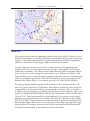
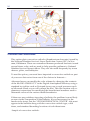
Digital Atmosphere is essentially a geographical display program that
ingests raw weather bulletins disseminated by the National Weather Service
to Internet sites, satellite feeds, and weather databases. Using this data, it
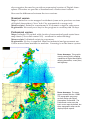
produces stunning plots and analyses that are equivalent to those found on
multi-million dollar workstations.
The maps and other products you create with Digital Atmosphere are fully
customizable. You can define the geographic area you wish to map and
specify the map’s resolution. You decide how much detail you want shown in
your maps, from country borders only to rendered topography with county
lines and roads overlaid. You choose what weather data you want displayed,
how the data is displayed, and in many cases what algorithms are used to
analyze the data. Whatever your meteorological graphics needs, Digital Atmosphere can create exactly the map you desire, using only the parameters
you desire.