1
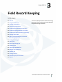
Loading the image . . . . . . . . . . . . . . . . . . . . . . . .
Drawing and importing boundaries. . . . . . . . . . . . . . . . . . .
Drawing field boundary maps . . . . . . . . . . . . . . . . . .
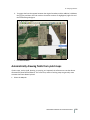
Automatically drawing fields from yield maps . . . . . . . . .
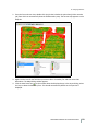
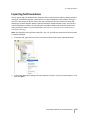
Importing field boundaries . . . . . . . . . . . . . . . . . . . .
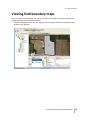
Viewing field boundary maps . . . . . . . . . . . . . . . . . . . . . .
Field boundary display: View changes . . . . . . . . . . . . . . . . .
Exporting field boundary maps . . . . . . . . . . . . . . . . . . . . .
Batch Shape File export . . . . . . . . . . . . . . . . . . . . . . . . .
Assigning colors to fields by crop enterprise . . . . . . . . . . . . . .
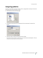
Assigning patterns . . . . . . . . . . . . . . . . . . . . . . . . . . . .
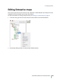
Editing Enterprise maps . . . . . . . . . . . . . . . . . . . . . . . . .
Setting up and selecting layer attributes . . . . . . . . . . . . . . . .
Creating Guidance / Feature layers . . . . . . . . . . . . . . . . . . .
Working with Guidance Line Layers . . . . . . . . . . . . . . .
Creating area features . . . . . . . . . . . . . . . . . . . . . .
Creating line features . . . . . . . . . . . . . . . . . . . . . . .
Creating point features . . . . . . . . . . . . . . . . . . . . . .
Multi Swath Lines management. . . . . . . . . . . . . . . . . . . . .
Crop Row Management . . . . . . . . . . . . . . . . . . . . .
Working with Multi Swath Lines as planting lines . . . . . . .
Editing row settings . . . . . . . . . . . . . . . . . . . . . . . .
Creating planned Multi Swath Lines . . . . . . . . . . . . . . .
Copying planned Multi Swath Lines from other sources. . . .
Working with offsets . . . . . . . . . . . . . . . . . . . . . . .
Working with Swath IDs for Case and New Holland displays .
Editing individual line Swath IDs . . . . . . . . . . . . . . . . .
Editing Swath IDs for multiple lines . . . . . . . . . . . . . . .
Creating clip lines . . . . . . . . . . . . . . . . . . . . . . . . .
Clipping lines to an area . . . . . . . . . . . . . . . . . . . . .
Writing out planned and crop row lines for use with a display
Working with the Buffer tool . . . . . . . . . . . . . . . . . . . . . .
Working with yield and as-applied maps . . . . . . . . . . . . . . . .
Importing Job data . . . . . . . . . . . . . . . . . . . . . . . .
Importing CNH vault data . . . . . . . . . . . . . . . . . . . .
Importing CNH large square baler data . . . . . . . . . . . . .
Analyzing yield and as-applied data . . . . . . . . . . . . . . .
Reprocessing Trimble yield data . . . . . . . . . . . . . . . . .
Merging jobs . . . . . . . . . . . . . . . . . . . . . . . . . . .
Splitting point data . . . . . . . . . . . . . . . . . . . . . . . .
Creating reconciled yield maps . . . . . . . . . . . . . . . . .
Creating polygon variety maps . . . . . . . . . . . . . . . . . . . . .
Adding polygon variety maps . . . . . . . . . . . . . . . . . .
Hand-drawing polygon variety maps . . . . . . . . . . . . . .
Writing Variety maps to a supported device . . . . . . . . . .
.
.
.
.
.
.
.
.
.
.
.
.
.
.
.
.
.
.
.
.
.
.
.
.
.
.
.
.
.
.
.
.
.
.
.
.
.
.
.
.
.
.
.
.
.
.
.
.
.
.
.
.
.
.
.
.
.
.
.
.
.
.
.
.
.
.
.
.
.
.
.
.
.
.
.
.
.
.
.
.
.
.
.
.
.
.
.
.
.
.
.
.
.
.
.
.
.
.
.
.
.
.
.
.
.
.
.
.
.
.
.
.
.
.
.
.
.
.
.
.
.
.
.
.
.
.
.
.
.
.
.
.
.
.
.
.
.
.
.
.
.
.
.
.
.
.
.
.
.
.
.
.
.
.
.
.
.
.
.
.
.
.
.
.
.
.
.
.
.
.
.
.
.
.
.
.
.
.
.
.
.
.
.
.
.
.
.
.
.
.
.
.
.
.
.
.
.
.
.
.
.
.
.
.
.
.
.
.
.
.
.
.
.
.
.
.
.
.
.
.
.
.
.
.
.
.
.
.
.
.
.
.
.
.
.
.
.
.
.
.
.
.
.
.
.
.
.
.
.
.
.
.
.
.
.
.
.
.
.
.
.
.
.
.
.
.
.
.
.
.
.
.
.
.
.
.
.
.
.
.
.
.
.
.
.
.
.
.
.
.
.
.
.
.
.
.
.
.
.
.
.
.
.
.
.
.
.
.
.
.
.
.
.
.
.
.
.
.
.
.
.
.
.
.
.
.
.
.
.
.
.
.
.
.
.
.
.
.
.
.
.
.
.
.
.
.
.
.
.
.
.
.
.
.
.
.
.
.
.
.
.
.
.
.
.
.
.
.
.
.
.
.
.
.
.
.
.
.
.
.
.
.
.
.
.
.
.
.
.
.
.
.
.
.
.
.
.
.
.
.
.
.
.
.
.
.
.
.
.
.
.
.
.
.
.
.
.
.
.
.
.
.
.
.
.
.
.
.
.
.
.
.
.
.
.
.
.
.
.
.
.
.
.
.
.
.
.
.
.
.
.
.
.
.
.
.
.
.
.
.
.
.
.
.
.
.
.
.
.
.
.
.
.
.
.
.
.
.
.
.
.
.
.
.
.
.
.
.
.
.
.
.
.
.
.
.
.
.
.
.
.
.
.
.
.
.
.
.
.
.
.
.
.
.
.
.
.
.
.
.
.
.
.
.
.
.
.
.
.
.
.
.
.
.
.
.
.
.
.
.
FARM WORKS MAPPING SOFTWARE USER GUIDE
. 126
. 127
. 127
. 132
. 135
. 137
. 139
. 141
. 142
. 144
. 146
. 148
. 151
. 153
. 154
. 158
. 159
. 160
. 161
. 161
. 164
. 165
. 168
. 170
. 174
. 175
. 177
. 179
. 180
. 182
. 183
. 184
. 186
. 186
. 190
. 192
. 195
. 198
. 200
. 201
. 203
. 205
. 205
. 207
. 212
5