1
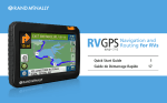
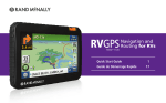
Quick Start Guide
IMPORTANT INFORMATION
Make sure you observe the following safety instructions in order to prevent accidents
or serious injuries:
• This navigation device for outdoor use is merely an orientation and navigation
aid that cannot be a substitute for making a sensible assessment of the situation
you are in. Please note the particular characteristics of the terrain and the
routes you are using. Do not follow any routes or suggested routes which would
entail a dangerous or illegal form of hiking or riding or would place you in a
dangerous situation.
• Road traffic regulations must be complied with at all times, for example when
cycling, and have priority over the routes of the navigation device.
• Never operate the navigation device while riding and do not allow yourself to be
distracted by the device while riding.
• The map data which is used may include inaccurate or incomplete data. You should
therefore check the calculated route to see if it makes sense and choose your own
alternative route if necessary.
CAUTION: The navigation device is intended for hiking, biking, and other outdoor
recreational uses and, as such, is not suitable for use as a vehicle navigation system.
1
installing batteries
Insert the batteries: To open the battery cover, lift
the silver fastener, turn it 90° counterclockwise
and pull it up so that the cover of the battery
1
compartment is removed.
2
battery
compartment
Insert the batteries as indicated in the
battery compartment. Place the battery
cover back on and close it by turning
the silver fastener clockwise.
3
Now switch on your navigation device.
Depending on which type of battery you
are using, you must select the battery type
under Settings > System/General > Battery type.
This is important to adapt the device optimally to the battery
type and thus to achieve the maximum run time from the battery.
Battery notes:
• Do not use any sharp objects to remove the batteries.
• Do not attempt to open the batteries.
• Note the regulations governing the disposal of the batteries.
• Operating temperature: The operating temperature range is 15° to 140°F.
Use AA alkaline, lithium batteries or rechargeable NiMH batteries. Please note that
batteries cannot be recharged while in the device. High brightness of the display
(e.g. over 50%) will reduce the run time of the batteries. Batteries are very sensitive
to temperature.
In cold conditions, the run time of the batteries is greatly curtailed. Optimum results
are achieved at around 70°F. If the battery is weak, the screen is dimmed and the
loudspeaker output is reduced.
To ensure the longest possible battery run time, beep output is recommended. When
using rechargeable batteries, please follow the manufacturer‘s instructions on use to
ensure the maximum capacity of the rechargeable batteries.
2
YOUR Device
1 Power button: switches the device on and off. When the device is on, use this button to access the following options:
• Keylock: Activates or disables the display lock.
• Screen: Switches off the display to save power. However, ongoing
navigations and track recordings remain active.
• Stand-By: Switches to stand-by mode.
• Switch off: Switches the device off completely.
2 Settings: Adjusts the volume and brightness.
Control key: Starts and pauses the track recording. You can change the function
of this button in Settings > System General > Quick Access Button.
3 4 USB port
5 Display
1
5
2
3
4
3
STARTING UP
When you turn on the device, you’ll be prompted to
select the language and country map, and to enter
your home address. Use the keypad to enter first the
city, then the street and street number. Note: To
search within a state, tap the flag at the top of the
screen and select the state.
You can change the address at any time in the
Settings menu.
Before navigating with the Foris, first calibrate the
compass and the barometer in the Settings >
System/General menu.
Note: For best results, recalibrate the barometer
before starting a trip, after elevation changes of
several hundred feet, and after changing the batteries.
4
main menu
From the main menu, you can enter a
destination, access settings, save
positions/waypoints, record tracks, and more.
Use the left and right arrows to scroll through
the options.
Note: The red dots at the top indicate how many
screens are available at this level, and which one
you are currently viewing.
The figure next to the battery icon indicates
pedestrian or bicycle routing mode.
enter destination
1. To enter an address, select
Destination Entry > Address.
2. Use the keypad to enter first the city,
then the street and street number.
Note: To search within a state, tap the flag at
the top of the screen and select the state.
3. Confirm your entry for city, street and street
number in each case by clicking on the
right arrow and then on OK to start the
route calculation.
Alternatively, when entering the street,
click on the middle button to be navigated
to the city center or to the middle of the
street when entering the street number.
You can also enter POIs, waypoints or coordinates as destinations.
5
Routing
After you have entered a destination, enter the
specifics for the route.
1.Select Bicycle or Pedestrian.
2. Tap OK to go directly to the route
confirmation screen, or tap Next to continue.
3. Select terrain preference (not available
in all models):
• Flat gives preference to routes with
inclines of 0-4%
• Hilly gives preference to routes with
inclines of 4-8%
• Short calculates the shortest route to
the destination, regardless of inclines
• Straight line distance shows a straight
line toward the destination starting from
your current position
4. Tap OK to go directly to the route
confirmation screen, or tap Next to continue.
5. Choose the modes of transport you want
to use, prefer, or avoid on the route.
6.Tap OK.
The following options are available on the
confirmation page:
Calculates two alternative routes
Shows the altitude profile
Changes the route options
Shows information about the route
Tap OK to begin the route.
6
track manager
The Track Manager shows all of the tracks that
are on the device. You can also record your own
tracks so that you can retrace a route you have
traveled at a later date.
From the main menu, tap Track Manager.
starts/continues the recording
pauses the recording
ends the recording and saves the track
The recorded tracks are saved in the list in the
Track Manager. To view a track, tap twice on
the track, or select and hit OK.
7
advanced routing features
Note: Not available in all models.
Loop Me!: Calculate a looped route that starts
and ends at the same place.
1. Tap Trip Manager > Loop Me!
2. Specify the loop parameters by distance
or duration.
3. If calculating by duration, enter the time
and confirm biking/walking speed.
4. Select Bicycle or Pedestrian.
5. Tap OK to go directly to the route
confirmation screen, or tap Next to continue.
6. Tap OK.
Terrain preference: From the Trip Manager, you can select Flat, Hilly,
or Neutral terrain for any route or looped route.
TrackNav: Route along a track you’ve recorded in Track Manager
8
MAP SCREEN
1 Compass
2 Pedestrian/bicycle routing
3 GPS signal quality
3
2
1
10
4
11
12
Info field 1: Information about
the calculated route. Tap on the
field to select other information.
(Tap to hear voice.)
4 5 Maneuver
6 Following maneuver
7 Tap for Main Menu
8 Tap for Elevation profile
14
6
13
5
15
Tap for Rapid access menu: can be
customized in settings
9 10 Battery life
11 Info field 2
12 Next street maneuver
13 Zoom button
14 Current position
15 Current street
7
8
9
Tap on the map to mark a point with a pin and display the position and address.
Tap Actions to navigate to the point, save the position, or search around the position.
9
GEOCACHING
Your device is equipped with comprehensive
functionality for paperless geocaching.
To transfer geocaches to your device, register
on a geocaching site on the Internet
(e.g., www.geocaching.com). You can then
save geocaches on your PC and transfer them
to your device via the Trailhead software.
From the main menu, tap Geocaching and select
Search For Geocache. Select a point around
which to search—for example, your current
location or a point of interest.
If you have transferred geocaches around your
current search point to the device, they are
displayed in a list sorted according to distance.
Briefly tap twice on the geocache or tap the
“i” for detailed information about the cache
and its description.
You can display the geocache location on the map,
or under Options add waypoints or comments or
display the hints. Select the cache by clicking OK.
Once you arrive at the cache, additional buttons
under Options allow you to log the cache and
record notes. You can find further information
about geocaching and operation in the detailed
user manual, which is available in the
Trailhead software.
Note: For geocaching, it is essential that under
Settings > Map Display you disable the function
Position On Street so that you can reach
the precise location of the geocache on all terrain.
For cycling or hiking, make sure you reactivate
the function Position On Street.
10
TRAILHEAD
With the free Trailhead software, you can manage tracks and waypoints on your
Foris,™ view recorded tracks, upload additional tracks, and manage geocaches.
Download at:
www.randmcnally.com/trailhead
Warnings, End-User License Agreement, and Warranty
Make sure you observe the following safety instructions in order to prevent accidents or serious
injuries:
• This navigation device for outdoor use is merely an orientation and navigation aid that cannot
be a substitute for making a sensible assessment of the situation you are in. Please note the
particular characteristics of the terrain and the routes you are using. Do not follow any routes
or suggested routes which would entail a dangerous or illegal form of riding or would place
you in a dangerous situation.
• The road traffic regulations must be complied with at all times, for example when cycling, and
have priority over the routes of the navigation device.
• Never operate the navigation device while riding and do not allow yourself to be distracted by
the device while riding.
• The map data which is used may include inaccurate or incomplete data. You should therefore
check the calculated route to see if it makes sense and choose your own alternative route if
necessary.
CAUTION: The navigation device is intended for hiking, biking, and other outdoor recreational
uses and, as such, is not suitable for use as a vehicle navigation system.
Pay attention to road conditions and street signs, and obey all traffic and safety laws. Traffic laws
and current traffic conditions must always be observed and take precedence over the instructions
issued by the Rand McNally navigation system. The User should be aware of situations where
current traffic conditions and the instructions from the navigation system may be in conflict.
Always use your best judgment and exercise common sense when making off-road navigational
decisions. For safety, be attentive to trail and weather conditions and defer to posted signs.
It is the User’s responsibility to ensure compliance with all laws and regulations. The use of the
navigation system does not relieve the User of his/her responsibilities. The User should be aware
of the surroundings at all times.
11
If after reading these statements the User decides not to accept these terms, the User should not
use the navigation system.
Rand McNally hereby grants you (“User”) a single-user non-exclusive, non-transferable license
to use the Rand McNally Foris™ navigation product (hereinafter referred to as the “Product”
(including software and associated data)) for User’s own internal business or personal use and
not for resale, sublicense or commercial use.
This Product and the software incorporated in it and related documentation are furnished under
license and may be used only in accordance with this license. Except as permitted by such license,
the contents of this Product and software may not be disclosed to third parties, copied or
duplicated in any form, in whole or in part, without the prior written permission of Rand McNally.
This Product and software contain proprietary and confidential information of Rand McNally
and its licensors. Rand McNally grants User a limited license for use of this Product and the
software incorporated in the Product for its normal operation. By using the Product, User
acknowledges that the content of this document and the Product are the property of Rand
McNally and its licensors and are protected by U.S. copyright, trademark and patent laws and
international treaties.
THE USER MAY NOT:
• Use the Product on a network or file server, time-sharing or to process data for other persons.
• Use the Product to create any routing tables, files, databases or other compendiums.
• Copy, loan or otherwise transfer or sublicense the Product, its software or content.
• Modify, or adapt the Product in any way, or decompile, disassemble, reverse engineer or
reduce to human readable form the Product and software incorporated therein.
• Alter, remove or obscure any copyright notice, trademark notice, or proprietary legend from
the Product, its software or content.
This license will terminate automatically if User fails to comply with any of the terms of this license
and User agrees to stop using the Product. Rand McNally may revise or update the Product and is
not obligated to furnish any revisions or updates to User.
Warranty: Please retain your original sales receipt for warranty service. Rand McNally warrants
that the Product, and the component parts thereof, will be free of defects in workmanship and
materials for a period of one (1) year from the date of first consumer purchase.
This warranty may be enforced by the first consumer purchaser, provided that the product is
utilized within the U.S.A.
12
Rand McNally will, without charge, repair or replace (with a new or newly reconditioned unit), at
its option, defective Products or component parts. For repair or replacement of defective Products,
User must contact Rand McNally at 1-800-333-0136 for return authorization and instructions.
User will be required to provide proof of the date of first consumer purchase, such as a duplicated
copy of a sales receipt. The consumer must pay any initial shipping charges required to ship the
product for warranty service, but the return charges will be at Rand McNally’s expense, if the
Product is repaired or replaced under warranty.
Repairs or replacements have a 90-day warranty. If the unit sent in is still under its original
warranty, then the new warranty is 90 days or to the end of the original one (1) year warranty,
depending on which is longer.
This warranty gives the consumer specific rights, and he or she may also have other rights which
vary from state to state.
Exclusions: This limited warranty does not apply: 1) to any product damaged by accident; 2) in the
event of misuse or abuse of the product or as a result of unauthorized alterations or repairs; 3) if
the serial number has been altered, defaced or removed; or 4) if the owner of the product resides
outside of the U.S.A.
Caution: Rand McNally makes no warranty as to the accuracy or completeness of the information
in the Product and disclaims any and all express, implied or statutory warranties, including any
implied warranty of merchantability or fitness for a particular purpose. It is the user’s responsibility
to use this product prudently. This product is intended to be used only as a travel aid and must
not be used for any purpose requiring precise measurement of direction, distance, location or
topography.
RAND MCNALLY AND ITS LICENSORS DO NOT MAKE ANY OTHER WARRANTY OR REPRESENTATION, EITHER EXPRESS OR IMPLIED, WITH RESPECT TO THE PRODUCT, INCLUDING ANY
WARRANTY AS TO QUALITY, PERFORMANCE, TITLE OR NON-INFRINGEMENT.
IN NO EVENT WILL RAND MCNALLY OR ITS LICENSORS BE LIABLE FOR ANY INDIRECT, SPECIAL,
INCIDENTAL, OR CONSEQUENTIAL DAMAGES ARISING OUT OF THE USE OR INABILITY TO USE
THE PRODUCT, EVEN IF ADVISED OF THE POSSIBILITY OF SUCH DAMAGES.
Some states do not allow limitations on how long an implied warranty lasts and/or do not allow
the exclusion or limitation of incidental or consequential damages, so the above limitations may
not apply to some consumers.
The User agrees to allow User-provided information to Rand McNally to be used for internal
business evaluation purposes, including, but not limited to, evaluating the effectiveness of
the services provided, methods to simplify or improve User experiences. Such information will not
be used by third parties or in any way that discloses the identity of the User.
13
Rand McNally may make use of third party software in the Product. Notwithstanding the terms
and conditions of this license, use of some third party materials included in the Product now or at
a later time may be subject to other terms and conditions.
The User agrees to indemnify, defend and hold Rand McNally and its licensors (including their
respective licensors, suppliers, assignees, subsidiaries, affiliated companies, and the respective
officers, directors, employees, shareholders, agents and representatives of each of them) free and
harmless from and against any liability, loss, injury (including injuries resulting in death), demand,
action, cost, expense or claim of any kind or character, including but not limited to attorney’s fees,
arising out of or in connection with any use or possession by the User of this Product.
These terms and conditions constitute the entire agreement between Rand McNally (and its
licensors and suppliers) and the User pertaining to the subject matter hereof, and supersedes in
their entirety any and all written or oral agreements previously existing between us with respect to
such subject matter.
The above terms and conditions shall be governed by the laws of the Illinois, without giving
effect to (i) its conflict of laws provisions, or (ii) the United Nations Convention for Contracts for
the International Sale of Goods, which is explicitly excluded. The User agrees to submit to the
jurisdiction of Illinois for any and all disputes, claims and actions arising from or in connection with
the Data provided to the User hereunder.
User shall not export the Product in violation of any U.S. or foreign laws. Rand McNally’s licensors
shall be third party beneficiaries of Rand McNally’s rights under this license, but are not parties
hereto and have no obligations hereunder.
By using this product you agree to be bound both by the foregoing and to the terms of use found
at www.randmcnally.com/outdoorgps.
Restricted Rights Legend. For governmental agencies: Use, reproduction or disclosure is subject
to restrictions set forth in subparagraph (c) (1) (iii) of the Right in Technical Data and Computer
Software clause at DFARS 52.227-7013, as amended.
Rand McNally, the Rand McNally logo, and the globe design mark are registered trademarks and
Foris is a trademark of RM Acquisition, LLC, d/b/a Rand McNally.
Data provided by: Rails-to-Trails Consortium and Allstays, LLC. The Geocaching.com logo and
cache type logos are property of Groundspeak, Inc. Used with permission.
© 2013 Rand McNally. © 2013 United Navigation GmbH, Ostfildern, Germany. Portions © 2012
NAVTEQ. All rights reserved.
14
Support
www.randmcnally.com/support
800-333-0136