1
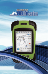
INTRODUCTION
Thank you for your interest in FieldGenius – the most productive and
easy-to-use data collection software solution ever!
If you are new to FieldGenius, you will be impressed by its graphic user
interface, one-screen graphical stakeouts, an easily deciphered raw
file that you can edit, powerful COGO tools, DXF file support (read,
coordinate and write), streamlined connection to your instrument or
computer, multi-point resections, roading, training movies, and the
easiest, most powerful linework tools in the industry.
FieldGenius supports all common RTK GPS and generic NMEA
receivers, as well as all standard and robotic total stations. With direct
support for LandXML, you can stake to DTM surfaces or cross sections
from your designed alignment. Real time surface generation allows you
to compute volumes instantly.
About MicroSurvey
For over 25 years, MicroSurvey Software Inc. has developed a family of
specialized computer software for land surveyors, civil engineers,
mapping technologists, engineering technicians, drafting
technologists, police officers, and accident reconstruction specialists.
MicroSurvey supports what it builds, and the staff values & listens to
its customers.
Our Mission Statement
The MicroSurvey Mission defines the way we do
business and how
we serve our customers. In 1985, we set out on
a mission to create
solutions that would offer our industry innovative
technology and
exceptional value.
The way we perceive and react to the ever-changi
ng worldwide
business climate continues the MicroSurvey tradit
ion of innovation
and value.
We engineer technology that is designed to work
the way people
think. We empower people – not machines.
Our solutions for surveying, construction, engin
eering and accident
reconstruction are inspired by our uncompromising
standards for
integrity, quality, leading-edge technology, suppo
rt and value.
TABLE OF CONTENTS
FieldGenius Features
Feature Highlights
4
Linework the FieldGenius Way
5
Advanced Features
6
Productivity Enhancements
7
Features by Module
8
Field Hardware Support
9
Data Collection Hardware
10
Testimonials
11
Pricing
12
Related Software
STAR*NET and MSDX
13
Desktop Survey & Design
14
Training and Support
15
www.MicroSurvey.com
1-800-668-3312
® Registered in the U.S. Patent and Trademark Office
All other brand names, product names or trademarks are property of their respective owners.
3
FieldGenius FEATURES
FIELDGENIUS HAS EVOLVED INTO THE MOST POWERFUL
AND PRODUCTIVE DATA COLLECTION SOFTWARE
What sets FieldGenius apart from the competition?
4
yy
Code-free linework: Linework is created automatically without
entering codes and is instantly displayed, eliminating the need for a
separate sketch. No need to connect the dots back at the office.
yy
Advanced display with live graphics and intuitive interface. Logical
icons, customizable toolbars, smart objects and easy to use GPS and
total station controls. Standard or high-definition devices!
yy
Productivity tasks: Customize your data collector by assigning
commands to your keypad keys.
yy
Calculating tools: Access the built-in RPN calculator from any edit
field and easily use surveying calculations.
yy
Plus advanced roading, surfacing, slope staking, smart points,
DXF & LandXML import/export and full robotic and GPS support.
FieldGenius is the choice of organizations that value productivity.
FieldGenius FEATURES
LINEWORK THE FIELDGENIUS WAY!
MicroSurvey has developed the simplest linework connectivity in the
industry. Absolutely NO CODING is required to generate your linework
in the field in real time. Other data collection systems force you to
predefine codes for generating linework. MicroSurvey has made real time
linework as simple as connecting the dots.
FIELDGENIUS LINEWORK IS EASIER THAN ANY OTHER
DATA COLLECTION SOFTWARE:
•
•
•
•
•
•
•
You can connect points that have different descriptions.
Linework can consist of straight segments, arcs and splines.
Linework is ALL in 3D including arcs and splines.
You can have more than one line with the same description;
FieldGenius is smart enough to know which line to work on.
Multiple lines can connect to the same point.
Missing segments can be drawn using the pencil tool any time you
need to add more info.
A bad line can be removed instantly by tapping it and selecting
“Delete Segment”.
Sound simple? It is. You’ll find FieldGenius is the easiest system to
generate the most accurate drawing from shots in the field.
5
FieldGenius FEATURES
FIELDGENIUS INCLUDES MORE ADVANCED FEATURES
THAN ANY OTHER DATA COLLECTION SYSTEM
Digital Terrain Modeling,
Volumes and Contouring
yy FieldGenius has the ability
to create and utilize DTM
surfaces from existing
survey data or create a
DTM in real time as the
data is collected. The
TIN and contours will
automatically update as
each new shot is taken.
Powerful Roading
yy FieldGenius roading allows
you to manually input or
import your alignment
data including centerline,
vertical and template data.
Powerful alignment staking
tools help you stake
your points along your
alignment with confidence.
Georeferenced Images
yy Use georeferenced
images and maps in the
background for visual
reference of your survey
work.
6
FieldGenius FEATURES
WORK FASTER AND MORE EFFICIENTLY IN THE FIELD WITH
THESE PRODUCTIVITY ENHANCEMENTS
Instrument Control at your
Fingertips
yy Total Station and GPS
functions are available on
a common and easy to use
instrument toolbar. Access
measure modes with the
click of a button.
Powerful RPN Calculator
yy FieldGenius includes an
easy to use and intuitive
RPN calculator. Quick
access to the calculator
from any edit field makes
survey calculations and
routines a breeze.
User Definable Shortcuts
yy Increase your productivity
by assigning frequently
used commands to keys on
your data collector.
7
FieldGenius FEATURES
FIELDGENIUS FEATURES BY MODULE
FieldGenius Standard Features
yy
Modern Windows interface with
smart menus, smart objects and
incredible graphics
yy
The drawing is primary to the
interface
yy
Real-time drawing generation with
automatic linework
yy
Built in COGO – intersections,
inversing and traversing
yy
Enter, edit and stake points
yy
One button project manager
yy
DXF import for background project
view
yy
DXF coordination of lines, arcs,
polylines, points...
yy
FBK export for easy Autodesk LDD
Import of raw data, points and
linework
yy
ASCII import/export
yy
Automatic traversing (1 set, 2 set, n
sets)
yy
Traverse closure calculations
yy
Raw data editing
yy
Traverse re-coordination in the
collector
yy
Closure calculations
yy
Angular adjustment, compass
balance
yy
Extensive total station support
yy
Support for multiple hardware
platforms
yy
One button file transfer to desktop
systems
yy
3D data view with dynamic zoom,
pan and scroll
yy
Support for built-in GPS on Nautiz X7
Advanced Features
(Requires Advanced Module)
yy
LandXML project explorer
yy
Surface modeling in real-time
yy
LandXML alignment, cross section
and zone staking
yy
Fixed area calculations
yy
Volume calculations
yy
Stake to DTM
yy
Contouring in real-time
yy
GIS attribute collection
yy
3D alignment, cross section and
template view
yy
Shaded, rendered view of surface
data
8
Robotics Features
(Requires Robotics Module)
yy
Automatic “Turn to Point”
features
yy
Navigate to stake point
yy
Advanced robotic control tools
yy
Wireless radio and bluetooth
support
yy
Automatic prism tracking
yy
Assign robotic functions to
keypad keys
yy
Real-time tracking icon in map
view
yy
Support for Trimble,
Geodimeter, Topcon, Leica and
Sokkia
yy
RC-2/RC-3/RC-4 (Topcon
Support)
RTK GPS Features
(Requires GPS Module)
yy
Full RTK GPS support
yy
Profiles for multiple receivers –
makes setup easy
yy
Full RTK support with tracking
icon in map view
yy
Automatic geodetic
transformations from WGS84 to
local coordinate systems
yy
Dynamic GPS toolbar – HDOP,
VDOP, PDOP and satellites
yy
Heads-up display shows lat/
long or grid coordinates
yy
Local transformation (Helmert)
yy
Horizontal/vertical adjustment
yy
Statistical analysis with
residuals and RMS
yy
Works with Leica Geosystems,
Trimble, Topcon, Javad, Altus,
Ashtech, Thales, Sokkia,
Novatel, NEMA, STONEX, FOIF,
NavCom, Champion and more!
*Visit the MicroSurvey website for an
updated list of hardware support.
FIELD HARDWARE SUPPORT
FIELDGENIUS WORKS ON MORE HARDWARE MODELS THAN THE
COMPETITION!
Data Collector Support:
yy
Nautiz X7 and Algiz 7 by Handheld, Juniper Systems Archer and
Allegro Field PCs, TDS Nomad/Ranger/Recon, Trimble TSCE/TSC2,
Topcon FC-100/FC-1000/FC-2000, Compaq/HP iPAQ Series and the
Leica RX1250, CS10, CS15 and TS11, TS15 onboard!
yy
Works on Windows Mobile 5 and 6 devices.
yy
Excellent for tablet devices such as the Algiz 7
by Handheld and the Mesa Rugged Notepad by
Juniper Systems.
Conventional/Robotic Total Station and RTK GPS
Systems Support:
yy
FieldGenius supports virtually all conventional
total stations dating back to the early `90s.
FieldGenius has built-in support for all major
manufacturers’ robotic total stations and
RTK-grade GPS systems as well. MicroSurvey’s
robotic and GPS support has the most intuitive
interface in the industry. All robotic and GPS
settings and functions are easily accessible
from a control toolbar. We are
continually developing FieldGenius
to support the newest and most
advanced hardware on the market
as it becomes available.
9
DATA COLLECTION HARDWARE
A WINNING COMBINATION
FieldGenius software is bundled with
all hardware configurations – making
the best use of standard and high
definition displays with large buttons
and crisp graphics.
Nautiz X7 by Handheld
exemplifies the
evolution of handheld
computers. Packed
with innovative
advancements in PDA
technology, it surpasses
everything else on the market with its mix of power,
functionality and ruggedness.
The Archer Field PC by Juniper Systems is rugged,
powerful, and versatile to handle your most demanding
needs. It meets IP67 and Mil-Std-810F standards for drop,
vibration, immersion, humidity and operating temperatures.
The ultra-rugged Allegro MX Field PC by
Juniper Systems is built to perform in the
most demanding outdoor or industrial
environments.
For those
seeking a
larger screen
and a more
powerful field
computer, ruggedized tablets
are the way to go. The Algiz 7
by Handheld sports a 7-inch
screen running Windows 7,
along with all the bells and whistles.
If you would like to stick with the leaner Windows
Mobile, the Mesa Rugged Notepad by Juniper
Systems is the perfect solution.
10
Testimonials
READ WHAT PROFESSIONALS IN THE FIELD HAVE TO SAY
ABOUT FIELDGENIUS
“In 2002, when we began using FieldGenius, it was such a solid, intuitive,
productive tool, that I couldn’t imagine at that time how it could be
improved. However, it is apparent that the folks at MicroSurvey are
striving for perfection, as the latest version shows. I’m skeptical that they
can find a way to improve the current version!
We’ve tried other field software, sometimes at the request of a new
employee that is familiar with one of the leading competitors, but once
that person has 15 minutes with the FieldGenius program, they don’t want
to go back to what they were familiar with. It’s just that easy to learn, yet
powerful enough to do whatever we need it to, and more.
It seems that on a weekly basis, at least one member of our field crews
can be overheard telling another person in the office about the amazingly
cool feature that they just found in the program. We love it.”
Matt Walters, PLS
Walters & Associates, LLC
“If you want to do a lot of field coding, go ahead and buy TDS or Carlson
but if you want automatic field coding that requires no coding (other than
tapping on an icon for lines, arcs or splines) then buy FieldGenius from
MicroSurvey.
MicroSurvey FieldGenius has the most in-depth website of anyone on the
market. Their technical support response is almost instant. They have
spent a lot of time and effort making training movies which are on-line
and their user manual is the best on the market. Try finding that with TDS
or Carlson.”
John Roberson, RLS
Georgia
11
PRICING
READ WHAT PROFESSIONALS IN THE FIELD HAVE TO SAY
ABOUT FIELDGENIUS
FieldGenius Software & Modules
FieldGenius Standard (NO Modules)
$495
+ Total Station Module
+$500
+ GNSS/GPS Module
+$800
+ Advanced Module (Roading, Surfacing, Slope Staking)
+$500
+ Robotic Module (Requires Total Station Module)
+$500
Typical Configurations
FieldGenius “Total Station”
(FieldGenius Standard + Total Station Module)
$995
FieldGenius “GNSS/GPS”
(FieldGenius Standard + GNSS/GPS Module)
$1,295
FieldGenius “Premium”
(FieldGenius Standard + ALL MODULES)
$2,195
Popular Data Collector Bundles (see website for more)
MicroSurvey DC4 + FieldGenius + GNSS/GPS Module
Built-in GPS, 3MP Camera, 624MHz CPU, 640x480 VGA, 256MB
RAM/storage (up to 8GB), WiFi, Bluetooth
$2,195
Nautiz X7 + FieldGenius + Total Station Module + Rob. Module
Built-in GPS, 3MP Camera, 806MHz CPU, 640x480 VGA, 128MB
RAM/4Gigabytes storage, Altimeter, WiFi, Bluetooth, Compass
$2,995
Handheld Algiz 7 (Tablet) + FieldGenius + GNSS/GPS Module
Built-in GPS, 2MP Camera, 1.6GHz CPU, 1024x600, 2GB RAM,
64GB SSD storage, WiFi, Bluetooth, Windows 7 Ultimate
$3,695
FieldGenius Upgrades (inc. 1yr maintenance support)
Upgrade from any version of FieldGenius: $350 + $95 per module
Maintenance Subscription Plans
12
Standard 90 days from date of purchase
FREE
Maintenance Support Plan (1 year)
$195
RELATED SOFTWARE
STAR*NET – NETWORK ADJUSTMENT UTILITY
MicroSurvey STAR*NET is
an easy-to-use Windows
application that adjusts
1D/2D/3D survey networks
using rigorous Least Squares
techniques.
STAR*NET handles networks
containing conventional
observations with up to
10,000 adjustable stations.
Differential leveling
observations can also be included within a 3D adjustment. Whether
a survey consists of a single-loop traverse or a complex network of
interconnecting traverses, all observations are adjusted simultaneously
to produce a single best-fit solution.
MICROSURVEY DATA EXCHANGE
Also known as MSDX, it is a FREE program designed primarily for
FieldGenius users. It allows you to easily exchange survey data between
FieldGenius and other CAD systems.
13
RELATED SOFTWARE
MicroSurvey CAD – COMPLETE DESKTOP SURVEY & DESIGN
When you need a fully featured desktop survey software package, you
now have two options for one competitive price. Every license key includes
a copy of MicroSurvey CAD and MicroSurvey inCAD. You can run on the
included IntelliCAD 6.6 engine or run on the latest versions of AutoCAD®.
You can have both versions installed on your machine, or you can move the
key between machines with different versions installed. Our USB licensing
system enables us to provide you with maximum flexibility.
Either way you choose to use it, you get complete survey drafting, COGO,
DTM, traversing, volumes, contouring and data collection interfacing.
MicroSurvey desktop solutions are compatible
with field data from all major total stations
and data collectors.
IF YOU PREFER AUTOCAD, TRY:
An AutoCAD®
plug-in with all
MicroSurvey tools
Stand-alone CAD
application, built
with Autodesk
technology™
14
“The combination of FieldGenius
and MicroSurvey CAD gives me
a complete software solution
for surveying. The integration of
the field and office software is
unbeatable. Data processing is
a breeze. From small stakeout
jobs to large developments,
MicroSurvey has me covered!”
Mark Cahill, BCLS
AllTerra Land Surveying &
Geomatics
TRAINING AND SUPPORT
All MicroSurvey products come with 90 days of FREE support, which
includes email and phone support. While on a support plan, you also
receive free service packs and upgrades as they become available.
Here are some other useful support resources:
Training Material (www.microsurvey.com/helpdesk)
Available for free on the MicroSurvey Helpdesk are hundreds of
training videos and articles. No access fees, no limitations. Search the
knowledge base for answers to your questions – basic or advanced!
User Forums (www.microsurvey.com/forum)
The user forum is an excellent community in which to bounce
questions off other professional users, like you.
Feedback Forum (feedback.microsurvey.com)
The Feedback Forum is a revolutionary tool that allows YOU to direct
the development of the MicroSurvey products you buy. It collects your
suggestions and allows you to vote on suggestions submitted by the
other professionals using the software. Use your votes wisely!
Classroom Training (www.microsurvey.com/training)
Want something a little more hands-on? MicroSurvey invests in the
best trainers and training facilities.
Receive instructor-lead
training while using your own
workstation and copies of all
software used in the course.
Call for booking, or view our
training schedule online.
Thank You
Please call us or visit our
website for more
information on how this, or
other MicroSurvey products,
can help you improve your
productivity!
of many
Train with MicroSurvey in one
US.
the
and
ada
facilities across Can
Part of Hexagon
®MicroSurvey and FieldGenius are registered in the USA Patent and
Trademark Office. Autodesk, AutoCAD, DWG are registered trademarks
or trademarks of Autodesk, Inc. in the USA and other countries.