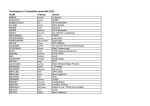
1
Del. Rev. Date Page D5.2.1 A 30/04/2015 1 of 45 AF3 Advanced Forest Fire Fighting D5.2.1 Prototypes CDR - Situation Awareness, C4I and Decision Support tools PREPARED BY [Federico Carvajal] [Name 2] [Name 3] [Name 4] [UPVLC] [Beneficiary] [Beneficiary] [Beneficiary] CONTRIBUTORS Maurizio Giovannini Shlomo Alkaher, Tal Greenberg Bruno Guillaume Alvaro Carrillo [SES] [ELBIT] [TRAGSA] [ARIA] Alkis Astyakopoulos, Dimitris Kiriazanos, Manolis Paterakis, Vassilis Kountouriotis, George Vastianos [NCSRD] DISSEMINATION LEVEL PU Public PP Restricted to other programme participants (including the Commission Services) RE Restricted to a group specified by the consortium (including the Commission Services) CO Confidential, only for members of the consortium (including the Commission Services) AF3- Advanced Forest Fire Fighting Grant Agreement no: 607276 Del. Rev. Date Page D5.2.1 A 30/04/2015 2 of 45 REVISIONS LOG REV CHANGE REFERENCE DATE CHANGE DESCRIPTION PREPARED 01 02 03 04 05 06 07 0 0 0 0 31/03/2015 02/04/2015 21/04/2015 22/04/2015 First draft Version 1 Version 2 Version 3 UPVLC UPVLC UPVLC UPVLC 0 0 09/06/2015 16/06/2015 Version 6 Coordinator review Version 7 Ethical review SES EFPC AF3- Advanced Forest Fire Fighting Grant Agreement no: 607276 Del. Rev. Date Page D5.2.1 A 30/04/2015 3 of 45 ABBREVIATIONS AND ACRONYMS ABBREVIATION ACRONYM CDR ASA HMI IP VoIP C4I WPF REST FFL DS / DESCRIPTION Critical Desing Review Advanced Situation Awareness Human Machine Interface Internet protocol Voice over IP Command, Control, Communication, Computers & Intelligence Windows Presentation Foundation REpresentational State Transfer Fire Fighthing Lab Decision Support AF3- Advanced Forest Fire Fighting Grant Agreement no: 607276 Del. Rev. Date Page D5.2.1 A 30/04/2015 4 of 45 TABLE OF CONTENTS TABLE OF FIGURES ........................................................................................................................................ 5 TABLE OF TABLES ......................................................................................................................................... 5 1. SCOPE .......................................................................................................................................... 6 2. ADVANCED SITUATION AWARENESS (ASA) PROTOTYPE CDR .......................................... 7 2.1 2.1.1 2.1.2 2.1.3 2.1.4 2.1.5 2.1.6 2.1.7 2.1.8 ASA DESIGN REVIEW AND INTERFACES DESCRIPTION ...................................................... 7 ASA Human Machine Interface (HMI) ........................................................................................ 8 Messaging .................................................................................................................................... 8 Data management ....................................................................................................................... 8 Video management ..................................................................................................................... 9 ASA Geo-tools ............................................................................................................................. 9 ASA interoperability with other AF3 tools ................................................................................ 9 ASA Communications interfaces .............................................................................................. 9 ASA Security & Privacy .............................................................................................................. 9 2.2 CORRELATION BETWEEN END USERS’ REQUIREMENTS AND ASA FEATURES ........... 10 2.3 SOFTWARE TEST DESCRIPTIONS ......................................................................................... 13 2.4 SOFTWARE RISKS (INCLUDING THOSE RELATED TO COST, SCHEDULE, AND PERFORMANCE) IDENTIFIED AND MITIGATION PLANS DEVELOPED. ............................. 14 2.5 CDR SUMMARY REPORT ......................................................................................................... 14 3. C4I PROTOTYPE CDR ............................................................................................................... 15 3.1 3.1.1 3.1.2 3.1.3 3.1.4 3.1.5 3.1.5.1 3.1.5.2 3.1.5.3 3.1.6 C4I DESIGN REVIEW AND INTERFACES DESCRIPTION ...................................................... 15 System main modules: ............................................................................................................. 15 C4I system objectives ............................................................................................................... 15 C4I system architecture ............................................................................................................ 16 C4I SW overview ....................................................................................................................... 16 The C4I is A Modularity based design architecture .............................................................. 17 Module ........................................................................................................................................ 17 Service........................................................................................................................................ 17 Map tool...................................................................................................................................... 17 AF3 C4I modules and services ................................................................................................ 18 3.2 CORRELATION BETWEEN END USERS’ REQUIREMENTS AND C4I FEATURES ............. 20 3.3 SOFTWARE TEST DESCRIPTIONS ......................................................................................... 22 3.4 SOFTWARE RISKS (INCLUDING THOSE RELATED TO COST, SCHEDULE, AND PERFORMANCE) IDENTIFIED AND MITIGATION PLANS DEVELOPED. ............................. 25 3.5 CDR SUMMARY REPORT ......................................................................................................... 25 4. DECISION SUPPORT (DS) PROTOTYPE CDR ........................................................................ 26 4.1 4.1.1 4.1.2 DS DESIGN REVIEW AND INTERFACES DESCRIPTION ...................................................... 27 Situation Map Tool .................................................................................................................... 28 Crowd Simulation Tool ............................................................................................................. 28 AF3- Advanced Forest Fire Fighting Grant Agreement no: 607276 Del. Rev. Date Page D5.2.1 A 30/04/2015 5 of 45 4.1.3 4.1.4 Data Integrator Tool .................................................................................................................. 33 Utilities for DS tools in Mobile devices ................................................................................... 33 4.2 4.2.1 4.2.2 4.2.3 4.2.4 CORRELATION BETWEEN END USERS’ REQUIREMENTS AND DS FEATURES .............. 34 Situation Map Tool .................................................................................................................... 34 Data Integrator tool ................................................................................................................... 34 DS tools in Mobile devices ....................................................................................................... 38 Crowd Simulation Tool ............................................................................................................. 40 4.3 SOFTWARE TEST DESCRIPTIONS ......................................................................................... 42 4.4 SOFTWARE RISKS (INCLUDING THOSE RELATED TO COST, SCHEDULE, AND PERFORMANCE) IDENTIFIED AND MITIGATION PLANS DEVELOPED. ............................. 43 4.5 CDR SUMMARY REPORT ......................................................................................................... 44 5. CONCLUSIONS .......................................................................................................................... 45 TABLE OF FIGURES Figure 1 ASA Design schema ........................................................................................................................... 7 Figure 2 C4I system architecture ..................................................................................................................... 16 Figure 3 Map aids ............................................................................................................................................ 17 Figure 4 Map view example ............................................................................................................................. 18 Figure 5 C4I Modules and services ................................................................................................................. 18 Figure 6 system start-up levels ........................................................................................................................ 19 Figure 7 interfaces of hyper merging of FR conventional systems over VHF/UHF/HF voice communication networks with C4I ............................................................................................................................................ 20 Figure 8- DS interaction with other subsystems .............................................................................................. 26 Figure 9- DS Tools Workstation ...................................................................................................................... 27 Figure 10- DS Tools Mobile ............................................................................................................................. 28 Figure 11: Realtime crowd visualization .......................................................................................................... 29 Figure 12: Realtime data analysis (congestion areas) .................................................................................... 30 Figure 13: First scenario (kinder-garden) diagrams (left to right: traffic, speed ranges, total evac time). Evacuation time resembles exponential growth (threat of congestion). .......................................................... 30 Figure 14: Second scenario (airport terminal) congestion points during controlled evacuation ...................... 31 Figure 15: Second scenario diagrams (left to right: as previously). Traffic flow and speed ranges are measured at ground level exit points. Evacuation time increases linearly. ..................................................... 31 Figure 16: Third scenario (academic campus) congestion points. .................................................................. 31 Figure 17: Third scenario (academic campus) diagrams. Main exit was preferred (greatest flow). A high average speed was maintained and the evacuation time remains constant for up to 300-400 occupants, then increases linearly. ............................................................................................................................................ 32 TABLE OF TABLES Table 1 ASA related requirements matching ................................................................................................... 12 Table 2 ASA test description ........................................................................................................................... 13 Table 3 ASA risk detected and corrective actions ........................................................................................... 14 Table 4 C4I related requirements matching .................................................................................................... 22 Table 5 C4I Test description ............................................................................................................................ 23 Table 6 Process for Software Integration & Tests Phase................................................................................ 24 Table 7 C4I risk detected and corrective actions ............................................................................................ 25 1. AF3- Advanced Forest Fire Fighting Grant Agreement no: 607276 Del. Rev. Date Page D5.2.1 A 30/04/2015 6 of 45 SCOPE The main objective of this document is to perform the Critical Design Review (CDR) of the main AF3 tools developed under WP5.2. These AF3 tools are the following: AF3 Advanced Situation Awareness (ASA), which is the main output of T5.2.1 C4I system, which is the main output of T5.2.2 Decision Support tool, which is the main output of T5.2.3. The purpose of the CDR is principally to review 3 questions: Are the tools features developed in WP5.2 reflected in the detailed AF3 system requirements? Will the design selected for implementation for each tool meet the requirements? Are interfaces to other subsystems defined adequately and completely? For this reason the primary purpose of this deliverable is to describe in detail the design of each of the tools above mentioned in order to show the correspondence among the end users requirements stated in D2.2.2 and the tools features. Finally the software tests description, the interfaces definition, the risks identification and their mitigation plans will be also described in this deliverable. AF3- Advanced Forest Fire Fighting Grant Agreement no: 607276 Del. Rev. Date Page D5.2.1 A 30/04/2015 7 of 45 2. ADVANCED SITUATION AWARENESS (ASA) PROTOTYPE CDR In this chapter the main parts of the ASA prototype CDR will be described in order to give a complete vision on how the ASA design covers its corresponding part of the AF3 user requirements gathered during T2.1.2. 2.1 ASA DESIGN REVIEW AND INTERFACES DESCRIPTION The ASA high level design scheme is shown in figure 1. In this picture the main blocks that compose the ASA are depicted. These blocks will be described in the following paragraphs including design details of each block. Figure 1 ASA Design schema AF3- Advanced Forest Fire Fighting Grant Agreement no: 607276 Del. Rev. Date Page D5.2.1 A 30/04/2015 8 of 45 2.1.1 ASA Human Machine Interface (HMI) The ASA HMI represents in real time different kind of information from different sources in order to provide a complete situation awareness (SA) to the commanders in charge of a wild fire extinction task. In addition, strict security and privacy policies are taken into account in order to pay attention to the EU directives on these topics. The information represented in the ASA HMI is the following: Maps of the affected area: The ASA is capable of managing the main GIS standards in order to show the most appropriate map of the affected area for geo-locating the rest of the information needed/visualized. Units on field location: The GPS locations of the units (including vehicles) are received through the available communication interface. They are stored in the database and shown on the map. The refresh rate of this locations is configurable by the system administrator. Aerial means location: The GPS locations of the aerial means (including altitude) are received through the available communication interface and they are stored in the database and shown on the map. The refresh rate of this locations is configurable by the system administrator. Real time video: The units (including terrestrial vehicles or drones) which have a video camera available, transmit their video flows through the communication network. These different real time video flows are shown on the ASA HMI at the demand of the commander in order to see the situation evolve. Data from other sensors: All data from other sensors deployed on the field that are connected to the ASA tactical network (e.g. fixed images, satellite images, temperature sensors, wind speed sensors, etc.) are shown in a geo-referenced manner on the ASA HMI under the commander demand in order to see the sensors measurements. Available GIS layers: Different GIS information layers such as; roads, grid, 3D terrain view, 3D buildings view, borders, available water points, guard towers, network firewalls locations etc. are shown on the ASA HMI at the demand of the commander. Fire perimeter location: The perimeter of the fire (real/virtual) will be received into the ASA from other AF3 system tools and it will be shown and updated in the ASA HMI. 2.1.2 Messaging The ASA has a messaging module capable of sending and receiving text messages to/from the units in the field. In addition, ASA has a voice over IP (VoIP) module capable of transmitting voice messages to the units in the field and also provide further voice communication capabilities among the units deployed in the field. 2.1.3 Data management The ASA has also a data management module in order to store properly all data received into the system from external sources or tools. This module also makes available all information stored in the DB in order to be accessible to the commanders where necessary. These data include: Units in the field location, Aerial means location, Data from other sensors, Fire perimeter etc. AF3- Advanced Forest Fire Fighting Grant Agreement no: 607276 Del. Rev. Date Page D5.2.1 A 30/04/2015 9 of 45 2.1.4 Video management The different video flows from the wearable/fixed cameras of the units deployed in the field and aerial means received into the ASA will be available to the commanders in any moment. The video management module is compliant with a large number of codecs in order to be able to play video from different models of cameras. Once the commander wants to see a specific video flow he/she has to click on the icon of the unit that owns the camera and then click on the video player button. 2.1.5 ASA Geo-tools The ASA includes a set of Geo-tools developed for performing some actions on the maps in an easy and quick manner. These actions would be the following: Quick distance measurement between two points on the map. Terrain 3D view Buildings 3D view Terrain profile between two points on the map. 2.1.6 ASA interoperability with other AF3 tools The ASA implements REST protocol as stated in D2.2.2. in order to be able to interoperate with the different tools that compose AF3 system (e.g. C4I system, risk management, decision support, Fire fighting lab, training tools etc.) 2.1.7 ASA Communications interfaces The ASA is currently fully compliant with the following communication technologies; Internet protocol (IP), Voice over IP (VoIP), VHF PR4G V3 F@snet radio, VHF PR4G V2 radio, HF Harris 5800 Radio, WiMAX, HF Thomson Radio, Satellite means Inmarsat, Iridium and Thuraya, Satelite means TLX-50 and TLX-5, Tetra and Tetrapol, ITT Spearnet Personal Radio, 3G, 4G. 2.1.8 ASA Security & Privacy The ASA includes a security access module based on the user profile which allows access to different system capabilities depending on the user role in the organization. In addition, security transmission protocols such as HTTPS or TLS are used for transmitting all data from the ASA. AF3- Advanced Forest Fire Fighting Grant Agreement no: 607276 Del. Rev. Date Page D5.2.1 A 30/04/2015 10 of 45 2.2 CORRELATION BETWEEN END USERS’ REQUIREMENTS AND ASA FEATURES The following table states the correlation of the AF3 Advanced Situation Awareness (ASA) tool main features and the some of the AF3 system requirements stated in D2.2.2. This ensures that the design implementation has met the AF3 system requirements and the system development can continue according to the T5.2.1 schedule. N° 1.0.1 Requirements The system should allow an understanding of the exact location and extent of a fire 1.0.6 The system should allow video sharing (between the various bodies and subjects that may be involved in a fire event) 1.0.7 The system should allow photo sharing (between the various corps and subjects that may be involved in a fire event) The system should allow distance voice communication (between the various corps and subjects that may be involved in a fire event) 1.0.8 ASA Features The ASA will receive the fire perimeter from other AF3 tools (e.g. FFL, 3D training) and will show it on the map, updating this perimeter according to the end users needs. (See point 2.1.1) Video from cameras deployed in the field or via aerial means will be shown through the ASA and these flows will be able to be shared with other bodies involved in the fire extinction tasks. (See point 2.1.1) Pictures from cameras deployed in the field or satellite images will be shared through the ASA HMI and ASA data management module. (See point 2.1.1) ASA has a voice over IP (VoIP) module capable of transmitting voice messages to the units on field and also provide further voice communication capabilities among the units deployed in the field. (See point 2.1.2) The ASA has a messaging module capable of sending and receiving text messages to/from the units on field. (See point 2.1.2) 1.0.11 The system should allow (text messaging between the various bodies and subjects that may be involved in a fire event) 1.0.12 The communication system should be The ASA is currently fully compliant with many of reliable even in the case of operations the main current communication technologies in in a difficult environment order to provide communications robustness in hostile evironments. (See point 2.1.7) 1.0.13 The system should be operable even The availability of the sensors does not impair the when some sensors are destroyed proper functioning of the ASA, since the data from sensors representation it is only a part of the ASA services. (See point 2.1.1) 1.0.18 The system must allow management The commanders will have, on demand all of a centralized decision-making information available about the crisis through the process ASA in order to help them in the decision making process. (See point 2.1.1) 1.0.19 The system must be able to manage The ASA includes a security access module resources with different access based on the user profile which allows access to restriction different system capabilities depending on the user role in the organization. (See point 2.1.1) 1.2.3 The fire's prediction system should See requirement 1.0.1 answer. interface with GIS in order to evaluate all possible scenarios. 1.2.4 The system should give accurate The GPS locations of the aerial means (including AF3- Advanced Forest Fire Fighting Grant Agreement no: 607276 Del. Rev. Date Page location of elevation. air D5.2.1 A 30/04/2015 11 of 45 vehicles including altitude) are received through the available communication interface and they are stored in the database and shown on the map. (See point 2.1.1) 1.2.7 The system should allow for the use The units (including terrestrial vehicles or drones) of drones equipped with sensors which have a video camera or other sensors attached will be able to transmit the sensors information through the communication network. (See point 2.1.1) 1.2.10 Showing at least: the territory The ASA is capable of managing the main GIS (physical, slopes, type of vegetation, standards (including 3D views) in order to show threatened assets, roads); the most appropriate map of the affected area for geo-locating the rest of the information needed/visualized. (See point 2.1.1) 1.2.11 Showing at least: information on fire infrastructures (water points, guard towers, network firewalls, access, database extinguishing media); 1.2.12 Showing at least: information about the resources (location, status) and extinguishing tasks performed (location, perimeter, areas, multimedia, etc.); 1.2.13 Showing at least: Information on digital layer to foster the possibility to turn off or on information according to specific needs and roles performed by the users. 1.3.1 1.3.2 1.3.3 4.4.3 The system should inform in real time the position of ground and air forces and possible obstacles; The system should inform in real time the exact location and extension of a fire, what are the risks and type of building involved; Different GIS information layers such as; roads, grid, 3D terrain view, 3D buildings view, borders, available water points, guard towers, network firewalls locations etc. are shown on the ASA HMI. (See point 2.1.1) The GPS locations of the units (including vehicles) are stored in the database and shown on the map along with other information available on the unit. (e.g. sensors attached, status, etc). (See point 2.1.1) Different GIS information layers such as; roads, grid, 3D terrain view, 3D buildings view, borders, available water points, guard towers, network firewalls locations etc. are shown on the ASA HMI under demand of the commander. (See point 2.1.1) See requirements 1.2.4 and 1.2.13 answers. The ASA will receive information from other AF3 tools such as the risk assessment tool and will show it to the commanders. In addition, The GPS locations of the aerial means (including altitude) are received and stored in the ASA database and shown on the map. (See point 2.1.1) The system should inform in real time See requirements 1.2.4, 1.2.7 and 1.2.12 where fire-fighting forces (aircraft, answers. helicopters, on-ground team) are working. It is considered appropriate to use a See requirement 1.2.10 answer. WebGIS platform that allows updating and displaying data in real time by operators, by firefighting forces and other users who may be involved in a fire. It is important to have data constantly updated to perform historical analysis, monitor specific AF3- Advanced Forest Fire Fighting Grant Agreement no: 607276 Del. Rev. Date Page D5.2.1 A 30/04/2015 12 of 45 areas subject to fires and maintaining fire-fighting operations in case of a fire. 4.4.8 The principle of transparency should Security transmission protocols such as HTTPS be implemented in respect of the right or TLS are used for transmitting all data from the of privacy and protection of personal ASA. (See point 2.1.1) data, the use of open data should not affect the privacy rights of the people and therefore measures should be taken to prevent the indexing of sensitive data by search engines and their reuse. Table 1 ASA related requirements matching AF3- Advanced Forest Fire Fighting Grant Agreement no: 607276 Del. Rev. Date Page D5.2.1 A 30/04/2015 13 of 45 2.3 SOFTWARE TEST DESCRIPTIONS The following test have been foreseen for testing the ASA functionalities Funtionality Test description Result (YES/NO) ASA HMI All data which were susceptible to be shown through the ASA HMI will be depicted in the HMI in a geolocated manner (if necessary) and following a standard symbology. (e.g. Maps, Units on field location, Aerial means location, Data from other sensors, Fire perimeter etc.) Messaging Several messages will be sent to the units on field and their responses will be received in the ASA messaging module. Data management Dummy data (in all necessary formats) will be inserted automatically in the ASA database. After that the data quantity and their reliability will be compared with the initial set of inserted data in order to verify the proper functioning of the data management module and the ASA database. Video management Several video flows codified with different codecs will be sent automatically to the ASA video management module and they will be played on demand. ASA Geo-tools Different measurements of parameters previously known (e.g. distance between two points, terrain profile, etc) will be done and their result will be compared with the real results. ASA interoperability A battery test will be established with the other AF3 with other AF3 tools tools in order to exchange the necessary data with each of them and in the necessary format. ASA Communications interfaces Different dummy data will be sent automatically through the different communications means supported by the ASA such as; wifi, wimax, Ethernet, tetra etc. Table 2 ASA test description AF3- Advanced Forest Fire Fighting Grant Agreement no: 607276 Del. Rev. Date Page D5.2.1 A 30/04/2015 14 of 45 2.4 SOFTWARE RISKS (INCLUDING THOSE RELATED TO COST, SCHEDULE, AND PERFORMANCE) IDENTIFIED AND MITIGATION PLANS DEVELOPED. The following risks have been identified at this stage of the ASA development process. Risk Corrective actions Incorrect resources assessment Monitor the resources spent each two months in order to during the proposal preparation. detect potential deviations or resources overspends. Delay in the task schedule due to Maintain constant e-mail contact with all partners involved lack of partners interaction. and performing a telecon each month in order to follow the correct task development. If significant delay is detected a bilateral or task meeting will be scheduled as soon as possible. Some users requirements related To review exhaustively the match of all requirements related to ASA were not covered. to the ASA with the ASA functionalities. Incompete integration with the rest Maintain constant e-mail contact with all partners involved of AF3 tools. and performing a telecon each month in order to follow the correct task development. If significant lack of integration is detected a bilateral or task meeting will be scheduled as soon as possible. Table 3 ASA risk detected and corrective actions 2.5 CDR SUMMARY REPORT This document confirms that all users requirements related to ASA are fully covered by the ASA functionalities. In addition, the ASA design has been described and the main development risks have been identified and its corrective actions stated. This information and process will affirm that the ASA development process is correct and the software development phase can continue as scheduled. AF3- Advanced Forest Fire Fighting Grant Agreement no: 607276 Del. Rev. Date Page D5.2.1 A 30/04/2015 15 of 45 3. C4I PROTOTYPE CDR Overview The C4I (Command, Control, Communication, Computers & Intelligence) system that will be developed as part of the AF3 project will be able to produce a processed display of the crisis that is being dealt with, and contribute to fire fighting efforts as detailed below: Command & control: The system will provide the commanding personnel with the tools to understand the situation and control and monitor it. Through the C4I system the commanders will be able to give the necessary commands, and intervene where there is a need for it. The system will gather all reports from the forces deployed in the field to allow full control by the systems user. Communications: The system will have full interfaces with all other subsystems in the AF3 project, such as Situation Awareness and Decision support. The communication with all users and forces will be through web services, as detailed in the system architecture document D2.2.2. Computers: Allow full functionality of the system, and display real time data on demand for all system users. Intelligence: Gathering data from all possible sources and using different models to analyse, store iand display it. 3.1 C4I DESIGN REVIEW AND INTERFACES DESCRIPTION 3.1.1 System main modules: Map display of desired area Display of all system and subsystem entities Mission planning Aerial fire fighting flight plan Interfaces with all other AF3 subsystems Messaging Data base and bank data 3.1.2 C4I system objectives As derived from the DOW: To communicate with all the operating forces that will be part of the fire fighting efforts in a given area. To control the different forces activity regarding: locations, mission, status, configuration and reports. To communicate with all operating forces based on wired and wireless communication, telephones, cellular and internet. AF3- Advanced Forest Fire Fighting Grant Agreement no: 607276 Del. Rev. Date Page D5.2.1 A 30/04/2015 16 of 45 To communicate with the public To communicate with National and Municipal Authorities and local C4I posts (police, defence, medical, aerial, naval, airports and harbours). To ensure backup C4I infrastructure and communication 3.1.3 C4I system architecture The C4I software is based on Elbit C4I tools that were developed for similar purposes. The software includes a Map tool, services and modules. Figure 2 C4I system architecture 3.1.4 C4I SW overview • • • Software environment • .NET Framework 4.0 • C# / C++ • Visual Studio 2010 Professional • Windows 7 Professional x64 OS Main Technologies • WPF (Windows Presentation Foundation) • Prism • C2 Framework (Application Infrastructure) • Mapcore Elbit engine AF3- Advanced Forest Fire Fighting Grant Agreement no: 607276 Del. Rev. Date Page D5.2.1 A 30/04/2015 17 of 45 3.1.5 The C4I is A Modular based design architecture 3.1.5.1 Module Standalone business logic, which can have a User Interface (UI) presentation. Gathers related capabilities to an independent package. Modularity design - Module can be loaded to the system, or not, without influencing other modules. 3.1.5.2 Service A package which provides common functionality to modules. Usually has no UI presentation. Each service can be used by many modules. 3.1.5.3 Map tool The C4I map tools will allow the user to better understand the scene including user map mark-up such a point of interest, polygons, circles etc. The C4I map tool supports different scales of prepared maps, vector map, shape files and more. Map module is required to display all geo-located elements on a map. Data is grouped by layers – every data type has a corresponding layer. The map will contain the following: Maps (Raster, Vector, Elevation..) Operational Aids Object Layers Figure 3 Map aids AF3- Advanced Forest Fire Fighting Grant Agreement no: 607276 Del. Rev. Date Page D5.2.1 A 30/04/2015 18 of 45 Figure 4 Map view example 3.1.6 AF3 C4I modules and services Figure 5 C4I Modules and services AF3- Advanced Forest Fire Fighting Grant Agreement no: 607276 Del. Rev. Date Page D5.2.1 A 30/04/2015 19 of 45 System start-up The bootstrapped loads all the services and modules according to configuration file. Figure 6 system start-up levels Network Adapter Network Adapter module is responsible for communicating with the other AF3 subsystem partners. Current phase adapter works using REpresentational State Transfer (REST) protocol. Upon receiving network message, the network adapter parses it and creates or updates applicable entities. System can have several network adapters according to amount of subsystems that C4I is hosting Modules and interfaces of the C4I with conventional FR systems NCSRD will provide a group of hardware and software components (modules – devices) that will be reproducible at low cost and will be connected to the existing conventional (analog) transceivers (2-way radios) that are used by fire-fighting personnel. These components will work as “add-ons” and will give to the conventional systems the capability to deliver (additional to voice) basic low capacity data like positioning information, status, sensory data or even small text messages (Figure 7). Such information can be very valuable and critical to the command and control for having a real-time view of the current status of available forces. In the context of 5.2.2 activities interfaces with the C4I will be specified and developed. AF3- Advanced Forest Fire Fighting Grant Agreement no: 607276 Del. Rev. Date Page D5.2.1 A 30/04/2015 20 of 45 Figure 7 interfaces of hyper merging of FR conventional systems over VHF/UHF/HF voice communication networks with C4I 3.2 CORRELATION BETWEEN END USERS’ REQUIREMENTS AND C4I FEATURES The following table contains the requirements from D2.1.2 (paragraph 7.2) that the C4I system for the AF3 project complies with and the fetures in the C4I sytem that will answer those requirements. N° 1.0.1 Requirements The system should allow understanding of the exact location and extent of a fire 1.0.2 The system should allow to evaluation of the risks and type of building involved 1.0.6 The system should allow video sharing (between the various corps and subjects that may be involved in a fire event) 1.0.7 The system should allow photo sharing (between the various corps and subjects that may be involved in a fire event) 1.0.11 The system should allow text messaging (between the various corps and subjects that may be involved in a fire event) 1.0.13 The system should be operable even when some sensors are destroyed 1.0.14 The system should allow precise crowd management during fire-fighting operations C4I Features The location of the fire will be displayed on a map tool The system will receive risk report from the risk analysis system C4I system supports Video sharing and viewing C4I system supports Photo sharing and viewing C4I will support transferring messages and commands to the different units on the field C4I will continue working regardless of the sensors operating status The system will receive the crowd behaviour model a report and provide the decision makers with the tools to implement a response 1.0.16 The system must ensure a minimal C4I will have no impact on the environmental impact environment AF3- Advanced Forest Fire Fighting Grant Agreement no: 607276 Del. Rev. Date Page 1.0.18 The system must allow management of a centralized decision-making process 1.0.19 The system must be able to manage resources with different access restriction 1.0.20 Back-end and front-end shall be accessible only to specific authorised resources/bodies 1.2.1 The system should classify users and reflect decisional daily procedures 1.2.4 The system should give accurate location of air vehicles including elevation. 1.2.7 The system should allow the use of drones equipped with sensors 1.2.8 The system should give information about resources' (includine fire-fighters) and civilian's health. Show as a minimum: the territory (physical, slopes, type of vegetation, threatened assets, roads); Show aas a minimum: information on fire infrastructures (water points, guard towers, network firewalls, access, database extinguishing media); Showing as a minimum: information about the resources (location, status) and extinguishing tasks performed (location, perimeter, areas, multimedia, etc.); Showing as a minimum: Information on digital layer to foster the possibility to turn off or on information according to specific needs and roles performed by the users. The system should allow to know in real time the position of on ground and air forces and possible obstacles; The system should allow to know in real time the exact location and extension of a fire, what are the risks and type of building involved; The system should allow to know in real time where firefighting forces (aircrafts, helicopters, on-ground team) are working. The system should allow to know in real time a real simulation of firefighting operations The system should be able to define the Entire process extent of the fire and the extent of the damaged land. 1.2.10 1.2.11 1.2.12 1.2.13 1.3.1 1.3.2 1.3.3 1.3.4 1.4.2 AF3- Advanced Forest Fire Fighting D5.2.1 A 30/04/2015 21 of 45 C4I will have the crisis management model intergated into it Accsess can be defined by administartor Accsess can be defined by administartor Users will identify themselves upon entering the system The system will receive the location of the different units from the sensors or SA, and present it on the map tool The system can receive data from all sensors (with accordance to the defined AF3 interfaces) The system will display the data received from the different AF3 models to the user Displayable on Map tool using external sources for information Displayable on Map tool using external sources for information Displayable on Map tool using external sources for information Displayable on Map tool using external sources for information Displayable on Map tool using external sources for information Displayable on Map tool using external sources for information Displayable on Map tool using external sources for information Displayable on Map tool using external sources for information (FFL) The C4I will have tools that will allow the user to measure the size of the affected area or predicted effected area (prediction by external Grant Agreement no: 607276 Del. Rev. Date Page D5.2.1 A 30/04/2015 22 of 45 model) 4.4.2 4.4.3 4.4.9 To lead an historical analysis it is necessary to integrate information about a fire with data as to the cause of the fire, where and who gave the alert, the extinguishing methods adopted and verifying the source. It is considered appropriate to use a WebGIS platform that allows updating and displaying data in real time both by operators, both by fire-fighting forces and other users who may be involved in a fire. It is important to have data constantly updated to perform historical analysis, monitor specific areas subject to fires and maintaining fire-fighting operations in case of a fire. It would be useful to create a manual or guidelines for the use of the platform to support various users, summarizing all the functions and analysis can be performed on the GIS and indicating the formats of data to insert or extract. C4I will have an event log that will be stored in the DB C4I will support real time display of data and will allow update rate as defined by the sensors C4I system will include a manual and help menu to support the user Table 4 C4I related requirements matching 3.3 SOFTWARE TEST DESCRIPTIONS The purpose of this phase is to integrate all the C4I SW components and verify that the SW operates correctly according to the requirements. The test will be based on running the C4I as standalone subsystem while simulating the external subsystems interconnected, such as SA, Risk Analysis, FFL+DS etc. ATP document will be prepared to run the C4I SW test step by step, the following example illustrates the test procedure for the C4I Step Name Step 1 Step 2 Step 3 Step 4 Description Expected Result Past/Failed Press the Way Point The WP form opens on ribbon the left side of the screen Verify next columns in Number the table Name Type Latitude Longitude Elevation Add a few WP of each WP should be added kind to the mission WP form by dragging Add a few WP of each WP should be added kind to the mission WP AF3- Advanced Forest Fire Fighting Grant Agreement no: 607276 Del. Rev. Date Page Step Name Step 6 Step …… Step 13 Step 14 Step 15 Step 16 Step 17 Step 18 Step 19 Step 20 Description form by copy/past …… Expected Result D5.2.1 A 30/04/2015 23 of 45 Past/Failed Select a WP row , Delete" button - The Press delete button will remove all the marked waypoints from the map without closing. Repeat step 13 after All selected wpts should selecting a several be deleted WPts Make a few changes in the table will be closed the wps than press without saving, a CLOSE prompt massage appear: "do you want to save the changes?". There will be 3 buttons: yes, no, cancel. Press YES Changes should be saved, WPs table is closed Press CLOSE > NO WPs table is closed, changes were not saved Press CLOSE > The dialog box is CANCEL closed, WP table is still opened Try changing WPs Changes should be order by drag and drop made for one and several WPs Try to drag and drop a WP data should be WP on the map changed correspondingly (longitude, latitude, altitude) Table 5 C4I Test description The following SW block will be tested o HMI – test all user inputs and expect the correct result o MAP Tools – test the measurement map tools , test the maps format swapping such as raster map, vector map topographic map and satellite maps, zoom in and zoom out, map pan, entities overlay o Files menu – open save etc. o Internet connectivity o External subsystem interaction using simulated subsystems AF3- Advanced Forest Fire Fighting Grant Agreement no: 607276 Del. Rev. Date Page D5.2.1 A 30/04/2015 24 of 45 Entry Criteria SW after unit test in. Exit Criteria Successful ATP (Acceptance Test procedure). Inputs Executable, implemented code. Integration plan for block. ATP Activities per Software Requirements Development Subjects Manage requirements changes. SW Analysis and Design Design requirements changes and additions. Coding and Development Testing Implement requirements changes and fix defects. Perform unit testing to the new/changed code as needed. SW Integration and Tests Perform System Testing (“Dry Run” Testing) o Conformance to operational requirements (graphic user interface and simulation control) o Conformance to data exchange interface requirements (ICD) and databases internal and external interfaces o System integrated performance. o Exception handling. Handle defects / changes and repeat the relevant Tests. Prepare installation kit and installation guidelines. Conduct testing cycles according to the ATP. Report defects using the defect management tool. Execute ATP Tests and produce the STR. o Perform HW/SW integration, o All of the I/O channels and drivers o Protocols implementation integrity o I/O errors handling o Full data and control flow o Load capacities (timing and throughput). Outputs Reviews SW Version Release It is normal to install preliminary non-formal versions at customer's site (Engineering Release*). Integrated and tested SW frozen in CM tool. Version installation kit and installation guidelines. Problem reports (PCRs). ATP. ATR None. Table 6 Process for Software Integration & Tests Phase AF3- Advanced Forest Fire Fighting Grant Agreement no: 607276 Del. Rev. Date Page D5.2.1 A 30/04/2015 25 of 45 3.4 SOFTWARE RISKS (INCLUDING THOSE RELATED TO COST, SCHEDULE, AND PERFORMANCE) IDENTIFIED AND MITIGATION PLANS DEVELOPED. The following table contains risks regarding the development of the C4I system for AF3 identified by Elbit: Risk Corrective actions Completion of C4I system falsl behind schedule 1. Internal status reports on progress of development Difficulty with Integration with distant partners (geographically) 1. Constant contact with partners to ensure coherence in development 2. Building an audited projection of the time to complete the task 2. A date will be set for mutual integration Interfaces with other models and subsystems not complete 3. Identify all necessary interfaces in CDR stage 4. Define in ICD for AF3 system the data packages for the data exchange between AF3 subsystems and models Table 7 C4I risk detected and corrective actions 3.5 CDR SUMMARY REPORT This chapter reviewed the features and capabilities of the C4I system that will be developed by ELBIT for the AF3 project. The C4I design is in compliance with the users’ requirements of the system and will allow added value to fire-fighting efforts together with all AF3 project components. Following this document, the process of development of the C4I system will continue as scheduled and with accordance to the DoW. AF3- Advanced Forest Fire Fighting Grant Agreement no: 607276 Del. Rev. Date Page D5.2.1 A 30/04/2015 26 of 45 4. DECISION SUPPORT (DS) PROTOTYPE CDR As depicted in the picture below the Decision Support is a subsystem, not included in the FFL subsystem, which will allow access to input data from different systems and returning an output to the C4I. This output will not necessarily be a command, in fact SES defines the Decision Support as mix of tools that produce output data information useful for different purposes. The output of these tools can be used by the C4I operator to take a decision during a fire-fighting or crisis monitoring of large scale fires. In addition, at a lower decision level, the Decision Support system will allow provision of useful information to the personnel with decision responsibilities in the fire area. A suite of utilities implemented on mobile devices will allow DS system outputs to be available from the units deployed in the area. Figure 8- DS interaction with other subsystems As shown in the picture above, the dashed line boxes identify the computer machines. SelexES intends to host in own workstation all the Decision Support applications. The input of the DS will be data that could come from Risk Analysis Tool, FFL C4I or others systems (local input can be considered). The result output could be a display window in the local pc or either files/messages for the C4I operator. Output will be considered for each tool and with the partner who are in charge to develop the application. The operator of the C4I can decide if information received is useful to carry out a firefighting decision. AF3- Advanced Forest Fire Fighting Grant Agreement no: 607276 Del. Rev. Date Page D5.2.1 A 30/04/2015 27 of 45 It is clear that FFL simulator is not the primary input for the DS because as designed in the current document, DS can access to different resources as local storage. The idea is to design a DS system as a support system for real-firefighting operations (in C4I) with its own tools. When simulated data are requested it will communicate with FFL system. SelexES defines DS as a mix of independent tools to limit the risk and minimize the integration time. All the developer partners will be free to design their own application as preferred (deliveries tools are not included in the FFL deliveries). The only constraint applicable is that SelexEs proposes its host workstation based on Windows 7 operating system. 4.1 DS DESIGN REVIEW AND INTERFACES DESCRIPTION Selex as leader of the task 5.2.3 defines DS as a set of mixed tools developed by AF3’s partners. These tools are totally independent among themselves. They will identify some input and output as preferred by the developers and the detail decisions will be reported in this document. If necessary, tools could consider the possibilities to use local input. The output will be, as preferred an application display window, files/messages to forward to the operator of the C4I, or OpenGIS Database available for C4I to be queried on demand. Interfaces with C4I will be discussed by the developers with ELBIT. SelexES offers its own host computer as DS resource, based on Windows 7 operating system. Developers will be responsible to clarify the input/output data, set up procedures and mini-How To user documents necessary for the application. Here are the three tools identified: Figure 9- DS Tools Workstation AF3- Advanced Forest Fire Fighting Grant Agreement no: 607276 Del. Rev. Date Page D5.2.1 A 30/04/2015 28 of 45 Figure 10- DS Tools Mobile A list of the tools is reported below: Situation Map Tool Crowd Simulation Tool Data Integrator Tool DS Apps 4.1.1 Situation Map Tool The situation map tool is a software that returns ioutputof a map with hazard zones and toxic cloud dispersion. This map is useful to decides where to concentrate the firefighting operation. This software will be implemented with the ARIA software used for other activities even by C4I, Risk Analysis tool and FFL. Input: Area of interest (User ) Simulated fire position (FFL) or real fire situation (C4I) Risk Zones Data (Risk Analysis Tool) Output: Window with an output map (may be interactive) or query output data. 4.1.2 Crowd Simulation Tool General Information The NCSRD Crowd Simulation Tool will provide a platform for facilitated implementation & testing of agent-based crowd behaviour models, as well as a framework for feeding data into the crisis management and decision support platform. Additionally, It will deliver real-time simulations of crowd behavior and spatial distribution, while allowing live interaction and modification with the model while running. Furthermore, it will be able to provide rich 3D visualization of the model progress as well as statistics and data analysis regarding the simulation progress. AF3- Advanced Forest Fire Fighting Grant Agreement no: 607276 Del. Rev. Date Page D5.2.1 A 30/04/2015 29 of 45 Technology Developed in C/C++ (C++11 standard) to support 64-bit platforms. High-performance multithreaded parallel execution. Movement model based on an implementation of ClearPath1. AI based on behaviour-trees2. TCP/UDP communication supported. Extendable and scriptable via Lua3. Architecture Decouple simulation core from individual behavioural layers, in order to deliver an extensible simulation platform with pluggable and modifiable behaviors. Adopt the Entity-Component model to facilitate further extensibility and polymorphism of simulation entities. Output Realtime Streaming Data Remote UDP communication can provide a real-time feed of the agent situuations, primarily aimed for live visualizations of the crowd state and data analysis. In combination with simulated sensor data produced by additional components of the crowd behavior platform, the decision support platform can utilize this feed to develop live data analysis and fusion solutions based on simulated models. Below is an example of a previous project communicating remotely with the simulator platform via UDP to produce rich-content visualizations (Figure 11) of a simulated airport facility, as well as live analysis of congestion and routing information (Figure 12) during an emergency evacuation procedure. Figure 11: Real-time crowd visualization 1 2 3 http://gamma.cs.unc.edu/CA/ http://en.wikipedia.org/wiki/Behavior_Trees http://www.lua.org/ AF3- Advanced Forest Fire Fighting Grant Agreement no: 607276 Del. Rev. Date Page D5.2.1 A 30/04/2015 30 of 45 Figure 12: Realtime data analysis (congestion areas) Offline Log Data In addition to live stream feeds of its state, the simulator can produce detailed logs of the simulation evolution after it is completed (offline) for post-processing and data extraction. Multiple runs of the simulation for the same scenario with variable parameters can produce a set of logs that can be used for comparative and differential analysis from the decision support platform. Below, there is a set of diagrams produced for a previous project, by running three evacuation simulation scenarios with variable number of initial crowd sizes. The three scenarios where a kinder-garden (Figure 13), an airport terminal (Figure 14, Figure 15) and an academic campus (Figure 16, Figure 17), and each one ran from a few initial agents up to maximum crowd size (a few dozens for the kinder-garten, several hundred for the airport terminal and around one thousand for the campus). Four kinds of diagrams where produced: congestion areas (most populated areas normalized in the unit of time), traffic flows measured at exits in relation to initial crowd size, speed ranges at exits per crowd size and total time required for evacuation per initial crowd size. Figure 13: First scenario (kinder-garten) diagrams (left to right: traffic, speed ranges, total evac time). Evacuation time resembles exponential growth (threat of congestion). AF3- Advanced Forest Fire Fighting Grant Agreement no: 607276 Del. Rev. Date Page D5.2.1 A 30/04/2015 31 of 45 Figure 14: Second scenario (airport terminal) congestion points during controlled evacuation Figure 15: Second scenario diagrams (left to right: as previously). Traffic flow and speed ranges are measured at ground level exit points. Evacuation time increases linearly. Figure 16: Third scenario (academic campus) congestion points. AF3- Advanced Forest Fire Fighting Grant Agreement no: 607276 Del. Rev. Date Page D5.2.1 A 30/04/2015 32 of 45 Figure 17: Third scenario (academic campus) diagrams. Main exit was preferred (greatest flow). A high average speed was maintained and the evacuation time remains constant for up to 300-400 occupants, then increases linearly. More technical details are reported in the table below. Information Description Hosting in (Company PC,SES PC Server in NCSRD running the simulator as a service. etc.) (For testing purposes it can also be deployed on thirdparty servers) Input Scene Geometry in .OBJ format (additional 3D geometry files will be supported). Crowd Scenario File in XML or Lua (initial agent positions, scheduled actions etc). Communication & Sensors data (section 4.15) relevant to the simulation (fire progress, temperature, cameras etc). Overview Description The NCSRD Crowd Simulation will provide a platform for facilitated implementation & testing of agent-based crowd behavior models, as well as a framework for testing & sandboxing crisis management strategies and methods. Behaviour and Functionalities Will provide real-time simulation of crowd behavior and spatial distribution, while allowing live interaction and modification with the model while running. Additionally, it will provide rich 3D visualization of the model progress as well as statistics and data analysis regarding the simulation progress. Dependency (external services) Integration of third-party providers of geographical data (Natural Earth, Google Earth, OpenStreetMap) will be investigated. Output The output will be fed to the Crisis Management platform. Visualisation modalities include Unity-based visualisation or desktop executable. Web-based visualisation can also be investigated. Depending on the final architecture of the platform, the simulator server can provide offline (statistical) or realtime access to data, either as a detailed log of the simulation progress via a web-service feed, or live streaming data, AF3- Advanced Forest Fire Fighting Grant Agreement no: 607276 Del. Rev. Date Page D5.2.1 A 30/04/2015 33 of 45 respectively. Possible Commands (init, start, stop, The simulator will be able to be remotely initialized with a pause, terminate) new scenario file, as well as paused/terminated via a web-interface. Output Rate As the simulator runs at realtime speed (~50Hz, the output rate is adjustable, limited only by network bandwidth. 4.1.3 Data Integrator Tool The data integration tool identifies some useful data from the source available and will integrate them to provide a complex output in an easier way to be used by the C4I Operator. It will be realized by the TRAGSA software as decided during previous architectural meetings with the technical leader. Input: Area of interest (User) Simulated fire position (FFL) or real fire situation (C4I) Risk Zones Data (Risk Analysis Tool) Mobile device data information C4I monitoring information Output: Mix of information as map or messages for C4I 4.1.4 Utilities for DS tools in Mobile devices This is a suite of mobile utilities aimed to provide the technical staff and middle rank command positions, in charge of operational management of units deployed in the operations scenario, with information coming from the DS Tool, useful for decision making, mainly related to the management of the units under their responsibility, from their hierarchical and physical position in the field. The input data will be mainly special items (points, polygons or lines), implemented with additional information regarding their nature (fire perimeter -simulated or real-, area of interest, sections, etc., risk zones, footprint of pellets, actual or simulated, images, etc). Input: Area of interest (User) Simulated fire position (FFL) or real fire situation (C4I) Risk Zones Data (Risk Analysis Tool) Mobile device data information C4I monitoring information Simulated pellet drop footprint (to clarify in which system is hosted) Real footprint of pellet drops (C4I) AF3- Advanced Forest Fire Fighting Grant Agreement no: 607276 Del. Rev. Date Page D5.2.1 A 30/04/2015 34 of 45 Output: Displaying (on mobile devices) of Maps of real/simulated Scenario, including position of units, capabilities, fire perimeters, Risk Zones Data, area protected through AAFF/preventive advanced countermeasures (i.e. eNube system) and other DS information. Additional Operational data related to each unit position (GIS entities: meteorological data, pictures, video, type of unit, contact data. Information is displayed on mobile devices over maps and augmented reality in accordance with the information demanded by the user. 4.2 CORRELATION BETWEEN END USERS’ REQUIREMENTS AND DS FEATURES In the following tables are shown the match between the Decision Support tools features and AF3 system requirements stated in D2.1.2. 4.2.1 Situation Map Tool N° Requirements 1.3.12 The system should provide regional information on smoke plume threat to the neighbouring cities to public administration For this software more requirements details subsystems will be completely defined. DS integrator tool Features Maps of smoke plume dispersion at regional scale around the fire will be made available in RESTful technology. will be added in future phases when all the AF3 4.2.2 Data Integrator tool N° 1.0.1 Requirements The system shall allow to understand the exact location and extension of a fire 1.0.2 The system shall allow evaluation of the risks and type of building involved 1.0.3 The system shall estimate ignition point 1.0.4 The system shall evaluate the most efficient resource effort AF3- Advanced Forest Fire Fighting DS integrator tool Features The DS integrator tool receives the Simulated fire position (FFL) or real fire situation (C4I) and makes it available for query by any other module (either for visualization or analysis) The DS integrator tool receives the Risk Zones Data (perimeters and alphanumeric data) from the Risk Analysis Tool (or FFL) and makes it available for query by any other module (either for visualitation or analysis) The DS integrator tool receives the ignition point position from the FFL (simulated) or the C4I (real) and makes it available for query by other modules (either for visualization or analysis) The DS integrator tool receives the simulated (from FFL) or registered (from C4I) AF3 countermeasures (perimeter with linked alphanumerical data: drop-footprint, water coverage, type of countermeasure) and makes the available to other modules (either for visualization Grant Agreement no: 607276 Del. Rev. Date Page 1.0.5 The system shall allow uploading and viewing metadata (between the various corps and subjects that may be involved in a fire event) 1.0.6 The system shall allow video sharing (between the various corps and subjects that may be involved in a fire event) 1.0.7 The system shall allow photo sharing (between the various corps and subjects that may be involved in a fire event) D5.2.1 A 30/04/2015 35 of 45 or analysis) Web services for data collection (RESTful) are developed for the uploading of metadata. The DS integrator tool further allows querys to the OpenGIS spatial data base and access to a Viewer. Record and upload (updated in server) using the tools for mobile devices (DS tools in Mobile devices HMI), Consultation and visualization centralized through accessing and querying the special OpenGIS database and accessing by the viewer Record and upload (updated in server) using the tools for mobile devices (DS tools in Mobile devices HMI). Consultation and visualization centralized through accessing and querying the special OpenGIS database and accessing the viewer 1.0.12 The communication system should be reliable even in the case of operations in a difficult environment The DS integrator tool will work with multiple information sources which mitigates eventual lacks of information, provided there is an internet connection. 1.0.13 The system should be operable even if some sensors are destroyed The DS integrator tool will work with multiple information sources which mitigates eventual lacks of information, provided there is an internet connection. The DS integrator tool receives information and makes it available queryable by other modules (either for visualization or analysis) through REST or SOAP protocols, improving interoperability with systems of other agencies or even countries. The data integration tool identifies some useful data from the source available and will integrate them to provide a complex output in an easier way to be used by the C4I Operator. Access to the functionalities of DS Intgrator Tool is managed according to different user profiles 1.0.14 The communication system should allow interoperability 1.0.19 The system must allow management of a centralized decision-making process 1.0.20 The system must be able to manage resources with different access restrictions 1.2.2 Depending on the type and characteristics of the vegetation and meteorological conditions (wind, humidity, etc.) the tool should provide each fire-fighter with information about possible risks and secure distance to keep from the fire 1.2.3 The risk for flashover behaviour should also be highlighted 1.2.4 The fire prediction system should interface with GIS in order to evaluate all possible scenario. AF3- Advanced Forest Fire Fighting The DS Data integrator tool will receive and display the risk area perimeters and metadata The DS Data integrator tool will receive and display the risk areas perimeters and metadata The DS tool receives geo-information from the FFL (simulated), as well as from ASA system and C4I, risk analysis tools and static spatial information, and allows queries to the OpenGIS spatial data Grant Agreement no: 607276 Del. Rev. Date Page 1.2.5 The system should give an evaluation of the biomass distribution 1.2.6 The system should give accurate location of air vehicles including altitude. 1.2.11 The system shall have an automatic alert in case of health emergency 1.2.12 Showing as a minimum: the territory (physical, slopes, type of vegetation, threatened values, roads) D5.2.1 A 30/04/2015 36 of 45 base. In addition to spatial information coming from risk analysis tools the DS Integrator tool may include additional GIS layers, such as Forest Map including biomass distribution at local scale (1:25.000 or larger) DS integrator tool may include current position of air and ground fire-fighting forces (simulated or real) The DS Data Integrator Tool receives alarms (request for help) trigged from deployed units (panic button) and allows to set up an automatic text message to officers in charge previously defined. Alarms are included in data base linked to the real position and warning signs are displayed The DS Data integrator tool includes layers of territory information classified for different levels of detail (implementing a system for managing their visualization according to the level of zoom selected in the viewer). In addition to the background maps available from public sources, in the case of Spain specific thematic information such as slope maps, infrastructure maps, Natura 2000 areas, etc will be supported. 1.2.13 Show at a minimum: information on fire infrastructures (water points, guard towers, network firewalls, access, database extinguishing media) The DS Data integrator tool includes layers for fire prevention infrastructure information classified for different levels of detail (implementing a system for managing their visualization according to the level of zoom selected in the viewer), and includes a system for uploading new infrastructures from the field through mobile devices tools, and from computers (through singular tools and bulk load tools) 1.2.14 Showing as a minimum information about the resources (location, status) and extinction tasks performed (location, perimeter, areas, multimedia, etc.) 1.2.15 Showing as a minimum : Information on digital layer to foster the possibility to turn off or on information according to specific needs and roles performed by the users 1.3.1 The system should make available in real time the position of on ground and air forces and possible obstacles; 1.3.2 The system should make available in real time the exact location and extension of a fire, what are the DS integrator tool includes in database the current position of air and ground fire-fighting forces (simulated or real) together with status, multimedia, areas, annotations, etc AF3- Advanced Forest Fire Fighting The DS Data Integrator Tool allows displaying or hiding the information in data base according to user profiles, on demand of the user, according to the zoom level, etc. DS integrator tool includes in database the current position of air and ground fire-fighting forces (simulated or real) together with status, multimedia, areas, annotations, Points Of Interest, etc The DS integrator tool will received information from other AF3 tools such as the Risk Analysis Grant Agreement no: 607276 Del. Rev. Date Page D5.2.1 A 30/04/2015 37 of 45 risks and type of building involved; Tool as well as form the FFL and C4I 1.3.3 The system should make available in real time where fire-fighting forces (aircrafts, helicopters, on-ground team) are working. 1.3.4 The system shall make available in real time a real simulation of firefighting operations DS integrator tool includes in database the current position of air and ground fire-fighting forces (simulated or real) together with status, multimedia, areas, annotations, Points Of Interest, etc. In case of loss of position information due to lack of mobile coverage, the Data Integrator Tool includes the last position of the fire-fighting unit which may be displayed in a different color in order to know the level of certainty of the position displayed. DS integrator tool includes in database the current position of air and ground fire-fighting forces (simulated or real) together with status, multimedia, areas, annotations, Points Of Interest, etc Smoke plume perimeter may be included in the DS data Integrator tool as a perimeter with linked alphanumeric data 1.3.12 The system should provide regional information on smoke plume threat for the neighbouring cities to public administration 4.4.1 To build a correct conceptual model of the GIS, where the data are well organized in databases or geodatabases, the relationship are well structured in entities and classes and to guarantee interoperability of data it is necessary to transpose the Directive 4.4.2 To lead an historical analysis it is necessary to integrate information about a fire with data as the cause of the fire, where and who gave the alert, the extinguishing methods adopted and verifying the source. 4.4.3 It is considered appropriate to use a WebGIS platform that allows updating and displaying data in real time both by operators, both by firefighting forces and other users who may be involved in a fire. It is important to have data constantly updated to perform historical analysis, monitor specific areas subject to fires and maintaining firefighting operations in case of a fire. 4.4.5 Should be defined earlier in which formats generate and extract the data, so that they can be compatible and manageable with GIS platforms and allow the carrying out of different kinds of analysis. AF3- Advanced Forest Fire Fighting A well organized OpenGIS Database will be created. The database will allow historical analysis thanks to its database log. All the data managed have temporality (validity date of information), i.e. starting date and ending date, being allowed queries for past events. Historical data is store in the database log and data will be updated as needed. The viewer of the DS Data Integrator Tool is based on HTML5 and, therefore, is available on Web. The viewer allows the query and visualization of both historic and current information. Formats are defined earlier and will be OPEN to allow compatibility with most platforms (according to OGC guidelines) Grant Agreement no: 607276 Del. Rev. Date Page 4.4.6 4.4.7 4.4.9 Use of metadata to check the quality of the data, the accuracy of the positions, attribute accuracy, logical consistency (data does not contradict) and completeness. The integrity of a WebGIS must be protected through technical, organizational and functional measures designed to ensure the correctness of the data, their confidentiality, access to the entire system or parts of it only to authorized users, by requiring authentication, especially through the protection from malevolent software attacks It would be useful to create a manual or guidelines for the use of the platform to support various users, summarizing all the functions and analysis can be performed on the GIS and indicating the formats of data to insert or extract. D5.2.1 A 30/04/2015 38 of 45 Metadata will be checked and updated. Information is logically sorted and stored in a in an organized relational OpenGIS database. The viewer of the DS Data Integrator Tool will have mechanisms to ensure security and confidentiality of individual user’s access to relevant information (use of firewalls, proxies, active directory for end users, distributed environments). The DS Data Integrator Tool counts on a user guide 4.2.3 DS tools in Mobile devices N° 1.0.1 Requirements The system shall allow to understand the exact location and extent of a fire The system shall allow to evaluate the risks and type of building involved The system shall estimate the ignition point DS tools in Mobile devices Features The DS tool will received the Simulated fire position (FFL) or real fire situation (C4I) The DS tool will received the Risk Zones Data from the Risk Analysis Tool The DS tool receives the ignition point position from the FFL (simulated) or the C4I (real) 1.0.5 The system shall allow uploading and viewing metadata (between the various corps and subjects that may be involved in a fire event) 1.0.6 The system shall allow video sharing (between the various corps and subjects that may be involved in a fire event) The DS Tools in Mobile devices perform queries and uploads of information (current position, stored positions registered under lack of mobile coverage conditions, multimedia, Points of Interest, Alarm/request for help, etc) The DS tool will allow sharing additional Operational data related to each unit position (GIS entities: meteorological data, pictures, video, type of unit, contact data.) 1.0.7 The system shall allow photo sharing (between the various corps and subjects that may be involved in a fire event) The DS tool will allow sharing additional Operational data related to each unit position (GIS entities: meteorological data, pictures, video, type of unit, contact data.) 1.0.2 1.0.3 AF3- Advanced Forest Fire Fighting Grant Agreement no: 607276 Del. Rev. Date Page 1.0.11 The system shall allow text messaging (between the various corps and subjects that may be involved in a fire event) 1.0.13 The system should be operable even if some sensors are destroyed The communication system should allow interoperability 1.0.14 1.0.19 The system must allow to management of a centralized decision-making process 1.0.20 The system must be able to manage resources with different access restriction 1.2.4 The fire prediction system should interface with GIS in order to evaluate all possible scenarios. The system should give accurate location of air vehicles including altitude. The system shall have an automatic alert in case of health emergency 1.2.6 1.2.11 1.2.12 Showing at least: the territory (physical, slopes, type of vegetation, threatened values, roads) 1.2.13 Showing at least: information on fire infrastructures (water points, guard towers, network firewalls, access, database extinguishing media) Showing at least: information about the resources (location, status) and extinction tasks performed (location, perimeter, areas, multimedia, etc.) 1.2.14 1.2.15 Showing at least: Information on digital layer to foster the possibility to turn off or on information according to specific needs and roles performed by the users AF3- Advanced Forest Fire Fighting D5.2.1 A 30/04/2015 39 of 45 Specific text messages related to request for help or health risk due to high effort intensity may be automated. Position, status, events and Points Of Interest may be sent through text messages if configured to do so. The DS mobile tool performance does not rely on specific sensor availability. The DS mobile tools will work on Android devices which is an open code frame which contributes to a better interoperability. The exchange of information is performed through standardized communication protocols (REST/SOAP). It will provide the technical staff and middle rank command positions, in charge of operational management of units deployed in the operations scenario, with information coming from the DS Tool, useful for decision making, mainly related to the management of the units under their responsibility, from their hierarchical and physical position in the field. The mobile tool includes a security access module based on the user profile which allows access to different system capabilities depending on the user role in the organization The DS tools form mobile devices will received the Simulated fire position (FFL) or real fire situation (C4I) The locations of the aerial means including altitude are provided. The effort intensity of brigade members will be monitored in terms of heart load zones or estimates The affected area, Risk Zones, areas protected, and other information linked to perimeters, points or lines can be displayed If this information is available, the DS tool GIS will be able to provide it to the user. Display the position of units, capabilities, fire perimeters, Risk Zones Data, area protected through AAFF/preventive advanced countermeasures (i.e. Nub-e system) and other DS information. Different GIS layers are shown on demand Grant Agreement no: 607276 Del. Rev. Date Page D5.2.1 A 30/04/2015 40 of 45 1.2.17 Propagation model should takes meteorological conditions (wind, rain, sun, air humidity) into account Spot Meteorological information can be gathered from DS mobile tools (Temperature, Wind speed, wind direction, etc). Information will be uploaded to the DS Data integrator Tool 1.3.1 The system should allow to know in real time the position of on ground and air forces and possible obstacles; The system should allow to know in real time the exact location and extension of a fire, what are the risks and type of building involved; Display the position of units both air and ground forces. 1.3.2 1.3.3 1.3.4 4.4.9 The system should allow knowledge in real time of where fire-fighting forces (aircraft, helicopters, onground team) are working. The system shall allow to know in real time a real simulation of firefighting operations It would be useful to create a manual or guidelines for the use of the platform to support various users, summarizing all the functions and analysis can be performed on the GIS and indicating the formats of data to insert or extract. The DS mobile tool will received information from the DS data integrator tool which integrates information from other AF3 tools such as the Risk Analysis Tool as well as form the FFL and C4I The positions of units will be display as well as additional Operational data related to each unit position. DS mobile tool could obtained simulation of firefighting operations from the FFL (via DS Data Integrator Tool) User´s guide will be provided in English 4.2.4 Crowd Simulation Tool N° 1.0.2 Requirements The system shall allow to evaluation of the risks and type of building involved 1.0.4 The system shall evaluate the most efficient resource effort 1.0.14 The communication system should allow interoperability AF3- Advanced Forest Fire Fighting DS Crowd Simulation Tool The Crowd Simulation Tool can simulate evacuation out of buildings and crowd flow indoors, effectively identifying risks connected with crowd congestion and panic movements. The tool implements first responders and professionals as independent agents and can run scenarios for human resource management in terms of crowd management and control. Integration of third-party providers of geographical data (Natural Earth, Google Earth, OpenStreetMap) will be investigated. The output will be fed to the Crisis Management platform. Visualization modalities include Unitybased visualization or desktop executable. Webbased visualization can also be investigated. Depending on the final architecture of the Grant Agreement no: 607276 Del. Rev. Date Page D5.2.1 A 30/04/2015 41 of 45 1.0.15 The system shall allow accurate crowd management during Fire-fighting operations 1.0.19 The system must allow management of a centralized decision-making process 1.3.4 The system shall allow to know in real time a real simulation of firefighting operations 1.2.12 Show as a minimum: the territory (physical, slopes, type of vegetation, threatened values, roads) platform, the simulator server can provide offline (statistical) or real-time access to data, either as a detailed log of the simulation progress via a web-service feed, or live streaming data, respectively. The Crowd Simulation tool provides real-time simulation of crowd behaviour and spatial distribution, while allowing live interaction and modification with the model while running. Through the simulation valuable information will be extracted with regards to the optimal crowd evacuation and management strategy. The tool can provide the technical staff and highmiddle rank command positions, in charge of overall mission planning and operational management of unit, with information useful for decision making, mainly related to the management of the crowd and evacuation planning. The tool will deliver real-time simulations of crowd behavior and spatial distribution, while allowing live interaction and modification with the model while running. The crowd simulation tool can provide 2D and 3D rich visualisation, representing the terrain in high detail if needed. 1.2.14 Show as a minimum: information about the resources (location, status) and extinguishing tasks performed (location, perimeter, areas, multimedia, etc.) The crowd simulation tool can provide 2D and 3D rich visualisation, including fire responders and professionals as independent visualised agents assisting the evacuation and crowd management. 4.4.9 It would be useful to create a manual or guidelines for the use of the platform to support various users, summarizing all the functions and analysis can be performed on the GIS and indicating the formats of data to insert or extract. User manual will be provided in English. AF3- Advanced Forest Fire Fighting Grant Agreement no: 607276 Del. Rev. Date Page D5.2.1 A 30/04/2015 42 of 45 4.3 SOFTWARE TEST DESCRIPTIONS The DS tool is designed as a set of independent software applications that an operator can decide to use as preferred. For this reason the tests to integrate them together are not necessary. Each DS tool could obtain input data from the other subsystems (C4I, ASA, FFL, Risk Analysis etc.) it implements the ICD, that is under definition, between the various AF3 subsystems. For this reason each tool included in the DS will provide its own test to evaluate the functionalities assigned. Tests for DS Data Integrator Tool Functionality Test description Result (YES/NO) DS data integrator Verification of the display of geo-located information tool-HMI through either dynamic or static layers (maps, perimeters including risk areas and fire perimeter, Points of Interest, Location of Firefighting units, etc). DS data integrator Verification of the instruments for data exchange with tool-HMI Queries other modules. Queries from C4I Uploading items of Security management new Verification of the uploading of data from mobile DS utilities, and from other modules (ASA, FFL) Verification of access management according to the user’s position in the command chain Tests for DS tools in Mobile devices Functionality Test description Result (YES/NO) HMI Verification of the display of geo-located information through either dynamic or static layers (maps, perimeters including risk areas and fire perimeter, Points of Interest, Location of Firefighting units, etc). Visualization of information though cartographic and Augmented Reality viewers. Verification of the information update and display of new features (PoI, perimeters, position and staturs of Firefighting units, etc) Security management Verification of access management according to the user’s position in the command chain Capture metherological information of Verification of the capture of meteorological parameters from mobile devices. Send of status Verification of sending of updated GPS positions, and verification of the data storage during lapses with no mobile coverage, and automatic sending once it is restored. AF3- Advanced Forest Fire Fighting Grant Agreement no: 607276 Del. Rev. Date Page D5.2.1 A 30/04/2015 43 of 45 4.4 SOFTWARE RISKS (INCLUDING THOSE RELATED TO COST, SCHEDULE, AND PERFORMANCE) IDENTIFIED AND MITIGATION PLANS DEVELOPED. For this system the risk should be limited because the system has been defined as set of independent tools to support operator decisions. One of the risk to take into account is the possibility to have problem in the ICD definition because at the moment is under definition. For This reason SelexES will arrange teleconference meeting to anticipate and sole possible misunderstanding with the patterns that are the prime developer of the systems. Risks for DS Data Integrator Tool Risk Corrective actions Incorrect resources assessment To monitor the resources spent each two months in order to during the developments. detect potential deviations or resources overspends. Delay in the task schedule due to To maintain constant e-mail and/or telephone contact with lack of partners interaction. the partners involved in order to follow the correct task development. If significant delay is detected a bilateral or task meeting will be scheduled as soon as possible. Some users requirements related To review exhaustively the match of all requirements related to DS Data integrator tool were not to the DS Data integrator tool with the DS Data integrator tool covered. functionalities. Not complete integration with the To maintain constant e-mail and/or telephone contact with rest of AF3 tools. the partners involved in order to follow the correct task development. If significant lack of integration is detected a bilateral or task meeting will be scheduled as soon as possible. DS tools in Mobile devices Risk Corrective actions Incorrect resources assessment To monitor the resources spent each two months in order to during the developments. detect potential deviations or resource overspends. Delay in the task schedule due to To maintain constant e-mail and/or telephone contact with lack of partners interaction. the partners involved in order to follow the correct task development. If significant delay is detected a bilateral or task meeting will be scheduled as soon as possible. Some users requirements related To review exhaustively the match of all requirements related to DS Data integrator tool were not to the DS tools in Mobile devices with the functionalities of tools covered. in Mobile devices. Not complete integration with the To maintain constant e-mail and/or telephone contact with rest of AF3 tools. the partners involved in order to follow the correct task development. If significant lack of integration is detected a bilateral or task meeting will be scheduled as soon as possible. AF3- Advanced Forest Fire Fighting Grant Agreement no: 607276 Del. Rev. Date Page D5.2.1 A 30/04/2015 44 of 45 4.5 CDR SUMMARY REPORT In this chapter confirms that the DS design is in compliance with the users’ requirements of the system and will allow added value to firefighting efforts together with all AF3 projects components. With this data can be affirmed that the DS development process is correct and the software development phase can continue as scheduled and with accordance to the DoW. AF3- Advanced Forest Fire Fighting Grant Agreement no: 607276 Del. Rev. Date Page D5.2.1 A 30/04/2015 45 of 45 5. CONCLUSIONS This deliverable encompass the CDR documents for the three AF3 tools developed under Workpackage 5.2. At this stage of the development, matching of the main features of the tools with the AF3 requirements stated in D2.1.2 has been performed. In addition, detailed descriptions of the tools design has been also included in the document. With this information the development phase will be able to start without problems derived from a requirements misunderstanding or erroneous design. Finally a risk analysis per tools has been done including associated contingency plans in order to be able to react efficiently in case of deviations during the development phase. After the results shown based on the above mentioned activities the consortium can start the real development phase of the tools described in Workpackage 5.2. AF3- Advanced Forest Fire Fighting Grant Agreement no: 607276