1
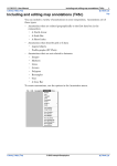
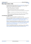
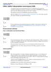
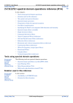
INTREPID User Manual
Library | Help | Top
Tools—menu guide (R03)
1
| Back |
Tools—menu guide (R03)
Top
This document refers to a common INTREPID menu system. It describes the Project
Manager menus specifically, but you will find that the Old Project Manager menus
are similar. For details about these tools, see:
•
INTREPID Project Manager (T02)
•
INTREPID Old Project Manager (T01)
You can launch INTREPID tools using Project Manager menus for interactive
sessions using the Project Manager menus.
See "How to start INTREPID—Overview" in Introduction to INTREPID (R02) for
instructions on the alternative methods of launching INTREPID tools.
You can customise the Project Manager's menu system to include your own options.
See "Customising the Project Manager menus" in Configuring and using INTREPID
(R04) for full details.
In this chapter:
Library | Help | Top
•
File and Dataset management
•
Editing your data—Spreadsheet, Profile, Flight Path editors
•
INTREPID data display tools
•
Levelling and Decorrugation
•
Grid operations—creating and combining grids
•
INTREPID Filters
•
Mapping
•
Gravity tools
•
Radiometrics tools
•
INTREPID Interpretation
•
INTREPID Utilities
•
Beta tools
•
Help
© 2012 Intrepid Geophysics
| Back |
INTREPID User Manual
Library | Help | Top
Tools—menu guide (R03)
2
| Back |
File and Dataset management
The Project Manager performs some dataset management operations (see "Dataset
management operations—Overview" in INTREPID Project Manager (T02).
The Old Project Manager performs a similar range of dataset operations. See
"INTREPID File and Dataset Management" in INTREPID Old Project Manager
(T01) for details of these and associated INTREPID tool operations.
Separate INTREPID tools perform Import, Export, Merge, Subsection, Append and
Remove duplicates operations. You can launch these tools from the Dataset menu
Import
Using the Import tool you can import data from a wide range of formats and store it
as an INTREPID dataset. See Importing to INTREPID datasets (T05) for detailed
information.
Import ASCII Columns
This tool specialises in importing from ASCII column format files. See Import ASCII
Columns Wizard (T06).
Export
Using the Export tool you can export data from an INTREPID dataset to a wide range
of other formats (See Exporting from INTREPID datasets (T07) for detailed
information).
Subsection
See Subsections of datasets (T21).
Merge Dataset
See Merging datasets (T04).
Append Dataset
Using the Append tool operation you can append one line or point dataset to another.
See Appending datasets (T03).
Remove Duplicates
See Removing duplicates (T04a)
Library | Help | Top
© 2012 Intrepid Geophysics
| Back |
INTREPID User Manual
Library | Help | Top
Tools—menu guide (R03)
3
| Back |
Editing your data—Spreadsheet, Profile, Flight Path editors
INTREPID has three tools for directly editing datasets—the Spreadsheet, the Profile
Editor and the Flight Path Editor. You can launch these tools using options from the
Editors menu. You can also launch a text editor from the Editors menu for modifying
or creating auxiliary files.
Spreadsheet Editor
The Spreadsheet tool enables you to edit datasets in a spreadsheet-type editor.
(Spreadsheet Editor (T15) for detailed information).
Profile Editor
The Profile Editor tool enables you to edit your line data graphically on a time
(fiducial) basis. (See Profile Editor (T17) for detailed information).
Flight Path Editor
The Flight Path Editor tool enables you to
•
Visualise datasets by displaying their contents in various ways.
•
Edit a line dataset graphically on a geographical basis.
See Flight Path Editor (T19) for detailed information.
Clip Line Tool
See Clip lines (T20).
Library | Help | Top
© 2012 Intrepid Geophysics
| Back |
INTREPID User Manual
Library | Help | Top
Tools—menu guide (R03)
4
| Back |
INTREPID data display tools
You can launch the Visualisation, Dataset Sampler and Histogram tools using
options from the Display menu.
The Visualisation tool
The current Visualisation tool is a modified version of the Flight Path Editor tool.
See Flight Path Editor (T19) for detailed documentation largely relevant to this tool.
Dataset sampler
See Dataset Sampler (T25a).
Dataset Statistics
The Histograms tool displays a histogram of a dataset. It can display the histogram
within different ranges of the data and with your choice of data 'bin' size. It can also
display histograms of individual bands of multiband grids and fields. See Histograms
(T08) for detailed information.
You can also obtain dataset statistics using:
•
Project Manager. See "Dataset preview and information display" in INTREPID
Project Manager (T02).
•
Old Project Manager. See:
•
"Viewing further information about a field or band" in INTREPID Old Project
Manager (T01)
•
"Obtaining statistics reports from datasets by command" in INTREPID Old
Project Manager (T01).
Other display options
You can also use the Grid Stitch tool (Grid menu) and the Hard Copy Composition
tool (Printing menu) for displaying data. The HP–GL Previewer (Printing menu)
enables you to view (Printing menu) files that you have output in HP–GL. The Print
Hard Copy tool can preview images described by a hard copy specification (.map) file
(using MAPCOMP language).
Library | Help | Top
© 2012 Intrepid Geophysics
| Back |
INTREPID User Manual
Library | Help | Top
Tools—menu guide (R03)
5
| Back |
Levelling and Decorrugation
INTREPID has tools for line levelling (using comparison of acquisition lines with tie
lines), grid decorrugation and microlevelling. You launch these tools using options
from the Level menu.
Tie Line Levelling
The Tie Line Levelling tool enables you to make automatic or manual corrections to
your line data using comparison of acquisition lines with tie lines. (See Line
correction and tie levelling (T30) for detailed information).
Pro Levelling
The Pro version of the Tie Line Levelling tool uses sophisticated tensor and gradient
methods for altitude and heading correction and for loop levelling. It uses the same
task description (job) language as the standard Tie Line Levelling tool. (See Line
correction and tie levelling (T30) for detailed information. For information about the
extra features of the Pro version, see "Levelling Pro" in Line correction and tie
levelling (T30)).
Decorrugation
The grid Decorrugation tool removes spurious elongate anomalies (streaks) from your
data. These anomalies arise from and correspond to adjacent traverse lines where
the aircraft has flown in opposite directions. (See Decorrugation (T32) for detailed
information).
Microlevelling
The Microlevelling tool enables you to apply corrections stored in a grid to a
corresponding line dataset. For example, the results of spurious elongate anomaly
Decorrugation are in a grid format, but you may wish to apply the corrections to the
original line dataset. (See Microlevelling (T33) for detailed information).
Multi Survey levelling
See Moving platform correction and levelling (T58).
Marine Split
See Split cruise (T57).
Library | Help | Top
© 2012 Intrepid Geophysics
| Back |
INTREPID User Manual
Library | Help | Top
Tools—menu guide (R03)
6
| Back |
Grid operations—creating and combining grids
INTREPID can derive a grid dataset from a line or point dataset using the Gridding
tool. The INTREPID Grid Merge tool can smoothly combine grids that are
geographically adjacent. Use options from the Grid menu to launch these INTREPID
tools.
Gridding
The INTREPID Gridding tool enables you to convert point and line data to a grid.
Each grid cell will contain a value derived from the raw data or interpolated from
neighbouring cells. See Gridding (T22a).
See also the Old Gridding tool Old Gridding (T22).
Grid Merge
The Grid Merge tool enables you to combine grid datasets. See GridMerge—merging
multiple grids (T24).
Grid Operations
The Grid Operations tool can resample grid datasets to produce data with different
cell size and origin. See Grid Operations (T25) for detailed information.
Old Gridding
The INTREPID Old Gridding tool enables you to convert point and line data to a grid.
We recommend that you use the current gridding tool. See Old Gridding (T22).
Old Grid Stitch
The Grid Stitch tool enables you to combine two grid datasets. The Grid Stitching
tool is also useful for examining grid datasets. See Grid Stitch—combining two grids
(T23) for detailed information.
Library | Help | Top
© 2012 Intrepid Geophysics
| Back |
INTREPID User Manual
Library | Help | Top
Tools—menu guide (R03)
7
| Back |
INTREPID Filters
You can launch the INTREPID Filter tools using options from the Filtering menu.
Line Filter
The Line Filter tool enables you to view a line dataset, filter some or all lines from it
with spatial and/or spectral domain filters and save the results. (See Line Filtering
(T31) for detailed information)
Grid FFT (Spectral domain grid filter)
The spectral domain filters tool enables you to transform grid datasets to the spectral
domain (using FFT), use filters to enhance the data, then transform it back to the
spatial domain. See Spectral domain grid filters tool (GridFFT) (T40)
Grid FFT Wizard
The Grid FFT Wizard provides an alternative user interface for applying spectral
domain grid filters. It is particularly used with INTREPIDLynx, but is also available
for general use. See Spectral domain grid filters (GridFFT) wizard (T39)
Grid Convolution (Spatial domain grid filter)
The Spatial Convolution tool modifies a grid by processing each cell using a
combination of the values of its neighbours (See Spatial Convolution Grid Filters
(T34)).
Horizontal Gradient TMI Enhancement
See Horizontal Gradient TMI Enhancement (T41).
Old Grid FFT (Spectral domain grid filter)
The old spectral domain filters tool enables you to transform grid datasets to the
spectral domain (using FFT), use filters to enhance the data, then transform it back
to the spatial domain. See Old spectral domain grid filters (OldGridFFT) (T38). We
recommend the current Grid FFT tool.
Library | Help | Top
© 2012 Intrepid Geophysics
| Back |
INTREPID User Manual
Library | Help | Top
Tools—menu guide (R03)
8
| Back |
Mapping
Using the INTREPID Map Composition tool you can prepare data for hard copy. The
INTREPID Print Map tool prints your hard copy to a device or to a file for later
printing. The HP–GL Previewer (not available from menus) enables you to view files
that you have output in HP–GL.
Compose Map
The Map Composition tool enables you to prepare hard copy including both draft hard
copy for internal use and professional standard maps representing INTREPID
datasets. See:
•
Map composition—introduction (T45a)
•
Including datasets in a map composition (T45b)
•
Including and editing map annotations (T45c)
•
Working with objects in maps—advanced operations (T45d)
•
Specifying map attribute values (T45e)
Print Map
The Print Map tool will output the image described by a hard copy specification
(.map) file in MAPCOMP language produced using the Hard Copy Composition tool
or by direct editing. Print Hard Copy can output the image to a file in PostScript or
HP–GL. Under Windows, Print Hard Copy can print directly to a device using Print
Manager. (See Map printing (T46)).
Library | Help | Top
© 2012 Intrepid Geophysics
| Back |
INTREPID User Manual
Library | Help | Top
Tools—menu guide (R03)
9
| Back |
Gravity tools
INTREPID has two gravity tools described in the sections below.
Field reduction
See Gravity corrections (T54)
Merge with Master
See Merging gravity datasets (T56).
Depth to Moho
See Estimating depth to Moho and Isostatic correction (T55).
Radiometrics tools
INTREPID has three radiometrics tools described in the sections below. You can
launch the tools using the options in the Radiometrics menu.
Multichannel spectra processing and correction (MSPC)
This tool enables you to adjust a radiometric spectra dataset for dead time, energy
calibration, aircraft and cosmic and radon backgrounds, then produce the standard 3
(K, U and Th) channel fields. See Multi-channel gamma ray spectrometric processing
(C07) for detailed information.
Calibration Spectra Processing
See Radiometric Spectra Calibration (T49).
Maximum Noise Fraction
See Maximum Noise Fraction (T50).
Standard 3 Corrections
Standard 3 gamma spectrometer corrections enables you to make height and
stripping corrections to the standard K, U, Th and Total Count gamma ray
spectrometer channels in a radiometrics dataset. (See Multi-channel gamma ray
spectrometric processing (C07) for detailed information)
Uranium Levelling
The Uranium Levels corrections tool enables you to enhance uranium data by
comparing two separate uranium frequencies. (See Uranium levelling (T53) for
detailed information).
Library | Help | Top
© 2012 Intrepid Geophysics
| Back |
INTREPID User Manual
Library | Help | Top
Tools—menu guide (R03)
10
| Back |
INTREPID Interpretation
Magnetic Interpretation
The Magnetic Interpretation tool (Magnetic interpretation (MagMage) (T42)) can
•
Produce a 'worm' diagram on grids to map high and lows (see also the new special
purpose ‘worm’ tool—Multi-scale edge detection wizard (T44a)).
•
Identify incoherencies in your data as an aid to studying regions with rapid
changes. You can use variance coherence or minimum curvature methods for this
process.
The Magnetic Interpretation tool was developed for the MAGMAGE project.
Naudy Automatic Model
The Naudy Automatic Model tool uses line profiles to estimate the depth of sources.
It creates a model then refines it to 'explain' your data. See Naudy Automatic Model
interpretation (T43) for details about this tool.
Euler Deconvolution
The Euler Deconvolution tool can calculate source depth estimations and rate them
for reliability. See Euler Deconvolution (T44) for detailed information.
Multi-Scale Edge Detection
See Multi-scale edge detection wizard (T44a).
Library | Help | Top
© 2012 Intrepid Geophysics
| Back |
INTREPID User Manual
Library | Help | Top
Tools—menu guide (R03)
11
| Back |
INTREPID Utilities
You can launch utilities using the options in the Utility menu.
Projection Conversion
The Projection Conversion tool enables you to transform data from one datum to
another and from one projection to another. (See Datum and Projection Utility (T13)
for detailed information).
Survey Distance calculator
The Survey Distance Calculator enables you to compute the distance traversed in a
survey. See Survey distance calculation (T10) for detailed information).
Degrees calculator
See Degrees Calculator (T14).
GPS Correction
The GPS Corrections tool merges Global Positioning Satellite (GPS) data with GPS
differential data and applies corrections to give final navigation data for a line
dataset. See GPS navigation corrections (T11).
Old Project Manager
See INTREPID Old Project Manager (T01)
Old Projection Conversion
See Old Datum and Projection Conversion (T12). We recommend the new tool for this
process—see Datum and Projection Utility (T13).
Library | Help | Top
© 2012 Intrepid Geophysics
| Back |
INTREPID User Manual
Library | Help | Top
Tools—menu guide (R03)
12
| Back |
Beta tools
The Beta menu has commands to launch the INTREPID beta tools.
New Print Map
New interactive and batch map composition tool with XML schema. For schema
details see http://www.geomodeller.com/geo/Geomodeller3D_Project/
mapprintSchema.xsd
Wiener Kernels
If you input sample source and results data, the Wiener Kernels tool can create a
convolution kernel that will produce the results from the source. You can then use
this convolution kernel to process other data in the same way.
See Spatial Convolution Grid Filters (T34) for information about using convolution
kernels. See Creating Weiner convolution kernels (T35) for details about the Wiener
Kernels tool.
Keating Coefficients Vector Tensor
This tool is based on the algorithm by Pierre Keating for creating theoretical gravity
and magnetic models of kimberlite pipes (vertical chimneys). It creates a
representative model of a vertical pipe for a diameter and buried depth that you can
set. A cross-correlation kernel is then passed over your observed geophysical grid
comparing every cell with the measured signal. The calculated correlation
coefficient is stored in an output grid. This tool is available in batch mode. We
provide the algorithm and calibration dataset by courtesy of the Geological Survey of
Canada.
Extensions to this idea include the use of observed gradients of both gravity and
magnetic, as well a gravity tensor gradiometer.
See Keating coefficients (T59).
Equivalent Layer
The Equivalent Layer tool performs height corrections in acquisition data processing.
See Equivalent Layer corrections (T36) for detailed information.
Gravity Layers (Batch only)
Use this tool for stripping the effects of a known depth of sedimentary cover. It
performs forward modelling for ‘layer cake’ geology. It can predict the response of
shallow sedimentary layers. This predicted response can be stripped from observed
gravity to reveal deeper gravity anomalies. See Gravity layers forward modelling
(T60) for more information.
Back Office Management
Launches our Geophysical Data Archive and Distribution System (GDADS). See
Introduction to GDADS (D01).
Library | Help | Top
© 2012 Intrepid Geophysics
| Back |
INTREPID User Manual
Library | Help | Top
Tools—menu guide (R03)
13
| Back |
Help
Getting Started
This option opens the INTREPID manual. See Overview of INTREPID
documentation (R01) for a summary of manuals and on-line help in INTREPID.
Tool Manager
The Tool Manager enables you to manage your INTREPID licence and to view a list
of the tools for which you have a licence.
Intrepid website
This is a link to the Intrepid Geophysics website.
About
If you choose About, INTREPID displays version information.
Library | Help | Top
© 2012 Intrepid Geophysics
| Back |