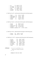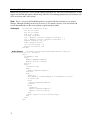
1
MapOCX Pro v7.1
Release 2
Reference Manual
Undertow Software, Corp. - PO BOX 249, N. Andover, MA 01845
Ph (978) 794-9377 Fx (978) 688-6312 www.undertowsoftware.com
2
Undertow Software Corp.
PO Box 249
N. Andover, MA 01845
U.S.A.
World Wide Web
http://www.undertowsoftware.com
MapPro OCX, ActiveX Mapping Control for Windows, Version 7.1, Rel. 2, User's Manual
Copyright © 2006 by Undertow Software Corp.
All rights reserved. Printed in the United States of America. Except as permitted under the Copyright
Act of 1976, no part of this publication may be reproduced or distributed in any form or by any means,
or stored in a database or retrieval system, without the prior written permission of the publisher.
3
4
TABLE OF CONTENTS
INTRODUCTION .....................................................................................................................................15
Map Data ..........................................................................................................................................15
Stock Dialogs, Toolbars,… ..............................................................................................................15
Map Rotation ....................................................................................................................................15
Underlays & Overlays ......................................................................................................................16
Geocoding and Reverse Geocoding..................................................................................................16
Route Optimization...........................................................................................................................16
User Registration ..............................................................................................................................17
What’s Included in the Developers Toolkit ..........................................................................................17
Minimum Requirements .......................................................................................................................17
Coordinate System................................................................................................................................17
Installing and Using the Control...........................................................................................................18
Properties, Methods, Events .................................................................................................................19
Internal Data Structure..........................................................................................................................19
Default Mouse Actions .........................................................................................................................19
Left Click (Re-centering)..................................................................................................................19
Right Click (Zooming Out) .............................................................................................................19
Left Click & Drag (Zooming In) .....................................................................................................19
Shift & Left Click (Quick Routing)..................................................................................................19
Control & Left Click (Attributes) .....................................................................................................20
Files in this package…..........................................................................................................................21
Root Directory of Distribution CD-ROM/DVD...............................................................................21
Data1 Directory of Distribution CD-ROM/DVD .............................................................................21
Data2 Directory of Distribution CD-ROM/DVD .............................................................................21
Data3 Directory of Distribution CD-ROM/DVD .............................................................................21
States Directory of Distribution CD-ROM/DVD .............................................................................21
Data4 Directory of Distribution CD-ROM/DVD (if POI data is Licensed).....................................22
Underlays Directory of Distribution CD-ROM/DVD ......................................................................22
Sample Source Code Directory of Distribution CD-ROM/DVD .....................................................22
Development Considerations – Quick How To’s and things to be aware of........................................23
Rotated Maps....................................................................................................................................23
Shading .............................................................................................................................................23
Sample Code.....................................................................................................................................23
Searching for Places & Geocoding...................................................................................................23
Reverse Geocoding...........................................................................................................................23
Displaying Data Points .....................................................................................................................23
Adding your own streets...................................................................................................................23
Single Instantiation – Many Map Views ..........................................................................................24
Distribution Files ..............................................................................................................................24
*.SIG Files ........................................................................................................................................24
Upgrading from an earlier Version...................................................................................................24
Street Level Data Visibility Problems ..............................................................................................24
Drawing on the Maps .......................................................................................................................25
Routing .............................................................................................................................................25
World Map Extents...........................................................................................................................25
MapOCX Pro Licensing .......................................................................................................................25
Technical Support .................................................................................................................................26
5
Updates .................................................................................................................................................26
OCX Reference Section ............................................................................................................................27
AboutBox() Procedure ..............................................................................................................27
AddViaPoint(x,y:Double; s:String) Procedure..........................................................................27
AutoConfig:Boolean Property...................................................................................................27
AutoPaint:Boolean Property .....................................................................................................28
AutoQuery:Boolean Property....................................................................................................28
BevelInner:Integer Property ......................................................................................................29
BevelOuter:Integer Property .....................................................................................................29
BevelWidth:Integer Property ....................................................................................................30
BorderWidth:Integer Property...................................................................................................30
CAD:Interface Interface ............................................................................................................30
CenterView(X,Y:Integer) Procedure.........................................................................................30
ClearExclusion() Procedure ......................................................................................................31
ClearStreets() Procedure ...........................................................................................................31
ClearOverlay() Procedure .........................................................................................................31
ClearViaPoints() Procedure......................................................................................................32
ClrStrBubble() Procedure..........................................................................................................32
Color:Integer (or enumerated ColorName) Property ................................................................32
Coords:Integer Property ............................................................................................................32
Cursor:Integer Property.............................................................................................................33
Custom:Integer Property ...........................................................................................................34
DataSource:txDataSource Property...........................................................................................34
DbFile:String Property ..............................................................................................................35
DegFormat:TxDegFormat Property ..........................................................................................35
DeleteAllitems() Procedure.......................................................................................................36
DeleteItem(ID:Integer) Procedure.............................................................................................36
DeleteItemRange(ID1,ID2:Integer) Procedure .........................................................................37
DeleteViaPoint(ID:Integer) Procedure......................................................................................37
DevCode:String Property ..........................................................................................................37
DevPass:String Property ...........................................................................................................38
DirectDraw(dc, offX, offY, Wd, Ht : Integer, Clear, Scale, BW : Boolean) Procedure ...........38
Distance(x1,y1,x2,y2: Variant):integer Function......................................................................39
DirectView(dc, w, h:integer; var LonL, LatB LonR, LatT: Double; var DvScale:Double).........40
DMS(x: OleVariant): string Function .......................................................................................41
DrawBubble(dc:integer; x,y:integer; S:string) Procedure.........................................................41
DrawLine(dc:integer; x1,y1,x2,y2:OleVariant;w,cl,mode: Longint) Procedure ......................42
DrawNorth(dc,x,y:integer) Procedure.......................................................................................43
DrawObject(dc:integer,Lon,Lat:OleVariant;Item,Color: Longint) Procedure..........................44
DrawScalebar(dc, x, y: Integer) Procedure ...............................................................................44
EdgePan:Boolean Property .......................................................................................................45
EdgePanAmount:Double Property ............................................................................................45
EdgePanWidth:Integer Property ...............................................................................................45
Enabled:Boolean Property.........................................................................................................46
ExecClosest() Procedure ...........................................................................................................46
ExecDbImport() Procedure .......................................................................................................47
ExecLonLat() Procedure ...........................................................................................................47
ExecMem(X:LongInteger):LongInteger Function ....................................................................48
ExecMethod(s:String) Procedure ..............................................................................................48
ExecPhone() Procedure .............................................................................................................51
ExecPlace() Procedure ..............................................................................................................51
6
ExecPrint() Procedure ...............................................................................................................52
ExecPrintEX() Procedure..........................................................................................................54
ExecRegister(x:LongInt) Procedure..........................................................................................54
ExecRoadOption() Procedure ...................................................................................................55
ExecRoute(x1, x2, x3, x4: Double) Procedure..........................................................................57
ExecSearch(Title:string;Option:Integer) Procedure..................................................................61
ExecStreet() Procedure..............................................................................................................65
ExecZipcode() Procedure ..........................................................................................................66
FindAcEx(temp:String) Procedure............................................................................................66
FindCity(temp:String) Procedure ..............................................................................................67
FindClosest(X,Y,Radius:OleVariant) Procedure ......................................................................69
FindClosestPlace(X,Y,Rad,Pop,Opt):string Procedure.............................................................71
FindItem(X,Y:OleVariant) Function.........................................................................................72
FindFirstItem(X,Y:OleVariant):String Function.......................................................................73
FindNextItem():String Function................................................................................................73
FindItemclose() Method............................................................................................................74
FindRoute(Lon1,Lat1,Lon2,Lat2:OleVariant;Opt: LongInt) Procedure...................................74
FindViaRoute(Opt: LongInt) Procedure ...................................................................................77
FindStr(const t, t2: string;add: Integer;xctr, yctr, mradius: OleVariant;const ststr: string)..........78
FindZip(z:LongInt) Procedure ..................................................................................................80
FirePmapEvent(EventID, Delay:Integer) Method ....................................................................81
Font:String Property..................................................................................................................82
GeoFind(s:String):Integer; Function .........................................................................................82
GeoFindArray(S:strring); Method.............................................................................................86
GeoFindClose() Procedure........................................................................................................88
GeoFindFirst(GeofindString:String):String Procedure .............................................................88
GeoFindNext():String Procedure ..............................................................................................89
GeoFindParse(Field, Result:String):String Procedure ..............................................................89
GetProductCode:String Property...............................................................................................90
GetRouteFirst(x1,y1,x2,y2:double; Consolidate:boolean; Option:integer):String.......................90
GetRouteNext():String Procedure .............................................................................................91
GetRouteClose() Procedure.......................................................................................................92
RouteParse(Fld:Variant, s:string):String Procedure..................................................................92
GetViaRouteFirst(Consolidate:Boolean; Options:Integer):String Procedure ...........................93
GetViaRouteNext():String Procedure .......................................................................................94
GetViaRouteClose():String Procedure ......................................................................................94
GotoPoint(x, y: OleVariant) Procedure.....................................................................................94
Grid:Boolean ................................................................................................................................94
Handle:Integer Property ............................................................................................................95
HeadsUp(x1,y1,x2,y2:OleVariant):longint Function................................................................95
HelpPath:String Property ..........................................................................................................96
HideAllItems() Procedure .........................................................................................................96
Import:ImportLayer; Property...................................................................................................97
ImportMgr:ImportManager; Property .......................................................................................97
InitNonVis() Procedure .............................................................................................................97
Int2Lat(i:Integer):Double Function...........................................................................................97
Int2Lon(i:Integer):Double Function..........................................................................................98
IsDrawing:Boolean Property.....................................................................................................98
ItemFontSize:Integer Property ..................................................................................................99
Kms Property:Double...............................................................................................................99
Lat2Int(x:OLEVariant):Integer Function ..................................................................................99
7
LatBottom:Double Property ....................................................................................................100
LatCenter:Double Property .....................................................................................................100
LatTop:Double Property .........................................................................................................100
LL2INT(x,y:OLEVariant):LongInt Function..........................................................................101
LLMode:Integer Property .......................................................................................................101
Load_Air:Boolean Property ....................................................................................................102
Load_City:Boolean Property...................................................................................................102
Load_County:Boolean Property..............................................................................................102
Load_Highway:Boolean Property...........................................................................................103
Load_Hydro:Boolean Property ...............................................................................................103
Load_Landmark:Boolean Property .........................................................................................103
Load_Park:Boolean Property ..................................................................................................104
Load_Shore:Boolean Property ................................................................................................104
Load_State:Boolean Property .................................................................................................104
Load_World:Boolean Property ...............................................................................................104
LoadConfig(path:String) Procedure ........................................................................................105
Loaded:Boolean Method .........................................................................................................105
LoadExclusion(filename:String) Procedure ............................................................................106
LoadStreets(s:String) Procedure..............................................................................................106
LoadViaFile(s:String) Procedure ............................................................................................106
Lon2Int(x:OLEVariant):Integer Function...............................................................................106
LonCenter:Double Property ....................................................................................................107
LonLatStr(x,y:OLEVariant):String Function..........................................................................107
LonLeft:Double Property ........................................................................................................107
LonRight Property .................................................................................................................107
Magnitude:Integer Property ....................................................................................................108
MainLay:Boolean Property .....................................................................................................108
MapCount:LongInt Property ...................................................................................................109
Mapmode:Integer Property .....................................................................................................109
MapUnits:Integer Property......................................................................................................112
Miles:Double Property ............................................................................................................112
OnClick
Event......................................................................................................................112
OnDblClick Event ...................................................................................................................113
OnDirect Event......................................................................................................................113
OnDirectBefore Event.............................................................................................................114
OneWayColor:Integer Property ..............................................................................................114
OneWayShow Property...........................................................................................................115
OneWayUse Property..............................................................................................................115
onCADChange(Current:Long) Event......................................................................................115
OnFind Event ..........................................................................................................................116
OnFindDir Event .....................................................................................................................117
OnFindPlace Event..................................................................................................................117
OnFindRte
Event...................................................................................................................118
OnMouseDown Event .............................................................................................................118
OnMouseMove Event .............................................................................................................118
OnMouseUp Event..................................................................................................................119
OnOptiRouterMsg Event.........................................................................................................120
OnPaintAfter Event .................................................................................................................120
OnPmapEvent Event ...............................................................................................................121
OnPaintBefore Event...............................................................................................................121
OnResize Event......................................................................................................................122
8
OnUnderAfter Event ...............................................................................................................122
OnUnderBefore Event.............................................................................................................122
OnStatus
Event......................................................................................................................122
OpenOverlay(s:String) Procedure ...........................................................................................123
OptiRouter:Interface Interface ................................................................................................123
OptiRouterBtn:Boolean Property ............................................................................................123
OptiPathOnTop:Boolean Property ..........................................................................................124
Overlay:Boolean Property.......................................................................................................124
Path_Data1 Property ...............................................................................................................124
Path_Data2 Property ...............................................................................................................124
Path_Data3 Property ...............................................................................................................125
Path_Data4 Property ...............................................................................................................125
Path_Library Property .............................................................................................................125
Path_States0:String Property...................................................................................................125
Path_States1:String Property...................................................................................................126
PhoneRegInfo Property ...........................................................................................................126
PmPalette:Integer Property .....................................................................................................126
PmParent:Integer Property ......................................................................................................127
PmScale:Double Property .......................................................................................................127
POIMgr:Interface Property .....................................................................................................127
PopUpRoute:Boolean Property ...............................................................................................128
PostUnderlay:Integer Property ................................................................................................128
QueryObj(x,y:Double) Property..............................................................................................129
Redirty Procedure ...................................................................................................................129
Redraw Procedure ...................................................................................................................130
Refresh Procedure ...................................................................................................................131
ResizeCtl(dx,dy:Integer) Procedure ........................................................................................131
Result
Property......................................................................................................................131
RoadOption(Option, Atrib:LongInt) Procedure ......................................................................132
Rotate(x:Double) Procedure....................................................................................................134
RouteProgressIcon(FineName:string):Boolean Procedure .....................................................134
RoutingActive:boolean Property.............................................................................................134
SaveConfig Procedure.............................................................................................................135
SaveExclusion(s:String) Procedure.........................................................................................135
SaveStreets(s:String) Procedure ..............................................................................................136
SavetoBitmap(s:String) Procedure ..........................................................................................136
SavetoGif(s:String) Procedure ................................................................................................136
SaveViaFile(s:String) Property ...............................................................................................137
SaveView:Boolean Property ...................................................................................................137
Scale
Property:Double.........................................................................................................137
ScaleBar:Integer Property .......................................................................................................138
Screen_Aspect:Double Property .............................................................................................138
SetDirtyRect(LeftX,TopY,RightX,BottomY) Procedure........................................................138
SetExclusion(IDString:string; x1,y1,x2,y2:double) Procedure...............................................139
SetItem(id: Integer; x, y: OleVariant) Procedure ....................................................................140
SetItem2Back(id:Integer) Procedure.......................................................................................141
SetItem2Front(id:Integer) Procedure ......................................................................................141
SetItemAngle(id:integer;x:Double) Procedure........................................................................141
SetItemBitmap(id:integer; handle:integer) Procedure.............................................................142
SetItemLocalBitmap(id:integer; s:String) Procedure..............................................................143
SetItemString(id:integer; s:String) Procedure .........................................................................143
9
SetItemVis Procedure..............................................................................................................144
SetOption(OpCode, Option:LongInt):LongInt Function ........................................................144
OpCode = 00 (Special Color Options) ...................................................................................145
OpCode = 01 (Background Color) .........................................................................................146
OpCode = 02 (Water Color)...................................................................................................146
OpCode = 03 (Parks Color)....................................................................................................146
OpCode = 10...1F (Build-in Color Shades)............................................................................146
OpCode = 20...5F (State Colors)............................................................................................146
OpCode = $80 (Major Street Labeling) .................................................................................147
OpCode = $81 (Minor Street Labeling) .................................................................................147
OpCode = $82 (Global Street Labeling) ................................................................................147
OpCode = $83 (Street Label Interference) .............................................................................147
OpCode = $84 (Hide Suffix)..................................................................................................147
OpCode = $85 (Street Text Size) ...........................................................................................147
OpCode = $86 (User Item Visibility).....................................................................................147
OpCode = $88 (Display Highway Shields)............................................................................147
OpCode = $89 (Display Coasre Layer)..................................................................................147
OpCode = $8F (Display Bounding Polygons) .......................................................................148
OpCode = $90 (State Text Size) ............................................................................................148
OpCode = $91 (Place Name Text Size) .................................................................................148
OpCode = $92 (Landmark Text size).....................................................................................148
OpCode = $93 (Reserved)......................................................................................................148
OpCode = $94 (Highway Shield Text Size)...........................................................................148
OpCode = $95 (Street Name Text Size).................................................................................148
OpCode = $98 (Street Data Threshold)..................................................................................148
OpCode = $99 (City Label Spacing)......................................................................................148
OpCode = $100+N (Layer Visibility) ....................................................................................148
OpCode = $200 (State Polygon Shading) ..............................................................................150
OpCode = $201 (County Polygon Shading) .........................................................................150
OpCode = $202 (MCD Polygon Shading) .............................................................................150
OpCode = $203 (Place Polygon Shading)..............................................................................150
OpCode = $301 (State Boundary Color)................................................................................150
OpCode = $302 (County Boundary Color) ............................................................................150
OpCode = $303 (MCD Boundary Color)...............................................................................150
OpCode = $C001 (Debug Mode) ...........................................................................................150
OpCode = $C002 (Render Time) ...........................................................................................150
OpCode = $C003 (Load Data Time)......................................................................................150
OpCode = $C004 (World Extents).........................................................................................150
OpCode = $D001 (Memory Usage) .......................................................................................150
OpCode = $D002 (Memory Page Size) .................................................................................150
OpCode = $D003 (Free Memory)..........................................................................................151
OpCode = $D004 (Max Memory)..........................................................................................151
OpCode = $D005 (One Way Arrow Collision) .....................................................................151
OpCode = $D007 (Min Zoom Scale) .....................................................................................151
OpCode = $D008 (Grid File Memory Usage) .......................................................................151
OpCode = $EEE2 (Internal Bitmap Mode)............................................................................151
OpCode = $EEE4 (User Item Paint Order) ............................................................................151
OpCode = $EEE9 (Double Lined Roads) ..............................................................................151
OpCode = $EEEA (Routing Local Radius) ...........................................................................151
OpCode = $EEEB (Routing Band Width) .............................................................................152
OpCode = $EEEC (Routing Highlight Resolution) ...............................................................152
10
OpCode = $EEEE (FindClosest Options) .............................................................................152
Shade_Cnty:Boolean Property ................................................................................................154
Shade_MCD:Boolean Property...............................................................................................154
Shade_Plc:Boolean Property...................................................................................................155
Shade_State:Boolean Property ................................................................................................155
ShowAllItems() Procedure......................................................................................................155
ShowToolBar() Procedure.......................................................................................................156
StartView(s:String) Property...................................................................................................157
Street:string Property...............................................................................................................157
Synch:Boolean Property..........................................................................................................158
Texture:Boolean Property .......................................................................................................158
TitlePrint(s:String) Property....................................................................................................158
TitleUser(s:String) Property ....................................................................................................159
ToolBarMode:Integer Property ...............................................................................................159
Underlay:Boolean Property.....................................................................................................159
UnderlayFile(s:String) Property ..............................................................................................160
UnderlayTransparent:Boolean Property..................................................................................161
UnderlayTrColor:Integer Property ..........................................................................................161
ViaCount:Integer Property ......................................................................................................161
ViewCmd(s:String) Property...................................................................................................162
Visible:Boolean Property ........................................................................................................162
Xcord:Double Property ...........................................................................................................162
Ycord:Double Property ...........................................................................................................163
ZoomAll() Procedure ..............................................................................................................163
ZoomCan() Procedure .............................................................................................................163
ZoomIn() Procedure ...............................................................................................................164
ZoomIWindow(x1, y1, x2, y2: Interger) Procedure................................................................164
ZoomLast() Procedure.............................................................................................................164
ZoomOut() Procedure .............................................................................................................165
ZoomOverlay() Procedure.......................................................................................................165
ZoomPan(i:Integer) Procedure................................................................................................165
ZoomSP(s:String) Procedure...................................................................................................166
ZoomUnderlay() Procedure.....................................................................................................167
ZoomWindow(x1, y1, x2, y2: OleVariant) Procedure............................................................167
.CAD Interface ........................................................................................................................................168
.CAD.Arrow(x1,y1,x2,y2:Double):CadObj Method...............................................................169
.CAD.Bezier(X1,Y1,X2,Y2,X3,Y3:Double):CadObj Method ...............................................169
.CAD.BringToFront Method...................................................................................................170
.CAD.Brush Property ..............................................................................................................171
.CAD.Clear() Method..............................................................................................................171
.CAD.Count:Integer Property .................................................................................................172
.CAD.Delete():Integer
Method..............................................................................................172
.CAD.Ellipse(X1, Y1, X2, Y2:Double):CadObj Method .......................................................172
.CAD.Extents :TExtentRec Method........................................................................................173
.CAD.Font() Method ...............................................................................................................173
.CAD.GetMarker(n:Integer):LongInteger Method..................................................................174
.CAD.GetMetaObj(s:String):LongInteger Method .................................................................174
.CAD.GetSymbol(index:Integer):LongInteger Method ..........................................................174
.CAD.Group() Method ............................................................................................................175
.CAD.ImportFile() Method .....................................................................................................175
.CAD.LoadFromFile(s:String; Option:Integer) Method .........................................................175
11
.CAD.Marker(X, Y:Double; hnd:Integer) Method ................................................................176
.CAD.mCircle(Xc, Yc, Xp, Yp, Aspect:Double):CadObj Method .........................................176
.CAD.MetaObj(X1,Y1,X2,Y2:Double; Hnd:LongInteger):CadObj Method .........................176
.CAD.mLine(X1, Y1, X2, Y2:Double):CadObj Method ........................................................177
.CAD.Objects(n:integer) array of CadObj Method .................................................................177
.CAD.ObjectType:Integer Property ........................................................................................178
.CAD.Pen() Method ................................................................................................................179
.CAD.Polygon(Points:TRPoint; N:Long):CadObj Method ....................................................180
.CAD.Polyline(Points:TRPoint; N:Long):CadObj Method ....................................................180
.CAD.Rectangle(X1, Y1, X2, Y2:Double):CadObj Method ..................................................181
.CAD.RegularPolygon(Xc, Yc, Xp, Yp:Double; N:Integer):CadObj Method........................181
.CAD.Rotate(Xp, Yp, Angle:Double) Method........................................................................182
.CAD.SaveToFile(S:String) Method.......................................................................................182
.CAD.ScaleToSize(Value,Height:Double):Double Function .................................................183
.CAD.SelectRange(Ns,Nn,Option:Integer) Method................................................................183
.CAD.SelectRect(x1,y1,x2,y2:Double, Option:Integer) Method............................................184
.CAD.SendToBack Property ...................................................................................................185
.CAD.Symbol(X1,Y1,X2,Y2:Double; Hnd:LongInteger):CadObj Method ...........................186
.CAD.Text(X,Y: Double; s:String) Method............................................................................186
.CAD.TextBubble(X,Y:Double, S:String) Method.................................................................186
.CAD.TextFloat(X1,Y1,Size:Float; Caption:String):CadObj Method....................................187
.CAD.Toolbar Interface...........................................................................................................187
.CAD.Ungroup() Method ........................................................................................................188
.CAD.Visible
Method ..........................................................................................................188
CAD Object Properties.............................................................................................................188
.objects().Brush Property ............................................................................................188
.objects().Caption Property .........................................................................................189
.objects().Font Property ..............................................................................................190
.objects().GreatCircle:Boolean Property.....................................................................191
.objects().MoveAbs(X,Y: Double) Property...............................................................192
.objects().MoveRel (X,Y: Double) Property ..............................................................192
.objects().ObjectType:Integer Property ......................................................................192
.objects().Pen Property................................................................................................193
objects().Selected:Boolean Property...........................................................................194
.objects().Tag:Integer Property ...................................................................................194
.objects().Visible:Boolean Property............................................................................194
Visual CAD Toolbar Interface ...................................................................................................195
CAD Attribute Dialog ................................................................................................................200
.OptiRouter Interface ..............................................................................................................................204
.OptiRouter.AddPoint(s:String, x,y:Double) Method .............................................................204
.OptiRouter.Calculate(n:integer) Method................................................................................206
.OptiRouter.Clear() Method ....................................................................................................206
.OptiRouter.ClearPoints() Method ..........................................................................................206
.OptiRouter.DeletePoint(n:Integer) Property ..........................................................................206
.OptiRouter.ExecOptiRoute() Method ....................................................................................207
.OptiRouter.GetRouteFirst(n:integer):String Function ...........................................................210
.OptiRouter.GetRouteNext():String Function .........................................................................210
.OptiRouter.GetRouteClose() Function...................................................................................211
.OptiRouter.CostPerGallon:Double Property..........................................................................211
.OptiRouter.ExRadius:Double Property..................................................................................212
.OptiRouter.GetFirstNode - Reserved Function......................................................................212
12
.OptiRouter.GetNextNode - Reserved Function .....................................................................212
.OptiRouter.StopPoints[n]:PointRec ..........................................................................................212
.OptiRouter.InsertPoint (n:Integer; pt:PointRec) Method.......................................................212
.OptiRouter.LoadFrom… Property .........................................................................................213
.OptiRouter.LoadPoints(s:String) Method ..............................................................................213
.OptiRouter.MemUsed:Integer Property .................................................................................213
.OptiRouter.MovePoint(From, To: Integer) Property .............................................................213
OptiRouter.mpgCity:double Property .....................................................................................214
OptiRouter.mpgHwy:double Property ....................................................................................214
.OptiRouter.NumPoint(s:String) Property...............................................................................214
.OptiRouter.PointExtent:TRPoint Property.............................................................................214
.OptiRouter.Priority:RoadRec Property ..................................................................................215
.OptiRouter.RoutePath Interface .............................................................................................215
.OptiRouter.RouteParse( index:Integer; s:string):String Function..........................................217
.OptiRouter.RouteType:TxRouteType Property .....................................................................218
.OptiRouter.Speed:RoadRec Property.....................................................................................219
.OptiRouter.SaveToFile… Future ...........................................................................................219
.OptiRouter.SavePoints(s:String) Method...............................................................................219
.ImportLayer Interface............................................................................................................................220
.Import.Brush Property............................................................................................................220
.Import.Count:Integer Property ...............................................................................................221
.Import.Filename:String Property............................................................................................222
.Import.Font Property..............................................................................................................222
.Import.LabelField:Variant Property.......................................................................................223
.Import.LabelFilter:Integer Property .......................................................................................224
.Import.Lower Property...........................................................................................................224
.Import.Mark Property.............................................................................................................225
.Import.Name:String Property.................................................................................................226
.Import.Opacity:Integer Method.............................................................................................226
.Import.Pen
Method...............................................................................................................226
.Import.ProximityCheck:Boolean Method ..............................................................................228
.Import.ShowDialog Method...................................................................................................228
.Import.Upper Property ...........................................................................................................229
.Import.Visible:Boolean Property ...........................................................................................230
.ImportManager Interface.......................................................................................................................231
.ImportMgr.AddLayer(Name:WideString, FileName:Widestring) Method ...........................231
.ImportMgr.Clear Method .......................................................................................................232
.ImportMgr.Count:Integer Property ........................................................................................232
.ImportMgr.CurrentIndex:Integer Property.............................................................................232
.ImportMgr.CurrentLayer:ImportLayer Property....................................................................233
.ImportMgr.DeleteIndex(n:integer) Method ...........................................................................233
.ImportMgr.DeleteNamedLayer(Lname:string):Integer Method ............................................234
.ImportMgr.Items[n]:ImportLayer Property............................................................................234
.ImportMgr.LoadfromFile(Fname:String) Method .................................................................234
.ImportMgr.SaveToFile(Fname:String) Method.....................................................................235
.ImportMgr.ShowDialog Method............................................................................................235
.ImportMgr.Visible:Boolean Property ....................................................................................236
.ImportMgr.ZoomLayers(N:Integer) Method .........................................................................236
.POIManage Interface ............................................................................................................................237
.POIMgr.CATCount:Integer; Property....................................................................................240
.POIMgr.CATVisibility(Index:OLEVariant):Boolean; Property............................................240
13
.POIMgr.Dialog; Method ........................................................................................................241
.POIMgr.FormatHint:String Property .....................................................................................241
.POIMgr.FormatLabel:String Property ...................................................................................243
.POIMgr.GetCATCode(Name:WideString):Integer; Method.................................................244
.POIMgr.GetCATName(CATcode:Integer):string; Method...................................................244
.POIMgr.MilesMajor:Double Property ...................................................................................244
.POIMgr.MilesMinor:Double Property...................................................................................244
.POIMgr.ReplaceBitmap(Index:OLEVariant; HBmp:Integer); Method.................................245
.POIMgr.Visible:Boolean Property.........................................................................................245
APPENDIX A - Overlay File Format ...................................................................................................246
APPENDIX B – Color Palette ...............................................................................................................249
APPENDIX C – Configuration File ......................................................................................................250
APPENDIX D – Abbreviations in Searching ........................................................................................257
APPENDIX E - Visual Basic Sample Code .........................................................................................258
APPENDIX F – CFCC Definitions .......................................................................................................262
APPENDIX H – Underlay File Format .................................................................................................274
APPENDIX I – Autoload.Cty File Format ............................................................................................275
APPENDIX J – CMX File Format ........................................................................................................276
APPENDIX K - Street Editing Mode ..................................................................................................282
APPENDIX L - Delphi Code Examples ...............................................................................................286
Printing to A printer Using DirectDraw.............................................................................286
Saving to a Meta File .........................................................................................................287
Using DirectView...............................................................................................................288
APPENDIX M - Enumerated Properties & Record Structures.............................................................294
APPENDIX N - SAMPLE LICENSE AGREEMENT..........................................................................297
APPENDIX O – DEPLOYING APPLICATIONS DEVELOPED WITH THE MapPro71.OCX,
Release2 SDK .........................................................................................................................................312
14
INTRODUCTION
MapOCX Pro (sometimes also referred to as MapPro) is a complete programming toolkit for
incorporating detailed maps and spatial information in the Microsoft Windows environment. The selfcontained ActiveX control was designed for quick and simple integration of high-quality, detailed map
displays into any Windows visual environment, and facilitates brief development and deployment cycles.
The latest version of the control is v7.1 (filename MapPro71.OCX).
This document is intended as an aid to developers, designers, and programmers in developing and
integrating sophisticated map content into their applications. It is not meant for distribution to the endusers of applications based on this technology. It contains everything you need to use the MapOCX Pro
toolkit. It also assumes you already are familiar with Microsoft’s Visual Basic, and/or Borland’s Delphi
Integrated Development Environments (IDEs).
The sample code provided in this document is for demonstration purposes ONLY. As such, it is subject
to modifications on a continuous basis as the MapOCX Pro evolves. The sample code does not
constitute a software product, nor is it supported as such.
The MapOCX Pro 32-bit ActiveX control permits users to interface to an extensive vector database of
roads, rivers, streams, ponds and other water bodies. The control has built-in behaviors which enable the
user to dynamically zoom in or out, pan the map image, search for addresses, places, Zip Codes,
Counties, perform Geocoding and Reverse Geocoding, and in general gives the developer/user the means
of accessing vast amounts of geographical data.
The MapOCX Pro control has published properties, methods, events and dialogs. All parts of the control
are written in Borland’s Delphi.
Map Data
Two self-contained mapping databases may be licensed from Undertow Software, for use with MapPro
OCX. One of these databases is based on the 2000 TIGER/Line data, from the Census Bureau, and the
other is based on Premium Mapping Data supplied from TeleAtlas. Both data sets provide coverage for
the Continental USA, Hawaii, Puerto Rico and US territories. The TeleAtlas data set also provides
coverage for Canada.
Although both data sets provide resolution down to neighborhood roads, the TeleAtlas-based premium
data set provides much more detailed address range coverage, additional resolution in the vector data,
one way street information, exit ramp information, and in general a significantly higher degree of detail.
In addition to the detailed USA and Canadian data available with MapOCX Pro, a basic World reference
data set is also provided, based on TeleAtlas, and enhanced with data from a number of other sources.
This world data set, is meant to be used as a reference layer for users that may want to use their own
underlay bitmaps, or overlays, for example, to produce maps for other parts of the world.
Stock Dialogs, Toolbars,…
Using just a single line of code, to access one of the numerous built-in stock dialogs and toolbars,
provides the user with the ability to perform searches, print, perform street-level routing, set display
options, and much more.
Map Rotation
On-the-fly map rotation, and a specialized “Heads-Up” mode allows the user to rotate map data to the
preferred orientation, ideal for in-vehicle navigation.
15
Underlays & Overlays
Users can also load underlay bitmaps (satellite or aerial photography, BMP, JPG or GIF), and can create,
load and edit overlays of CAD objects (lines, boxes, circles). Loaded overlay files may be of the older
MapPro formats (.OVR or .CMX), of the new, advanced native CAD format, with support of attributable
objects. A built-in CAD toolbar makes it easy for the developer to add vector elements that become part
of the user CAD layer which is painted on top of the map surface.
The new CAD interface also allows the user to Group CAD objects in logical sets, modify individual or
group object attributes, use built-in markers and wmf symbols to identify map locations, import wmf
objects, an more. All these capabilities, are also available programmatically, for the developer that is
interested in building their own CAD interface.
Geocoding and Reverse Geocoding
Although not designed as a dedicated geocoder, A variety of built-in search methods allow the user to
Geocode based on an address, and the control also has built-in methods that permit the user to enter
latitude and longitude coordinates and find the closest street, address, city, etc.
Route Optimization
A whole collection of new capabilities were added to the Map control in the new release, MapPro71.
One of the most important additions is the Optimized Route Solution (ORS), many times referred to as
the Traveling Salesman Problem (TSP).
This is the solution to the problem where a number of points need to be visited, and the user is interested
in the optimized set of routes to all those points. In this implementation, the ORS can use either a closed
circle path, i.e., a complete closed path is generated between all the user-specified points, or it can use
fixed Start and Finish points. Although it may seem to be a trivial problem, for a couple of points, one
can quickly see that the number of possible solutions that need to be examined, even for 6 pint, can
quickly get very high.
Possible Routing Combinations for 6 points
ORS result for the same point
The ORS is implemented as a collection of Interfaces, Properties and Methods, described in the
Optirouter section of this manual. below. Its capabilities can be selected both programmatically, or by
invoking the Route Optimizer built-in dialog.
16
User Registration
The MapOCX control is registered in each development project, using the licensing information obtained
from UnderTow Software, at the time of purchase, or (most likely) following the SDK’s installation. No
further interaction with Undertow is needed, by the developer. (See section on installing and using the
control). Please, note that the the Mappro SDK is distributed as a Single User SDK. If more than
one developer will be using the SDK, on different computer system, a separate SDK license needs
to be purchased for each such computer/user.
All distributed, end-user copies of applications developed with MapOCX Pro, on the other hand,
need to be registered with Undertow Software, individually, within 15 days of installation. The user
is reminded upon startup of the application; they can register by phone or over the internet. This
allows the developer to monitor the usage of their application and at the same time automates the
licensing procedure.
What’s Included in the Developers Toolkit
The MapOCX Pro Package contains the following:
•
•
•
•
•
•
•
A choise of Map Data
• 2000 TIGER/Line Street-level Data Set for USA, or
• TeleAtlas Prime street-level Data for the USA (and /or Canada if licensed)
Auxiliary files containing coarse world, state, county, place, hydro and roads data
MapPro71.OCX ActiveX Component
Developer’s Users Manual
REGSVR32.exe
OC30.DLL
Vendor Product Code and Developer Password (This is supplied to Licensee by phone)
Minimum Requirements
The following represent the minimum operating requirements for MapOCX Pro.
Minimum OS:
Operates On:
Windows 2000
Windows 2000/XP
CPU
RAM
HD
CD-ROM
Video
Pentium 4, 1 GHz+ or equivalent
256 MB
100 MB (see note below)
4x
800x600, 256 colors
NOTE: 100 MB is assumed to be available in order to accommodate the OCX and associated files. The
data is assumed to remain on the CD-ROM. If the data is transferred to the HD, then approximately 655 Mb
(for Tiger Data) or 1+ Gb (for TeleAtlas) of space is required.
Coordinate System
The coordinate system used in the data accompanying the OCX, is a Lon/Lat (x,y), Cartesian coordinate nonprojected map system. The system treats longitude and latitude as a simple rectangular coordinate system.
17
Scale, distance, area, and shape, in such a projection, are all distorted with the distortion increasing as one
moves toward the poles.
Installing and Using the Control
The steps required to install and use MapPro71.OCX control are briefly described below:
1. Create a folder (subdirectory) and copy the MapPro71.OCX and associated files from the
distribution disk to the folder. It is recommended that you retain the structure of the data
directories (e.g., Data1, Data2, …) which makes it easier to troubleshoot problems should they
arise later on.
2. Although some IDEs may transparently take care of this, it is recommended that you register the
OCX with Windows. To do so, you may go to the command line, navigate to the folder where
you installed MapPro71.OCX and REGSVR32.EXE, and
Type: REGSVR32.EXE MAPPRO71.OCX
And press ENTER.
3. Start your Development environment. If your IDE requires it (such as Delphi or Visual Basic,
for example), then make sure you install the component in that environment. Refer to your
IDE’s documentation on installing components if necessary.
4. Create a new form and place the control on it.
5. Before you can create an application, you must enter in your Vendor Code (XXXX-XXXX) and
your Password (XXXXXX). This information is either supplied when you purchase the
MapPro71 SDK, or given to you by phone after you have received the SDK. In design mode,
right mouse click on the MapOCX and select "Properties", then select the "Installation" tab
where you can enter this information. If you are not yet a licensed developer or have lost your
Developer ID, please contact Undertow Software at 1-978-794-9377 for further information.
Note that this process, of entering Vendor Code and password, will need to be repeated every
time you place a new instance of the control on a form in your project.
6. In the FormCreate event, or equivalent, set the Data Path properties so the OCX can find the
data files (refer to Path_Data1, Path_Data2, Path_Data3, Path_States0, and Path_States1 in this
manual for further information). Immediately following the path properties, also set the
DataSoure property for the appropriate licensed set of data you will be using. It appears the
loading sequence of some IDEs may interfere with loading sequence of the control. It is
therefore recommended that in the FormCreate event, the developer also programmatically set
the Vendor Code and Vendor Password.
Note: Once the OCX control is placed on a form, clicking the right mouse button, while the mouse
cursor is on the control, will open the “Properties” dialog. If this “Properties” dialog is exited by
clicking on the O.K. button, a new configuration file (MapPro71.CFG) containing the new options is
saved to the disk. Furthermore, if any of the properties controlling the map view port are modified from
the object inspector, the control is updated and a new MapPro71.CFG file is written to the disk.
18
Properties, Methods, Events
Only Properties, Methods and Events explicitly documented in this manual are supported and controlled by
the OCX. Other inherited Properties, Methods and Events are available to the user through the control,
depending on the development environment used. However, these are not controlled by the OCX and as
such, support for them is beyond the scope of this document. There are also Reserved Methods that,
although sometimes visible, are not supported for user access through the OCX.
Internal Data Structure
The data file structure of the map data, overlays, underlays, configuration files, and other support files
used are proprietary. The format of some of these files is described in the appendices to this document.
Default Mouse Actions
Left Click (Re-centering)
Pressing the Left mouse button, while in the default mode (mapMode=MdZoom), pans and repositions
the map so that the clicked point is in the center of the ViewPort..
Right Click (Zooming Out)
Pressing the Right mouse button, while in the default mode (mapMode=MdZoom), zooms the map out
by a factor of 2.
Left Click & Drag (Zooming In)
Pressing the Left mouse button, while in the default mode (mapMode=MdZoom), and dragging the
mouse pointer, while holding the mouse button down, draws a dynamic rectangle on the screen. Once
the mouse button is released, the map is zoomed in so that the area included in the selection polygon,
fills the viewport.
Shift & Left Click (Quick Routing)
Pressing the Left mouse button, while holding down the Shift key, marks the current cursor location with
a routing point marker, and pops up the Quick Routing menu (Only enabled if RoutingActive is set to
True – see info on the RoutingActive property).
19
The quick routing menu allows you to add the Start, a
Via or the End point for a routing calculation, Clear the
currently calculated route, Zoom to the currently
calculated route extents, open the main routing dialog,
or perform a calculation using the currently defined
points (the calculation options are disabled if at least
two routing points have not been defined).
Note that points added this way are also accessible
from within the OptiRouter dialog, as well.
Control & Left Click (Attributes)
Pressing the Left mouse button, while holding down the Control key, opens au a dialog displaying
additional attribute data about the object at the clicked point. Note that this behavior is available only
when the map is zoomed in to the point where local streets are visible, i.e., ~ 2 mile scale.
It should be pointed out that a number of other mouse-click behaviors are also available, when the map is not
in its default mode, i.e., MapMode<>mdZoom, but those are described in the individual sections where the
MapMode options are discussed.
20
Files in this package…
This section summarizes the various files distributed as part of the MapOCX Pro v7.1 developer’s
package with short description of their contents. Please, note that these files are subject to change
without notice, as data gets modified/updated. For the latest files available at any given time, you may
want to visit the Undertow Software web site, at www.undertowsoftware.com .
Root Directory of Distribution CD-ROM/DVD
MapPro71.OCX
The main mapping Active-X control.
Data1 Directory of Distribution CD-ROM/DVD
CRSHWY.ZPX
Coarse Hwy Network file, used by Optirouter
mAIR.ZPX
Airports points file
mCITY.ZPX
City/Place Points File
mCNTY.ZPX
Shaded County Polygons, below 2 mi scale
mCNTY03.ZPX
Shaded County Polygons, below 2 mi scale, Canada
mCNTYL.ZPX
Shaded County Polygons, above 2 mi scale
mHWY.ZPX
USA Interstate, State, and Local highways, used for rendering
mHYDRO.ZPX
Hydrographic features file
mPARK.ZP
Park polygons, above 2 miles.
mRTE.ZPX
USA Interstate and State Highways file (used for routing)
mRTE03.ZPX
Canada Interstate and State Highways file (used for routing and rendering)
mSHORE.ZPX
World Shoreline boundary, high definition
mSTATE.ZPX
State and County shaded polygons, above 2 mi scale
mWORLD.ZPX
High resolution shaded country polygons
VCRSHWY
Very Coarse Hiwhay Network (used by Optirouter)
Data2 Directory of Distribution CD-ROM/DVD
mLAND.ZPX
USA Landmarks file (used for rendering)
mLAND03.ZPX
Canada Landmark files (used for rendering)
Data3 Directory of Distribution CD-ROM/DVD
cities.BIN
Old, USA binary cities index file, used for searching
cities03.BIN
USA and Canada binary cities index file used for searching
fon.bin
Old USA binary phone area code index file, used for searching
place.ZPX
Additional Names Places Polygon file
zip.BIN
Old, USA binary ZiCode index file, used for searching
zip03.BIN
USA and Canada binary Zip/Postal Code index file used for searching
States Directory of Distribution CD-ROM/DVD
nnnnnnnn.ZPG
A series of state and Province files containing the high resolution
Street level TeleAtlas Data (If the TeleAtlas data is licensed)
nnnnnnnn.ZP5
A series of state and Province files containing the high resolution
Street level TIGER/Line based Data. (If Tiger Data is Licensed)
nnnnnnnn.SIG
A series of signature files required for end-user registration and use
of any distributed applications. Note: End-user applications will not be
operational if the appropriate *.SIG files are NOT presents in the states
directorie(s). Also, the developer needs to be very careful about what files
are present in that folder, because end-user registration pricing is keyed to
21
those files. You need to carefully read the “Deployment” section of this
document.
Data4 Directory of Distribution CD-ROM/DVD (if POI data is Licensed)
POInn.CRA
POI Data in Proprietary format
POI0A.SIG
A signature file required for end-user registration and use
of the POI data. Note: End-user applications will not be able to access the
POI data if the appropriate *.SIG file is NOT present. The developer needs
to be very careful about what files are present in that folder, because enduser registration pricing is keyed to those files. You need to carefully read
the “Deployment” section of this document (Appendix O)
Underlays Directory of Distribution CD-ROM/DVD
*
Contains a number of underlay files (vary from release-to-release)
Sample Source Code Directory of Distribution CD-ROM/DVD
*
Contains sample Source code the demonstrates the use of the ActiveX
control in a number of different development environments, in different
archives. Each archive is named according to the development environment
it is for, and contains all the necessary files for the user to compile and run a
sample project.
22
Development Considerations – Quick How To’s and things to be aware of
Rotated Maps
When working with rotated maps, screen updates may be slightly slower due to the additional vector
manipulations required for the rotation.
Shading
When using DirectDraw, the shading of places and MCD areas is based on a dynamic, "First-ComeFirst-Served" basis. Two DirectDraw processes on two different surfaces on the screen could result in
different shades for the same place or MCD area.
Sample Code
Any samples of code provided in this manual are for Delphi or Visual Basic, and are not part of any
integral application. Each example is meant solely as an illustration of the procedure or property for
which it is given and not necessarily in combination with the other code snippets in this documentation.
Searching for Places & Geocoding
There are a number of different methods that may be used for searching. The most versatile method is
using GeoFind, primarily for visual environments, or the GeoFindFirst/Next and GeoFindArray for
non-visual environment. The GeoFind collection of methods attempts to perform a fuzzy search based
on a partial street address string specified by the user. Other more specific, explicit, methods are the
FindCity, FindZip and FindStr. The results from these method-based searches can be parsed and used
to locate a Lat,Lon set of coordinates for a specific address location.
If a visual interface is of interest, then a collection of dialog based, specific searches are available
through the ExecSearch tabbed dialog interface. There are also the ExecStreet, ExecPlace and
ExecZipCode search dialogs, which use older technology and older index files. They are not
recommended and were only left in the newer releases of the OCX for compatibility with older
applications.
Reverse Geocoding
One of the most powerful features of this ActiveX control, is it’s ability to Reverse Geocode, i.e. find the
street address or place name closest to a specified set of coordinates. This is achieved through the use of
the FindClosest and FindClosestPlace methods.
Displaying Data Points
A number of methods are available for the user to display their own data points on the map. A builtin marker can be displayed at a given Lon,Lat, by using the DrawObject method (if called in the
OnPaintAfter event, then it will be painted at those coordinates every time the screen updates). A
built-in symbol can be places at the desired coordinates using one of the methods in the .CAD
interface (.CAD.Marker, .CAD.MetaObject, etc.). Large sets of user specified points may also be
displayed through the ExecDbImport method, which plays the items on the map, therefore not
using precious memory resources for rendering. Finally, maximum flexibility is provided to the user
by being able to use and manage a set of user items, that can be placed at any Lon,Lat location,
accompanied by a user-specified bit-map, an identifying string, etc. This is achieved though a
collection of methods, SetItem, SetItemString, SetItemBitmap, SetItem Angle, etc.
Adding your own streets
Although the streets databases are updated on a on-going basis, given the tens of millions of road
segments, and the continuous additions of new housing developments, new roads, etc., and the time
necessary for such information to be collected by the Census Bureau (or our prime data suppliers),
23
verified, processed, etc., it’s possible that you may find localized road issues that you need to address, by
temporarily augmenting the built-in database. The MapOCX Pro control enables you to do that by
setting MapMode=2, and then using the steps described in Appendix –K.
Single Instantiation – Many Map Views
The system is set up for a single MapPro control instance in the user's application. Users are warned not
to use a second control, as they tow controls would share some of the data segments, thus corrupting
each other. Instead, they should use either the DirectDraw, or better yet, the DirectView methods to
create additional map views in a single application. Note that in some IDEs, the user may also have to
issue a FormX.Show, followed by a FormX.Hide, prior to using a FormX.ShowModal when using more
than one form.
Distribution Files
When distributing your application to end-users, you need to include all files in the States, Data1, Data2,
and Data3 directories, in the distribution disk(s) you received from Undertow Software. Files in other
directories may be optional, depending on the feature set your application is using.
It is strongly recommended that Regsvr32.exe and oc30.dll should be distributed with your application’s
setup and installed in the Windows System directory. Although most operating systems contain these
files, some do not. It is also recommended that you install the MapPro71.OCX in the application
directory when distributing your application, and if possible, automate the Windows OCX registration
process through your installation procedure.
*.SIG Files
The data sets distributed with this package, contain a number of files with the extension SIG in the states
folder. These files need to be there for the street level data to be accessible. These SIG files need to also
be present in the street-level data folder, in the any distribution application package to the end user.
Note, however, that if you are not using Canadian data in your distributed application, then you should
NOT include the TANACAN08.SIG file in your distribution package. If you do, then the end-user
registration process will automatically charge your vendor account for the Canadian data use, for every
end-user that registers with Undertow Software Corp. even though your application may not need/use it.
Upgrading from an earlier Version
• If you are upgrading from an earlier version of the control, you should be aware that the
MapPro71.OCX uses a new CLSID and can therefore co-exist with prior versions of the control,
installed on the same system. This does not apply to MapPro71.OCX Release 1 and Release 2
that have the same CLSID, and they look as the same control, to the Operating System.
• If you are replacing an instance of an older version of the control in one of your projects, with
this one, you should note that depending on your IDE, you may have to re-link all events in your
project. Note that in most IDEs, in order to have a new control interface registered, the IDE has
to be shut down first, as it will not permit a new OCX file to replace an existing one, and/or to
be registered, if an instance of the control is currently being used.
• If you are replacing an old build of MapPro71.OCX, with a more recent one, it is recommended
that you re-import the interface, to make sure that any new interface additions to the control are
properly registered.
Street Level Data Visibility Problems
One of the most common problems developers encounter, is that the OCX appears to work as expected, only
when they zoom in, there is no street level data visible. 99% of such problems reported, it turns out to be a
data path issue. If you experience such problems, before you contact technical support, please make sure that
you check the data settings, by echoing the respective OCX properties at the point in your code where you’d
24
expect the street-level data to be visible. Echo the properties Path_States, Path_Data1, Path_Data2,
Path_Data3, Data4 and DataSource, and make sure they are what you’d expect them to be at the point. Do
not assume that because you set them somewhere in code, they must be so. Different IDE timing
considerations in autoloading the control’s configuration files, or default directories at the time of execution,
may be affection what the above properties are pointing to. Also, make sure that the appropriate *.SIG files
are present in the states foldr.
Drawing on the Maps
Although use of the built-in .CAD interface is straight forward, and does not require the developer to manage
the CAD objects, there may be instances when the developer needs to draw their own lines, on the map. This
can be achieved be using the built-in DrawLine method. Note that if you want to give the line(s) a “sticky”,
behavior, i.e., be drawn every time the map is redrawn, then any such user-controlled drawing should be
done in the OnPaintAfter event. The additional benefit is that the event also makes the map’s dc available
to the user, so they do not have to get and release dc’s. The user may also use the various Windows APIs
(MoveToEx, LineTo, etc.) to draw on the surface of the map, either in the OnPaintAfter event (since the dc
is available), or anywhere in their application by using the Windows GetDC and ReleaseDC APIs.
Routing
Because of the difference pricing in licensing applications with or without routing, the default setting is for
the MapPro71. Rel 2 OCX not to permit routing calculations. These capabilities can be activated by setting
the RoutingActive property of the OCX to True.
Setting of this property also results in the appropriate end-user license cost being charged at the time of
registration of the client license (see Appendix N and Appendix O for more details).
World Map Extents
The default behavior of the OCX is to restrict the viewport to North America. In order to have the ability to
zoom, pan, etc. outside the North America extents, the “World Extents” flag needs to be set to true by calling
the SetOption with Opcode= $C004 (See SetOption section).
MapOCX Pro Licensing
The MapOCX Pro SDK is only licensed for development purposes. Before you distribute an application
which contains MapOCX Pro or use the control in a server environment, you need to obtain a licensing
and distribution Agreement from Undertow Software. A “sample” license agreement is included in this
document. Because this sample may not be up to date, call 978-794-9377 for the latest version of the
Agreement, and for further information and pricing of the end-user (client) licenses.
25
Technical Support
In the event you have a technical question about the MapOCX, support is available at
[email protected], www.undertowsoftware.com or call (978) 794-9377.
When you call, you should be at your computer, have the appropriate product documentation, and
prepared with the following information:
•
•
•
•
The product and version you are using
The hardware and operating system you are using
The exact wording of any messages that appeared
A description of what happened and what you were doing when the problem occurred
Updates
It is recommended you frequent our web site, www.undertowsoftware.com, where maintenance releases of
the MAPOCX71.OCX will be placed from time to time.
26
OCX Reference Section
AboutBox()
Procedure
Displays a dialog showing the OCX name, version and copyright information. This information is
required to be displayed in the about box of any application using the OCX.
VB Example
Private Sub Command1_Click()
‘ Open the About Box
MapPro1.AboutBox
End Sub
Delphi Example Procedure TForm1.Button3Click(Sender: TObject);
begin
{Display the OCX name, version, etc.}
MapPro1.AboutBox;
end;
AddViaPoint(x,y:Double; s:String)
Procedure
Adds the specified point to the list of Via points that are used for routing. Note that Via points can be
added, and managed, from within the Routing dialog, as well.
X,Y
S
VB Example
-
Lon/Lat coordinates (decimal degrees)
Identifying string
Private Sub Command84_Click()
‘ Add three points to the Via points array
MapPro1.AddViaPoint -89.4, 43, "MyViaPoint1"
MapPro1.AddViaPoint -112.4, 42.12, "MyViaPoint2"
MapPro1.AddViaPoint -118.23, 35.55, "MyViaPoint3"
End Sub
AutoConfig:Boolean
Property
When this property is FALSE, the configuration file is saved only when the Config procedure is called.
If it is TRUE, the configuration file is saved automatically when a property is changed, and when the
application is exited. The default config file name used by the control is MapPro71.cfg The
configuration file may also be loaded by the user, at will, using the LoadConfig property.
Note: Depending on the development environment, the sequence of instantiation and initialization
of the OCX, and loading the Config file may be different. If during your development testing, it
appears that Properties being set in your code, at run time, appear to have different values once the
27
control is created, then set AutoConfig to False and repeat your testing. It could be that the loading
of a config file happens *after* initialization of such properties.
VB Example
Private Sub Command1_Click()
MapPro1.AutoConfig = true
End Sub
Delphi Example Procedure TForm1.Button3Click(Sender: TObject);
begin
MapPro1.AutoConfig:=true;
end;
AutoPaint:Boolean
Property
When this property is FALSE, the surface of the OCX control is NOT painted unless a Redraw or
Repaint command is issued. The value of this property may be set when designing the application, or at
run time. If the value of this property is true, then all zoom operations and any other operation that is
deemed to have changed any of the viewport properties results in automatically repainting the map.
Normally this is turned off by the developer if they know that a lot of operations affecting the viewport
are going to take place - in order to avoid time-consuming map repaints, and then set to True again at
the end to finally update the map.
VB Example
Private Sub Command1_Click()
‘ force a repaint of the map
MapPro1.AutoPaint = true
End Sub
Delphi Example Procedure TForm1.Button3Click(Sender: TObject);
begin
MapPro1.AutoPaint := False;
MapPro1.Miles := 0.03;
MapPro1.GotoPoint(-88.5,41.56);
MapPro1.AutoPaint:=true;
MapPro1.Redraw; //Map changes scale & goes to point in 1 step
end;
AutoQuery:Boolean
Property
When this property is TRUE, visible features with a name are described by a floating hint window,
when the cursor is placed on them. In addition if the feature is a road or street with an address range,
this information will appear below the name. The value of this property may be set when designing the
application, or at run time.
28
VB Example
Private Sub Command1_Click()
MapPro1.AutoQuery = false
End Sub
Delphi Example Procedure TForm1.Button5Click(Sender: TObject);
begin
MapPro1.AutoQuery:=false;
end;
BevelInner:Integer
Property
Sets the state of the inside bevel of the OCX control and is used to create 3D effects. The value of this
property may be set from the properties editor, when designing the application, or at run time.
Valid states are
VB Example
0 - BvNone
1 - BvLowered
2 - BvRaised
Private Sub Command1_Click()
MapPro1.BevelInner = 1
(or MapPro1.BevelInner = BvLowered
End Sub
could be used)
Delphi Example Procedure TForm1.Button5Click(Sender: TObject);
begin
MapPro1.BevelInner:=1;
{ or MapPro1.BevelInner:=BvLowered; could be used }
end;
BevelOuter:Integer
Property
Sets the state of the outside bevel of the OCX control and is used to create 3D effects. The value of this
property may be set from the properties editor when designing the application, or at run time.
Valid states are
VB Example
0 - BvNone
1 - BvLowered
2 - BvRaised
Private Sub Command1_Click()
MapPro1.BevelOuter = 0
(or MapPro1.BevelOuter = BvNone
End Sub
could be used)
Delphi Example Procedure TForm1.Button6Click(Sender: TObject);
begin
MapPro1.BevelOuter:=0;
{ or MapPro1.BevelInner:=BvNone; could be used }
end;
29
BevelWidth:Integer
Property
Sets the width of the inner and outer bevels of the OCX control, in pixels.
VB Example
Private Sub Command1_Click()
MapPro1.BevelWidth = 2
End Sub
Delphi Example Procedure TForm1.Button7Click(Sender: TObject);
Begin
MAPPRO1.bevelwidth:=4;
End;
BorderWidth:Integer
Property
Sets the width of the border around the OCX control, in pixels.
VB Example
Private Sub Command1_Click()
MapPro1.BorderWidth = 2
End Sub
Delphi Example Procedure TForm1.Button3Click(Sender: TObject);
begin
MapPro1.Borderwidth:=2;
end;
CAD:Interface
Interface
Allows the user access to the CAD interface, in order to draw CAD objects on the map surface. See
later sections in this document for a detailed description of this interface.
VB Example
Private Sub Form_Activate()
MapPro1.InitNonVis
QrMode = 0
‘ Display the CAD toolbar mode
MapPro1.Cad.Toolbar.Mode = TbFix
List1.AddItem MapPro1.PostUnderlay
End Sub
CenterView(X,Y:Integer)
Procedure
Takes the x,y cursor position, in device coordinates relative to the OCX, calculates the Lon/Lat
equivalent to that position and centers the map about the point with the calculated coordinates, at the
current scale factor.
Note: The GotoPoint Procedure can be used to locate the viewport using Lon/Lat coordinates instead.
30
VB Example
Private Sub Command1_Click()
MapPro1.CenterView(20,20) 'Center the viewport at screen
'coordinates 20,20 from top left corner.
End Sub
Delphi
Procedure TForm1.Button7Click(Sender: TObject);
begin
{Center the viewport at screen coordinates 20,20 from the
top left corner of the control}
MapPro1.CenterView(20,20);
end;
ClearExclusion()
Procedure
Clears the current exclusion boundaries from memory. These boundaries are used to exclude enclosed
road segments from routing calculations. See the SetExclusion, SaveExclusion and LoadExclusion
methods as well, for more information.
Delphi Example Procedure TForm1.Button34Click(Sender: TObject);
// Clear the current exclusion list
begin
MapPro1.ClearExclusion;
ExcludeRt:=false;
end;
ClearStreets()
Procedure
Clears memory of currently loaded User streets file. (see SaveStreets, LoadStreets). Also, see
Appendix-K for details on the Street-Editing mode, and how to create and load these User street files,
which can be used to augment supplied mapping data for new streets added since the generation of the
datasets..
VB Example
Private Sub Command2_Click()
MapPro1.ClearStreets
End Sub
ClearOverlay()
Procedure
Clears memory of the currently loaded User Overlay file. (See OpenOverlay). Also, see Appendix-A
for details on the format of the overlay file. It only applies to the older type OVR/CMX overlays.
VB Example
Private Sub Command2_Click()
MapPro1.ClearOverlay
End Sub
31
ClearViaPoints()
Procedure
Clears All currently defined Via (routing) points, from the Via points list. It also clears the point
markers and the highlighted route from the map surface. Also see the AddViaPoints and the routing
dialog descriptions about adding via points to a routing calculation.
ClrStrBubble()
Procedure
Clears the bubble that appears on the screen following a Street search operation using the ExecStreet
procedure. This is needed because the bubble object intentionally remains on the screen once it has been
created through the ExecStreet call. This way, a street “searched for” by the user can remain identified,
as the user pans the map around.
VB Example
Private Sub Command1_Click()
MapPro1.ClrStrBubble
MapPro1.Redraw
End Sub
Delphi Example Procedure TForm1.Button7Click(Sender: TObject);
begin
{Execute the ExecStreet procedure and locate a street}
MapPro1.ExecStreet;
{ After the ExecStreet procedure has been executed and
the street has been located, eliminate the bubble }
MapPro1.ClrStrBubble;
end;
Color:Integer (or enumerated ColorName)
Property
Inherited Property. Color of the background, i.e., the color for Mexico and Canada. The default color is
yellow.
VB Example
Private Sub Command1_Click()
MapPro1.Color = vbGreen
End Sub
Delphi Example Procedure TForm1.Button1Click(Sender: TObject);
begin
{ Set Background color to System Green}
MapPro1.color:=clGreen;
end;
Coords:Integer
Property
Sets the coordinate notation in the ExecSearch and ExecLonLat dialogs as well as the echo area in the
toolbar.
If Coord is set to:
32
0 (or 'CdLonLat')
The Lon,Lat convention is used, consistent
with the rest of the OCX.
1 (or 'CdLatLon')
The ExecSearch and ExecLonLat dialogs and
the coordinates echoed in the toolbar
area use the Lat,Lon form.
VB Example
Private Sub Command1_Click()
MapPro1.Coords = 1
End Sub
Delphi Example Procedure TForm1.Button21Click(Sender: TObject);
begin
{ Set Coordinate format to lat/Lon}
MapPro1.Coords:=1;
end;
Cursor:Integer
Property
Cursor type. Meaningful only when the MapMode property is set to MdUser. A positive value will use
one of the pre-defined cursor types in the OCX. If no cursor type is defined for that value, then a stock
Windows pointer cursor will be returned. Zero or a negative value will use one for the Windows stock
cursor types. "-1" results in a non-visible cursor. However, if the "edgepan" property is true, even if
Cursor=-1, the standard MdZoom OCX cursor will be selected.
Although cursor types can be selected using this property, it is recommended that the 'Custom' property
is used to select the cursor type, instead, as it gives more control to the user. It should be pointed out
that if the value of Cursor is set to 2, i.e., pointing to the second position in the cursor array, and
mapMode is set to mdUser, then the cursor defined by .Custom is used.
Note: The cursor types defined in the OCX are subject to change without notice. It is recommended
that either Windows stock cursors or user-created ones are used.
VB Example
Private Sub Command12_Click()
CurId = 105
MapPro1.MapMode = MdUser
‘ Load Cursor from Resource File
Picture = LoadResPicture(CurId, vbResCursor)
MapPro1.Custom = Picture.Handle
MapPro1.Cursor=2
End Sub
Delphi Example Procedure TForm1.Button4Click(Sender: TObject);
begin
{* Set User mode and the left arrow cursor
defined in the OCX *}
MapPro1.mapmode:=MdUser;
MapPro1.cursor:=17;
end;
procedure TForm1.Button3Click(Sender: TObject);
33
// Another example of using a custom cursor.
var h1,custCursorNo:integer;
begin
custCursorNo:=strtoint(edit2.Text);
if custCursorNo in[1..2] then
begin
MapPro1.MapMode:=mdUser;
if custCursorNo=1 then h1:=loadcursor(0,IDC_NO)
else h1:=loadcursor(0,idc_APPSTARTING);
MapPro1.Custom:=h1;
end else MapPro1.MapMode:=mdZoom;
end;
Custom:Integer
Property
It sets the handle to the Cursor type, when the MapMode property is set to MdUser. If this property is
undefined, when MdUser is set, the cursor type defaults to the Windows CR_Default type. The handle
used for setting this property may be obtained by the Windows API calls, CreateCursor, or LoadCursor.
Notes: This property may be set at any time, and not just prior to setting MapMode to MdUser. It will
remain set and become active when MapMode = MdUser. It should also be noted that the Custom
cursor definition is placed in position “2” of the Cursors array, so Cursor has to be set equal to “2” for
Custom to work.
VB Example
Delphi
Private Sub Command1_Click()
MapPro1.Mapmode=mduser
h1=loadcursor(0,idc_wait) ' any valid "*.ani" or "*.cur"
MapPro1.custom=h1
MapPro1.cursor=2
End Sub
procedure TForm1.Button3Click(Sender: TObject);
var h1,custCursorNo:integer;
begin
custCursorNo:=strtoint(edit2.Text);
if custCursorNo in[1..2] then
begin
MapPro1.MapMode:=mdUser;
if custCursorNo=1 then h1:=loadcursor(0,IDC_NO)
else h1:=loadcursor(0,idc_APPSTARTING);
MapPro1.Custom:=h1;
MapPro1.Cursor:=2;
end else MapPro1.MapMode:=mdZoom;
end;
DataSource:txDataSource
Property
Enumerated variable specifying the dataset to use used. The available choices are shown below. Please
not that in some IDEs, the enumerated values are not accessible and the integer values (from the left
column shown below) need to be used.
34
#
0
1
2
3
4
5
6
Enumeration
Z_NONE
ZP5_TIGER
ZPG_GDTUSA
ZPG_RESV1
ZPG_CDN
ZPG_RESV2
ZPG_GDTUSACDN
Data Set to Use
No Data
Tiger USA Data Set
TeleAtlas USA Data Set
Reserved
TeleAtlas CANADAData Set
Reserved
TeleAtlas USA and CANADA Data Set
Files
None
*.ZP5
*.ZPG
None
*.ZPG
None
*.ZPG
It should be noted that each data set contains files in different format, and they are not interchangeable.
Also note that a signature file needs to be present in the directory with the state files.
It is recommended that this property is set in your code, not just in the property inspector to ensure
consistent data access.
Delphi Example procedure TForm1.Button37Click(Sender: TObject);
// Toggle use of datasets
begin
if MapPro1.DataSource=ZP5_TIGER then
begin
MapPro1.DataSource:=ZPG_GDT;
Button37.caption:='Data:GDT';
Label3.Caption:='Using: GDT, Set Data Paths...';
button38.enabled:=false;
button11.click;
end else
begin
MapPro1.DataSource:=ZP5_TIGER;
Button37.caption:='Data:TIG';
Label3.Caption:='Using: TIGER, Set Data Paths...';
button38.enabled:=true;
button11.click;
end;
end;
DbFile:String
Property
Sets the database file (dbf format) to be used for displaying pints on the screen. (Also see the
ExecDbImport method).
DegFormat:TxDegFormat
Property
Sets the format for the string labeling Grid lines displayed on the map.
0 or dfDEC
1 or dfDECMIN
=
=
Decimal degrees (dd.fffffff)
Degrees, decimal minutes (dd mm.fffffff)
35
2 or df DMS
VB Example
=
Degrees, minutes, seconds (dd mm ss)
Private Sub Command80_Click()
If i=0 then MapPro1.DegFormat = dfDEC
MapPro1.refresh
End Sub
DeleteAllitems()
Procedure
Clears all objects from the Object layer (the user layer where all user created bitmap items are placed).
It also clears the cache used to store user bitmaps. Note that deleting a single user item does not release
the cache space used by it.
Note: See the SetItem and related procedures for information on how to place user created bitmaps on
the control surface, or other surfaces in the user's application.
VB Example
Private Sub Command1_Click()
MapPro1.DeleteAllItems
End Sub
Delphi Example Procedure TForm1.Button8Click(Sender: TObject);
begin
{Delete all user created bitmaps from the displayed map}
MapPro1.DeleteAllItems;
end;
DeleteItem(ID:Integer)
Procedure
Deletes object with a given ID from the object layer.
Note: See the SetItem and related procedures for information on how to place user-created bitmaps on
the control surface, or other surfaces in the user's application.
VB Example
Private Sub Command1_Click()
Call MapPro1.DeleteItem(5)
‘Or
MapPro1.DeleteItem 5
End Sub
Delphi Example Procedure TForm1.Button11Click(Sender: TObject);
begin
{* Deletes the fifth item created by the user *}
MapPro1.DeleteItem(5);
end;
36
DeleteItemRange(ID1,ID2:Integer)
Procedure
Deletes all user created items from id1 to id2. Id1 must be less than id2. If id1 is greater or equal to id2,
no action takes place.
Note: See the SetItem and related procedures for information on how to place user created bitmaps on
the control surface, or other surfaces in the user's application.
VB Example
Private Sub Command1_Click()
Call MapPro1.DeleteAllItemRange(3,11)
Or
MapPro1.DeleteItem 3,11
End Sub
Delphi Example Procedure TForm1.Button3Click(Sender: TObject);
begin
{Deletes items 3 to 11, inclusive, created by the user}
MapPro1.DeleteAllItemRange(3,11);
end;
DeleteViaPoint(ID:Integer)
Procedure
Deletes specified Via point from the routing list. Also see the AddViaPoint method, and the Routing
dialog for adding/deleting Via points interactively.
VB Example
Private Sub Command101_Click()
' Delete Via point #1 (note 0-based list)
MapPro1.DeleteViaPoint 1
End Sub
DevCode:String
Property
The value is assigned to each unique customers product. This is used in conjunction with DevPass to
unlock the OCX for development. This property is only set within a non-visual environment. In a visual
environment, you would normally enter the developer code and password by right mouse clicking on the
control and selecting the properties menu item and then the installation tab. (Also see ExecRegister,
DevPass)
Note: Contact Undertow Software for Developer Codes and Passwords (978) 794-9377.
VB Example
Private Sub Form_Load()
'Used to develope with the OCX is a non-visual environment
MapPro1.DevCode = "1234-1234"
MapPro1.DevPass = "134534"
MapPro1.ExecRegister (5432)
End Sub
37
DevPass:String
Property
DevPass is a unique password to use the DevCode. This is used in conjunction with DevCode to unlock
the OCX for development. This property is only set within a non-visual environment. In a visual
environment, you would normally enter the developer code and password by right mouse clicking on the
control and selecting the properties menu item and then the installation tab.
Note: Contact Undertow Software for Developer Codes and Passwords (978) 794-9377.
VB Example
Private Sub Form_Load()
'Used to develope with the OCX is a non-visual environment
MapPro1.DevCode = "1234-1234"
MapPro1.DevPass = "134534"
MapPro1.ExecRegister (5432)
End Sub
DirectDraw(dc, offX, offY, Wd, Ht : Integer, Clear, Scale, BW : Boolean)
Procedure
Draws the map onto the windows display context (DC) provided by the user. When the DirectDraw
procedure finishes painting, it triggers an OnDirect event, prior to resetting the scale that was used to
map the OCX control size to the user specified DC size (if scale was set to true). This allows the user to
use Windows API calls to draw to the same output device specified by the DC, without having to worry
about scaling problems.
The DirectDraw process works as follows:
-
Determines scale needed to map the OCX to the DC
Clears the background (if specified by the user)
Triggers the OnDirectBefore event
Paints the Map
Paints the overlay
Triggers an OnDirect event
Paints the user layer
Resets scale
dc: Device context
offX, offY: The X and Y offsets from the top left corner of the control.
Wd, Ht: The width and height of the output in device units.
Clear: A boolean flag that instructs the OCX to clear the control background prior to drawing
on it. This is very useful when sending output to a printer device (generally, Clear should be
true). It might be set to false if the user wants to paint his own background on the control, prior
to issuing the DirectDraw command. Note that the current viewport will be adjusted to fit the
specified output dimensions.
Scale: A boolean flag (True/False), which indicates whether the DirectDraw output should be
scaled or not. It is recommended that when printing, this flag should be TRUE. Note, however,
that when this is TRUE, the quality of the printout depends on the size of the OCX control
surface. The smaller the OCX surface, the larger the scaling that needs to be applied, creating
the possibility of jagged, coarse lines.
38
BW: A boolean flag (True/False) that defines if the printout is monochrome (TRUE), or color
(FALSE).
Notes: When using the DirectDraw procedure, it is up to the user to determine whether the print
device supports direct bitmap scaling, which affects the print quality of user-created objects. This could
be done through the Windows API call GetDeviceCaps (consult your Windows documentation for
more details). DirectDraw uses the BitBlt API, however, when the scale flag is set to true, Windows
internally uses the StretchBlt API.
It should also be noted that the user should make certain the color mapping mode of a B&W print device
is correctly set when printing color bitmaps. It is recommended that monochrome bitmaps be used
when attempting to print. If a color bitmap is used, the color of the lower left corner pixel of the bitmap
is assumed to be the background color (white), and every other color maps to black.
The Windows API in DirectDraw uses a variable of type TRect to identify the size and position of the
scaleable polygons used for highway shield bitmaps and other bitmaps placed on the control surface. It
assumes that the input coordinates are in device units - not Twips. The user must ensure that the
mapping mode for the control is set to mmText. Furthermore, when operating under Visual Basic, the
user must ensure that the parent form of the control has its map mode set to device units.
When creating large bitmaps using Directdraw, the user should be conscious of the resources required.
For example, using DirectDraw to create a bitmap to be eventually be printed on a high resolution color
device could cause the system to run out of resources. Mono bitmaps are recommended in such
situations. See Appendix-L for sample code on how to use DirectDraw for printing.
VB Example
Private Sub Command1_Click()
MapPro1.directdraw(dc,0,0,Image1.Picture.bitmap.width,
Image1.Picture.bitmap.height,true,true,true)
MapPro1.redraw
End Sub
Delphi Example Procedure TForm1.Button10Click(Sender: TObject);
{ Simply draws the map directly to an image control. Note
that in this simple example, the width and height in
device units do not need to be calculated, they are
obtained from the image control properties }
var dc:hdc;
begin
dc:=Image1.Picture.bitmap.canvas.handle;
MapPro1.directdraw(dc,0,0,Image1.Picture.bitmap.width,
Image1.Picture.bitmap.height,true,
true,true);
MapPro1.redraw;
end;
Distance(x1,y1,x2,y2: Variant):integer
Function
Calculates the distance between two points given their Lon/Lat coordinates. The calculated distance is in
thousandths of a mile, using a modified Great Circle distance formula, optimized for speed.
x1,y1: Lat, Lon coordinates of first point
39
x2,y2: Lat, Lon coordinates of second point
VB Example
Private Sub Command1_Click()
MapPro1.Distance(x1,y1,x2,y2)
End Sub
Delphi Example Procedure TForm1.Button3Click(Sender: TObject);
var ax,bx,ay,by:real;
begin
ax:=-123;
bx:=-121.35;
ay:=43.756;
by:=35.1927;
with MapPro1 do
begin
Panel1.caption:='Distance: '+str(Distance(ax,ay,bx,by)*1000);
end;
end;
DirectView(dc, w, h:integer; var LonL, LatB LonR, LatT: Double; var DvScale:Double)
Draws a map using the current viewport settings, on a control surface specified by the user. Ideal for
situations where more than one map need to be visible, at different scales and viewport extents. (See
Appendix-L for a sample Delphi project using DirectView.
Where:
dc – handle of the control surface onto which the DirectView
map will be drawn
W, H – The width and height of the control Surface
LonL,LatB,LonR,LatT – the longitude and latitude coordinates of the desired map.
DvScale – Option that specifies the criteria to be used for determining the Viewport
extents.
(1) If the DvScale parameter is zero, then the method sets the DirectView viewport extents to those
passed by the user, modifying them for any needed aspect ratio adjustments, and returns the
adjusted extents and the calculated MapPro1.miles property as DvScale.
(2) If the DvScale parameter is NOT zero, then the method uses the extents passed by the user to
calculate a DirectView viewport centerpoint, sets the mappPro61.miles parameter to the value of
DvScale and returns the calculated extents of the DirectView window.
Delphi Example Procedure Tform1.DoWindow1(image:timage;f:double);
// Use Picture box for DirectView image
var dc:integer; bmp:tbitmap; x1,y1,x2,y2:double;
sf:double;
begin
// Create default bitmap if not present
if image.picture.bitmap.width=0 then
begin
40
bmp:=tbitmap.create;
bmp.width:=image1.width;
bmp.height:=image1.height;
image.picture.bitmap:=bmp;
end;
// The handle to the bitmap obtained this way is transient,
// Lock it to ensure it remains usable by DirectView
image.picture.bitmap.canvas.lock;
dc:=image.picture.bitmap.canvas.handle;
with MapPro1 do
begin
x1:=lonleft;
x2:=lonright;
y1:=latbottom;
y2:=lattop;
end;
messagebeep(0);
sf:=MapPro1.miles /f;
label6.caption:=floattostr(x1);
MapPro1.DirectView(dc,image1.width,image1.height,x1,y1,x2,y2,sf);
label8.caption:=floattostr(x1);
image1.picture.bitmap.canvas.unlock;
image1.Refresh;
end;
DMS(x: OleVariant): string
Function
Converts a double value from decimal degrees to a DEG:MIN:SEC String (also see See LLMode,
Coords)
VB Example
Private Sub Command1_Click()
Text1.Text = "Lat: " + CStr(MapPro1.DMS(MapPro1.Ycord))
+ ", Lon: " +
CStr(MapPro1.DMS(MapPro1.Xcord))
End Sub
Delphi Example Procedure TForm1.Button9Click(Sender: TObject);
begin
with MapPro1 do
begin
ax:=xcord;
ay:=ycord;
end;
{Set Panel2 to display the coordinates given by xcord,
ycord, in Deg:Min:Sec format}
Panel3.caption:=DMS(ax)+' , '+DMS(ay);
end;
DrawBubble(dc:integer; x,y:integer; S:string)
Procedure
Draws a text bubble at the user specified Lat/Lon (x,y)coordinates, containing specified text. Using a
CR (CHR(12), will act as a line break and a carriage return.
41
Note: The object created by DrawBubble is NOT part of the map; it is temporarily drawn on the screen.
If the user wanted to retain the object, for subsequent drawings, provisions would have to be made for
storing it and repainting it on the screen, or the user should draw it in the OnPaintAfter event handler.
VB Example
Private Sub Command1_Click()
Call MapPro1.DrawBubble(Dc,-125,45, "Sample" &
Chr(13) &
"Break")
'Or
MapPro1.DrawBubble Dc,-125,45, "Sample" & Chr(13) & "Break"
End Sub
Delphi Example Procedure TForm1.MapPro1paintAfter(Sender: TObject;dc: Integer);
begin
{Draw a text bubble on top of the map surface,
at -125,45 Lon/lat coordinates }
MapPro1.Drawbubble(dc,-125,45,'Sample');
end;
DrawLine(dc:integer; x1,y1,x2,y2:OleVariant;w,cl,mode: Longint)
Procedure
Draws a line between two points using the dc and the parameters specified by the user and described
below. The object created by DrawBubble is NOT part of the map; it is temporarily drawn on the
screen. If the user wanted to retain the object, for subsequent drawings, provisions would have to be
made for storing it and repainting it on the screen, or the user should draw it in the OnPaintAfter event
handler.
x1,y1
x2,y2
w
cl
mode
=
=
=
=
=
Coordinates of point #1 in Longitude and Latitude.
Coordinates of point #2 in Longitude and Latitude.
Width of the line in pixels.
RGB color of the brush
Any of the supported Windows raster operations,
e.g. R2_CopyPen, R2_MAskPen, R2_Black,… The graphic below show the result of a
number of Raster Operations with a Red color line. From top to bottom they are:
R2_BLACK, R2_COPYPEN, R2_MASKNOTPEN, R2_MASKPEN,
R2_MASKPENNOT, R2_MERGENOTPEN, R2_MERGEPEN, R2_MERGEPENNOT
R2_NOTCOPYPEN, R2_NOTMERGEPEN.
Note: The drawn line is clipped against the edges of the drawing window.
42
VB Example
Private Sub Command1_Click()
MapPro1.DrawLine(dc,-87.65,41.84,-118.24,34.05,W,Color,Mode)
End Sub
Delphi Example Procedure TForm1.Button18Click(Sender: TObject);
{------------------------------------------------------}
{ Draw a line using the control's DrawLine Method}
{------------------------------------------------------}
var dc,w,color,mode:longint;
begin
{get the dc for the map object}
dc:=getdc(MapPro1.handle);
{set the color to blue}
Color:=clblue;
{set the mode to raster operation to R2_MergePen}
Mode:=R2_MergePen;
{set the width to 10 pixels}
W:=10;
{Draw a line from Chicago to LA.
Note that if the screen}
{is updated, the line is not redrawn unless it's tied to}
{the OnPaintAfter event}
MapPro1.DrawLine(dc,-87.65,41.84,-118.24,34.05,W,Color,Mode);
{finally, release the dc}
releasedc(handle,dc);
end;
DrawNorth(dc,x,y:integer)
Procedure
Draws an arrow indicating the North direction, using the device context and the screen coordinates
(X,Y) specified by the user. The X,Y=0,0 point is the top left corner of the dc, consistent with the
Windows convention.
VB Example
Private Sub Command38_Click()
MapPro1.DrawNorth GetDC(MapPro1.Handle), 15, 45
End Sub
Delphi Example
Procedure TForm1.Button8Click(Sender: TObject);
var dc:longint;
begin
{Draw a North Arrow after painting the map on the dc }
dc:=getdc(MapPro1.handle);
MapPro1.DrawNorth(dc,15,45);
releasedc(dc,handle);
end;
43
DrawObject(dc:integer,Lon,Lat:OleVariant;Item,Color: Longint)
Procedure
Draws the predefined icon specified by Item, and the specified color, at the Longitude and Latitude
coordinates specified by Lon & Lat, on the control specified by the device context, dc. A white
highlight is drawn around the item as well.
The predefined items are identified below:
1 - Circle
2 - Square
3 - Diamond
4 - Triangle
5 - Left arrow
6 - Right arrow
7 - Up arrow
8 - Down arrow
VB Example
Private Sub Command1_Click()
MapPro1.drawobject (GetDC(MapPro1.Handle), tempYcord,
tempXcord, 1, vbGreen)
End Sub
Delphi Example Procedure TForm1.Button18Click(Sender: TObject);
{---------------------------------------}
{ Draw an Object at the cursor location }
{---------------------------------------}
begin
dc:=getdc(MapPro1.handle);
DrawObject(dc,MapPro1.xcord,MapPro1.ycord,2,clRed);
releasedc(handle,dc);
end;
DrawScalebar(dc, x, y: Integer)
Procedure
Draws a scale bar at the specified x,y screen (logical) coordinates. The user must provide a Device
Context (DC). For example this procedure could be used to place a scale bar on the left side of the
bottom status bar similar to that displayed in Precision Mapping Streets. (Also see the ScaleBar property
for an alternative way of displaying a scale bar on the map, without using a DC)
VB Example
Private Sub Command41_Click()
MapPro1.DrawScaleBar GetDC(MapPro1.Handle), 5, 8
End Sub
DelphiExample Procedure TForm1.MapPro1paintAfter(Sender: TObject;dc: Integer);
begin
{ Since this is part of the OnPaintAfter event, which is
part of the OCX control, there is no need to get the
device context. It's just 'dc'. The scale bar is drawn
with its top left corner starting at 5 units horizontally
and 8 units vertically from the top left corner of the map
44
control }
MapPro1.drawscalebar(dc,5,8);
end;
Example:
Procedure TForm1.PaintBox1Paint(Sender: TObject);
begin
{ Here, the procedure paints using a paintbox canvas
handle, rather than getting a dc }
MapPro1.DrawScaleBar(paintbox1.canvas.handle,8,2);
end;
EdgePan:Boolean
Property
Boolean property which when TRUE allows fixed edge pan behavior to operate. When active, this
mode changes the cursor appearance when within 8 pixels from the frame edges. When the left mouse
button is pressed, the viewport pans in the indicated direction.
VB Example
Private Sub Command39_Click()
MapPro1.EdgePan = True
End Sub
Delphi Example Procedure TForm1.Button2Click(Sender: TObject);
begin
MapPro1.EdgePan:=True;
end;
EdgePanAmount:Double
Property
The fraction of the viewport to advance during an EdgePan operation. For example, if EdgePan=0.5,
then a pan operation will result in 50% of the viewport being panned.
VB Example
Private Sub Command39_Click()
‘ Set EdgePan to 25% of viewport
MapPro1.EdgePanAmount = 0.25
End Sub
EdgePanWidth:Integer
Property
The number of the pixels from the edge, defining the EdgePanZone. When the cursor is within
EdgePanWidth pixels from the edge, and EdgePan is turned on, the cursor changes to the Edgepan mode
and clicking it pans the map in the indicated direction.
VB Example
Private Sub Command92_Click()
MapPro1.EdgePanAmount = 0.5
MapPro1.EdgePanWidth = Val(Text26.Text)
45
MapPro1.EdgePan = Not (MapPro1.EdgePan)
End Subb
Enabled:Boolean
Property
Inherited property determines whether the OCX control will be able to receive mouse and keyboard
messages.
VB Example
Private Sub Command39_Click()
MapPro1.Enabled = True
End Sub
Delphi Example Procedure TForm1.Button2Click(Sender: TObject);
begin
MapPro1.Enable:=True;
end;
ExecClosest()
Procedure
Presents the user with a dialog that permits the user to search and display the 10 street segments closest
to the current view port center point (its coordinates displayed in the dialog). Double clicking on one of
the 10 names will reposition the viewport around that point, at the Zoom scale specified by the user.
VB Example
Private Sub Command39_Click()
MapPro1.ExecClosest
End Sub
Delphi Example Procedure TForm1.Street3Click(Sender: TObject);
begin
MapPro1.ExecClosest;
End;
46
ExecDbImport()
Procedure
Presents the user with a dialog that permits them to interface to a dbf database file, and display points
from the file on the map. When the specified file is opened, it is searched for fields named LON and
LAT, and if it finds them it assumes that they contain the corresponding coordinates for each record in
the database (in decimal degrees). It also assumes that the field immediately following the LON and
LAT fields is text and will be used for labeling the points. Note that the user can override thes fields and
has control over displaying a label, or not, as shown below. (Also see the dfFile property).
• The user may click
desired dbf file.
to navigate to the
• The fields in the “Show” panel are populated with
the autodetected fields to be used for Lat, Lon and
labeling, but the user may select from any of the
available fields in the drop down list.
• The user may select the type of marker to use,
select the upper visibility scale (in miles), and
select whether to display a marker, the label,
and/or both.
ExecLonLat()
Procedure
Presents user with a dialog that permits the input of Latitude and longitude coordinates, and upon
confirmation, places the viewport around the point specified by the user.
VB Example
Private Sub Command39_Click()
MapPro1.ExecLonLat
End Sub
Delphi Example Procedure TForm1.Street3Click(Sender: TObject);
begin
MapPro1.ExecLonLat;
end;
47
ExecMem(X:LongInteger):LongInteger
Function
Returns the amount of RAM available on the system, in bytes. Furthermore, if the amount of memory
detected is less than the number specified in the function call, then the OCX will display a message
warning box indicating that the amount of memory available may be not enough to execute the
application effectively. For example, here is the error message dialog that would appear with the call
ExecMem(505000000) on 512 Mb system.
Delphi Example procedure TForm1.Button5Click(Sender: TObject);
var i,j:LongInt;
begin
// Check to see that at least 92 MB RAM is found
i:=92*1024*1024;
j:=PMAP21.execMem(i)
end;
ExecMethod(s:String)
Procedure
Invokes dialogs based on the standard dialogs of Precision Mapping Streets 4.0.
1.
48
s = CONFIG Invokes the File, Config dialog which permits the user to set the data paths
either by simply typing them in, or by navigating through their system (navigate by clicking
on the ellipses next to each data path)
2.
s = LAYER Invokes the Options, Screen_Options dialog which is made up of three
different tabs as described below.
o Layers Tab
o States Tab
o Landmarks Tab
49
3.
s = DISPLAY Invokes the Diaply Options dialog. This dialog is comprised of 3 tabs as
shown and explained below:
o Screen Settings
o Detailed Info
o Miscellaneous
50
VB Example
Private Sub Command_Click()
MapPro1.ExecMethod(“COnfig”)
End Sub
Delphi Example procedure TForm1.Button5Click(Sender: TObject);
Begin
MapPro1.ExecMethod('DISPLAY');
End;
ExecPhone()
Procedure
Presents user with the standard Precision Mapping Streets phone search dialog. Once a AreaCode is
specified and the search is completed, the user is presented with a listbox containing the retrieved
matches. Selecting one of the listbox choices presented, by double clicking, will center the viewport at
the Lon/Lat of the selected AreaCode centroid.
VB Example
Private Sub Command39_Click()
MapPro1.ExecPhone
End Sub
Delphi Example Procedure TForm1.Button1Click(Sender: TObject);
begin
MapPro1.execPhone;
end;
ExecPlace()
Procedure
Presents user with the standard Precision Mapping Streets place search dialog. Once a Place is specified
and the search is completed, the user is presented with a listbox containing the retrieved matches.
51
Selecting one of the listbox choices presented, by double clicking, will center the viewport at the
Lon/Lat of the selected Place centroid.
Entering a place name followed by an asterisk (wildcard) will find all places that contain the specificed
strint, otherwise an exact match search is performed.
VB Example
Private Sub Command39_Click()
MapPro1.ExecPlace
End Sub
Delphi Example Procedure TForm1.Place1Click(Sender: TObject);
begin
MapPro1.execplace;
end;
ExecPrint()
Procedure
Presents user with a Print dialog, where the print device, margins, etc. may be specified. Note that for
more control over the print process, the DirectDraw method may be used with a printer device as the
output. Once the Print dialog opens, the following options are available to the user, arranged in 3 tabs.
52
The first tab (Print) allows the user to…
•
Set the page margins. (clicking on maximize sets the margins to correspond to the maximum
printable area for the currently selected print device)
•
Select the Text size, as a percent of the default size.
•
Preview the selected map area that would be printed
•
Select the number of murals to use (up to 16). When selecting more than one mural, the control
will print a key map showing the location of each mural grid, followed by the mural grids
themselves. Note that when printing multiple tiles, the viewport is resized to retain the scale, but
account for the different aspect ration of the control on the screen and the paper.
Prints the map using the current settings and the currently selected print device.
Opens up the windows printer setup dialog
Returns control back to MapPro71.OCX.
The Options tab permits the user to:
•
Set Shading intensity (this would affect the shading or parks, water bodies, and in general all
filled polygons). As you change the Shade Intensity values, the Preview area reflects the current
intensity of the image to be printed.
•
Select whether to use Shading.
•
Select whether to print color or B&W
•
Select whether to print Lon/Lat lines, or not.
53
•
Select whether to print the scale bar
•
Select what type of borders to use
•
Set the title to be printed on top of each printout of the map.
If the print dialog is invoked from the Routing dialog, then there are two extra options. One to print the
Routing detailed, verbose directions, and the other to print key maps at every identified turn of the route.
The Printer tab contains detailed information regarding the currently selected printer device, which is
obtained by directly querying the device. This information can be very helpful in identifying and solving
printing problems.
ExecPrintEX()
Procedure
ExecPrintEX() opens the same dialog as ExcPrint, with the addition of having the options available
when printing from within one of the routing dialogs.
ExecRegister(x:LongInt)
Procedure
ExecRegister(5432) will present the user with the registration dialog box if the MapOCX is not
registered. This will allow them to enter the registration code if needed. The Registration process is
managed by the OCX, so there should normally *not* be a reason for the developer to call this routine,
but it may be useful in some circumstances. Contact Undertow Software Corp. for information
regarding self-registering end-user applications.
54
VB Example
Private Sub Form_Load()
'Opens the registration dialog
MapPro1.ExecRegister (1)
MapPro1.ExecRegister (5432)
End Sub
ExecRoadOption()
Procedure
Allows the user to specify advanced options for calculating the optimum route between two points. Also
see FindRoute, ExecRoute.
The options are organized in a number of tabs, as described below.
Speeds: In this dialog, the user may set the travel speeds (mph) for 6 different types of roads
from Limited Access (Interstate) Highways, to Trails, etc.
55
Priorities: The user is permitted to set the travel preference priority for the 6 types of roads
identified in the "Speeds" tab. A value of "1" sets the lowest priority while a value of "5" sets
the highest. A value of "0" excludes that road type from routing calculations.
Other: In this dialog, the user is permitted to select the type of Route highlighting on the map:
Dot(10%), Dot(25%), Dot(50%), Cross, Hatch, and Grid, as well as the color of the route
highlight.
Notes: These are just the options to be used when doing routing calculations. The actual route
calculation is done using either the FindRoute, or the ExecRoute methods. The user should be cautioned
that the likelihood of routing failure increases when road types are totally excluded, i.e., when travel
preference priority is set to "0" for one or more road types.
VB Example
Private Sub Command39_Click()
MapPro1.ExecRoadOption
End Sub
Delphi
Procedure TForm1.Button6Click(Sender: TObject);
{----------------------------------------------------}
{ Invoke the Options Dialog
}
{----------------------------------------------------}
begin
MapPro1.ExecRoadOption;
end;
56
ExecRoute(x1, x2, x3, x4: Double)
Procedure
Presents user with a dialog that permits the input necessary to perform a Routing calculation. They X1,
x2, x3, x4 parameters are remnants from an earliee implementation and were left for backward
compatibility. They can be set to *any* value and have no effect. This routing dialog may also be
invoked by clicking on the routing icon of standard toolbar. (Only enabled if RoutingActive is set to True
– see info on the RoutingActive property).
When the dialog is first opened, the focus is on the Set Via Points tab, which allows the user to perform
the following operations.
Search for the address or location entered by the user in the edit field of the combo
box. If an exact match is found, then the located address is entered in the edit field. If
multiple addresses (hits) are found, then the combo box opens up listing all of them.
The user needs to select one of the returned hits, at which time the selected hit
(address) is entered in the edit field of the combo box.
Add the address in the edit field to the routing list. Note that this button is disabled
until a search has been performed and a valid address or location has been returned
and selected by the user. If this is the first point being added, it becomes the Starting
point for the routing calculation. If it’s the second point being selected, then it
becomes the End (finish) point for the routing calculation. If it’s the 3rd, 4th, point, etc.
then it becomes the end point and the previous end point become a Via point for the
routing calculation. Note that the points may also be moved up or down in the
sequence, before performing the actual calculation, as explained further down.
57
Clears the current route and all associated list boxes.
Load a set of Routing points, and user set preferences from a file.
Save the current Routing points and associated user preferences to a file.
Move the highlighted Routing point to the top of the list, i.e., make it the starting point
of the Routing calculation.
Move the highlighted Routing point up one position.
Move the highlighted Routing point down one position.
Move the highlighted Routing point to the bottom of the list, i.e., make it the Finish
point of the Routing calculation.
Delete the currently selected Routing point.
Clicking on the down arrow of this combo box,
allows the user to select the type of routing
calculation to be performed.
Opens up the Routing options dialog (see below)
Calculate the route based on the currently selected routing points and
options. When the calculation is finished, the dialog automatically
switches to the View Directions tab (see below)
Opens up the standard print dialog of the OCX, which
allows the user to print the calculated directions. When
the print dialog is opened from the router dialog, it
contains additional Print options, as shown to the right.
58
The View Directions tab of the dialog, automatically appears when the routing calculations are finished,
and it displays detailed driving directions, as well as the calculated distance and travel times for each
segment. The format of each line is as follows…
The actual type of information displayed depends on the options selected by the user. The total travel
time, distance, etc. are also displayed in a panel, below the segment routing information listbox.
When the user clicks on the options button of the Set Waypoint tab, the following dialog is presented,
allowing the user to set a wide range of routing options.
59
The Speed/Priorities tab allows the user to
set the Priority and the travel speed for each
major road type. The highest the priority
for a certain road type, the more preference
is given to that road type during the
calculations. Note that even when the
priority is set to zero, there is still a nonzero preference used internally, in order to
avoid a situation of not being able to
calculate a route because of priorities. Only
priority is used when the user selects the
shortest route option.
Turn Factor allows the user to select
whether to give preference to a path of
fewest turns, over other considered
pathways (0-5, 0 uses no biasing). It only
has an effect whet the User-Defined routing
option is used.
The Route Highlight tab allows the user to
select the percent highlight to be used when
marking the calculated route on the map
surface.
The enhance Route Line option allows the
user to bypass some the built-in smoothing
of road segments, that is designed to speed
up the routing calculations. Note that
setting this option ON, can significantly
increase the Routing calculation time. Even
when it is ON, there is some smoothing
done, using the Douglas-Pucker smoothing
algorithm. Look at SetOption($EEED,n)
for bypassing smoothing completely.
60
The Report options allows the user to select
what information to be displayed in the List
box containing the routing information for
each Road segment.
The third tab of the Routing Dialog contains brief instruction on how to use it.
VB Example
Private Sub Command39_Click()
MapPro1.ExecRoute
End Sub
Delphi Example Procedure TForm1.Button1Click(Sender: TObject);
{----------------------------------------------------}
{ Invoke the Routing Dialog with the current default }
{ Lon/Lat Coordinates.
}
{----------------------------------------------------}
begin
{ Locate the viewport to the center point of the current}
{ Lon/Lat routing coordinates
}
MapPro1.GotoPoint((defx1+defx2)/2,(defy1+defy2)/2);
{ Set the magnitude to 11 to ensure Tiger grids are loaded }
MapPro1.Magnitude:=11;
{ Execute the Dialog }
MapPro1.ExecRoute(defx1,defy1,defx2,defy2);
end;
ExecSearch(Title:string;Option:Integer)
Procedure
Presents user with a generic tabbed search dialog similar to that used in the Routing dialog.The string
specified in "Title" is used in the dialog caption, and 'Option' can have the value of 0..4, depending
which tab the user wants active when the dialog opens.
Option=0
Open the dialog with the Address Search tab selected.
61
Once the dialog appears on the screen, the user may type in an address to search for, in the form:
# Street,Place,State,ZipCode
And a cross street, if desired. The ZipCode is optional, but it can speed search significantly under
certain conditions. In typing the # and Street name, the following forms are equivalent (for example if
searching for "10 West Main Street"):
10 W. Main Street
10 West Main Street
10 W Main Street
10 W.Main Street
10 W. Main St
10 West Main St
10 W Main St
10 W.Main St
If the suffix is not specified, then all Streets, Avenues, Lanes, etc. meeting the criteria are returned (see
Appendix "D" for suffix abbreviations)
Double-clicking on one of the addresses returned in the listbox, will center the viewport around that
street segment's Lon/lat and will place the following information in the Result variable (separated by
tabs, #9):
StreetName,Place,Block#,State,ZipCode,Lon,Lat
Option=1
Open the dialog with the Place Search tab selected.
62
The user may specify a Place, City, Town to search for, including the state (if desired). Wildcard
characters are permitted in the search. The only condition is that the first character of either the Place
name or the state CANNOT be a wildcard! For example,
(1) Specifying Lem*,IL as the search string would return the following hits:
Lemmon,IL
Lemont,IL
(2) Specifying Lee*,IL as the search string would return the following hits:
Lee,IL
Lee Center,IL
Lee County,IL
Leeds,IL
Leesburg,IL
Leesville,IL
(3) Specifying Le???a,T? as the search string would return the following hits:
Leanna,TN
Levita,TX
Double-clicking on one of the Place names returned in the listbox, will center the viewport around its
Lon/lat and will place the following information in the Result variable (separated by tabs, #9):
Place,State,Lon,Lat
Option=2
Open the dialog with the ZipCode Search tab selected.
The user may enter a ZipCode for the search. If all five digits of the ZipCode are specified, a single hit
is returned, if found in the ZipCode database. Wildcards may be used in the search as well.
For example, specifying ?2?14 as the search string would return a number of hits such as,
02814 Chepachet, RI
02914 East Providence, RI
12214 Albany, NY
63
and so on....
Double-clicking on one of the Place names returned in the listbox, will center the viewport around its
Lon/lat and will place the following information in the Result variable (separated by tabs, #9):
Place,State,AreaCode,ZipCode,Lon,Lat
Option=3
Open the dialog with the Area Code Search tab selected.
The user may enter an area code and a local exchange for a search. Area code, Exchange, Place Name,
State and Zipcode information matching the criteria, are displayed in the listbox.
Double-clicking on one of the entries returned in the listbox, will center the viewport around its Lon/lat
and will place the following information in the Result variable (separated by tabs, #9):
Place,State,ZipCode,AreaCode&Exchange,Lon,Lat
Option=4
Open the dialog with the Lon/Lat Search tab selected.
The user may enter a Lon/Lat coordinate separated by comma, (see the Coords property for changing
the input to Lat/Lon). Pressing ENTER or clicking Find centers the viewport around the specified point.
64
VB Example
Private Sub Command39_Click()
MapPro1.ExecSearch "My Search Dialog",4
End Sub
Delphi Example Procedure TForm1.Button4Click(Sender: TObject);
//-----------------------------------------------// Search for a street
//-----------------------------------------------begin
MapPro1.execsearch('Searching for a Street',0);
end;
Procedure TForm1.Button1Click(Sender: TObject);
//-----------------------------------------------// Search for a Place
//-----------------------------------------------begin
MapPro1.execsearch('Searching for a Place',1);
end;
ExecStreet()
Procedure
Presents user with a street search dialog (similar to that in Precision Mapping 4.0). Once a street is
specified and the search is completed, the user is presented with a listbox containing the retrieved
matches. Selecting one of the listbox choices presented, by double clicking, will center the viewport at
the Lon/Lat of the selected street segment.
Note that a cross Street may also be specified in the search. Also, note that the user can specify the
search radius (Search is faster for smaller search radii), and the State (default is **, which signifies
search ALL states within the specified radius).
VB Example
Private Sub Command39_Click()
MapPro1.ExecStreet
End Sub
Delphi Example
Procedure TForm1.Street1Click(Sender: TObject);
begin
MapPro1.ExecStreet;
end;
65
ExecZipcode()
Procedure
Presents user with the standard Precision Mapping Streets zipcode search dialog. Once a ZipCode is
specified and the search is completed, the user is presented with a listbox containing the retrieved
matches. Selecting one of the listbox choices presented, by double clicking, will center the viewport at
the Lon/Lat of the selected ZipCode centroid.
VB Example
Private Sub Command39_Click()
MapPro1.ExecZipcode
End Sub
Delphi Example Procedure TForm1.Zipcode1Click(Sender: TObject);
begin
MapPro1.ExecZipcode;
end;
FindAcEx(temp:String)
Procedure
Searches the Area Code/Exchange data base ( FONE.BIN ) and returns the area code/exchange and
other data closest to the query value in the 'Result' string. 'Result' is a variable length string formatted as
follows;
Areacode #9 Exchange #9 City #9 State #9 Lon #9 Lat
The argument Temp can be 3 or 6 digits in length with the first 3 digits taken as the area code. If 4 or 5
digits are specified, then the only 3 are used and the first exchange in the specified area code is
returned.
Notes: The location of the phone data is specified in the property 'path3'. It is up to the user to check
the first 6 characters returned by the OCX to determine if the desired area code and/or exchange were
found.
It should also be noted that no "OnFind" event is triggered by this procedure. The "Result" property
should be checked immediately after the call to it. If 'AreaCode' in Result is the same as that specified
by the user for the search, then the requested AreaCode was found, if the Areacode returned is different
that that specified, then no exact match occurred, and the closed match (next higher AreaCode) was
returned.
66
VB Example
Private Sub Command39_Click()
MapPro1.FindAcEx Text1.text
Text2.text = MapPro1.Result
End Sub
Delphi Example Procedure TForm2.Button6Click(Sender: TObject);
begin
MapPro1.findacex(edit5.text);
label7.caption:=MapPro1.Result;
end;
FindCity(temp:String)
Procedure
Searches the Place data base ( CITIES03.BIN ) and returns the place specified in temp, by generating an
OnFindPlace event. The search focus is better if the desired place name is followed by a comma and the
corresponding state abbreviation. This method will also accept wildcards both in the City/Place name
and the two letter State abbreviation. The only condition is that the first character of neither the Place
name or the state abbreviation CANNOT be a wildcard.
For each place that is found matching the search specification an OnFindPlace event is triggered. The
user must then query the 'Result' property in the OnFindPlace event handler, and store it or otherwise
process its value, e.g., add it to a list box, parse it to its appropriate components. The string stored in
"Result" contains the following information separated by a tab character (#9).
In addition to being able to search for Place names, this method also enables the user to search for
counties (or parishes, in LA). Counties may be specifically searched for by appending the suffix
“county”, after them, or they cab be search as part of a wildcard place search, by simply specifying the
name and an asterisk.
FindCity supports two different paradigms:
•
If an explicit string is searched for, then the OnFindPlace is triggered and a single hit (if
found) returns in the "Result" property of the control.
•
If a wildcard search is specified, then an OnFind event is triggerred and found hits are
returned in the "Street" property.
Name: The place (City, Town, etc.) name from the places database
State: The two letter state abbreviation
Lon: Longitude (from the places database)
Lat: Latitude (from the places database)
Examples of using the wildcards with FindCity
(1) FindCity('Lem*,IL') would return the following hits in the Result property
o Lemmon IL -89.794 39.531
o Lemont IL -88.002 41.674
(2) FindCity('Lee*,IL') would return the following hits in the Result property
67
o
o
o
o
o
o
Lee
IL -88.941 41.795
Lee Center IL -89.279 41.747
Lee County IL -89.283 41.751
Leeds
IL -88.988 41.021
Leesburg
IL -90.317 40.247
Leesville
IL -87.625 41.025
(3) FindCity('Lem*,I?') would return the following hits in the Result property
o
o
o
o
o
Lemhi
Lemhi County
Lemhi Range
Lemmon
Lemont
ID
ID
ID
IL
IL
-113.619
-114.017
-113.490
-89.794
-88.002
44.852
44.967
44.519
39.531
41.674
(4) FindCity('Lemont*') would return the following hits in the Result property
o
o
o
o
o
Lemont
IL -88.002
Lemont
PA -77.819
Lemont Furnace PA -79.670
Lemontree
AZ -111.743
Lemontree Condomiium UT
41.674
40.810
39.914
33.410
-111.876 40.901
(5) FindCity('Le?n??t') would return the following hits in the Result property
o Leinarts
o Leoncito
TN -84.190 36.108
NM -105.138 34.672
(6) FindCity('Le????t,T?') would return the following hits in the Result property
o
o
o
o
o
o
o
VB Example
Le Verte
Ledbetter
Ledbetter
Ledbetter Hills
Lee Estates
Lees Station
Leggett
TX -93.927 30.529
TN -88.729 35.934
TX -96.791 30.151
TX -96.926 32.692
TN -84.886 35.223
TN -85.253 35.554
TX -94.870 30.818
Private Sub Command39_Click()
MapPro1.FindCity Text1.text
Text2.text = MapPro1.Result
End Sub
Example of how this works:
68
** Explicit Search **
FindCity Search String:
Event Triggerred:
Number of hits Returned:
Property Used for Hit(s):
Hit(s) Returned:
** WildCat Search **
FindCity Search String:
Event Triggerred:
Number of hits Returned:
Property Used for Hit(s):
Hit(s) Returned:
VB Example
Lemont
OnFindPlace
1
Result
LEMONT | IL | -88.002,41.674
Lemont,*
OnFind
3
Result & Street
LEMONT | IL | -88.002,41.674
LEMONT | IA | -94.469,41.333
LEMONT | PA | -77.819,40.811
Private Sub Command113_Click()
List1.Clear
' This wll return all Essex, e.g. Essex County, Essex Falls,
‘ etc. in MA
List1.AddItem "Wildcard - Essex, in MA"
MapPro1.FindCity "Essex*,MA"
' This will return ONLY "Essex County" in ALL states
List1.AddItem "Essex County in ALL States"
MapPro1.FindCity "Essex County,*"
End Sub
Delphi Example Procedure TForm2.Button5Click(Sender: TObject);
begin
MapPro1.findCity(edit4.text);
label7.caption:=MapPro1.Result;
end;
FindClosest(X,Y,Radius:OleVariant)
Procedure
Searches the Streets data bases within the specified radius, and finds the street segment that is closest to
the user specified point X,Y (Lon/Lat). The radius (miles) is useful in restricting the search operation
which, if not bound, could take a considerable length of time. The procedure performs an exhaustive
search, and calculates the distances to every street in the grids within "Radius", even if only portion of
such a grid is within that radius.
The results of the search are returned in the property "Result", which a string that contains the following
fields separated by character #9:
Street, City, Block#, State, Zip, Lon, Lat, Distance
The "Lon, Lat" in Result is the point on the street segment determined to be the closest to the user
specified point. If the Search fails, a null string is returned as the Street name in Result. See SetOption
with OpCode $EEEE for selecting either the closest road segment end-point, or the closest interpolated
point.
69
Note: It should be noted that the perpendicular distance from the specified point to each road segment
is used in determining the closest one.
For example, if AD, BC, CD, DE are the road segments in
question, and P is the point of interest, perpendicular distances PG,
PF, PC and PH are calculated and compared to determine the
shorter distance, i.e., the closest street segment.
VB Example
Private Sub Command39_Click()
Dim Lon as Double
Dim Lat as Double
Dim Temp as String
Dim Street as String
Lon = (MapPro1.LonLeft + MapPro1.LonRight) / 2
Lat = (MapPro1.LatTop = MapPro1.LatBottom) / 2
MapPro1.FindClosest Lon, Lat, 0.03)
Temp = MapPro1.Result
Street = Mid(temp, 1, InStr(1, temp, Chr(9)) - 1)
For X = 1 To 8
Temp = Mid(Temp, InStr(1, Temp, Chr(9)) + 1)
If X = 5 Then Lon = Mid(Temp,1,InStr(1,Temp, Chr(9)) - 1)
end If
If X = 6 Then Lat = Mid(Temp,1,InStr(1,Temp, Chr(9)) - 1)
End If
Next X
MapPro1.Miles = 0.2
MapPro1.drawbubble GetDC(MapPro1.handle),Lon,Lat,Street
End Sub
Delphi Example Procedure TForm1.Button49Click(Sender: TObject);
{--------------------------------------------------}
{ Find the closest street to the current viewport }
{ centroid. Search radius is set to 2 miles}
{--------------------------------------------------}
var j,dc:integer;
s:string;
Lon,Lat:real;
begin
{Calculate current viewport centroid}
Lon:=(MapPro1.LonLeft+MapPro1.LonRight)/2;
Lat:=(MapPro1.LatTop+MapPro1.LatBottom)/2;
{ Find the closest street}
MapPro1.Findclosest(lon,lat,2);
Application.ProcessMessages;
{get the lon/lat coordinates from the returned result}
{and draw a bubble at that location}
j:=pos(chr(9),MapPro1.result);
s:=copy(MapPro1.result,1,j-1);
70
MapPro1.miles:=0.2;
dc:=getdc(MapPro1.handle);
MapPro1.drawbubble(dc,lon,lat,'Closest is: '+s);
end;
FindClosestPlace(X,Y,Rad,Pop,Opt):string
Procedure
Finds the closest named place from a point in the USA. The returned string contains the following
information, separated by tab (#9) characters:
Place Name,
X,Y:
Rad:
Pop:
Opt:
VB Example
FIPS Code,
Population,
Distance from specified point,
Longitude & Latitude
Lon/Lat coordinates - search center point
Search radius in miles
Population criterion to be used for search
Option specifying the type of search,
-1 Find closest place with population less than the one specified
+1 Find closest place with population higher than the one specified
0 Find closest place regardless of population
Private Sub Command1_Click()
'Find the closest named place from the center of the screen,
'with population more than 30000 within 10 miles
xc = (MapPro1.LonRight + MapPro1.LonLeft) / 2
yc = (MapPro1.LatTop + MapPro1.LatBottom) / 2
city = MapPro1.FindClosestPlace(xc, yc, 30000, 10, 1)
' Display the returned information in an edit box
' Info is: FIPS Code, Pop, Dist, Longitude, Latitude
' separated by tab characters
Text1.Text = city
End Sub
Delphi Example procedure TForm1.Button2Click(Sender: TObject);
var xc,yc:real;
begin
// Find the closest named place from the center of the screen,
// with population less than that specified in the Edit2 box
// within the radius specified in the Edit3 box.
xc:=(pmap21.lonRight+pmap21.lonleft)/2;
yc:=(pmap21.lattop+pmap21.latbottom)/2;
City:=pmap21.FindClosestPlace(xc,yc,
strtoint(edit2.text),strtoint(edit1.text),-1);
// Display the returned information as a panel caption
// Info is: FIPS Code, Pop, Dist, Longitude, Latitude
panel2.caption:=city;
end;
71
FindItem(X,Y:OleVariant)
Function
Returns the User Item ID#, if one is found within 8 pixels from X,Y (lon, Lat), or zero otherwise. It also
triggers and OnFind and returns a Result string with ID,X,Y,ItemString separated by a tab character (#9)
(Also see SetItem and FindFirstItem).
Note: This is a very powerful method that allows you to hot-link desired actions to user placed
bitmaps. Although searching for the item ID can be a CPU intensive process, it has been tried with
several thousand points on the screen without a significant time penalty.
VB Example
Private Sub Command39_Click()
Dim Lon as Double
Dim Lat as Double
Dim ID as Integer
Dim Temp as String
Lon = (MapPro1.LonLeft + MapPro1.LonRight) / 2
Lat = (MapPro1.LatTop = MapPro1.LatBottom) / 2
MapPro1.Finditem Lon, Lat
Temp = MapPro1.Result
ID = Val(Left(Temp, 1))
MapPro1.DeleteItem (ID)
end Sub
Delphi Example
Procedure TForm1.MapPro1MouseMove(Sender: TObject;
Shift:TShiftState; X,Y: Integer);
begin
If MsMode=1 then
begin
MapPro1.MapMode:=MdUser;
MapPro1.Cursor:=crArrow;
end else
begin
if Imode=1 then
begin
MapPro1.Mapmode:=MdUser;
end else
begin
Imode:=0;
fpt:=MapPro1.Finditem(MapPro1.xcord,MapPro1.ycord);
if fpt=0 then
begin
MapPro1.Mapmode:=MdZoom;
end else
begin
Imode:=2;
MapPro1.mapmode:=MdUser;
MapPro1.cursor:=crHelp;
end;
panel5.caption:='Pt #'+inttostr(fpt);
end;
end;
end;
72
FindFirstItem(X,Y:OleVariant):String
Function
Searches for user items within 8 pixels from the specified point, creates a list of the ones it finds, and
and returns a string identifying the first in the list. Note thet the bitmap associates with the item and the
bounding polygon for the string associated with the item are used in a point-in-polygon calculation to
determine what to return as a valid hit. The string contains the following information separated by a tab
character.
Item_ID #9 Item_X-Coordinate #9 Item_Y-Coordinate #9 Item_String
This is one of a set of 3 fuctions that work together, also see FindNextItem and FindItemClose. The
developer needs to make sure that once finished they call the FindItemClose method to close the list
object and return any used resources to the resource pool.
Delphi Example
procedure TForm1.Button11Click(Sender: TObject);
var s:string;
begin
// Find User Items within 8 pixels from specified point
s:=Mappro1.FindFirstItem(-76.10011, 42.0001);
while s<>'' do
begin
listbox2.Items.Add(s);
s:=mappro1.FindNextItem;
end;
mappro1.FindItemClose;
end;
FindNextItem():String
Function
Once the FindFirstItem function has been called, and the list of found objects is created, this function
returns the next item in the list. A null string is returned if no more objects are in the list. The string
contains the following information separated by a tab character.
Item_ID #9 Item_X-Coordinate #9 Item_Y-Coordinate #9 Item_String
This is one of a set of 3 fuctions that work together, also see FindFirstItem and FindItemClose. The
developer needs to make sure that once finished they call the FindItemClose method to close the list
object and return any used resources to the resource pool.
Delphi Example
procedure TForm1.Button11Click(Sender: TObject);
var s:string;
begin
// Find User Items within 8 pixels from specified point
s:=Mappro1.FindFirstItem(-76.10011, 42.0001);
while s<>'' do
begin
listbox2.Items.Add(s);
s:=mappro1.FindNextItem;
end;
mappro1.FindItemClose;
end;
73
FindItemclose()
Method
Once the FindFirstItem and FindNextItem have been used to find all desired user objects at a specified
location, this method needs to be called to close the list object and return any used resources to the
resource pool.
This is one of a set of 3 fuctions that work together, also see FindFirstItem and FindItemClose.
FindRoute(Lon1,Lat1,Lon2,Lat2:OleVariant;Opt: LongInt)
Procedure
Performs a calculation between the points identified by Lon1,Lat1 and Lon2,Lat2. (Only enabled if
RoutingActive is set to True – see info on the RoutingActive property).
Opt: Long Integer that can accept either an integer value, or one of the enumerated constants described
below (or any combination, i.e., sum, of the values of these options)
Enumerated
Constant Value Action
74
Rt_Clear
0
Clear the highlighted route
Rt_Spots
1
Mark the Begin and End point of the calculated route.
Rt_Hatch
2
Highlight the calculated route using the current user-selected
hatch pattern. (the hatch pattern is selected using the
RoadOptions)
Rt_Zoom
4
Zoom the map viewport out so that the route start and end
points are visible.
Rt_Short
16
Calculate the Shortest route
Rt_Fast
32
Calculate the Fastest route
Rt_Direct
48
Calculate the most direct route (least # of turns. Note that
this is a combination of Rt_Short and Rt_Fast).
Rt_Hours
64
Return the calculated time as a fraction of hr:min, not hr:min:sec.
Rt_km
128
Return the calculated distances in kilometers, not miles.
Rt_Total
512
Display total (cumulative) distance and time at the end of
each road segment in the route.
Print the point maps after the route is calculated
Rt_PrtMap
1024
Rt_PrtDir
2048
Print the directions after the route is calculated
Rt_NoERR 4096
Suppresses error dialog from display if no route is found
Rt_NoDlg
Calculate the route without displaying a dialog
8192
For example, if the FindRoute method was called and Options had the value 42, then RT_Hatch,
Rt_Combine and Rt_Total would be the selected options. The 'Result' string returned on each
OnFindRte event contains the following fields of information separated by a tab (#9) character.
Route Segment No.
Road Classification
Reserved
Road Name
Reserved
Place name
Time
Reserved
Reserved
Speed
Direction
Position
- First one is #1
- A41, etc.
- Contains % sign, used for other intermediate
calculations
- First one is always "Start"
- Blank
- City, Town, etc. It should be noted that limited
access Interstate highways have no place names
assigned to them.
- xx:xx:xx
- Blank
- Blank
- Speed for the road segment in mph or kph.
- E, NW, W, etc.
- Lon/Lat coordinates of segment endpoint.
It should be noted the first string returned when the event is fired contains the literal 'Start' in the third
field, while the last string returned, at the completion of the route calculation, contains the literal 'Finish'
in the third field.
Note: For each road segment that is found to be part of the calculated route, an OnFindRoute Event is
triggered. The user must then query the 'Result' property in the OnFindRoute event handler, and store it
or otherwise process this value, e.g., add it to a list box. The user may also parse the returned string into
its appropriate components.
Since segments of the same road are consolidated for generating the driving directions, an OnFindDir
event is fired every time a consolidated segment is generated, and a tabbed string is passed with it
containing the following information:
RoadName,Lon,Lat,Descriptor,Direction,Distance
VB Example
Private Sub Command39_Click()
Dim FRteOption as Integer
Dim StartLon as Long
Dim StartLat as Long
Dim EndLon as Long
Dim EndLat as Long
MapPro1.RoadOption(48,5)
MapPro1.RoadOption(49,0)
'Set the desired value for the Options Flag
FRteOption:=FRteOption+1
{mark the start/finish points}
FRteOption:=FRteOption+2
{highlight the calculated route}
FRteOption:=FRteOption+3
{Zoom so endpoints are visible}
FRteOption:=FRteOption+32
{Return cumulative distances/times)
FRteOption:=FRteOption+128 {return distances in km)
'Calculate the Route
MapPro1.FindRoute StartLon,StartLat,EndLon,EndLat,FRteOption
75
'Refresh the map control
MapPro1.Refresh
End Sub
Delphi Example
(Calculating the Route)
Procedure TForm1.Button2Click(Sender: TObject);
{--------------------------------------------------------}
{ Set color and hatch options and calculate simple Route }
{ using the FIndRoute method (results handled by user)
}
{--------------------------------------------------------}
const FRteOption:longint=0;
begin
{Clear the list box, prepare for the new road segments}
listbox1.Clear;
{Set color and the hatch pattern for highlighting Route}
MapPro1.RoadOption(48,5);
MapPro1.RoadOption(49,0);
{Set the desired value for the Options Flag}
FRteOption:=FRteOption+1;
{mark the start/finish}
FRteOption:=FRteOption+2;
{highlight the route}
FRteOption:=FRteOption+3;
{Zoom to see route}
FRteOption:=FRteOption+32;
{Cumulative distances/times)
FRteOption:=FRteOption+128; {return distances in km)
{ Calculate the Route }
MapPro1.FindRoute(defx1,defy1,defx2,defy2,FRteOption);
{ Refresh the map control }
MapPro1.Refresh;
end;
Example (Calculating the Route & Printing)
Procedure TForm1.Button2Click(Sender: TObject);
{--------------------------------------------------------}
{ Set options, Calculate and Print Route
}
{--------------------------------------------------------}
const FRteOption:longint=0;
begin
listbox1.Clear;
MapPro1.RoadOption(48,5);
MapPro1.RoadOption(49,0);
FRteOption:=FRteOption+1+2+3;
{Set flag to Print Calculated Route}
FRteOption:=FRteOption+256;
MapPro1.FindRoute(defx1,defy1,defx2,defy2,FRteOption);
MapPro1.Refresh;
end;
Example (placing the results in a listbox)
Procedure TForm1.MapPro1FindRte(Sender: TObject);
{----------------------------------------------------}
{ Add the road segments to a simple list box
}
{----------------------------------------------------}
begin
Listbox1.Items.add(MapPro1.result);
end;
76
68
FindViaRoute(Opt: LongInt)
Procedure
Performs a Routing calculation between the Via points currently defined (note, this is different than
FIndRoute which calculates a route between the points identified by Lon1,Lat1 and Lon2,Lat2, as part
of the call to the method). See AddViaPoints and related routines on how to add such points to the
routing list prior to calling this function.
Opt: Long Integer that can accept either an integer value, or one of the enumerated constants described
below (or any combination, i.e., sum, of the values of these options)
Enumerated
Constant Value Action
Rt_Clear
0
Clear the highlighted route
Rt_Spots
1
Mark the Begin and End point of the calculated route.
Rt_Hatch
2
Highlight the calculated route using the current user-selected
hatch pattern. (the hatch pattern is selected using the
RoadOptions)
Rt_Zoom
4
Zoom the map viewport out so that the route start and end
points are visible.
Rt_Short
16
Calculate the Shortest route
Rt_Fast
32
Calculate the Fastest route
Rt_Direct
48
Calculate the most direct route (least # of turns. Note that
this is a combination of Rt_Short and Rt_Fast).
Rt_Hours
64
Return the calculated time as a fraction of hr:min, not hr:min:sec.
Rt_km
128
Return the calculated distances in kilometers, not miles.
Rt_Total
512
Display total (cumulative) distance and time at the end of
each road segment in the route.
Print the point maps after the route is calculated
Rt_PrtMap
1024
Rt_PrtDir
2048
Print the directions after the route is calculated
Rt_NoERR 4096
Suppresses error dialog from display if no route is found
Rt_NoDlg
Calculate the route without displaying a dialog
8192
For example, if the FindViaRoute method was called and Options had the value 42, then RT_Hatch,
Rt_Combine and Rt_Total would be the selected options. The 'Result' string returned on each
OnFindRte event contains the following fields of information separated by a tab (#9) character.
Route Segment No.
Road Classification
Reserved
Road Name
Reserved
- First one is #1
- A41, etc.
- Contains % sign, used for other intermediate
calculations
- First one is always "Start"
- Blank
77
Place name
- City, Town, etc. It should be noted that limited
access Interstate highways have no place names
assigned to them.
- xx:xx:xx
- Blank
- Blank
- Speed for the road segment in mph or kph.
- E, NW, W, etc.
- Lon/Lat coordinates of segment endpoint.
Time
Reserved
Reserved
Speed
Direction
Position
It should be noted the first string returned when the event is fired contains the literal 'Start' in the third
field, while the last string returned, at the completion of the route calculation, contains the literal 'Finish'
in the third field.
Note: For each road segment that is found to be part of the calculated route, an OnFindRte Event is
triggered. The user must then query the 'Result' property in the OnFindRte event handler, and store it or
otherwise process this value, e.g., add it to a list box. The user may also parse the returned string into its
appropriate components.
Since segments of the same road are consolidated for generating the driving directions, an OnFindDir
event is fired every time a consolidated segment is generated, and a tabbed string is passed with it
containing the following information:
RoadName,Lon,Lat,Descriptor,Direction,Distance
VB Example
Private Sub Command85_Click()
‘ Add some Via points
MapPro1.AddViaPoint -89.4, 43, "MyVia"
MapPro1.AddViaPoint -112.4, 42.12, "MyVia2"
MapPro1.AddViaPoint -118.23, 35.55, "MyVia3"
' Calculate Route using defined points
MapPro1.FindViaRoute 31
End Sub
FindStr(const t, t2: string;add: Integer;xctr, yctr, mradius: OleVariant;const ststr: string)
Initiates a substring search for the specified street and optional cross street, optional address, center of
search (lon/lat) and search radius (miles) and optional state specifier. (also see Street and onFind).
T
T2
Add
xctr,yctr
Mradius
Ststr
-
specified street
optional cross street
optional address
center of search ( lon/lat)
search radius (miles)
optional state specifier (if blank searches all states, otherwise uses
two character state abbreviation, i.e. MA;
Note: For each street that is found an OnFind Event is triggered. The user must then query the 'Street'
property in the OnFind event handler, and store it or otherwise process this value, e.g., add it to a list
box. The user is also responsible for parsing the returned string into its appropriate components.
78
If a cross street search is requested, the user must handle every OnFind event (one is triggered for every
street hit - not just the cross street), and determine whether a cross street was found. This determination
can be made by examining the first character of the returned "Street" property. If a cross street was
found, that character will be an asterisk. Furthermore, if a cross street was found, the Streetname field
will contain a concatenation of the two streets, e.g., "First and Main", and the address block field will
contain the string "N/A"
'Street' is a variable length string with each field separated by ASCII code 9 (Tab) and is formatted as
follows;
StreetName #9 CityName #9 Address #9 State #9 ZipCode #9 Lon #9 Lat #9 Distance.
VB Example
Example #1
Button routine invokes the search
Private Sub Command39_Click()
dim x,y,r as double
' Set a sample lat, lon and search radius
x=-73.5
y=43.5
R=20.0
' Search for 20 Main street using the sample coordinates
'specified above }
MapPro1.Findstr("Main","",20,x,y,r,"MA")
' After the search is finished, set the magnification factor
'to 14 - double lined streets
MapPro1.Magnitude=14
' Since Magnification 14 might involve loading a lot of data,
'yield to windows message processing, prior to issuing a
'command to relocate the viewport
application.ProcessMessages
MapPro1.GotoPoint(x,y)
End Sub
Example #2
The OnFind Event is used to store and display
the Street, block number, and City for each hit,
in a listbox.
procedure TForm1.MapPro1Find(Sender: TObject);
dim i,l,ns,ne as integer
dim a as string
ns=1
a=""
l=length(MapPro1.street)
'{ Use simple loop to extract desired info }
For i=1 to 3
ne=pos(#9,copy(MapPro1.street,ns,l-ns-1))
a=a+copy(MapPro1.street,ns,ne-1)+" * "
ns=ns+ne
a=a+copy(MapPro1.street,ns,l-ns-1)
ListBox1.AddItem(a)
End Sub
Delphi Example
Example #1
Button routine invokes the search
79
Procedure TForm1.Button14Click(Sender: TObject);
var x,y,r:real;
begin
{ Set a sample lat, lon and search radius }
x:=-73.5;
y:=43.5;
R:=20.0;
{ Search for 20 Main street using the sample coordinates
specified above }
MapPro1.Findstr('Main','',20,x,y,r,'MA');
{ After the search is finished, set the magnification factor
to 10 - double lined streets }
MapPro1.Magnitude:=14;
{ Since Magnification 14 might involve loading a lot of data,
yield to windows message processing, prior to issuing a
command to relocate the viewport }
application.ProcessMessages;
MapPro1.GotoPoint(x,y);
end;
Example #2
The OnFind Event is used to store and display the
sreet, block number, and City for each hit, in a
listbox.
Procedure TForm1.MapPro1Find(Sender: TObject);
var i,l,ns,ne:integer;
a:string;
begin
ns:=1;
a:='';
l:=length(MapPro1.street);
{ Use simple loop to extract desired info }
For i:=1 to 3 do
begin
ne:=pos(#9,copy(MapPro1.street,ns,l-ns-1));
a:=a+copy(MapPro1.street,ns,ne-1)+' * ';
ns:=ns+ne;
end;
a:=a+copy(MapPro1.street,ns,l-ns-1);
ListBox1.Items.Add(a);
end;
FindZip(z:LongInt)
Procedure
Searches the zipcode database (ZIP.BIN) and returns data associated with the closest zipcode which
matches the search query
in the 'Result' property string.
'Result' is a variable length string with each field separated by ASCII code 9 and is formatted as follows:
Zipcode #9 city #9 State #9 areacode #9 lon #9 lat.
80
The specified Zip Code should be 5 digits long. If less than 5 digits are specified, then the entered value
is padded on the left with zeroes, e.g., if 1234 is specified, then the routine searches for the Zip Code
01234.
Note: The location of Zipcode data is specified in the OCX property 'path3'. The areacode in the
returned Result is the one associated with the centroid of the ZipCode.
Note that an "OnFind" event is not triggered by this procedure. The "Result" property should be
checked immediately after the call to it. If 'ZipCode' in Result is the same as that specified by the user
for the search, then the requested Zipcode was found, if the Zipcode returned is different that that
specified, then no exact match occurred, and the closed match (next higher ZipCode) was returned.
VB Example
Private Sub Command39_Click()
MapPro1.findzip val(Text1.text)
list1.additem MapPro1.Result
End Sub
Delphi Example Procedure TForm2.Button4Click(Sender: TObject);
var z,code:longint;
begin
val(edit3.text,z,code);
MapPro1.findzip(z);
label7.caption:=MapPro1.Result;
end;
FirePmapEvent(EventID, Delay:Integer)
Method
Fires a generic event added to the control, at the user's will and discretion. The Event is fired by calling
the FirePmapEvent method, with the following parameters.
The Event can be fired for multiple operations, using a unique EventID specified and managed by the
user, and the Delay, before the event is fired, is in milliseconds.
When the method is called, the event PmapEvent is fired, with the form:
MapPro1PmapEvent(Sender: TObject; EventID: Integer);
The user needs to manage this event themselves.
Delphi Example
Procedure TForm1.Button6Click(Sender: TObject);
// Fire an event with a 500 msec delay and increment the
eventide #
begin
inc(eid);
MapPro1.FirePmapEvent(eid,500);
end;
procedure TForm1.MapPro1PmapEvent(Sender: TObject; EventID:
Integer);
// When the event is fired, it is trapped here an a string is
added
81
// to the listbox to let the user know
begin
ListBox1.items.add('Fired Event #'+inttostr(Eventid));
end;
Font:String
Property
Inherited Property. Sets the font (Font.Name) and height (font.Height) to be used for State names,
Country names, Landmarks, Major water bodies, City names and Highway shields.
Note: If the specified font name is not found on the system, the last font used is assumed.
VB Example
Private Sub Command39_Click()
' button to set a new font
Font.Name="Arial"
Font.Height=16
End Sub
Delphi Example Procedure TForm1.Button3Click(Sender: TObject);
begin
{ button to set a new font }
Font.Name:='Arial';
Font.Height:=16;
end;
GeoFind(s:String):Integer;
Function
Returns the number of hits (if a StreetAddress Search is done), or -1 if a City Search is performed and
there is NO unique match to the specified city/place. Each hit generated by the function trigers a Find
(OnFind) event and the developer can examine the results for each hit by examining the Street property
of the OCX, in the OnFind event. The following fields are returned in the Street property, separated by
tab characters #9:
Street|City|Block Number|State|ZipCode|*reserved|Longitude,Latitude
The *Reserved field is blank for now.
It requires a variable string argument as follows, s = StreetAddress, City, State, ZipCode [|Radius]
Any of the four fields may be ommitted. In particular, the last argument, separated from the rest of the
string by a piping character, specifies the search radius (in miles), from the center search point (Zip,
state, place coordinates). The search hierarchy is
(1) ZipCode
(2) City, State
(3) StreetAddress
82
Here are some examples and brief explanations of the operation of the function. A few of them are
explained in detail, while the rest are presented as the specified string and a simple listing of the results
returned in the Street property.
N = GeoFind('Lowell,MA')
Returns the N = 1 (one hit) and examination of the Street property reveals the string:
|LOWELL||MA|||-71.317000,42.633000
where | is used to denote the tab delimeter #9 character, used in the returned string.
The program recognizes that a City, State search is being requested and performs it accordingly.
N = GeoFind('Market St,Lowell,Ma')
Returns the N = 16 (16 hits) and examination of the Street property, on each OnFind event,
reveals the strings:
|MARKET ST|LOWELL|630 - 699|MA|01854||-71.318912,42.647360
|MARKET ST|LOWELL|612 - 629|MA|01854||-71.318464,42.647168
|MARKET ST|LOWELL|578 - 611|MA|01854||-71.318144,42.647104
|MARKET ST|LOWELL|564 - 577|MA|01854||-71.317888,42.646912
|MARKET ST|LOWELL|544 - 563|MA|01854||-71.317696,42.646848
|MARKET ST|LOWELL|530 - 543|MA|01854||-71.317504,42.646720
|MARKET ST|LOWELL|512 - 529|MA|01854||-71.317312,42.646656
|MARKET ST|LOWELL|452 - 511|MA|01854||-71.316800,42.646464
|MARKET ST|LOWELL|380 - 451|MA|01854||-71.315776,42.645888
|MARKET ST|LOWELL|353 - 379|MA|01854||-71.315072,42.645632
|MARKET ST|LOWELL|320 - 352|MA|01852||-71.314752,42.645440
|MARKET ST|LOWELL|292 - 323|MA|01852||-71.314048,42.645120
|MARKET ST|LOWELL|248 - 290|MA|01852||-71.313536,42.644928
|MARKET ST|LOWELL|221 - 246|MA|01852||-71.313088,42.644800
|MARKET ST|LOWELL|116 - 219|MA|01852||-71.311872,42.644672
|MARKET ST|LOWELL|1 - 98|MA|01852||-71.309632,42.644544
The program recognizes that a street search (without a block number) is being requested and
returns all street segments (blocks) that match the specified street within the city/state
specified by the user. Identical results would be returned if the user specified
'Market,Lowell,MA' as well.
However, if the specified search was:
N = GeoFind('207 Market Street,Lowell,MA);
Then N=1 (single hit) would be returned and the property Street would countain the string:
MARKET ST|LOWELL|116 - 219|MA|01852||-71.312576,42.644736
N = GeoFind('Andover')
Returns the N = -1 and examination of the Street property, on each OnFind event, reveals the
strings:
83
|ANDOVER||CA|||-120.246080,39.310528
|ANDOVER||CA|||-120.256384,39.301952
|ANDOVER||CT|||-72.370816,41.737216
|ANDOVER||IL|||-90.291968,41.293888
|ANDOVER||IA|||-90.251648,41.979136
|ANDOVER||KS|||-97.136128,37.713920
|ANDOVER||ME|||-70.751680,44.635584
|ANDOVER||MA|||-71.137472,42.658304
|ANDOVER||MN|||-93.291136,45.233344
|ANDOVER||MO|||-93.894976,40.564992
|ANDOVER||NH|||-71.823872,43.436928
|ANDOVER||NJ|||-74.742528,40.985856
|ANDOVER||NY|||-77.795840,42.156416
|ANDOVER||OH|||-80.572480,41.606656
|ANDOVER||PA|||-78.084160,39.946368
|ANDOVER||SC|||-82.205824,35.079168
|ANDOVER||SD|||-97.902208,45.410304
|ANDOVER||VT|||-72.697216,43.277248
|ANDOVER||VA|||-82.796672,36.923584
|ANDOVER ESTATES||MD|||-76.504704,38.168640
|ANDOVER GOLF ESTATES||FL|||-80.208640,25.963904
|ANDOVER JUNCTION||NJ|||-74.746112,40.996928
|ANDOVER LAKESOUTH ESTATES||FL|||-80.202240,25.965824
|ANDOVER NORTH||GA|||-84.302528,34.09446
The program recognizes that a search for a place (City, town, etc.) is being performed, but since
there is no state or Zip code information, it does a sub-string search and returns all places found
that contain the string 'Andover' in them.
N = GeoFind('Andover,01810');
Returns N = 1
|ANDOVER||MA|01810||-71.155800,42.648700
The ZipCode is used for the search.
N = GeoFind('Andover,MA,02117');
Returns N = 1
|BOSTON||MA|02117||-71.060300,42.358300
The ZipCode is used for the search. The correct coordinates (Boston) are returned, and the
city/state specification is ignored.
N = GeoFind('Main Street,Andover,MA');
Returns N = 11
MAIN ST|ANDOVER|1 - 4|MA|01810||-71.140096,42.656896
84
MAIN ST|ANDOVER|5 - 17|MA|01810||-71.139904,42.656512
MAIN ST|ANDOVER|33 - 46|MA|01810||-71.139712,42.656128
MAIN ST|ANDOVER|47 - 64|MA|01810||-71.139456,42.655680
MAIN ST|ANDOVER|65 - 96|MA|01810||-71.138752,42.654720
MAIN ST|ANDOVER|95 - 108|MA|01810||-71.138048,42.653696
MAIN ST|ANDOVER|109 - 121|MA|01810||-71.137472,42.652864
MAIN ST|ANDOVER|120 - 131|MA|01810||-71.136832,42.651840
MAIN ST|ANDOVER|133 - 158|MA|01810||-71.135936,42.650752
MAIN ST|ANDOVER|151 - 157|MA|01810||-71.135104,42.649600
MAIN ST|ANDOVER|165 - 206|MA|01810||-71.134464,42.648320
All 'Main Street' segments are returned since there is no block number specified. The same
results would have been returned if the specified search was:
N = GeoFind('Main St,Andover,01810');
N = GeoFind('1000 Main,Andover,MA');
Returns N = 1
|ANDOVER||MA|||-71.137000,42.658000
N = GeoFind('North Andover');
Returns N = -1
|NORTH ANDOVER||MA|||-71.135552,42.698624
|NORTH ANDOVER||WI|||-90.965824,42.815552
|NORTH ANDOVER CENTER||MA|||-71.112512,42.683328
N = GeoFind('Main Street, North Andover');
Returns N = -1
|NORTH ANDOVER||MA|||-71.135552,42.698624
|NORTH ANDOVER||WI|||-90.965824,42.815552
|NORTH ANDOVER CENTER||MA|||-71.112512,42.683328
Since no unique North Andover was specified, no street search was performed, but a sub-string
search on the place was done instead.
N = GeoFind('North Andover,MA,01810');
Returns N = 1
|ANDOVER||MA|01810||-71.155800,42.648700
Results based on ZipCode search.
N = GeoFind('Andover,NH,1045');
Returns N = 1
85
|ANDOVER||NH|||-71.824000,43.437000
Invalid ZipCode so a City/State search was performed instead.
N = GeoFind('N. andover,MA');
Returns N = 1
|NORTH ANDOVER||MA|||-71.136000,42.699000
N = GeoFind('Lawrence,NH');
Returns N = -1
|LAWRENCE CORNER||NH|||-71.523904,42.847232
A substring search on the city, within the specified state, was performed.
N = GeoFind('Lawrence,MA,01845');
Returns N = 1
|NORTH ANDOVER||MA|01845||-71.117900,42.687600
Results based on ZipCode search
N = GeoFind('Lawrence,MA,02117');
Returns N = 1
|BOSTON||MA|02117||-71.060300,42.358300
GeoFindArray(S:strring);
Method
It takes the same argument as the GeoFind routine. The results are returned through an interface
StreetsArray, through a record structure, IStreetRec. This approach was incorporated to primarily
accommodate developers not using visual environments, and therefore not being able to handle events
fired by the OCX in order to examine the Street property for hits generated from GeoFind.
IStreetRec = record
Name:string;
Address:string;
City:string;
State:string;
ZipCode:String;
AreaCode:String;
X:double;
Y:double;
end;
86
The IStreetsArray Interface object has the following properties & methods.
IStreetsArray.Count
-
# of hits
IStreetsArray.Items[] -
Indexed array of the unparsed strings
that are usually returned by GeoFind
IStreetsArray.Streets[] -
Indexed list of Parsed records of returned hits
(Record Type IStreetRec)
Delphi Example Sample Code (Delphi
procedure TForm1.GeoFindHitsClick(Sender: TObject);
//---------------------------------------------------------------//
New Method GeoFindArray takes identical arguments to those
//
used by GeoFind and returns an IStreetsArray.
//
IStreetsArray.Count
- # of hits
//
IStreetsArray.Items[] - Indexed array of the unparsed strings
//
that are usually returned by GeoFind
//
//
IStreetsArray.Streets[]- ndexed list of Parsed records of
//
returned hits (Record Type IStreetRec)
//
//
IstreetRec.Name
- Street Name
//
IstreetRec.Address - Block #
//
SIstreetRec.City
- City Name
//
IstreetRec.State
- State Name
//
IstreetRec.ZipCode - ZipCode
//
IstreetRec.AreaCode - Telephone Area Code (for Future use)
//
IstreetRec.X
- Latitude
//
IstreetRec.Y
- Longitude
//
//
or in terms of the indexed array...
//
//
Streets[n].Name
- Street Name
//
Streets[n].Address - Block #
//
Streets[n].City
- City Name
//
Streets[n].State
- State Name
//
Streets[n].ZipCode - ZipCode
//
Streets[n].AreaCode - Telephone Area Code (for Future use)
//
Streets[n].X
- Latitude
//
Streets[n].Y
- Longitude
//----------------------------------------------------------------var
SearchStr:string;
i:integer;
gHits:IstreetsArray;
begin
SearchStr:=edit1.text;
if length(SearchStr)<3 then
begin
SearchStr:='Market Street, Lowell, MA, 01852';
edit1.text:=SearchStr;
end;
// Search for multiple hits by not specifying a block #
gHits:=MapPro1.GeoFindArray(SearchStr);
ListBox1.clear;
listbox1.Items.add('Found '+inttostr(gHits.count)+' Hits');
87
// Note that AC was added to the record for completenes, and
possibly future
// use. AC was never returned by the GeoFind method.
listBox1.items.add('Listed below as: #, Street, City, State,
ZipCode, and AreaCode');
// List all generated hits
For i:=0 to gHits.count-1 do
begin
Listbox1.items.add(gHits.Streets[i].Address);
Listbox1.items.add(gHits.Streets[i].Name);
Listbox1.items.add(gHits.streets[i].City);
Listbox1.items.add(gHits.streets[i].State);
Listbox1.items.add(gHits.streets[i].ZipCode);
Listbox1.items.add(gHits.streets[i].AreaCode+'(N/A)');
ListBox1.items.add(floattostr(gHits.streets[i].x)
+','+floattostr(gHits.streets[i].y));
ListBox1.items.add('---------------------------');
end;
// List the unparsed Strings
ListBox2.clear;
Listbox2.items.add('Unparsed strings for each hit');
for i:=0 to gHits.count-1 do
begin
Listbox2.Items.Add(gHits.items[i]);
end;
Messagebeep(0);
end;
GeoFindClose()
Procedure
Clears the list object and returns all used memory to the pool. This should be called after
GeoFindFirst/Next metods are used. (See GeoFindFirst for sample source code).
GeoFindFirst(GeofindString:String):String
Procedure
Searches for the specified criteria and creates a list object to hold the results and returns the first hit in
the list. Returns an empty string if no further items exist in the list object. The returned result is a tabdelimited string with the following information:
Street #9 City #9 Block #9 State #9 ZipCode #9 Reserved #9 Lon,Lat
VB Example
88
Private Sub Command1_Click()
If FirstTime = True Then
s = MapPro1.GeoFindFirst("Winter Street, Boston, MA")
FirstTime = False
nfd = 1
Else
nfd = nfd + 1
s = MapPro1.GeoFindNext
End If
If s <> Null Then
Label4.Caption = "[" & Str(nfd) & "] " & s
Else
Label4.Caption = "No more Items Found"
MapPro1.GeoFindClose
End If
Label4.Visible = True
Beep
End Sub
GeoFindNext():String
Procedure
Finds and returns the next item in the Geofind list object. Returns an empty string if no further items
exist in the list.
VB Example
Private Sub Command1_Click()
If FirstTime = True Then
s = MapPro1.GeoFindFirst("Winter Street, Boston, MA")
FirstTime = False
nfd = 1
Else
nfd = nfd + 1
s = MapPro1.GeoFindNext
End If
If s <> nil Then
Label20.Caption = "[" & Str(nfd) & "] " & s
Else
Label20.Caption = "No more Items Found"
GeoFindParse(Field, Result:String):String
Procedure
Return the value of Field, from the result string generated by the GeoFindFirst or GeoFindNext
methods.
Field The field whose value is to be returned. It can have one of these string values,
STREET, CITY, ADDRESS, STATE, ZIPCODE, AREACODE, X, Y
Result
VB Example
The GeofFind result string being parsed.
Private Sub Command21_Click()
If FirstTime = True Then
s = MapPro1.GeoFindFirst(Text8.Text)
FirstTime = False
nfd = 1
Else
nfd = nfd + 1
s = MapPro1.GeoFindNext
End If
If s <> Null Then
Label20.Caption = "[" & Str(nfd) & "] " & s
Else
Label20.Caption = "No more Items Found"
End If
Label6.Caption = MapPro1.GeoFindParse("ADDRESS", s)
89
Label8.Caption = MapPro1.GeoFindParse("STREET", s)
Label10.Caption = MapPro1.GeoFindParse("CITY", s)
Label12.Caption = MapPro1.GeoFindParse("STATE", s)
Label14.Caption = MapPro1.GeoFindParse("ZIPCODE", s)
Label16.Caption = MapPro1.GeoFindParse("AREACODE", s)
Label18.Caption = MapPro1.GeoFindParse("X", s) & "," &
MapPro1.GeoFindParse("Y", s)
Beep
End Sub
GetProductCode:String
Property
Returns the string that is needed to transmit to Undertow in order to register a product. Normally this is
not required as the OCX checks to determine if it is registered, and if not it initiates its own internal
registration process and presents this information to the end user through its own dialogs. (Also see
ExecRegister)
VB Example
Private Sub Command21_Click()
S = Mappro1.GetProductCode
End Sub
GetRouteFirst(x1,y1,x2,y2:double; Consolidate:boolean; Option:integer):String
A List object added to the control to facilitate the calculation of routes in non-visual environments, that
do not support event-driven operations. (Three methods were added to access this list object,
GetRouteFirst, GetRouteNext, and GetRouteClose)
Where:
x1,y1 - are the coordinates of the starting point,
x2,y2 - are the coordinates of the endpoint
Consolidate - a flag that specifies whether to return each individual segment, or
consolidate segments with the same name
Option - is an integer that specifies a variety of options to be used for the calculation
(see FindRoute for a description of the same variable). It should be pointed out,
however, that certain "Option" values that are available as part of the FindRoute method,
have no effect when using the "GetRoute..." methods, as hown below:
Enumerated
Constant
Value
---------------- ------Rt_Clear
0
Rt_Spots
1
Rt_Hatch
2
Rt_Zoom
4
Rt_Short
16
Rt_Fast
32
Rt_Direct
48
90
Action
-----------------------Clear Current Route
Mark the Start and End points
Highlight the calculated route
No Effect
Calculate the Shortest route
Calculate the Fastest route
Calculate the most direct route (least # of turns.
Rt_Hours
Rt_km
Rt_Total
Rt_PrtMap
Rt_PrtDir
Rt_NoERR
Rt_NoDlg
Rt_Degree
Note that this is a combination of Rt_Short and Rt_Fast).
Return the calculated time as a fraction of hr:min, not hr:min:sec.
Return the calculated distances in kilometers, not miles.
Display total (cumulative) distance and time at the
end of each road segment in the route.
1024 No Effect
2048 No Effect
4096 Suppresses error dialog from display if no route is found
8192 No Effect
16384 Return the bearing as degrees, instead of literal.
64
128
512
This function returns the first entry in the routing calculation array, containing information about the
first route segment, as a string made up of a number of fields, delimited by the tab character (#).
Here is the information (fields) returned.
Leg
Type
Instructions
Locale
Time
Dist
Speed
Bearing
Lon or X
Lat or Y
Street
Place
- Integer identifying the # of this segment of the trip.
- The CFCC Code for this road segment
- Literal instructions for this Leg
- The local place & road name
- The time required for this Leg, or the cumulative
time, depending on the Option setting.
- The distance traveled for this Leg, or the cumulative
distance, depending on the Option setting.
- Speed for this Leg (km/hr or mi/hr, based on Option)
- Bearing for this Leg (Degrees or literal, based on Option)
- Longitude (or X-coordinate) of Leg start
- Latitude (or Y-coordinate) of Leg start
- The Street/Road name
- The local place name
It should be noted the first string returned when the event is fired contains the literal 'Start' in the third
field, while the last string returned, at the completion of the route calculation, contains the literal
'Finish' in the third field.
GetRouteNext():String
Procedure
Returns the next string of the List Object. If the end of the list has been reached, a blank string is
returned.
Delphi Example procedure TForm1.Button5Click(Sender: TObject);
// List Calculated Route segments
var s,t:string;
i,j:integer;
begin
i:=0;
s:=MapPro1.GetRouteFirst(-71.77,42.55, -71.81,42.70, true,
Rt_Spots +
Rt_Hatch +
Rt_Zoom +
91
Rt_Total+
8192);
messagebeep(0);
repeat
listbox1.Items.add('* New Leg');
inc(i);
for j:=1 to 12 do
begin
t:=MapPro1.GetRouteParse(j,s);
listbox1.Items.add(t);
end;
s:=MapPro1.GetRouteNext;
until s='';
MapPro1.GetRouteClose;
end;
GetRouteClose()
Procedure
Destroys the Routing List Object and returns all resources to the system. Needs to be used once the
developer is finished with the GetRouteFirst/Next methods.
RouteParse(Fld:Variant, s:string):String
Procedure
Parses the results returned by the GetRouteFirst, GetRouteNext, GetOptiFirst, GetOptiNext methods.
Fld - FieldName or Index #
s – StringToBeParsed
Fld is one of the fields (or its equivalent fild #) from the list presented earlier, i.e.,
Here is the information (fields) returned.
No
1
2
3
4
5
Name
Leg
Type
Instructions
Locale
Time
6 Dist
7
8
10
11
12
92
Speed
Bearing
Lon or X
Lat or Y
Street
Explanation
Integer identifying the # of this segment of the trip.
The CFCC Code for this road segment
Literal instructions for this Leg
The local place & road name
The time required for this Leg, or the cumulative time,
depending on the Option setting.
The distance traveled for this Leg, or the cumulative distance,
depending on the Option setting
Speed for this Leg (km/hr or mi/hr, based on Option)
Bearing for this Leg (Degrees or literal, based on Option)
Longitude (or X-coordinate) of Leg start
Latitude (or Y-coordinate) of Leg start
The Street/Road name
13 Place
The local place name
For example, GetRouteParse(2,GetRouteNext)) or GetRouteParse(Type,GetRouteNext)) would return
the CFCC road type of the current Route Leg.
VB Example
Private Function MyQFactor() As Integer
MyQFactor = 1
If MapPro1.GeoFindParse(3, MapPro1.Street) <> "" Then
MyQFactor = 5
Else
If MapPro1.GeoFindParse(1, MapPro1.Street) <> "" Then
MyQFactor = 4
Else
If MapPro1.GeoFindParse(2, MapPro1.Street) <> "" Then
MyQFactor = 3
Else
If MapPro1.GeoFindParse(5, MapPro1.Street) <> "" Then
MyQFactor = 2
Else
If MapPro1.GeoFindParse(4, MapPro1.Street) <> "" Then
MyQFactor = 1
End If
End If
End If
End If
End Function
GetViaRouteFirst(Consolidate:Boolean; Options:Integer):String
Procedure
Used to perform a routing calculation with Via points and return the results in a list object.
Consolidate controls whether the similarly named road segments will be consolidated into a continuous
segment, and Options is the same Options parameter used in the FindRoute method. This method
creates a list object and populates it with the calculated routing instructions, and returns the first one.
See GetViaRouteNext and GetViaRouteStop for information on how to get the remaining directions and
close the list object.
The returned string is of the same format as the string returned in the GetRouteFirst/Next and can
therefore be parsed using the GetRouteParse method.
VB Example
Private Sub Command104_Click()
' Clear the list object to get the results
' of the new routing calculation
List1.Clear
' Get the first routing leg. This presumes that
' Some Via points have been defined.
If Check1.Value = 1 Then
s = MapPro1.GetViaRouteFirst(True, 31)
Else
s = MapPro1.GetViaRouteFirst(False, 31)
End If
' Continue to get the rest of the routing serments
While s <> ""
93
List1.AddItem s
s = MapPro1.GetViaRouteNext
Wend
' Close the list object
MapPro1.GetViaRouteClose
End Sub
GetViaRouteNext():String
Procedure
Returns the next string of the List Object created when GetViaRouteFirst is called. If the end of the list
has been reached, a blank string is returned.
GetViaRouteClose():String
Procedure
Closes the list object created when GetViaRouteFirst is called, and releases all resources used by the
object back to the system.
GotoPoint(x, y: OleVariant)
Procedure
Centers the viewport around the specified lon/lat coordinate in decimal degrees. The screen is updated
after this command. (Note that no change of the scale takes place).
VB Example
Private Sub Command1_Click()
Call MapPro1.GotoPoint(-110,42)
Or
MapPro1.GotoPoint -110,42
End Sub
Delphi Example Procedure TForm1.Button7Click(Sender: TObject);
begin
MapPro1.GotoPoint(-110,42);
end;
Grid:Boolean
Makes visible the lon and lat grid lines on the map, with appropriate scale labeling. The labeling
depends on the value of the property LLMode (which also controls the display format in the coordinate
area of the toolbar). An alternative way to control the baleling of the Grid lines is through the use of
the property of degFormat.
Note: It should be noted that when LLMode=3, the grid labels are in Deg.DecimalMinutes, as it would
make no sense to label them with screen coordinates.
VB Example
94
Private Sub Command39_Click()
' Button to display gridstatus
MapPro1.Grid=1
End Sub
Delphi Example Procedure TForm1.Button8Click(Sender: TObject);
begin
// Button to display gridstatus
MapPro1.Grid:=1;
end;
Handle:Integer
Property
Windows Handle of the OCX container. Used by Windows API calls to manage the control.
VB Example
Private Sub Command39_Click()
dc=getdc(MapPro1.handle)
End Sub
Delphi Example
{------------------------------------------------------}
{ Draw a line using the control's DrawLine Method
}
{------------------------------------------------------}
var dc,w,color,mode:longint;
begin
{get the dc for the map object}
dc:=getdc(MapPro1.handle);
{set the color to blue}
Color:=clblue;
{set the mode to raster operation to R2_MergePen}
Mode:=R2_MergePen;
{set the width to 10 pixels}
W:=10;
{Draw a line from Chicago to LA.
Note that if the screen}
{is updated, the line is not redrawn unless it's tied to}
{the OnPaintAfter event}
MapPro1.DrawLine(dc,-87.65,41.84,-118.24,34.05,W,Color,Mode);
{finally, release the dc}
releasedc(handle,dc);
end;
HeadsUp(x1,y1,x2,y2:OleVariant):longint
Function
Given the coordinates of two points (Lat/Lon), it returns the angle (degrees) that the map must be
rotated by, in order for the "PointOne-to-PointTwo" direction to be UP. Note that the zero degree angle
is due North, and the positive rotation is counterclockwise. Useful for developers that need to always
display direction of movement, for example, always up.
90
0
|
------|-----|
180
270
95
VB Example
Private Sub Command39_Click()
'Use two points on horizontal line, which
'should rotate the map by 90 degrees
Dim x as Long
x = MapPro1.Headsup -101.56,48.12,-101.43,48.12
MapPro1.Rotate(x)
End Sub
Delphi Example Procedure TForm1.Button1(Sender: TObject);
var x:longint;
begin
{ Use two points on horizontal line, which
should rotate the map by 90 degrees }
x:=MapPro1.Headsup(-101.56,48.12,-101.43,48.12);
MapPro1.Rotate(x);
end;
HelpPath:String
Property
Specifies the help file/path to be used by Winhelp when the question mark icon on the toolbar is clicked.
VB Example
Private Sub Command39_Click()
MapPro1.helppath="d:\cmap40\help\pmap.hlp"
End Sub
Delphi Example
Procedure TForm1.FormCreate(Sender: TObject);
begin
MapPro1.helppath="d:\cmap40\help\pmap.hlp;
end;
HideAllItems()
Procedure
Sets the attribute for all user-created item objects to invisible.
VB Example
Private Sub Command39_Click()
MAPPRO1.HideAllItems
End Sub
Delphi Example Procedure TForm1.Button9Click(Sender: TObject);
begin
MapPro1.HideAllItems;
end;
96
Import:ImportLayer;
Property
Allows the user to access the IImportLayer interface and enables them to load a layer of information
from a MID/MIF or a SHP file. Please, see the section “Import Interface” of this document for more
details.
VB Example
Private Sub Command39_Click()
‘Load a shape file as a new layer
MAPPRO1.import.Filename = “f:\Mydata\Sample.shp”
End Sub
ImportMgr:ImportManager;
Property
Allows the user to access the IImportManager interface and enables them to load and manage a
collection of layers of information from numerous MID/MIF or a SHP files. Please, see the section
“ImportManager Interface” of this document for more details.
VB Example
Private Sub Command39_Click()
‘Load a shape file as a new layer
MAPPRO1.ImportMgr.items(0).filename = “Sample.shp”
End Sub
InitNonVis()
Procedure
It is recommended that this new method is called right after the object is created in a non-visual
environment(i.e. ASP). It forces the build-in map (USA with coarse highway network) to be loaded and
gets the application handle. Not using this method may result in non-visula applications not displaying
any mapping info until after the first need to update the screen, due to a zoom operation, etc.
Int2Lat(i:Integer):Double
Function
Returns a real value of the Latitude, given the Y coordinate in screen units.
Note: It only applies to non-rotated maps. An incorrect coordinate will be returned if the map has been
rotated.
VB Example
Private Sub Command39_Click()
Dim x as Single
Dim p as Integer
p = 345
x = MAPPRO1.Int2Lat(p)
Text1 = Str(x)
End Sub
Delphi Example Procedure TForm1.Button3Click(Sender: TObject);
97
var Yd:string[12];
p:integer;
begin
p:=345;
floattstr(MapPro1.Int2Lat(p));
panel2.caption:='Lat = '+Yd;
end;
Int2Lon(i:Integer):Double
Function
Returns a real value of the Longitude, given the X coordinate in screen units.
Note: An incorrect coordinate will be returned if the map has been rotated.
VB Example
Private Sub Command39_Click()
Dim x as Single
Dim p as Integer
p = 345
x = MAPPRO1.Int2Lon(p)
Text1 = Str(x)
End Sub
Delphi Example Procedure TForm1.Button6Click(Sender: TObject);
var Yd:string[12];
p:integer;
begin
p:=412;
floattstr(MapPro1.Int2Lon(p));
panel2.caption:='Lon = '+Yd;
end;
IsDrawing:Boolean
Property
When true, it indicates that the control is in the process of drawing the map. The *true* state of the
Boolean initiates when the Windows OS message to Paint is issued, and is terminated when all painting
of the control is completed.
VB Example
Private Sub Command39_Click()
If Mappro1.IsDrawing = False Then
MapPro1.ZoomAll
End Sub
Delphi Example Procedure TForm1.Button8Click(Sender: TObject);
begin
with MapPro1 do
begin
If Not(IsDrawing) then ZoomPan(2);
end;
end;
98
ItemFontSize:Integer
Property
Sets the size of the font to be used for the user items placed on the map control by the SetItem method.
VB Example
Private Sub Command105_Click()
' Set font size for labeling user items
MapPro1.ItemFontSize = 20
' Set a user item
MapPro1.SetItem 1, -70, 40
MapPro1.SetItemString 1, "Sample"
' Refresh the screen to show the label
MapPro1.Refresh
End Sub
Kms Property:Double
This property sets the scale of the map control. The value of Kms is the number of Kilometers per
logical inch of the control. This results in much more accurate zooming than that using the Magnitude
property.
VB Example
Private Sub Command39_Click()
MapPro1.Kms=27
End Sub
Delphi Example Procedure TForm1.Button1Click(Sender: TObject);
begin
{ Set Scale to 20 Kms to the inch}
MapPro1.Kms=27;
end;
Lat2Int(x:OLEVariant):Integer
Function
Returns an integer giving the Latitude equivalent in device coordinates. Truncates to the nearest pixel.
Note: An incorrect value will be returned if the map has been rotated. See the LL2INT function for
getting the equivalent information, even with rotated maps.
VB Example
Private Sub Command39_Click()
Dim x as Integer
x = MapPro1.Lat2Int(MapPro1.ycord)
Text1 = Str(x)
End Sub
Delphi Example Procedure TForm1.Button3Click(Sender: TObject);
var Yd:string[12];
begin
inttstr(Lat2Int(MapPro1.ycord),Yd);
panel2.caption:='Lon Equivalent: '+Yd;
end;
99
LatBottom:Double
Property
Indicates the Latitude of the lower edge of the map view window.
VB Example
Private Sub Command39_Click()
Dim x as Double
x = MapPro1.LatBottom
End Sub
Delphi Example Procedure TForm1.Button11Click(Sender: TObject);
var xt:double;
begin
xt:=MapPro1.Latbottom;
end;
LatCenter:Double
Property
Indicates the Latitude of the center point of the map view window.
VB Example
Private Sub Command105_Click()
Dim x As Double, y As Double, xd As Double, yd As Double
Dim deltaX As Double, deltaY As Double
' Obtain center coordinates
x = MapPro1.LonCenter
y = MapPro1.LatCenter
'Calculate center coordinates using alternate method
yd = (MapPro1.LatTop + MapPro1.LatBottom) / 2
xd = (MapPro1.LonLeft + MapPro1.LonRight) / 2
' Deltas shoud be zero
deltaX = x - xd
deltaY = y - yd
End Sub
LatTop:Double
Property
Indicates the Latitude of the upper edge of the map view window.
VB Example
Private Sub Command39_Click()
Dim x as Double
x = MapPro1.LatTop
End Sub
Delphi Example Procedure TForm1.Button15Click(Sender: TObject);
var x:double;
begin
x:=MapPro1.LatTop;
end;
100
LL2INT(x,y:OLEVariant):LongInt
Function
Take the lon (x) and lat (y) coordinates and return a packed long integer containing the rotated screen coordinates,
lon (x) in the 'high' word and lat (y) in the 'low' word.
Note: The user does not have to perform the calculation transformation. For example, if the user was
drawing a line from unrotated coordinates x1,y1 to x2,y2, then in Delphi,
xy1:=MapPro1.LL2INT(x1,y2);
xx1:=loword(xy1);
yy1:=hiword(xy1);
xy2:=MapPro1.LL2INT(x2,y2);
xx2:=loword(xy2);
yy2:=hiword(xy2);
xx1,yy1 and xx2,yy2 would be the rotated screen coordinates corresponding to x1,y1 and x2,y2.
VB Example
Private Sub Command39_Click()
Dim x as Integer
x = MapPro1.LL2Int(MapPro1.ycord)
Text1 = Str(x)
End Sub
Delphi Example Procedure TForm1.MapPro1paintAfter(Sender: TObject; dc: Integer);
var testing1,testing2,i,j,ix1,iy1,ix2,iy2:longint;
hp:hpen;
DInteger:integer;
begin
i := MapPro1.LL2int(MapPro1.LonLeft, MapPro1.LatTop);
j := MapPro1.LL2int(MapPro1.LonRight, MapPro1.LatBottom);
iX1 := i div 65536;
iY1 := i Mod 65536;
iX2 := j div 65536;
iY2 := j Mod 65536;
val(edit2.text,MyBlue,code);
hp:=createpen(ps_solid,5,RGB(MyRed,MyGreen,MyBlue));
hp:=selectobject(dc,hp);
MoveToEx(dc, iX1, iY1, nil);
LineTo(dc, iX2, iY2);
deleteobject(selectobject(dc,hp));
end;
LLMode:Integer
Property
Sets the format to be used when displaying the coordinates in the toolbar area. Also sets the format for
the Grid line labels.
LLMode can take the following values:
0 - LLDMS (Display format DD MM' SS")
1 - LLDEG (Display format DD.xxxxxx)
2 - LLInternal (Display internal coordinate, LongInt)
101
3 - LLScreen (Display screen coordinates)
Note: The user may also cycle through these different display formats by clicking in the coordinate
display area when the toolbar is visible.
Delphi Example Procedure TForm1.Button15Click(Sender: TObject);
var x:double;
begin
x:=MapPro1.LLMode:=1;
end;
Load_Air:Boolean
Property
When true enables loading of the airport data layer. The layer remains visible all the way down to the
detailed Tiger data level (<2 mi).
VB Example
Private Sub Command39_Click()
MapPro1.Load_Air = Not MapPro1.Load_Air
End Sub
Delphi Example Procedure TForm1.Button15Click(Sender: TObject);
begin
MapPro1.Load_Air:=not(MapPro1.Load_Air);
end;
Load_City:Boolean
Property
When true enables loading of the city, place and county names data layer. It remains visible all the way
down to the detailed Tiger data level (<2 mi).
VB Example
Private Sub Command39_Click()
MapPro1.Load_city = Not MapPro1.Load_city
End Sub
Delphi Example Procedure TForm1.Button15Click(Sender: TObject);
begin
MapPro1.Load_City:=not(MapPro1.Load_City);
end;
Load_County:Boolean
Property
When true enables loading of county area information so that it may be shaded. Visibility of this layer
is turned off at the Tiger data level (<2 mi).
102
VB Example
Private Sub Command39_Click()
MapPro1.Load_county = Not MapPro1.Load_county
End Sub
Delphi Example Procedure TForm1.Button5Click(Sender: TObject);
begin
MapPro1.Load_county:=not(MapPro1.Load_county);
end;
Load_Highway:Boolean
Property
When true, it enables loading of the National Highway Network data layer. Visibility of this layer is
turned off at the Tiger data level (<2 mi).
VB Example
Private Sub Command39_Click()
MapPro1.Load_highway = Not MapPro1.Load_highway
End Sub
Delphi
Procedure TForm1.Button9Click(Sender: TObject);
begin
MapPro1.Load_highway:=not(MapPro1.Load_highway);
end;
Load_Hydro:Boolean
Property
When true, it enables loading of the USGS major water bodies and rivers layer. Visibility of this layer
is turned off at the Tiger data level (<2 mi).
VB Example
Private Sub Command39_Click()
MapPro1.Load_hydro = Not MapPro1.Load_hydro
End Sub
Load_Landmark:Boolean
Property
When true, it enables loading of the landmark data layer. Visibility of this layer is enabled only below
the Tiger data threshold (<2 mi).
Note:
Depending on the map scale, landmarks are displayed as,
(a) 2x2 bit color coded marker, at about 2 mi scale
(b) 12x12 bit color coded rectangle with a landmark number, at about 0.5 mi scale (see
Precision Mapping Help for landmark identification numbers)
(c) 12x12 bit color icon and the actual landmark name (where available) at less than
1000 ft scale (see Precision Mapping Help for landmark identification icons and
numbers)
103
VB Example
Private Sub Command39_Click()
MapPro1.Load_landmark = Not MapPro1.Load_landmark
End Sub
Delphi
Procedure TForm1.Button7Click(Sender: TObject);
begin
MapPro1.Load_landmark:=not(MapPro1.Load_landmark);
end;
Load_Park:Boolean
Property
When true enables loading of the parks data from the mparks.zpx file.
VB Example
Private Sub Command39_Click()
MapPro1.Load_state = Not MapPro1.Load_state
End Sub
Delphi
Procedure TForm1.Button5Click(Sender: TObject);
begin
MapPro1.Load_state:=not(MapPro1.Load_state);
end;
Load_Shore:Boolean
Property
When true enables loading of the shoreline data from the mshore.zpx file in the DATA1 folder. Note
that this is the shoreline data that becomes visible below the 200 mile threshold. It has no effect on the
course world outline that is bound to the OCX.
Load_State:Boolean
Property
When true enables loading of the state and county political border data.
VB Example
Private Sub Command39_Click()
MapPro1.Load_state = Not MapPro1.Load_state
End Sub
Delphi
Procedure TForm1.Button5Click(Sender: TObject);
begin
MapPro1.Load_state:=not(MapPro1.Load_state);
end;
Load_World:Boolean
Property
When true enables loading of the world reference data from the mworld.zpx file in the DATA1 folder.
Note that this is the shaded country polygon data that becomes visible below the 200 mile threshold. It
has no effect on the course world outline that is bound to the OCX.
104
LoadConfig(path:String)
Procedure
Loads the configuration file specified by the full path specification, 'Path'. Note that the default
configuration file name, used by AutoConfig is MapPro71.cfg
VB Example
Private Sub Command39_Click()
MapPro1.Loadconfig (App.Path & "\MapPro.cfg")
End Sub
Delphi
Procedure TForm1.Button1Click(Sender: TObject);
begin
// Load the file MAPPRO.OCX from the directory d:\MyData
MapPro1.LoadConfig('d:\MyData\MAPPRO.CFG);
end;
Loaded:Boolean
Method
This is used when running the OCX in a non-visual environment. This forces the OCX to load all of the
necessary data files and configurations that are normally done in a visual environment automatically.
VB Example
Private Sub Form_Load()
'Create the object
Set MapPro1 = CreateObject("MapPro50.Pmap")
'Load in all of the little things that are in the
'Config file - if you want to change your paths
'do it after the Loaded statement
MapPro1.AutoConfig = True
MapPro1.Loaded
'Set your map size
MapPro1.ResizeCtl 300, 300
'Echo your paths so you know it loaded the config
'file. Sometimes you don't know which MapPro50.cfg
'file it is loading in.
MsgBox MapPro1.Path_states0
End Sub
Private Sub Command1_Click()
MapPro1.Miles = 1
MapPro1.GotoPoint -85, 41
MapPro1.SetItem 1, -85, 41
MapPro1.SetItemString 1, "MapOCX"
MapPro1.SaveToGif "C:\Test.gif"
Picture1.Picture = LoadPicture("C:\Test.gif")
Picture1.Refresh
End Sub
105
LoadExclusion(filename:String)
Procedure
Loads the list of bounding box coordinates from the specified file. The exclusion bounding polygons
read from the file replace any such polygons currently in the memory-based exclusion list. The
bounding boxes are used to exclude areas in route.
Delphi
Procedure TForm1.Button35Click(Sender: TObject);
begin
// Load exclusions file - assumed extension: .exl
MapPro1.LoadExclusion('MyRtExcFile');
end;
LoadStreets(s:String)
Procedure
Loads a User Street file specified by a file name. It replaces any user streets currently in memory.
VB Example
Private Sub Command2_Click()
MapPro1.LoadStreets ("C:\Steets.Str")
End Sub
LoadViaFile(s:String)
Procedure
Loads a file containg Via points to be used for routing.
VB Example
Private Sub Command2_Click()
Mappro1.LoadStreets ("C:\Steets.via")
End Sub
Lon2Int(x:OLEVariant):Integer
Function
Returns an integer giving the Longitude equivalent in device coordinates. Truncates to the nearest pixel.
Note: An incorrect value will be returned if the map has been rotated. See the LL2INT function for
getting the equivalent information, even with rotated maps.
VB Example
Private Sub Command39_Click()
Dim x as Integer
x = MapPro1.Lon2Int(MapPro1.xcord)
Text1 = Str(x)
End Sub
Delphi
Procedure TForm1.Button4Click(Sender: TObject);
var Xd:string[12];
begin
106
LonCenter:Double
Property
Indicates the Longitude of the center point of the map view window. (Also see LatCenter)
LonLatStr(x,y:OLEVariant):String
Function
Returns a formatted string for the specified Lon/Lat coordinates. X and Y are decimal coordinates, and
the returned string contains the coordinates in Deg.Min.Sec format.
VB Example
Private Sub Command39_Click()
Text1.text = MapPro1.lonlatstr(-120,32)
End Sub
Delphi
Procedure TForm1.Button7Click(Sender: TObject);
begin
panel2.caption:=MapPro1.lonlatstr(-120,32);
end;
LonLeft:Double
Property
Indicates the Longitude of the left edge of the map view window.
VB Example
Private Sub Command39_Click()
Dim x as Double
x = MapPro1.LonLeft
End Sub
Delphi
Procedure TForm1.Button5Click(Sender: TObject);
var xl:double;
begin
xl:=MapPro1.LonLeft;
end;
LonRight
Property
Indicates the Longitude of the right edge of the map view window.
VB Example
Private Sub Command39_Click()
Dim x as Double
x = MapPro1.LonRight
End Sub
107
Delphi
Procedure TForm1.Button18Click(Sender: TObject);
{Calculate screen center coordinates }
var Centerx,Centery:double;
begin
CenterX:=(MapPro1.lonleft+MapPro1.lonright)/2;
CenterY:=(MapPro1.lattop+MapPro1.Latbottom)/2;
end;
Magnitude:Integer
Property
This property controls the scale of the map in the viewport. When the magnitude property is set, the
value of the internal "Scale" property changes as well.
Magnitude is an enumerated variable that can take the following values (Note that the scale of
Magnitude is approximate. See the Miles property for more accurate scaling):
0
1
2
3
4
5
6
7
8
9
10
11
12
13
14
15
:
:
:
:
:
:
:
:
:
:
:
:
:
:
:
:
M500_0
M300_0
M200_0
M100_0
M050_0
M030_0
M020_0
M010_0
M005_0
M003_0
M002_0
M001_0
M000_5
M000_3
M000_2
M000_1
500
300
200
100
50
30
20
10
5
3
2
1
0.5
0.3
0.2
0.1
mi
mi
mi
mi
mi
mi
mi
mi
mi
mi
mi
mi
mi
mi
mi
mi
to
to
to
to
to
to
to
to
to
to
to
to
to
to
to
to
the
the
the
the
the
the
the
the
the
the
the
the
the
the
the
the
inch
inch
inch
inch
inch
inch
inch
inch
inch
inch
inch
inch
inch
inch
inch
inch
Note: Although the largest enumerated magnitude (15) corresponds to approximately 0.1 mi/inch,
internally, the maximum scale limit is 0.025 mi/inch. So, setting a magnitude of 15 would zoom in,
however, further zooming might be possible using the mouse. Also, setting the Scale property to a
value greater than 10, would result in maximum magnification.
VB Example
Private Sub Command39_Click()
MapPro1.Magnitude = 3
End Sub
Delphi
Procedure TForm1.Button2Click(Sender: TObject);
begin
{ Set Magnitude scale to 50 mi/in }
MapPro1.Magnitude:=4;
end;
MainLay:Boolean
When true enables loading of the Main Tiger Data Set.
VB Example
108
Private Sub Command39_Click()
MapPro1.MainLay = False
Property
End Sub
Delphi
Procedure TForm1.Button3Click(Sender: TObject);
begin
MapPro1.MainLay:=False;
end;
MapCount:LongInt
Property
This read-only property returns the number of map generations or map redraw actions. This is used
when licensing for internet server or per transaction licensing.
Mapmode:Integer
Property
This property controls the built in behavior of zooming. Autozooming is enabled when mapmode is set
to a value of 0 (MdZoom) and is evidenced by the Zoom circle cursor. A value of 1 (MdUser) permits
users to set their own cursor type, and it disables the default zoom/window mode. Note that while in
this latter mode, the user still has access to the Xcord, Ycord properties which, for example, may be
used with the SetItem procedures to place user-created objects, using an OnMouse... event. A value of 2
permits users to add/delete or edit user-defined street segments. See APPENDIX L for Mode 2
(Adding Streets).
Note: When MapMode=2 is invoked, the cursor changes to a plain cross-hair that can be used to locate
vertices of a new street segment. As the cursor moves around, a circle of "snap" or "attach" influence
can be seen tracking the cursor movement always being on an existing road segment. If the cursor is
inside this influence circle, when the left mouse button is clicked, then the current vertice will attach
(snap) to the existing road point in the circle.
The user may continue to press the left mouse button and define new vertices (belonging to the same
street polyline) at will. When the desired number of vertices have been defined, the user may press the
right mouse button to signify completion of the current street polyline definition. It should be noted that
when the Street editing mode is invoked, all user-defined road segments become cyan for
better/quicker identification.
When the right mouse button is pressed, a dialog appears that permits the user to specify the name for
the created segment, as well as to assign the desired road attribute. The options available in this dialog
are:
(File) New Clears all currently defined segments from memory (make certain you have saved
any road segments you want, prior to selecting this command ).
(File) Open Load a user specified external roads file, (see further down for file structure).
Note that this operation will erase ALL user-defined segments currently in memory before
loading the specified roads file (also see File, Merge.)
(File) Save The user may save the currently defined street segments to a file (the extension
.STR is automatically appended)
109
(File) Merge Load a user specified external roads file, (see further down for file structure).
Note that this operation will does NOT erase-user defined segments currently in memory but
merges them with the ones loaded from the specified file.
(File) Exit Close the street editing dialog (note that this does NOT cancel the street editing
mode, which can only be done by setting the appropriate MapMode value.)
(Options) ZoomAll Zooms the view port to the extents of all User Defined streets currently
in memory.
(Options) Attach
Toggles the display and operation of the "attach" circle on or off.
(Options) Ortho
permitted.
When toggled on, only horizontal and vertical street orientations are
Name This is the name assigned to the current road segment by the user. It's used to label the
road segment, search for it, etc. (Note: When searching for streets, these road segments are
identified as "User Defined" in the listbox that appears in the search dialog.)
Road Type Five Road types are allowed. The descriptions of these types in the dialog are selfexplanatory.
Add [Button] Adds a newly defined road segment to the list of road segments already in
memory. Note that these segments are NOT saved unless the File, Save command (from this
dialog) is executed.
Modify [Button] Replaces the attributes of the currently selected road segment with new ones
specified in the dialog.
Delete [Button] Deletes the currently selected road segment from the list of segments in
memory (but not from a file such segments have been saved
in, unless the File, Save command is executed subsequent to the deletion)
Cancel [Button] Close the street editing dialog (note that this does NOT cancel the street
editing mode, which can only be done by setting the appropriate MapMode value.)
a) A defined road segment is selected for editing, or deletion, by placing the cursor on the segment
and pressing the left mouse button while holding down the Shift key. The selected road segment
will assume flashing highlight attribute to clearly show the used that it is being modified
b) The user-created road segments are NOT visible at scales above the Tiger Street level scale, i.e.
about 2 miles. Also, the editing mode ahould not be activated if the current scale is not at the
Tiger street level scale or lower.
c) The number of road segments that can be loaded at any given time is 50,000.
d) User defined road segments may be "searched for" using the standard searching techniques of
MAPPRO, by specifying the assigned street name.
110
e) While in the street editing mode, road segment vertices may be moved by placing the mouse
cursor on them, and holding down the control key and the left mouse button. This action
engages the vertex which may them be dynamically moved to a new location. When the mouse
button is released, the new location of the vertex become permanent.
User-Created Street file format (plain text)
Street File:Chicago Map Corporation
STR "RoadName/SecondaryFileName" Class N
x1 y1
x2 y2
...
...
xN yN
where:
First Line is an identifying header line
STR - Keyword used internally
RoadName - Name specified for the road by the user. Used for display and search
purposes. Note that a secondary name may also be specified using the slash character as
a separator.
Class - 50: Interstate
59: Primary Highway
68: Major Road
77: Minor Road
93: Ramp
N - Number of points for this Road segment
x1, y1 - The longitude and latitude (x and y) coordinates for each of the segments
defining this road (in decimal degree units). It should be noted that streets files created
with earlier releases of MAPPRO40.OCX, i.e., without the header line and using internal
coordinates, may still be read by the OCX transparently.
VB Example Private Sub Command39_Click()
MapPro1.mapmode = MdUser
MapPro1.cursor = 17
End Sub
Delphi
Procedure TForm1.SpeedButton10Click(Sender: TObject);
begin
{ set default mode }
MapPro1.Mapmode:=mdZoom;
end;
Procedure TForm1.Button4Click(Sender: TObject);
begin
{ Set User mode and North/South cursor }
MapPro1.mapmode:=MdUser;
111
MapPro1.cursor:=crsizens;
end;
MapUnits:Integer
Property
This property controls the units used in the mapping application of the OCX control. If equal to 0, or
'Mumi', then the units are miles. If equal to 1, or 'Mukm' the units are kilometers.
VB Example
Private Sub Command39_Click()
MapPro1.mapmode = MdUser
End Sub
Delphi
Procedure TForm1.Button4Click(Sender: TObject);
begin
{ Set Units to miles }
MapPro1.mapmode:=MdUser;
end;
Miles:Double
Property
This property sets the scale of the map control. The value of Miles is the number of miles per logical
inch of the control. This results in much more accurate zooming than that using the Magnitude
property.
VB Example
Private Sub Command39_Click()
MapPro1.Miles = 27
End Sub
Delphi
Procedure TForm1.Button1Click(Sender: TObject);
begin
{ Set Scale to 27 miles to the inch}
MapPro1.Miles=27;
end;
OnClick
Event
Issued when a mouse clicks on the control surface.
VB Example
Private Sub MapPro1_Click()
Dim x As Integer
x = MapPro1.Lat2Int(MapPro1.Ycord)
Text1 = Str(x)
End Sub
Delphi
Procedure TForm1.MapPro1Click(Sender: TObject);
{----------------------------------------------------}
{ In Click mode. Select current location
}
112
{----------------------------------------------------}
var dc:integer;
begin
defx1:=MapPro1.xcord;
defy1:=MapPro1.Ycord;
str(defx1:10:6,xc1);
str(defy1:10:6,yc1);
Panel2.Caption:='Selected: Point #1 = '+ xc1 + ', ' + yc1);
end;
OnDblClick
Event
Issued when a mouse double clicks on the control surface.
VB Example
Private Sub MapPro1_DblClick()
Dim x As Integer
x = MapPro1.Lat2Int(MapPro1.Ycord)
Text1 = Str(x)
End Sub
Delphi
Procedure TForm1.ListBox1DblClick(Sender: TObject);
var temp:string;
dc,j,i,code:integer;
x,x1,y1,x2,y2:real;
begin
Temp:=listbox1.items[listbox1.itemindex];
j:=pos(chr(9),temp);
temp:=copy(temp,j+1,length(temp)-j);
j:=pos(chr(9),temp);
val(copy(temp,1,j-1),x1,code);
temp:=copy(temp,j+1,length(temp)-j);
j:=pos(chr(9),temp);
val(copy(temp,1,j-1),y1,code);
temp:=copy(temp,j+1,length(temp)-j);
MapPro1.gotopoint(x1,y1);
end;
OnDirect
Event
Issued when DirectDraw has finished processing the Map, the Overlay and the User layer, but prior to
setting the scale factor used by DirectDraw to map the OCX control surface to the user specified DC.
VB Example
Private Sub MapPro1_Direct(ByVal dc As Long)
Call MapPro1.DrawScalebar(Printer.hdc, 3, 3)
End Sub
Delphi
Procedure TForm1.MapPro1Direct(Sender: TObject; dc: Integer);
{-----------------------------------------------}
{ Processes to be done following a DirectDraw
}
{-----------------------------------------------}
var hp:hpen;
113
begin
hp:=createpen(ps_solid,4,RGB(0,0,255));
hp:=selectobject(dc,hp);
{Paint Blue line}
MoveToEx(dc, 10,10, nil);
Lineto(dc,60,60);
deleteobject(selectobject(dc,hp));
end;
OnDirectBefore
Event
Performs the specified Operations immediately before re-painting the map by DirectDraw on the user
specified surface. The painting on the control surface is completed in this order:
-
The OnDirectBefore Event is triggered
The map is painted
The overlay is painted
The OnDirect event is triggered
The user layer is painted
VB Example
Private Sub MapPro1_PaintBefore(ByVal dc As Long)
Call MapPro1.DrawScalebar(Printer.hdc, 3, 3)
End Sub
Delphi
Procedure TForm1.MapPro1directBefore(Sender: TObject;dc: Integer);
{----------------------------------------------------------}
{ Draw a blue line at the specified Lat/Lon coordinates
}
{ prior to the map being drawn to the dc.
}
{ Note that in order for the line draw here to be visible, }
{ shading has to be turned off
}
{----------------------------------------------------------}
begin
{Use DrawLine so that the line can be clipped to the
viewing window if necessary }
MapPro1.Drawline(dc,-101.34056,34.55798,
-99.32330,30.676885,4,clblue,R2_CopyPen);
end;
OneWayColor:Integer
Property
Color to be used for highlighting One-way street segments above the double-line-road zoom levels, and
the arrows when at double-line level. A negative value indicates no highlighting will be done. Note that
because of the need to retain the data structure in older versions of MapPro, only colors primary 0 - 16
may be assigned to this property.
Delphi
114
Procedure TForm1.Button29Click(Sender: TObject);
// Cycle through the 16 colors to highlight one way roads
begin
MapPro1.OneWayColor:=MapPro1.OneWayColor+1;
// Make sure it's limited to 16
if MapPro1.Onewaycolor>16 then MapPro1.onewaycolor:=0;
MapPro1.redraw;
end;
OneWayShow
Property
Enables the automatic drawing of arrows for road segments that are one way, when the view port is
zoomed to the double-line road level, or the different color lines when zoomed out.
Delphi
Procedure TForm1.Button30Click(Sender: TObject);
// Toggle the onewayshow flag
begin
with MapPro1 do
begin
MapPro1.OneWayShow:=not(OneWayShow);
if Onewayshow=true then button30.caption:='s:T'
else button30.caption:='s:F';
MapPro1.Redraw;
end;
end;
OneWayUse
Property
Enables the use of the one-way information when calculating a route. The default is true. Note that is
also disables the old logic (used with TIGER data), where the angle of attack was used to determine the
appropriateness of using a limited access highway ramp (that was the only way On/Off ramps could be
discerned in the past. This was introduced with the use of GDT/TeleAtlas data.
Delphi
procedure TForm1.Button33Click(Sender: TObject);
// Toggle the onewayuse flag
begin
with MapPro1 do
begin
OneWayUse:=not(OneWayUse);
if OneWayUse=true then button33.caption:='u:T'
else button33.caption:='u:F'
end;
end;
onCADChange(Current:Long)
Event
This event is fired each time the ObjectType is changed, and it returns the
current ObjectType. The valid ObjectTypes, corresponding to valid CAD objects,
are shown below. If ObjectType=-1, then the control is in object selection
115
mode. If ObjectType=0, then the control is in NUL mode, i.e., the mapMode may
be set to mbZoom.
#
1
2
3
4
5
6
7
8
9
10
11
12
13
14
15
13
VB Example
Object Type
Line
Rectangle
Ellipse
Polyline
Polygon
Marker
Text
Circle
Regular Polygon
Free Hand (*)
Arrow
Bezier
Symbol
Text Bubble
Grouped Object
MetaObj
Private Sub MapPro1_CadChange(ByVal Current As Long)
' Check to see if Current (ObjectType) is -1 and change MapMode
If Current = -1 Then MapPro1.MapMode = MdZoom
Beep
End Sub
OnFind
Event
This event is triggered by the FindStreet method when a street matching the search specification has
been found. The user should then query the Street property and parse the information of interest from
the resulting string.
VB Example
Private Sub MapPro1_Find()
Text1 = MapPro1.Street
End Sub
Delphi
Procedure TForm1.MapPro1Find(Sender: TObject);
begin
If ProcMode=4 then listbox1.items.add(MapPro1.street);
{Display number of streets found}
panel4.caption:=' Found: '+inttostr(listbox1.items.count);
Application.ProcessMessages;
end;
116
OnFindDir
Event
Road segments found when the FindRoute method, or the ExecRoute dialog are executed, are combined
into explicit directions. For each explicit direction placed in the ExecRoute listbox, the OnfindDir is
fired, and a string is passed in it. The string contains the following information, separated by tabs (#9
character):
Road Name;X,Y coordinates;Instruction;Direction;Distance;Time
VB Example
Private Sub MapPro1_FindDir(ByVal s As String)
List1.AddItem s
End Sub
Delphi
Procedure TForm1.MapPro1FindDir(Sender: TObject;s:string);
begin
listbox2.items.add(s);
end;
OnFindPlace
Event
For each place that is found, when the user calls FindCity, an OnFindPlace event is triggered. The user
must then query the 'Result' string property in the OnFindPlace event handler, and store it or otherwise
process the string, e.g., add it to a list box, parse it to its appropriate components. The string stored in
"Result" contains the following information separated by a tab character (#9).
Name
State
Lon
Lat
-
The place (City, Town, etc.) name from the places database
The two letter state abbreviation
Longitude (from the places database)
Latitude (from the places database)
FindCity supports two different paradigms:
(a) If an explicit string is searched for, then the OnFindPlace is triggered and a single hit (if found)
returns in the "Result" property of the control.
(b) If a wildcard search is specified, then an OnFind event is triggerred and found hits are returned in
the "Street" property.
VB Example
Private Sub MapPro1_FindPlace()
List1.AddItem MapPro1.Result
End Sub
Example of how this works:
** Explicit Search **
FindCity Search String: Lemont
Event Triggerred: OnFindPlace
Number of hits Returned: 1
117
Delphi Example Procedure TForm1.MapPro1FindPlace(Sender: TObject);
begin
listbox1.items.add(MapPro1.result);
{Increase the count and add item to array}
inc(m);
res[m]:=MapPro1.result;
{Display the # of places found}
panel4.caption:=' Found: '+inttostr(listbox1.items.count);
Application.ProcessMessages;
end;
OnFindRte
Event
For each road segment found when the FindRoute method is used, an OnFindRte event is triggered.
The user must then query the 'Result' property in the OnFindRte event handler, and store it or otherwise
process its value, e.g., add it to a list box, parse
Note: For details on what the 'Result' string contains, see the documentation for the FindRoute method.
VB Example
Private Sub MapPro1_FindPlace()
List1.AddItem MapPro1.Result
End Sub
Delphi
Procedure TForm1.MapPro1FindRte(Sender: TObject);
begin
listbox2.items.add(MapPro1.result);
end;
OnMouseDown
Event
Issued when the mouse button is held down on the control surface.
VB Example Private Sub MapPro1_MouseDown(button As Long, shift As Long, x As
Long, y As Long)
Dim dc%
Dim di%
dc = GetDC(MapPro1.Handle)
MapPro1.DrawObject dc, MapPro1.Xcord, MapPro1.Ycord, 3, vbRed
di = ReleaseDC(MapPro1.Handle, dc)
End Sub
OnMouseMove
Event
Issued when the mouse moves over the control surface.
VB Example Private Sub MapPro1_MouseMove(button As Long, shift As Long, x As
Long, y As Long)
Form1.Caption = "lat: " & MAPPRO1.Ycord & " Lon:" &
MAPPRO1.Xcord
118
End Sub
Delphi
Procedure TForm1.MapPro1MouseMove(Sender: TObject;
Shift: TShiftState; X, Y: Integer);
var xtemp,ytemp,x2,y2:string[12];
begin
with MapPro1 do
begin
str(xcord:10:6,xtemp);
str(ycord:10:6,ytemp);
{ Now, let's get the coordinates in Deg.Min.Sec form as
well, and then place both types on panel2 }
panel2.caption:='W:'+xtemp+' N:'+ ytemp
+'('+DMS(xcord)+', '+DMS(ycord)+')';
end;
end;
OnMouseUp
Event
Issued when the mouse button is released.
VB Example Private Sub MapPro1_MouseUp(button As Long, shift As Long, x As
Long, y As Long)
If MapPro1.Mapmode = MdUser And button = 1 Then
MapPro1.SetItem 1, MapPro1.Xcord, MapPro1.Ycord
Call OlePmMap.SetItemlocalbitmap(1, App.Path & "\" & "car.bmp")
MapPro1.SetItemString 1, "My car"
MapPro1.Redraw
End If
End Sub
Delphi
Procedure TForm1.MapPro1MouseUp(Sender: TObject; Button:
TMouseButton; Shift: TShiftState; X, Y: Integer);
{--------------------------------------------------------}
{ Simply displays a message indicating the mouse button }
{ has been Released. Better illustrated if the right
}
{ mouse button is pressed and released
}
{--------------------------------------------------------}
begin
Panel2.caption:='Mouse Button is Up (Released)';
{ annunciate the buttonup event}
messagebeep(0);
Application.ProcessMessages;
end;
119
OnOptiRouterMsg
Event
This event is fired at various points during the Optimized Route calculation, following an
OptiRouter.Calculate call, or the selection the option to perform the calculations from the OptiRouter
dialog. Code is reserved, and not used at this time. MsgStr contains one of the following strings
identified what part of the calculation the OptiRouter is in.
•
•
•
•
Loading NetWork – The OptiRouter has started the process of loading the Road Node Network
which will be used for the routing calculations.
A series of data grid ID’s specifying which grids are currently loaded.
Network Loaded – The OptiRouter has successfully loaded the Road Nodes Network
Finished Opti Route xxx mi – The OptiRouter has finished its calculations, the total travel
distance in miles is alco displayed.
VB Example
Private Sub MapPro1_OptiRouteMsg(ByVal Code As Long,
ByVal MsgStr As String)
' Display the Status message returned each time the
' event is fired, in a list box
List1.AddItem "Event fired: " & MsgStr
End Sub
OnPaintAfter
Event
Performs the specified operations immediately after re-painting the map on the surface of the OCX
control. This takes place immediately after the map is re-painted, but prior to the user layer being
painted on the control surface. The painting on the control surface is completed in this order:
-
The underlay is painted
The map is painted
The overlay is painted
The OnPaintAfter event is triggered
The user layer is painted
VB Example
Private Sub MapPro1_PaintAfter(ByVal dc As Long)
Call MapPro1.DrawScalebar(dc, 5, 8)
End Sub
Delphi
Procedure TForm1.MapPro1paintAfter(Sender: TObject; dc: Integer);
begin
{Draws a scale bar and a text bubble on top of the map surface}
MapPro1.drawscalebar(dc,5,5);
MapPro1.Drawbubble(dc,-125,45,'Sample');
end;
procedure TForm1.MapPro1paintAfter(Sender: TObject; dc: Integer);
var hp:hpen;
begin
With MapPro1 do
begin
{Get Device Context and select Pen}
hp:=createpen(0,1,RGB(0,0,$ff));
120
hp:=selectobject(dc,hp);
{Draw A line from Denver to Oklahoma City}
movetoex(dc,Lon2Int(-104.83),Lat2Int(39.64),nil);
lineto(dc,Lon2Int(-97.35),Lat2Int(35.42));
{Deselect Pen and release device context}
deleteobject(selectobject(dc,hp));
end;
end;
OnPmapEvent
Event
This event is fired as needed by the user. See FirePMapEvent.
Delphi Example Procedure TForm1.Button6Click(Sender: TObject);
// Fire an event with a 500 msec delay and increment the eventide
#
begin
inc(eid);
MapPro1.FirePmapEvent(eid,500);
end;
procedure TForm1.MapPro1PmapEvent(Sender: TObject; EventID:
Integer);
// When the event is fired, it is trapped here an a string is
added
// to the listbox to let the user know
begin
ListBox1.items.add('Fired Event #'+inttostr(Eventid));
end;
OnPaintBefore
Event
Performs the specified operations prior to re-painting the map on the surface of the OCX control.
VB Example
Private Sub MapPro1_PaintBefore(ByVal dc As Long)
MapPro1.DrawLine dc, -89.76, 41.12, -88.99, 42.43, 4, vbGreen,
13
End Sub
Delphi
Procedure TForm1.MapPro1PaintBefore(Sender: TObject; dc:
Integer);
{--------------------------------------------------}
{ Draw Thick Red line before drawing the map
}
{ It's visible ONLY outside the USA boundary
}
{ Unless shading is turned OFF
}
{--------------------------------------------------}
begin
MapPro1.Drawline(dc,-115.34056,28.55798,
-90.32330,49.676885,8,
clRed,R2_CopyPen);
end;
121
OnResize
Event
This event is triggered when the height or width of the control is changed.
VB Example
Private Sub MapPro1_Resize()
Dim dc%
Dim di%
dc = GetDC(MapPro1.Handle)
MapPro1.DrawScalebar dc, 5, 8
di = ReleaseDC(MapPro1.Handle, dc)
End Sub
Delphi
Procedure TForm1.MapPro1Resize(Sender: TObject);
var dc:integer;
begin
dc:=getdc(MapPro1.handle);
DrawObject(dc,MapPro1.xcord,MapPro1.ycord,2,clRed);
releasedc(handle,dc);
end;
OnUnderAfter
Event
This event is triggered after the underlay specified by the user has been painted.
VB Example
Private Sub MapPro1_UnderAfter(ByVal dc As Long)
Dim hp As Long
' Get the dc to the PmParent
h = dc ' GetDC(MapPro1.PmParent)
' Use Windows API MoveToEX
hp = SelectObject(h, GetStockObject(0))
MoveToEx h, 200, 1, 0
' Draw Line using Windows APIs from previous point to 100,100
LineTo h, 1, 200
' Release the dc
' ReleaseDC MapPro1.PmParent, h
SelectObject h, hp
End Sub
OnUnderBefore
Event
This event is triggered before the underlay specified by the user has been painted.
OnStatus
Event
This event is triggered during drawing operations and contains a value from 0 to 100 representing the
progress of drawing operations. This can be used to show a dynamic bar or some other indicator during
lengthy drawing operations.
122
VB Example
Private Sub MAPPRO1_Status(ByVal s As Long)
ProgressBar1.Visible = True
ProgressBar1.Value = s
ProgressBar1.Visible = False
End Sub
OpenOverlay(s:String)
Procedure
Loads the specified overlay. Overlay files may be created by the user's application (see Appendixes A
and K for format description), or created by Precision Mapping Streets V4.0, and can NOT contain any
Metafile Objects. The filetype is determined by the specified filename extension (.ovr or .cmx). By
specifying a null name, or a non-existent overlay filename, the control now erases the currently loaded
overlay data from memory. For a description of the Overlay file structure, see Appendix "A". The
argument needs to be a full file specification, i.e., with drive, path, etc.
VB Example
Private Sub Command39_Click()
'-----------------------------------------------}
'Display an overlay file created with Precision }
'Mapping 4.0 (S. Dakota area)
}
'-----------------------------------------------}
MapPro1.OpenOverlay("c:\pmap40\sdak01.ovr")
' Zoom to the Overlay area}
MapPro1.ZoomOverlay
End Sub
Delphi
Procedure TForm1.Button32Click(Sender: TObject);
{-----------------------------------------------}
{Display an overlay file created with Precision }
{Mapping 4.0 (S. Dakota area)
}
{-----------------------------------------------}
begin
MapPro1.OpenOverlay('c:\pmap40\sdak01.ovr');
{Zoom to the Overlay area}
MapPro1.ZoomOverlay;
end;
OptiRouter:Interface
Interface
Allows the user to acces the OptiRouter Interface (See sections later in this document)
OptiRouterBtn:Boolean
Property
This property controls the visibility of the OptiRouter dialog button in the stock toolbar.
123
OptiPathOnTop:Boolean
Property
Controls whether the highlighted path painted by the Optirouter is painted on top of all other map layers
– if true, (which may obscure place names, highway shields, etc.), or painted before (below) the other
map layers.
Overlay:Boolean
Property
Controls visibility of the overlay file, if present. True state sets the overlay to visible.
VB Example
Private Sub Form_Load()
MapPro1.Overlay = True
End Sub
Delphi
Procedure TForm1.FormCreate(Sender: TObject);
begin
MapPro1.OverLay:=True;
end;
Path_Data1
Property
Identifies the location of the Precision Mapping Streets coarse data.
VB Example
Private Sub Command39_Click()
MapPro1.Path_data1="d:\pmap40\data1"
End Sub
Delphi
Procedure TForm1.FormCreate(Sender: TObject);
begin
MapPro1.Path_data1:='d:\pmap40\data1';
end;
Path_Data2
Property
Identifies the location of the Precision Mapping Streets landmark data.
VB Example
Private Sub Command39_Click()
MapPro1.Path_data2="d:\pmap40\data2"
End Sub
Delphi
Procedure TForm1.FormCreate(Sender: TObject);
begin
MapPro1.Path_data2:='d:\pmap40\data2';
end;
124
Path_Data3
Property
Identifies the location of the Precision Mapping Streets City, ZipCode and Phone database files.
VB Example
Delphi
Private Sub Command39_Click()
MapPro1.Path_data3="d:\pmap40\data3"
End Sub
Procedure TForm1.FormCreate(Sender: TObject);
begin
MapPro1.Path_data3:='d:\pmap40\data3';
end;
Path_Data4
Property
Identifies the location of the Points of Interest (POI) database files. Also, note thet the POI0A.SIG file
needs to be present in this location for the POI data to be accessible and visible on the map.
Delphi Example procedure TForm1.Button81Click(Sender: TObject);
begin
Mappro1.path_data4:='c:\mapdata\pmtana0601\data4';
end;
Path_Library
Property
Identifies the location of the metafile symbols that are accessed through the CAD toolbar.
VB Example
Private Sub Command39_Click()
MapPro1.Path_library="d:\pmap\pmap.lib"
End Sub
Path_States0:String
Property
Identifies the location of States Street data files. The Path_States0 is checked first, then the
Path_States1 data directory is checked. If the system finds the data file in the States0 directory it uses
that file. If it doesn't find it in the States0, it moves on the the States1. This allows the user to have
some data on the hard drive and some on CD. It is also useful when updates are made to certain state
files.
Also note that in version 6.0 and above a "XXXXXX.SIG" file must be present in the States data
directory based upon the use of either Tiger or TeleAtlas data.
VB Example
Private Sub Command39_Click()
MapPro1.Path_States0="d:\pmap40\states"
End Sub
125
Delphi
Procedure TForm1.FormCreate(Sender: TObject);
begin
MapPro1.Path_states:='d:\pmap40\states';
end;
Path_States1:String
Property
Identifies the location of States Street data files. The Path_States0 is checked first, then the
Path_States1 data directory is checked. If the system finds the data file in the States0 directory it uses
that file. If it doesn't find it in the States0, it moves on to look in the States1 path. This allows the user
to have some data on the hard drive and some on CD. It is also useful when updates are made to certain
state files.
Also note that in version 6.0 and above a "XXXX.SIG" file must be present in the States data directory
based upon the use of either Tiger or TeleAtlas data.
VB Example
Private Sub Command39_Click()
MapPro1.Path_States1="d:\pmap40\states"
End Sub
Delphi
Procedure TForm1.FormCreate(Sender: TObject);
begin
MapPro1.Path_States1:='d:\pmap40\states';
end;
PhoneRegInfo
Property
This will allow you to modify the text in the Register Over the Phone dialog. This is usefull when you
would like a different phone number so users can call your company direct. If this property is set to ""
or Null, it will disable the Register Over the Phone button in the registration dialog.
Note: This property may not be visible in the properties inspector, you can only set this via code in
your application, usually the form load event.
VB Example
Private Sub Command103_Click()
'Sets the registration phone number to your selected number
MapPro1.PhoneRegInfo = "Call us at 800-123-4567"
End Sub
PmPalette:Integer
Property
PmPalette is the handle of the OCX Palette. Note that this is a read-only property that can be used to
synchronize the palette of the user canvas to that of the OCX. Also see the SetOption method section
for controlling the PmPallete.
126
VB Example
Private Sub Form_Load()
MyPalette = MapPro1.PmPalette
' Set user bitmap palette to that of OCX
Piture1.Picture.hPal = MyPalette
End Sub
Delphi
Procedure Tform1.button5click(Sender:Tobject)
MyPalette := MapPro1.PmPalette;
End
PmParent:Integer
Property
PmParent is used to assign the parent form handle to the OCX.
VB Example
Delphi
Private Sub Command114_Click()
' Get the dc to the PmParent
h = GetDC(MapPro1.PmParent)
' Use Windows API MoveToEX
MoveToEx h, 1, 1, 0
' Draw Line using Windows APIs from previous point to 100,100
LineTo h, 100, 100
' Release the dc
ReleaseDC MapPro1.PmParent, h
End Sub
Procedure TForm1.Button3click(Sender:Tobject);
MapPro1.PmParent: = Form1.hwnd;
End
PmScale:Double
Property
This property is the same as Scale internal scaling factor and was implemented to avoid conflicts in
Visual Basic which already uses a 'Scale' property.
Note: Tthe maximum value that can be set for this property is 10, which results in maximum
magnification.
VB Example
Private Sub Form_Load()
MapPro1.PmScale = 10
End Sub
POIMgr:Interface
Property
Allows access to the interface that can be used to manage the Points of Interest (POI) database. See
POIMgr interface section in this manual. Note that access to the POI data requires explicitly licensing
of the POI dataset from UnderTow Software.
127
PopUpRoute:Boolean
Property
Permits the user to pop up a routing selection menu by pressing the left or right mouse button while
holding down the shift
VB Example
Private Sub Form_Load()
' Disable the popup menu for routing.
MapPro1.PopUpRoute = False
End Sub
Delphi
Procedure TForm1.FormCreate(Sender: TObject);
begin
// Disable the popup menu for routing.
MapPro1.PopUpRoute:=false;
end;
PostUnderlay:Integer
Property
Defines when the Underlay will be painted in the map drawing sequence. The default mode,
PostUnderlay=0, operates as in early versions of MapPro, i.e., the Underlay is painted, the water
polygons are painted and then all the other data is oainted. When PostUnderlay=1, the order is: the
water polygons are painted, then the underlay is painted and then all the other data is painted. When
PostInderlay=2, then the all the map data is painted and the Underlay is painted last (before the
OnPaintAfter even is fired).
VB Example
Private Sub Command71_Click()
'Open stock dialog to open underlay file
CommonDialog2.ShowOpen
s = CommonDialog2.FileName
' Set underlay file
MapPro1.UnderlayFile = s
' Set the Underlay transparency mode
MapPro1.UnderlayTransparent = True
' Set the Underlay Transparent color
MapPro1.UnderlayTrColor = RGB(255, 255, 255)
'Redraw the Map
MapPro1.Redraw
End Sub
Private Sub Command70_Click()
' Set the underlay visibility to True
MapPro1.Underlay = True
' Set the Underlay painting Sequence
MapPro1.PostUnderlay = 2
MapPro1.Redraw
End Sub
128
QueryObj(x,y:Double)
Property
Searches the current viewport, and if it finds an object within 8 pixels of the specified x.y (Lo,Lat)
coordinate, it pops up a dialog with attributes about that object. No action is taken if no object is found
within the 8-pixel tolerance.
Redirty
Procedure
Updates the dirty rectangles and the new/changed objects without repainting the complete map surface.
Usually called after a user-drawn bitmap is moved. Can provide significant time savings if used
following user item movements, rather that using Redraw – which would regenerate the map, or even
Refresh, which would repaint all the uset item bitmaps.
VB Example
Private Sub Timer2_timer()
'-----------------------------------------------}
' Timer used to show animated car trail
}
129
'-----------------------------------------------}
dim temp1,temp2 as double
inc(locnum)
'Check to see if all cars have been drawn}
if locnum>MaxCarLoc then
'Disable the timer to stop the loop}
timer2.enabled=false
'Turn AutoQuery back ON}
MapPro1.AutoQuery=true
end if
'Set the bitmap to a new location}
MapPro1.SetItem(1,carloc[locnum,1],carloc[locnum,2])
'erase the old bitmap and refresh the one at the new location}
MapPro1.ReDirty
'annunciate every other movement}
if (locnum mod 2) =0 then Messagebeep(0)
End Sub
Delphi
Procedure TForm1.Timer2Timer(Sender: TObject);
{-----------------------------------------------}
{ Timer used to show animated car trail
}
{-----------------------------------------------}
var temp1,temp2:real;
begin
inc(locnum);
{Check to see if all cars have been drawn}
if locnum>MaxCarLoc then
begin
{Disable the timer to stop the loop}
timer2.enabled:=false;
{Turn AutoQuery back ON}
MapPro1.AutoQuery:=true;
end else
begin
{Set the bitmap to a new location}
MapPro1.SetItem(1,carloc[locnum,1],carloc[locnum,2]);
{erase the old bitmap and refresh the one at the new
location}
MapPro1.ReDirty;
end;
{annunciate every other movement}
if (locnum mod 2) =0 then Messagebeep(0);
end;
Redraw
Procedure
Causes the map to load any required map data and draw all elements to the specified control. If the map
has not changed and only other items, painted on the map, have been modified, using Refresh instead or
Redraw would be much faster.
Note: If the users have their own paint handler, then it's better to use the Refresh method, if
background drawing is enabled.
VB Example
130
Private Sub Command39_Click()
MapPro1.Redraw
End Sub
Delphi
Procedure TForm1.Update1Click(Sender: TObject);
begin
MapPro1.redraw;
end;
Refresh
Procedure
Causes the map to update its surface with the background bitmap which is saved when background
drawing is enabled.
Note: This is different from ReDraw as the screen refresh is done with an image that's already created
and doesn't involve the loading of any data.
VB Example
Private Sub Command39_Click()
MapPro1.Refresh
End Sub
Delphi
Procedure TForm1.SpeedButton6Click(Sender: TObject);
begin
MapPro1.Refresh;
end;
ResizeCtl(dx,dy:Integer)
Procedure
Modifies the internal scale factor and viewing window coordinates to account for changes in the size of
the control. Dx and Dy represent the new size that the control adopts after a windows resize operation.
Note: The OCX control may be set to automatically resize to the client window size, in which case the
ResizeCtl call might not be required. It is recommended that a call to this procedure occur in response
to a Wm_size message which is issued every time a window, control, form, etc. changes size. In a
visual development environment, like Delphi, Visual Basic, etc., this message is handled by, or replaced
with, an OnResize event.
VB Example
Private Sub Command39_Click()
MapPro1.ResizeCtl(MapPro1.width,MapPro1.height)
End Sub
Delphi
Procedure TForm1.PmMap1Resize(Sender: TObject);
begin
MapPro1.ResizeCtl(PmMap1.width,PmMap1.height);
end;
Result
Property
This string is used as a general purpose way to return the result of city, areacode and zipcode searches.
131
Note: A different variable, "Street" is used for Street searches, as they are based on totally different
models, i.e., Street searches return multiple hits. Refer to the documentation for each of the search
operations to see the prospective contents of "Result".
VB Example
Private Sub Command39_Click()
' Display the Result from a ZipCode search, in a panel}
MapPro1.findzip val(text1.text)
label7.caption=OlPmMap1.Result
End Sub
Delphi
Procedure TForm2.Button4Click(Sender: TObject);
{ Display the Result from a ZipCode search, in a panel}
var z,code:longint;
begin
val(edit3.text,z,code);
MapPro1.findzip(z);
label7.caption:=MapPro1.Result;
end;
RoadOption(Option, Atrib:LongInt)
Procedure
Permits the user to set options to be used for the routing calculation without using the dialog described
in the ExecRoadOption method.
The parameters Option and Attrib are described below.
(a) When Option = 1..6, then the value of Attrib sets the travel speed (mph) for the road type identified
in Option.
Option Travel Speed for Type of Road
------- ---------------------------------------------1
Limited Access Highways (Tiger types A10..A18)
2
US and State Highways (Tiger types A20..A28)
3
Secondary Highways (Tiger types A30..A38)
4
Residential Roads (Tiger types A40..A48)
5
Trails (Tiger types A50..A53)
6
Other (Tiger types A60..A65)
(b) When Option = 17..22, then the value of Attrib sets the priority (0 to 5), of the road type identified in
Option,
Option Priority for Type of Road
------- ---------------------------------------------17 Limited Access Highways (Tiger types A10..A18)
18 US and State Highways (Tiger types A20..A28)
19 Secondary Highways (Tiger types A30..A38)
20 Residential Roads (Tiger types A40..A48)
21 Trails (Tiger types A50..A53)
22 Other (Tiger types A60..A65)
(c) When Option = 33..38, then the value of Attrib sets the gas mileage of the road type identified in
option,
132
Option
-------33
34
35
36
37
38
Type of Road
---------------------------------------------Limited Access Highways (Tiger types A10..A18)
US and State Highways (Tiger types A20..A28)
Secondary Highways (Tiger types A30..A38)
Residential Roads (Tiger types A40..A48)
Trails (Tiger types A50..A53)
Other (Tiger types A60..A65)
(d) When Option = 48, then the value of Attrib sets the color to be used for highlighting the calculated
route on the map.
(e) When Option = 49, then the value of Attrib sets the type of hatching to be used for highlighting the
calculated route on the map:
0
1
2
3
4
5
=
=
=
=
=
=
Dot (10%)
Dot (20%)
Dot (50%)
Cross
Hatch
Grid
Note: The user should be cautioned that the likelihood of routing failure will increase when road types
are totally excluded, i.e., when travel preference priority is set to "0" for one or more road types.
VB Example
Private Sub Command39_Click()
'----------------------------------------------------}
' Change Some Routing options
}
'----------------------------------------------------}
'change the color of the Routing highlight}
Hcolor=Hcolor+16
MapPro1.RoadOption(48,Hcolor)
'Set faster driving options}
MapPro1.RoadOption(1,80)
MapPro1.RoadOption(2,75)
MapPro1.RoadOption(3,65)
'Set Road priorities to avoid Limited Access Highways}
'and preferably use secondary roads}
Delphi
Procedure TForm1.Button8Click(Sender: TObject);
{----------------------------------------------------}
{ Change Some Routing options
}
{----------------------------------------------------}
begin
{change the color of the Routing highlight}
Hcolor:=Hcolor+16;MapPro1.RoadOption(48,Hcolor);
{Set faster driving options}
MapPro1.RoadOption(1,80);
MapPro1.RoadOption(2,75);
133
MapPro1.RoadOption(3,65);
{Set Road priorities to avoid Limited Access Highways}
{and preferably use secondary roads}
MapPro1.RoadOption(17,1);
MapPro1.RoadOption(18,2);
MapPro1.RoadOption(19,2);
MapPro1.RoadOption(20,5);
end;
MapPro1.RoadOption(17,1)
MapPro1.RoadOption(18,2)
MapPro1.RoadOption(19,2)
MapPro1.RoadOption(20,5)
End Sub
Rotate(x:Double)
Procedure
Rotates the map X degrees about the centerpoint of the view port. Place and Landmarks text remains
horizontal. Street label text is automatically rotated so that it aligns itself with the rotated street/road
segment. The orientation (from-to) of the string depends on the setting of the Synch boolean property.
If Synch is set to false (default), then the text orientation is always restricted in the East quadrants. If
Synch is set to true, then the text is rotated through the same angle as the street segment, retaining the
original relative orientation to the street. (Also see Synch)
Note: Positive direction is counterclockwise, and zero degrees is due North.
VB Example
Private Sub Command39_Click()
' Rotate the screen counter clockwise by 20.5 degrees}
MapPro1.Rotate(20.5)
End Sub
Delphi
Procedure TForm1.PmMap1Rotate(Sender: TObject);
begin
{ Rotate the screen counter clockwise by 20.5 degrees}
MapPro1.Rotate(20.5);
end;
RouteProgressIcon(FineName:string):Boolean
Procedure
Allows the user to load their own bitmam to be used in the Routing progress bar (Routing and
OptiRouting dialogs), instead of the default, built-in sports car bitmap. It returns true, if the specified
bitmap file (24-bit, Windows .BMP) is found, and false otherwise.
RoutingActive:boolean
Property
Setting the value of this property enables or disables the routing capabilities of the program. Care
134
should be taking in setting this property because it is tied to the licensing prices with routing, and to the
client license registration process. Please, refer to Apendix N and Appendix O, for more details and
client license pricing when the routing capabilities are enabled.
Delphi Example procedure TForm1.Button75Click(Sender: TObject);
// Toggle Routing capabilities On/Off
begin
mappro1.RoutingActive:=Not(mappro1.RoutingActive);
// Note that the routing icon on the toolbar is also toggled
if mappro1.RoutingActive=false
then button75.caption:='Routing: Off'
else button75.caption:='Routing: ON';
end;
SaveConfig
Procedure
Saves the current parameters in the configuration file specified in 'Path'.
VB Example
Private Sub Command39_Click()
' Save config file to d:\MyData
MapPro1.SaveConfig("d:\MyData\mappro.ocx")
End Sub
Delphi
Procedure TForm1.SaveBitmap1Click(Sender: TObject);
begin
// Save config file to d:\MyData
MapPro1.SaveConfig('d:\MyData\mappro.ocx');
end;
SaveExclusion(s:String)
Procedure
Saves the current list of bounding box coordinates to the specified file. This is a flat ASCII file with one
entry line per exclusion polygon of the form:
X1, Y1, X2, Y2, Identifying String
The identifying string specified by the user is automatically enclosed in double quotes.
Sample File
-71.068928,42.349952,-71.067840,42.348864,"Route Exclusion-1"
-71.070928,42.351952,-71.069840,42.350864,"Route Exclusion-2"
Delphi
Procedure TForm1.Button36Click(Sender: TObject);
// Save currently defined exclusions to file
// Assumed extension: .exl
begin
MapPro1.SaveExclusion('MyRtExcFile');
end;
135
SaveStreets(s:String)
Procedure
Saves the current user defined streets in memory to the specified file.
VB Example
Private Sub Command2_Click()
MapPro1.SaveStreets ("C:\Steets.Str")
End Sub
SavetoBitmap(s:String)
Procedure
Saves the current background bitmap (the map bitmap) to a BMP file specified by the user.
Note: No extension is added, so the user would have to supply the ".BMP" file extension.
VB Example
Private Sub Command39_Click()
Clipboard.Clear
MapPro1.SaveToBitmap (App.Path & "\ClipboardSave.bmp")
End Sub
Delphi
Procedure TForm1.SaveBitmap1Click(Sender: TObject);
begin
with opendialog1 do
begin
filter:='Bitmap Files|*.bmp';
if execute then
begin
MapPro1.SaveToBitmap(filename);
end;
end;
end;
SavetoGif(s:String)
Saves the current background bitmap (the map bitmap) to a GIF file specified by the user.
Note: No extension is added, so the user would have to supply the ".GIF" file extension.
VB Example
Private Sub Command39_Click()
MapPro1.SavetoGif (App.Path & "\Test.Gif")
End Sub
Delphi
Procedure TForm1.SaveBitmap1Click(Sender: TObject);
begin
with opendialog1 do
begin
filter:='Gif Files|*.Gif';
if execute then
begin
MapPro1.SavetoGif(filename);
end;
end;
end;
136
Procedure
SaveViaFile(s:String)
Property
Save the currently defined Via points to a file for later use.
VB Example
Private Sub Form_Load()
MapPro1.SaveViaFile “c:\mydata\sample.via”
End Sub
SaveView:Boolean
Property
Upon starting the application, if true, this property restores the view of the map that was visible when
the application was last executed (the coordinates are taken from the .CFG file).
VB Example
Private Sub Form_Load()
MapPro1.SaveView = True
End Sub
Delphi Example Procedure TForm1.FormCreate(Sender: TObject);
begin
MapPro1.SaveView:=True;
end;
ScaleProperty:Double
This property is an internal scaling factor and ONLY makes sense when used in a "relative scale"
manner. Its value changes when the Magnitude or Miles properties are set. When the scale value is set,
the control determines the closest enumerated value of Magnitude. A redraw is issued when the value
of this internal scale factor changes.
Note: Note that the maximum value that can be set for this property is 10, which results in maximum
magnification. Cannot Use in Visual Basic - Use PMScale.
VB Example
Cannot Use in Visual Basic - Use PMScale
Delphi Example
Procedure TForm1.Button8Click(Sender: TObject);
begin
// echo current value, and reduce scale by 50%
label1.caption:=floattostr(mappro1.scale);
mappro1.scale:=mappro1.scale*0.5;
Mappro1.Redraw;
// echo new scale value
label2.caption:=floattostr(mappro1.scale);
end;
137
ScaleBar:Integer
Property
An easier way to display the scale bar without the need to use the DC and a specific offset location.
The available enumerated values for this option are:
0 = sbNone
1 = sbTopLeft
2 = sbTopRight
3 = sbBottomLeft
4 = sbBottomRight
Screen_Aspect:Double
Property
Defines the aspect ratio used when drawing to the OCX control. This is the ratio of Width to Height.
VB Example
Private Sub Command39_Click()
MapPro1.Screen_Aspect=2
End Sub
Delphi
Procedure TForm1.Button1Click(Sender: TObject);
begin
MapPro1.Screen_Aspect:=2;
end;
SetDirtyRect(LeftX,TopY,RightX,BottomY)
Procedure
Permits users to add their own rectangle to the dirty rectange list which can then be updated with the
ReDirty method.
VB Example
Private Sub Command6_Click()
' Set a small rectangle of current screen to be preserved
MapPro1.SetDirtyRect 2, 2, 100, 100
' Get the dc and paint the main screen
dc = GetDC(MapPro1.Handle)
hp = SelectObject(dc, GetStockObject(0))
Rectangle dc, 1, 1, 700, 500
SelectObject dc, hp
' Issue the redirty command. The added rectangle should
' be retained, while the rest of the screen is white
MapPro1.Redirty
End Sub
Delphi
procedure TForm1.Button6Click(Sender: TObject);
var hp:hbrush;
dc:integer;
138
begin
// Set a small rectangle of current screen to be preserved
pmap21.SetDirtyRect(2,2,100,100);
// Get the dc and paint the main screen black
dc:=getdc(Pmap21.handle);
hp:=selectobject(dc,getstockobject(black_brush));
windows.rectangle(dc,1,1,700,500);
selectobject(dc,hp);
// Issue the redirty command. The added rectangle should
// be retained, while the rest of the screen is black.
pmap21.Redirty;
end;
SetExclusion(IDString:string; x1,y1,x2,y2:double)
Procedure
Adds the bounding box defined by the user-specified string and the two corners (x1,y1 and x2,y2) to the
memory-based routing exclusion list. (units are in degrees). Note that any such exclusions are lost when
the application is terminated, unless they have been previously saved to a file using the SaveExclusion
method.
The X1,Y1 and X2,Y2 coordinate pairs specify a bounding polygon for the exclusion. Road segments
with both end-nodes within the exclusion polygon, are excluded from the routing nodes list.
Original Calculated Route
Calculated Route after Exclusion (red rectangle) is set
Delphi Example procedure TForm1.Button32Click(Sender: TObject);
// Add two exclusion polygons to the current exclusions list
var id:string;
begin
ExcludeRt:=true;
exx1:=strtofloat(edit6.text);
eyy1:=strtofloat(edit7.text);
exx2:=strtofloat(edit13.text);
139
eyy2:=strtofloat(edit14.text);
id:=edit15.text;
MapPro1.SetExclusion(id+'-1', exx1, eyy1, exx2, eyy2);
// Set another exclusion slightly offset from first one
MapPro1.SetExclusion(id+'-2', exx1-0.002, eyy1+0.002,
exx2-0.002, eyy2+0.002);
MapPro1.ZoomWindow(exx1-0.002,eyy1+0.002,exx2-0.002,eyy2+0.002);
panel6.visible:=false;
end;
SetItem(id: Integer; x, y: OleVariant)
Procedure
Creates an overlay object with the specified ID at the lon/lat coordinates. If an item of the same ID
already exists, the item is repositioned to the new coordinates. These “items”, sometimes also refered to
as “user items”, can be used in a variety of application, e.g., displaying movement of an automobile on a
map, as shown in the VB example below.
Note: The SetItem procedure needs to be executed PRIOR to using the SeItemLocalBitmap procedures.
The maximum number of elements is 32,000, but the maximum value of 'id' has to be less than a word.
VB Example
Private Sub Command110_Click()
'Cycle through the various mapmodes, when mapmode is 1, then
' click on the map to record positions to temporary array
MapPro1.MapMode = MapPro1.MapMode + 1
If MapPro1.MapMode > 4 Then MapPro1.MapMode = 0
Command110.Caption = "Mode=" & MapPro1.MapMode
End Sub
Private Sub MapPro1_Click()
' If the mapmodes is MdUser, then add the coordinates
' of the point that is clicked on, to a temporary
' two-dimentional array (needs to have been predefined)
If MapPro1.MapMode = MdUser Then
ipos = ipos + 1
pos(ipos, 1) = MapPro1.Xcord
pos(ipos, 2) = MapPro1.Ycord
Else
End If
End Sub
Private Sub Command111_Click()
' Set the starting index
Iposstart = 0
' Set the timer interval
Timer1.Interval = 200
' ebnable the timer
Timer1.Enabled = True
End Sub
Private Sub Timer1_Timer()
' Check to see if all the points have been plotted
If Iposstart > ipos Then
Timer1.Enabled = False
140
Else
'If Not, set the item to the next set of coordinates
Iposstart = Iposstart + 1
MapPro1.SetItem 101, pos(Iposstart, 1), pos(Iposstart, 2)
MapPro1.SetItemLocalBitmap 101, "d:\test\mappro71\CarIcon.bmp"
MapPro1.SetItemString 101, Iposstart
MapPro1.Refresh
End If
End Sub
Delphi
Procedure TForm1.Button7Click(Sender: TObject);
begin
MapPro1.SetItem(1,-120,32);
MapPro1.SetItemLocalBitmap(1,'BMP1.BMP');
end;
SetItem2Back(id:Integer)
Procedure
Sets the user-created object with "Id" to be painted on the screen first when a screen update takes place.
VB Example
Private Sub Command39_Click()
MapPro1.SetItem2Back(12)
End Sub
Delphi
Procedure TForm1.Button4Click(Sender: TObject);
begin
MapPro1.SetItem2Back(12);
end;
SetItem2Front(id:Integer)
Procedure
Sets the user-created object with "Id" to be painted on the screen last (on top) when a screen update
takes place.
VB Example
Private Sub Command39_Click()
MapPro1.SetItem2Front(12)
End Sub
Delphi
Procedure TForm1.Button4Click(Sender: TObject);
begin
MapPro1.SetItem2Front(12);
end;
SetItemAngle(id:integer;x:Double)
Procedure
Allows the user to rotate (clockwise) a user bitmap placed on the screen using SetItem.
141
Note: The color of the lower left pixel of the bitmap becomes transparent when rotated. It should be
further noted that any bitmap that is not masked (early MAPOCX implementations required it to be
masked for transparency), sets the color of the lower left pixel to transparent when placed on the screen
using SetItem.
VB Example
Private Sub Command1_Click()
xc = (MapPro1.LonRight + MapPro1.LonLeft) / 2
yc = (MapPro1.LatTop + MapPro1.LatBottom) / 2
' Set the item bitmap
MapPro1.SetItem 1,xc,yc
MapPro1.SetItemLocalBitmap 1,"\images\sample.bmp"
' Rotate the bitmap 45 degrees
MapPro1.SetItemAngle 1,45
' Use Redirty instead of having to repaint the whole screen
MapPro1.Redirty
End Sub
SetItemBitmap(id:integer; handle:integer)
Procedure
Attaches a user bitmap by assigning the handle (id#) of the bitmap (h) to the object. A mask concept is
used for bitmaps. If SetItemBitmap or SetItemLocalBitmap are passed a "negative" id #, they do NOT
mask the bitmap, they simply paint the square bitmap on the screen. All the user has to do is to simply
negate the item #. If the ID is positive, it will mask the color that is used in the first pixel (top left).
This allows for a transparant background.
Note: The SetItem procedure needs to be executed prior to using the SetItemBitmap procedures. The
user is responsible for allocating and deallocating the bitmap resource. It should also be noted that on
systems with 256 colors or less, 16 color bitmaps should be used (see Appendix "B"), otherwise the
bitmap palette might interact with the background or the OCX control palette.
There is a limit of 200 unique bitmaps that can be used by the item caching system. Attempts to use
more than that, may result in the User Items layer not rendering.
VB Example
Private Sub Command39_Click()
MapPro1.SetItem 1,-100,32
'Set bitmap from existing handle
MapPro1.Setitembitmap(1,Image1.Picture.handle)e
End Sub
Delphi
Procedure TForm1.Button7Click(Sender: TObject);
begin
MapPro1.SetItem(1,-100,32);
{Set bitmap from existing handle}
MapPro1.Setitembitmap(1,Image1.Picture.Bitmap.handle);
{Draw on the bitmap surface}
with Image1.Picture.bitmap.canvas do
begin
pen.color:=clred;
Moveto(0,0);
Lineto(20,20);
end;
end;
142
SetItemLocalBitmap(id:integer; s:String)
Procedure
Causes the specified bitmap file (s) to be loaded into memory and attaches the bitmap handle to the
overlay object. A mask concept is used for bitmaps. If SetItemBitmap or SetItemLocalBitmap are
passed a "negative" id #, they do NOT mask the bitmap, they simply paint the square bitmap on the
screen. All the user has to do is to simply negate the item #. If the ID is positive, it will mask the color
that is used in the first pixel (top left). This allows for a transparant background.
Note: The SetItem procedure needs to be used to set an item ID before this procedure is called to assign
the bitmap to it. The number of unique local bitmaps that may be set is 200. Using more than that may
result in the User Item layer not rendering.
VB Example
Private Sub Command39_Click()
MapPro1.Gotopoint -120,32
MapPro1.SetItem 1,-120,32
call MapPro1.SetitemLocalbitmap (1,"bmp1.bmp")
End Sub
Delphi
Procedure TForm1.Button7Click(Sender: TObject);
begin
MapPro1.Gotopoint(-120,32);
MapPro1.SetItem(1,-120,32);
MapPro1.SetitemLocalbitmap(1,'bmp1.bmp');
end;
SetItemString(id:integer; s:String)
Procedure
Attaches a descriptive string to the overlay object created by the user. Using a CR will act as a line
break. If no bitmap is selected, rather than getting a black frame, only the text assigned to the item is
displayed, centered, and enclosed in a black
VB Example
Private Sub Command39_Click()
Call MapPro1.SetItem (1,-120,32)
Call MapPro1.SetItemString(count,"Item:" + str(count) & chr(13)
& "Break")
End Sub
Delphi
Procedure TForm1.Button7Click(Sender: TObject);
begin
MapPro1.SetItem(1,-120,32);
MapPro1.SetItemString(count,'Item:'+inttostr(count));
end;
143
SetItemVis
Procedure
Sets the attribute for the specified user-created object to visible (when flag is true) or invisible (when
Flag is false).
VB Example
Private Sub Command39_Click()
'-----------------------------------------------}
'Set the Visibility of the yellow cars to True }
'-----------------------------------------------}
dim locnum as integer
for LocNum = 9 to MaxCarLoc
If caronscreen = true then
if (Locnum mod 2)=0 then
MapPro1.SetitemVis(LocNum,true)
else
MapPro1.SetitemVis(LocNum,false)
end if
else
'If the cars have not been drawn, display a message}
Call MsgBox("No cars drawn on the map", vbCritical, "No Cars”
MapPro1.refresh
Exit Sub
SetOption(OpCode, Option:LongInt):LongInt
Function
Allows the user to change a number of OCX properties as identified by the OpCode and Option values
given below (in hex notation). It returns a Long Integer which contains useful information depending
on the OpCode.
Helpful Hint (for VB Users)
Users have reported problems with setting these OpCodes in VB. For example, when specifying
an OpCode of EEEE, the &HEEEE Vb representation, by basic positional values math, is
supposed to be
(14x163)+(14x162)+(14x161)+(14x160) = 61166
However, in VB , this evaluates to -4270, because, for some reason, VB Does not appear to use
Unsigned values for Hex operations. Users may implement their own workarounds, but here is a
VB function that can help.
Public Function ConvertSigned2Unsigned(N As Long) As Double
If N < 0 Then
If (N < &H8FFF) Then
ConvertSigned2Unsigned = (2 ^ 32) + N
Else
ConvertSigned2Unsigned = (2 ^ 16) + N
End If
Else
ConvertSigned2Unsigned = N
End If
End Function
If you call SetOption(ConvertSigned2Unsigned(&HEEEE),1) you should get the desired results.
144
Note that you can use this function for any SetOption and any other situation where VB gets
confused in trying to handle unsigned values. Conversely, you can calculate the hex values out
and call the SetOption routines with decimal values in VB, e.g., SetOption 61166,2
OpCode = 00 (Special Color Options)
Special Opcode use to reset or query attributes according to the "Option" values shown below. (Note
that only some of the OpCodes are shown here, but specifying OpCode 00, the user can query the value
of *any* OpCode described in this section, by setting the appropriate Option value).
Option = -1
Reset the palette to the built-in default. The function returns zero if the operation was successful.
Option = 00
Regenerate the palette handle. Required since the palette is not automatically generated every
time a
color is added. The function returns zero if the operation was successful.
Option = 01
Returns the value of the background color. For example, BkCol=.Setoption($00,01) would
return an integer representing the RGB color of the background.
Option = 02
Returns the value of the water color.
Option = 03
Returns the value of the parks color.
Option = 10..1F
Returns the color value of the shade color specified (used for shading states and counties).
Option = 20..6F
Returns the color of the specified state, (see below for State ID number). Note that either a
color or a color index will be returned. If a 3-byte value is returned, then it is an RGB color. If
a 4-byte value is returned with the highest byte equal to $08, then the number is an index to the
built-in shading color definition.
Option = 80..84
Returns the value of the corresponding street labeling option (see OpCodes 80..84 below for a
detailed
description).
Option = $89
Returns the value corresponding to the current visibility state of the PMAP built-in coarse layer
(see OpCode $89 below for description).
Option = $100+N
Returns the value corresponding to the current visibility state of layer N (see OpCode $100+N
below for layer description).
Option = $EEE2
145
Returns an integer indicating the current graphics bitmap mode (see the description for OpCode
$EEE2 later in this section for a description).
OpCode = 01 (Background Color)
Change the background color (Canada, Mexico, etc.), to that specified by Option. (The default is
yellow), e.g., .SetOption($01,$00FF00) would set the color to green.
OpCode = 02 (Water Color)
Change the color of the water (ocean) to that specified by Option (The default is blue) , e.g.,
.SetOption($01,$00FF00) would set the color to green.
OpCode = 03 (Parks Color)
Change the color of the park areas to that specified by Option (The default is green) , e.g.,
.SetOption($01,$00FF00) would set the color to green.
OpCode = 10...1F (Build-in Color Shades)
Set the identified color, used for shading states and county, areas to that specified by Option. Up to 16
dithered colors are used for the shading. For example, .SetOption($10,$00FF00) would set the first color
in the shading array to green. Use SetOption(0,1) if you need to reset the default palette.
OpCode = 20...5F (State Colors)
Set the color for the state specified by the OpCode (see table below), to that specified by Option.
Option can be an RGB color or it can be an index to the shading colors, if a 4-byte value is specified and
the highest byte is $08. For example, using .SetOption($20,$FF0000) (in Delphi) would set the color of
Alabama to blue, whereas .SetOption($46,$08000005) would set the color of Ohio to the 5-th value in
the color shading array (see opcodes $10 - $1F above).
State/#
AL 20
AK 21
RSV 22
AZ 23
AR 24
CA 25
RSV* 26
CO 27
CT 28
DE 29
DC 2A
FL 2B
GA 2C
RSV 2D
RSV 2E
ID 2F
IL 30
IN 31
IA 32
State/#
KS 33
KY 34
LA 35
ME 36
MD 37
MA 38
MI 39
MN 3A
MS 3B
MO 3C
MT 3D
NE 3E
NV 3F
NH 40
NJ 41
NM 42
NY 43
NC 44
ND 45
State/#
OH 46
OK 47
OR 48
PA 49
RSV 4A
RI 4B
SC 4C
SD 4D
TN 4E
TX 4F
UT 50
VT 51
VA 52
RSV 53
WA 54
WV 55
WI 56
WY 57
State/#
OH 46
OK 47
OR 48
PA 49
RSV 4A
RI 4B
SC 4C
SD 4D
TN 4E
TX 4F
UT 50
VT 51
VA 52
RSV 53
WA 54
WV 55
WI 56
WY 57
* RSV Denotes slot is reserved for later use
146
Province/#
AB 5B
BC 5C
MB 48
NB 5E
NF 5F
NS 60
ON 61
PE 62
QC 63
YT 64
NT 65
SK 66
OpCode = $80 (Major Street Labeling)
Set the labeling of major streets (secondary roads and above) to start when the scale reaches the value
specified by Option (in tenths of miles). For example, SetOption($80,5) would set the major street
labeling to start when the scale is 5/10=0.5 miles. Of course, such roads are labeled only if they are
visible at the specified scale.
OpCode = $81 (Minor Street Labeling)
Set the labeling of minor (neighborhood) street to start when the scale reaches the value specified by
Option (in tenths of miles). For example, SetOption($81,2) would set the minor street labeling to start
when the scale was 2/10=0.2 miles.
OpCode = $82 (Global Street Labeling)
Set the labeling of roads (major and minor) ON, when the specified Option value is 1, or OFF, when the
specified Option value is 0. For example, SetOption($82,0) would set street labeling OFF.
OpCode = $83 (Street Label Interference)
Set the simple, built-in label interference detection for street labeling of roads (major and minor) ON,
when the specified Option value is 1, or OFF, when the specified Option value is 0. For example,
SetOption($83,1) would set street labeling interference detection ON.
OpCode = $84 (Hide Suffix)
Hide Suffix for street labeling of roads (major and minor) is ON, when the specified Option value is 1,
or OFF, when the specified Option value is 0. For example, SetOption($84,0) would set street labeling
Hide Suffix OFF. With this option set ON, a road segment normally labeled as “Melton Ave” would
now be lebeled simply “Melton”.
OpCode = $85 (Street Text Size)
Scale Factor for the street labeling text. These values are (mod 5) so a value of 10 increases the size of
the font used for labeling streets by a factor of 2.0.
OpCode = $86 (User Item Visibility)
Turns the visibility of all user items, created by the SetItem methods, Off (Option=0), or On
(Option=1).
OpCode = $88 (Display Highway Shields)
Controls the display of Highway Shields. Shield display is ON, when the specified Option value is 1, or
OFF, when the specified Option value is 0.
OpCode = $89 (Display Coasre Layer)
Turn the complete PMAP built-in coarse layer ON/OFF. SetOption($89,1) - Sets PMAP coarse layer
visible. SetOption($89,0) - Sets PMAP coarse layer invisible
147
OpCode = $8F (Display Bounding Polygons)
Display the simple bounding polygons that are used for placing text on the map and performing a simple
collision detection. Primarily used for debugging purposes. The bounding polygon is displayed when
the specified Option value is 1, or OFF, when the specified Option value is 0.
OpCode = $90 (State Text Size)
Sets the size of the font used to label the 2-letter State name abbreviations and the major cities in each
state. The default size is 11.
OpCode = $91 (Place Name Text Size)
Sets the size of the font used to label place names. The default size is 10.
OpCode = $92 (Landmark Text size)
Sets the size of the font used to label Landmarks when zoomed below 2 miles. The default size is 9.
OpCode = $93 (Reserved)
Reserved for later use.
OpCode = $94 (Highway Shield Text Size)
Sets the size of the font used to label Highway Shields. The default size is 12. The shield is resized to
accommodate the new specified text size.
OpCode = $95 (Street Name Text Size)
Sets the text size for the Street names. The default value is 9.
OpCode = $98 (Street Data Threshold)
Sets the scale value (miles) at which the coarse data layers become invisible and the Street level data
layers phase in. The default values is 2.0 miles. The maximum value that this is internally limited to, is
4 miles.
OpCode = $99 (City Label Spacing)
Sets the spacing between City labels (in points). The larger this value is, the more space will be
reserved between city name labels during the simple collision detection algorithm of the control.
OpCode = $100+N (Layer Visibility)
Set the visibility of specific layers ON/OFF. All layer values have an offset of $100, and are listed as the
increment above $100. The form is SetOption($100+N,State) where "N" is one of the values below, and
"State" is the visibility of the layer, 0 (false), or 1 (true).
For example, the Delphi call: MapPro1.SetOption($100+33,byte(false))
will set the display of highway shields OFF.
148
N = 1 State Boundaries
N = 2 State Interiors (shading)
N = 3 Reserved
N = 4 Reserved
N = 5 County Boundaries
N = 6 MCD Boundaries
N = 7 Place Boundaries
N = 8 MCD Shading
N = 9 Interstate Highways
N = 10 US Principal Highways
N = 11 Secondary (County) Highways
N = 12 Secondary (State) Highways
N = 13 Other Main Roads
N = 14 Streets
N = 15 Landmarks
N = 16 Reserved
N = 17 Railroads
N = 18 Power Lines
N = 19 Parks
N = 20 Reserved
N = 21 Reserved
N = 22 Reserved
N = 23 Permanent Hydro Features
N = 24 Intermitent Hydro Features
N = 25 Reserved
N = 26 Reserved
N = 27 Reserved
N = 28 Reserved
N = 29 Reserved
N = 30 Reserved
N = 31 Reserved
N = 32 Reserved
N = 33 Shields (Highways, State/County)
N = 34 Coarse Secondary Highways
N = 35 Reserved
N = 36 Reserved
N = 37 Reserved
N = 38 Reserved
N = 39 Reserved
N = 40 Reserved
SetOption($100+N), where N=41 and above, controls individual layers from the Tiger Data Set, as
follows (see Appendix for Census Feature Class Code [CFCC]descriptions):
N/CFCC
41 A00
42 A01
43 A02
44 A03
45 A04
46 A05
47 A06
48 A07
49 A08
50 A10
51 A11
52 A12
53 A13
54 A14
55 A15
56 A16
57 A17
58 A18
59 A20
60 A21
61 A22
62 A23
63 A24
64 A25
N/CFCC
65 A26
66 A27
67 A28
68 A30
69 A31
70 A32
71 A33
72 A34
73 A35
74 A36
75 A37
76 A38
77 A40
78 A41
79 A42
80 A43
81 A44
82 A45
83 A46
84 A47
85 A48
86 A50
87 A51
88 A52
N/CFCC
89 A53
90 A60
91 A61
92 A62
93 A63
94 A64
95 A65
96 A70
97 A71
98 A72
99 A73
100 B00
101 B01
102 B02
103 B03
104 B10
105 B11
106 B12
107 B13
108 B20
109 B21
110 B22
111 B23
112 B30
N/CFCC
113 B31
114 B32
115 B33
116 B40
117 B50
118 B51
119 B52
120 C00
121 C10
122 C20
123 C30
124 C31
125 D00
126 D10
127 D20
128 D21
129 D22
130 D23
131 D24
132 D25
133 D26
134 D27
135 D28
136 D29
N/CFCC
137 D30
138 D31
139 D32
140 D33
141 D34
142 D35
143 D36
144 D37
145 D40
146 D41
147 D42
148 D43
149 D44
150 D50
151 D51
152 D52
153 D53
154 D54
155 D55
156 D60
157 D61
158 D62
159 D63
160 D64
N/CFCC
161 D65
162 D66
163 D70
164 D71
165 D80
166 D81
167 D82
168 D83
169 D84
170 D85
171 D90
172 D91
173 E00
174 E10
175 E20
176 E21
177 E22
178 F00
179 F10
180 F11
181 F12
182 F13
183 F14
184 F15
N/CFCC
185 F20
186 F21
187 F22
188 F23
189 F24
190 F25
191 F30
192 F40
193 F50
194 F60
195 F70
196 F71
197 F72
198 F73
199 F74
200 F80
201 F81
202 F82
203 H00
204 H01
205 H02
206 H10
207 H11
208 H12
N/CFCC
209 H13
210 H20
211 H21
212 H22
213 H30
214 H31
215 H32
216 H40
217 H41
218 H42
219 H50
220 H51
221 H53
222 H60
223 H70
224 H71
225 H72
226 H73
227 H74
228 H75
229 H80
230 H81
231 X00
149
OpCode = $200 (State Polygon Shading)
Shade State/Province Polygons. Shading is performed using the currently defined color shades (See
Appendix for information on the shading array stored in the configuration file)
OpCode = $201 (County Polygon Shading)
Shade County Polygons. Shading is performed using the currently defined color shades (See Appendix
for information on the shading array stored in the configuration file)
OpCode = $202 (MCD Polygon Shading)
Shade MCD Polygons. Shading is performed using the currently defined color shades (See Appendix
for information on the shading array stored in the configuration file)
OpCode = $203 (Place Polygon Shading)
Shade Place Polygons. Shading is performed using the currently defined color shades (See Appendix for
information on the shading array stored in the configuration file)
OpCode = $301 (State Boundary Color)
Sets the pen color to be used for drawing State boundaries.
OpCode = $302 (County Boundary Color)
Sets the pen color to be used for drawing County boundaries.
OpCode = $303 (MCD Boundary Color)
Sets the pen color to be used for drawing MCD boundaries.
OpCode = $C001 (Debug Mode)
It controls the OCX debug mode. If Option=1 the debug mode is turned ON, and if Option=0, it is
turned OFF. When the debug mode is ON, a file named mpdebug.txt is created in the default directory
of the C: drive, containing useful information for Undertow Software’s development department, when
trying to resolve complex tech support problems. This file can get fairly large. Use this option only
when directed to do so by Undertow Software, and follow whatever other instructions are given to you
at the time.
OpCode = $C002 (Render Time)
Time (Sec) to generate the last display, including the time to load the data.
OpCode = $C003 (Load Data Time)
Time (sec) to load the data (included in value returned by OpCode $C002).
OpCode = $C004 (World Extents)
Setting it to true, permits the control to accommodate coordinates outside North America.
OpCode = $D001 (Memory Usage)
Maximun Number of EMS (the internal memory management module) Pages Allocated for any
operation this far (ReadOnly, can be queried with OpCode 00).
OpCode = $D002 (Memory Page Size)
Size of EMS page in bytes (ReadOnly, can be queried with OpCode 00). Note that the page size and the
maximum allowable pages is optimized in each release of MapPro, in order to support the widest group
of hardware and also perform efficiently.
150
OpCode = $D003 (Free Memory)
Free EMS, in bytes (ReadOnly, can be queried with OpCode 00).
OpCode = $D004 (Max Memory)
Maximum EMS, bytes, allocated (ReadOnly, can be queried with OpCode 00).
OpCode = $D005 (One Way Arrow Collision)
This controls the one way street indicator collision bounding rectangle size. This can limit the number
of arrows and overlap. You can do so using SetOption($D005,N) where N adds the specified number of
pixels to the rectangle bounding box.
OpCode = $D007 (Min Zoom Scale)
Sets the minimum zoom scale value (in feet). There is also a built-in limit of 100 feet.
OpCode = $D008 (Grid File Memory Usage)
Returns the memory (bytes) used by the currently loaded grid files.
OpCode = $EEE2 (Internal Bitmap Mode)
Set the mode to be used by the map drawing module, in terms of the Windows PixelFormats. This
allows the user to select the type of internal bitmap to be generated by the map drawing routine. If the
developer wants to use 16- or 24-bit bitmaps generated, instead of the default 8-bit 256-color bitmaps,
they need only set the appropriate mode.
Option can be used to set one of the following modes:
Option = 1, pf1bit - Mono
Option = 2, pf4bit - 16 color
Option = 3, pf8bit - 256 color
Option = 4, pf15bit - 15 bit color
Option = 5, pf16bit - 16 bit color
Option = 6, pf24bit - RGB True color
Option = 7, pf32bit - 32 bit color
OpCode = $EEE4 (User Item Paint Order)
Sets the order in which the OCX paints the user items on screen. Option = 0 - Instructs the OCX to paint
the items in the OnPaintAfter event "prior" to painting the user bitmaps placed by the SetItem methods.
Option = 1 instructs the OCX to paint the user bitmaps first. The values are in Hex.
OpCode = $EEE9 (Double Lined Roads)
Set the single-line street mode when zoomed very close. The default is Option=0, i.e., double line
streets are used. If Option is set to 1, then single line streets are used when zoomed in.
OpCode = $EEEA (Routing Local Radius)
Sets the local radius (through the Option value, in miles) to be used at the start/end points or a
specified routing calculation, for connecting to the local road network. The larger the Radius, the
151
higher the likelihood that the Interstate Network will find a node to connect to the local road
network. Experienced user, familiar with the routing capabilities of the program can use this option
to optimize their routing calculations, or eliminate problems where the default radius is too small
and a national to local transition node is not found. The default value is 10 mi.
When doing routing calculations, a straight line is drawn between the From and To points. If
applicable, an highway route is calculated between the points and then a transition from a highway to a
local street node is sought for within the radius set with this OpCode around the From and To points.
OpCode = $EEEB (Routing Band Width)
Sets the width of the bitmap used to determine the grids to load for en-route routing. The larger the
width, the higher the likelihood that a route calculation will complete, at the expense of consuming
significantly higher resources. The default value is set to 100 mi. This is the width of the straight
line drawn between the From and To points, and it defines how many grids need to be loaded in
creating the node network for calculating the route (See graphic for OpCode $EEEA).
OpCode = $EEEC (Routing Highlight Resolution)
If Option=1, then ALL the nodes are used for highlighting the route, and if Option=0, then only the
first and last points of each chain are used, as it used to work in earlier versions of the OCX. The
default value is set to 0.
OpCode = $EEEE (FindClosest Options)
It affectes the behavior when using the FindClosest Method. If Option=0, then it operates as before, i.e.,
it returns the coordinate of the segment endpoint. If Option=1, then it returns the coordinates of the
interpolated address (Note that since not all segments are divided the same way in real life, the
interpolated coordinates may, or may not be correct).
Some simple code examples using the SetOption method.
VB Example
152
Private Sub Command39_Click()
'------------------------------------------------}
' Change the background (Canada/Mexico) color
}
'------------------------------------------------}
dim flag as long
'Set the color using the RGB function}
flag=MapPro1.setoption(1,RGB(33,23,45))
'repaint the map surface to reflect the new color}
MapPro1.redraw
End Sub
'---------------------------------------------------}
' Set Some options using SetOption
}
'---------------------------------------------------}
dim flag as Integer
dim cl,StNum as Long
'Set the State number for MA }
StNum=38
'Set the color to solid Red}
cl=RGB(255,0,0)
'Use SetOption to Set the color of MA to Red}
flag=MapPro1.SetOption(StNum,cl)
'Set the Palette}
MapPro1.SetOption(0,0)
'Check to see if the operation was successful and echo
'appropriate message as a caption to panel 5}
if flag<>0 then Panel5.caption=""Palette Setting Failed!""
else Panel5.caption=""Palette Setting Successful!""
'If the operation was successful, redraw the map
'to reflect the new color}
if flag=0 then MapPro1.redraw
End Sub
'--------------------------------------------------}
' Example using SetOption to query the map control }
'--------------------------------------------------}
Dim val,QResult,opt as long
'Convert the input entered by user in Textbox #3 to a value}
Opt = val(Text3.text)
'Use SetOptions to query the property specified by the user}
QResult=MapPro1.SetOption(0,Opt)
'Echo the returned result as the panel5 caption}
panel5.caption=str(opt)+"":""+str(QResult)
End Sub
Delphi Example Procedure TForm1.Button14Click(Sender: TObject);
{------------------------------------------------}
{ Change the background (Canada/Mexico) color
}
{------------------------------------------------}
var flag:longint;
begin
{Set the color using the RGB function}
flag:=MapPro1.setoption(1,RGB($33,$23,$45));
{repaint the map surface to reflect the new color}
MapPro1.redraw;
end;
procedure TForm1.Button15Click(Sender: TObject);
{---------------------------------------------------}
{ Set Some options using SetOption
}
{---------------------------------------------------}
var flag:integer;
cl,StNum:LongInt;
begin
{Set the State number for MA }
153
StNum:=$38;
{Set the color to solid Red}
cl:=RGB($ff,0,0);
{Use SetOption to Set the color of MA to Red}
flag:=MapPro1.SetOption(StNum,cl);
{Set the Palette}
MapPro1.SetOption(0,0);
{Check to see if the operation was successful and echo
appropriate message as a caption to panel 5}
if flag<>0 then Panel5.caption:='Palette Setting Failed!'
else Panel5.caption:='Palette Setting Successful!';
{If the operation was successful, redraw the map
to reflect the new color}
if flag=0 then MapPro1.redraw;
end;
procedure TForm1.Button17Click(Sender: TObject);
{--------------------------------------------------}
{ Example using SetOption to query the map control }
{--------------------------------------------------}
var QResult,opt:longint;
begin
{Convert the input entered by user in editbox #3 to a value}
val(edit3.text,Opt,code);
{Use SetOptions to query the property specified by the user}
QResult:=MapPro1.SetOption(0,Opt);
{Echo the returned result as the panel5 caption}
panel5.caption:=inttostr(opt)+':'+inttostr(QResult);
end;
Shade_Cnty:Boolean
Property
If set to True, the polygons defined by the County outlines are shaded. If set to false, they are not
shaded, but instead assume the generic background color.
VB Example
Private Sub Command39_Click()
MapPro1.Shade_Cnty=false
End Sub
Delphi Example
Procedure TForm1.Button11Click(Sender: TObject);
begin
MapPro1.Shade_Cnty:=true;
end;
Shade_MCD:Boolean
Property
If set to True, the polygons defined by the MCD outlines are shaded. If set to false, they are not shaded,
but instead assume the generic background color.
VB Example
154
Private Sub Command39_Click()
MapPro1.Shade_MCD=false
End Sub
Delphi Example
Procedure TForm1.Button10Click(Sender: TObject);
begin
MapPro1.Shade_MCD:=true;
end;
Shade_Plc:Boolean
Property
If set to True, the polygons defined by the Place outlines are shaded. If set to false, they are not shaded,
but instead assume the generic background color.
VB Example
Private Sub Command39_Click()
MapPro1.Shade_Plc=false
End Sub
Delphi
Procedure TForm1.Button9Click(Sender: TObject);
begin
MapPro1.Shade_Plc:=false;
end;
Shade_State:Boolean
Property
If set to True, the polygons defined by the State outlines are shaded. If set to false, they are not shaded,
but instead assume the generic background color.
VB Example
Private Sub Command39_Click()
MapPro1.Shade_State=false
End Sub
Delphi
Procedure TForm1.Button5Click(Sender: TObject);
begin
MapPro1.Shade_State:=false;
end;
ShowAllItems()
Procedure
Sets the attribute for all user-created objects to visible.
VB Example
Private Sub Command39_Click()
MapPro1.ShowAllItems
End Sub
Delphi
Procedure TForm1.Button9Click(Sender: TObject);
begin
MapPro1.ShowAllItems;
end;
155
ShowToolBar()
Procedure
Displays a floating toolbar with predefined icons to automatically execute a number of the build in
methods.
Zooms the Viewport IN by a factor of 2.
Zooms the Viewport OUT by a factor of 2.
Reverts the Viewport to the immediately previous view.
Zoom out so that USA extents are shown.
Zoom out so that the world extent s are shown.
Toggle the display of the Lon/Lat grid On/Off
Open up the stock print dialog.
Open up the standard routing dialog.
Open up the Optirouter dialog (this button appears in the tool bar only if the
OpriRouterBtn property is set to True).
Open up the stock search dialog and have the Search for an Address Tab selected.
Open up the stock search dialog and have the Search for a Place Tab selected. Note
that this is also used to search four county names, either as part of a wildcard
search, or by adding the suffix “County” (or “Parish” for Louisianna).
Open up the stock search dialog and have the Search for an Area Code Tab
selected .
Open up the stock search dialog and have the Search for a Zip Code/Postal Code
Tab selected.
Open up the stock search dialog and have the Goto a Lon,Lat Tab selected.
Invoked Windows help and opens up the file at the location specified by the
developer. (Note that this is to accommodate the developer in providing help
facilities for end-users of their applications, not to invoke help facilities for the
OCX).
Sets one of the predefined Zoom scales.
This area echoes the coordinates of the current cursor position. Clicking in this area
cycles the different Lon/Lat display formats available in the control.
156
Note: The toolbar can be cancelled by clicking on the "x" icon on the far right. When the toolbar is
floating, double-clicking in the caption area anchors it (similar to setting ToolBarMode to 1). Also, leftclicking on the toolbar gives the user the option to anchor, un-anchor or close the toolbar. While the
toolbar is displayed, the rightmost portion of it displays the current mouse coordinates. Clicking in the
coordinate echo area cycles thought the various coordinate formats.
VB Example
Private Sub Command39_Click()
MapPro1.Parent = Form1.hdc
MapPro1.ShowToolBar
End Sub
Delphi
Procedure TForm1.Button2Click(Sender: TObject);
begin
MapPro1.ShowToolBar;
end;
StartView(s:String)
Property
A new property was added that can be set at design time. A string of the form x1,y1,x2,x2, (Upper Left,
Lower Right Lat/Lon Values of Map) sets the viewport extents when the application starts up, and it
takes precedence over LastView or any other viewport settings in the .CFG file.
Street:string
Property
This string holds the data returned by the Findstreet method when an ONFIND event is triggered. Data
in the string consists of 8 fields delimited by ASCII character #9 and is in the order shown below. (See
FindStr for more information).
Streetname,Cityname,Address,State,Zipcode,Lon,Lat,Distance
When searching for a Cross Street, the field "Streetname" contains the concatenation of both cross street
names, preceded by an asterisk, and the Address fields contains "N/A".
Note: It should be emphasized that this is used only for the Street search. "Result" is used to return
information from the other available search operations.
VB Example
Private Function MyQFactor() As Integer
MyQFactor = 1
If MapPro1.GeoFindParse(3, MapPro1.Street) <> "" Then
MyQFactor = 5
Else
If MapPro1.GeoFindParse(1, MapPro1.Street) <> "" Then
MyQFactor = 4
Else
If MapPro1.GeoFindParse(2, MapPro1.Street) <> "" Then
MyQFactor = 3
Else
If MapPro1.GeoFindParse(5, MapPro1.Street) <> "" Then
MyQFactor = 2
Else
157
If MapPro1.GeoFindParse(4, MapPro1.Street) <> "" Then
MyQFactor = 1
End If
End If
End If
End If
End Function
Synch:Boolean
Property
Determines the rotation of street labeling when the Rotate procedure is called. If Synch is false
(default), then the street label rotation is restricted in the eastern quadrants. If Synch is true, then the
rotation of the street labels stays synchronized with the street segment (retains original relative
orientation), around 360 degrees.
VB Example
Private Sub Command39_Click()
MapPro1.Synch=true
End Sub
Delphi
Procedure TForm1.Synch(Sender: TObject);
begin
MapPro1.Synch:=true;
end;
Texture:Boolean
Property
Displays areas that do not contain map data with a gray textured surface.
VB Example
Private Sub Command39_Click()
MapPro1.Texture = True
End Sub
TitlePrint(s:String)
Property
Sets the title to be printed at the top of the page of the driving directions and the driving map(s) in
MapPro.. Sets the footer text displayed at the bottom of maps printed with ExecPrint.
VB Example
Private Sub Command39_Click()
MapPro1.TitlePrint("My Printed Directions")
End Sub
Delphi
Procedure TForm1.Button2Click(Sender: TObject);
begin
MapPro1.TitlePrint('My Printed Directions');
end;
158
TitleUser(s:String)
Property
Sets the string to be printed as part of the footer of the driving directions pages and the driving map(s).
Sets the footer text displayed at the bottom right of maps printed with ExecPrint.
VB Example
Private Sub Command39_Click()
MapPro1.TitleUser("Copyright 1999 XYZ Company")
End Sub
Delphi
Procedure TForm1.Button2Click(Sender: TObject);
begin
MapPro1.TitleUser('Copyright 1999 XYZ Company');
end;
ToolBarMode:Integer
Property
Sets the mode for the built-in toolbar.
It can take one of three values (also enumerated, depending on the development environment).
0 or TbHide = Hides (closes) the toolbar
1 or TbFix = Displays the toolbar fixed in the upper left corner of the form.
2 or TbFloat = Displays the toolbar floating in the general form area.
Note: Note that when the toolbar is floating, double-clicking in the caption area anchors it (similar to
setting ToolBarMode to 1).
Also, left-clicking on the toolbar gives the user the option to anchor, unanchor or close the toolbar.
VB Example
Private Sub Command39_Click()
MapPro1.toolbarmode=1
End Sub
Delphi
Procedure TForm1.Button2Click(Sender: TObject);
// ----------------------------------------------// Display a fixed (anchored) toolbar
// ----------------------------------------------begin
MapPro1.toolbarmode:=1;
end;
Underlay:Boolean
Property
Controls visibility of the bitmap underlay file, if present. True state sets the underlay to visible.
Note: Underlays do NOTprint.
VB Example
Private Sub Command39_Click()
159
MapPro1.Underlayfile="C:\pmap40\contour\pmap.pcc"
MapPro1.underlay=true
End Sub
Delphi
Procedure TForm1.UnderlayCN1Click(Sender: TObject);
begin
MapPro1.Underlayfile:='C:\pmap40\contour\pmap.pcc';
MapPro1.underlay:=true;
end;
UnderlayFile(s:String)
Property
Specifies the name of the underlay bitmap file. You can use a wildcards "*" for the software to
dynamically check all similar files and load the appropriate image if it is located in the view port.
Version 7.1 of MapPro will load files of .BMP, .GIF or .JPG format. (Also see the PostUnderlay
property that determines the sequence in which the underlay is drawn).
Note: A full file name specification (including path) is required, e.g., drive:\Folder\FileName.BMP. It
should be emphasized that the OCX will also look in the specified directory for a file 'FileName.SAT'.
This file contains the top left and bottom right Lon/Lat coordinates separated by comma. Using the
OCX method ZoomUnderlay, after loading the file, will relocate the viewport to the location described
by the .SAT file.
The SAT file layout is as follows: UpperLON, UpperLAT, LowerLON, LowerLAT:double
VB Example
Private Sub Command39_Click()
' Use the sample Underlay file on the Precision Mapping
' Streets 4.0 CD-ROM disk, assuming that the CD-ROM drive
' letter is D: Note that the OCX looks for a file
' 'st_louis.sat' in the same directory as the
' 'st_louis.BMP' file. The contents of the .SAT file, in
' this case, are:
'
'
-90.979339, 39.013707,-90.031627, 38.182347
'
' which are the upper right and bottom left coordinates
' of the area covered by the st_louis.bmp image file}
MapPro1.UnderlayFile="D:\pmap40\contour\st_louis.bmp"
End Sub
Delphi
Procedure TForm1.UnderlaySL1Click(Sender: TObject);
begin
{ Use the sample Underlay file on the Precision Mapping
Streets 4.0 CD-ROM disk, assuming that the CD-ROM drive
letter is D: Note that the OCX looks for a file
'st_louis.sat' in the same directory as the
'st_louis.BMP' file. The contents of the .SAT file, in
this case, are:
-90.979339, 39.013707,-90.031627, 38.182347
which are the upper right and bottom left coordinates
of the area covered by the st_louis.bmp image file}
160
MapPro1.UnderlayFile:='D:\pmap40\contour\st_louis.bmp';
end;
UnderlayTransparent:Boolean
Property
Declares whether the loaded overlay will have a transparent color (see OverlayTrColor property), or not.
VB Example
Private Sub Command71_Click()
'Open stock dialog to open underlay file
CommonDialog2.ShowOpen
s = CommonDialog2.FileName
' Set underlay file
MapPro1.UnderlayFile = s
' Set the Underlay transparency mode
MapPro1.UnderlayTransparent = True
' Set the Underlay Transparent color (white)
MapPro1.UnderlayTrColor = RGB(255, 255, 255)
'Redraw the Map
MapPro1.Redraw
End Sub
UnderlayTrColor:Integer
Property
Defines what the transparent color in an underlay is (RGB color). This has an effect only when
UnderlayTransparent =True.
VB Example
Private Sub Command71_Click()
'Open stock dialog to open underlay file
CommonDialog2.ShowOpen
s = CommonDialog2.FileName
' Set underlay file
MapPro1.UnderlayFile = s
' Set the Underlay transparency mode
MapPro1.UnderlayTransparent = True
' Set the Underlay Transparent color (white)
MapPro1.UnderlayTrColor = RGB(255, 255, 255)
'Redraw the Map
MapPro1.Redraw
End Sub
ViaCount:Integer
Property
Total number of via points currently defined.
161
ViewCmd(s:String)
Property
This forces the system to open a map to a specific location upon startup. “S” is a composite string made
up of that can have two different forms, depending on its first character.
If the first character is 'P', then it denotes that the viewport is to be set by a center point and a scale
value, so S is of the form: Px,y,Scale.
If the first character is 'W', it denotes that a viewport windows will be set, so it is of the form:
Wx1,y1,x2,y2. This format is also the same as the ZoomSp property.
VB Example
Private Sub Form_Load()
MapPro1.ToolbarMode = TbFix
' Set the viewport using the Window method
' This was implemented to address the start-up issues
MapPro1.ViewCmd = "w-80,45,-92,38"
End Sub
Visible:Boolean
Property
Sets the visibility of the Map object.
VB Example
Private Sub Command39_Click()
'Turn visibility off, zoom the map and turn it ON
MapPro1.Visible=false
MapPro1.ZoomPan(2)
MapPro1.Zoomin
MapPro1.Visible=true
End Sub
Delphi
Procedure TForm2.Button4Click(Sender: TObject);
{Turn visibility off, zoom the map and turn it ON}
begin
MapPro1.Visible:=false;
MapPro1.ZoomPan(2);
MapPro1.Zoomin;
OlePmMa1p.Visible:=true;
end;
Xcord:Double
Property
Returns the Longitude of the current cursor position in decimal degrees.
VB Example
Private Sub Command39_Click()
Text1.text =str(MapPro1.xcord)+ ", " + str(MapPro1.ycord)
End Sub
Delphi
Procedure TForm1.MapPro1MouseMove(Sender: TObject;
162
Shift: TShiftState; X, Y: Integer);
var xtemp,ytemp:string[12];
begin
with MapPro1 do
begin
str(MapPro1.xcord:10:6,xtemp);
str(MapPro1.ycord:10:6,ytemp);
panel2.caption:='W:'+xtemp+' N:'+ ytemp;
end;
end;
Ycord:Double
Property
Returns the Latitude of the current cursor position in decimal degrees.
VB Example
Private Sub Command39_Click()
Text1.text =str(MapPro1.xcord)+ ", " + str(MapPro1.ycord)
End Sub
Delphi
Procedure TForm1.MapPro1MouseMove(Sender: TObject;
Shift: TShiftState; X, Y: Integer);
var xtemp,ytemp:string[12];
begin
with MapPro1 do
begin
str(MapPro1.xcord:10:6,xtemp);
str(MapPro1.ycord:10:6,ytemp);
panel2.caption:='W:'+xtemp+' N:'+ ytemp;
end;
end;
ZoomAll()
Procedure
Resizes map to show continental USA within the view window. The map is redrawn.
VB Example
Private Sub Command39_Click()
MapPro1.ZoomAll
End Sub
Delphi
Procedure TForm1.SpeedButton3Click(Sender: TObject);
begin
MapPro1.ZoomAll;
end;
ZoomCan()
Procedure
Resizes map to show Canada within the view window. The map is redrawn.
163
VB Example
Private Sub Command39_Click()
MapPro1.ZoomCan
or
MapPro1.ZoomAll
End Sub
Delphi
Procedure TForm1.SpeedButton3Click(Sender: TObject);
begin
MapPro1.ZoomCan;
or
MapPro1.ZoomAll;
end;
ZoomIn()
Procedure
Resizes map by a factor of 2. All data required to display the map at the new size is automatically
loaded (provided the path properties have been correctly defined). The map is redrawn at its new size.
VB Example
Private Sub Command39_Click()
MapPro1.ZoomIn
End Sub
Delphi
Procedure TForm1.SpeedButton1Click(Sender: TObject);
begin
MapPro1.ZoomIn;
end;
ZoomIWindow(x1, y1, x2, y2: Interger)
Procedure
Resizes map so that rectangle specified by screen coordinates is totally visible. Largest dimension,
height or width dominates.
VB Example
Private Sub Command39_Click()
MapPro1.ZoomWindow(10,10,60,50)
End Sub
Delphi
Procedure TForm1.Button1Click(Sender:Object);
begin
MapPro1.ZoomIWindow(10,10,60,50)
end;
ZoomLast()
Procedure
Restores the previous view resulting from any view operation.
VB Example
164
Private Sub Command39_Click()
MapPro1.ZoomLast
End Sub
Delphi
Procedure TForm1.SpeedButton4Click(Sender: TObject);
begin
MapPro1.ZoomLast;
end;
ZoomOut()
Procedure
Resizes map downwards by a factor of 1/2. All data required to display the map is automatically loaded.
VB Example
Private Sub Command39_Click()
MapPro1.ZoomOut
End Sub
Delphi
Procedure TForm1.SpeedButton2Click(Sender: TObject);
begin
MapPro1.ZoomOut;
end;
ZoomOverlay()
Procedure
Calculates the extents based on the elements in the currently loaded overlay and repositions and resizes
viewport so that they are ALL visible. Note that this only applies to the older overlays of the type of
.CMX and .OVR, which have been loaded using the OpenOverlay method. It does *not* aply to the
newer CAD overlays which have their own Zoom method through the CAD interface.
Notes
There is no effect if there is no Overlay file loaded.
VB Example
Private Sub Command39_Click()
MapPro1.Openoverlay("D:\PMAP40\OVERLAYS\myfile.ovr")
MapPro1.ZoomOverlay
End Sub
Delphi
Procedure TForm1.SpeedButton2Click(Sender: TObject);
begin
MapPro1.Openoverlay('D:\PMAP40\OVERLAYS\myfile.ovr');
MapPro1.ZoomOverlay;
end;
ZoomPan(i:Integer)
Procedure
Specified number causes viewport to move by a fixed amount in each of 8 principal directions. The
directions are defined as shown below:
Direction
Bit
S
8
N
4
E
2
W
1
165
To move north, specify a ZoomPan integer factor of "4". To move west,
specify 1. To move NorthEast use 6 (2+4), to move SouthWest use 9,
with SouthEast use 10, etc.
VB Example
Delphi
Private Sub Command39_Click()
'Pan the viewport NorthWest
MapPro1.ZoomPan(5)
End Sub
Procedure TForm1.Button2Click(Sender: TObject);
begin
{Pan the viewport NorthWest}
MapPro1.ZoomPan(5);
end;
ZoomSP(s:String)
Procedure
This Zooms the system to open a map to a specific location. “S” is a composite string made up of that
can have two different forms, depending on its first character.
If the first character is 'P', then it denotes that the viewport is to be set by a center point and a scale
value, so S is of the form: Px,y,Scale.
If the first character is 'W', it denotes that a viewport windows will be set, so it is of the form:
Wx1,y1,x2,y2. This format is also the same as the ViewCmd property.
VB Example
Private Sub Form_Load()
MapPro1.ToolbarMode = TbFix
' Set the viewport using the Window method
' This was implemented to address the start-up issues
MapPro1.ZoomSp(“w-80,45,-92,38")
End Sub
Private Sub Command1_Click()
' Set the viewport using the Point method
MapPro1.ZoomSP "P-82.1234,41.4321,15"
End Sub
166
ZoomUnderlay()
Procedure
Repositions and resizes viewport so that the area defined by the 'top left' and 'bottom right' coordinated
in the '.SAT' file associated with the currently loaded Underlay file, is visible.
VB Example
Private Sub Command39_Click()
MapPro1.UnderlayFile="D:\pmap40\contour\st_louis.bmp"
MapPro1.ZoomUnderlay
End Sub
Delphi
Procedure TForm1.SpeedButton2Click(Sender: TObject);
begin
MapPro1.UnderlayFile:='D:\pmap40\contour\st_louis.bmp';
MapPro1.ZoomUnderlay;
end;
ZoomWindow(x1, y1, x2, y2: OleVariant)
Procedure
Resizes map so that rectangle specified by LON/LAT coordinates (decimal degrees) is totally visible.
Largest dimension, height or width dominates. Resizes map so that rectangle specified (in decimal
degrees) is visible. All data required to display map is automatically loaded. The order of the points
(top-left, bottom-right, etc. is not important as they are ordered by the OCX.
Note: It should be noted that the actual extents of the viewport will not necessarily be those specified
by the user, as such extents depend on the current viewport size. The largest dimension (height/width)
dominates. However, the centroid of the requested windows will be located in the center of the view
port.
VB Example
Private Sub Command39_Click()
MapPro1.Zoomwindow(-120,30,-100,40)
End Sub
Delphi
Procedure TForm1.Button11Click(Sender: TObject);
begin
MapPro1.Zoomwindow(-120,30,-100,40);
end;
167
.CAD Interface
An interface that enables the user to annotate a map surface by drawing desired objects on a “user”
layer, superimposed on the map. These objects and their attributes can be set and edited either
programmatically, or through the built-in toolbars, off the .CAD interface, as described later in this
section. Objects are stored in an indexed array and can be randomly accessed and modified through that
array. The map control needs to be refreshed, following the creation of these objects, for them to be
rendered on the map surface.
User drawn objects can be saved to an external binary file (with the default extension .CAD), and can
then be loaded from such a file either replacing any currently defined objects or being appended to them.
All objects defined in the CAD interface, have the following properties/methods.
.CAD.Object.Brush
.CAD.Object.Caption
.CAD.Object.Font
.CAD.Object.GreatCircle
.CAD.Object.MoveAbs
.CAD.Object.MoveRel
.CAD.Object.Objecttype
.CAD.Object.Pen
.CAD.Object.Selected
.CAD.Object.Tag
.CAD.Object.Visible
Details of these properties methods are included at the end of the CAD interface definition. New
mdCAD mode.
CAD objects can be created in a number of ways.
(a) Programatically, by directly calling a CAD.Object method, and specifying all the appropriate
parameters.
(b) By setting the appropriate mapMode value (mapMode=mdCAD), and the desired
CAD.ObjectType, and then interactively drawing the object specified by ObjectType, or
(c) By opening the CAD toolbar and clicking the appropriate button to draw the desired object.
168
.CAD.Arrow(x1,y1,x2,y2:Double):CadObj
Method
Creates an Arrow object. X1,X2 are the Lon/Lat coordinates of the arrowhead, and X2,Y2 the
coordinates of the arrow tail endpoint.
The arrow object may be re-sized, moved, etc, once it has been created, by
invoking the CAD Edit mode from the CAD toolbar, os setting ObjectType=0 and
then setting mapMode to mdCAD.
VB Example
Private Sub Command51_Click()
Dim Arr As CadObj
' Draw the arrow - second point is tip location
Set Arr = MapPro1.Cad.Arrow(-100, 30, -110, 40)
' Set some brush attributes
Arr.Brush.Color = vbBlue
Arr.Brush.BackColor = vbGreen
Arr.Brush.Style = 4
Arr.Brush.Mode = 2 ' 1 would be transparent
' Set some pen attributes
Arr.Pen.Width = 4
Arr.Pen.Color = vbRed
' Set some Caption Attributes
Arr.Caption = "Sample Arrow Object"
Arr.Font.Height = 14
Arr.Font.Style = 1 'bold
MapPro1.Refresh
End Sub
.CAD.Bezier(X1,Y1,X2,Y2,X3,Y3:Double):CadObj
Method
Creates a bezier line object, using the coordinates of the three specified points, as shown in the graphics
below.
VB Example
Private Sub Command52_Click()
Dim Bz As CadObj, Pt1 As CadObj, Pt2 As CadObj, Pt3 As CadObj
169
Dim Ln1 As CadObj, Ln2 As CadObj
MapPro1.Cad.Clear
' Set the coordinates for the three points
Pt1X = -100
Pt1Y = 30
Pt2X = -105
Pt2Y = 34
Pt3X = -107
Pt3Y = 30
Set Bz = MapPro1.Cad.Bezier(Pt1X, Pt1Y, Pt2X, Pt2Y, Pt3X, Pt3Y)
' Show the Bezier control lines
Set Ln1 = MapPro1.Cad.mLine(Pt1X, Pt1Y, Pt3X, Pt3Y)
Set Ln2 = MapPro1.Cad.mLine(Pt2X, Pt2Y, Pt3X, Pt3Y)
Ln1.Pen.Style = 3
Ln1.Pen.Color = vbBlue
Ln2.Pen.Style = 3
Ln2.Pen.Color = vbBlue
' The commented alternative would mark the 3 points
' by getting and then using the handles to the built-in markers.
'
s1 = MapPro1.Cad.GetMarker(2)
'
s2 = MapPro1.Cad.GetMarker(2)
'
s2 = MapPro1.Cad.GetMarker(7)
' We'll use external bitmaps, instead
Set Image1.Picture = LoadPicture("d:\test\mappro71\One.gif")
Set Image2.Picture = LoadPicture("d:\test\mappro71\Two.gif")
Set Image3.Picture = LoadPicture("d:\test\mappro71\Three.gif")
Set Pt1 = MapPro1.Cad.Marker(Pt1X, Pt1Y, Image1.Picture.Handle)
Set Pt2 = MapPro1.Cad.Marker(Pt2X, Pt2Y, Image2.Picture.Handle)
Set Pt3 = MapPro1.Cad.Marker(Pt3X, Pt3Y, Image3.Picture.Handle)
' Set some attributes
Bz.Pen.Width = 4
Bz.Pen.Color = vbGreen
MapPro1.Refresh
End Sub
.CAD.BringToFront
Method
Brings the currently selected CAD objects to the front, i.e., draws them after (on top of) all other CAD
Objects. See the SelectRange and SelectRect methods for selecting CAD objects to operate on.
VB Example
170
Private Sub Command58_Click()
Dim Bz As CadObj, Pt1 As CadObj, Pt2 As CadObj, Pt3 As CadObj
Dim Ln1 As CadObj, Ln2 As CadObj, rc1 As CadObj, rc2 As CadObj, rc3
As CadObj
MapPro1.Cad.Clear
' Set the coordinates for the three points
Pt1X = -100
Pt1Y = 30
Pt2X = -105
Pt2Y = 34
Pt3X = -102
Pt3Y = 36
s1 = MapPro1.Cad.GetMarker(2)
s2 = MapPro1.Cad.GetMarker(4)
s3 = MapPro1.Cad.GetMarker(7)
Set Pt1 = MapPro1.Cad.Marker(Pt1X, Pt1Y, s1)
Set Pt2 = MapPro1.Cad.Marker(Pt2X, Pt2Y, s2)
Set Pt3 = MapPro1.Cad.Marker(Pt3X, Pt3Y, s3)
Pt1.Caption = "point[1]"
Pt1.Font.Align = 1
Pt2.Caption = "point[2]"
Pt2.Font.Align = 2
Pt3.Caption = "point[3]"
' create a circle and an ellipse
Set rc1 = MapPro1.Cad.mCircle(-100, 30, -80, 38, 1)
rc1.Caption = "Circle[4]"
rc1.Brush.Style = 4
rc1.Brush.Mode = 2
Set rc2 = MapPro1.Cad.Ellipse(-99, 28, -92, 40)
rc2.Caption = "Ellipse[5]"
rc2.Brush.Color = vbBlue
'Also draw enclosing polygon
Set rc3 = MapPro1.Cad.Rectangle(-99, 28, -92, 40)
rc3.Brush.Style = 1
' Bring the first object Tofront, i.e. above the other objects
With MapPro1.Cad
.Objects(0).Selected = True
.BringToFront
End With
MapPro1.Refresh
End Sub
.CAD.Brush
Property
Sets the default brush properties for all CAD objects. When an object is created it inherits these brush
properties, unless specific brush properties are set for the object, either prior to, or after its creation. (See
object.brush, later on, for a detailed description of the brush properties)
VB Example
.CAD.Clear()
Private Sub Command41_Click()
Dim RegPol As CadObj
' Set default Brush Properties for all CAD objects
MapPro1.Cad.Brush.Color = vbRed
MapPro1.Cad.Brush.BackColor = vbBlue
MapPro1.Cad.Brush.Mode = vbTransparent
MapPro1.Cad.Brush.Style = vbCross
' Draw a polygon to test settings
Set RegPol = MapPro1.Cad.RegularPolygon(-100, 40, -80, 40, 4)
' refresh the map to see object
MapPro1.Refresh
End Sub
Method
Clears all CAD objects currently defined in memory. Note that unless you have saved your CAD
objects to an external file, you will not be able to recover them following the issuance of .Clear
command. Also, remember to refresh the map object following the .Clear call.
171
VB Example
Private Sub Command38_Click()
' Clear all CAD objects, but first save them to an external file
MapPro1.Cad.SaveToFile ("MyTestCadFile")
MapPro1.Cad.Clear
MapPro1.Refresh
End Sub
.CAD.Count:Integer
Property
Holds the count of the total CAD objects currently defined in memory. Note that the Objects array is
zero-based, so if CAD.Count = 5, for example, the Objects() array is represented by
Object(0)..Object(4).
VB Example
Private Sub Command42_Click()
' List the types of all current objects (note array is zero based)
List1.Clear
For i = 1 To MapPro1.Cad.Count
List1.AddItem "Item # " & i & ", Type: " & MapPro1.Cad.Objects(i
- 1).ObjectType
Next i
End Sub
.CAD.Delete():Integer
Method
Deletes the currently selected CAD objects. See the SelectRange and SelectRect methods for selecting
CAD objects to operate on. It returns the number of CAD objects that were deleted.
VB Example
Private Sub Command55_Click()
' Delete all selected objects and display the # of
' objects deleted (for confirmation purposes)
n = MapPro1.Cad.Delete
Command55.Caption = "Last Delete=" & n
End Sub
.CAD.Ellipse(X1, Y1, X2, Y2:Double):CadObj
Method
Creates an ellipse within the bounding rectangle defined by the two points X1,Y1 and X2,Y2.
172
VB Example
Private Sub Command25_Click()
Dim TEL As CadObj, Trec As CadObj
' Draw the bounding rectangle
Set Trec = MapPro1.Cad.Rectangle(-120, 40, -82, 30)
Trec.Pen.Style = 3
Set TEL = MapPro1.Cad.Ellipse(-120, 40, -82, 30)
' Set some of the line attributes
TEL.Pen.Width = 1
TEL.Pen.Color = vbBlue
TEL.Pen.BackColor = vbRed
TEL.Pen.Style = 1
'TEL.Pen.Mode = 0
TEL.Brush.Color = vbGreen
TEL.Brush.BackColor = vbYellow
TEL.Brush.Style = Val(Text18.Text) ' I varried these 0-5
TEL.Brush.Mode = Val(Text19.Text) ' Varried these 0-5
MapPro1.Refresh
End Sub
.CAD.Extents :TExtentRec
Method
A record containing the extents of all current CAD objects. This can be used with ZoomWindow to
zoom to zoom in or out to the extents of existing CAD objects. The record contains 4 doubles, as shown
below:
TExtentRec = record
Xmin:double;
Ymin:double;
Xmax:double;
Ymax:double;
end;
VB Example
Private Sub Command54_Click()
' Use the CAD. Extents to zoom to all the CAD objects
With MapPro1.Cad.Extents
MapPro1.ZoomWindow .Xmin, .Ymin, .Xmax, .Ymax
End With
End Sub
.CAD.Font()
Method
Sets the default font properties for all CAD objects (the caption of the object). When an object is
created it inherits these font properties, unless specific font properties are set for the object, either prior
to, or after its creation. (See object.font later on for a detailed description of the brush properties)
VB Example
Private Sub Command31_Click()
173
' Set Text Default Attributes
Mappro1.CAD.Font.Height = 42
Mappro1.CAD.Font.Mode = -1
Mappro1.CAD.Font.Angle = 30
End Sub
.CAD.GetMarker(n:Integer):LongInteger
Method
Returns a handle to the n-th marker in the built-in markers array, which can then be used to place a
marker on the map using the CAD.Marker method.
VB Example
Private Sub Command28_Click()
Dim Tmk1 As CadObj, Tmk2 As CadObj
' Get the handle of one of the built-in markers
hmark = MapPro1.Cad.GetMarker(2)
' Now use that handle to paint the marker on the map
Set Tmk1 = MapPro1.Cad.Marker(-92, 27, hmark)
' Select a user-defined bitmap to use as a marker
Set Image1.Picture = LoadPicture("d:\test\mappro71\test.bmp")
Set Tmk2 = MapPro1.Cad.Marker(-72, 42, Image1.Picture.Handle)
'Refresh the map
MapPro1.Refresh
End Sub
.CAD.GetMetaObj(s:String):LongInteger
Method
Returns a handle to the windows metafile specified by the user, primarily to be used with the MetaObj
object. This method works both with metafiles and enhanced metafiles.
VB Example
Private Sub Command60_Click()
Dim Wm1 As CadObj, Mhnd As Long
' Get handle to user's metafile
Mhnd = MapPro1.Cad.GetMetaObj("d:\test\mappro71\One.wmf")
' Use handle to set MetaObj
Set Wm1 = MapPro1.Cad.MetaObj(-100, 30, -80, 36, Mhnd)
MapPro1.Refresh
End Sub
.CAD.GetSymbol(index:Integer):LongInteger
Method
Returns a handle to the built-in symbols windows metafile specified by the user, primarily to be used
with the Symbol object. The vailable range of values for index are 1..95.
VB Example
174
Private Sub Command60_Click()
Dim Wm1 As CadObj, Mhnd As Long
' Get handle to built-in symbol
Mhnd = MapPro1.Cad.GetSymbol(5)
' Use handle to set Symbol
Set Wm1 = MapPro1.Cad.Symbol(-100, 30, -80, 36, Mhnd)
MapPro1.Refresh
End Sub
.CAD.Group()
Method
Groups the currently selected CAD objects into a composite object that can then be modified as a single
entity. Grouped CAD objects can be broken down to the components using the .CAD.Ungroup method.
VB Example
Private Sub Command66_Click()
' Ungroup selected COmplex Object
MapPro1.Cad.UnGroup
' Update to show new objecs. Mode to show handles.
MapPro1.MapMode = MdCad
MapPro1.Cad.ObjectType = 0
MapPro1.Refresh
End Sub
.CAD.ImportFile()
Method
Imports a CMX or OVR file (older overlay file format), and appends the objects to any objects currently
defined. Note that at the end of the Import process, the elements in memory have been converted to the
native CAD format and can be modified using the CAD interface. This is different than the
OpenOverlay method which simply opens the older overlay files without altering their format.
VB Example
Private Sub Command108_Click()
' Import an older-type OVR overlay file
' Objects in it get converted to CAD objects
MapPro1.Cad.ImportFile "d:\test\mappro71\desmgrms.ovr"
' MapPro1.OpenOverlay "d:\test\mappro71\desmgrms.ovr"
' Zoom to the extents of the Overlay
MapPro1.ZoomOverlay
End Sub
.CAD.LoadFromFile(s:String; Option:Integer)
Method
Loads the CAD object in the specified external file. Note: the map control needs to be refreshed,
following the file loading, for the CAD objects to be painted on the map surface. If Option=0, then the
existing CAD layer is cleared before the file is loaded. If Option=1, then the CAD objects in the file are
appended to any CAD objects currently defined.
VB Example
Private Sub Command33_Click()
' Load CAD objects from file (Clear objects first)
MapPro1.Cad.LoadFromFile "myCadTest01.cad",0
' refresh the map to see the objects
MapPro1.Refresh
End Sub
175
.CAD.Marker(X, Y:Double; hnd:Integer)
Method
Creates an instance of the marker (bitmap) defined by the handle (hnd) at the specified Lon, Lat
coordinates. The handle can be that of one of the built-in bitmap markers (see CAD.GetMarker), or one
externally defined by the user.
VB Example
Private Sub Command28_Click()
Dim Tmk1 As CadObj, Tmk2 As CadObj
' Get the handle of one of the built-in markers
hmark = MapPro1.Cad.GetMarker(2)
' Now use that handle to paint the marker on the map
Set Tmk1 = MapPro1.Cad.Marker(-92, 27, hmark)
' Select a user-defined bitmap to use as a marker
Set Image1.Picture = LoadPicture("d:\test\mappro71\test.bmp")
Set Tmk2 = MapPro1.Cad.Marker(-72, 42, Image1.Picture.Handle)
'Refresh the map
MapPro1.Refresh
End Sub
.CAD.mCircle(Xc, Yc, Xp, Yp, Aspect:Double):CadObj
Method
Returns a CadObj structure, and draws a circle given the following information:
Xc,Yc
Lon, Lat coordinates (in decimal degrees) of the center of the circle.
Xp,Yp
Lon, Lat coordinates of the first point on the circle circumference.
Note that if Xp=Xc then Yp-Yc is the radius of the circle in degrees, and if Yp=Yc,
then Xp-Xc is the radius of the circle in degrees,
Aspect
The circle aspect ratio (horizontal to vertical diameter ratio)
VB Example
Private Sub Command35_Click()
Dim Circ As CadObj
Set Circ = MapPro1.Cad.mCircle(-80, 40, -60, 40, 1.5)
'Set some properties
Circ.Brush.Color = vbRed
Circ.Brush.BackColor = vbYellow
Circ.Brush.Style = vbDash
Circ.Brush.Mode = 0
Circ.Pen.Color = vbGreen
Circ.Pen.Style = vbDash
'Refresh the map
MapPro1.Refresh
End Sub
.CAD.MetaObj(X1,Y1,X2,Y2:Double; Hnd:LongInteger):CadObj
Method
Draws a symbol within the specified bounding rectangle, using the handle to an external metafile
specified by the user. The metafile is automatically scaled to fit within the bounding rectangle, and is
then played on the screen.
176
VB Example
Private Sub Command20_Click()
Dim hndl As Long, MObj As CadObj
' Get handle to external meta file
MapPro1.Cad.GetMetaObj("d:\test\mappro71\One.wmf")
' USe handle to create object
Set MObj = MapPro1.Cad.MetaObj(-100, 30, -120, 41, hndl)
' No attributes can be changed for these objects
MapPro1.Refresh
End Sub
.CAD.mLine(X1, Y1, X2, Y2:Double):CadObj
Method
Draws a line between the two specified points. The line is either a straight line or a Great Circle line
depending on the GreatCircle flag of the object.
X1,Y1
Lon, Lat coordinates of the starting point
X2,Y2
Lon, Lat coordinates of the end point
VB Example
Private Sub Command24_Click()
Dim TL As CadObj
' Draw a Straight Line
Set TL = MapPro1.Cad.mLine(-89, 32, -112, 42)
' Set some of the line attributes
TL.Pen.Width = Val(Text17.Text)
TL.Pen.Color = Val(Text7.Text)
TL.Pen.BackColor = Val(Text8.Text)
TL.Pen.Style = Val(Text11.Text) 'or vbDash
Label6.Caption = MapPro1.Cad.Count
MapPro1.Refresh
End Sub
.CAD.Objects(n:integer) array of CadObj
Method
An indexed array holding all the currently defined CAD objects. Each object can be directly accessed,
adited, etc. by its index number. This is a zero-based array. The maximum number of objects that can
be accommodated is only limited by system resources.
VB Example
Private Sub Command42_Click()
' List the types and pen colors of all current objects (note array
is zero based)
List1.Clear
With MapPro1.Cad
For i = 1 To .Count
List1.AddItem "Item # " & i & ", Type: " & .Objects(i 1).ObjectType & ", Color: " & .Objects(i - 1).Pen.Color
Next i
177
' Now let's change the pen color of the 3rd item and list them
again
' this is a zero-based array, so the third item is index #2
.Objects(2).Pen.Color = 11
For i = 1 To .Count
List1.AddItem "Item # " & i & ", Type: " & .Objects(i 1).ObjectType & ", Color: " & .Objects(i - 1).Pen.Color
Next i
End With
End Sub
.CAD.ObjectType:Integer
Property
Sets the default object type, for interactive object creation. This is one of the ways the user may
implement interactive object creation (the other is by invoking the CAD.Toolbar).
The user needs to set whatever default CAD Object attributes they want, set the desired
CAD.ObjectType and then set the mapMode to mdCAD. The control goes into the interactive drawing
mode until the completion of the object, and then refreshes the screen. (Note if ObjectType=0, then the
control is in CAD selection mode, and if ObjectType=-1, then the control has finished its previous
operation and is in NUL mode, i.e., mapMode can be safely set to mdZoom.
The available ObjectType values are:
#
1
2
3
4
5
6
7
8
9
10
11
12
13
14
15
16
VB Example
178
Object Type
Line
Rectangle
Ellipse
Polyline
Polygon
Marker
Text
Circle
Regular Polygon
Free Hand (*)
Arrow
Bezier
Symbol
Text Bubble
Grouped Object
MetaObj
Private Sub Command57_Click()
Dim Otp As Integer
' Get the Object type specified by the user
Otp = Val(Text20.Text)
' Make sure it is a valid type, otherwise pop up message
' Remember ObjectType=-1 is NUL mode and
' ObjectType=0 is Select mode
If (Otp > -2) And (Otp < 14) Then
' Set a global Variable flag to indicate that the control is
' in Programmatic Drawing Mode
IamDrawing = True
MapPro1.Cad.ObjectType = Otp
MapPro1.Cad.ObjectType = Val(Text20.Text)
MapPro1.MapMode = MdCad
' Note: The CADChange event needs to be checked to make sure
it's safe to
' set MapMode back to mdZoom
Else
MsgBox "Sorry, valid Object Types are 1 - 13.", vbOKOnly, "An
Error was encountered!"
' Reset the mode back to mdZoom
MapPro1.MapMode = MdZoom
End If
End Sub
Private Sub MapPro1_CadChange(ByVal Current As Long)
' Check to see if Current (ObjectType) is -1 and change MapMode
' Also make sure the control was in Programmatic DRAW mode
If ((Current = -1) And (IamDrawing = True)) Then
MapPro1.MapMode = MdZoom
IamDrawing = False
Else
End If
Beep
End Sub
.CAD.Pen()
Method
Sets the default pen properties for all CAD objects. When an object is created it inherits these pen
properties, unless specific pen properties are set for the object, either prior to, or after its creation. (See
object.pen later on for a detailed description of the brush properties)
VB Example
Private Sub Command44_Click()
Dim Robj As CadObj
' Set some default pen properties for the CAD Interface
MapPro1.Cad.Pen.Color = vbRed
MapPro1.Cad.Pen.Width = 4
' Create a regular polygon
Set Robj = MapPro1.Cad.RegularPolygon(-100, 40, -100, 42, 7)
'change pen color
Robj.Pen.Color = vbBlue
'Refresh the map
MapPro1.Refresh
End Sub
179
.CAD.Polygon(Points:TRPoint; N:Long):CadObj
Method
Draws a polygon object of N vertices. Points is the staring element in a TRPoints array. This allows
the user to use the same array of points to define a mumber of different polygons. These are all closed
polygons.
VB Example
Private Sub Command27_Click()
Dim Tpt(20) As TrPoint
Dim Tpg1 As CadObj, Tpg2 As CadObj
' Define some points to be used for polygons
Tpt(1).x = -100
Tpt(1).y = 40
Tpt(2).x = -92
Tpt(2).y = 41
Tpt(3).x = -88
Tpt(3).y = 32
Tpt(4).x = -96
Tpt(4).y = 38
Tpt(5).x = -84
Tpt(5).y = 39
Tpt(6).x = -80
Tpt(6).y = 38.5
Tpt(7).x = -85
Tpt(7).y = 34
' Draw Polygon with first 4 Points
Set Tpg1 = MapPro1.Cad.Polygon(Tpt(1), 4)
Tpg1.Pen.Width = 2
Tpg1.Pen.Color = vbRed
Tpg1.Brush.Color = vbBlue
' Draw a second polygon with Points 5, 6, and 7
Set Tpg2 = MapPro1.Cad.Polygon(Tpt(5), 3)
Tpg2.Pen.Width = 1
Tpg2.Pen.Style = vbDash
Tpg2.Pen.Color = vbGreen
Tpg2.Brush.Color = vbRed
MapPro1.Refresh
End Sub
.CAD.Polyline(Points:TRPoint; N:Long):CadObj
Method
Draws a polyline object of N vertices. Points is the staring element in a TRPoints array. This allows
the user to use the same array of points to define a number of different polylines.
VB Example
180
Private Sub Command26_Click()
Dim Tpt(10) As TrPoint
Dim Tpg As CadObj, Tpg2 As CadObj
' Define some points
Tpt(1).x = -101
Tpt(1).y = 32
Tpt(2).x = -102
Tpt(2).y = 34
Tpt(3).x = -103
Tpt(3).y = 31
Tpt(4).x = -116
Tpt(4).y = 40
Tpt(5).x = -113
Tpt(5).y = 38
Tpt(6).x = -86
Tpt(6).y = 34
' Draw Polyline with first 4 Points
Set Tpg = MapPro1.Cad.Polyline(Tpt(1), 4)
' Set some of the line attributes
Tpg.Pen.Width = 6
Tpg.Pen.Color = vbRed
Tpg.Caption = "This is the first Polyline"
'Draw another line using points 2 through 6
Set Tpg2 = MapPro1.Cad.Polyline(Tpt(2), 5)
Tpg2.Pen.Width = 2
Tpg2.Pen.Color = vbYellow
MapPro1.Refresh
End Sub
.CAD.Rectangle(X1, Y1, X2, Y2:Double):CadObj
Method
Creates a rectangle object defined by the Lon/Lat coordinates of two opposite corners.
VB Example
Private Sub Command46_Click()
Dim RecO1 As CadObj, RecO2 As CadObj
' Create a rectangle Object
Set RecO1 = MapPro1.Cad.Rectangle(-100, 30, -80, 40)
RecO1.Pen.Color = vbRed
'Refresh the map surface
MapPro1.Refresh
End Sub
.CAD.RegularPolygon(Xc, Yc, Xp, Yp:Double; N:Integer):CadObj
Method
Creates a regular polygon Object, where…
Xc,Yc
Lon, Lat coordinates (in decimal degrees) of the center of the regular polygon
Xp,Yp
Lon, Lat coordinates of the first point on the circumference of the prescribed circle
i.e., the virst vertex.
N
The number of sides (and vertices)
VB Example
Private Sub Command34_Click()
Dim RegPol As CadObj
Set RegPol = MapPro1.Cad.RegularPolygon(-100, 40, -80, 40, 9)
RegPol.Caption = "Sample Regular Polygon"
RegPol.GreatCircle = False
RegPol.Pen.Color = vbBlue
RegPol.Pen.BackColor = vbRed
RegPol.Pen.Style = vbDash
RegPol.Brush.Color = vbGreen
RegPol.Brush.BackColor = vbWhite
181
' RegPol.Brush.Style = Val(Text18.Text)
' RegPol.Brush.Mode = Val(Text19.Text)
' RegPol.Pen.Color = Val(Text7.Text)
' RegPol.Brush.Color = Val(Text9.Text)
' RegPol.Brush.Mode = mergepaint
' RegPol.Brush.Style = Val(Text12.Text)
MapPro1.Refresh
End Sub
.CAD.Rotate(Xp, Yp, Angle:Double)
Method
Rotates any selected objects through an angle specified by Angle, about a point specified by Xp, Yp.
VB Example
Private Sub Command63_Click()
Dim mk As CadObj, nhd As Integer, xt1, yt1, ang As Double
' Set the rotation point and Angle
xt1 = -100
yt1 = 20
ang = 15
' Get marker and mark center of rotation point
nhd = MapPro1.Cad.GetMarker(6)
Set mk = MapPro1.Cad.Marker(xt1, yt1, nhd)
' Select the second CAD object
MapPro1.Cad.Objects(1).Selected = True
' Rotate the object
MapPro1.Cad.Rotate xt1, yt1, ang
MapPro1.Refresh
End Sub
.CAD.SaveToFile(S:String)
Method
Saves all currently defined CAD objects to a binary CAD file specified by S. It shuld be pointed out
that when an application using the OCX is started, if a file named “AUTOLOAD.CAD” is found in the
applications directory, it will be automatically loaded.
VB Example
182
Private Sub Command32_Click()
' Save CAD objects to file
MapPro1.Cad.SaveToFile "myCadTest02"
' Clear all Objects from Map
MapPro1.Cad.Clear
'Refresh the map
MapPro1.Refresh
End Sub
.CAD.ScaleToSize(Value,Height:Double):Double
Function
This CAD helper function takes Value, which is the map scale in miles/km that you are interested it, and
Height, which is the font heigh (in pixels) that you would like at Value scale, and returns the Size that
you should be passing to TextFloat CAD method.
Delphi Example
procedure TForm1.Button17Click(Sender: TObject);
var tmk1, tmk2:array [1..10] of CadObj;
i:integer;
x:double;
begin
// Set 2 TextFloat and 2 Text objects
For i := 1 To 2 do
begin
// Get the value to use for 12 pixel height at 5 mile scale
x:=mappro1.cad.scaletosize(5,12);
tmk1[i] := MapPro1.Cad.Textfloat(-110 + (i * 0.02),
30 + (i * 0.02), x, 'Item: ' + inttostr(i));
tmk1[i].Font.color := clblue;
tmk2[i] := MapPro1.Cad.Text(-110 - (i * 0.04),
30 + (i * 0.04), 'Item: ' + inttostr(i));
end;
mappro1.GotoPoint(-110,30);
mappro1.miles:5;
end;
.CAD.SelectRange(Ns,Nn,Option:Integer)
Method
Sets the .Selected property of a user specified number of CAD objects.
Ns – The starting index # of the Objects to be acted on
Nn – The Last index # of the object to be acted on
Option – It can have the following values:
0 – De-Select all objects in Selection rectangle, i.e. set their .Selected
property to False.
1 – Select all objects in Selection rectangle, i.e. set their .Selected
property to True
2 – Toggle the .Selected property of all objects in the selection rectangle.
VB Example
Private Sub Command52_Click()
Dim Bz As CadObj, Pt1 As CadObj, Pt2 As CadObj, Pt3 As CadObj
183
Dim Ln1 As CadObj, Ln2 As CadObj, Sb1 As CadObj
MapPro1.Cad.Clear
' Set the coordinates for the three points
Pt1X = -100
Pt1Y = 30
Pt2X = -105
Pt2Y = 34
Pt3X = -107
Pt3Y = 30
Set Bz = MapPro1.Cad.Bezier(Pt1X, Pt1Y, Pt2X, Pt2Y, Pt3X, Pt3Y)
' Show the Bezier control lines
Set Ln1 = MapPro1.Cad.mLine(Pt1X, Pt1Y, Pt3X, Pt3Y)
Set Ln2 = MapPro1.Cad.mLine(Pt2X, Pt2Y, Pt3X, Pt3Y)
Ln1.Pen.Style = 3
Ln1.Pen.Color = vbBlue
Ln2.Pen.Style = 3
Ln2.Pen.Color = vbBlue
' We'll use external bitmaps
Set Image1.Picture = LoadPicture("d:\test\mappro71\One.gif")
Set Image2.Picture = LoadPicture("d:\test\mappro71\Two.gif")
Set Image3.Picture = LoadPicture("d:\test\mappro71\Three.gif")
Set Pt1 = MapPro1.Cad.Marker(Pt1X, Pt1Y, Image1.Picture.Handle)
Set Pt2 = MapPro1.Cad.Marker(Pt2X, Pt2Y, Image2.Picture.Handle)
Set Pt3 = MapPro1.Cad.Marker(Pt3X, Pt3Y, Image3.Picture.Handle)
' Set some attributes
Bz.Pen.Width = 4
Bz.Pen.Color = vbGreen
Set Sb1 = MapPro1.Cad.mCircle(-104, 35, -120, 38, 1)
' Select the seventh and send place it underneath the other
objects
n = MapPro1.Cad.SelectRange(6, 7, 1)
MapPro1.Cad.SendToBack
MapPro1.Refresh
End Sub
.CAD.SelectRect(x1,y1,x2,y2:Double, Option:Integer)
Method
Sets the selected flag of any object within the specified rectangle.
X1,Y1 – Lon/Lat coordinates of one corner of Selection rectangle
X2,Y2 – Lon/Lat coordinates of opposite corner of Selection rectangle
Option – It can have the following values:
0 – De-Select all objects in Selection rectangle, i.e. set their .Selected
property to False.
1 – Select all objects in Selection rectangle, i.e. set their .Selected
property to True
2 – Toggle the .Selected property of all objects in the selection rectangle.
VB Example
184
Private Sub Command56_Click()
Dim r1 As CadObj
Set r1 = MapPro1.Cad.Rectangle(-70, 32, -120, 46)
r1.Brush.Style = 1
n = MapPro1.Cad.SelectRect(-70, 32, -120, 46, 1)
Command56.Caption = "Selected =" & n
MapPro1.Refresh
End Sub
.CAD.SendToBack
Property
Sends any currently selected objects to the back, i.e., they are drawn before (underneath) any other CAD
objects. See the SelectRange and SelectRect methods for selecting CAD objects to operate on.
VB Example
Private Sub Command53_Click()
Dim Bz As CadObj, Pt1 As CadObj, Pt2 As CadObj, Pt3 As CadObj
Dim Ln1 As CadObj, Ln2 As CadObj, rc1 As CadObj, rc2 As CadObj
MapPro1.Cad.Clear
Pt1X = -100
Pt1Y = 30
Pt2X = -105
Pt2Y = 34
Pt3X = -102
Pt3Y = 36
Set Bz = MapPro1.Cad.Bezier(Pt1X, Pt1Y, Pt2X, Pt2Y, Pt3X, Pt3Y)
Bz.Caption = "Bezier[1]"
' Show the Bezier control lines
Set Ln1 = MapPro1.Cad.mLine(Pt1X, Pt1Y, Pt3X, Pt3Y)
Ln1.Caption = "Line[2]"
Set Ln2 = MapPro1.Cad.mLine(Pt2X, Pt2Y, Pt3X, Pt3Y)
Ln2.Caption = "Line[3]"
Ln1.Pen.Style = 3
Ln1.Pen.Color = vbBlue
Ln2.Pen.Style = 3
Ln2.Pen.Color = vbBlue
' Get and then use the handles to the built-in markers.
s1 = MapPro1.Cad.GetMarker(2)
s2 = MapPro1.Cad.GetMarker(4)
s3 = MapPro1.Cad.GetMarker(7)
Set Pt1 = MapPro1.Cad.Marker(Pt1X, Pt1Y, s1)
Set Pt2 = MapPro1.Cad.Marker(Pt2X, Pt2Y, s2)
Set Pt3 = MapPro1.Cad.Marker(Pt3X, Pt3Y, s3)
Pt1.Caption = "point[4]"
Pt2.Caption = "point[5]"
Pt3.Caption = "point[6]"
Bz.Pen.Width = 4
Bz.Pen.Color = vbGreen
' create a circle and a triangle
Set rc1 = MapPro1.Cad.mCircle(-100, 30, -80, 38, 2)
rc1.Caption = "Circle[7]"
Set rc2 = MapPro1.Cad.RegularPolygon(-100, 30, -90, 36, 3)
rc2.Caption = "Triangle[8]"
' Send the last object ToBack, i.e. below the other objects
With MapPro1.Cad
.Objects(.Count - 1).Selected = True
185
.SendToBack
End With
MapPro1.Refresh
End Sub
.CAD.Symbol(X1,Y1,X2,Y2:Double; Hnd:LongInteger):CadObj
Method
Draws a symbol within the specified bounding rectangle, using the built-in symbol metafile specified
through the Hnd parameter, i.e., using its handle. The metafile for the selected build-in symbol is
automatically scaled to fit within the bounding rectangle, and is then played on the screen.
VB Example
Private Sub Command60_Click()
Dim hndl As Long, SymO As CadObj
' Get a built-in meta symbol handle
hndl = MapPro1.Cad.GetSymbol(2)
' USe handle to create object
Set SymO = MapPro1.Cad.Symbol(-100, 30, -120, 41, hndl)
' Set some symbol attributes
SymO.Pen.Width = 4
SymO.Pen.Color = vbBlue
MapPro1.Refresh
End Sub
.CAD.Text(X,Y: Double; s:String)
Method
Creates a text object with the caption specified by S and at the specified coordinates. Note that the
precise placement of the text is also affected by the .Font.Align value.
VB Example
Private Sub Command31_Click()
Dim TTx As CadObj
' Create a Text Object
Set TTx = MapPro1.Cad.Text(-100, 42, "Sample Text")
TTx.Font.Height = 42
TTx.Font.BackColor = vbRed
TTx.Font.Color = vbBlue
TTx.Font.Style = 3
MapPro1.Refresh
' Change the object caption (mod will not be seen till nect
refresh)
TTx.Caption = "New one"
End Sub
.CAD.TextBubble(X,Y:Double, S:String)
Creates a TextBubble at the specified Lon,Lat location containing the specified string.
186
Method
VB Example
Private Sub Command49_Click()
Dim Txb As CadObj
' Create Text Bubble
Set Txb = MapPro1.Cad.TextBubble(-80, 32, "Sample Text Bubble")
MapPro1.Refresh
End Sub
.CAD.TextFloat(X1,Y1,Size:Float; Caption:String):CadObj
Method
Creates a CAD text object using the current font attributes. The Size of the text is tied to the current
scale value and it resizes automatically as the user zooms in/out.
X1,Y1 - are the lon/Lat coordinates of the reference point for the text object.
Size - is the font size in degrees. Note that by definitions this is a dynamically resizable object, so this
size is tied to the current viewport scale. Also take a look at the CAD Helper function ScaleToSize
which was specifically developed to help the developer with the use of TextFloat.
Delphi Example
procedure TForm1.Button17Click(Sender: TObject);
var tmk1, tmk2:array [1..10] of CadObj;
i:integer;
x:double;
begin
// Set 2 TextFloat and 2 Text objects
For i := 1 To 2 do
begin
// Get the value to use for 12 pixel height at 5 mile scale
x:=mappro1.cad.scaletosize(5,12);
tmk1[i] := MapPro1.Cad.Textfloat(-110 + (i * 0.02),
30 + (i * 0.02), x, 'Item: ' + inttostr(i));
tmk1[i].Font.color := clblue;
tmk2[i] := MapPro1.Cad.Text(-110 - (i * 0.04),
30 + (i * 0.04), 'Item: ' + inttostr(i));
end;
mappro1.GotoPoint(-110,30);
mappro1.miles:5;
end;
.CAD.Toolbar
Interface
Controls the CAD Toolbar, which gives the user access to all the CAD capabilities through a visual
interface, rather than having to implement them programmatically. See the CAD.Toolbar section for a
detailed description of the Toolbar’s functionality.
187
Toolbar.mode
Sets the mode of the CAD Toolbar. The following three enumerated modes are available.
TbFix – Anchors the CAD toolbar at the top of the application form.
TbFloat – Creates a floating instance of the CAD toolbar
TbHide – Hides the CAD Toolbar
ToolBar.SetPos - Reserved
.CAD.Ungroup()
Method
Breaks a grouped CAD object down to the components. (Also see the .CAD.Group method)
VB Example
Private Sub Command65_Click()
' Group selected objects
MapPro1.Cad.Group
' Update to show grouped objecs.
MapPro1.MapMode = MdCad
MapPro1.Cad.ObjectType = 0
MapPro1.Refresh
End Sub
Mode to show handles.
.CAD.Visible
Method
Controls the visibility of the whole CAD layer.
objects to visible/invisible.
VB Example
A convenient way to turn all
Private Sub Command61_Click()
' Toggle the CAD layer visibility
MapPro1.Cad.Visible = Not (MapPro1.Cad.Visible)
MapPro1.Refresh
End Sub
CAD Object Properties
All CAD objects defined in MapPro have a common set of properties as defined below.
.objects().Brush
Property
Holds the brush that is used to paint (fill) the interiors of defined objects (polygons, circles, etc.)
Default brush is Solid, White, Opaque.
188
.brush.BackColor
Defines the brush background color
.brush.Color
Defines the brush color
.brush.Mode
Two brush modes are available. 1 – Transparent and 2- Opaque.
Note that the mode of the pen, which controls raster operations, is
used to define the raster operation of the brush, since the pen object is used for
the brush as well.
.brush.Style
Constants specifying the brush style (note that the actual line style is controlled
by the pen attribute).
0 – Solid
1 – Clear
2 – Horizontal
3 – Vertical
4 – Left Dash
5 – Right Dash
6 – Cross
7 – Diagonal Cross
VB Example
Private Sub Command35_Click()
Dim Circ As CadObj
Set Circ = MapPro1.Cad.mCircle(-80, 40, -60, 40, 3.5)
'Set some properties
Circ.Brush.Color = vbRed
Circ.Brush.BackColor = vbYellow
Circ.Brush.Style = 3 'constants only
Circ.Brush.Mode = 1 ' Transparent 2 is solid
Circ.Pen.Color = vbGreen
Circ.Pen.Style = vbSolid
'Refresh the map
MapPro1.Refresh
End Sub
.objects().Caption
Property
Holds the caption text associated with each object. The attributes for the text in the caption are set
through the Object.Font interface. Note that for Line objects, the caption is automatically aligned
parallel with the line in the From-To direction. Any Font.Angle set for line objects is added to the
automatically calculated angle used for the above arallel placement.
VB Example
Private Sub Command31_Click()
Dim TTx As CadObj
' Create a Text Object
Set TTx = MapPro1.Cad.Text(-100, 42, "Sample Text")
TTx.Font.Height = 42
TTx.Font.Mode = -1
189
TTx.Font.BackColor = vbRed
TTx.Font.Color = vbBlue
TTx.Font.Style = Val(Text18.Text)
MapPro1.Refresh
' Change the object caption (mod will not be seen till nect
refresh)
Tx.Caption = "New Caption for Text Object"
End Sub
.objects().Font
Property
Controls the attributes of the text object, as well as of the attributes of the .Caption of every other CAD
object.
.font.Align: Integer
Controls the alignment of the text within the text bounding rectangle. Note that the reference point of
any text string is the bottom left corner of the string.
The default vertical aligment is zero, which sets the top of the text bounding rectangle aligned with the
reference point. There are basically 3 primary top alignment options, 1=Left, 2=Right, 3-Center. Those
options “ORed with 4” also provide “middle” vertical alignment, while “ORed with 8” provide
“bottom” vertical alignment.
.font.Angle:Integer
Sets the angle the text is to be rotated through, in degrees. Positive direction is counter-clockwise.
.font.BackColor:Integer
Sets the background color of the text. Note that this has any bearing only when .font.Mode is set to
opaque or when the .font.Style is set to Outline.
.font.Color:Integer
Sets the foreground Font Color.
.font.Height:Integer
Sets the Font height pixels.
.font.Mode:Integer
Two font modes are available. Mode=1 is transparent and Mode=2 is opaque.
.font.Name:String
.font.Size:Integer
190
Sets the font size in points.
.font.Style:Integer
Three basic font styles are available, which can be combined to achieve a compounded affect.
Style #
1
2
8
Font Style
Bold
Italic
Outline
Setting the style to 1+2 = 3, will result in a Bold, Italic style.
VB Example Private Sub Command34_Click()
Dim RegPol As CadObj
' Making sure we have a clean slate
MapPro1.Cad.Clear
MapPro1.Refresh
' Draw Regular Polygon
Set RegPol = MapPro1.Cad.RegularPolygon(-100, 40, -80, 40, 4)
RegPol.Font.Style = 8
RegPol.Font.Align = 3
RegPol.Font.Color = vbYellow
RegPol.Font.BackColor = vbRed
UnFlg = Not (UnFlg)
If UnFlg = True Then
RegPol.Caption = "GC = True"
RegPol.GreatCircle = True
Else
RegPol.Caption = "GC = False"
RegPol.GreatCircle = False
End If
End Sub
.objects().GreatCircle:Boolean
Property
Controls whether an object is drawn using a straight line, or a Great Circle paradigm.
191
.objects().MoveAbs(X,Y: Double)
Property
Move the object to a new absolute Lon, Lat position. The anchor/reference point is moed to the new
location. For example, for Lines, Polylines, etc. the first point of the object is used, whereas for Circles,
Polygons, etc. the center point is used.
VB Example
Private Sub Command45_Click()
' Move the first object to a new location
MapPro1.Cad.Objects(1).MoveAbs -118, 22
MapPro1.Refresh
End Sub
.objects().MoveRel (X,Y: Double)
Property
Moves the object to a new location offset by X,Y degrees from its current location. The first point of
the object is used as the reference point for the move.
VB Example
Private Sub Command45_Click()
' Move the first object to a new location 5 degrees
‘ west 2 degrees north from its current location.
MapPro1.Cad.Objects(1).MoveRel -5, 2
MapPro1.Refresh
End Sub
.objects().ObjectType:Integer
Property
Identifies the type of CAD object. The following object types are available in this CAD interface.
#
1
2
3
4
5
6
7
8
9
10
11
12
13
14
15
16
192
Object Type
Line
Rectangle
Ellipse
Polyline
Polygon
Marker
Text
Circle
Regular Polygon
Free Hand (*)
Arrow
Bezier
Symbol
TextBubble
Grouped Object
MetaObj
(*)
This is the ObjectType for the Free Hand object in the GUI. Once the
object is created, it is internally converted to a polyline, so an object that was created as
a free hand object and the saved, will be retrieved as a polyline object.
.objects().Pen
Property
Sets the properties for the pen that will be used to draw the object.
.pen.BackColor
The pen background color, i.e., the color seen in the spaces, when something like a dashed-line style is
used.
.pen.Color
The main (foreground) pen color.
.pen.Mode
The pen mode controls whether the pen will be opaque (=1) or transparent (=2).
.pen.ROP
The pen raster operation that defines how it will interact with the colors of the map layer.
The Raster Operations vvailable are:
VB Constant
vbBlackness
vbNotMergePen
vbMaskNotPen
vbNotCopyPen
vbMaskPenNot
vbInvert
vbXorPen
vbNotMaskPen
vbMaskPen
vbNotXorPen
vbNop
vbMergeNotPen
vbCopyPen
vbMergePenNot
vbMergePen
vbWhiteness
Value
1
2
3
4
5
6
7
8
9
10
11
12
13
14
15
16
Description
Black
Not Merge pen
Mask Not pen
Not Copy pen
Mask pen Not
Invert
Xor pen
Not Mask pen
Mask pen
Not Xor pen
No operation; output remains unchanged
Merge Not pen
Copy pen
Merge pen Not
Merge pen
White
.pen.Style
Set the style of the pen used to draw the lines of fill patterns. Note that this style
193
0
Solid
1
Dash
2
Dot
3
Dash-dot
4
Dash-dot-dot
5
Invisible
6
Inside solid
.pen.width
The width of the pen in pixels. Please note that the windows GDI supports line styles other than solids,
ONLY for pen thicknesses of one pixel!
VB Example
Private Sub Command35_Click()
Dim Circ As CadObj
Set Circ = MapPro1.Cad.mCircle(-80, 40, -60, 40, 3.5)
Circ.Brush.Color = vbRed
Circ.Brush.BackColor = vbYellow
Circ.Brush.Style = 3 'constants only
Circ.Brush.Mode = 1 ' Transparent 2 is solid
Circ.Pen.Color = vbGreen
Circ.Pen.Style = vbSolid
Circ.Pen.Width = 4
'Refresh the map
MapPro1.Refresh
End Sub
objects().Selected:Boolean
Property
A property that indicates if the object is currently selected. Certain methods of the CAD interface (like,
Delete, BringToFront, etc.) operate ONLY on selected CAD objects.
.objects().Tag:Integer
Property
This property is reserved for future use. It could, however, be used by the user to relate the current
CAD object to some other external file, etc.
.objects().Visible:Boolean
Sets the visibility of the object to True or False.
VB Example
194
Private Sub Command53_Click()
Property
Dim Bz As CadObj, Pt1 As CadObj, Pt2 As CadObj, Pt3 As CadObj
Dim Ln1 As CadObj, Ln2 As CadObj, rc1 As CadObj, rc2 As CadObj
MapPro1.Cad.Clear
' Set the coordinates for the three points
Pt1X = -100
Pt1Y = 30
Pt2X = -105
Pt2Y = 34
Pt3X = -102
Pt3Y = 36
Set Bz = MapPro1.Cad.Bezier(Pt1X, Pt1Y, Pt2X, Pt2Y, Pt3X, Pt3Y)
Bz.Caption = "Bezier[1]"
' Show the Bezier control lines
Set Ln1 = MapPro1.Cad.mLine(Pt1X, Pt1Y, Pt3X, Pt3Y)
Ln1.Caption = "Line[2]"
Set Ln2 = MapPro1.Cad.mLine(Pt2X, Pt2Y, Pt3X, Pt3Y)
Ln2.Caption = "Line[3]"
Ln1.Pen.Style = 3
Ln1.Pen.Color = vbBlue
Ln2.Pen.Style = 3
Ln2.Pen.Color = vbBlue
s1 = MapPro1.Cad.GetMarker(2)
s2 = MapPro1.Cad.GetMarker(4)
s3 = MapPro1.Cad.GetMarker(7)
Set Pt1 = MapPro1.Cad.Marker(Pt1X, Pt1Y, s1)
Set Pt2 = MapPro1.Cad.Marker(Pt2X, Pt2Y, s2)
Set Pt3 = MapPro1.Cad.Marker(Pt3X, Pt3Y, s3)
Pt1.Caption = "point[4]"
Pt2.Caption = "point[5]"
Pt3.Caption = "point[6]"
' Set some attributes
Bz.Pen.Width = 4
Bz.Pen.Color = vbGreen
' create a circle and a triangle
Set rc1 = MapPro1.Cad.mCircle(-100, 30, -80, 38, 2)
rc1.Caption = "Circle[7]"
Set rc2 = MapPro1.Cad.RegularPolygon(-100, 30, -90, 36, 3)
rc2.Caption = "Triangle[8]"
' Set the first and last object to invisible
With MapPro1.Cad
.Objects(0).Visible = False
.Objects(.Count - 1).Visible = False
.SendToBack
End With
MapPro1.Refresh
End Sub
Visual CAD Toolbar Interface
The CAD capabilities in MapPro are also accessible though the control’s built-in CAD toolbar, which is
invoked through the .CAD.Toolbar interface. Once the Toolbar is instantiated, the following
capabilities are available to the user:
195
Note that the user may click on the blue caption area of the toolbar and drag it to a new location. In
addition to that, the user may Right-Click on the two vertical handles (left side of the toolbar) and select
the option to Anchor, UnAnchor and Close.
This is the Selection action button. Clicking on it toggles the control from an
Object-Selection mode, when it’s depressed (the mouse pointer changes, as well), to
a normal mdZoom mode, when it is not depressed. While in the select mode, the user
can select objects for subsequent editing action, either by clicking and dragging the
mouse pointer, i.e., enclosing the objects in the dynamically drawn selection
rectangle, or by clicking inside or on the object itself. When an object is selected,
it’s highlighted in Yellow.
Holding down the Shift button, while selecting individual objects, adds them to the
already selected list.
When an object is selected, it’s control points are made visible. In addition to that, a
red control point is shown (for moving the object) and a rotate control point is shown
for rotation the object.
The Edit/Select mode stays active until the user clicks on the button once again.
Ckiclinng on the Down-Arrow portion of the button invokes the pop-up menu (see
later on).
When an object is selected, it displays
three types of handles.
(a) The solid red handle is the Control
Handle which allows the user to move an
object by clicking on it an dragging the
mouse cursor. (b) the square white handle
with black border is simply a Vertex that
can be used to resize or modify the shape
of the object (where permitted). (c) the
Rotation handle that permits certain
objects to be rotated about their control
handle.
196
If an object (or multiple objects) are selected and the
user clicks the Right mouse button, then a pop-up menu
appears giving the user a number of editing options, as
shown to the left. Most of the commands available are
self-explanatory, or are explained in the main portion of
the CAD documentation.
•
•
•
•
Properties opens up the dialog the allows the
user to change the attributes of the selected
object(s).
Load… and Save… permit the user to Load a
CAD file (clearing any current objects), or save
the current CAD objects to disk.
Append allows the user to Load a CAD file and
append its objects to those currently defined.
There is also an extra option that allows the user
to load old-style CMX/OVR files, which are
transparently converted to the new CAD format.
This is button will also invoke the pop-up menu, described earlier, and doesn not
require that any objects are selected.
This is a dual action button. Clicking on the brush portion, sets the default brush/pen
color to that displayed at the bottom portion of the button. If any objects are
selected, then the pen/brush color of those objects is set to that color as well.
Clicking on the down-arrow portion of the button, opens up a color selection dialog
that allows the user to set the pen/brush color that will be used for any subsequent
Objects.
Note that if any objects are selected, then the pen/brush color of those objects is set
to that color as well.
It should also be pointed out that the pen/brush color for selected objects, may also
be modified by opening the Attributes dialog (see description later on)
This is a dual action button. Clicking on the fill-bucket portion, sets the default fill
color to that displayed at the bottom portion of the button. If any objects are
selected, then the fill color of those objects is set to that color as well.
Clicking on the down-arrow portion of the button, opens up a color selection dialog
that allows the user to set the fill color that will be used for any subsequent Objects.
Note that if any objects are selected, then the fill color of those objects is set to that
color as well.
It should also be pointed out that the fill color for selected objects, may also be
modified by opening the Attributes dialog (see description later on)
This is a dual action button. Clicking on the brush portion, sets the default font color
197
to that displayed at the bottom portion of the button. If any objects are selected, then
the font color of those objects is set to that color as well.
Clicking on the down-arrow portion of the button, opens up a color selection dialog
that allows the user to set the font color that will be used for any subsequent Objects.
Note that if any objects are selected, then the font color of those objects is set to that
color as well.
It should also be pointed out that the font color for selected objects, may also be
modified by opening the Attributes dialog (see description later on)
Opens up the attributes dialog that allows the user to set the default pen, fill and font
attributes that become the default for any subsequently drawn object. If any objects
are selected, then the attributes of those objects are also modified as set by the user.
See the section on CAD Attributes for a detailed description of these dialogs.
Draw a straight line segment. The cursor changes into a small cross hair to indicate
that the control is in the “object-drawing” mode. Clicking the left mouse button sets
the starting point of the line segment. Moving the cursor and left-clicking again, sets
the end point of the segment, and the start point of the next segment, i.e., the user
may create connected straight line segments by sequentially moving the pointer and
clicking the left mouse button. The drawing mode is cancelled by clicking the right
mouse button, and the screen is updated to reflect the currently drawn object.
Draw a rectangle. The cursor changes into a small cross hair to indicate that the
control is in the “object-drawing” mode. Clicking the left mouse button sets one of
the corners of the rectangle, the anchor corner. Dragging the mouse pointer
dynamically resizes the rectangle until the user clicks the left mouse button again, at
which time the rectangle object is created, the screen is updated to reflect the newly
created object, and the “object-creation” mode is exited.
Draw an ellipse. The cursor changes into a small cross hair to indicate that the
control is in the “object-drawing” mode. Clicking the left mouse button sets one of
the corners of the bounding rectangle of the ellipse, the anchor corner. Dragging the
mouse pointer dynamically resizes the bounding rectangle, and the ellipse, until the
user clicks the left mouse button again, at which time the ellipse object is created, the
screen is updated to reflect the newly created object, and the “object-creation” mode
is exited.
Draw a circle. The cursor changes into a small cross hair to indicate that the control
is in the “object-drawing” mode. Clicking the left mouse button sets the center of
the circle. Dragging the mouse pointer dynamically resizes the circle until the user
clicks the left mouse button again, at which time the circle object is created, the
screen is updated to reflect the newly created object, and the “object-creation” mode
is exited.
Draw a regular polygon. The cursor changes into a small cross hair to indicate that
the control is in the “object-drawing” mode. Clicking the left mouse button sets the
198
centroid of the regular polygon. Dragging the mouse pointer dynamically resizes the
regular polygon until the user clicks the left mouse button again, at which time the
object is created, the screen is updated to reflect the newly created object, and the
“object-creation” mode is exited. Note that the number of sides of the polygon is set
through the CAD Attributes dialog, described later on.
Draw a PolyLine Object. The cursor changes into a small cross hair to indicate that
the control is in the “object-drawing” mode. Clicking the left mouse button sets the
starting point of the object. Moving the cursor and left-clicking again, sets the end
point of the current segment of the polyline, and the start point of the next segment.
The drawing mode is cancelled by clicking the right mouse button, and the screen is
updated to reflect the currently drawn object.
Draw a Polygon Object. The cursor changes into a small cross hair to indicate that
the control is in the “object-drawing” mode. Clicking the left mouse button sets the
starting point (first vertex) of the polygon. Moving the cursor and left-clicking
again, sets subsequent vertices. The drawing mode is cancelled by clicking the right
mouse button, and the screen is updated to reflect the currently drawn object.
Draw an Arrow Object. The cursor changes into a small cross hair to indicate that
the control is in the “object-drawing” mode. Clicking the left mouse button sets the
point of the arrow. Moving the cursor and left-clicking again, sets the tail (end)
point of the arrow, the drawing mode is cancelled, and the screen is updated to
reflect the currently drawn object.
Draw a Freehand Object. The cursor changes into a small cross hair to indicate that
the control is in the “object-drawing” mode. Clicking the left mouse button sets the
starting point of the object. Moving the cursor, while keeping the left mouse button
pressed, dynamically creates a trace of the mouse movement. The drawing mode is
cancelled by releasing the mouse button, and the screen is updated to reflect the
currently drawn object.
Draw a Floating Size Text Object. The text is drawn at the selected size at the
current map scale, and is then proportionally scaled as the map scale changes.
Draw a Text Bubble Object. The cursor changes into a small cross hair to indicate
that the control is in the “object-drawing” mode. Clicking the left mouse button sets
the pointer of the text bubble, opens up an edit box and allows the user to type in the
desired text. When ENTER is pressed, the drawing mode is cancelled and the screen
is updated to reflect the currently drawn object.
Draw a Text Object. The cursor changes into a small cross hair to indicate that the
control is in the “object-drawing” mode. Clicking the left mouse button sets the
reference point for the text object, opens up an edit box and allows the user to type in
the desired text. When ENTER is pressed, the drawing mode is cancelled and the
screen is updated to reflect the currently drawn text object. Note that the size of the
text remans the same regardless of the current map scale.
Draw a Bezier Object. The cursor changes into a small cross hair to indicate that the
control is in the “object-drawing” mode. Clicking the left mouse button sets the
starting point of the object. Clicking a second time sets the and point of the bezier
199
object. Moving the cursor, dynamically modifies the bezier by varying its third
control point. The bezier object is set by pressing the left mouse button for a third
time. The drawing mode is cancelled and the screen is updated to reflect the
currently drawn object.
This is a dual action button. Clicking on the object portion, select the current
Windows metafile (has to have been selected by the user) and sets the object creation
mode. The cursor changes to a small cross-hair. Clicking the left mouse button sets
one of the corners of the metafile bounding polygon. Dragging the mouse pointer
dynamically resizes the bounding rectangle until the user clicks the left mouse button
again, at which time the metafile object is created.
Clicking on the down-arrow portion of the button, opens up a stock windows dialog
that permits the user to navigate and select a metafile to be used as the default, until a
subsequent, new selection.
This is a dual action button. Clicking on the icon portion, selects the current built-in
metafile object (also reflected on the button’s surface). The cursor changes to a small
cross-hair. Clicking the left mouse button sets the current metafile symbol at the
user-selected location, and leaves it in a resize mode, i.e., dragging the cursor
dynamically resizes the object. Until the left mouse button is pressed.
Clicking on the down-arrow portion of the button, opens up a selection
list with built-in simple metafile objects, and allows the user to select
one of them for subsequent placement on the map surface.
Note that unlike the user-specified metafile objects that cannot have
their attributes altered, the pen and brush color and line styles of this
group of objects may be modified by the user, after the object is placed
on the map surface.
If the symbol library file is not found, then the button displays “No
Lib”, instead.
This is a dual action button. Clicking on the icon portion, select the current Marker
and sets the object creation mode. The cursor changes to a small cross-hair. Clicking
the left mouse button sets the current marker at the user-selected location.
Clicking on the down-arrow portion of the button, opens up a dialog that permits the
user select a new marker type. The new marker is reflected on the icon portion of
the dual action button.
Anchors the toolbar to the bottom of the control frame.
Closes the Toolbar.
CAD Attribute Dialog
200
If the CAD toolbar is visible, clicking on the Attributes button opens up the attributes dialog, which
permits the user to set the default attributes for any CAD objects that are subsequently created. If any
CAD objects are currently selected, then the attributes of the selected objects are set to those selected by
the user. The Attribute dialog is described below.
CAD Attributes Dialog – Pen Tab
Pen Style – The user may select one of the available pen styles
(solid, dotted, dash, etc.)
Width – The user may select the pen width, in pixels. Note that
Windows limitations only permit lines of thickness = 1 pixel to
have any pan style other than solid.
Raster Op – The user may select one of four main Windows raster
operations: COPY, MERGER, MASK, XOR.
ForeColor – Clicking on the color button, a color selection dialog
opens up and lest the user select the pen foreground color.
BackColor – Clicking on the color button, a color selection dialog
opens up and lest the user select the pen background color, i.e., the color visible underneath when a line
style other than solid is used.
Mode – The user may select either a transparent or an opaque pen mode.
The currently selected pen attributes are reflected in the bottom portion of the dialog.
CAD Attributes Dialog – Brush Tab
Hatch Style – The user may select one of the available hatch styles
(vertical, horizontal, slash, solid, etc.)
ForeColor – Clicking on the color button, a color selection dialog
opens up and lest the user select the brush foreground color.
BackColor – Clicking on the color button, a color selection dialog
opens up and lest the user select the brush background color.
Mode – The user may select either a transparent or an opaque pen
mode.
The currently selected pen attributes are reflected in the bottom
portion of the dialog.
201
CAD Attributes Dialog – Font Tab
Name – The user may select one of the available installed Windows
Fonts.
ForeColor – Clicking on the color button, a color selection dialog
opens up and lest the user select the brush foreground color.
BackColor – Clicking on the color button, a color selection dialog
opens up and lest the user select the brush background colo.
Mode – The user may select either a transparent or an opaque pen
mode (applies to the background color).
Angle – The user may specify an angle that the Text is to be rotated
through, in degrees (positive is counter clockwise).
Size – The font size in points
Alignment – The user may select one of the following text alignments (relative to the text reference
point specified): TopLeft, TopRight, TopCenter, Left, Right, Center, BotLeft, BotRight, BotCenter.
Styles – The available styles may be combined as desired by the user.
The currently selected pen attributes are reflected in the bottom portion of the dialog.
CAD Attributes Dialog – Misc Tab
Caption – The user may enter the default caption to appear for any
subsequently created object.
Polygon Sides – Clicking on one of the predefined buttons sets the
number of Regular Polygon sides, or the user may enter the number
of desired sides.
Tag – An extra identifier that can be used by the user.
Great Circle Line Drawing – If selected, affected objects are drawn
with Great Circle Lines, instead of straight lines.
202
CAD Attributes Cross-Reference Table
Caption
Font
Great Circle
MoveAbs
MoveRel
ObjectType
Pen
Selected
Tag
Visible
Line
Rectangle
Ellipse
Polyline
Polygon
Marker
Text
Circle
Regular Polygon
Free Hand
Arrow
Bezier
Symbol
TextBubble
Grouped Object
MetaObj
Brush
Although all CAD objects seem to include all available attributes (for object consistency) not all
attributes are accessible/usable for all objects, as shown in this summary table.
▒
x
x
▒
x
x
▒
x
x
▒
x
x
x
x
x
▒
x
x
x
x
x
x
x
x
x
x
x
x
x
x
x
x
x
x
x
x
x
x
x
x
x
x
x
x
x
x
x
▒
x
x
▒
x
x
x
▒
x
x
▒
x
x
▒
x
x
▒
x
x
x
x
x
x
x
x
x
x
x
x
x
x
x
▒
x
x
x
x
x
x
x
x
x
x
x
x
x
x
x
▒
x
x
x
x
x
x
x
x
x
x
x
x
x
x
x
▒
x
x
x
x
x
x
x
x
x
x
x
x
x
▒
x
▒
x
x
x
x
x
x
x
x
x
x
x
x
x
x
x
▒
x
x
x
x
x
x
x
x
x
x
x
x
x
x
x
▒
x
x
x
x
x
x
x
x
x
x
x
x
x
x
x
▒
203
.OptiRouter Interface
A whole collection of new capabilities were added to the Map control in the new release, MapPro71.
One of the most important additions is the Optimized Route Solution (ORS), many times referred to as
the Traveling Salesman Problem (TSP). This is the solution to the problem where a number of points
need to be visited, and the user is interested in the optimized set of routes to all those points. In this,
first, implementation, the ORS assumes a closed circle path, i.e., a complete closed path is generated
between all the user-specified points. Although it may seem to be a trivial problem, for a couple of
points, one can quickly see that the number of possible solutions that need to be examined, even for 6
pint, can quickly get very high.
Possible Routing Combinations for 6 points
ORS result for the same point
The ORS is implemented as a collection of Interfaces, Properties and Methods as described below. Its
capabilities can be selected both programmatically, or by invoking the RouteOptimizer built-in dialog.
.OptiRouter.AddPoint(s:String, x,y:Double)
Method
Adds the specified point to the optimization routing points list. Note that the points currently defined
may also be accessed at any time using the StopPoints array.
where:
s
x,y
= Any string identifying the specified point
= The x,y (Lat/Lon) coordinates of the point
Points are appended at the end of the list of any points that have already been added. Also see the
MovePoint, DeletePoint and Insert point methods of the OptiRouter interface.
VB Example
204
Private Sub Command3_Click()
Dim s1b As Double, s1c As Double, s2b As Double, s2c As Double
Dim s3b As Double, s3c As Double, s4b As Double, s4c As Double
' Do some address look-ups and add the points returned
MapPro1.GeoFind "231 sutton Street,North Andover,MA, 01845"
s1a = MapPro1.GeoFindParse(1, MapPro1.Street)
s1b = Val(MapPro1.GeoFindParse(7, MapPro1.Street))
s1c = Val(MapPro1.GeoFindParse(8, MapPro1.Street))
MapPro1.OptiRouter.AddPoint s1a, s1b, s1c
List1.AddItem "Just Set: " & s1a & ", " & s1b & ", "
'--MapPro1.GeoFind "100 Main St, N. Andover, MA"
s2a = MapPro1.GeoFindParse(1, MapPro1.Street)
s2b = Val(MapPro1.GeoFindParse(7, MapPro1.Street))
s2c = Val(MapPro1.GeoFindParse(8, MapPro1.Street))
MapPro1.OptiRouter.AddPoint s2a, s2b, s2c
List1.AddItem "Just Set: " & s2a & ", " & s2b & ", "
'--MapPro1.GeoFind "245 Summer Street, Boston, MA"
s3a = MapPro1.GeoFindParse(1, MapPro1.Street)
s3b = Val(MapPro1.GeoFindParse(7, MapPro1.Street))
s3c = Val(MapPro1.GeoFindParse(8, MapPro1.Street))
MapPro1.OptiRouter.AddPoint s3a, s3b, s3c
List1.AddItem "Just Set: " & s3a & ", " & s3b & ", "
'--MapPro1.GeoFind "207 Market Street, Lowell, MA 01852"
s4a = MapPro1.GeoFindParse(1, MapPro1.Street)
s4b = Val(MapPro1.GeoFindParse(7, MapPro1.Street))
s4c = Val(MapPro1.GeoFindParse(8, MapPro1.Street))
MapPro1.OptiRouter.AddPoint s4a, s4b, s4c
List1.AddItem "Just Set: " & s4a & ", " & s4b & ", "
'--'Set some Mark properties (even after the fact)
MapPro1.OptiRouter.RoutePath.MarkType = 1
MapPro1.OptiRouter.RoutePath.MarkSize = 20
MapPro1.OptiRouter.RoutePath.MarkColor = vbRed
& s1c
& s2c
& s3c
& s4c
' Use a delta Offset to make sure Marks are visible (Ref
point is Mak center)
Delta = 0.01
' Zoom to the extents of the defined points
MapPro1.ZoomWindow MapPro1.OptiRouter.PointExtent.Xmax +
Delta, MapPro1.OptiRouter.PointExtent.Ymax + Delta,
MapPro1.OptiRouter.PointExtent.Xmin - Delta,
MapPro1.OptiRouter.PointExtent.Ymin - Delta
End Sub
Delphi Example procedure TForm1.Button1Click(Sender: TObject);
var i,k,code:integer; x,y:double;
temp:shortstring;
r:tpointrec ;
begin
MapPro1.OptiRouter.ClearPoints;
for i:=0 to listbox1.items.count-1 do
begin
temp:=listbox1.items[i];
//--k:=pos(',',temp);
val(copy(temp,1,pred(k)),x,code);
val(copy(temp,succ(k),length(temp)-k),y,code);
MapPro1.OptiRouter.AddPoint('Start-'+inttostr(i),x,y);
r:=MapPro1.OptiRouter.stopPoints[i];
listbox3.Items.add(r.name+', '+floattostr(r.x)+',
'+floattostr(r.y));
end;
label1.caption:=Inttostr(MapPro1.OptiRouter.NumPoints);
end;
205
.OptiRouter.Calculate(n:integer)
Method
Performs the route optimization calculation, using the parameters currently specified by the user. The
parameter N, specifies whether to return all individual road segments, or consolidate all segments with
the same name in the reporting of the calculated route. N=0 reports ALL individual segments, N=1
consolidates same name segments.
VB Example
Private Sub AddPt_Click()
' Use the AddPoint to add 4 points to the OptiRouter
MapPro1.OptiRouter.AddPoint "Poin 1", -88.299318, 42.039389
MapPro1.OptiRouter.AddPoint "Point 2", -88.306011, 42.036385
MapPro1.OptiRouter.AddPoint "Point 3", -88.303308, 42.031365
MapPro1.OptiRouter.AddPoint "Point 4", -88.296486, 42.033983
' Zoom to the defined points extents
With MapPro1.OptiRouter.PointExtent
MapPro1.ZoomWindow .Xmin, .Ymin, .Xmax, .Ymax
End With
' Save the defined points for later use
MapPro1.OptiRouter.SavePoints "MyTestOptiPts.pts"
'Now Calculate the Optimized Route
MapPro1.OptiRouter.Calculate (0)
End Sub
.OptiRouter.Clear()
Method
Clears the current Nodes and road segment network that was generated durion a prior .Calculate call.
This is different than the .ClearPoints method which clears the routing points.
VB Example
Private Sub AddPt_Click()
' Clear OptiRouting Nodes/segments
Mappro1.OptiRouter.Clear
End Sub
.OptiRouter.ClearPoints()
Method
Clears Only the currently defined Priority Routing points. But leaves all the rest of the parameters
currently specified for this module, intact.
VB Example
Private Sub AddPt_Click()
' Clear OptiRouting Points ONLY
Mappro1.OptiRouter.ClearPoints
End Sub
.OptiRouter.DeletePoint(n:Integer)
Property
Delete the specified OptiRouter point. Remaining points are moved up a position in the points array. If
N> NumPoints, then o action is taken.
206
VB Example
Private Sub Command8_Click()
MapPro1.OptiRouter.DeletePoint (Val(Text4.Text))
MapPro1.Refresh
End Sub
.OptiRouter.ExecOptiRoute()
Method
Opens up a dialog to permit the user to specify all the Route Optimization parameters. The first tab of
the Optirouter dialog permist the user to search for and add Stop Points to be used in the calculation.
In addition to being able to
search for an address to be
added in as a stop point, this
dialog also allows the user to
“bring over” via points that
may have been specified for a
routing calculation.
This, in turn, makes it possible
for the user to specify Stop
Points by Point-and-click.
(See introsuction section on
Mouse Button functionality).
The functionality of all the
buttons available in the
StopPoints tab of the
Optirouter dialog is explained
below.
Search for the address typed in the edit box
Add the “qualified” address (following a search) that appears in the edit box, to the
list of Stop Points.
Clear the Sop Points list. It also clears the markers on the map and the highlighted
Optimized Route.
“Bring Over” any via points that may have been defined and append them to the Stop
Points list, immediately above the “End” point.
Open (Load) a file containing a list of Stop Points.
Save the current list of Stop Points to a file.
207
Make the currently highlighted Stop Point the “Start” point for the Calculation.
Move the currently highlighted Stop Point UP one position in the list.
Move the currently highlighted Stop Point DOWN one position in the list.
Make the currently highlighted Stop Point the “End” point for the Calculation.
Delete the currently highlighted Stop Point.
Select the Type of Route to calculate
Calculate an Optimized route through the current Stop Points (Note that executing
this optimize routine, will resequence the stop Points as needed).
Calculate a route through the current stop points, in the order they appear in the list
(not necessarily optimized).
Open the Print dialog to print the Optimized Route. The same dialog as the one for
printing the Via point routing calculation is used. See the Routing sections for a
detailed description.
Close the OptiRouter dialog.
208
The “Directions” tab of the Optirouter dialog, contains the calculated routing directions, and relative
information (distance, cost, etc.), as whown below:
Note that the headers are
resizeable. Placing the cursor
on one of the vertical dividers
and dragging, while holding
down the left mouse key,
allows the user to resize the
column and display more/less
information.
The “Routing” Tab, shown below, allows the user to set a number of the OptiRouter Options, in
particular regarding the look of the Stop Points, the calculated route, etc.
Note that the default method
“Open”, does an optimization
calculation holding the user
specified Start and Finish
points, in their respective
positions, and doing a From/To
calculation. If “Loop” is
selected, then all points
(including Start and Finish) are
allowed to be resequenced.
Finally, the vehicle parameters tab, shown below, permits the user to set local and highway MPG
consumption, fuel price, etc.
209
.OptiRouter.GetRouteFirst(n:integer):String
Function
The calculated Routes are placed in a list object and can then be accessed using a GetFirst/GetNext
construct. This function takes an argument of zero (reserved for later), as it is assumed that all the
required information has already been specified by the user. The function returns the segment # zero,
followed by the word Start (tab delimited) to signify the start of the Routing calculations.
VB Example
Private Sub GetFirstNext_Click()
' Calculate the optimized route using already defined points
MapPro1.OptiRouter.Calculate (0)
' Get the segments and populate the Listbox
Rseg = MapPro1.OptiRouter.GetRouteFirst(0)
' Chek to see if the end of the list object has been reached
While Rseg <> ""
List1.AddItem Rseg
Rseg = MapPro1.OptiRouter.GetRouteNext
Wend
' Close the List object to release
MapPro1.OptiRouter.GetRouteClose
End Sub
.OptiRouter.GetRouteNext():String
Function
The calculated Routes are placed in a list object and can then be accessed using a GetFirst/GetNext
construct. This function has to be called after a GetFirstRoute call (GetFirstRoute opens the list object),
and takes no arguments. The function returns a tab-delimited string containing the following
information:
210
•
•
•
•
•
•
•
•
•
•
•
Sequential Segment #
Road Classification (CFCC)
Literal Driving Directions - Continue, Bear, Turn Sharp, and Bearing (SE, NW, etc.). Also
includes a Left – Right Modifier. Following the Bearing, the angle is included in square
brackets, as well
Street Name
Place Name
Segment Travel time
Tavel Distance in Miles
Cumulative Travel time to the end of this segment
Cumulative Travel Distance to the end of this segment
Speed during this segment (mi/hr)
X,Y Start Point coordinates separated by a comma
Since routing between multiple points is performed during these calculations, at the begigning of the
routing from each point, this function returns 0|Start, just like the GetFirstRoute, to indicate that a new
segment between two points is started. When the end of the list object has been reached, the function
returns a blank string.
VB Example
Private Sub GetFirstNext_Click()
' Calculate the optimized route using already defined points
MapPro1.OptiRouter.Calculate (0)
' Get the segments and populate the Listbox
Rseg = MapPro1.OptiRouter.GetRouteFirst(0)
' Chek to see if the end of the list object has been reached
While Rseg <> ""
List1.AddItem Rseg
Rseg = MapPro1.OptiRouter.GetRouteNext
Wend
' Close the List object to release
MapPro1.OptiRouter.GetRouteClose
End Sub
.OptiRouter.GetRouteClose()
Function
Closes the OptiRouter list object containing the routing information, and releases all resource, used by
the list object, to the system resource pool. It is important to remember that unless this function is
called, those resources will not be released.
.OptiRouter.CostPerGallon:Double
Property
The cost per gallon, which is used to calculate the cost for the Optimized Route.
211
.OptiRouter.ExRadius:Double
Property
The search radius about the Optirouter points, for which the network is loaded. The default is 5 miles.
Care should be taken not to specify a large radius, since this defines the number of street-level data grids
that are loaded, and such grids require significant system resources.
.OptiRouter.GetFirstNode - Reserved
Function
This is reserved for possible future expansion.
.OptiRouter.GetNextNode - Reserved
Function
This is reserved for possible future expansion.
.OptiRouter.StopPoints[n]:PointRec
An indexed array holding all the points that have been specified for the OptiRouter up until this point.
(the total number of points is reflected in OptiRouter.NumPoints).
VB Example
Private Sub Command2_Click()
For i = 0 To MapPro1.OptiRouter.NumPoints - 1
List1.AddItem MapPro1.OptiRouter.StopPoints(i).Name & ": " &
MapPro1.OptiRouter.StopPoints(i).x & ", " &
MapPro1.OptiRouter.StopPoints(i).y
Next i
End Sub
.OptiRouter.InsertPoint (n:Integer; pt:PointRec)
Insert the specified point structure at the Nth position in the currently defined points list.
VB Example
212
Private Sub Command12_Click()
Dim NewPt As TPointRec
' define the point
NewPt.Name = "New point being Inserted"
NewPt.x = -88.35
NewPt.y = 42.03
'Insert a point at position 3
MapPro1.OptiRouter.InsertPoint 3, NewPt
End Sub
Method
.OptiRouter.LoadFrom…
Property
Reserved for possible future expansion of the module’s capabilities.
.OptiRouter.LoadPoints(s:String)
Method
Loads a number of pre-specified point to be used by the OptiRouter, form a text file, replacing ANY
points currently defined in memory. The text file format is one line per specified point, with each line
containing:
Name, X, Y
VB Example
Private Sub Command2_Click()
' Load some points from a point file
MapPro1.OptiRouter.LoadPoints "MyTestOptiPts.pts"
' Now, list the loaded points
For i = 0 To MapPro1.OptiRouter.NumPoints - 1
List1.AddItem MapPro1.OptiRouter.StopPoints(i).Name & ": " &
MapPro1.OptiRouter.StopPoints(i).x & ", " &
MapPro1.OptiRouter.StopPoints(i).y
Next i
End Sub
.OptiRouter.MemUsed:Integer
Property
The amount of memory (bytes) used to hold the network of points and edges that define the search area
around the OptiRouter points.
VB Example
Private Sub Command2_Click()
' Get memory used
s = Mappro1.optirouter.MemUsed
End Sub
.OptiRouter.MovePoint(From, To: Integer)
Property
Move the point from the specified (From) position to the specified (To) position in the array of the
currently defined points.
VB Example
Private Sub Command13_Click()
' Load some points from a point file
MapPro1.OptiRouter.LoadPoints "MyTestOptiPts.pts"
' Now, list the loaded points
For i = 0 To MapPro1.OptiRouter.NumPoints - 1
List1.AddItem MapPro1.OptiRouter.StopPoints(i).Name & ": " &
MapPro1.OptiRouter.StopPoints(i).x & ", " &
MapPro1.OptiRouter.StopPoints(i).y
213
Next i
' Move Some of the defined points
MapPro1.OptiRouter.MovePoint 1, 3
MapPro1.OptiRouter.MovePoint 2, 4
' And, list the newly ordered points
For i = 0 To MapPro1.OptiRouter.NumPoints - 1
List1.AddItem MapPro1.OptiRouter.StopPoints(i).Name & ": " &
MapPro1.OptiRouter.StopPoints(i).x & ", " &
MapPro1.OptiRouter.StopPoints(i).y
Next i
End Sub
OptiRouter.mpgCity:double
Property
Miles per gallon for city driving. Used to calculate the cost for the Optimized Route.
OptiRouter.mpgHwy:double
Property
Miles per gallon for Highway driving. Used to calculate the cost for the Optimized Route.
.OptiRouter.NumPoint(s:String)
Property
The total number of points currently specified in the OptiRouter points array. Note that the points array
is a zero-based array, so really NumPoints-1 is the total number of defined points.
VB Example
Private Sub Command2_Click()
' Load some points from a point file
MapPro1.OptiRouter.LoadPoints "MyTestOptiPts.pts"
' Now, list the loaded points
For i = 0 To MapPro1.OptiRouter.NumPoints - 1
List1.AddItem MapPro1.OptiRouter.StopPoints(i).Name & ": " &
MapPro1.OptiRouter.StopPoints(i).x & ", " &
MapPro1.OptiRouter.StopPoints(i).y
Next i
End Sub
.OptiRouter.PointExtent:TRPoint
Extents of all currently defined OpriRouter Points.
VB Example
214
Private Sub Command101_Click()
'Zoom Window around OptiRouter Points
MapPro1.ZoomWindow MapPro1.OptiRouter.PointExtent.Xmin,
Property
MapPro1.OptiRouter.PointExtent.Ymin,
MapPro1.OptiRouter.PointExtent.Xmax,
MapPro1.OptiRouter.PointExtent.Ymax
End Sub
.OptiRouter.Priority:RoadRec
Property
Uses a RoadRec record structure to set the priorities for the six main road types. The allowable priority
values are 1 (lowest) to 6 (highest), no provision exists to completely exclude a type of road, because in
some situations that may be the ONLY road type available. The RoadRec Structure is shown below:
RoadRec - Record Structure
This is a record structure that is used to hold the speed and priority settings (see OptiRouter Interface
properties) for the various road types. There are 6 such road types supported by the system at this point:
.Interstate: LongInt (includes all CFCC A10 classification Roads, i.e., Interstate and limited
access highways – some US highways *are* classified as limited access)
.Primary: LongInt (includes all CFCC A20 classification Roads – US Highways that are NOT
limited access)
.Secondary: LongInt (includes all CFCC A30 classification Roads)
.Road:LongInt (includes all CFCC A40 classification Roads)
.Trail: LongInt (includes A51, A52 and A53 classification Roads)
.Other: LongInt (includes all A61, A62, A64, A73 and A74 classification Roads)
For example, .OptiRouter.Speed.Interstate = 65 would set the speed limit for the Interstate highways,
while performing the OptiRouter calculations, to 65 mi/hr. .OptiRouter.Speed.Priority = 1 would give
interstate highways a selection priority of 1, when thr OptiROuter is attempting to decide which road to
select for the route calculations.
VB Example
Private Sub Command14_Click()
' Set Selection priorities for the various road types.
MapPro1.OptiRouter.Priority.Interstate = 1
MapPro1.OptiRouter.Priority.Primary = 1
' Set Secondary Roads the preferred ones
MapPro1.OptiRouter.Priority.Secondary = 6
MapPro1.OptiRouter.Priority.Road = 1
MapPro1.OptiRouter.Priority.Trail = 1
MapPro1.OptiRouter.Priority.Other = 1
End Sub
.OptiRouter.RoutePath
Interface
This interface provides the user with the capabilities of setting the way the calculated optimized route
will be displayed, as well as other visual parameters.
.ArrowVis: Boolean
Display Travel direction arrows on the calculated Route.
215
.RouteVis: Boolean
Display/Highlight the calculated Route.
With Direction Arrows
Without Direction Arrows
.RouteColor: LongInt
Set the color of the Route highlight
.RouteOpacity: LongInt
Set the opacity level (from 0=Solid to 100= Clear) of the Route highlight
.RouteWidth: LongInt
Set the Width of the route highlight, in pixels.
.RouteLineStyle: LongInt
Specify the line type to be used for routing. This is here for future expansion. Path routes are
highlighted with transparent solid lines of the width and color specified by the user. The transparency of
the highlighting is set using the .RouteOpacity property.
.MarkVis: Boolean
Display the Markers used to identify the points you have set for the route optimization.
.MarkColor: LongInt
Set the color of the Markers used to identify the points you have set for the route optimization.
.MarkSize: LongInt
Set the size of the Markers used to identify the points you have set for the route optimization (this is
actually the size of the circumscribed square), in pixels.
.MarkType: LongInt
Specify the Mark type to be used in identifying the points you have set for the route optimization.
216
The available types of markers are 0-Square, and 1-Round. The squares are painted in a semitransparent mode, and the point number is displayed in the middle of the marker, if the appropriate
properties have been set.
.MarkColor: LongInt
Set the color of the Markers used to identify the points you have set for the route optimization.
.FontVis:Boolean
Sets the Visibility of the Text used to identify the routing points set by the user. This is controlled
independently of the marker available for each point.
.FontName:String
Sets the font to be used for the Text used to identify the routing points set by the user.
.FontSize:Integer
Sets the Point size of the Text used to identify the routing points set by the user.
.FontBold:Boolean
Sets the Bold state of the Text used to identify the routing points set by the user.
VB Example
Private Sub Command1_Click()
MapPro1.OptiRouter.RoutePath.RouteVis = True
MapPro1.OptiRouter.RoutePath.RouteColor = vbRed
MapPro1.OptiRouter.RoutePath.RouteWidth = 10
MapPro1.OptiRouter.RoutePath.FontSize = 14
MapPro1.OptiRouter.RoutePath.FontBold = True
MapPro1.OptiRouter.RoutePath.MarkVis = True
MapPro1.OptiRouter.RoutePath.MarkColor = vbBlue
MapPro1.OptiRouter.RoutePath.MarkSize = 10
MapPro1.OptiRouter.RoutePath.MarkType = 3
End Sub
.OptiRouter.RouteParse( index:Integer; s:string):String
Function
Returns the desired portion of S, where S is the composite string returned by .OptiRouter.GetNextRoute.
Index can be either the numeric order of the desired field in the composite string, or the actiual name of
the field.
217
Index
1
2
3
4
5
6
7
8
9
10
11
12
VB Example
Field
Leg
Type
Instructions
Street
Place
STime
SDistance
Time
Distance
Speed
Lon or X
Lat or Y
Private Sub GetFirstNext_Click()
' Calculate the optimized route using already defined points
MapPro1.OptiRouter.Calculate (0)
' Get the segments and populate the Listbox
Rseg = MapPro1.OptiRouter.GetRouteFirst
' Chek to see if the end of the list object has been reached
While Rseg <> ""
Rseg_1 = MapPro1.OptiRouter.RouteParse("Leg", Rseg)
Rseg_2 = MapPro1.OptiRouter.RouteParse("Street", Rseg)
Rseg_3 = MapPro1.OptiRouter.RouteParse("Distance", Rseg)
Rseg_4 = MapPro1.OptiRouter.RouteParse(10, Rseg)
List1.AddItem "Leg: " & Rseg_1 & ", Street: " & Rseg_2 & ",
Dist: " & Rseg_3 & ", Time: " & Rseg_4
Rseg = MapPro1.OptiRouter.GetRouteNExt
Wend
' Close the List object to release
MapPro1.OptiRouter.GetRouteClose
End Sub
.OptiRouter.RouteType:TxRouteType
Enumerated list of the route type calculation the user is interested in.
0-Shortets
1-Fastest
2-Direct
3-Preferred
4-ShortUnbiased
VB Example
218
Private Sub Command17_Click()
' Set the route type to use in the calculations
MapPro1.OptiRouter.RouteType = Direct
MapPro1.OptiRouter.Calculate 1
End Sub
Property
.OptiRouter.Speed:RoadRec
Property
Uses a RoadRec record structure to set the speed limits (mi/hr) for the six main road types.
VB Example
Private Sub Command16_Click()
' Set Speed Limits for the various road types.
MapPro1.OptiRouter.Speed.Interstate = 65
MapPro1.OptiRouter.Speed.Primary = 55
MapPro1.OptiRouter.Speed.Secondary = 45
MapPro1.OptiRouter.Speed.Road = 30
MapPro1.OptiRouter.Speed.Trail = 5
MapPro1.OptiRouter.Speed.Other = 25
End Sub
Delphi Example
procedure TForm1.SMPSpEdit3Change(Sender: TObject);
// Use custom SpinEdit control to set Speeds
var t:integer;
begin
t:=tsmpspedit(sender).tag;
With MapPro1.OptiRouter.Speed do
begin
Case t of
0:Interstate:=smpspedit1.ivalue;
1:Primary:=smpspedit2.ivalue;
2:Secondary:=smpspedit3.ivalue;
3:Road:=smpspedit4.ivalue;
4:Trail:=smpspedit5.ivalue;
5:Other:=smpspedit6.ivalue;
end;
end;
end;
.OptiRouter.SaveToFile…
Future
Reserved for possible future expansion of the module’s capabilities.
.OptiRouter.SavePoints(s:String)
Method
Saves the currently specified routing points set by the user, to the specified text file. The text file format
is one line per specified point, with each line containing:
Name, X, Y
VB Example
Private Sub Command18_Click()
' Save currently defined Points for later use
MapPro1.OptiRouter.SavePoints "MyTestOptiPts2.pts"
End Sub
219
.ImportLayer Interface
An simple interface that enables the user to import a single MID/MIF and SHP/DBF file pair and
overlay it on the MapPro map surface. Note that no data translation takes place, i.e., that data is NOT
converted to the native MapPro format, it is simply painted on the map as an overlay. Also note that the
data has to be in X,Y projection – no other projections are supported. This interface was implemented
in earlier releases and it was left active for compatibility with older products using the MapPro71.OCX.
In Release 2, a much more powerful interface was added, that allows the importing of multiple
MID/MIF and/or shape files. See the section on the ImportMgr interface for more details.
Any attributes in the imported files are ignored and a single set of Pen, Brush, Mark and Font attributes
are assigned to all elements in the imported file, by the user.
Importing such data files can be achieved either
(d) Programatically, by directly calling a sequence of Import.Interface methods, or
(e) By calling the method Import.ShowDialog and then using the options within that dialog.
The data from the specified file is not actually loaded into memory, but rather is played onto the map
when the map is redrawn, thus allowing much larger external data sets to be rendered.
The methods and properties that are available through the Import interface are explained in this section.
Note that instead of using ImportLayer, as the root in the examples given below, the property off the
main control, Import, is used since that’s how it would be called from the application.
.Import.Brush
Property
Holds the brush definition that is used to paint (fill) the interiors of polygon objects, circles, etc.) The
Default brush is Solid, White, Opaque.
.brush.BackColor (N/A)
This property was kept in the brush interface to keep it consistent with other brush structures
used in the control (e.g., the CAD.brush structure), but has no effect at this time.
.brush.Color
Defines the brush color
.brush.Mode (N/A)
This property was kept in the brush interface to keep it consistent with other brush structures
used in the control (e.g., the CAD.brush structure), but has no effect at this time.
.brush.Style
Constants specifying the brush style (note that the actual line style is controlled by the pen
attribute).
0 – Solid
1 – Clear
220
2 – Horizontal
3 – Vertical
4 – Left Dash
5 – Right Dash
6 – Cross
7 – Diagonal Cross
.brush.Visible
Sets the Visibility of the brush.
VB Example
Private Sub Command126_Click()
' Set the Upper and Lower visibility thresholds
MapPro1.Import.Upper = 5000
MapPro1.Import.Lower = 5
' Set brush color (this would be the fill color)
MapPro1.Import.Brush.Color = vbYellow
' Set pen color (for polygon outline)
MapPro1.Import.Pen.Color = vbBlue
' Set hatch style
MapPro1.Import.Brush.Style = 4
' setting MapPro1.Import.Brush.Visible = False would
' only print the polygon outline
' Import a shape file (and the associated DBF file)
MapPro1.Import.FileName = "D:\country_col_region.shp"
' Redraw the map to reflect the imported data
MapPro1.Redraw
End Sub
.Import.Count:Integer
Property
The number of objects in the imported file.
Delphi Example
procedure TForm1.Button16Click(Sender: TObject);
var i,j,n:integer;
begin
// Cycle through the imported layers and show # of objects
If Mappro1.ImportMgr.Count > 0 then
begin
for i:=1 to Mappro1.ImportMgr.Count do
begin
listbox2.items.add('No. '+inttostr(i)+
'L: ' + Mappro1.ImportMgr.items[i-1].name+
'F. ' + Mappro1.ImportMgr.items[i-1].FileName+
' #. '+ inttostr(Mappro1.ImportMgr.items[i-1].count));
end;
end else label1.caption:='No Layers have been imported';
end;
221
.Import.Filename:String
Property
Specifies the Filename that is to be imported. If a filename is specified and the Visibility is set to True,
then the data is automatically rendered (subject to visibility scale thresholds, etc.), no further action is
required. The filename needs to also include an extension of either “.MIF” or “.SHP”. Note that all
imported files need to be in X-Y projection. No other projections are supported at this time.
VB Example
Private Sub Command11_Click()
' Import a shape file (and the associated DBF file)
' No additional info is needed to import the data (using
' the built-in default attributes.
MapPro1.Import.FileName = "D:\TG24001.shp"
' Redraw the map to reflect the imported data
MapPro1.Redraw
End Sub
.Import.Font
Property
This interface specifies the Font attributes to be used when labeling imported objects. Note that the
property Import.LabelFilter is used to specify what type of objects are to be labeled.
.font.Align: Integer
Controls the alignment of the text within the text bounding rectangle. Note that the reference
point of any text string is the bottom left corner of the string.
The default vertical aligment is zero, which sets the top of the text bounding rectangle aligned
with the reference point. There are basically 3 primary top alignment options, 1=Left, 2=Right,
3-Center. Those options “ORed with 4” also provide “middle” vertical alignment, while “ORed
with 8” provide “bottom” vertical alignment.
.font.Angle:Integer (N/A)
This property was kept in the font interface to keep it consistent with other font structures used
in the control (e.g., the CAD.font structure), but has no effect at this time.
.font.BackColor:Integer (N/A)
This property was kept in the font interface to keep it consistent with other font structures used
in the control (e.g., the CAD.font structure), but has no effect at this time.
.font.Color:Integer
Sets the foreground Font Color.
222
.font.Height:Integer
Sets the Font height (pixels). You may alss set the Font Size in points (See below).
.font.Mode:Integer (N/A)
This property was kept in the font interface to keep it consistent with other font structures used
in the control (e.g., the CAD.font structure), but has no effect at this time.
.font.Name:String
Specify the name of the font (as it appears in the OS font listing)
.font.Size:Integer
Sets the font size in points. You may alss set the Font Height in pixels (See above).
.font.Style:Integer
Three basic font styles are available, as shown beloa
Style #
1
2
3
Font Style
Bold
Italic
Bold Italic
.font.Visible:Boolean
Sets the visibility of the ltext used to label objects.
VB Example
Private Sub Command127_Click()
' Set the Upper and Lower visibility thresholds
MapPro1.Import.Upper = 2000
MapPro1.Import.Lower = 1
' Set the color of the pen and the font for the labels
MapPro1.Import.Pen.Color = vbGreen
MapPro1.Import.Font.Color = vbBlue
' Set the Font Size and Style (3 = Bold Italic)
MapPro1.Import.Font.Size = 12
MapPro1.Import.Font.Style = 3
' Set the font name
MapPro1.Import.Font.Name = "Arial Black"
' Set the label Filter to Points, Lines & Polys
MapPro1.Import.LabelFilter = 1 + 2 + 4
MapPro1.Import.Font.Visible = True
' Set the First field to be used for lab
MapPro1.Import.LabelField = 1
' Import a shape file (and the associated DBF file)
MapPro1.Import.FileName = "D:\country_col_region.shp"
' Redraw the map to reflect the imported data
MapPro1.Redraw
End Sub
.Import.LabelField:Variant
Property
Specifies which field in the database will be used to label the imported objects. The field #, or the field
name (if known) can be used.
223
VB Example
Private Sub Command17_Click()
' Set the Upper and Lower visibility thresholds
MapPro1.Import.Upper = 2000
MapPro1.Import.Lower = 1
‘ Use the first field to label the objects
MapPro1.Import.LabelField = 1
' Import a MID/MIF pair
MapPro1.Import.FileName = "D:\TGR24003.MIF"
' Redraw the map to reflect the imported data
MapPro1.Redraw
End Sub
.Import.LabelFilter:Integer
Property
Specifies which types of objects to be labeled when imported, using a bit position approach (so that
options can be combined).
0–
1–
2–
4–
Do not Label anything
Label Points (for text alignment see the .Font interface)
Label Lines (label is parallel to segment at midpoint)
Label Polygons (Polygon centroid is labeled)
For example, setting the value of this property to 3 would label points and lines.
Note that when points and polygon centroids are labeled, the labels are horizontal, and there is some
collision detection that is performed to eliminate possible interference of the labels. Polylines, however,
which are labeled paralled to the segment that the label corresponds to, have no collision detection, so
care should be taken to set approximate Upper and Lower values to eliminate some of the possible
labeling clutter.
.Import.Lower
Property
The lower threshold of visibility for the imported data (miles/km – depending on unts that have been
selected. For example, if Lower=2, then when the scale factor is below 2 miles/km, the imported data is
not rendered.
VB Example
224
Private Sub Command42_Click()
' Private Sub Command125_Click()
' Set the Upper and Lower visibility thresholds
MapPro1.Import.Upper = 50
MapPro1.Import.Lower = 5
' Import a shape file (and the associated DBF file)
' This is the only action needed to import the file
‘ using the default attributes
MapPro1.Import.FileName = "N:\TGR25001A.SHP"
' Redraw the map to reflect the imported data
MapPro1.Redraw
End Sub
.Import.Mark
Property
Interface containing the attributes for the mark that is used to visualize point data, or mark polygon
centroids.
.mark.BackColor
The color of the pen used to draw the perimeter of the mark.
.mark.Handle
The handle of a bitmap, obtained by the user, that will be used to mark points and polygon
centroids, if Mark.Style is set to zero.
.mark.Color
The brush color used to flood the interior of the mark.
.mark.Size
The size of the Mark in pixels.
.mark.Style
Specifies the type of mark to be used. 0 = Reserved, 1 = Square marker, 2 = Elipse (circular)
marker. If a negative number is specified, then it uses the bult-in CAD marker corresponding to
the absolute value of the variable (CAD Markers are reference row-wise). If Reserved is
specified, then the Mark.Handle is used to get the mark to be used for the points.
.mark.Transparent:Boolean
This property is used to set the transparency of the marks used for points and polygon centroids.
It only has an effect if Mark.Style is set to 0 or a negative value. If Transparent=True, then the
color of the lower left pixel of the user specified bitmap is used as the transparent color.
.mark.Visible
Sets the visibility of markers in the imported point data.
VB Example
Private Sub Command127_Click()
'------' Here a handle is used to get one of the build-in marks,
' for demo purposes. If just a CAD.mark was desirable,
' the user could have simply set the style to -2, as well.
hmark = MapPro1.Cad.GetMarker(2)
MapPro1.Import.Mark.Handle = hmark
MapPro1.Import.Mark.Style = 0
'------' Set the MArk transparency
MapPro1.Import.Mark.Transparent = True
'Set visibility thresholds
MapPro1.Import.Upper = 3000
MapPro1.Import.Lower = 0.5
' Set the color of the pen and the font for the labels
MapPro1.Import.Pen.Color = vbGreen
MapPro1.Import.Font.Color = vbRed
' Set the Font Size and Style
MapPro1.Import.Font.Size = 11
MapPro1.Import.Font.Style = 1
' Set the font name
225
MapPro1.Import.Font.Name = "Arial"
' Set the label Filter to Polys
MapPro1.Import.LabelFilter = 4
MapPro1.Import.Font.Visible = True
' Set the First field to be used for lab
MapPro1.Import.LabelField = 1
' Import a shape file (and the associated DBF file)
' MapPro1.Import.FileName = "N:\trius\smpmap\TGR25001A.SHP"
MapPro1.Import.FileName = "D:\Develop\undertow\maptivate\samplesource-VB\country_col_region.shp"
' Redraw the map to reflect the imported data
MapPro1.Redraw
End Sub
.Import.Name:String
Property
A name assigned to the imported layer by the user. This name appears in the ImportMgr Dialog and may
also be specified through the Import.Dialog interface. Note that when a file is imported, the value of
this property is automatically set to the filename, as well, until modified by the user.
.Import.Opacity:Integer
Method
Controls the Opacity of the brush used to paint the interior of polygons. It can take values from 0 to
100. A value of zero corresponds to a totally transparent (clear) polygon, and a value of 100
corresponds to a totally opaque (solid) polygon.
It should be pointed out that this Opacity property only affects the map rendering on th e screen. The
Opacity property is NOT supported for printed output. All polygon fills in printed output are generated
as if the opacity value was 100.
.Import.Pen
Method
Sets the attributes for the pen to be used to paint imported line objects.
.pen.BackColor (N/A)
This property was kept in the pen interface to keep it consistent with other pen structures used in
the control (e.g., the CAD.pen structure), but has no effect at this time.
.pen.Color
The pen color to be used for lines and polygon outlines.
.pen.Mode (N/A)
This property was kept in the pen interface to keep it consistent with other pen structures used in
the control (e.g., the CAD.pen structure), but has no effect at this time.
226
.pen.ROP
This property was kept in the pen interface to keep it consistent with other pen structures used in
the control (e.g., the CAD.pen structure), but has no effect at this time. There is no Need for the
ROP, since the Opaque property of the Import interface achieves the same result.
.pen.Style
Set the style of the pen used to draw the lines of fill patterns. Note that this style is meaningful
ONLY when the pen width is set to 0.
0
Solid
1
Dash
2
Dot
3
Dash-dot
4
Dash-dot-dot
5
Invisible
6
Inside solid
.pen.visible
Sets the visibility of the pen (therefore, of the line objects, painted by the pen).
.pen.width
Pen width in pixels. (Note that pen widths other than 1 do not support any of the pen styles –
only solid).
VB Example
Private Sub Command127_Click()
MapPro1.Import.Mark.Style = 2
MapPro1.Import.Mark.Size = 10
MapPro1.Import.Mark.BackColor = vbBlue
MapPro1.Import.Mark.Color = vbYellow
'Set visibility thresholds
MapPro1.Import.Upper = 3000
MapPro1.Import.Lower = 0.5
' Set the color of the pen and the font for the labels
MapPro1.Import.Pen.Color = vbBlue
MapPro1.Import.Pen.Width = 4
MapPro1.Import.Font.Color = vbRed
' Set the Font Size and Style
MapPro1.Import.Font.Size = 11
MapPro1.Import.Font.Style = 1
' Set the font name
MapPro1.Import.Font.Name = "Arial"
' Set the label Filter to Polys
MapPro1.Import.LabelFilter = 7
MapPro1.Import.Font.Visible = True
' Import a MID/MIF pair
MapPro1.Import.FileName = "D:\TEMP\L\L9995.MIF"
227
' Redraw the map to reflect the imported data
MapPro1.Redraw
End Sub
.Import.ProximityCheck:Boolean
Method
Determines whether imported objects will be labeled automatically and indiscriminately, or a proximity
check will be performed and no overlapping labeling will be permitted.
.Import.ShowDialog
Method
Opens up a dialog that allows the user to dynamically specify the data file to be imported, as well as the
attributes to be used when rendering the dta onto the map.
Each section of the dialog is briefly described below:
Permits the user to set the visibility, Upper and Lower visibility thresholds and the opacity of the brush
used to fill polygons.
Permits the user to set the pen attributes (for drawing line objects and the outline of polygon objects)
228
Permits the user to set the attributes of the brush used to fill polygon objects.
Permits the user to select the type of mark to be used for labeling point opjects and polygon centroids.
Note that if “icon” is selected, then the user may select from a list of built-in bitmap icons.
Permits the user to set the attributes of the font user to label imported objects.
Permits the user to select whether to label Points, Lines, and Polygon (centroids), using the font
attributes set above.
Permits the user to select the field (from the imported database) to be used for labeling, and to set the
horizontal and vertical text alignment of the labels.
VB Example
Private Sub Command121_Click()
' A single call to the method is needed. Note that since this is
an interface,
' in VB you have to set the result to a variable.
s = MapPro1.Import.ShowDialog
End Sub
.Import.Upper
Property
The upper threshold of visibility for the imported data (miles/km – depending on unts that have been
selected. For example, if Upper=100, then when the scale factor is above 100 miles/km, the imported
data is not visible.
VB Example
Private Sub Command42_Click()
229
' Private Sub Command125_Click()
' Set the Upper and Lower visibility thresholds
MapPro1.Import.Upper = 50
MapPro1.Import.Lower = 5
' Import a shape file (and the associated DBF file)
' This is the only action needed to import the file using the
default
' attributes
MapPro1.Import.FileName = "N:\TGR25001A.SHP"
' Redraw the map to reflect the imported data
MapPro1.Redraw
End Sub
.Import.Visible:Boolean
Property
Sets the visibility of the imported data (note that the visibility of points, lines and polygons,
individually, may also be controlled using the visibility property of the mark, pen and brush. Also note
that this is setting takes precedence over the Upper and Lower settings, if it set to false.
230
.ImportManager Interface
An new, powerful import interface that enables the user to import multiple MID/MIF and SHP/DBF file
pairs and overlay them on the MapPro map surface. Note that no data translation takes place, i.e., that
data is NOT converted to the native MapPro format, it is simply painted on the map as an overlay. Also
note that the data has to be in X,Y projection – no other projections are supported, at this point.
Any attributes in the imported files are ignored and attributes for each such layer may be assigned by the
user.
Importing such data files as layers can be achieved either
(f) Programatically, by directly calling a sequence of ImportMgr Interface method, or
(g) By calling the method ImportMgr.ShowDialog and then using the options within that dialog.
The data from the specified files is not actually loaded into memory, but rather is played onto the map
when the map is redrawn, thus allowing much larger external data sets to be rendered.
The methods and properties that are available through the ImportMgr interface are explained in this
section. Note that instead of using ImportManager, as the root in the examples given below, the
property off the main control, ImportMgr, is used since that’s how it would be called from the
application.
.ImportMgr.AddLayer(Name:WideString, FileName:Widestring)
Method
Adds the layer specified by FileName to the Import Manager, and assigns Name to it. The Layer is
appended at the bottom of the currently loaded layers and the layers count is incremented by one.
Delphi Example
procedure TForm1.Button6Click(Sender: TObject);
var n:integer;
begin
// Import the file Z25P.MIF and name it "Mass Points, ZIP5"
Mappro1.ImportMgr.AddLayer('Mass Points, ZIP5','z25p.shp');
// The file just loaded is a points file, set some attributes
with MapPro1.ImportMgr do
begin
currentindex:=0;
currentlayer.Font.Color:=clgreen;
currentlayer.Font.size:=24;
currentlayer.LabelField:=2;
currentlayer.labelfilter:=1;
currentlayer.Mark.Style:=4;
// Now use current layer to set the opacity to 30%
currentlayer.Opacity:=30;
end;
// We'l also load a polygons shape file Z525PSA.mif
231
Mappro1.ImportMgr.AddLayer('Mass Polys, ZIP5','z525psa.mif');
// Zoom the viewport to the extents of the imported layers
mappro1.ImportMgr.ZoomLayers(-1);
end;
.ImportMgr.Clear
Method
Clears all imported layers.
Delphi Example
procedure TForm1.Button7Click(Sender: TObject);
begin
Label1.caption:=inttostr(mappro1.importmgr.count);
Mappro1.ImportMgr.clear;
// Check to see that the count is zero
Label2.caption:=inttostr(mappro1.importmgr.count);
end;
.ImportMgr.Count:Integer
Property
The total number of layers currently imported.
Delphi Example
procedure TForm1.Button7Click(Sender: TObject);
begin
// Show # of layers before and after clear is called
Label1.caption:=inttostr(mappro1.importmgr.count);
Mappro1.ImportMgr.clear;
// Check to see that the count is zero
Label2.caption:=inttostr(mappro1.importmgr.count);
end;
.ImportMgr.CurrentIndex:Integer
Property
The currently selected Layer. Makes it easy for the user to access the Layer info using the
ImportMgr.CurrentLayer interface, once the CurrentIndex is set.
Delphi Example
procedure TForm1.Button6Click(Sender: TObject);
begin
// Import the file Z525PSA.MIF and name it "Mass, ZIP5"
Mappro1.ImportMgr.AddLayer('Mass, Zip5','z525psa.mif');
// The file just loaded is a polygon file, set some attributes
232
with MapPro1.ImportMgr do
begin
// set the current layer index
currentindex:=0;
// Now use current layer to set the opacity to 30%
currentlayer.Opacity:=30;
// Set the brush color and style (cross)
currentlayer.Brush.Color:=clblue;
currentlayer.Brush.Style:=6;
end;
mappro1.Redraw;
end;
.ImportMgr.CurrentLayer:ImportLayer
Property
The current default layer inerface. Makes it easier for the developer to access the properties of the
current layer without having to explicitly use the ImportMgr.Items array.
Delphi Example
procedure TForm1.Button6Click(Sender: TObject);
begin
// Import the file Z525PSA.MIF and name it "Mass, ZIP5"
Mappro1.ImportMgr.AddLayer('Mass, Zip5','z525psa.mif');
// The file just loaded is a polygon file, set some attributes
with MapPro1.ImportMgr do
begin
// set the current layer index
currentindex:=0;
// Now use current layer to set the opacity to 30%
currentlayer.Opacity:=30;
// Set the brush color and style (cross)
currentlayer.Brush.Color:=clblue;
currentlayer.Brush.Style:=6;
end;
mappro1.Redraw;
end;
.ImportMgr.DeleteIndex(n:integer)
Method
Deletes the N-th layer from the list (the layers indexed array is zero-based), and decreases the property
ImportMgr.Count.
Delphi Example
procedure TForm1.Button8Click(Sender: TObject);
begin
// Delete the 2nd layer, remembr, array is 0-based
mappro1.ImportMgr.DeleteIndex(1);
// Open dialog to confirm
233
mappro1.ImportMgr.ShowDialog;
end;
.ImportMgr.DeleteNamedLayer(Lname:string):Integer
Method
Deletes the specified named layer and returns the index # of the layer that was deleted, or -1 if the
deletion process failed (because no such layer was found).
Delphi Example
procedure TForm1.Button8Click(Sender: TObject);
var n:integer;
s:string;
begin
// Delete a named Lyer
s:='Second Layer';
n:=mappro1.ImportMgr.DeleteNamedLayer(s);
if n=-1 then label1.caption:=s+' - was not found'
else label1.caption:=s+' - Deleted';
// Open dialog to confirm
mappro1.ImportMgr.ShowDialog;
end;
.ImportMgr.Items[n]:ImportLayer
Property
Array of loaded Layer interfaces. The user can access any of the Layers through this indexed array.
Delphi Example
procedure TForm1.Button7Click(Sender: TObject);
begin
// Get the Layers Count. If count>1 then access and modify
// the second laye attributes
If Mappro1.ImportMgr.Count>1 then
begin
Mappro1.ImportMgr.Items[1].Pen.color:=clyellow;
Mappro1.ImportMgr.Items[1].Pen.width:=6;
// Echo the number of object in this imported file
Label2.caption:=inttostr(Mappro1.ImportMgr.Items[1].count);
end;
end;
.ImportMgr.LoadfromFile(Fname:String)
Loads a previously saved import layer configuration file (*.ILM).
Delphi Example
procedure TForm1.Button9Click(Sender: TObject);
234
Method
begin
// load Layers import config file
mappro1.ImportMgr.LoadFromFile('Mysample.ilm');
end;
.ImportMgr.SaveToFile(Fname:String)
Method
Saves the current Import layer configuration to an external file, with the extension .ILM that can be
loaded later on, if desired.
Delphi Example
procedure TForm1.Button9Click(Sender: TObject);
begin
// Save Import Layers config file - extension needed
mappro1.ImportMgr.savetoFile('Mysample2.ilm');
end;
.ImportMgr.ShowDialog
Method
It opens the Import Manager dialog that allows the user to manage all the import layers, their properties,
etc.
The various parts of the Import Manager dialog, the
informations displayed and the actions available are
described in detail below.
The three columns of information displayed is the
Visibility state of a layer, the name assigned to the
layer by the user, and the filename containing the data
for the imported layer. Note that clicking on the “X”
in the visibility column, toggles the visibility of the
selected layer On/Off. It should also be noted that the
visibility of each layer is also controlled by the individual visibility thresholds for the selected layer,
which can be set through the “Properties” button.
Move the selected layer on position up in the list. This is very important because layers are
painted in the order they appear in this list, i.e., the layer that appears at the top of the list is
painted first, then the second layer is painted on top of that, and so on.
Move the selected layer on position Down in the list.
Add a layer to the list. It opens up a stock windows file dialog and allows the user to select a MIF
235
or a SHP file to add as a layer.
Delete the currently highlighted layer.
Clear (Delete) All layers.
Open/Load a previously saved Import Layers configuration (*.ILM) file.
Save the current Layer(s) Definition. It opens up a stock windows dialog and allows you to save
the current Import Layers configuration to a file, with the extension “ILM”, that can be
opened/loaded at a later time.
Opens the Properties dialog (see .Import.Dialog) and allows the user to set the properties
for the currently selected Layer.
Sets the visibility of ALL layers in the list (Takes precedence over the Upper/Lower
visibility settings of individual layers)
Saves all changes and closes the dialog
Cancels any changes made during this session, and closes the dialog.
Delphi Example
procedure TForm1.Button7Click(Sender: TObject);
begin
// Display the Import Layers Manager Dialog
Mappro1.importMgr.ShowDialog;
end;
.ImportMgr.Visible:Boolean
Property
Sets the visibility of the Layer Manager interface, i.e., all imported layers.
.ImportMgr.ZoomLayers(N:Integer)
Method
Zooms out to an imported layer extents, i.e., so that the extents of the specified imported Layer, N, fill
up the viewport. If it is called with an agument of N = -1, it zooms in/out so that ALL imported layers
are visible in thme viewport.
Delphi Example
procedure TForm1.Button7Click(Sender: TObject);
begin
// Display the Import Layers Manager Dialog
Mappro1.importMgr.ShowDialog;
End;
236
.POIManage Interface
This interface is usable only if the developer has licensed and is using the premium Points Of Interest
(POI) dataset. It allows the developer to programmatically control the searching and rendering of the
database points. See Appendix N and Appendix O for details on licensing, deployment and pricing of
the POI data.
The categories and subcategories of the POIs in this datavase are provided below. (You can see how
they are actually used later in this section).
Category Code
500100
500101
500202
500300
500400
500500
500600
500700
500800
500900
501000
502000
510100
510300
510400
530200
530201
540100
540201
540202
540210
540220
540400
540500
540700
540800
540801
540803
550100
550200
550300
550400
550500
550600
550601
550700
550703
550706
550800
Category Name
Automobile Club
Towing Service
Car Parking
Car parts & accessories
Car Rental
Car Repair facility
Car Repair/Dealer
Car Wash
Petrol/Gas Station
Motorcycle Repair/Dealer
Boat Repair/Dealer
Recreational Vehicles/Dealer
Bank
Convention Center
Currency Exchange
School
School
Pharmacy
Doctor
Doctor
Dental Surgeon/Dentist
Veterinarian
Emergency Medical Service
Fire Station
Hospital/Polyclinic
Police Station
Police Station
Police Station
Art Gallery
Arcade
Casino
Cinema
Museum
Night Life
Night Life
Stage
Stage
Stage
Winery & Brewery
Sub-Category Name
N
(N – denotes none)
N
Parking Garage
N
N
N
N
N
N
N
N
N
N
N
N
N
Nursery school
N
General Practitioner
Specialist
N
N
N
N
N
N
Municipal
State
N
N
N
N
N
N
Discotheque
N
Cultural center
Theater
N
237
560100
560200
560201
560202
560300
560400
560500
560501
560502
560503
560504
560505
560506
560507
560509
560510
560511
560512
560513
560515
560516
560517
560518
560519
560520
560521
560523
560524
560525
560526
570200
570400
570401
570402
570403
570404
570405
580100
580200
580300
580500
580600
590100
600100
600300
600500
600550
600551
600600
600604
600610
600700
238
Fast food
Bar
Bar
Bar
Ice cream parlor
Pizzeria
Restaurant
Restaurant
Restaurant
Restaurant
Restaurant
Restaurant
Restaurant
Restaurant
Restaurant
Restaurant
Restaurant
Restaurant
Restaurant
Restaurant
Restaurant
Restaurant
Restaurant
Restaurant
Restaurant
Restaurant
Restaurant
Restaurant
Restaurant
Restaurant
Court House
Government Office
Government Office
Government Office
Government Office
Government Office
Government Office
Camping
Bed&Breakfast
Hotel
Recreational Camp
Youth Hostel
Travel agency
Amusement Park
Fairground
Park
Zoo
Zoo
Stadium
Stadium
Stadium
Thematic Sport
N
N
Microbrewery/Beer Garden
Cocktail Bar
N
N
N
Asian (other)
American
Barbecue
Café & Espresso
Chinese
Continental
Creole-Cajun
French
Greek
Indian
Italian
Japanese
Mexican
Seafood
Steak Houses
Thai
German
Spanish
Vietnamese
Korean
Jamaican
Hawaiian
Polish
N
N
Municipal
County or equivalent
State
National
Supra National
N
N
N
N
N
N
N
N
N
N
Aquarium
N
Horse racing
Motor Sport
N
600701
600702
600703
600705
600706
600707
600708
600709
600800
600804
600900
610100
610200
610400
620100
620200
620300
620301
620302
620304
620305
620306
620307
620400
620401
620402
620403
620404
620405
Thematic Sport
Thematic Sport
Thematic Sport
Thematic Sport
Thematic Sport
Thematic Sport
Thematic Sport
Thematic Sport
Thematic Outdoor Sport
Thematic Outdoor Sport
Fitness Club
Library
Post Office
Tourist Information Office
Cash dispenser/ATM
Shopping Center
Shopping Service
Shopping Service
Shopping Service
Shopping Service
Shopping Service
Shopping Service
Shopping Service
Shop
Shop
Shop
Shop
Shop
Shop
620406
620407
620408
620409
620410
620411
620412
620413
620414
620415
620416
620417
620419
620421
620423
620424
620425
620426
620427
620500
620501
620502
Shop
Shop
Shop
Shop
Shop
Shop
Shop
Shop
Shop
Shop
Shop
Shop
Shop
Shop
Shop
Shop
Shop
Shop
Shop
Shop (food)
Shop (food)
Shop (food)
Bowling alley
Golf Course
Skating rink
Swimming pool
Tennis court
Yacht Basin/Marina
Squash court
Billiard Parlor/Pool Hall
N
Ski resort
N
N
N
N
N
N
N
Beauty salon
Barber shop
CD/Video rental
Laundry
Photo lab/Development
Photocopy
N
Antique/Art
Beauty
Books/Magazines
Camera/Clocks/Wristwatch
Computer/Consumer
electronics
CD/Video shop
Hardware/Home improvement
Drug store
Electric appliance
Fashion
Flower shop
Hobby/Free Time
Furniture/Home Furnishing
Gardening
Glassware/Ceramic
House/Office
Jeweler
Opticians shop
Recycling shop
Shoes & bags
Gift/Souvenir
Sporting Goods
Toys
Musical instruments
N
Bakery
Butcher
239
620503
620504
620506
620507
620508
630400
630401
630500
630501
630502
630503
Shop (food)
Shop (food)
Shop (food)
Shop (food)
Shop (food)
Other Tourist Attraction
Other Tourist Attraction
Place of Worship
Place of Worship
Place of Worship
Place of Worship
Convenience store
Delicatessen
Grocery store
Liquor/Wine/Beer shop
Specialty Food
N
Observatory
N
Church
Mosque
Synagogue
.POIMgr.CATCount:Integer;
Property
The total number of categories (and sub-categories) in the POI database.
Delphi Example
procedure TForm1.Button731Click(Sender: TObject);
var i:integer;
begin
// Set all categories invisible
For i:=1 to MapPro1.POIMgr.CATCOunt do
begin
MapPro1.POIMgr.CATVisibility[i]:=false;
end;
// Set Pizzerias visible
MapPro1.POIMgr.CATVisibility['Pizzeria']:=true;
Mappro1.Redraw;
End;
.POIMgr.CATVisibility(Index:OLEVariant):Boolean;
Property
Sets the visibility of the specified vategory. Index can either be the index # of the category in the
categories array (not recommended, as this may cnahge as more categories are added), or the category
name. Sub-categories may also be included at the end of the category name, separated by the paiping
character.
Delphi Example
procedure TForm1.Button731Click(Sender: TObject);
var i:integer;
begin
// Set all categories invisible
For i:=1 to MapPro1.POIMgr.CATCount do
begin
MapPro1.POIMgr.CATVisibility[i]:=false;
end;
240
// Set Pizzerias visible
MapPro1.POIMgr.CATVisibility['Pizzeria']:=true;
// the same could have been achieved by using
// MapPro1.POIMgr.CATVisibility[560400]:=true;
Mappro1.Redraw;
End;
.POIMgr.Dialog;
Method
Opens up a dialog that allows the user to set the visibility of individual categories, set the limits of
visibility for the icons and the text identifying POIS, etc.
Delphi Example
procedure TForm1.Button731Click(Sender: TObject);
var i:integer;
begin
// Set the POI layer visibility to true
For i:=1 to MapPro1.Visible:=true;
// Open dialog to set visibility of individual categories
Mappro1.POIMgr.dialog;
End;
.POIMgr.FormatHint:String
Property
Defines the information that will be displayes when the mouse cursor rests on one of the POI icons on
the map. Also see FormatLabel to see how to define the information that is used to label the POI
location.
241
The format used for defining this property is as follows:
+
Is used to concatenate the various parts making up the string definition
@n
Specifies that the contents of the n-th field of the POI database should be inserted here. Note
that the database field name could also be inserted here, but it is possible that field names may
change in the future.
“…”
Double quotes enclose any literal text that should be added to the string
#nn
Two digit control code for things like CR, LF, etc.
Example:
POIMgr.FormatHint:=’+”Name: ”+@2+#13+#10+”Telephone:”+PHONE’
Would result in the following information being displayed, when the mouse pointer was over the POI
icon, for North End Motor Sales.
Name:North End Motor Sales
Telephone:508-853-7665
The fileds that are accessible in the POI database are:
CAT_CODE – Category Code (See table at the beginning of this section)
STD_NAME – Name of the POI
PHONE – Telephone #
SIC_CODE1 – Industry Code
HOUSE_NUMBER – Street Address #
STREET – Street Name
CITY – City
COUNTY_CODE – County FIPS code
STATE_ABBR – State two char abbreviation
ZIP – 5 digit Zip Code
ZIP_4 – Zip+4
Delphi Example
procedure TForm1.Button71Click(Sender: TObject);
begin
// This will turn the icons on at the 10 miles scale
mappro1.poimgr.MilesMajor:=10;
// This will turn on the labels at one mile scale
mappro1.poimgr.MilesMinor:=1.5;
// Does the *first* character in the format string have to be "+" ?
mappro1.POIMgr.FormatLabel:='"Name:"+@2';
// In the Hint format, we'll use a field name, as well - PHONE
mappro1.POIMgr.FormatHint:='+"Name: "+@2+#13+#10+"Telephone:"+PHONE';
Mappro1.POIMgr.Visible:=true;
end;
242
.POIMgr.FormatLabel:String
Property
Defines the information that will be used to label the POI icons on the map. Also see FormatHint to see
how to define the information that appears when the mouse cursor is on a POI icon.
The format used for defining this property is as follows:
+
Is used to concatenate the various parts making up the string definition
@n
Specifies that the contents of the n-th field of the POI database should be inserted here. Note
that the database field name could also be inserted here, but it is possible that field names may
change in the future.
“…”
Double quotes enclose any literal text that should be added to the string
Example:
POIMgr.FormatLabel:=’+”Name: ”+@2’
Would result in the following labeling:
Delphi Example
procedure TForm1.Button71Click(Sender: TObject);
begin
// This will turn the icons on at the 10 miles scale
mappro1.poimgr.MilesMajor:=10;
// This will turn on the labels at one mile scale
mappro1.poimgr.MilesMinor:=1.5;
// Does the *first* character in the format string have to be "+" ?
mappro1.POIMgr.FormatLabel:='"Name:"+@2';
// In the Hint format, we'll use a field name, as well - PHONE
mappro1.POIMgr.FormatHint:='+"Name: "+@2+#13+#10+"Telephone:"+PHONE';
Mappro1.POIMgr.Visible:=true;
end;
243
.POIMgr.GetCATCode(Name:WideString):Integer;
Method
Returns the Category Code that corresponds to the specified name. A Sub-Category Code can also be
obtained by appending the sub-category name, to the category name, separted by a piping character.
Delphi Example
procedure TForm1.Button71Click(Sender: TObject);
var i:integer;
s:String;
begin
//--// Get the code for the general category "Police Station"
s:='Police Station';
i:=Mappro1.POIMgr.GetCATCode(s);
Listbox1.Items.add(s+' = '+ inttostr(i));
// Get the code for the sub-category "Mexican Restaurant"
s:='Restaurant|Mexican';
i:=Mappro1.POIMgr.GetCATCode(s);
Listbox1.Items.add(s+' = '+ inttostr(i));
end;
.POIMgr.GetCATName(CATcode:Integer):string;
Method
Returns the Category Name that corresponds to the specified code. If the code is for a sub-Category,
then it’s also returned separated from the category name by a piping character.
Delphi Example
procedure TForm1.Button71Click(Sender: TObject);
var i:integer;
s:String;
begin
// Get the Category name for 570404
i:=570404;
s:=mappro1.POIMgr.GetCATName(i);
Listbox1.Items.add(inttostr(i)+' = '+s);
end;
.POIMgr.MilesMajor:Double
Property
Specifies the scale (miles) below which the POI icons will be visible on the map.
.POIMgr.MilesMinor:Double
Specifies the scale (miles) below which the POI icons will also be labeled.
244
Property
.POIMgr.ReplaceBitmap(Index:OLEVariant; HBmp:Integer);
Method
Replaces the icon for the POI specified by Index, with the user bitmap that the HBmp handle is referring
to. The user bitmap needs to be of Windows BMP format. It can be either 12-bit or 24-bit, and 17x17
pixels. The color of the lower left corner pixel of the bitmap is treated as the transparent color.
Delphi Example
procedure TForm1.Button71Click(Sender: TObject);
var i:integer;
begin
// -- Replace the icon used for Banks
//
with user bitmap loaded in image object
i:=image1.Picture.Bitmap.Handle;
Mappro1.POIMgr.ReplaceBitmap('Bank',i);
// or Mappro1.POIMgr.ReplaceBitmap(12,i);
end;
.POIMgr.Visible:Boolean
Property
Sets the visibility of the whole POI layer.
245
APPENDIX A - Overlay File Format
FORMAT OF OLDER PRECISION MAPPING OVERLAY FILE (OVR)
The format of the Precision Mapping older, binary format Overlay files is proprietary, and is only
released to licensed users of the OCX unit, to be used according to the terms of their licensing
Agreement with Undertow Software Corp.
(1)
Each entity is in a complete block of data, each block of similar format.
(2)
All record elements described here are required. Elements marked as reserved may be left
blank, but still need to be allocated.
(3)
File is terminated with a single FD byte.
Record Type (1) - Line
-------------------------------------------------------------Byte #
Variable
Type
Explanation
-------------------------------------------------------------1
CODE
Byte
1 = Line
2..3
LAYER
Sm Int
Color, Style, etc. See (a)
4
THICKNESS
byte
Line thickness ID
5..10
Xc
Real
Start Pt. X coordinate
11..16
Yc
Real
Start Pt. Y coordinate
17..22
Xa
Real
End Pt. X coordinate
23..28
Ya
Real
End Pt. Y coordinate
29..34
Xb
Real
Reserved
35..40
Yb
Real
Reserved
Example of Overlay file consisting of a single line
---------------------------------------------------01 00 00 00 95 78 D5 40 00 C8 94 93 42 44 BE 17 95
4A C7 1B FD C7 94 40 BA 6B BC 17 84 10 6C 00 43 04
FE 00 C4 05 84 01 FD
Example of Overlay file consisting of a single line with a thick line attribute.
---------------------------------------------------11 00 00 06 95 78 D5 40 00 C8 94 93 42 44 BE 17 95
4A C7 1B FD C7 94 40 BA 6B BC 17 84 10 6C 00 43 04
FE 00 C4 05 84 01 FD
Note (a)
When used, the LAYER variable holds the following information:
bits
bits
bits
bits
1..4
5..8
9..12
13..16
:
:
:
:
Foreground color
Background color
Fill Style
Line Style
Record Type (3) - Circle (Defined in terms of a bounding box)
-------------------------------------------------------------Byte #
Variable
Type
Explanation
-------------------------------------------------------------1
CODE
Byte
3 = Circle
2..3
LAYER
Sm Int
Color, Style, etc. See (a)
4
THICKNESS
byte
Line thickness ID
5..10
Xc
Real
Top Left Pt. X coordinate
11..16
Yc
Real
Top Left Pt. Y coordinate
17..22
Xa
Real
Bot. Right Pt. X coordinate
23..28
Ya
Real
Bot. Right Pt. Y coordinate
29..34
Xb
Real
Reserved
35..40
Yb
Real
Reserved
Example of Overlay file consisting of a Circle
----------------------------------------------------
246
03 00 00 01 95 50 15 38 00 C8 94 93 42 44 BE 17 95
FB 46 0A FD C7 94 93 42 A4 C4 17 23 04 F1 00 43 04
FE 00 C4 05 84 01 FD
Record Type (6) - Bezier
-------------------------------------------------------------Byte #
Variable
Type
Explanation
-------------------------------------------------------------1
CODE
Byte
6 = Bezier
2..3
LAYER
Sm Int
Color, Style, etc. See (a)
4
THICKNESS
byte
Line thickness ID
5..10
Xc
Real
Start Pt. X coordinate
11..16
Yc
Real
Start Pt. Y coordinate
17..22
Xa
Real
End Pt. X coordinate
23..28
Ya
Real
End Pt. Y coordinate
29..34
Xb
Real
MidPoint X coordinate
35..40
Yb
Real
MidPoint Y coordinate
Example of Overlay file consisting of a Bezier
---------------------------------------------------06 00 00 01 95 50 15 38 00 C8 94 44 C2 32 BE 17 95
72 87 24 FD C7 94 8F 3A 7D BC 17 95 D6 0A E5 FD C7
94 D3 CF 34 C1 17 FD
Record Type (8) - Text
-------------------------------------------------------------Byte #
Variable
Type
Explanation
-------------------------------------------------------------1
CODE
Byte
8 = Text
2..3
LAYER
Sm Int
Color, Style, etc. See (a)
4
THICKNESS
byte
Line thickness ID
5..10
Xc
Real
Lower Left X coordinate
11..16
Yc
Real
Lower Left Y coordinate
17..22
Xa
Real
Reserved
23..28
Ya
Real
Reserved
29..34
Xb
Real
Reserved
35
L
Byte
Length of String
36..291
S
String
Text
Example of Overlay file consisting of Text
---------------------------------------------------08 00 00 01 95 33 33 41 00 C8 94 00 80 41 BE 17 00
00 00 00 00 00 00 00 00 00 00 00 0F 00 00 00 00 00
06 53 41 4D 50 4C 45 37 22 A8 0C 37 22 AA 05 00 00
00 8C 10 AC 00 E1 24 DF 24 64 0D 37 22 EC 05 37 22
F7 FF FF FF 60 00 80 00 8C 10 94 00 00 00 5A 0D 30
C2 00 00 C0 C0 C0 02 00 00 00 00 00 FF 00 00 8C 10
7C 00 00 00 00 00 00 00 00 00 00 00 FD 12
Record Type (10) - Polyline
-------------------------------------------------------------Byte #
Variable
Type
Explanation
-------------------------------------------------------------1
CODE
Byte
10 = Polyline
2..3
LAYER
Sm Int
Color, Style, etc. See (a)
4
THICKNESS
byte
Line thickness ID
5..10
Xc
Real
Reserved
11..16
Yc
Real
Reserved
17..22
Xa
Real
Reserved
23..28
Ya
Real
Reserved
29..30
N
Sm Int
No. of points (max=100)
variable
N number of X,Y coordinate pairs.
Example of Overlay file consisting of a 3-segment Polyline.
---------------------------------------------------0A 00 00 01 95 72 87 24 FD C7 94 BE CC 85 C0 17 95
78 D5 40 00 C8 94 52 B5 53 BB 17 04 00 95 78 D5 40
00 C8 94 93 42 44 BE 17 95 60 8C 3C FE C7 94 BE CC
85 C0 17 95 EB CF 05 FF C7 94 52 B5 53 BB 17 95 72
247
87 24 FD C7 94 40 BA 6B BC 17 FD
Record Type (12) - Bubble
-------------------------------------------------------------Byte #
Variable
Type
Explanation
-------------------------------------------------------------1
CODE
Byte
12 = Bubble
2..3
LAYER
Sm Int
Color, Style, etc. See (a)
4
TP
byte
Reserved
5..10
Xc
Real
Bubble X coordinate
11..16
Yc
Real
Bubble Y coordinate
17..22
Xa
Real
Reserved
23..28
Ya
Real
Reserved
29..284
S
string[256] Bubble string. First byte
is the actual length of the
string
Example of Overlay file consisting of a text bubble
---------------------------------------------------0C 00 00 01 95 50 15 38 00 C8 94 93 42 44 BE 17 95
E7 05 CD FC C7 94 85 4F 23 C1 17 0D 42 75 62 62 6C
65 20 53 61 6D 70 6C 65 35 70 0C 7F 35 AA 05 00 00
73 14 1D EC 00 E1 24 DF 24 58 18 7F 35 EC 05 37 22
F7 FF FF FF 60 00 52 4E 14 1D D4 00 27 25 DF 24 58
18 7F 35 B4 18 7F 35 14 1D C4 00 00 00 8E 0D 30 C2
00 00 C0 C0 C0 02 00 00 00 00 00 29 7C 2A 14 1D AC
00 00 00 00 00 00 00 00 00 00 00 14 00 14 00 01 00
14 1D 98 00 00 00 00 00 00 00 00 00 01 00 14 1D 7F
35 F8 18 7F 35 CE 00 14 1D 80 00 00 00 00 2C 19 7F
35 44 19 7F 35 58 19 7F 35 00 00 00 00 C6 00 88 00
A3 40 DF 24 E0 18 7F 35 7F 59 DF 24 E0 18 7F 35 E0
18 7F 35 AA 05 00 00 01 14 1D 4C 00 E1 24 DF 24 F8
18 7F 35 EC 05 37 22 FF FF FF 00 60 00 AB 01 68 19
14 00 04 25 DF 24 F8 18 7F 35 A4 06 37 22 04 02 03
02 14 1D 20 00 27 25 DF 24 F8 18 7F 35 14 10 7F 35
14 1D 10 00 14 1D 0C 00 14 1D 08 00 FD
Record Type (14) - Group
-------------------------------------------------------------Byte #
Variable
Type
Explanation
-------------------------------------------------------------1
CODE
Byte
14 = Group
2..3
LAYER
Sm Int
Reserved
4
THICKNESS
byte
Reserved
5..10
Xc
Real
Reserved
11..16
Yc
Real
Reserved
17..22
Xa
Real
Reserved
23..28
Ya
Real
Reserved
29..30
QCOUNT
Sm Int
No. of elements (max=100)
variable
QCOUNT number of records, each
record consistent with the format
given above.
Example of Overlay file consisting of a a Grouped object made up of a line, a circle and a polyline
---------------------------------------------------1E 10 9C 02 49 F8 B0 00 52 F8 B0 00 58 F8 B0 00 5A
F8 B1 00 5B F8 B1 00 60 F8 B1 00 03 00 01 00 00 01
95 33 33 41 00 C8 94 00 80 41 BE 17 95 CD 0C 24 FD
C7 94 9A 99 73 BC 17 0A 37 22 AA 05 00 00 02 5C 0B
0C 00 0A 00 00 01 95 CD 0C 24 FD C7 94 00 00 75 C1
17 95 00 C0 39 00 C8 94 33 B3 3A BB 17 04 00 95 00
C0 39 00 C8 94 00 80 41 BE 17 95 66 66 F9 FE C7 94
00 00 75 C1 17 95 33 B3 CC FE C7 94 33 B3 3A BB 17
95 CD 0C 24 FD C7 94 00 80 82 BC 17 03 00 00 01 95
CD 4C 32 00 C8 94 00 80 41 BE 17 95 33 F3 32 FD C7
94 00 80 41 C4 17 30 C6 00 00 C0 C0 C0 00 00 00 00
00 FD
Record Type (FD) - End of file
-------------------------------------------------------------Byte #
Variable
Type
Explanation
-------------------------------------------------------------1
CODE
Byte
FD = End Of File
248
APPENDIX B – Color Palette
COLOR PALETTE
The color palette used in the OCX unit(s) is a 256 color palette. The palette uses the 20 system colors,
plus 16 colors defined for shading, with the rest of the colors in the palette being undefined.
The 16 colors used for shading are as follows (in RGB hex notation):
1
2
3
4
5
6
7
8
9
10
11
12
13
14
15
16
$DFDFDF
$BAC9BC
$B4CFCA
$D1DAD5
$CACABB
$BBC8C8
$C5BEC5
$DDCECE
$B5CECE
$C5BEBE
$A0B8C5
$ABCCCF
$B8BECB
$C7C6BC
$B3C2C6
$C9E2E2
The user should be aware that the entries in the [Shades] section of the .CFG file may be of two
different types. If the high bit is set, then that entry is simply an index to the above table and not a real
color. If the highbit is not set, then the last three bytes are the RGB color (remember they are reversed).
For example, an entry of STSH=17,$08000003 indicates that the 17th state (IL) uses the 3rd color in the
above table, whereas an entry of STSH=17,$000000FF would indicate that the 17th state uses the
color red.
It is recommended that if any sort of bitmap is used with the OCX, these 16 colors be part of its palette
to avoid any palette conflict problems.
249
APPENDIX C – Configuration File
CONFIGURATION (.CFG) FILE
This Appendix contains a copy of a 'typical' .CFG file that is created every time an application using the
OCX terminates normally, or when the Map object properties change at design time. It is read every
time the application is started. Note that the information written out to the .CFG file is for general
reference only.
[Directories]
CDSTATE=D:\pmap40\states
CDDATA1=D:\pmap40\data1
CDDATA2=D:\pmap40\data2
CDDATA3=D:\pmap40\data3
CDOVR=
CDLIB=
CDCONT=
CDHELP=
BMP=
OVR=
LIB=
[Registration]
NAME= {Reserved}
IDTYPE= {Reserved}
[Visible]
UNDER=TRUE {Underlay Visibility flag}
OVER=TRUE {Overlay Visibility flag}
MAIN=TRUE {Mainlay Visibility flag}
DBASE=TRUE
[Modules]
ASP=1.000
BRATIO=4.000
TIGER=2
CSPC=5
PMODE=1
BKPNT=FALSE
[Overlays]
LMAIN=TRUE
LHYDRO=TRUE
LHNET=TRUE
LSTATE=TRUE
LCITY=TRUE
LAIR=TRUE
LLAND=TRUE
LCNTY=TRUE
[Options]
HINT=TRUE
TOOL=TRUE
STATUS=TRUE
GLOBE=TRUE
XDT=TRUE
PC=TRUE
250
{main}
{Hydro}
{Highway Network}
{State Outlines}
{City Outlines}
{Airports}
{Landmarks}
{County Outlines}
BEEP=TRUE
OPTID=TRUE
UMONO=0
UMNT=10
[ Font Info ]
IMAX=9
IMIN=6
SMJ=0.500
SHADO=TRUE
SHFACT=128
SHPOL=128
BWON=FALSE
SCBAR=TRUE
LVIEW=TRUE
LWIND=-133.706624,16.801664,-55.718080,58.773184
[Printer]
MLT=0.25 {Left margin}
MRT=0.25 {Right margin}
MTP=0.25 {Top margin}
MBT=0.25 {Bottom margin}
SIZE=1
FSIZE=1
TITLE=Current Map
FPS=0
XYMODE=0
UNIT=1
PRTBDR=2
[Search]
PLC=LEMONT {Last city/place searched for}
STR=127 {Last street searched for}
ZIP=60439 {Last Zip Code searched for}
ACODE=630 {Last Area Code searched for}
STNUM=56 {Last block/Street number searched for}
SMODE=2
ZMARD=1,0,2
ZMARD=2,0,0
ZMARD=3,0,0
ZMARD=4,0,0
ZMARD=5,0,0
ZMARD=6,0,2
[Landmarks] {Visibily of each 1:Visible, 0:Invisible}
LAND=1,1
LAND=2,1
LAND=3,1
LAND=4,1
LAND=5,1
LAND=6,1
LAND=7,1
LAND=8,1
LAND=9,1
LAND=10,1
LAND=11,1
LAND=12,1
LAND=13,1
LAND=14,1
LAND=15,1
251
LAND=16,1
LAND=17,1
LAND=18,1
LAND=19,1
LAND=20,1
LAND=21,1
LAND=22,1
LAND=23,1
LAND=24,1
LAND=25,1
LAND=26,1
LAND=27,1
LAND=28,1
LAND=29,1
LAND=30,1
LAND=31,1
LAND=32,1
LAND=33,1
LAND=34,1
LAND=35,1
LAND=36,1
LAND=37,1
LAND=38,1
LAND=39,1
LAND=40,1
LAND=41,1
LAND=42,1
LAND=43,1
LAND=44,1
LAND=45,1
LAND=46,1
LAND=47,1
LAND=48,1
LAND=49,1
LAND=50,1
LAND=51,1
LAND=52,1
LAND=53,1
LAND=54,1
LAND=55,1
LAND=56,1
LAND=57,1
LAND=58,1
LAND=59,1
LAND=60,1
LAND=61,1
LAND=62,1
LAND=63,1
LAND=64,1
LAND=65,1
LAND=66,1
LAND=67,1
LAND=68,1
LAND=69,1
[Layers]
The visibility flags for Layers 1-29 are stored in this section of
the .CFG file. A flag of 1 indicates visible, while a flag of "0"
indicates invisible. The 29 layers used are composite layers
based primarily on Tiger type entities, as identified below. Note
252
that the composition of each layer may be changed at any time, if
required.
---------------------------------------------------------Composition of the 29 layers, in terms of their Tiger identifiers.
Consult the Tiger documentation, of the Precision Mapping Streets
help file for the Tiger classification IDs.
Layer # 1
Layer # 2
Layer # 3
=
=
=
Reserved
Reserved
Reserved
Layer
Layer
Layer
Layer
Layer
Layer
=
=
=
=
=
=
Reserved
Reserved
Reserved
Reserved
Reserved
A10, A11, A12, A13, A14, A15, A16,
A17, A18
A20, A21, A22, A23, A24, A25,
A26, A27, A28
A30, A31, A32, A33, A34, A35
A36, A37, A38
A00, A01, A02, A03, A04, A05, A06,
A07, A08, A45, A46, A47, A48,
A50,A51, A52, A53, A60, A61, A62,
A63, A64, A65, A70, A71, A72, A73
A40, A41, A42, A43, A44
Reserved
Reserved
B00, B01, B02, B03, B10, B11, B12,
B13, B20, B21, B22, B23, B30, B31,
B32, B33, B40, B50, B51, B52
C00, C10, C20, C30, C31
D00, D10, D20, D21, D22, D23, D24,
D25, D26, D27, D28, D29, D30, D31,
D32, D33, D34, D35, D36, D37, D40,
D41, D42, D43, D44, D50, D51, D52,
D53, D54, D55, D60, D61, D62, D63,
D64, D65, D66, D70, D71, D80, D81,
D82, D83, D84, D85, D90, D91
E00, E10, E20, E21, E22
F00, F10, F11, F12, F13, F14, F15,
F20, F21, F22, F23, F24, F25, F30,
F40, F50, F60, F70, F71, F72, F73,
F74, F80, F81, F82
Reserved
H00, H01, H10, H11, H13, H20, H21,
H30, H31, H40, H41, H50 ,H51, H53,
H60, H70, H71, H73, H74, H75, H80,
H81
H02, H12, H22, H32, H42, H72
Reserved
X00
Reserved
Reserved
Reserved
#
#
#
#
#
#
4
5
6
7
8
9
Layer # 10
=
Layer # 11
Layer # 12
Layer # 13
=
=
=
Layer
Layer
Layer
Layer
14
15
16
17
=
=
=
=
Layer # 18
Layer # 19
=
=
Layer # 20
Layer # 21
=
=
Layer # 22
Layer # 23
=
=
Layer
Layer
Layer
Layer
Layer
Layer
=
=
=
=
=
=
#
#
#
#
#
#
#
#
#
#
24
25
26
27
28
29
----------------------------------------------------------
253
LAYER=1,1
LAYER=2,1
LAYER=3,1
LAYER=4,1
LAYER=5,1
LAYER=6,1
LAYER=7,1
LAYER=8,1
LAYER=9,1
LAYER=10,1
LAYER=11,1
LAYER=12,1
LAYER=13,1
LAYER=14,1
LAYER=15,1
LAYER=16,1
LAYER=17,1
LAYER=18,1
LAYER=19,1
LAYER=20,1
LAYER=21,1
LAYER=22,1
LAYER=23,1
LAYER=24,1
LAYER=25,1
LAYER=26,1
LAYER=27,1
LAYER=28,1
LAYER=29,1
[Shades]
CNTYON=TRUE
MCDON=TRUE
PLCON=TRUE
AUTOQ=TRUE
STATEON=TRUE
{Shade Counties}
{Shade MCDs}
{Shade Places}
{AutoQuery flag}
{Shade States}
[Fills]
FILLS=
FILLS=
FILLS=
[Shades]
STSH=1,$08000004
STSH=2,$08000000
STSH=3,$08000000
STSH=4,$08000002
STSH=5,$08000003
STSH=6,$08000003
STSH=7,$08000000
STSH=8,$08000004
STSH=9,$08000006
STSH=10,$08000002
STSH=11,$08000003
STSH=12,$08000002
STSH=13,$08000003
STSH=14,$08000000
STSH=15,$08000000
STSH=16,$08000003
254
STSH=17,$08000006
STSH=18,$08000002
STSH=19,$08000002
STSH=20,$08000006
STSH=21,$08000003
STSH=22,$08000002
STSH=23,$08000007
STSH=24,$08000003
STSH=25,$08000003
STSH=26,$08000007
STSH=27,$08000006
STSH=28,$08000006
STSH=29,$08000004
STSH=30,$08000006
STSH=31,$08000003
STSH=32,$08000004
STSH=33,$08000006
STSH=34,$08000006
STSH=35,$08000003
STSH=36,$08000004
STSH=37,$08000003
STSH=38,$08000003
STSH=39,$08000004
STSH=40,$08000002
STSH=41,$08000002
STSH=42,$08000007
STSH=43,$08000000
STSH=44,$08000004
STSH=45,$08000006
STSH=46,$08000004
STSH=47,$08000002
STSH=48,$08000006
STSH=49,$08000006
STSH=50,$08000002
STSH=51,$08000004
STSH=52,$08000000
STSH=53,$08000004
STSH=54,$08000006
STSH=55,$08000003
STSH=56,$08000002
STSH=57,$00DFDFDF
STSH=58,$00B5CECE
STSH=59,$00BAC9BC
STSH=60,$00C5BEBE
STSH=61,$00B4CFCA
STSH=62,$00A0B8C5
STSH=63,$00D1DAD5
STSH=64,$00ABCCCF
STSH=65,$00CACABB
STSH=66,$00B8BECB
STSH=67,$00BBC8C8
STSH=68,$00C7C6BC
STSH=69,$00C5BEC5
STSH=70,$00B3C2C6
STSH=71,$00DDCECE
STSH=72,$00C9E2E2
[Route]
PRIOR=1,65,5
PRIOR=2,50,4
255
PRIOR=3,45,3
PRIOR=4,35,3
PRIOR=5,5,1
HTYPE=2
HCLR=65535
TFACTOR=5
RTERAD=10
256
APPENDIX D – Abbreviations in Searching
ABBREVIATIONS IN SEARCHING
When searching for a street, the following abbreviations may be used:
Suffix Abbreviations
Lane, Ln
Street, St
Place, Pl
Drive, Dr
Trail, Tr
Avenue, Ave
Parkway, Pkwy
Circle, Cir
Highway, Hiway, Hwy
Terrace, Ter
Court, Ct
Turnpike, Tpke
Road, Rd
For example, Searching for 'Linda Dr' or 'Linda Drive' should return the same results.
Prefix Abbreviations
West, W
East, E
North, No., N
South, So., S
For example, searching for 'West Main', or 'W Main' should return the same results.
257
APPENDIX E - Visual Basic Sample Code
Visual Basic Sample Code
This Appendix contains sample Visual Basic code using various aspects of MapPro.OCX.
General Basic Examples
Note: Declarations, Events and Functions have been included ' to illustrate how MapPro can be used
with Visual Basic.
'The following declarations are required in order to use the
'WinApi calls provided in the examples.
Public Type POINTAPI
x As Long
y As Long
End Type
Dim LPoint As POINTAPI
Declare Function MoveToEx Lib "gdi32" (ByVal hdc As Long, ByVal x As Long, ByVal
y As Long, LpPoint As POINTAPI) As Long
Declare Function LineTo Lib "gdi32" (ByVal hdc As Long, ByVal x As Long, ByVal y
As Long) As Long
Declare Function CreatePen Lib "gdi32" (ByVal nPenStyle As Long, ByVal nWidth As
Long, ByVal crColor As Long) As Long
Declare Function SelectObject Lib "gdi32" (ByVal hdc As Long, ByVal hObject As
Long) As Long
Declare Function DeleteObject Lib "gdi32" (ByVal hObject As Long) As Long
Declare Function Ellipse Lib "gdi32" (ByVal hdc As Long, ByVal X1 As Long, ByVal
Y1 As Long, ByVal X2 As Long, ByVal Y2 As Long) As Long
Declare Function SetROP2 Lib "gdi32" (ByVal hdc As Long, ByVal nDrawMode As
Long) As Long
Declare Function GetDC Lib "user32" (ByVal hwnd As Long) As Long
Declare Function GetDeviceCaps Lib "gdi32" (ByVal hdc As Long, ByVal nIndex As
Long) As Long
Declare Function ReleaseDC Lib "user32" (ByVal hwnd As Long, ByVal hdc As Long)
As Long
' The following functions can be used to parse delimited strings
Public Function CommaDelStr(ByRef CommaStr) As String
' If CommaStr contains a comma delimited string
' Then CommaDelStr returns all characters up to
' but not including the first comma. All Characters
' up to (and including) the first comma are removed
' from CommaStr
Dim Tstr, CommaPos
Tstr = CommaStr
CommaPos = InStr(1, Tstr, ",", vbTextCompare)
If CommaPos = 0 Then
CommaDelStr = CommaStr ' Return the entire string since it has no comma
ElseIf CommaPos > 0 Then
CommaDelStr = Left(Tstr, CommaPos - 1)
CommaStr = Right(Tstr, Len(Tstr) - CommaPos)
258
End If
End Function
Public Function TabDelStr(ByRef TabStr) As String
' If TabStr contains a Tab delimited string
' Then TabDelStr returns all characters up to
' but not including the first Tab. All Characters
' up to (and including) the first Tab are removed
' from TabStr
Dim Tstr, TabPos
Tstr = TabStr
TabPos = InStr(1, Tstr, Chr(9), vbTextCompare)
If TabPos = 0 Then
TabDelStr = TabStr ' Return the entire string since it has no comma
ElseIf TabPos > 0 Then
TabDelStr = Left(Tstr, TabPos - 1)
TabStr = Right(Tstr, Len(Tstr) - TabPos)
End If
End Function
Private Sub MapPro1_Find()
' The Find Event is called for every street segment located by
' the MapPro1.FindStr Function.
' The TabDelStr Function shown is not included as an OCX method.
' See the examples for parsing comma and tab delimited strings.
' TabDelStr returns all text up to the first Tab. The function
' removes all characters up to and including the tab from Tstr.
' This example converts the Tab Delimited String to a Comma Delimited
' and places it in a list.
' (Remember to clear the list before calling FindStr)
Dim Tstr, ListStr
Tstr = MapPro1.Street ' Put the street results in a temp var
ListStr = TabDelStr(Tstr)
' Street Name
ListStr = ListStr & "," & TabDelStr(Tstr) ' City
ListStr = ListStr & "," & TabDelStr(Tstr) ' Address range
ListStr = ListStr & "," & TabDelStr(Tstr) ' State
ListStr = ListStr & "," & TabDelStr(Tstr) ' Zip
ListStr = ListStr & "," & TabDelStr(Tstr) ' Longitude
ListStr = ListStr & "," & TabDelStr(Tstr) ' Latitude
ListStr = ListStr & "," & TabDelStr(Tstr) ' Distance
List1.AddItem (ListStr)
End Sub
Private Sub MapPro1_paintAfter(ByVal DC As Long)
' This event is where much of your application drawing activity
' can be handled. Lines will be drawn over streets.
' This example shows several WinApi calls
Dim Lp As POINTAPI
Dim hp As Long
Dim tmpXLoc, tmpYLoc, diff As Double
Call MapPro1.DrawScalebar(DC, 1, 10) ' Place the scale bar on the map
MagEd.Text = MapPro1.Magnitude
' Report some properties to user
ScaleEd.Text = MapPro1.Scale
MileEd.Text = MapPro1.Miles
259
AspEd.Text = MapPro1.Screen_Aspect
hp = CreatePen(0, 1, 0)
hp = SelectObject(DC, hp)
' Pen used to draw with WinApi
With MapPro1
tmpXLoc = (.LonLeft + .LonRight) / 2 ' Get the center of the map
tmpYLoc = (.LatTop + .LatBottom) / 2
.DeleteAllItems
' Clear any previous items.
.SetItem 1, tmpXLoc, tmpYLoc
' Place an item on the map
.SetItemBitmap 1, Picture1.Picture.Handle ' Associate bitmap with item
.SetItemString 1, "My Bitmap"
' String will appear above bitmap
' Draw a text bubble pointing to item.
Call .DrawBubble(DC, tmpXLoc, tmpYLoc, "Bubble")
' Draw line from lower left to upper right using WinApi calls
Call MoveToEx(DC, .Lon2Int(.LonLeft), .Lat2Int(.LatBottom), Lp)
Call LineTo(DC, .Lon2Int(.LonRight), .Lat2Int(.LatTop))
End With
Call DeleteObject(SelectObject(DC, hp)) ' Do NOT forget this!!!!!
End Sub
Private Sub MapPro1_PaintBefore(ByVal dc As Long)
' Lines can be drawn under streets in this event if all map
' shading is turned OFF. The line will disappear if shading
' is on however.
' The DirectBefore event can be used in a similar manner when
' when using DirectDraw to draw to another bitmap or the printer.
Dim tmpXLoc, tmpYLoc As Double
With MapPro1
tmpXLoc = (.LonLeft + .LonRight) / 2 ' Get the center of the map
tmpYLoc = (.LatTop + .LatBottom) / 2
' Draw a red line from upper right to center of the map.
Call .DrawLine(DC,.LonRight,.LatTop,tmpXLoc,tmpYLoc,1,ClRed,13);
End With
End Sub
Private Sub DirDrawNotScaled_Click()
' Demonstrates DirectDraw not Scaled.
' DirDrawFrm contains a PictureBox called DirDrawPic
' The Map aspect ratio is maintained to prevent
' distortion.
DirDrawFrm.Show
DirDrawFrm.Caption = "Direct Draw Not Scaled "
DirDrawFrm.DirDrawPic.Width = MapPro1.Width \ 4
DirDrawFrm.DirDrawPic.Height = MapPro1.Height \ 4
With DirDrawFrm
Call MapPro1.DirectDraw(.DirDrawPic.hdc, 0, 0, .DirDrawPic.Width,
.DirDrawPic.Height, True,
False, True)
End With
End Sub
Private Sub DirdrawScaled_Click()
260
'
'
'
'
Demonstrates DirectDraw Scaled.
DirDrawFrm contains a PictureBox called DirDrawPic
The Map aspect ratio is maintained to prevent
distortion.
DirDrawFrm.Show
DirDrawFrm.Caption = "Direct Draw Scaled "
DirDrawFrm.DirDrawPic.Width = MapPro1.Width \ 4
DirDrawFrm.DirDrawPic.Height = MapPro1.Height \ 4
With DirDrawFrm
Call MapPro1.DirectDraw(.DirDrawPic.hdc, 0, 0, .DirDrawPic.Width,
.DirDrawPic.Height, True,
True, False)
End With
End Sub
Private Sub GotoBtn_Click()
Dim Lon, Lat
Lon = -83.436
Lat = 42.732
Call MapPro1.GotoPoint(Lon, Lat)
End Sub
Private Sub ZoomWin_Click()
Dim X1, X2, Y1, Y2 As Variant
X1 =
Y1 =
X2 =
Y2 =
Call
End Sub
-88
41.56
-88.01
41.575
MapPro1.Zoomwindow(X1, Y1, X2, Y2)
261
APPENDIX F – CFCC Definitions
Census Feature Class Codes (CFCC) Definitions
A CFCC is used to identify the most noticeable characteristic of a feature. The CFCC is applied only
once to a chain or landmark with preference given to classifications that cover features that are visible to
an observer and are part of the ground transportation network. Thus a road that is also the boundary of a
town would have a CFCC describing its road characteristics not its boundary characteristics. The
CFCC, as used in the TIGER/Line(TM) files, is a three-character code; the first character is a letter
describing the feature class; the second character is a number describing the major category; and the
third character is a number describing the minor category.
A
B
D
E
F
H
X
-
Roads
Railroad - Ground Transportation
Landmarks
Physical Features
Non Visible Features
Hydrography
NonClassified
Feature Class A, Road
The definition of a divided highway has been the source of considerable discussion. Earlier
specifications have defined a "divided" road as having "... opposing traffic lanes that are physically
separated by a median strip no less than 70 feet wide in former GBF/DIME areas or no less than 200
feet wide in nonGBF/DIME areas." This definition caused confusion in the proper coding of interstates
having narrow medians. To clarify the situation, the Census Bureau now uses the term "divided" to
refer to a road with opposing traffic lanes separated by any size median, and "separated" to refer to lanes
that are represented in the Census TIGER data base as two distinct complete chains.
Earlier operations may have depicted widely separated lanes as a single line in the data base or created
separate lines when the median was small, depending on the available source used during the update.
The term "rail line in center" indicates that a rail line shares the road right-of-way. The rail line may
follow the center of the road or be directly next to the road, representation is dependent upon the
available source used during the update. The rail line can represent a railroad, a street car line, or other
carline.
Road With Major Category Unknown [A00-A08]
Source materials do not allow determination of the major road category. These codes should
not, under most circumstances, be used since the source materials usually provide enough
information to determine the major category.
A00
A01
A02
A03
A04
A05
A06
A07
A08
Road,
Road,
Road,
Road,
Road,
Road,
Road,
Road,
Road,
major and minor categories unknown
unseparated
unseparated, in tunnel
unseparated, underpassing
unseparated, with rail line in center
separated
separated, in tunnel
separated, underpassing
separated, with rail line in centercategory
Primary Highway with Limited Access [A10-A18]
This road is distinguished by the presence of interchanges, access to the highway is by way of
ramps, and there are multiple lanes of traffic. A road in this category has the opposing traffic
262
lanes "divided" by a median strip. Interstate highways and some toll highways are in this major
category. The TIGER/Line(TM) files may depict the opposing lanes of a road in this category
as two distinct lines; in this case the road is called "separated."
A10 Primary road with limited access or interstate highway, major category used alone when
the minor category could not be determined
A11 Primary road with limited access or interstate highway, unseparated
A12 Primary road with limited access or interstate highway, unseparated, in tunnel
A13 Primary road with limited access or interstate highway, unseparated, underpassing
A14 Primary road with limited access or interstate highway, unseparated, with rail line in
center
A15 Primary road with limited access or interstate highway, separated
A16 Primary road with limited access or interstate highway, separated, in tunnel
A17 Primary road with limited access or interstate highway, separated, underpassing
A18 Primary road with limited access or interstate highway, separated, with rail line in
center
Primary Road without Limited Access [A20-A28]
A road in this major category must be hard surface, that is, concrete or asphalt, and may be
divided or undivided and have multi-lane or single lane characteristics. This road has
intersections with other roads, usually controlled with traffic lights. This major category
includes nationally and regionally important highways that do not have limited access as
required by major category A1. Thus, major category A2 includes most U.S. and State
highways and some county highways that connect cities and larger towns
A20 Primary road without limited access, U.S. and State highway, major category used alone
when the minor category could not be determined
A21 Primary road without limited access, U.S. and State highways, unseparated
A22 Primary road without limited access, U.S. and State highways, unseparated, in tunnel
A23 Primary road without limited access, U.S. and State highways, unseparated, underpassing
A24 Primary road without limited access, U.S. and State highways, unseparated, with rail
line in center
A25 Primary road without limited access, U.S. and State highways, separated
A26 Primary road without limited access, U.S. and State highways, separated, in tunnel
A27 Primary road without limited access, U.S. and State highways, separated, underpassing in
center
A28 Primary road without limited access, U.S. and State highways, separated, with rail line
Secondary and Connecting Road [A30-A38]
A road in this major category must be hard surface, that is, concrete or asphalt, usually
undivided with single lane characteristics. This road has intersections with other roads,
controlled with traffic lights and stop signs. This major category includes State and county
highways that connect smaller towns, subdivisions, and neighborhoods, thus the road is smaller
than a road in major category A2. This road, usually with a local name along with a route
number, intersects with many other roads and driveways.
263
A30 Secondary and connecting road, State and county highways, major category used alone when
the minor category could not be determined
A31 Secondary and connecting road, State and county highways, unseparated
A32 Secondary and connecting road, State and county highways, unseparated, in tunnel
A33 Secondary and connecting road, State and county highways, unseparated, underpassing
A34 Secondary and connecting road, State and county highways, unseparated, with rail line in
center
A35 Secondary and connecting road, State and county highways, separated
A36 Secondary and connecting road, State and county highways, separated, in tunnel
A37 Secondary and connecting road, State and county highways, separated, underpassing
A38 Secondary and connecting road, State and county highway, separated, with rail line in
center
Local, Neighborhood, and Rural Road [A40-A48]
A road in this major category is used for local traffic, usually with a single lane of traffic in each
direction. In an urban area, this is a neighborhood road and street that is not a thoroughfare
belonging in categories A2 or A3. In a rural area, this is a short distance road connecting the
smallest towns; the road may or may not have a State or county route number. In addition, this
major category includes scenic park roads, unimproved or unpaved roads, and industrial roads.
Most roads in the Nation are classified in this major category.
A40 Local, neighborhood, and rural road, city street, major category used alone when the
minor category could not be determined
A41 Local, neighborhood, and rural road, city street, unseparated
A42 Local, neighborhood, and rural road, city street, unseparated, in tunnel
A43 Local, neighborhood, and rural road, city street, unseparated, underpassing
A44 Local, neighborhood, and rural road, city street, unseparated, with rail line in center
A45 Local, neighborhood, and rural road, city street, separated
A46 Local, neighborhood, and rural road, city street, separated, in tunnel
A47 Local, neighborhood, and rural road, city street, separated, underpassing
A48 Local, neighborhood, and rural road, city street, separated, with rail line in center
Vehicular Trail [A50-A53]
A road in this major category is usable only by four-wheel drive vehicles and is usually a one
lane, dirt trail. The road is found almost exclusively in a very rural area, sometimes the road is
called a fire road or logging road and may include an abandoned railroad grade where the tracks
have been removed. Minor, unpaved roads usable by ordinary cars and trucks belong in major
category A4.
A50 Vehicular trail, road passable only by four-wheel drive (4WD) vehicle, major category
used alone when the minor category could not be determined
A51 Vehicular trail, road passable only by 4WD vehicle, unseparated
A52 Vehicular trail, road passable only by 4WD vehicle, unseparated, in tunnel
264
A53 Vehicular trail, road passable only by 4WD vehicle, unseparated, underpassing
Road with Special Characteristics [A60-A65]
A road, portion of a road, intersection of a road, or the ends of a road that are parts of the
vehicular highway system that have separately identifiable characteristics
A60 Road with characteristic unspecified, major category used alone when the minor category
could not be determined
A61 Cul-de-sac, the closed end of a road that forms a loop or turn around (the node symbol
that appears on some census maps is not included in the TIGER/Line(TM) files)
A62 Traffic circle, the portion of a road or intersection of roads that form a roundabout
(the node symbol that appears on some census maps is not included in the TIGER/Line(TM)
files)
A63 Access ramp, the portion of a road that forms acloverleaf or limited access interchange
(the node symbol that appears on some census maps is not included in the TIGER/Line(TM)
files)
A64 Service drive, the road or portion of a road thatprovides access to businesses,
facilities, and rest areas along a limited access highway, this frontage road may intersect
other roads and be named
A65 Ferry crossing, the portion of a road over water that consists of ships, carrying
automobiles, connecting roads on opposite shores
Road as Other Thoroughfare [A70-A73]
A road that is not part of the vehicular highway system. This road is used by bicyclists or
pedestrians and is typically inaccessible to mainstream motor traffic except by service vehicles.
A stair and walkway may follow a road right-of-way and be named as if it were a road. This
major category includes foot and hiking trails located on park and forest land.
A70 Other thoroughfare, major category used alone when the minor category could not be
determined
A71 Walkway, nearly level road for pedestrians, usually unnamed
A72 Stairway, stepped road for pedestrians, usually unnamed
A73 Alley, road for service vehicles, usually unnamed,located at the rear of buildings and
property
Feature Class B, RAILROAD & Ground Transportation
Railroad With Major Category Unknown [B00-B03]
Source materials do not allow determination of the major railroad category. These codes should
not, under most circumstances, be used since the source materials usually provide enough
information to determine the major category.
B00 Railroad, major and minor categories unknown
B01 Railroad track, not in tunnel or underpassing, major category used alone when the minor
category could not be determined
B02 Railroad track, in tunnel
B03 Railroad track, underpassing
265
Railroad Main Line [B10-B13]
A railroad in this major category is the primary track that provides service between destinations.
A main line track often carries the name of the owning and operating railroad company.
B10 Railroad main track, major category used alone when the minor category could not be
determined
B11 Railroad main track, not in tunnel or underpassing
B12 Railroad main track, in tunnel
B13 Railroad main track, underpassing
Railroad Spur [B20-B23]
A railroad in this major category is the track that leaves the main track, ending in an industrial
park, factory, or warehouse area or forming a siding along the main track.
B20 Railroad spur track, major category used alone when the minor category could not be
determined
B21 Railroad spur track, not in tunnel or underpassing
B22 Railroad spur track, in tunnel
B23 Railroad spur track, underpassing
Railroad Yard [B30-B33]
A railroad yard track has parallel tracks that form a working area for the railroad company.
Train cars and engines are repaired, switched, and dispatched from a yard.
B30 Railroad yard track, major category used alone when the minor category could not be
determined
B31 Railroad yard track, not in tunnel or underpassing
B32 Railroad yard track, in tunnel
B33 Railroad yard track, underpassing
Railroad with Special Characteristics [B40]
A railroad or portions of a railroad track that are parts of the railroad system and have separately
identifiable characteristics.
B40 Railroad ferry crossing, the portion of a railroad over water that consists of ships,
carrying train cars to connecting railroads on opposite shores. These are primarily located
on the Great Lakes.
Railroad as Other Thoroughfare [B50-B52]
A railroad that is not part of the railroad system. This major category is for a specialized rail
line or railway that is typically inaccessible to mainstream railroad traffic.
B50 Other rail line, major category used alone when the minor category could not be
determined
B51 Carline, a track for street cars, trolleys, and other mass transit rail systems, used
when the carline is not part of the road right-of-way
266
B52 Cog railroad, incline railway, or logging tram
Feature Class C, Miscellaneous Ground Transportation
Miscellaneous Ground Transportation With Category Unknown [C00]
Source materials do not allow determination of the miscellaneous ground transportation
category. This code should not, under most circumstances, be used since the source materials
usually provide enough information to determine the major category.
C00 Miscellaneous ground transportation, not road or railroad, major and minor categories
unknown
Pipeline [C10]
Enclosed pipe, carrying fluid or slurry, situated above ground or, in special conditions, below
ground when marked by a cleared right-of-way and signage.
C10 Pipeline, major category used alone
Power Transmission Line [C20]
High voltage electrical line, on towers, situated on cleared right-of-way.
C20 Power transmission line, major category used alone
Miscellaneous Ground Transportation with Special Characteristics [C30-C31]
A portion of a ground transportation system that has separately identifiable characteristics. This
major category is for specialized transportation, usually confined to a local area, that is separate
from other ground transportation.
C30 Other ground transportation that is not a pipeline or a power transmission line.
major category is used alone when the minor category could not be determined.
The
C31 Aerial tramway, monorail, or ski lift
Feature Class D, Landmark
Definition Applicable to Landmark. Landmark is the general name given to a cartographic or locational
landmark, a land use area, and a key geographic location. A cartographic landmark is identified for use
by an enumerator while working in the field. A land use area is identified in order to minimize
enumeration efforts from where people are restricted or nonexistent. A key geographic location is
identified in order to more accurately geocode and enumerate a place of work or place of residence.
TIGER/Line(TM) files contain only cartographic landmarks or land use areas, if identified within the
county area, but not key geographic locations.
Landmark With Category Unknown [D00]
Source materials do not allow determination of the landmark category. This code should not,
under most circumstances, be used since the source materials usually provide enough
information to determine the major category.
D00 Landmark, major and minor categories unknown
Military Installation [D10]
Base, yard, or depot used by any of the armed forces or the Coast Guard
267
D10 Military installation or reservation, major category used alone
Multihousehold or Transient Quarters [D20-D29]
D20 Multihousehold or transient quarters, major category used alone when the minor category
could not be determined
D21 Apartment building or complex
D22 Rooming or boarding house
D23 Trailer court or mobile home park
D24 Marina
D25 Crew of vessel
D26 Housing facility for workers
D27 Hotel, motel, resort, spa, YMCA, or YWCA
D28 Campground
D29 Shelter or mission
Custodial Facility [D30-D37]
This major category is for an institution that maintains guards, nurses, caretakers, and so forth to
preserve the welfare of those individuals resident in the facility.
D30 Custodial facility, major category used alone when the minor category could not be
determined
D31 Hospital
D32 Halfway house
D33 Nursing home, retirement home, or home for the aged
D34 County home or poor farm
D35 Orphanage
D36 Jail or detention center
D37 Federal penitentiary, State prison, or prison farm
Educational or Religious Institution [D40-D44]
D40 Educational or religious institution, major category used alone when the minor category
could not be determined
D41 Sorority or fraternity
D42 Convent or monastery
D43 Educational institution, including academy, school, college, and university
D44 Religious institution, including church, synagogue, seminary, temple, and mosque
Transportation Terminal [D50-D55]
The facility where transportation equipment is stored, the destination for travel on the
transportation system, or the intermodal connection facility between transportation systems.
268
D50 Transportation terminal, major category used alone when the minor category could not be
determined
D51 Airport or airfield
D52 Train station
D53 Bus terminal
D54 Marine terminal
D55 Seaplane anchorage
Employment Center [D60-D66]
This major category is for a location with high density employment.
D60 Employment center, major category used alone when the minor category could not be
determined
D61 Shopping center or major retail center
D62 Industrial building or industrial park
D63 Office building or office park
D64 Amusement center
D65 Government center
D66 Other employment center
Tower [D70-D71]
D70 Tower, major category used alone when the minor category could not be determined
D71 Lookout tower
Open Space [D80-D85]
This major category contains areas of open space with no inhabitants or with inhabitants
restricted to known sites within the area.
D80 Open space, major category used alone when the minor category could not be determined
D81 Golf course
D82 Cemetery
D83 National park or forest
D84 Other Federal land
D85 State or local park or forest
Special Purpose Landmark [D90-D91]
Use this category for landmarks not otherwise classified.
D90 Special purpose landmark, major category used alone when the minor category could not be
determined
D91 Post office box ZIP Code(R)
269
Feature Class E, Physical Feature
Physical Feature With Category Unknown
Source materials do not allow determination of the physical feature category. This code should
not, under most circumstances, be used since the source materials usually provide enough
information to determine the major category.
E00 Physical feature, tangible but not transportation or hydrographic.
categories are unknown.
The major and minor
Fence
This major category describes a fence that separates property. For example, a fence around a
military reservation or prison separates the reservation from civilian land, thus, a fence line is a
property line marked by a fence.
E10 Fence line locating a visible and permanent fence between separately identified property
Topographic Feature
This category refers to topographical features that may be used as boundaries or as a reference
for an area. The Census TIGER data base contains topographic features used to define the limits
of statistical entities in locations where no other visible feature could be identified.
E20 Topographic feature, major category used when the minor category could not be determined
E21 Ridge line, the line of highest elevation of a linear mountain
E22 Mountain peak, the point of highest elevation of a mountain
Feature Class F, Nonvisible Features
Definition Applicable to Nonvisible Features. Nonvisible features are used to delimit tabulation entities,
property areas, and legal and administrative entities. The Census Bureau separately identifies nonvisible
boundaries only when they do not follow a visible feature such as a road, stream, or ridge line.
Nonvisible Boundary With Classification Unknown or Not Elsewhere Classified [F00]
F00 Nonvisible boundary, major and minor categories unknown
Nonvisible Legal or Administrative Boundary [F10-F15]
This major category refers to nonvisible boundaries of legal or administrative areas.
F10 Nonvisible jurisdictional boundary of a legal or administrative entity, major category
used when the minor category could
not be determined
F11 Offset boundary of a legal or administrative entity
F12 Corridor boundary of a legal or administrative entity
F13 Interpolated boundary of a legal or administrative entity used for closure through
hydrological areas
F14 Superseded legal or administrative boundary
F15 Superseded legal or administrative boundary, corrected through post census process
270
Nonvisible Features for Data Base Topology [F20-F25]
This category contains various types of nonvisible lines used to maintain the topology in the
Census TIGER data base.
F20 Nonvisible feature for data base topology, major category used when the minor category
could not be determined
F21 Automated feature extension to lengthen existing physical feature
F22 Irregular feature extension, determined manually, to lengthen existing physical feature
F23 Closure extension to complete data base topological closure between extremely close
features (used to close small gaps
between complete chains and create polygons to improve block labeling on cartographic
products)
F24 Nonvisible separation line used with offset and corridor boundaries
F25 Nonvisible centerline of area enclosed by corridor boundary
Point-to-Point Line [F30]
F30 Point-to-point line, follows a line of sight and should not cross any visible feature,
for example, from the end of a road to a
mountain peak.
Property Line [F40]
F40 Property line, nonvisible boundary of either public or private lands, e.g., a park
boundary
ZIP Code(R) Boundary [F50]
F50 ZIP Code(R) boundary, reserved for future use in delineating ZIP Code(R) Tabulation
Areas
Map Edge [F60]
F60 Map edge, now removed, used during data base creation
Nonvisible Statistical Boundary [F70-F74]
F70 Statistical boundary, major category used when the minor category could not be
determined
F71 1980 statistical boundary
F72 1990 statistical boundary, used to hold collection and tabulation census block
boundaries not represented by existing
physical features
F73 1990 statistical boundary and extent of land use, it is not classifiable as a physical
feature
F74 1990 statistical boundary, used to hold a tabulation census block boundary not
represented by an existing physical
feature
Nonvisible Other Tabulation Boundary [F80-F82]
F80 Nonvisible other tabulation boundary, major category used when the minor category could
not be determined
F81 School district tabulation boundary
F82 Special census tabulation boundary
271
Feature Class H, Hydrography
Basic Hydrography [H00-H02]
This category includes shorelines of all water regardless of the classification of the water itself.
H00 Water feature, classification unknown or not elsewhere classified
H01 Shoreline of perennial water feature
H02 Shoreline of intermittent water feature
Naturally Flowing Water features [H10-H13]
H10 Stream, major category used when the minor category could not be determined
H11 Perennial stream or river
H12 Intermittent stream, river, or wash
H13 Braided stream or river
Man-Made Channel to Transport Water [H20-H22]
These features are used for purposes such as transportation, irrigation, or navigation.
H20 Canal, ditch, or aqueduct, major category used when the minor category could not be
determined
H21 Perennial canal, ditch, or aqueduct
H22 Intermittent canal, ditch, or aqueduct
Inland Body of Water [H30-H32]
H30 Lake or pond, major category used when the minor category could not be determined
H31 Perennial lake or pond
H32 Intermittent lake or pond
Man-Made Body of Water [H40-H42]
H40 Reservoir, major category used when the minor category could not be determined
H41 Perennial reservoir
H42 Intermittent reservoir
Seaward Body of Water [H50-H53]
H50 Bay, estuary, gulf, sound, sea, or ocean, major category used when the minor category
could not be determined
H51 Bay, estuary, gulf, or sound
H53 Sea or ocean
Body of Water in a Man-Made Excavation [H60]
H60 Gravel pit or quarry filled with water
Nonvisible Definition Between Water Bodies H70-H74]
272
The Census Bureau digitizes nonvisible definition boundaries to separate named water areas, for
instance, an artificial boundary is drawn to separate a named river from the connecting bay.
H70 Nonvisible water area definition boundary, used to separate named water areas and as the
major category when the minor
category could not be determined
H71 USGS closure line, used as maritime shoreline
H72 Census water center line, computed to use as median positional boundary
H73 Census water boundary, international in waterways or at 12-mile limit, used as area
measurement line
H74 Census water boundary, separates inland from coastal or Great Lakes, used as area
measurement line
H75 Census water boundary, separates coastal from territorial at 3-mile limit, used as area
measurement line
Special Water Feature [H80-H81]
Includes area covered by glaciers or snow fields.
H80 Special water feature, major category used when the minor category could not be
determined
H81 Glacier
Feature Class X, Not Yet Classified [X00]
Classification Unknown or Not Elsewhere Classified:
X00 Feature not yet classified
273
APPENDIX H – Underlay File Format
UNDERLAY FILE FORMAT
Each underlay image (256-color .BMP file) must have an associated .SAT file that contains the
reference coordinates for the image. The ASCII text file contains the northwest corner coordinates
followed by the southeast corner coordinates. The .SAT file must be saved with the same name as the
graphic image, but with a .SAT extension (e.g. hoover.bmp would require a hoover.sat). The .SAT file
layout is DD.dddd format imported as a double: UpperLON, UpperLAT, LowerLON, LowerLAT.
274
APPENDIX I – Autoload.Cty File Format
FORMAT OF AUTOLOAD.CTY
An external file, AUTOLOAD.CTY, may now be used to locate user defined place names on the map
(to add places that may not be in the GNIS database used in our data). This is a plain ASCII file, two
lines per place, with the structure described below.
Line-1: CTY "PlaceName" "State" Population Elevation
Line-2: Longitude Latitude
The quotes around PlaceName and State are optional, however, they are required if the PlaceName
definition contains multiple words (separated with spaces, commas, etc.). State is the proper two-letter
state abbreviation.
This file needs to be in the same path as the application, and it gets loaded automatically when the
application is started.
The data becomes visible at scales below 2 miles, and is included in the search used by the ExecDialog,
FindPlace and FindClosestPlace methods of the OCX.
275
APPENDIX J – CMX File Format
CMX FILE FORMAT
This file format is used to export/import user designed overlays from/to Precision Mapping Streets Ver
4.0 and 5.0, and the MAPPRO40.OCX (v4.00.03) and MAPPRO50.OCX mapping control from
Chicago Map Corp.
The format consists of a header and a series of keyword "elements" with the required information for
each element, as described below. Please, note that text between the dashed lines below is only for
information purposes, and not part of the CMX file format.
HEADER Information
Required text at the beginning of the file. It describes the type of data file. Files created by subsequent
releases of the program would possibly use a slightly modified header.
CHICAGO MAP EXCHANGE FORMAT v40
REAL
DATA
LINE Element
Defined by two end-points x1,y1 and x2,y2 and a set of brush and pen attributes. The pen and brush
attributes are described at the end of the format description, prior to the sample file listing.
Line X1,Y1 X2,Y2
Pen(Style,Thickness,Color)
Brush(Pattern,Color)
PLINE (Polyline) Element
Defined by a number of contiguous straight line segments (two end-points each) and a set of brush and
pen attributes. Up to 100 line segments may be joined. If X1,Y1 and Xn,Yn are identical, the Pline
forms a closed polygon that may have a fill pattern (based on the Brush attributes). The pen and brush
attributes are described at the end of the format description, prior to the sample file listing.
Pline N
X1,Y1
X2,Y2
.....
Xn,Yn
Pen(Style,Thickness,Color)
Brush(Pattern,Color)
ELLIPSE Element
Defined by a center point (x1,y1), a point on the circumference (x2,y2), and a set of brush and pen
attributes. The pen and brush attributes are described at the end of the format description, prior to the
sample file listing.
Ellipse
X1,Y1
X2,Y2
Pen(Style,Thickness,Color)
Brush(Pattern,Color)
276
BEZIER Element
Defined by two end-point (x1,y1 and x2,y2), an inflection point (x3,y3) and a set of brush and pen
attributes. The pen and brush attributes are described at the end of the format description, prior to the
sample file listing.
Bezier
X1,Y1
X2,Y2
X3,Y3
Pen(Style,Thickness,Color)
Brush(Pattern,Color)
TEXT Element
Defined by an X,Y coordinate, the user specified string (or road name when using the label command),
the text size (in degrees latitude multiplied by 1.0E+06 and divided by 64 for internal unit consistency,
see note below), text rotation angle (degrees, clockwise from due East), and a set of brush and pen
attributes. The pen and brush attributes are described at the end of the format description, prior to the
sample file listing.
* Note: The user should remember that the size given here is for the bounding box, including
descenders, etc. For example, if the desired text bounding box size (height) was 0.35 degrees, then the
CMC entry for the Text element size value would be: 0.35 * (1000000/64) = 5469
Also, note the 0,0 entry folowing the X1,Y1 coordinates below. It's reserved, required, and is always
0,0.
Text
X1,Y1
0,0
Str("Enter Sample Text here", TextSize, TextAngle)
Pen(Style,Thickness,Color)
Brush(Pattern,Color)
MCIRCLE Element
Mercator circle, defined by a center point (x1,y1), a point on the circumference (x2,y2), and a set of
brush and pen attributes. The pen and brush attributes are described at the end of the format
description, prior to the sample file listing.
Mcircle
X1,Y1
X2,Y2
Pen(Style,Thickness,Color)
Brush(Pattern,Color)
MLINE Element
Merrcator Line, defined by two end-points (x1,y1 and x2,y2), and a set of brush and pen attributes. The
pen and brush attributes are described at the end of the format description, prior to the sample file
listing.
Mline
X1,Y1
X2,Y2
Pen(Style,Thickness,Color)
Brush(Pattern,Color)
277
META Element
Symbol elements in the Precision Mapping Symbol library. Defined by an point (x1,y1), X and Y size
of bounding rectangle (in degrees latitude and longitude, respectively, multiplied by 1.0E+06 and
divided by 64 for internal unit consistency, similar to the Text element entry), the internal name of the
individual metafile (built into the Precision Mapping library see note further down), a rotation angle
(degrees, clockwise from due
East), and a set of brush and pen attributes. The pen and brush attributes are described at the end of the
format description, prior to the sample file listing.
Meta X1,Y1 ScaleX,ScaleY Name("FileName.WMF",RotationAngle)
Pen(Style,Thickness,Color) Brush(Pattern,Color)
GROUP Element
Simply specifies that the preceding "N" elements are grouped together in a composite element.
Group N
Pen(Style,Thickness,Color)
Brush(Pattern,Color)
** Note that the Pen and brush information for this element is redundant and has NO effect on the
ndividual Group Elements.
Pen(Style,Thickness, Color)
Pen Style: An index number pointing to line styles array shown below.
0: Solid
1: Dash
3: Dot
4: Dash-Dot
5: Dash-Dot-Dot
6: Clear
7: Inside Frame
Pen thickness: 0-15 pixels
Pen Color: 0-15 system colors
Brush(Pattern, Color)
Brush Pattern: Index pointing to fill pattern array.
0: Clear
1: Solid
3: Horizontal
4: VErtical
5: Forward Diagonal
6: Backward Diagonal
7: Horizontal Cross
8: Diagonal Cross
Brush Color: 0-15 system colors
278
Internal Meta file name
The symbol library distributed with Precision Mapping (PMAP.LIB), contains a total of 92 symbol meta
files. The names of the files are 001.WMF to 092.WFM in the order in which they appear in the toolbox
when invoked in Precision Mapping streets. For example, 009.WMF would refer to the symbol of the
worker with the shovel, 018.WMF would be the hi-rise building, etc.
Sample CMX File #1
CHICAGO MAP EXCHANGE FORMAT v40
REAL
DATA
Pline 5
-88.485504,41.917952
-88.485504,41.910848
-88.477824,41.910848
-88.477824,41.917952
-88.485504,41.917952
Pen(0,0,0)
Brush(4,0)
Ellipse
-88.473460,41.913998
-88.469620,41.917838
Pen(0,0,9)
Brush(7,12)
Pline 4
-88.464128,41.916672
-88.468608,41.912896
-88.463104,41.910912
-88.464128,41.916672
Pen(0,0,0)
Brush(0,0)
Bezier
-88.460350,41.910745
-88.458773,41.917842
-88.462322,41.918334
Pen(0,0,0)
Brush(0,0)
Pline 4
-88.455424,41.912896
-88.452864,41.918848
-88.452096,41.913216
-88.449280,41.917440
Pen(0,0,0)
Brush(0,0)
Text
-88.489428,41.905521
0.0, 0.0
Str("Sample Text Entry",25,0)
Pen(0,0,0)
Brush(0,0)
Text
-88.477173,41.902645
0.0, 0.0
Str("SampleTextObject",0,0)
Pen(0,0,0)
Brush(0,0)
Meta
-88.467349,41.920996
36.62551,25.55604
Name("003.WMF",339)
Pen(0,0,0)
Brush(0,0)
Meta
-88.460646,41.921094
48.22439,46.78055
Name("002.WMF",0)
Pen(0,0,0)
279
Brush(0,0)
Line
-88.482478,41.924345
-88.478421,41.921235
Pen(0,0,9)
Brush(5,12)
Line
-88.491596,41.914885
-88.484105,41.920996
Pen(0,0,0)
Brush(0,0)
Pline 5
-88.498368,41.924096
-88.498368,41.918016
-88.491776,41.918016
-88.491776,41.924096
-88.498368,41.924096
Pen(0,0,9)
Brush(7,12)
Pline 4
-88.495040,41.918080
-88.497984,41.912960
-88.492096,41.912960
-88.495040,41.918080
Pen(15,0,11)
Brush(5,15)
Group 3
Pen(6,1,0)
Brush(5,0)
Sample CMX File #2
CHICAGO MAP EXCHANGE FORMAT
REAL
DATA
Line
-132.926549,57.492981
-57.271921,13.989185
Pen(0,5,0)
Brush(0,0)
Line
-132.831146,13.989185
-57.176518,57.302175
Pen(0,5,0)
Brush(0,0)
Ellipse
-94.956130,35.645680
-89.518178,41.083632
Pen(0,3,12)
Brush(0,0)
Text
-95.433146,26.582389
0.0, 0.0
Str("Sample Text (Yellow)",23851,0)
Pen(0,3,14)
Brush(5,0)
Pline 5
-110.411426,39.080190
-110.411426,32.688185
-103.351600,32.688185
-103.351600,39.080190
-110.411426,39.080190
Pen(0,3,14)
Brush(5,0)
Meta
-80.264059,36.504308
29533.95563,31956.29900
Name("009.WMF",0)
Pen(0,3,14)
Brush(5,0)
Line
-113.220141,53.805239
280
-105.702091,46.287189
Pen(0,0,0)
Brush(0,0)
Line
-105.702091,46.287189
-101.525397,55.371500
Pen(0,0,0)
Brush(0,0)
Line
-101.525397,55.371500
-96.408946,45.347433
Pen(0,0,0)
Brush(0,0)
Line
-96.408946,45.347433
-91.501330,54.327326
Pen(0,0,0)
Brush(0,0)
Line
-91.501330,54.327326
-87.429052,45.138598
Pen(0,0,0)
Brush(0,0)
Line
-87.429052,45.138598
-81.894932,53.805239
Pen(0,0,0)
Brush(0,0)
Line
-81.894932,53.805239
-77.509403,45.973937
Pen(0,0,0)
Brush(0,0)
Pline 5
-134.312449,41.170738
-134.312449,27.387646
-118.858679,27.387646
-118.858679,41.170738
-134.312449,41.170738
Pen(0,0,0)
Brush(0,0)
Line
-127.420903,43.676755
-127.420903,24.672795
Pen(0,0,0)
Brush(0,0)
Bezier
-119.171931,41.066321
-134.416866,41.066321
-134.312449,27.492064
Pen(0,0,0)
Brush(0,0)
Group 3
Pen(8,1,13)
Brush(4,10)
281
APPENDIX K - Street Editing Mode
STREET EDITTING MODE
A mode was created in the OCX for adding/deleting or editing user defined street segments. The mode
is invoked by setting MapMode=2.
f) When the mode is invoked, the cursor changes to a plain cross-hair, that can be used to locate
vertices of a new street segment.
g) As the cursor moves around, a circle of "snap" or "attach" influence can be seen tracking the
cursor movement always being on an existing road segment. If the cursor is inside this influence
circle, when the left mouse button is clicked, then the current vertice will attach (snap) to the
existing road point in the circle.
h) The user may continue to press the left mouse button and define new vertices (belonging to the
same street polyline) at will. When the desired number of vertices have been defined, the user
may press the right mouse button to signify completion of the current street polyline definition.
i) It should be noted that when the Street editing mode is invoked, all user-defined road segments
become cyan for better/quicker identification.
j) When the right mouse button is pressed, a dialog appears that permits the user to specify the
name for the created segment, as well as to assign the desired road attribute. The options
available in this dialog are:
(File) New Clears all currently defined segments from memory (make certain you have saved
any road segments you want, prior to selecting this command ).
(File) Open Load a user specified external roads file, (see further down for file structure).
Note that this operation will erase ALL user-defined segments currently in memory before
loading the specified roads file (also see File, Merge.)
(File) Save The user may save the currently defined street segments to a file (the extension
.STR is automatically appended)
282
(File) Merge Load a user specified external roads file, (see further down for file structure).
Note that this operation will does NOT erase-user defined segments currently in memory but
merges them with the ones loaded from the specified file.
(File) Exit Close the street editing dialog (note that this does NOT cancel the street editing
mode, which can only be done by setting the appropriate MapMode value.)
(Options) ZoomAll Zooms the view port to the extents of all User Defined streets currently
in memory.
(Options) Attach
Toggles the display and operation of the "attach" circle on or off.
(Options) Ortho
permitted.
When toggled on, only horizontal and vertical street orientations are
Name This is the name assigned to the current road segment by the user. It's used to label the
road segment, search for it, etc. (Note: When searching for streets, these road segments are
identified as "User Defined" in the listbox that appears in the search dialog.)
Road Type Five Road types are allowed. The descriptions of these types in the dialog are selfexplanatory.
Add [Button] Adds a newly defined road segment to the list of road segments already in
memory. Note that these segments are NOT saved unless the File, Save command (from this
dialog) is executed.
Modify [Button] Replaces the attributes of the currently selected road segment with new ones
specified in the dialog.
Delete [Button] Deletes the currently selected road segment from the list of segments in
memory (but not from a file such segments have been saved in, unless the File, Save command
is executed subsequent to the deletion). Note the segments are selected by holding down the
Shift when clicking the left mouse button.
Cancel [Button] Close the street editing dialog (note that this does NOT cancel the street
editing mode, which can only be done by setting the appropriate MapMode value.)
k) A defined road segment is selected for editing, or deletion, by placing the cursor on the segment
and pressing the left mouse button while holding down the Shift key. The selected road segment
will assume flashing highlight attribute to clearly show the used that it is being modified
l) The user-created road segments are NOT visible at scales above the Tiger Street level scale, i.e.
about 2 miles. Also, the editing mode ahould not be activated if the current scale is not at the
Tiger street level scale or lower.
m) The number of road segments that can be loaded at any given time is 50,000.
n) User defined road segments may be "searched for" using the standard searching techniques of
MAPPRO, by specifying the assigned street name.
283
o) While in the street editing mode, road segment vertices may be moved by placing the mouse
cursor on them, and holding down the control key and the left mouse button. This action
engages the vertex which may them be dynamically moved to a new location. When the mouse
button is released, the new location of the vertex become permanent.
User-Created Street file format (plain text)
Street File:Chicago Map Corporation
STR "RoadName/SecondaryFileName" Class N
x1 y1
x2 y2
...
...
xN yN
where:
First Line is an identifying header line
STR - Keyword used internally
RoadName - Name specified for the road by the user. Used for display and search
purposes. Note that a secondary name may also be specified using the slash character as
a separator.
Class - 50: Interstate
59: Primary Highway
68: Major Road
77: Minor Road
93: Ramp
N - Number of points for this Road segment
x1, y1 - The longitude and latitude (x and y) coordinates for each of the segments
defining this road (in decimal degree units). It should be noted that streets files created
with earlier releases of MAPPRO40.OCX, i.e., without the header line and using internal
coordinates, may still be read by the OCX transparently.
Sample File
Street File:Chicago Map Corporation
STR "I-440" 50 2
-92.163200 34.775040
-92.163072 34.780928
STR "S70/Scenic Route" 59 5
-92.199424 34.766656
-92.194752 34.762752
-92.187072 34.762816
-92.184384 34.766912
-92.187392 34.770560
STR "Rt61/Main Street" 68 5
-92.200192 34.775744
-92.205056 34.775744
-92.206400 34.777280
-92.207616 34.781440
-92.204352 34.782528
STR "My Street" 77 8
-92.201856 34.773888
284
-92.202688 34.774848
-92.206080 34.774592
-92.208384 34.776768
-92.209216 34.778112
-92.210432 34.777280
-92.208640 34.775296
-92.210304 34.774912
STR "Exit-001" 93 4
-92.196736 34.764416
-92.196736 34.766144
-92.196160 34.767424
-92.194944 34.769280
Using the AUTOLOAD.STR file
The AUTOLOAD.STR file, is a file containing user-defined streets, and as the name indicates, is
automatically loaded when an application using MAPPRO40.OCX is started, if found in the default
directory. It's loading is transparent.
Once the application is started, if the user invokes the street editing mode, it will be apparent that the
AUTOLOAD.STR is loaded, as the New Road counter (next the dialog caption) will display the streets
loaded from AUTOLOAD.STR.
If new streets are added, then the above counter will advance, and if the user saves the file, both the
streets loaded from AUTOLAOD.STR and the newly added ones will be saved in the user-specified
file. So, if the user re-started the application 5 times adding new streets in each session and saving
each session to a different file, each file would also contain whatever streets were loaded from
AUTOLOAD.STR.
That would be fine, if that's what the user intended to do. However, if the intent is to have different
files containing new streets for "specific" areas, in order to avoid having the duplicity of the data in
AUTOLOAD.STR in each of the generated files, here is what the user should do:
(1) If practical, the AUTOLOAD.STR street can be temporarily renamed, while the creation of
such files takes place, or
(2) Prior to starting the generation of each of these "regional" or otherwise "specific" files, the Street
editing mode should be started and the File, New command should be executed (making sure, of
course, that any needed data is stored as desired by the user).
(3) When all new streets have been designed/created and saved to indiviual .STR files, the final
step might be to add the changes to the AUTOLOAD.STR file. To do that:
a. Exit the application.
b. Restore the AUTOLOAD.STR name (if you want to add the changes to the existing
AUTOLOAD.STR data)
c. Restart the application
d. Use File, Import (from the Streets dialog), to load and combine each individual street
file.
e. Save the combined data with the AUTOLOAD.STR file name.
f. Exit and restart the application.
285
APPENDIX L - Delphi Code Examples
Delphi Code Examples
This appendix contains a number of Delphi source code snippets for performing useful operations, while
using the MapPro.OCX.
Printing to A printer Using DirectDraw
//-----------------------------------------------------// Print Displayed Map using the current default printer
//-----------------------------------------------------var l,t,w,h,r,b,PixPerInX,PixPerInY:integer;
margin:real;
dc:hdc;
syscolors:integer;
begin
Label2.caption:='printing';
application.processmessages; // let it paint the control
// start the print job
printer.begindoc;
// Lock the printer device canvas to avoid problems
printer.canvas.lock;
dc:=printer.canvas.handle;
// Get the horizontal and vertical resolution for the device
pixperinx:=getdevicecaps(dc,logpixelsx);
pixperiny:=getdevicecaps(dc,logpixelsy);
syscolors:=getdevicecaps(dc,NUMCOLORS);//new for info
label1.caption:=inttostr(syscolors);
// L,T : Left and top margins, set to x.xx inches
Margin:=0.7;
L:=round(Margin*pixperinx);
T:=round(Margin*pixperiny);
// R,B : Right and Bottom margins, set to 2 inches
R:=round(Margin*pixperinx);
B:=round(Margin*pixperiny);
// w,h: Width and height of print
w:=printer.pagewidth-L-R;
h:=printer.pageheight-T-B;
// Make sure dimensions are at least 300x300 pixels
if (w>300) and (h>300) then
begin
// Print color map: clear, scale, Mono
MapPro1.directdraw(dc,L,T,W,H,true,true,true);
messagebeep(31);
// Print border around map
with printer.canvas do
begin
brush.style:=tbrushstyle(bsclear);
pen.width:=3;
286
pen.color:=clblack;
end;
rectangle(dc,L,T,L+W,T+H);
end;
printer.canvas.unlock;
printer.enddoc;
label2.caption:='Done';
label2.update;
end;
Saving to a Meta File
implementation
{$R *.DFM}
const inn:integer=0;
SetUserPoint:boolean=false;
procedure TForm1.Button1Click(Sender: TObject);
var metadc,MetaHn:integer;
d,metarect:trect;
begin
// You could use this to create a memory file, if you wanted, and then
// manipulate it as needed
// MetaDc:=CreateEnhMetaFile(canvas.handle,nil,nil,nil);
//-// Or, this one so that you can create an external MetaFile
// Create
an enhanced meta file canvas and get the dc to it
MetaDc:=CreateEnhMetaFile(canvas.handle,'Test.wmf',nil,nil);
//-// Use DirectDraw to draw the image on the metafile canvas.
// (Note that you need to set the appropriate options, depending on
// aht your desired outcome is) This is without scaling.
MapPro1.DirectDraw(MetaDc,0,0,MapPro1.width,MapPro1.height,true,false,false);
// Close the metafile
MetaHn:=CloseEnhMetaFile(MetaDc);
// Set the dimension of the PaintBox so you can play the metafile.
setrect(metaRect,0,0,MapPro1.width,MapPro1.height);
d:=metarect;
PlayEnhMetaFile(paintbox1.canvas.handle,MetaHn,d);
// Delete the enhanced-format metafile handle.
DeleteEnhMetaFile(metaHn);
end;
procedure TForm1.Button2Click(Sender: TObject);
var metadc,MetaHn:integer;
d,metarect:trect;
begin
// You could use this to create a memory file, if you wanted, and then
// manipulate it as needed
// MetaDc:=CreateEnhMetaFile(canvas.handle,nil,nil,nil);
//-// Or, this one so that you can create an external MetaFile
// Create
an enhanced meta file canvas and get the dc to it
MetaDc:=CreateEnhMetaFile(canvas.handle,'Test2.wmf',nil,nil);
//-// Use DirectDraw to draw the image on the metafile canvas.
287
// (Note that you need to set the appropriate options, depending on
// that your desired outcome is). This is WITH scaling to show that the
created
// output is not grainny, i.e., it is vector, and thus scaled as a vector.
MapPro1.DirectDraw(MetaDc,0,0,MapPro1.width*2,MapPro1.height*2,true,true,false);
// Close the metafile
MetaHn:=CloseEnhMetaFile(MetaDc);
// Set the dimension of the PaintBox so you can play the metafile.
setrect(metaRect,0,0,MapPro1.width*2,MapPro1.height* 2);
d:=metarect;
PlayEnhMetaFile(paintbox1.canvas.handle,MetaHn,d);
// Delete the enhanced-format metafile handle.
DeleteEnhMetaFile(metaHn);
end;
procedure TForm1.MapPro1PaintAfter(Sender: TObject; dc: Integer);
var i:integer;
x,y:real;
begin
if SetUSerPoint=true then
begin
inc(inn);
for i:=1 to inn do
begin
x:=-100-i*1;
y:=40+i*1;
MapPro1.DrawObject(dc,x,y,2,clblue);
end;
listbox1.Items.add(inttostr(i)+': DC = '+inttostr(dc)+'
x,y =
'+floattostr(x)+','+floattostr(y));
SetUserPoint:=false;
end;
end;
procedure TForm1.Button3Click(Sender: TObject);
begin
SetUserPoint:=true;
MapPro1.redraw;
end;
Using DirectView
unit Unit_new1;
interface
uses
Windows, Messages, SysUtils, Classes, Graphics, Controls, Forms, Dialogs,
ExtCtrls, StdCtrls, OleCtrls, MapPro61_TLB;
type
TForm1 = class(TForm)
Panel1: TPanel;
Panel2: TPanel;
Panel3: TPanel;
Panel4: TPanel;
MapPro1: TPmap6;
Panel5: TPanel;
288
Button1: TButton;
Image1: TImage;
ScrollBar1: TScrollBar;
Label1: TLabel;
Label2: TLabel;
Image2: TImage;
Label3: TLabel;
Label4: TLabel;
Button4: TButton;
Button5: TButton;
Button2: TButton;
Button3: TButton;
Label5: TLabel;
Button6: TButton;
Label6: TLabel;
Panel6: TPanel;
Image3: TImage;
Button7: TButton;
PaintBox1: TPaintBox;
Image4: TImage;
procedure ScrollBar1Change(Sender: TObject);
procedure MapPro1PaintAfter(Sender: TObject; dc: Integer);
procedure Button1Click(Sender: TObject);
procedure Button2Click(Sender: TObject);
procedure Button3Click(Sender: TObject);
procedure MapPro1MouseMove(Sender: TObject; Shift: TShiftState; X,
Y: Integer);
procedure Button4Click(Sender: TObject);
procedure Button5Click(Sender: TObject);
procedure Button6Click(Sender: TObject);
procedure Button7Click(Sender: TObject);
private
{ Private declarations }
Procedure WmDoWindow(var msg:tmsg);message wm_User+1;
public
{ Public declarations }
Procedure DoWindow1(image:timage;f:double);
Procedure MakeSkin(scanvas:tcanvas;s:trect;dcanvas:tcanvas;d:trect);
end;
var
Form1: TForm1;
implementation
{$R *.DFM}
Procedure Tform1.DoWindow1(image:timage;f:double);
var dc:integer; bmp:tbitmap; x1,y1,x2,y2:double; sf:double;
sbefore_after:string;
begin
if image.picture.bitmap.width=0 then
begin
bmp:=tbitmap.create;
bmp.width:=image1.width;
bmp.height:=image1.height;
image.picture.bitmap:=bmp;
end;
image.picture.bitmap.canvas.lock;
289
dc:=image.picture.bitmap.canvas.handle;
with MapPro1 do
begin
x1:=lonleft;
x2:=lonright;
y1:=latbottom;
y2:=lattop;
end;
sf:=MapPro1.miles /f;
sbefore_after:=format('%6.2f',[x1]);
MapPro1.DirectView(dc,image1.width,image1.height,x1,y1,x2,y2,sf);
sbefore_after:=sbefore_after+' / '+format('%6.2f',[x1]);
label6.caption:='In/Out: '+sbefore_after;
image1.picture.bitmap.canvas.unlock;
image1.Refresh;
end;
Procedure Tform1.WmDoWindow(var msg:tmsg);
begin
DoWindow1(image1,scrollbar1.position);
end;
procedure TForm1.ScrollBar1Change(Sender: TObject);
begin
label1.caption:=Inttostr(scrollbar1.position);
DoWindow1(image1,scrollbar1.position);
end;
Procedure Tform1.MakeSkin(scanvas:tcanvas;s:trect;dcanvas:tcanvas;d:trect);
var sx,sy,dx,dy:integer;
ul,uls:trect;
Procedure Transparent(scanvas:tcanvas;s:trect;dcanvas:tcanvas;d:trect);
var r:trect; bmp:tbitmap;
begin
bmp:=tbitmap.create;
bmp.pixelformat:=pf24bit;
bmp.width:=(s.right-s.left);
bmp.height:=(s.bottom-s.top);
r:=s;
offsetrect(r,-r.left,-r.top); // zero bse
bmp.canvas.copyrect(r,scanvas,s);
bmp.transparent:=true;
bmp.transparentcolor:= clblack;
bmp.transparentmode:=tmFixed ;
dcanvas.draw(d.left ,d.top,bmp);
bmp.free;
end;
begin
sx:=s.right-s.left;
sy:=s.bottom-s.top;
dx:=d.right-d.left;
dy:=d.bottom-d.top;
// upper left
setrect(ul,0,0,dx div 2,dy div 2);
uls:=ul;
290
Transparent(scanvas,uls,dcanvas,ul);
//- lower left
setrect(ul,0,0,dx div 2,dy-dy div 2);
uls:=ul;
offsetrect(uls,0,sy-(ul.bottom-ul.top));
offsetrect(ul,0,dy-(ul.bottom-ul.top));
Transparent(scanvas,uls,dcanvas,ul);
//-- upper right
setrect(ul,0,0,dx-dx div 2,dy div 2);
uls:=ul;
offsetrect(uls,sx-(ul.right-ul.left),0);
offsetrect(ul,dx-(ul.right-ul.left),0);
Transparent(scanvas,uls,dcanvas,ul);
//-- lower right
setrect(ul,0,0,dx-dx div 2,dy-dy div 2);
uls:=ul;
offsetrect(uls,sx-(ul.right-ul.left),sy-(ul.bottom-ul.top));
offsetrect(ul,dx-(ul.right-ul.left),dy-(ul.bottom-ul.top));
Transparent(scanvas,uls,dcanvas,ul);
end;
procedure TForm1.MapPro1PaintAfter(Sender: TObject; dc: Integer);
var cv:tcanvas;
d,s:trect;
x1,x2,y1,y2,factor:double;
dc3:integer;
begin
MapPro1.SetItem(1,MapPro1.LonCenter, MapPro1.latcenter);
MapPro1.SetItemBitmap(1,image4.picture.bitmap.handle);
setrect(d,0,0,MapPro1.width,MapPro1.height);
setrect(s,0,0,image2.picture.bitmap.width,image2.picture.bitmap.height);
cv:=tcanvas.create;
cv.handle:=dc;
MakeSkin(image2.picture.bitmap.canvas,s,cv,d);
cv.free;
PostMessage(handle,wm_user+1,0,0);
end;
procedure TForm1.Button1Click(Sender: TObject);
begin
MapPro1.ExecMethod('CONFIG');
end;
procedure TForm1.Button2Click(Sender: TObject);
begin
MapPro1.ZoomIn;
end;
procedure TForm1.Button3Click(Sender: TObject);
begin
MapPro1.ZoomOut;
end;
procedure TForm1.MapPro1MouseMove(Sender: TObject; Shift: TShiftState; X,
Y: Integer);
begin
label3.caption:=format('%8.6f,%8.6f',[MapPro1.xcord,MapPro1.ycord]);
end;
291
procedure TForm1.Button4Click(Sender: TObject);
begin
MapPro1.ScaleBar:=sbbottomleft;
end;
procedure TForm1.Button5Click(Sender: TObject);
begin
MapPro1.toolbarmode:=tbfix;
end;
procedure TForm1.Button6Click(Sender: TObject);
begin
MapPro1.path_states0:='d:\mapdata\statesgdt';
MapPro1.path_states1:='d:\mapdata\statesgdt';
MapPro1.path_data1:='d:\mapdata\data1';
MapPro1.path_data2:='d:\mapdata\data2';
MapPro1.path_data3:='d:\mapdata\data3';
MapPro1.DataSource:=2;
end;
procedure TForm1.Button7Click(Sender: TObject);
var x1,x2,y1,y2,factor:double;
dc3:hdc;
begin
dc3:=paintbox1.Canvas.Handle;
paintbox1.Canvas.Lock;
x1:=MapPro1.lonleft;
x2:=MapPro1.lonright;
y1:=MapPro1.latbottom;
y2:=MapPro1.lattop;
factor:=MapPro1.miles*0.4;
MapPro1.DirectView(dc3,PaintBox1.width,Paintbox1.height,x1,y1,x2,y2,factor);
PaintBox1.canvas.unlock;
end;
end.
292
Delphi DirectView Project Form
293
APPENDIX M - Enumerated Properties & Record Structures
TxDegFormat
dfDMS = 0
dfDEC = 1
dfDECMIN = 2
TxRasterOps
RopBlack = 1
RopNotMergePen = 2
RopMaskNotPen = 3
RopNotCopyPen = 4
RopMaskPenNot = 5
RopNot = 6
RopXor = 7
RopNotMaskPen = 8
RopMask = 9
RopNotXorPen = 10
RopNop = 11
RopMergeNotPen = 12
RopCopy = 13
RopMergePenNot = 14
RopMerge = 15
RopWhite = 16
TxMagnitude
M500_0 =
M300_0 =
M200_0 =
M100_0 =
M050_0 =
M030_0 =
M020_0 =
M010_0 =
M005_0 =
M003_0 =
M002_0 =
M001_0 =
M000_5 =
M000_3 =
M000_2 =
M000_1 =
0
1
2
3
4
5
6
7
8
9
10
11
12
13
14
15
TxMapMode
MdZoom = 0
MdUser = 1
MdStreet = 2
MdCad = 3
MdDistance = 4
TxMapunit
MuMi = 0
Mukm = 1
TxTbMode
TbHide = 0
TbFix = 1
TbFloat = 2
294
TxMouseButton
mbLeft = 0
mbRight = 1
mbMiddle = 2
TxLLMode
TmHMS =
TmDEG =
TmBIG =
TmSMALL
0
1
2
= 3
TxCoord
CdLonlat = 0
CdLatLon = 1
TxRteOps
RT_Clear = 0
RT_Spots = 1
RT_Hatch = 2
RT_Zoom = 4
RT_Short = 16
RT_Fast = 32
RT_Direct = 48
RT_Hours = 64
RT_Km = 128
RT_Total = 512
RT_PrtMap = 1024
RT_PrtDir = 2048
RT_NoERR = 4096
RT_NoDLG = 8192
RT_Degree = 16384
TxAlignment
taLeftJustify = 0
taRightJustify = 1
taCenter = 2
TxDragMode
dmManual = 0
dmAutomatic = 1
TxSourceData
Z_NONE = 0
ZP5_TIGER = 1
ZPG_GDTUSA = 2
ZPG_RESV1 = 3
ZPG_GDTCDN = 4
ZPG_RESV2 = 5
ZPG_GDTUSACDN = 6
TxScaleBar
sbNone = 0
sbTopLeft = 1
sbTopRight = 2
sbBottomLeft = 3
sbBottomRight = 4
295
TxRouteType
Shortest = 0
Fastest = 1
Direct = 2
Preferred = 3
ShortUnbiased = 4
TxRasterOps
RopBlack = 1
RopNotMergePen = 2
RopMaskNotPen = 3
RopNotCopyPen = 4
RopMaskPenNot = 5
RopNot = 6
RopXor = 7
RopNotMaskPen = 8
RopMask = 9
RopNotXorPen = 10
RopNop = 11
RopMergeNotPen = 12
RopCopy = 13
RopMergePenNot = 14
RopMerge = 15
RopWhite = 16
TxDegFormat
dfDMS = 0
dfDEC = 1
dfDECMIN = 2
Record TPointRec
double x
double y
BSTR Name
Record TExtentRec
double Xmin
double Ymin
double Xmax
double Ymax
Record TrPoint
double x
double y
296
APPENDIX N - SAMPLE LICENSE AGREEMENT
MapOCX Pro 7.1, Rel. 2 Licensing & Distribution Agreement
This Agreement, effective _________________, 2006, by and between UnderTow Software Corp., a
Massachusetts corporation, having its principal place of business at 231 Sutton Street, Suite 2D-3, North
Andover, Massachusetts, 01845 (hereinafter referred to as "USC") and _________________________
_______________________________________________ having its principal place of business at
______________________________________________________ (hereinafter referred to as
"LICENSEE").
WHEREAS, USC is the owner of certain mapping Software and Documentation, retains a license to
certain Data from third party suppliers, and the copyrights for the work(s) listed in Exhibit A attached
(hereinafter collectively referred to as the "USC Software" or "USC Copyrights" or "Copyrighted
Works"); and
WHEREAS, LICENSEE desires to incorporate and/or employ USC Software and USC Copyrighted
Works into its products pursuant to the terms of this Agreement; and
WHEREAS, LICENSEE desires to obtain and USC is willing to grant, a non-transferable, non-exclusive
license to use the USC Software and related documentation in accordance with the terms and conditions
of this Agreement; and
WHEREAS, LICENSEE is willing to obtain and USC is willing to grant the rights and licenses as
provided in this Agreement.
NOW, THEREFORE, in consideration of the promises and mutual agreements herein contained, it is
hereby agreed as follows:
1. DEFINITIONS
1.1.
"COPYRIGHTS" means the common law Copyrights and the U.S. Copyright Registrations
for the works, as described in the attached Exhibit A
1.2.
"LICENSEE Products" or “Products” means custom applications developed by LICENSEE
and any other product utilizing the Software, Data, Copyrighted Works or any portions thereof
during the term of this Agreement.
1.3.
"Licensed Software" or "Software" shall mean USC computer programs, data and data files in
machine readable, object code form for the works listed in Exhibit A and any subsequent
updates supplied by USC to LICENSEE pursuant to this Agreement, which may be amended
from-time-to-time by the parties in writing.
1.4.
“Directions” shall mean visual, verbal, and/or textual representation of a Route, Itinerary
and/or Location(s).
1.5.
“Location” shall mean a point identified by a longitude/latitude coordinate used to represent a
physical location or the placement of a Mobile Unit etc. within the Enhanced Product(s).
Location may be described in visual, verbal or textual terms.
1.6.
"Map Display" shall mean a visual rendering of any portion of the Product(s) which may
display lines, points or polygons that are sourced, in whole or in part, from the Product(s).
297
1.7.
“Mobile Units” shall mean any mobile assets such as cars, vans, trucks, boats, trailers, buses,
personnel, etc., equipped with the mobile component of the AVL Application. The mobile
units need not be attached to the mobile asset, or be self-propelled or motorized.
1.8.
“Route” shall mean the use of the Enhanced Product(s) to determine a logical means of
progression from one Location to another.
1.9.
“Transaction” shall mean a single distinct use of the USC Product to determine Location, Map
Display, Route, or convey Directions to a user.
1.10. “Premier License” shall mean a license to use the Product(s), as incorporated into the
Enhanced Products (a) in AVL Applications, Routing, scheduling and dispatch applications or
route optimization applications any of which are used for the management of fleets of twenty
five (25) or more Mobile Units, or (b) the developer receives periodic service fees from End
Users, or (c) the application is delivered over the Internet or is server based.
1.11. “TANA’ or “TANA Data” shall mean third party data licensed by USC from Tele Atlas
North America, Inc., as detailed in Exhibit A to this Agreement.
1.12. “Enhanced Product” shall mean the Licensed Software together with any product(s) and/or
service(s) provided by the LICENSEE, and using the Licensed Software, or parts thereof.
1.13. “End User(s)” shall mean purchaser(s) of licenses to use the Enhanced Product for their own
use and not with a view to the resale thereof. End User is further defined as a single, nonconcurrent user of the Enhanced Product. The Enhanced Product is to be installed on a
specific workstation, or licensed to a named person.
1.14. “Product(s)” shall mean USC's proprietary software and/or proprietary format databases(s)
more particularly described in Exhibit A, attached to this Agreement.
2. GRANT OF LICENSE
2.1.
For the consideration recited herein, USC grants to LICENSEE a non-exclusive, nontransferable right and license to copy and use the USC Licensed Software in products and to
distribute and sell those Products to End Users.
2.2.
No right or license is granted hereby by implication or otherwise to LICENSEE or any Third
Party Manufacturer under any copyright, except as specifically provided herein.
2.3.
No right or license is granted to copy, distribute or sell the Licensed Software unless packaged
and bundled for sale by LICENSEE with USC's map engine and database.
2.4.
The right and license granted is restricted and limited by the terms and conditions set forth in
this Agreement, and in any other restriction set forth in Exhibits to this Agreement.
2.5.
The Licensed Software may not be used for in-vehicle navigation applications meaning a
permanently installed devices that provides real-time guidance and real-time map display to
indicate the position of a vehicle, or other real-time information used to support turn-by-turn
navigation.
2.6.
In application involving tracking mobile assets, a single client seat license cannot be used to
track more than twenty-five (25) such assets
2.7.
Any distribution of the Enhanced Product shall be under a licensing Agreement between
LICEBSEE and LICENSEE’s End User, that:
2.7.1. Includes a provision prohibiting the End User from translating and/or converting the data
into another data format.
298
2.7.2. Includes a provision stating that if LICENSEE becomes insolvent, or otherwise ceases to
exist, any End User payments and obligations will be directed to USC.
2.7.3. Includes a provision stating that if this License terminates, the End User License shall
automatically terminate 12 months thereafter.
2.7.4. Includes the following: U.S. GOVERNMENT RIGHTS. If End User is an agency,
department, or other entity of the United States Government, or funded in whole or in part
by the United States Government, then use, duplication, reproduction, release,
modification, disclosure or transfer of this commercial product and accompanying
documentation, is restricted in accordance with the LIMITED or RESTRICTED rights as
described in DFARS 252.227-7014(a)(1) (JUN 1995) (DOD commercial computer
software definition), DFARS 227.7202-1 (DOD policy on commercial computer software),
FAR 52.227-19 (JUN 1987) (commercial computer software clause for civilian agencies),
DFARS 252.227-7015 (NOV 1995) (DOD technical data – commercial items clause); FAR
52.227-14 Alternates I, II, and III (JUN 1987) (civilian agency technical data and
noncommercial computer software clause); and/or FAR 12.211 and FAR 12.212
(commercial item acquisitions), as applicable. In case of conflict between any of the FAR
and DFARS provisions listed herein and this License, the construction that provides
greater limitations on the Government’s rights shall control. Contractor/manufacturer is
Tele Atlas North America, Inc., 11 Lafayette Street, Lebanon, NH 03766-1445. Phone:
603.643. 0330. The Licensed Products are ©1984-2006 by Tele Atlas North America, Inc.
ALL RIGHTS RESERVED. For purpose of any public disclosure provision under any
federal, state or local law, it is agreed that the Licensed Products are a trade secret and a
proprietary commercial product and not subject to disclosure.
2.7.5. Includes the following: If LICENSEE Partner is an agency, department, or other entity
of any State government, the United States Government or any other public entity or
funded in whole or in part by the United States Government, then LICENSEE Partner
hereby agrees to protect the Licensed Products from public disclosure and to consider the
Licensed Products exempt from any statute, law, regulation, or code, including any
Sunshine Act, Public Records Act, Freedom of Information Act, or equivalent, which
permits public access and/or reproduction or use of the Licensed Products. In the event
that such exemption is challenged under any such laws, this LICENSEE Partner agreement
shall be considered breached and any and all right to retain any copies or to use of the
Licensed Products shall be terminated and considered immediately null and void. Any
copies of the Licensed Products held by LICENSEE Partner shall immediately be
destroyed. If any court of competent jurisdiction considers this clause void and
unenforceable, in whole or in part, for any reason, this LICENSEE Partner agreement shall
be considered terminated and null and void, in its entirety, and any and all copies of the
Licensed Products shall immediately be destroyed.
3. DELIVERY
3.1.
USC shall deliver to LICENSEE a master copy of the current version of the Licensed
Software in a proprietary format object code form, suitable for reproduction, in electronic files
only upon execution of this Agreement.
3.2.
USC shall also deliver to LICENSEE one copy of the applicable printed Documentation for
the Software.
3.3.
LICENSEE acknowledges that Licensed Software requires user registration with USC for
activation and LICENSEE may be required to establish a pre-paid royalty/licensing account
299
with USC for the purposes of activating licenses for products sold by LICENSEE, as provided
in Exhibit “D” of this Agreement.
4. CONSIDERATION, LICENSE FEES AND PAYMENT
4.1.
As consideration for the grant of this License, LICENSEE agrees to pay royalties to USC on
all LICENSEE Products distributed or sold in accordance with the terms and conditions set
forth in the attached Exhibit B.
4.2.
If the tpe of Vendor Account selected by LICENSEE in Exhibit D does not require an escrow
account, then on or before the 15TH day of each month of each year during the term hereof
and/or the thirtieth (30th) day after termination hereof, shall send USC a written report in the
format provided in the attached Exhibit C to USC. The report shall be certified by a financial
officer of LICENSEE as to its correctness, and shall compute the amount due USC, for the
preceding calendar month. Unless LICENSEE is otherwise directed in writing by USC, each
such report shall be accompanied by a check in the proper amount then payable to USC as
shown on such report, and sent to:
Undertow Software Corp.
Attention: Licensing
P.O. BOX 249
N. Andover, MA 01845
300
4.3.
All amounts due and payable hereunder by LICENSEE shall be made in United States funds
without deductions for taxes, assessments, fees, hold-backs or charges of any kind. Checks
shall be made payable to USC and shall be forwarded to USC at the address in paragraph 4.2
above along with a Royalty Report in the form designated by USC.
4.4.
LICENSEE shall keep complete and accurate records of all Products produced, distributed,
sold or otherwise used or disposed of by LICENSEE with credit shown for returns for which
actual credit is given to customers, such records to show separately the identity of and
quantity of LICENSEE Product sold or otherwise used or disposed. Sales shall be considered
as made on either the date of shipment of the products, or registration activation, if such
registration is required under this License.
4.5.
USC shall have the right, upon prior notice to LICENSEE, to have the correctness of any
Royalty Report audited, at its expense, by an independent certified public accountant chosen
by USC who shall examine LICENSEE's business records only on material pertinent to this
Agreement. In the event the royalties reported and/or paid by LICENSEE are underreported
by more than 5% as determined by the audit report, then LICENSEE shall immediately pay
the balance owed plus audit expenses and an additional 20% of the amount owed as a penalty
for said underreporting. The results of any audit shall remain confidential to the parties. USC
shall have the right to terminate this Agreement if, after audit, LICENSEE has underreported
royalties for any two months in a 12-month period. Royalty-based records of LICENSEE
shall be kept available by LICENSEE for at least a period of time as such records are
maintained in the ordinary course of business by LICENSEE after termination of the calendar
year in which they are made.
4.6.
LICENSEE shall pay USC interest at the rate of sixteen percent (16%) per annum,
compounded monthly on any payment that is more than thirty (30) days overdue from the date
such payment is due to the date of payment. This interest payment shall be in addition to any
other remedy provided USC by law or this Agreement.
5. PROTECTION OF SOFTWARE
5.1.
Proprietary Notices. LICENSEE agrees to respect and not to remove, obliterate, or cancel
from view any copyright, trademark, confidentiality or other proprietary notice, mark, or
legend appearing on any of the Software or output generated by the Software, and to
reproduce and include same on each copy of the Software. Specifically, LICENSEE agrees
to:
5.1.1. Have a prominent way for the End-User to access the “About” API provided with the
Software, from the LICENSEE’s End User interface.
5.1.2. Prominently display the information and any marks required and presented in Exhibit A
to this Agreement.
5.2.
No Circumvention or Reverse Engineering. LICENSEE agrees not to modify, reverse
engineer, circumvent any technological measure used to control access to the copyright work,
disassemble, or decompile the Software, or any portion thereof.
5.3.
Ownership. LICENSEE further acknowledges that all copies of the Licensed Software and
Copyrighted Works in any form provided by USC are the sole property of USC and/or its
suppliers. LICENSEE shall not have any right, title, or interest to any such Licensed Software
or Copyrighted Works or copies thereof except as provided in this Agreement, and further
shall secure and protect all Licensed Software and Documentation consistent with
maintenance of USC's proprietary rights therein.
5.4.
Unauthorized duplication and/or Distribution. LICENSEE agrees not to be involved in any
duplication and/or distribution of the Licensed Software or Copyrighted Works, or any part
thereof, that is not expressly provided for in this Agreement.
6. CONFIDENTIALITY
6.1.
Acknowledgment. LICENSEE hereby acknowledges and agrees that the USC Software and
Documentation constitute and contain valuable proprietary products and trade secrets of USC
and/or its suppliers, embodying substantial creative efforts and confidential information,
ideas, and expressions. Accordingly, LICENSEE agrees to treat (and take precautions to
ensure that its employees treat) the USC Software and Documentation as confidential in
accordance with the confidentiality requirements and conditions set forth below.
6.2.
Maintenance of Confidential Information. Each party agrees to keep confidential all
confidential information disclosed to it by the other party in accordance herewith, and to
protect the confidentiality thereof in the same manner it protects the confidentiality of similar
information and data of its own (at all times exercising at least a reasonable degree of care in
the protection of confidential information); provided, however, that neither party shall have
any such obligation with respect to use or disclosure to others not parties to this Agreement of
such confidential information as can be established to: (1) have been known publicly; (2) have
been known generally in the industry before communication by the disclosing party to the
recipient; (3) have become known publicly, without fault on the part of the recipient,
subsequent to disclosure by the disclosing party; (4) have been known otherwise by the
recipient before communication by the disclosing party; or (5) have been received by the
recipient without any obligation of confidentiality from a source (other than the disclosing
party) lawfully having possession of such information.
301
6.3.
Injunctive Relief. LICENSEE acknowledges that the unauthorized use, transfer or disclosure
of the USC Software and Documentation or copies thereof will: (1) substantially diminish the
value to USC of the trade secrets and other proprietary interests that are the subject of this
Agreement; (2) render USC's remedy at law for such unauthorized use, disclosure or transfer
inadequate; and (3) cause irreparable injury in a short period of time. If LICENSEE breaches
any of its obligations with respect to the use or confidentiality of the Software or
Documentation, USC shall be entitled to equitable relief to protect its interests therein,
including, but not limited to, preliminary and permanent injunctive relief.
6.4.
Survival. LICENSEE's obligations under this Section will survive the termination of this
Agreement or of any license granted under this Agreement for whatever reason.
7. INFRINGEMENT
7.1.
LICENSEE shall notify USC of any infringement or threatened infringement by a third party
of the USC Copyrights, or any of the Copyrights of USC’s suppliers, which shall become
known to it. USC shall be entitled to the exclusive right to use its own discretion in deciding
how to act on this information, and its refusal to act thereon shall not affect this Agreement.
7.2.
USC shall not be liable for any consequences or damage arising out of or resulting from
anything made available hereunder or the exercise by LICENSEE of any rights granted
hereunder nor be liable to LICENSEE for consequential damages under any circumstances.
8. WARRANTY
302
8.1.
Ownership. USC represents and warrants that it owns free and clear of any liens or claims of
ownership all of the proprietary rights licensed to LICENSEE.
8.2.
Indemnity. LICENSEE agrees to indemnify and hold USC, its officers, directors,
shareholders, representatives, agents and suppliers harmless from against any and all
liabilities, damages, injuries, claims, suits, including USC's attorneys' fees incurred in its own
defense (a) brought by any governmental authority concerning the Products or any portion
thereof, or (b) that may in any way arise from breach of warranty, express or implied, or any
tort actions or claims, as to the quality or defectiveness of the Products, or any portion thereof,
or its merchantability, or its fitness for the purpose for which it was sold.
8.3.
Notice of Proceedings. LICENSEE shall, within ten (10) days after receipt of notice of any
legal proceeding against it with regard to the Products manufactured by or for LICENSEE,
notify USC. LICENSEE shall have the right to defend any claim relating to production,
distribution or consumption of the Products at its sole expense.
8.4.
Limited Warranty. USC represents and warrants to LICENSEE that the Licensed Software,
when properly installed by LICENSEE and used with LICENSEE's application, will perform
substantially as described in USC's then current Documentation for such Software for a period
of ninety (90) days from the date of shipment.
8.5.
Limitations. Notwithstanding the warranty provisions set forth herein, all of USC's obligations
with respect to such warranties shall be contingent on LICENSEE's use of the Software in
accordance with this Agreement and in accordance with USC's instructions as provided by
USC in the Documentation, as such instructions may be amended, supplemented, or modified
by USC from time to time. USC shall have no warranty obligations with respect to any
failures of the Software which are the result of accident, abuse, misapplication, extreme power
surge or extreme electromagnetic field.
8.6.
LICENSEE's Sole Remedy. USC's entire liability and LICENSEE's exclusive remedy shall
be, at USC's option, either: (1) return of the price paid; or (2) repair or replacement of the
Software upon its return to USC; provided USC receives written notice from LICENSEE
during the warranty period of a breach of warranty. Any replacement Software will be
warranted for the remainder of the original warranty period or thirty (30) days, whichever is
longer.
8.7.
Disclaimer of Warranties. USC DOES NOT REPRESENT OR WARRANT THAT ALL
ERRORS IN THE SOFTWARE AND DOCUMENTATION WILL BE CORRECTED. THE
WARRANTIES STATED IN THIS SECTION ARE THE SOLE AND THE EXCLUSIVE
WARRANTIES OFFERED BY USC. THERE ARE NO OTHER WARRANTIES
RESPECTING THE SOFTWARE AND DOCUMENTATION OR SERVICES PROVIDED
HEREUNDER, EITHER EXPRESS OR IMPLIED, INCLUDING BUT NOT LIMITED TO
ANY WARRANTY OF DESIGN, MERCHANTABILITY, OR FITNESS FOR A
PARTICULAR PURPOSE, EVEN IF USC HAS BEEN INFORMED OF SUCH PURPOSE.
NO AGENT OF USC IS AUTHORIZED TO ALTER OR EXCEED THE WARRANTY
OBLIGATIONS OF USC AS SET FORTH HEREIN.
8.8. Limitation of Liability. LICENSEE ACKNOWLEDGES AND AGREES THAT THE
CONSIDERATION WHICH USC IS CHARGING HEREUNDER DOES NOT INCLUDE
ANY CONSIDERATION FOR ASSUMPTION BY USC OF THE RISK OF LICENSEE'S
CONSEQUENTIAL OR INCIDENTAL DAMAGES WHICH MAY ARISE IN
CONNECTION WITH LICENSEE'S USE OF THE SOFTWARE AND
DOCUMENTATION. ACCORDINGLY, LICENSEE AGREES THAT USC SHALL NOT
BE RESPONSIBLE TO LICENSEE FOR ANY LOSS-OF-PROFIT, INDIRECT,
INCIDENTAL, SPECIAL, OR CONSEQUENTIAL DAMAGES ARISING OUT OF THE
LICENSING OR USE OF THE SOFTWARE OR DOCUMENTATION.
Any provision herein to the contrary notwithstanding, the maximum liability of USC to any
person, firm or corporation whatsoever arising out of or in the connection with any license, use
or other employment of any Software delivered to LICENSEE hereunder, whether such liability
arises from any claim based on breach or repudiation of contract, warranty, tort or otherwise,
shall in no case exceed the actual price paid to USC by LICENSEE for the Software whose
license, use, or other employment gives rise to the liability. The essential purpose of this
provision is to limit the potential liability of USC arising out of this Agreement. The parties
acknowledge that the limitations set forth in this Section are integral to the amount of
consideration levied in connection with the license of the Software and Documentation and any
services rendered hereunder and that, were USC to assume any further liability other than as set
forth herein, such consideration would of necessity be set substantially higher.
9. COPYRIGHT OWNERSHIP AND USE
9.1. LICENSEE shall not use the USC Copyrights in connection with any product other than the
Licensed Products.
9.2. LICENSEE agrees to apply appropriate legends on its labels or other printed materials
indicating ownership by USC, and/or its suppliers, and, as appropriate, registration of said
Copyrights, as provided in Exhibit A of this Agreement.
9.3. Neither this Agreement, the facts of this Agreement or its termination, or LICENSEE's
exercise of the rights granted under this Agreement, including use of said Copyrights, shall
effect, diminish or otherwise alter USC's right, title and interest in and to the Copyrights and
LICENSEE agrees to assign, and hereby does assign to USC any and all right, title and
interest in said Copyrights which may accrue to or otherwise be acquired by LICENSEE
303
during or as a result of this Agreement or any other undertaking or contract between the
parties hereto. Nothing in this Agreement shall be construed to grant or otherwise convey to
LICENSEE any ownership or any like right to LICENSEE relating to said Copyrights.
9.4.
LICENSEE acknowledges USC's ownership of and exclusive rights in the Copyrights and
agrees that it will not use the Copyrights except as authorized hereunder or as may hereafter
be agreed by USC in writing. LICENSEE agrees that the benefits of its use of said
Copyrights shall inure solely to the benefit of USC. LICENSEE agrees to execute and deliver
to USC such documentation relating to the Copyrights as may be required by law, or be
requested by USC, including, but not limited to, any documents needed in conjunction with
any trademark registration, application for registration, renewal or registered user agreement.
9.5.
LICENSEE acknowledges that all Copyrights to TANA Data is owned by Tele Atlas North
America, Inc., and its suppliers, as described in Exhibit A to this Agreement, and agrees to
display the appropriate Copyright notices provided in Exhibit A.
10. PRODUCT QUALITY
10.1. LICENSEE agrees that Products sold pursuant hereto shall conform to standards of quality
established by any state or federal agency having jurisdiction over said products.
10.2. LICENSEE agrees, at least once every year and at USC's request, to supply USC with a copy
of all of LICENSEE's current Products, using the Software, to permit USC to determine if
quality standards and licensing requirements are being maintained LICENSEE.
10.3. LICENSEE agrees to supply USC, upon request, with copies of written material including
packaging, advertising, labels and the like on, or in, which the Copyright Notices appear, to
permit USC to determine if LICENSEE's use of the Copyrights are in accordance to this
Agreement.
11. TERM AND TERMINATION
11.1. The initial term of this Agreement shall begin on the date of acceptance by LICENSEE and
continue for one (1) year and shall automatically continue in full force and effect for an
additional one (1) year period, unless sooner terminated as hereinafter provided, or written
notice of termination is provided to the other party at least 90 days prior to expiration of the
term.
11.2. USC may terminate this Agreement upon written notice to LICENSEE if LICENSEE remains
in default in making any payment or report required hereunder, or fails to comply with any
other provision hereof for a period of fifteen (15) days after written notice of such default or
failure is given by USC to LICENSEE. USC shall also have the right to place LICENSEE'S
account on hold, and prohibit registrations, if LICENSEE is overdue on any payment for more
than 30 days.
11.3. Any termination of this Agreement shall not relieve LICENSEE of liability for any payments
accrued prior to the effective date of such termination, or for any payments on Products
marked with said Copyrights pursuant to this Agreement prior to the effective date of such
termination and sold thereafter.
11.4. Upon termination of this Agreement, LICENSEE agrees to cease and desist from any and all
further use of USC Copyrights, or use of any of USC suppliers Copyrights and data.
11.5. Upon termination of this Agreement, USC shall be entitled to all relief in law and equity,
including but not limited to, entry of judgment on the amount of consideration then due and
304
owing, preliminary and permanent injunctive relief, as well as USC's costs and attorney's fees
incurred in any enforcement action.
12. ASSIGNMENT
12.1. This Agreement may not be assigned by LICENSEE without written authorization by USC.
Such authorization shall not be unnecessarily withheld.
12.2. This Agreement shall inure to the benefit of, and be binding upon, the successors and assigns
of both parties, but no assignment by LICENSEE of this Agreement or any part thereof,
including any transfer or the like in conjunction with a sale, merger or the like of LICENSEE
or any part thereof, shall have any force or validity whatsoever, except, unless and until
approved in writing by USC.
13. MISCELLANEOUS
13.1. All notices or communications which either party may desire, or be required, to give to the
other shall be in writing and shall be deemed to have been duly served if and when forwarded
by registered or certified mail or overnight delivery by Federal Express to such address as
shall have been designated by notice from the addressee for addressing of notices to it, or if no
such designation shall have been made, to the address of the party appearing below:
(LICENSOR):
(LICENSEE):
Undertow Software Corp.
Attention: Licensing
P.O. Box 249
N. Andover, MA 01845
____________________________________
____________________________________
____________________________________
____________________________________
13.2. The failure to act upon any default hereunder shall not be deemed to constitute a waiver of
such default.
13.3. The validity, legality and enforceability of any provision hereof shall not be affected or be
impaired in any way by any holding that any other provision contained herein is invalid,
illegal or unenforceable in any respect.
13.4. LICENSEE hereby assumes responsibility for obtaining all necessary official governmental
approval for the Products produced and sold under this Agreement.
13.5. Dispute Resolution. All disputes other than non-payment of consideration set forth in Section
4 which arise in connection with performance under this Agreement, at USC’s discretion may
be first submitted to good faith, face-to-face mediation with a qualified mediator chosen by
the parties and located in Boston, Massachusetts before any party shall be entitled to file any
legal action hereunder. This Agreement and any mediation, arbitration or litigation hereunder
shall be governed by the rules and laws of the State of Massachusetts. Termination for nonpayment of consideration under paragraph 4 shall entitle USC to seek immediate relief from
the court in accordance with the terms of this Agreement.
13.6. Jurisdiction. If the parties are unable to resolve any dispute by good faith negotiations or
mediation as set forth above, the parties agree that the exclusive venue for all actions relating
in any manner to this Agreement shall only be brought in the courts of the Commonwealth of
305
Massachusetts, and each party consents and submits to the personal jurisdiction of such courts
(and of the appropriate appellate courts) in any such action or proceeding and irrevocably
waives any objection to venue laid therein. Process in any action or proceeding referred to in
the preceding sentence may be served on any party anywhere in the world.
13.7. This Agreement and the terms thereof shall be construed, interpreted, applied and enforced
under and pursuant to the laws of the State of Massachusetts.
14. INTEGRATION
This Agreement constitutes the entire understanding of the parties, and revokes and supersedes all prior
agreements between the parties and is intended as a final expression of their Agreement. It shall not be
modified or amended except in writing signed by the parties hereto and specifically referring to this
Agreement. This Agreement shall take precedence over any other documents that may be in conflict
therewith.
The LICENSEE warrants and represents that the signator or person accepting this License is an officer
of LICENSEE and is authorized to enter into this Agreement on behalf of the LICENSEE.
IN WITNESS WHEREOF, the parties have executed this Agreement effective as of the date first written
above.
UNDERTOW SOFTWARE CORP.
LICENSEE:
By (Name)____________________________________
By: ________________________________________
Title: ________________________________________
Title: _______________________________________
Signature: ____________________________________
Signature: ___________________________________
Date:________________________________________
Date: _______________________________________
306
LICENSING EXHIBIT A
LICENSED PRODUCT AND COPYRIGHTS DISPLAY
Licensed Software/Data:
• MapOCX Pro 7.1, Release 2 (MapPro71.OCX, Release 2)
• Tiger 2000 Data for the United States Dataset (Depending on License)
• TANA Data for the United States (Depending on License)
• TANA Data for Canada (Depending on License)
Copyrights
USC - USC is the owner of certain mapping Software, Data and Documentation and the common
law copyrights for the work entitled "Map OCX Pro 7.0 or MapOCX Pro 7.1, and United States
Copyright Certificates of Registration for the works entitled: "Map OCX Pro 4.0", Registration No.
ATX 5-571-581, effective August 16, 2002; and "Precision Mapping Streets 3.0", Registration No.
TX 4-526-524, effective April 21, 1997, (hereinafter referred to as the "USC Software" or "USC
Copyrights" or "Copyrighted Works").
Required displays in End-User Products
LICENSEE shall conspicuously display each applicable copyright notice for the Licensed Software on
the initial splash screen, in the code, on the storage medium, on the packaging, in the “Help/About”
section, in the operator’s manual, and in any displayed or printed map image.
On All Products
© 2006 UnderTow Software Corp.
In addition, on Products Using the TANA Data set for the USA and/or Canada
Data © 2006 Tele Atlas North America, Inc.
In addition, on Products Using the TANA Data set for Canada
© 2006 Geographic Data Technology (Canada) Inc. All rights reserved. This material is
proprietary and the subject of copyright protection and other intellectual property rights owned
or licensed to Geographic Data Technology (Canada) Inc. The use of this material is subject to
the terms of a License Agreement. You will be held liable for any unauthorized copying or
disclosure of this material.”
In addition, on Products Using the Points of Interest (POI)
307
LICENSING EXHIBIT B
CONSIDERATION AND PAYMENT TERMS
RESTRICTIONS AND LIMITATIONS TO LICENSE
The following pricing applies to each individual dataset: Tiger 2000 covering the United States, TANA
data covering the United States, and TANA data covering Canada. For each instance of the dataset
distributed, used or registered, LICENSEE will compensate USC based upon the following guidelines.
Unless otherwise noted, these are one-time fees and entitle the end-user to perpetual use of the version
of the Software and Data provided to LICENSEE at the time of the execution of this Agreement.
(1) Standard Licensing – LICENSEE is Distributing End-user Application based on the Software
LICENSEE will pay USC for each user client seat distributed or registered. Each single user client seat
license must be either paid for at the time of distribution or at the time of registration of the software. If
the LICENSEE has escrow account funds available at the time of registration, the licensing fee will be
automatically deducted from the account automatically; in the event that sufficient funds are not
available, the registration system will either prompt the user to purchase the client seat license or
prohibit the registration process entirely. It is the LICENSEE’s sole responsibility to contact USC to
establish the desired account, and to insure that funds are available to register any client seats.
All license purchases are non-refundable. Should LICENSEE dispute a registration or deduction from
their escrow account, LICENSEE has 30 days from the date of the charge to refute these charges. After
30 days, all transactions are considered final.
Volume discount pricing is available based upon the quantity purchased for each order, at a given time;
pricing is not cumulative based upon past purchases.
For Applications that DO NOT provide Routing and/or Directions capability the following fees shall
apply:
Number of
Client
Licenses
(Seats**)
Purchased
License Cost
per Client
Seat TANA
USA Dataset
Only
License Cost
per Client
Seat TANA
USA Dataset
Only w/POI
License Cost per
Client Seat
TANA USA &
Canada Datasets
License Cost
per Client Seat
TANA USA &
Canada
Datasets w/POI
License Cost per
Client Seat Tiger
2000 Data set
1 - 24
25 - 49 *
$120.00
$100.00
$150.00
$125.00
$180.00
$150.00
$210.00
$175.00
$100.00
$80.00
* Contact Undertow Software Corp. for Higher Volume Pricing (as low as $20 ea)
For Applications that DO provide Routing and/or Directions capability the following fees shall apply:
Number of
Client
Licenses
(Seats**)
Purchased
License Cost
per Client
Seat TANA
USA Dataset
Only
License Cost
per Client
Seat TANA
USA Dataset
Only w/POI
License Cost per
Client Seat
TANA USA &
Canada Datasets
License Cost
per Client Seat
TANA USA &
Canada
Datasets w/POI
License Cost per
Client Seat Tiger
2000 Data set
1 - 24
25 - 49 *
$160.00
$133.00
$190.00
$175.00
$220.00
$183.00
$250.00
$225.00
$100.00
$80.00
* Contact Undertow Software Corp. for Higher Volume Pricing (as low as $25 ea)
308
** Number of Seats shall mean the number of client seat licenses purchased at one time.
(2) Premier Licensing –Per Mobile Asset being Tracked or Per Transaction Pricing
(a) Tracking Mobile Assets Licensing
i.
If the application is used *in house*, using the 4 client seat licenses provided as part of the
Software License, to track mobile assets, whether these assets belong to LICENSEE or
LICENSEE’s customers, and provided that LICENSEE does NOT charge any monthly, or
other fees, or consideration, for such tracking. LICENSEE can track up to twenty-five (25)
mobile assets per client seat, without ANY additional payment to Undertow. If additional
client seats are needed to meet the 25 asset requirement, client seat licenses need to be
purchased, at the prices described in section (1) of this Exhibit B.
ii.
If the application is used *in house* as outlined in (i) above, and LICENSEE charges a fee
or consideration, for tracking the mobile assets, then a licensing fee of "$2 - per month - per
asset being tracked", provided that the application does not involve the routing or directions,
or a fee of "$3.50 - per month - per asset being tracked", if the application involves routing
or directions, shall also paid to Undertow.
iii.
If LICENSEE distributes copies of their application to end-users/clients, then each such
copy requires a client seat license, at the prices describer in section (1) of this Exhibit B, and
each such licensed copy is subject to the same limitations and conditions, as described in (i)
and (ii) above. For example, if LICENSEE develops an application and licenses it to a
client to track their assets, then that client needs a client license (purchased either by
LICENSEE or by customer at the time of registration). Client can then use such license to
track their own assets (up to 25 per client seat), no additional payment is required. If
LICENSEE’s client uses licensed software to track other assets, for which they charge a fee
or consideration, then LICENSEE shall pay a fee of "$2 - per month - per asset being
tracked", provided that the application does not involve the routing or directions, or a fee of
"$3.50 - per month - per asset being tracked", if the application involves routing or
directions.
Note that the above pricing for Premiere Licenses does NOT include Map Display in Mobile Units.
(b) Server or Internet Server Licensing
Server or Internet Server Licensing is provided to LICENSEE on a “Per Transaction” basis. The
number of Transactions permitted for each LICENSEE on an annual basis, will be determined on the
number of Transactions purchased by LICENSEE at the beginning of each year. At the end of each
year, the total number of transactions will be tallied and LICENSEE shall pay for any transaction above
and beyond those purchased at the beginning of the year.
# of Transactions Purchased
at Beginning of Year *
125,000
500,000
Annual Licensing Cost
$2,000.00
$5,000.00
* For Higher Transaction numbers and discounts, contact Undertow
309
EXHIBIT C - ROYALTY REPORT
ROYALTY REPORT FOR UNDERTOW SOFTWARE CORP.
LICENSEE:
Name:___________________________________________________________
Address:_________________________________________________________
Address:_________________________________________________________
City:___________________________________ State:____________________
Country:_________________________________________________________
Remit To:
Undertow Software
PO BOX 249
N. Andover, MA 01845
Tel 978-794-9377 Fax 978-688-6312
Reports the following information for _____________ 20___:
(Month)
Royalty Per Mobile Unit:
(YY)
Royalty Per Unit
(OR)
a. Total Units: _____________
a. Total Units Sold: _____________
b. Fee Per Unit: ____________
b. Royalty Fee Per Unit: _________
c. Total Royalty Fee: ________
c. Total Royalty Fee: ____________
(OR)
Internet Transaction Count Number: ___________________________________________________
Amount Enclosed: __________________
Check Number: ________________________
*If there were no royalties for this month, please leave a brief explanation:
_________________________________________________________________________________
_________________________________________________________________________________
_________________________________________________________________________________
I _________________________________ am acting as an authorized representative of the company
listed above. The information is accurate and true, which meets the criteria of our agreed upon contract.
_______________________________________
Signature
310
_____/______/______
Date
LICENSING EXHIBIT D
VENDOR ACCOUNTING AND TYPE OF DEPLOYMENT
(This form needs to be signed as part of the Agreement)
I. Type of Vendor Account Desired (please select one)
___ Per Transaction Fee - Special licensing for applications that are based on a single, or
multiple servers that are used to dispense maps, directions, etc. to clients through a wide LAN or
web/internet connection. Please, note that you need a special Licensing Agreement for this type
of deployment. POIs cannot be part of this type of license.
___ Pre-Pay Only - Each vendor has an escrow account on the USC registration servers.
Money can be deposited into the account by the vendor at any time, by logging to
www.registermyapp.com/login.asp and making an on-line payment using their credit card, or by
mailing USC a check for deposit into their account. When an end user client seat is about to be
registered, the escrow account is checked and if the balance is sufficient to process the
registration, it goes through, and a serial Registration code is issued. If the balance is
insufficient, a message is displayed in the end-user’s registration dialog to contact USC. Note
that this is the preferred license, in particular if vendors want to pre-purchase a number of
licenses so that they can get a volume discount. It may also be preferred because it allows the
end-user to register themselves, without any intervention by the vendor.
___ Pre-Pay Register by Vendor - Same as option (d) above, but the registration can be done
ONLY by the vendor (if vendors require such control). The vendor needs to log on to the USC
registration servers (using their Vendor Code and Vendor Accounting Password) to process each
registration.
___ Trial Version (Sell it) - This is probably the simplest implementation from the
developer/vendor standpoint. The vendor develops and deploys their application and at the time
of the client seat registration, either the end user or the vendor can pay for it, using our on-line
purchase system (they will be prompted appropriately and be directed to UnderTow site’s
shopping cart)
II. Type of Application Developed and Distributed by LICENSEE (select all the apply)
___ No Routing Directions – The application deployed by LICENSEE to the end user, does
not provide any routing directions, and is not used to track mobile assets.
___ With Routing Directions – The application deployed by LICENSEE to end users,
includes the ability to provide routing directions, and is not used to track mobile assets.
___ No End-User application, No Tracking – The application is used in-house by
LICENSEE, only. There is no distribution to end users, and it is not used to track mobile assets.
___ No End-User application, With Tracking – The application is used in-house by
LICENSEE, only. There is no distribution to end users, and it is used to track mobile assets.
___ End User Asset Tracking – The application deployed by LICENSEE to the end user, is
used to track mobile assets, by each end-user.
LICENSEE:
Signature:_________________________________________
Title: _______________________________
311
APPENDIX O – DEPLOYING APPLICATIONS DEVELOPED
WITH THE MapPro71.OCX, Release2 SDK
A number of developers were confused about the requirements/details for deploying their enduser/client applications based on MapPro71 Rel 2, and although portions of this information appear in
various sections in this manual, it is also summarized here for convenience.
Note – Deployment cannot take place without a Signed Licensing and Distribution Agreement!
One of the most important considerations in deploying applications using MapPro71 Rel 2, is whether the
application uses point-to-point routing or not. End-user license pricing is different for applications that use
the routing capabilities of the OCX. If the deployed applications does not use routing, then you need to
make sure that the property RoutingActive is set to False, otherwise the higher prices, including routing will
be charged at the time of registration of the client license.
1. In deploying your end-user Product, you need to distribute (copy or install to the end user’s
system HD) the following
a. A copy of your application (with an appropriate installer if applicable, to get the rest of
the material referenced here, installed to your customer’s system)
b. A copy of the MapPro71.OCX mapping control
c. A copy of the data folders: DATA1, DATA2, DATA3, STATES that were provided to
you when you purchased the MapPro71 SDK (the appropriate files need to be copied
depending on whether you are deploying Tiger or Premium TeleAtlas Dynamap® data).
Important Note: End-User License Registration, Proper operation of each
installed/registered copy and the cost of each registration, that is automatically
determined by our registration servers, depend on the signature (*.SIG) files present in
the STATES and in the DATA4 folder, if the Points of Interest (POI) database is also
licensed for distribution.
(1) If your application is going to be using the US Tiger data, and that is the only
dataset you want to be charged for, at the time of the registration, then the only
SIG file in that folder should be TGR01.SIG.
(2) If your application is going to be using ONLY the Dynamap® Data for the
USA (not Canada), and that is the only dataset you want to be charged for, at
the time of the registration, then the only SIG file in that folder should be
TANAUSA07.SIG.
(3) If your application is going to be using ONLY the Dynamap® Data for
CANADA (not the USA), and that is the only dataset you want to be charged
for, at the time of the registration, then the only SIG file in that folder should
be TANACAN08.SIG.
(4) If your application is going to be using the Dynamap® Data for the USA and
CANADA, then both TANA07.SIG and TANA08.SIG files need to be in the
STATES folder.
312
(5) If your application is also going to be using the POI database, then the
signature file POI0A.SIG should be in the DATA4 directory (which contains
the POI data).
Please note that if other SIG files (for example, SIG files from earlier releases) are
present in the states folder during the registration process, you vendor account will
be charged for licenses to all of them. That’s why it is important to distributed ONLY
the SIG files needed and make sure you delete any other SIG afiles.
d. Any other files that your application may need.
Note: You do not need to purchase and or distribute a copy of UnderTow’s end-user product
Precision Mapping Streets and Traveler, for each client license, to get access to the mapping
data. The data is in the folders described in 1.c above, and you are licensed to distribute copies
of this data set under one of the Licensing Account Agreements described below.
2. Before you start deploying your end-user application you need to decide what type of a
Licensing Account you want, and you need to sign the Licensing & Distribution Agreement
(usually an appendix of the User’s manual for each mapping control). Remember, as explained
in the MapPro user’s manual, each client (end-user) installation needs to have a client license
whish is obtained though registering the client copy either by phone or through our on-line
registration servers. The types of Licenses available to the vendor/developer are presented
below:
a. Per Transaction Fee - Special licensing for applications that are based on a single, or
multiple servers that are used to dispense maps, directions, etc. to clients through a wide
LAN or web/internet connection. Please, note that you need a special Licensing Agreement
for this type of deployment. POIs cannot be part of this type of license.
b. Pre-Pay Only: Each vendor has an escrow account on our registration servers. Money can
be deposited into the account by the vendor at any time, by logging to
www.registermyapp.com/login.asp and making an on-line payment using their credit card,
or by mailing Undertow a check for deposit into the account. When an end user client seat is
about to be registered, the escrow account is checked and if there is enough $$ to process the
registration, it goes through. If there is not enough $$, a message is displayed in the enduser’s registration dialog to contact UnderTow Software. Note that this is the preferred
license, in particular if vendors want to pre-purchase a number of licenses so that they can
get a discount. It also is preferred because it allows the end-user to register themselves,
without any interaction by the vendor being required.
c. Pre-Pay Register by Vendor: Same as option (d) above, but the registration can be done
ONLY by the vendor (if vendors require such control), by signing onto the UnderTow
registration servers using their vendor code and vendor accounting password.
d. Trial Version (Sell it): This is probably the simplest implementation from the
developer/vendor standpoint. The vendor develops and deploys their application and at the
time of the client seat registration, either the end user or the vendor can pay for it, at that
time, using our on-line purchase system (they will be prompted and be directed to our site’s
shopping cart).
313
Why the Need for Registration?
Every copy of your end-user application that uses the OCX and/or the data supplied by UnderTow
Software needs to be registered with the UnderTow Software registration servers.
One of the main reasons is that we need to account for all copies of the dataset licensed to end-users, as
part of our contractual obligations to our data providers.
Ways to Register End-User Client Licenses
The registration process may be realized in a number of different ways.
1. The OCX attempts to take care of this registration process without the need for intervention
from the developer. It detects when it is in “end-user” mode and the first time it is instantiated
in the end-user’s environment, it starts a timer the gives
the end-user 15 days to register. It also displays a
registration dialog, that reminds the user of the need to
register and gives them an option to :
a. Register Over the Internet, or
b. Register over the Phone, or
c. Register later (within the 15 days)
It should be pointed out that regardless of the registration
option selected, or the time of registration, one piece of
information is always required, the Product Code. It is a
number unique to the computer the product is installed
on, and it is displayed for the user in the next step of the
registration process.
Note: The days left to register the end user application is displayed, as well.
If Register Over the Internet is selected, then the following dialog is presented.
The dialog clearly indicates the 3 steps that need to be takes to
complete the registration over the Internet.
Note that the Product Number, which will be asked of the user
when logging onto www.registermyapp.com, is prominently
displayed in this dialog.
After the Serial Registration Code is obtained, the user enters it
in the appropriate area in the dialog and clicks O.K.
314
If Register Over the Phone is selected, then the following dialog
is presented.
The dialog clearly indicates the 2 steps that need to be takes to
complete the registration over the Internet.
Note that the Product Number, which will be asked of the user
when calling the indicated telephone number, is prominently
displayed in this dialog.
After the Serial Registration Code is obtained, the user enters it in
the appropriate area in the dialog and clicks O.K.
The Registration is complete.
If Register Later is selected, then the dialog disappears and does not come up until the next time the
application is started. It is important to remember, however, that after the 15 day evaluation, the
registration dialog that appears has the Register Later option disabled, and the only thing the user can do
is register either over the phone, or over the Internet.
If the user exits the dialog, it will reopen every time the user attempts any map manipulation, until such
time when they register the application.
2. If, for some reason, the automatic registration process does not fit the requirements of the
developer’s application, the developer can invoke the registration dialog at will, by calling the
routine ExecRegister(0). If the application is already registered, then calling this routine has no
affect at all, otherwise the standard registration dialog, displayed above, is invoked. This may
be useful, for example, when developing applications that do not use the surface of the OCX to
paint the map, but a user-defined control surface, instead, in which case the dialog cannot be
displayed on its own, and the developer has to make provisions for invoking the dialog
themselves. Note that even in this specialized case, the application will stop working if the 15
day grace period is exceeded.
3. A third way to initiate the registration process and
invoke the registration dialog is though the About
box. While the application is not registered, when the
About box is displayed, the number of days left before
registration is required, is also displayed. During that
period, placing the cursor on the text “Mapping
Control” and pressing Ctrl-Click, invokes the
registration dialog. If the product is already
registered, then the “Evaluation Mode, Days Left” is
not displayed, and pressing Ctrl-Click has no effect.
Again, this is useful in situations where the automatic
invocation of the registration dialog is not possible,
due to special requirements and conditions of the
developed application.
315
* In order to further facilitate developer special requirements, another helper function has been
implemented, GetProductCode(), which returns the same product code that would be displayed in the
registration dialog. Note that this function returns a valid product code, only if the application is not
already registered.
316