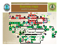
1
Woodlot efm Project June 25th , 2008 JWG Presentation Understanding & Communication Endorsement of our ideas & suggestions Support for short term plan Resources Communication (linkages with other initiatives) Business alignment Discussion around top recommendations Overview Background Business Case Project Purpose & Team Methodology Findings Products Recommendations Key Learnings & Reflections Next Steps – plan finalization & implementation Background 2003 – Efm initiative comes alive – introduction of new Ministry web-enabled applications 2004 – Federation/FIA commission Forsite report 2005 e-FM was first introduced to woodlot licensees at woodlot workshops in March 2005 Streamlining Forest Initiatives – Infomall, data clean up, CP/RP bundles, single form WARRT (woodlot administrative review and recommendation team) 2006 CIO Forum / ILMB = Data sharing initiatives BAPS – FIMW 2007 FBCWA Efm User need report - Woodlot Licensee e-FM User Group Northeast BC Pilot Project NRSIC Strategy and action plan Efm Project DTAP – POW Various initiatives – WARRT, BAPS, POW, etc. – lack of coordination = inefficiencies + duplication of efforts Business Case identified efm issues/challenges Woodlot Federation Cost & Complexity Lack of resources and/or skills Reliance on service providers Ministry of Forests and Range Lack of district efm expertise Capture/ document business & policy Ministry core requirements Both Low client participation Database Integrity – spatial & attribute Inadequate Training Desire to improve relations Overall Frustration 2005-07 releases of business applications Follow-through (previous recommendations) Perceptions: - Systems drives business rules - Inconsistent business practices -reduced workload associated with efm submission Our Team Left to right: Dave Haley, Jacques Bousquet, Doug Stewart, Stephanie Mooney, Tom Bradley, Gord Wall, Coleen MacLean-Marlow, Susan Prosser efm Project Purpose Purpose: “Development of a strategic plan that provides short, mid and long term recommendations which, if implemented, will enable woodlot holders to more easily and effectively submit data electronically to support their business and the Ministry’s efm objectives." Deliverables: 1. Business Process Maps depicting interaction with efm and data requirements 2. Identification of issues, inconsistencies, perceived duplication and possible solutions Methodology Research Phase Interviews and Demos Business Process Mapping Analysis Phase Review business process maps Identification of business inconsistencies, issues, duplication, etc. Recommendations Compilation Development Categorization: Short – Mid – Long Term Prioritization Strategic Plan Development – next steps Strategic Plan Approval – next steps General Results Business Process Maps -15 total - Overview, BCeid/MFR applications, ECAS (Coast & Interior), ESF FTA CP & RP, RESULTS Online & Ezlink Issues – over 50 identified Inconsistencies – over 50 identified Perceived Duplications – over 20 identified Training & Knowledge Transfer – required (by/for both MFR & woodlot licensees) General Findings Story Time Key Disappointments Data Integrity & Clean Up Inaccurate or minimal spatial information Missing or inaccurate attribute data Cultural reluctance to change (all sides) Lack of meaningful reports to get info from systems (MFR & licensees) Many of our recommendations have been documented in previous reports but never implemented Key Findings Business rules drive the systems Huge amount of information required From clients’ perspective, systems are very individualized & could be more audience-friendly Business inconsistencies (legs, regs, policy, templates, systems) Minimal System data requirement inconsistencies General lack of knowledge of and training in ESF systems System Interface issues (multiple ports) Key Surprises Ezlink is easy to use (although still room for improvement)!! Numerous similar initiatives relating to systems are going on at same time --- no apparent coordination & possible duplication Possibly more change coming due to NE pilot project recommendations for push/pull system How little we understood each other’s perspective of our joint business (MFR districts vs branches vs IMG vs licensees) Products Detailed Business Process Maps (flowcharts) – including identification of perceived duplications, issues, questions, inconsistencies, suggested improvements Cheat Sheets for: BCeid application FTA & RESULTS submissions Listings of Issues & Recommendations (prioritized) Listings of Perceived Duplications and Inconsistencies Business maps Woodlot Overview Business maps CP Submission to FTA Woodlot EFM Project – “FINAL” ESF FTA Cutting Permit Submission (using ezlink to populate FTA) Business Process Mapping Dated June 22, 2008 Assumptions: 1. Woodlot licensee have access to Ezlink – either their own copy, a group licence, or through a service provider #11 (Ezlink) From Woodlot Overview BP Submission Pieces Post-it notes shadows Ezlink metadata requirements Cutblock Submission Cutting Permit Submission Map Submission Tips Inconsistencies Issues Perceived Duplications Suggested Improvements Questions WL ESF Road Permit Application to FTA process STOP WL Choose “Create new submission” WL Choose coordinate system (Govt = BC Albers but can select UTM zone) WL Choose FTA Block START WL Enter amdt reason = access additional cutblocks, salvage, engineering, forest service initiated Yes WL Enter Planned Harvest Date Have to use calendar as NOT standard format of yyyy-mm-dd Shows up as May 5, 2008 WL Hover cursor over yellow warning sign to see what’s missing WL Is there a yellow warning sign? WL Select whether CP is deciduous (Y/N) or Crown granted (Y/N) SCROLL DOWN WL Select whether CP is cruise based (Y/N) – select N if billing will be based on scaled volume Yes WL Select salvage type = SSSP is the only option Need salvage code option for woodlots – so permit indicates “salvage” rather than “green” Instead of Y or N, why not “cruise” or “scale” since this field should dictate clauses in CP Planned Gross Area is only mandatory in Ezlink – was removed from Schema 9 WL Enter Planned Net Area Why are these areas required if spatial populating gross area in FTA & NAR needs to be reported in RESULTS? WL Enter Planned Gross Area WL Enter marking instrument & marking method WL Enter Cutblock Block Description Having these areas in FTA complicates RESULTS as FTA gross area does not include WTPs but gross area in RESULTS is supposed to and Net area in FTA includes roads but net area in RESULTS does not No WL Is there more than one block for this CP? WL Right click then click “Paste selected items” WL Click on File Click “Upload submission” WL Fill in Username Password Domain (bceid) User Reference WL Click upload WL Wait for email Is this a new CP or an amendment to an existing CP? NEW WL Enter Cutting Permit ID (must be 2 letters) Normally in RESULTS, Licence Number is woodlot licence # but in this case, the owned by file (private timber mark) will show up instead WL Highlight & click appropriate Cut Block under Cutting Permit Application WL Click “Copy Selected Items” WL Place cursor on Block and right click WL Electronic Submission accepted? Yes STOP No WL Fix errors or call APPHELP Need to have district esf contacts reestablished, trained & resourced Apr 15, 2008 Coleen MacLean Marlow Dave Haley Stephanie Mooney Susan Prosser Dona Stapley Does system still autopopulate with 0 if only one letter submitted? WL Choose “Add another block?” Yes No WL Is there more than one block for this CP? Block END No WL Enter Owned by CP Although manual indicates this is mandatory, if filled in, submission fails validation rules Why can’t this be changed to what it’s really looking for = “Private Timber Mark”? WL Click on appropriate Block (should highlight with yellow squares) Original Design completed by: Apr 23, 2008 Coleen MacLean Marlow Dave Haley Stephanie Mooney Susan Prosser Tom Bradley Gord Wall Brian McNaughton Jacques Bousquet Why does it have to be 2 letters – why not just one?? Yes WL Enter Owned by File (this is your private timber mark) April 13, 2008 Original Visio completed by: Stephanie Mooney WL Enter Geographic District (District Code) Jan 22, 2008 Coleen MacLean Marlow Dave Haley Stephanie Mooney Ron Greschner (half) This has to be in accordance with Transportation Regulation (normal CP = standard hammer & 100%) WL Is block on private land? April 2008 Original Re-Design Team Members TBD WL Enter Licence # (Forest File ID) AMDT Why is management unit not required here but is for RP? Why does it not autopopulate for private land? Map End WL Go to “Working” layer and click on checkbox to remove checkmark WL Enter Application Description – where & what types of logging WL Enter application purpose = New or Amdt FTA will accept an incorrect instrument & method - What are possible implications to other systems (eg. CIMS, SCS)? What is this deciduous indicator for? Is this intended for partitioned AACs only or appraisal purposes for conventional AACs? No WL Click File Click “Save Submission As” Enter filename Click Save WL Select Cutting Permit (CP) Application No WL Enter cutblock ID (10 characters – no spaces & no hyphens) Yes Cutting Permit or Amdt Should this even be submitted to FTA?? Doesn’t it belong in SCS? WL Is CP catastrophic? No Can only do this if select catastrophic & no category for Woodlot salvage Why is planned harvest date mandatory when have to submit NOC anyway?? WL Add missing mandatory information What type of application or submission? Why is catastrophic indicator still mandatory if irrelevant with grade changes?? (ask Denis McPhail) WL Enter Tenure Term Schema indicates term required for new tenure applications but then indicates MFR assigns term if new CP??? Choose Amendment if adding a new block to an existing cutting permit WL Enter Cruise Volume WL Enter client #, location code, and select forest district (this is the actual client NOT the submitter’s info) CP END WL Enter application purpose = New or Amdt WL Amendment? WL Enter submitter’s email & telephone # (this is for recognition of BCeid submitter who can be licensee, service provider, RPF) UPDATES (bold indicates who did Visio update) Descripton could be anything – need consistent guidance as to what this should be?? Is this redundant or duplication with NOC? CP START Road Permit or Amdt START Comments: 1. There are other tools available to woodlot licensees besides Ezlink. Ezlink was the only tool available to the team and was simply used to capture what’s truly required by the schema so that cheat sheets can be developed outlining all of the required information for each submission to aid those who will use the various other tools. Does description populate “Location” in FTA which is supposed to then link & populate CIMS location field?? LEGEND WL Click on arrow icon WL Click View, Zoom to full extent (or click Planet icon) WL Click File Click “Save Submission As” Enter filename Click Save WL Click File Click Load Dataset (or click 6th icon from left) WL On left hand side of new dialogue box, Choose format of spatial info to be loaded (shp, IGDS, etc) WL Locate appropriate file (go to correct directory where files are stored) Click ok Map Start Format of spatial info needs to be the same as that selected in box #3 (from “start”) Business maps RP Submission to FTA Business maps Interior ECAS Submission Woodlot EFM Project – “FINAL” ECAS Appraisal Submission (Interior) Business Process Mapping Dated June 22, 2008 LEGEND #9 (Interior) Assumptions: Submission Pieces Post-it notes shadows Reference Information From Woodlot Overview BP Log Transportation & Admin Cruise & Tree to Truck START WL Go to Submission Tab Highlight Interior Submission Click Reference Information WL Click “Add New” button Enter Timbermark Click “Create New” WL Choose Woodlot Annual Rate Selection (annually or quarterly adjusting) WL Select Admin Forest District Select TSB (Timber Supply Block) OPTIONAL WL Indicate Appraisal Effective and/or Expiry dates OPTIONAL WL Select Point of Appraisal Indicate Y/N for Comparative Cruise and/or Salvage WL Choose Appraisal type = new Choose Rate calculation = CVP (default) Tech specs indicate Point of Appraisal as optional but tutorial indicates as mandatory?? Why is the district not automatically tied to the woodlot?? Attachments Roads Info WL Click on Cruise info/TTT Tab (tree to truck) WL Click Save Inconsistencies Perceived Duplications Issues Questions WL Enter CP Avg Vol/Tree CP avg Vol/ha CP avg slope BEC zone, subzone, variant, and % Selling price zone OPTIONAL ?? WL Enter Total Net Cruise Area Deciduous Volume Sampling Error % Tutorial says to enter data in all cruise info fields but only half have the “mandatory” star?? What’s salvage definition – is it same as one in FTA?? ANSWER: No, applies to BCTS appraisals as a cost additive Tips Comments: 1. This flowchart may not be accurate as it is based on the ECAS tutorials and other documentation on the ECAS website since access to ECAS test and/or production environments was denied Suggested Improvements WL Choose Licence Small Log Utilization (Y/N) Choose Grade 4 Hemlock (Y/N) WL Scroll down to Species section WL Click Save April 2008 Original Re-Design Team Members TBD Deciduous = total net deciduous volume if licence requires harvesting in deciduous & not reserved from harvesting – is this related to partitioned cuts at all??? WL Select Species Enter Volume Enter LRF Yes April 19, 2008 Original Visio completed by: Stephanie Mooney OPTIONAL ?? WL Enter Decay Enter Stud Log (%) Enter Burn (%) (O?) Yes OPTIONAL?? WL Enter Partial Cut % Yes WL Partial Cut harvesting method? OPTIONAL WL Enter Stand Defect % Blowdown % Heavy fire damage % Dead useless snags % WL Enter Vol. to be harvested Biogeoclimatic zone Net volume/tree Volume/ha Average slope WL Select Support Centre Enter Distance to Support Centre WL Go to applicable harvesting method WL Scroll down to Tree to Truck section No WL Enter Primary cycle time Select if responsible for basic silviculture (Y/N) No OPTIONAL WL Enter Lodgepole pine volume Yes WL Highlead/grapple harvesting method? No OPTIONAL WL Enter skyline yarding distance Yes WL Skyline harvesting method? WL Has data for all applicable harvesting methods been entered? WL Enter heli yarding distance Indicate if uphill yarding Yes No WL Helicopter harvesting method? Yes WL Select Insect Damage Type Enter Volume WL Click Save WL Is there another tree species? WL Click Tabular Roads Tab Enter road identifier Road groups BGC Zone Road section # Road type Section length (km) Click Save WL Click culverts tab (large culverts) Enter appropriate info Click Save WL Click Other Development tab Enter appropriate info Click Save WL Click ops tab Enter appropriate info Click Save Yes Yes Yes Yes Yes WL Is there more than one applicable harvesting method for this CP? No Apr 23, 2008 Coleen MacLean Marlow Dave Haley Stephanie Mooney Susan Prosser Tom Bradley Gord Wall Brian McNaughton April 18, 2008 Coleen MacLean Marlow Stephanie Mooney Susan Prosser Dave Haley (half) ECAS 60 – 1st line Licence box not available but timbermark is available? How does submission get associated with woodlot – just through the timbermark? ECAS 64 Woodlot Road Management Cost Estimate from IAM table – difficulty in using this -- why isn’t it showing when timbermark starts with W?? Indicates that licence # has to be entered in ECAS 60 but can’t (see above)??? WL Does appraisal contain log transportation/ administration costs? WL Click Save WL Click Save Original Design completed by: May 12, 2008 Stephanie Mooney WL Click Save WL Click Log Trans/ Admin Tab Select Primary haul method Yes No WL Is there another insect damage type? No UPDATES (bold indicates who did Visio update) No WL Does appraisal contain road information? No WL Does appraisal contain major culvert information? WL Does appraisal contain other development costs? No No WL Does appraisal contain specified operations costs? ECAS 63 How do we know if there is 1+ blocks? See conventional column cc – pc Why report size of piece & m3/ha? ECAS 67 – Roads Tab Why is BEC zone required here? ECAS 67 – HELP Text for stabilizing material is incorrect – states “Blank/G/Q” but program only offers or accepts Blank & Q???? No WL Enter or check RPF/ RFT informaiton WL Select the appropriate radio button certifying who did the work Yes WL Is Woodlot Licensee also the signing RPF or RFT? WL Click Acknowledge Tab WL Click SAVE WL Paper copies still mandatory in appraisal manual No WL Click SAVE WL Enter Licensee name, phone, fax, email address Yes WL Send paper maps to district office WL At minimum, include Appraisal map Cruise compilation (or comparative cruise info) Detailed cycle time calculation Paper WL How will attachments be sent? Electronic WL All applicable attachments added? WL Locate appropriate file (go to correct directory where file is stored) Click Open No WL Locate appropriate file (go to correct directory where zip file is stored) Click Open WL Scroll to top of attachment screen Click Browse Zip WL Submitting individual attachments or one zip file? Individual WL For each attachment being submitted, click radio button under “Paper copy to follow” WL Click SUBMIT STOP WL Check off each of the file types included in zip file WL Click Browse WL For each attachment being submitted, click radio button under “Electronic (Attached)” WL At minimum, send: Appraisal map Cruise compilation (or comparative cruise info) Detailed cycle time calculation WL For each attachment not being submitted, click radio button under “N/A” WL Scroll to bottom of attachment screen WL Click Attachments Tab Business maps Coast ECAS Submission Woodlot EFM Project – “FINAL” ECAS Appraisal Submission (Coast) Business Process Mapping Dated June 22, 2008 LEGEND #9 (Coast) Assumptions: Submission Pieces Reference Information Why is the district not automatically tied to the woodlot?? From Woodlot Overview BP Post-it notes shadows Tree to Truck, Log Transp, Admin Cutting Authority Detail Inconsistencies Perceived Duplications Roads Info Issues Questions Comments: 1. This flowchart may not be accurate as it is based on the ECAS tutorials and other documentation on the ECAS website since access to ECAS test and/or production environments was denied Tips Suggested Improvements UPDATES (bold indicates who did Visio update) Attachments START WL Click “Add New” button Enter Timbermark Enter Timbermark cruise volume WL Go to Submission Tab Highlight Coast Submission Click Reference Information WL Select Admin Forest District Select TSB (Timber Supply Block) Enter POA Distance WL Click SAVE Is TSB same as Mgmt Unit # (eg. 37A for W1611)?? Is this needed?? WL Select if cutting permit is accessible (Y/N) WL Click SAVE WL Choose Appraisal type = new Choose Rate calculation = CVP (default) TSB not indicated as mandatory (ie. star missing) but tutorial indicates it is mandatory??? WL Select if responsible for basic silviculture (Y/N) OPTIONAL WL Single tree selection boxes Second growth boxes Sampling error % OPTIONAL WL Indicate Appraisal Effective and/or Expiry dates WL Scroll down to Volume by species section WL Click SAVE WL Enter Initial Merch Area Appraisal Year Area Logged (ha) WL Select Species Enter Volume WL Click Save WL Go to Cutting Authority Details Tab WL Select Point of Appraisal Enter Cutblock Select Harvest method Enter Volume Area logged is mandatory (*) but licensees enter 0 – assume this is for reappraisals only??? Why is CVP default when coast has been using MPS for quite some time?? WL Select if Routine Road Management required (Y/N) WL Enter Average haul distance Select Point of Origin WL Scroll down to Administration section WL Scroll down to Log Transportation section WL Fill in appropriate info Yes WL Enter Distance (for crew transportation) Select Access./Isolated Select Road Mgnt (Y/N) Select Major Centre Enter Distance WL Enter Average side slope CP Vol/Log WL Will conventional logging methods be used? WL Select Point of origin Select Appraisal log dump Enter Truck haul distance (for water transportation) WL Scroll down to Tree to Truck Cost Estimate section WL Click TTT/Lg Trns/ Adm Tab (tree to truck, log transportation & Administration cost estimates) WL Click Save Yes WL Does appraisal contain specified operations? WL Click Coast Bridges Tab Fill in appropriate info Click SAVE WL Click Coast Culverts Tab Fill in appropriate info Click SAVE Yes Yes No WL Fill in appropriate helicopter logging methods info WL Click End Haul Tab Fill in appropriate info Click SAVE End Haul?? no longer required or available?? ECAS is working - it’s still a people system Goes to district office for review – no automatic rejections but a lot of duplication of efforts Yes ECAS has been around longer and used only by forest professionals WL Does appraisal contain road, bridge or culvert information? No WL Does appraisal contain bridge information? No WL Does appraisal contain culvert information? No WL Does appraisal contain road information? WL No Does appraisal contain end haul information? Yes WL Click Appraised Roads Tab Enter road name WL Select the appropriate radio button certifying who did the work Yes WL Is Woodlot Licensee also the signing RPF or RFT? WL Click Acknowledge Tab WL Enter Appraisal Year Crown % Amortized % WL Select Road Name Enter station # -Start & End (km) WL Click Tabular Roads Tab WL Enter or check RPF/ RFT informaiton WL Enter Case Road Name Start & End Appraisal Year WL Click SAVE Yes WL At minimum, include: Appraisal map Cruise compilation WL Click SAVE WL Does appraisal contain detailed engineering information? No No WL Select Subgrade Bank Height Category Select RMC (rock mass class code) WL Check off each of the file types included in zip file WL Click Detailed Eng Tab Fill in appropriate info Click SAVE Should there be 2 separate processes for roads – one for new construction and one for reconstruction?? WL Locate appropriate file (go to correct directory where zip file is stored) Click Open WL Scroll to top of attachment screen Click Browse Zip WL For each attachment being submitted, click radio button under “Paper copy to follow” WL Send paper maps to district office WL Click SUBMIT WL All applicable attachments added? STOP WL Submitting individual attachments or one zip file? Individual Yes WL Locate appropriate file (go to correct directory where file is stored) Click Open No Paper Option to send information by paper conflicts with Coast Appraisal Manual WL Click Browse WL How will attachments be sent? Electronic WL For each attachment being submitted, click radio button under “Electronic (Attached)” WL At minimum, send: Appraisal map Cruise compilation Some districts are requiring maps, site plans, and/or a cover letter (including FTA number) to be submitted as a pdf in a separate email so that the dm can see what he/she is approving. Attachments Cruise map (actual) Exhibit B Cruise Cards (scanned) Roadeng Site plan (ASP doc)? May not be required Why do we need to submit Road Eng & Exhibit B? Why can’t road write off be shown on Cruise Map?? No WL Click SAVE WL Enter Licensee name, phone, fax, email address WL Click Attachments Tab Yes WL Click Road Reconstruction Tab April 19, 2008 Original Visio completed by: Stephanie Mooney Original Design completed by: May 12, 2008 Stephanie Mooney Apr 23, 2008 Coleen MacLean Marlow Dave Haley Stephanie Mooney Susan Prosser Tom Bradley Gord Wall Brian McNaughton April 18, 2008 Coleen MacLean Marlow Stephanie Mooney Susan Prosser Dave Haley (half) No WL Click Spec Ops Tab Select description Enter Rate April 2008 Original Re-Design Team Members TBD WL For each attachment not being submitted, click radio button under “N/A” WL Scroll to bottom of attachment screen Business maps WASTE Submission LEGEND Woodlot EFM Project – “FINAL” WASTE Waste “Annual Plan” & “Survey” Submission (Online) Business Process Mapping Dated June 22, 2008 Submission Pieces From Woodlot Overview BP NOTE: WASTE Annual Plan not represented on Woodlot Overview BP map WL Review list & find name associated with your woodlot Enter last name Click Search Annual Plan (AP) Start WL Click Annual Plan Tab Click “Create Annual Plan” (screen 501) START WL Page down to Aggregrate Option WL Do I know my client #? Yes WL Click Create Plan (“Save successful” message should appear) *OPTIONAL* WL Record Annual Plan ID # Survey Submission Start WL Click details WL Scroll down to type of sampling option chosen in annual plan (usually ocular) WL Click “Annual Plan Details” Enter “Annual Plan ID #” Click Go Start Survey Block Details (Screen 102) What’s difference between “year logged to” and “primary logging complete date”? Yes WL Do I know Annual Plan ID #? Later What’s definition of net area? Why can’t this come from FTA or RESULTS? ANSWER: Net area = gross area – roads Normally provided from but FTA is plan and areas may not be the same. WASTE requires info sooner than RESULTS WL Click Save WL Page down to Ocular Estimate Option Ocular Estimate WL Click Create New (ie. Reporting Unit) AP RU details Start *OPTIONAL* WL Record Reporting Unit ID# from Screen 501 WL Page down to Cut Block Option WL Enter proposed dispersed (CV%) Enter proposed accumulated (CV%) WL Click Save Plan gets approved (Status changes No from Draft to Approved) Now Conflicting advice user’s guide indicates approval required on Coast but in reality approval automatic by system WL Select Mature or Immature WL Complete section (Primary Mark, etc) Click Save WL Select assessment method Enter net area Click Save Coast Yes Yes WL Multiple marks or amalgamated blocks? Wl Did I have standing trees left on block that were suppose to be harvested but were not? WL Is my woodlot within the Coast Region? WL Wait for Approval by MFR regional staff Yes Start Survey Waste Details (Screen 205) WL Select Species Kind Waste class Grade WL Click Save Click Details WL Click 1st checkbox Select Role = unlicensed surveyor (most probable) WL Enter Length, Top & Select End Enter Butt & Select End WL Page up to top of Screen 501 Click Submit WL Click Back No WL Enter % Estimate Yes Original Design completed by: May 5-6, 12, June 11-12, 2008 Stephanie Mooney April 15, 2008 Coleen MacLean Marlow Stephanie Mooney Susan Prosser Dave Haley (half) WASTE PLAN – requires null report – why?? Why not cross reference with FTA & CIMS (NOC) to determine if monitoring is required?? Use annual Plan ID for Woodlot Don’t require reporting unit for each cutblock Map - same process as RESULTS for copy map as a short term solution End Survey Waste Details (Screen 205) 100% Scale % estimate May 12 & April 19, 2008 Original Visio completed by: Stephanie Mooney No direct link from help screens to training manual --welcome screen application link takes you to waste homepage and can then click on Training Manual Don’t use submit button on block screen 101 WL Do I plan to conduct a waste survey on more than one block this year? *OPTIONAL* WL Enter Deductions Length, Top, Butt Select Decay Type & Comm Code WL Type of assessment method? April 2008 Original Re-Design Team Members TBD 1. Clarify use of ocular estimate 2. Estimate base level of wast & bill accordingly Training powerpoint presentation different than reality – no “Save New” button available AP submission (Screen 303) WL Scroll to bottom of page Click Submit What’s purpose of plan? WL Enter Licence # Block Timbermark Net Area WL Click Save (should indicate “save successful”) UPDATES (bold indicates who did Visio update) Why does waste plan submitted within 1 month of expiry of previous plan? -- workload with amending plan if block not logged?? Options: WL Page up or down to type of waste sampling planned Click Details Survey reporting process & requirements appear to be the same no matter which “Option” is chosen?? If only certain types of assessment methods are applicable for each option, then only those methods should be available to select on Screen 102 Cutblock WL Submitting waste survey info now or later? Annual Plan should be done in accordance with Waste Manual (ie. before submitting survey info) WL Click on Annual Plan Search Enter Year From Enter Year To Click Search WL Click Details for appropriate plan Why not have “primary logging complete date” auto-fill “year logged to” field? WL Enter Survey date Return number Waste survey licence # (eg. 1, 2, etc) WACO/WASI/WANI Questions AP RU details end WL Go to Annual Plan Tab No WL Enter Year logged from Year logged to Primary logging complete date Suggested Improvements Comments: 1. Only minimal submission requirements shown – anything more is district specific 2. This flowchart is based on the TEST environment of WASTE Version 01.12.06 on the TURQUE server at the following website address: http://testapps30.for.gov.bc.ca/waste/indexAction.do with username IDIR\SJMOONEY for organization 00012797 – Ministry of Forests AP RU shell End What kind of waste sampling is planned? Why does it only come up as a warning instead of saying no – you can’t have more than one cutblock to create new plan (apparently can add new blocks later??) ANSWER: If want more than 1 block under 1 reporting unit, should choose aggregrate Appears as though client location cannot be changed from 00 despite some woodlot licensees having several client #s and 00 might not be the client # associated with woodlot licence WL Go to appropriate block Click details Perceived Duplications Aggregate AP Reporting Unit (RU) Start AP Shell End WL Enter Licensee Client # (autopopulates if did search) Finding WASTE application is an issue since it’s called “Production” on Waste website *OPTIONAL* WL Record or print screen to have copy of Annual Plan ID & Reporting Unit ID Issues Click Select No WL Enter Year Select District WL Enter proposed dispersed (CV%) Enter proposed accumulated (CV%) Tips Inconsistencies Waste Survey Submission WL Click 3 dots next to Licensee Client # Assumptions: Post-it notes shadows Annual Plan Submission #21 (Online) WL Another species of waste to be recorded? WL Click Save Yes WL Fix errors WL Click Back Yes No WL Where is woodlot located? No WL Did I have waste that would be categorized as dispersed waste? No WL Did I have waste that would be categorized as accumulated waste? No WL Click Back button on screen 102 to return to screen 101 No Interior Yes Yes WL Select Zone type and Select Condition WL Go to Dispersed section WL Go to Accumulation section Easy link to definitions of waste types would be useful Assume “area” to be entered here is actual estimated area of waste only WL Have I entered accumulated waste? Yes WL Select Waste type Harvest method Assessment method Waste level Enter Area WL Any error messages? No WL Click 1st checkbox Select Role Enter Comments (if necessary/desired) End Survey Block Details (Screen 102) Yes No WL Click submit WL Do I have another category of waste to enter? Cold deck is different as it needs to be submitted separately and benchmarks do not apply No There are different types of waste under each waste category and there could be more than one category and/or type of waste associated with a block Yes WL Attach waste survey map No WL Do I have another waste type to enter? Yes WL Was Plot assessment method used? End Survey Waste Details (Screen 205) WL Click submit Yes Start Survey Waste Details (Screen 205) WL Was “Plot” the assessment method? No WL Click Save Click Details “kind” are these letters defined anywhere? = user’s manual. Why not include as part of drop down box?? Yes WL Enter Plot Size Click Save Click Details WL Enter Plot and Measure Factor (Screen 204) WL Select Species Kind Waste class Grade Plot size is shown as mandatory even if haven’t selected “Plot” as assessment method WL Select borderline WL Was assessment method ocular estimate? “species” are given as codes only – these codes differ from species codes in RESULTS. Why not include species names as part of drop down box?? plot No WL Type of assessment method? Yes WL Enter either: Estimate (m3/ha) or Estimate volume (m3) WL Another species of waste to be recorded? No WL Was Plot assessment method used? No WL Click Back (to Screen 102) Estimate or estimate volume does not appear to be mandatory but is – why no * = one or the other is mandatory % estimate WL Receive email acknowledgement of submission STOP WL Enter Total Estimated Volume Click Save 100% Scale WL Enter Length, Top & Select End Enter Butt & Select End WL Click save *OPTIONAL* WL Enter Deductions Length, Top, Butt Select Decay Type & Comm Code WL Enter % Estimate WL Is there another plot to be entered? No Survey Submission End Business maps RESULTS Online post-harvest Submission LEGEND #26 (Online) Submission Pieces Post-it notes shadows Opening Definition Submission From Woodlot Overview BP Disturbance Submission Stocking Standards Submission TIP Need declaration access in order to create new opening (don’t need to be RPF) WL Highlight Openings Tab WL Click on Opening Inquiry Inconsistencies Forest Cover Submission Why do you have to scroll down to click “add” - why not at top?? Whole design is an issue Because of “Owned by File” field in FTA, RESULTS identifies Tenure File as private mark instead of woodlot licence – private openings are therefore not tied to the woodlot licence in RESULTS --this needs to be fixed! START Why can you create an opening not tied to a licence?? = problems when service providers do this as licensee has no idea what opening id it is?? Why does “add” wipe out info entered if forget to scroll down & click “add”??? Why can’t licence autopopulate based on client #?? WL Scroll to bottom & click “Add” WL Select Org Unit (= district) Tips Issues Perceived Duplications Suggested Improvements Questions Start Opening Definition (OD) general WL Select opening category (= FTWL) MAPVIEW Options to search by Woodlot – not working = Known Bug = to be fixed in 5.03 What approval date?? Silv Presc or site plan approved by dm if under CODE or CP issuance date or WLP approval date if under FRPA or ??? Why is it mandatory vs conditional – if under Code but not required if under FRPA for woodlots Approval Date not required if submitting via Ezlink??? ANSWER: - it is required but is automatically set to ESF submission date Licence # is woodlot licence # and must be capital W followed by 4 numbers (eg. W0500) WL Enter Licence # CP Block Gross area Is this still appropriate for woodlots under FRPA who can operate without an approved site plan? No No WL Click Back Click Select Click Save WL Click Submit Amendment Amendment WL Wait for MFR approval MFR Stocking Standards Approval Process WL Click Back (goes back to Search screen) End OD Stocking Standards (goes to Screen 312) WL Click Back No (goes to Screen 310) WL Does opening have another SU? No WL Click Forest Tenure Click Cutblocks Select Approved Cutblocks WL Enter Stocking Standards ID Click SAVE Yes WL Do I have a stocking standards id for this block? WL Scroll down to Preferred Species section Start Disturbance Activity WL Is silviculture system “Seed Tree”, “Selection”, “Shelterwood”, or “Intermediate Cut”? WL Click Save WL Scroll back down to Layers section of Stocking Standards WL Scroll back down Click Layer 1 Scroll back down Make changes to appropriate boxes WL Click “Convert to Multi-Layers” button Why can minor amdt change NAR?? Is there any restriction ie. What’s point of minor amdt Can only change vs correction vs amendment it to a smaller when seem to be able to number?? change everything under correction?? WL Click Save WL Select each layer (click in each blank checkbox to add checkmark) WL Scroll back down Click Layer 2 Scroll back down Make changes to appropriate boxes WL Click Save WL WL Click “Include Exhibit A Spatial” WL Choose “No Regen Obligations” WL Click SAVE Yes WL Is there another acceptable species? WL Select Reserve Type Select Reserve Objective WL Click Back Scroll down Click “Add Disturbance” WL Click SAVE Potential requirement for layered forest cover – according to Results Info Submission Specifications for licensees – but do these apply to woodlots?? WL Enter Max Coniferous (st/ha) WL Enter Max WL WL Is there another disturbance (ie. different silv. system)? End Disturbance Activity No WL Click Forest Cover tab Start Forest Cover WL Go to lower right hand side of screen Click “New Forest Cover” hyperlink WL Select SU # Enter Polygon ID Enter Gross Area of polygon WL Enter Reference Year (ie. year logging complete or data collected) WL Are there trees left in opening that are excluded (reserved) from future harvesting? Start OD Stocking Standards WL Click Amendment Read Click Accept May 2008 Original Re-Design Team Members TBD WL Click stocking standards tab Scroll to bottom of page WL Does opening only have one block? Yes WL Select Stocking Status Select Stocking Type Enter: SU ID (#) NAR BGC zone BGC subzone BGC variant BGC site series BGC is the same as BEC = biogeoclimatic ecosystem classification DO NOT START ADDING DATA Go to bottom of first section & click add WL Choose “Regen Obligations” No Enter Regen (# of yrs) WL Enter Min Horiz (m) No definition in Help as to what different buttons mean or how they differ. Apr 23, 2008 Coleen MacLean Marlow Dave Haley Stephanie Mooney Susan Prosser Tom Bradley Gord Wall Brian McNaughton Jacques Bousquet Caroline MacLeod (half) Eg. “correction” vs “amendment” vs “minor amendment” or “Save” vs “Copy” under standards regime search or “Copy Regime”, “Add Activity”, Add Disturbance”, etc Summary of Advice includes: 1. Use Amendment if operating under WLP 2. Use Correction if operating under FDP 3. Use either as outlined to left 4. Use Amendment for all Stocking Standards ID unavailable when using correction Why not have drop downs to choose BEC zone, subzone & variant?? WL Enter Average Age Enter Average Height WL Is FC polygon Stocking Status IMM (immature)? Yes Defaults = 5% for interior 5% for coast April 16, 2008 Coleen MacLean Marlow Stephanie Mooney Susan Prosser John Gallimore Dave Haley (half) No Flowchart boxes should be numbered and alternating colours to help keep track of where you are when using them WL Is there another tree species? Mandatory fields should be shown with an asteriks * for RESULTS Online data entry WL Click Add (next to Avg Height) No Yes Select Tree Species Enter Species % WL Change Max Soil Disturbance % WL Enter Basal Area WL Enter Late (# of yrs) (for Free Growing) Click Save Click SAVE WL Scroll down to Stocking Standards section WL Enter Target No No Yes WL Is there a Basal Area requirement to meet as part of my stocking standards or other objectives (eg. MDWR)? Why are both Inv & Silv layers required when stocking standards screen indicates I-Inventory label not S-Silviculture label (Screen 310)??? WL Enter Min Original Design completed by: May 2-12, 2008 Stephanie Mooney Different advice regarding when to use Amendment (= stocking standards regime id) vs Correction (= manual data entry). Training documentation implies that licensee has choice regardless if operating under WLP or FDP. RESULTS guide for woodlots assumes everyone is using stocking standards regime id. Verbal advice from different sources indicates to use Amendment for WLP & Correction for FDP WL Click Correction Read Click Accept WL Is the default maximum soil disturbance appropriate? Yes Have another checkbox for WLP or FDP so Standards Regime ID can then be entered WL Enter Well Spaced Free Growing WL Have all 4 inventory layers been entered? Yes WL Scroll up Click “Add Silviculture Layer” button Why do crown closure & total stems boxes show up again under Silv layer when only for Inventory?? WL Have all 4 silviculture layers been entered? No Yes WL Is SU multi-layered ? Yes Yes No Yes WL Is SU multi-layered ? WL WL Is SU multi-layered ? WL Click Add (next to Type) Enter ID Enter Area Select Status Select Type WL Are there non-mapped areas within polygon (eg. rock, road, swamp, etc)? May 12 & April 19, 2008 Original Visio completed by: Stephanie Mooney WL Do I want to use an existing stocking standards regime to auto-populate the stocking standards fields? WL Click “Convert to Multi Layer” button (= Inventory Layers – Mature, Pole, Sapling & Regen) WL Enter Site Index & Site Index Source No No Click box “Include spatial Exhibit A” Click Save Yes 3.This flowchart is based on the DEV environment of RESULTS Version 03.01.05 at the following website address: http:// victoria.pangaeainc.com:9989/results/ with username IDIR|RESULTSADMIN No End OD general No Every time you save something throughout this process you are bumped back up to the top of the page and you have to scroll back down to where you were. This is time consuming and not very user friendly. Couldn't either the entire page be entered and everything saved at once or it leaves you in the place you saved at? Yes Yes Click “Disturbance Complete” box Click SAVE No WL Does opening only have one SU? Yes Dangerous wording as the wrong interpretation could easily be made; however, wording comes directly from HELP screen in RESULTS Yes Updates Block Status from HB (Harvest Approved) to LC – Logging Complete on opening inquiry screen Map submission Process by Service provider) If select “no regen obligations” - system interprets that there’s also no FG obligation despite Help definition and despite late FG date being mandatory in order to save data entered?? Also, opening inquiry page shows no FG offset and there are no milestone options to update except post-harvest?? WL Is block a partial cut (ie. sufficient stocking already exists)? WL Enter Min Residual Area (m2/ha) WL Select Acceptable species Enter Min Height Enter Cutphase WL Enter completion date WL Scroll down to Regen & Free Growing section Enter Max Post Spacing Density WL Enter Height Relative to Comp (cm/%) No WL Scroll down to Acceptable Species section WL Does the opening only have one SU? NOTE: Can continue without spatial but legal obligation not fulfilled until spatial is submitted No WL Click “Copy Layers” button WL Click Layer 3 Scroll back down Make changes to appropriate boxes WL Click SAVE NOTE: Can continue without spatial but legal obligation not fulfilled until spatial is submitted No WL Did I select Amendment or Correction for entering Stocking Standard info? Amendment 2. For those operating under an FDP, the opening definition and stocking standards information should be the same as the information in the approved site plan for an individual block(s). Multi-tenure process WL Enter Min Post Spacing Density WL Select Preferred species Enter Min Height WL Is there another preferred species? No UPDATES (bold indicates who did Visio update) Comments: 1. For those operating under a WLP, the opening definition and stocking standards information is required in lieu of submitting a site plan so MFR knows which standards apply to an individual opening. On the ground performance will be measured against these standards. WL Smile : ) Yes Multi-tenure pulls gross & net area over from FTA = same as Exhibit A area in tombstone BUT gross area at bottom of opening inquiry is whatever licensee puts in & can be very different WL Click SAVE Yes Correction WL After 24 hours, check for SP map image Is it there? Service provider or Advanced XML submission (geeks only) Why does this not autopopulate from previous screen where already entered this info?? Correction WL Is SU multi-layered ? No Previous FC can be accessed by Mapview including SI – often from an adjacent stand Need screen shot with instructions for training of how to get to Mapview and pick layers WL Select Previous Stand Age Class Height Class Stock Class Site Index Site Index Source Is the assumption that standards came in via ESF & so only certain things can be corrected in that case?? No Yes No Clarification required as to whether or not both variant and cutphase have to be entered for seed tree, selection & shelterwood or just variant (RESULTS appears to let you do variant only) WL Click Refresh Map (double arrow icon or scroll down) Click Identify icon (white “i" in black circle) (district) WL Contact District Office Yes WL Enter Disturbance Start, Area & Code Yes WL Click Back again Scroll to top of first section & click add Enter Silv System WL Enter Variant WL Click on button with three dots next to Standards ID Select Org Unit WL Click back Yes WL Click Layers Tab Click Land Cover Select Vegetated Land Cover Outline Click on “i” Select Veg. Full Label WL Select Previous Stand Species 1 & Species 2 WL Select Previous Stand Type Yes WL Click in map area (repeat until desired scale) Yes WL Go to Activities Tab Scroll down Click “Add Disturbance” TIP Amendment info only shows up once amendment is approved WL Enter BEC zone, subzone, variant & site series Click Search No COMMENT needs to be verified: Licensee would only need approval if it was a site plan or silviculture prescription prepared under the FPC. No approval is required if operating under FRPA, already approved in the WLP. You might need 2 Amendment loops here, one for FPC and one for FRPA. WL Did I select Amendment or Correction for entering Stocking Standard info? WL Are there any more standards listed in search? WL Select piece of woodlot where block is located Click Zoom Out (magnifying glass icon with “-“ sign) Defaults = 7% for interior 5% for coast WL Click details and review standards to see if appropriate for woodlot WL Are standards appropriate for block? WL Do I know all previous stand info? No RESULTS assumes silviculture prescription unless a Stocking Standards Regime ID is used – then RESULTS sees the submission as a major licensee site plan (which is different than a woodlot site plan) WL Read Click Accept Yes Yes TIP Can only have one mapview session open at a time WL If info Click within Block not there (Vegetation Identify for block, Report should show) use Scroll down & copy adjacent Codes & Percent for stand species 1 & 2, Crown info Closure & Site Index Other option is to use cruise information WL Click Search Tab Click Links Click Mapview WL Is the default for Maximum Permanent Access Structures appropriate? Why WL Enter Approval date WL Click Navigation Tab Click Find Feature Select Feature Type (= Managed Licence) Enter Woodlot # Click Search WL Enter Max PAS % doesn’t default show before saving?? Reporting harvest start and end date, silviculture activities and FG milestone are legal obligations (Annual Report). Is creating the opening definition and completing the stocking standards section really a legal obligation? This is a duplication caused by the system as already approved in WLP Assumptions: 1. Licensee or person operating on his/her behalf has applied for appropriate RESULTS access (Update at a minimum) 2. Only one block per opening (block could be made up of one or more separate pieces but is identified as one block in FTA) 3. Submission is made only once block is completely finished or CP has expired 4. No amendments are required (ie. Flowchart does not provide any guidance for amendments) WL Call APPHELP to report SP map is missing Woodlot EFM Project – “FINAL” RESULTS 3.1 New Opening Definition, Disturbance, & Forest Cover Submission for area that has just been logged and does not yet exist in RESULTS (Online) Business Process Mapping Dated June 22, 2008 No WL Is FC polygon Stocking Status NSR? No Why do well spaced & total well spaced boxes show up under Inv layer if only for Silviculture?? WL Click “Add Layer” button (= Inventory Layer) WL Enter Crown Closure Basal Area Stems/ha Total WL Enter Basal Area No Enter Average Age Enter Average Height Yes Yes WL Is there a Basal Area requirement to meet as part of my stocking standards or other objectives (eg. MDWR)? WL Click Add No (next to Avg Height) Select Tree Species Enter Species % 4 codes for Douglas fir – which one to use??? F, FD, FDC, FDI. Any provincial reports are probably skewed. WL Is FC polygon Stocking Status IMM (immature)? No No WL Is there another tree species? Ask for pair of SU files in digital format from service provider so have when need to submit free growing FC Yes WL Is there more than one SU or polygon for this block? Yes If select Immature stocking status & don’t fill in SI & SI source or Reserve type & Reserve obj., then get error to enter SI, SI source & tree species. If include Reserve info then save successful without SI info??? No WL Scroll up to top of page Click on “Include Exhibit A spatial NOTE: legal obligation not fulfilled until spatial is submitted Yes WL Click “Add Polygon” Yes Wl Is there another polygon to be added for this block? End Forest Cover WL Click “Save Forest Cover” No WL Scroll up to top of page Click “Save Forest Cover” Map submission Process by Service provider STOP Business maps RESULTS Ezlink post-harvest Submission WL Click Navigation Tab Click Find Feature Select Feature Type (= Managed Licence) Enter Woodlot # Click Search Woodlot EFM Project – “FINAL” RESULTS 3.1 New Opening Definition, Disturbance, & Forest Cover Submission for area that has just been logged and does not yet exist in RESULTS (Ezlink) Business Process Mapping Dated June 22, 2008 LEGEND Submission Pieces #26 (Ezlink) From Woodlot Overview BP Disturbance Submission Opening Definition Submission Forest Cover Submission WL Choose “Create new submission” START Suggested Improvements If submitting existing site plans that are only being logged now, then approval date is automatically set to ESF submission date – which is incorrect WL Go to listing on left hand side of screen Right click on bolded Opening Clarification required as to whether or not both variant and cutphase have to be entered for seed tree, selection & shelterwood or just variant (RESULTS online appears to let you do variant only but Ezlink requires both) WL Choose No Click Finish WL Is there another disturbance (ie. different silv. system)? No WL Choose “Add Opening Items” Choose “Forest Cover Polygons” Click Next Licence Yes WL Enter client #, location code, and select forest district (this is the actual client NOT the submitter’s info) Do I want to have a draft version reviewed before making my final submission? Why enter this info twice – have to enter again under “Add Tenure Data” ?? Which information do I want to use to identify my block? No WL Do I want to include an opening number? WL RESULTS Woodlot Guide indicates cutphase and variant are optional but they are actually mandatory depending on silvicuture system WL Enter Silviculture Cutphase WL Click Next No Gross Area to be reported is actually Gross Disturbance Area WL Is silviculture system “Seed Tree”, “Selection”, “Shelterwood”, or “Intermediate Cut”? WL Scroll down Select Silviculture System WL Enter Gross Area Indicate if “Harvest Complete” = Y WL Select Disturbance Code Start Date Completion Date Updates Block Status from HB (Harvest Approved) to LC – Logging Complete on opening inquiry screen Yes WL Select Opening category Enter Opening Gross Area WL Under Action, choose “Insert” Yes NOTE: Opening Numbers are all auto-generated except in 2 districts Start Disturbance Activity WL Click “Add Opening Items” Choose “Disturbance” Click Next WL Under Action, choose “Insert” Enter Licence #, CP, Cut Block End OD Stocking Standards WL Go to listing on left hand side of screen Right click on bolded Opening WL Choose Finish Click Finish WL Enter Max Soil Disturbance % WL Does block have another SU? No WL Enter SU ID Click Next WL NSR = no layers Anything else needs silv & inv layers WL Choose “Add another Forest Cover Polygon” Click Next Wl Is there another polygon to be added for this block? No WL Enter Site Index & Site Index Source Click Next WL Choose “Add Layers . . .” Click Next WL Is SU multi-layered? No WL Select Layer “I = Inventory Layer” Yes No WL Are there non-mapped areas within polygon (eg. rock, road, swamp, etc)? No WL Click File Click “Save Submission As” Enter filename Click Save WL Is SU multi-layered? Yes Yes WL Choose “Add Tree Species to the current Layer” Click Next No WL Have all 4 inventory layers been entered? WL Choose “Add Non Mappable …” Click Next WL Have all 4 silviculture layers been entered? WL Enter ID Enter Area Select Stock. Status Select Stock. Type Click Next No WL Choose “Add another Layer . . .” Click Next WL Click Next WL Is there another tree species? WL Enter Basal Area No Yes No WL Choose “Add another Tree Species to the current Layer” Click Next WL Choose “Add another Layer . . .” Click Next Need confirmation about these two separate processes WL Select Tree Species Enter Species % WL Choose “Add Tree Species to the current Layer” Click Next No WL Is there a Basal Area requirement to meet as part of my stocking standards or other objectives (eg. MDWR)? No WL Is FC polygon Stocking Status IMM (immature)? Yes WL Enter Average Age Average Height Required for dominant, leading species only Select Layer called: “S = Silviculture Layer – even aged” No No WL On left hand side of new dialogue box, Choose format of spatial info to be loaded (shp, IGDS, etc) WL Locate appropriate file (go to correct directory where files are stored) Click ok Select appropriate Silviculture layer 1S 2S 3S 4S WL Click on button with three dots next to stocking standards id WL Click on arrow icon (or click File and Select Features) WL Click on appropriate SU (should highlight with yellow squares) WL Are standards appropriate for block? If use wrong Regime Id, can’t change without doing an amendment which requires approval No WL Are there any more standards listed in search? No WL Place cursor on SU and right click WL Click “Copy Selected Items” WL Highlight & click appropriate Stocking Standards under Opening Definition WL Right click then click “Paste selected items” Why can’t this autopopulate from previous screen or when click 3 dots just bring up standards that exist for that BEC info WL Enter BEC zone, subzone & site series Click Search WL Choose “Add Layers to the Stocking Standards Amendment” Click Next WL Is FC polygon same shape as SU? Yes WL Highlight & click appropriate Forest Cover Polygon under Forest Cover WL Right click then click “Paste selected items” WL Click “Combine Selected Items” WL Place cursor over block and right click No Can choose wrong standard for BEC or for SP and no rejection WL Is SU multi-layered? No WL Select appropriate inventory layer 1-Mature 2-Pole 3-Sapling 4-Regen Yes WL Did I set ezlink to submit only a draft version to be reviewed before making my final submission? WL Enter: Height Relative to Competition Height Relative to Competition Units Click Next WL Click “Copy Selected Items” No WL Click on appropriate block (include WTPs, etc) (should highlight with yellow squares) WL Place cursor on block and right click WL Highlight & click Opening Definition WL Select Species Indicate Y/N if Preferred Species Enter Min Height Click Next WL Is there another species to be added? WL Go to “Working” layer and click on checkbox to remove checkmark No No WL Locate appropriate file (go to correct directory where files are stored) Click ok WL Click View, Zoom to full extent (or click Planet icon) WL Click on arrow icon WL Click on appropriate Forest Cover polygon (should highlight with yellow squares) WL Place cursor on Forest Cover polygon and right click WL Click “Copy Selected Items” WL Highlight & click appropriate Forest Cover Polygon under Forest Cover WL Wait for email WL Submission accepted? No WL Read Error Messages WL Click upload WL Fix errors or call APPHELP WL Fill in Username Password Domain (bceid) User Reference WL Click File Click “Save Submission As” Enter filename Click Save WL Click on File Click “Upload submission” If don’t save submission – will not allow you to upload WL Add missing mandatory information No WL Is there a yellow warning sign? Yes WL Hover cursor over yellow warning sign to see what’s missing Start Upload to ESF End Map There is no spatial error if submit SU2 without spatial WL Is there more than one SU for this block? No Yes WL Right click then click “Paste selected items” WL Go to listing on left hand side of screen Right click on “Results Submission Metadata” Go to “Validate Only” Change Y to N Yes WL Click “Add Amendment Species to the current amendment layer” WL Have all 4 layers been entered? WL Is SU multi-layered? Yes What are the WL mandatory Enter: fields?? Guide Min Inter-tree was written assuming distance Min Post Spacing standards regime Max Post Spacing id would be used Max Coniferous No WL Click back End Upload to ESF No WL Select Layer “I = Inventory Layer” WL Is there another FC polygon to be added? May 2008 Original Re-Design Team Members TBD WL On left hand side of new dialogue box, Choose format of spatial info to be loaded (shp, IGDS, etc) Rationale should be New opening without standard regime id ??? WL Enter: Target Well Spaced Min Well Spaced Min Pref. Well Spaced Residual Basal Area WL Choose “Add Another Amdendment Layer to the Stocking Standards Amendment” Click Next WLFMR stocking standards apparently exist under HFP org unit No WL Click File Click Load Dataset (or click 6th icon from left) WL Enter Rationale Indicate Y/N if there are regen obligations WL Click “Add Another Amendment Species to the current amendment layer” WL Is block (including SUs and WTPs) more than one piece? WL Choose “Add Another Tenure” Yes WL Enter Late Free Growing Offset Click Next Yes WL Click details of a regime id and review standards to see if appropriate for woodlot Yes WL Click “Add a Stocking Standards Amendment” Yes WL Is there another SU to be added for this block? WL Click View, Zoom to full extent (or click Planet icon) Yes WL Contact District Office WL While holding down the Shift key, click on each appropriate piece of block (should highlight with yellow squares) WL Indicate if Prime Licence (Y/N) Enter Licence # Enter CP Enter Block Click Next WL Does opening include blocks associated with more than one tenure ? No WL Is SU multi-layered? (ie. unevenaged) Yes WL Choose “Add Tenures” Click Next Lots of confusion over this field “SP exempt”– Ezlink indicates SP = site plan while FPB indicates SP = silviculture prescription while districts interpret it as “free growing exemption” and wonder why such “openings” are even in RESULTS STOP No Why do crown closure & total stems boxes show up again under Silv layer when only for Inventory?? WL Under Site Plan Exemption field, select N Click Next End OD general WL Choose “Add Stocking Standards” Click Next Yes WL Enter Well Spaced Free Growing Yes WL Click File Click Load Dataset (or click 6th icon from left) WL Go to RESULTS Click on Stocking Standards tab Click on Amendment Advice includes: 1. Required if operating under WLP 2. Optional if operating under FDP 3. Not to be used if operating under FDP – add stocking standards by “correction” in RESULTS” --- tried this but it didn’t work WL Write down standards regime id WL Go to listing on left hand side of screen Right click on bolded Stocking Standards Since Action set for Opening Definition is “Insert” (not “Update”), then chosing “amendment” here is not supposed to trigger an amendment approval in RESULTS Different advice received regarding when to use stocking standards regime id. Nothing indicated in any documentation as to correct use of Stocking Standard Regime IDs??? WL Click Cancel in RESULTS Go to RESULTS & convert to multi layer standards & complete data entry WL Is SU multi-layered? WL Leave Stocking Standards Regime ID empty (blank) No WL Do you have a stocking standards id for this block? Yes Yes WL Is there another tree species? No WL Select Tree Species Enter Species % WL Enter SU ID (standards unit # or letter) Yes WL Go back into Ezlink WL Did Standards Regime ID include multi-layered information? Yes Yes Yes WL Do I want to use an existing stocking standards regime to auto-populate the stocking standards fields? WL Enter Stocking Standards Regime ID WL Is SU multi-layered ? Yes No WL Click Next No Why do well spaced & free growing boxes show up under Inv layer if only for Silviculture?? Yes Yes End Forest Cover WL Enter Crown Closure Total Stems Click Next No Yes Yes WL Click Finish Required for 1st & 2nd species only WL Is there a Basal Area requirement to meet as part of my stocking standards or other objectives (eg. MDWR)? WL Choose “Add another Tree Species to the current Layer” Click Next WL Click Next No Yes WL Is FC polygon Stocking Status IMM (immature)? WL Do I want to use an existing stocking standards regime to auto-populate the stocking standards fields? Say yes if blocks on private and Crown land considered all under one opening No WL Is FC polygon Stocking Status NSR? Yes WL Is there more than one SU or polygon for this block? WL Enter Basal Area Yes No Apparently if use SSID there are no more approvals required for ezlink amendments but if don’t use SSID, then ezlink amendments require approval Yes WL Enter Average Age Average Height Yes Start OD Stocking Standards WL Enter Net area BGC Zone BGC Subzone BGC Variant (c) BGC Site Series WL Is the default maximum soil disturbance appropriate? No approval process required if done thru Ezlink?? Approval required if done online WL Choose “Add another Layer . . .” Click Next WL Select appropriate inventory layer 1-Mature 2-Pole 3-Sapling 4-Regen WL Is the default for Maximum Permanent Access Structure (Max PAS) appropriate? Yes In Ezlink, Completion Date is not mandatory but should be if Harvest Complete = Y Potential requirement for layered forest cover – according to Results Info Submission Specifications for licensees – but do these apply to woodlots?? WL Select Reserve Type Select Reserve Objective WL Select Previous Stand Age Class Height Class Stock Class Site Index Site Index Source UPDATES (bold indicates who did Visio update) No WL Choose “Add Another Stocking Standard” No Yes No WL Select Previous Stand Species 1 & Species 2 WL Select Previous Stand Type Comments: 1. This flowchart is based on Ezlink Version 1.5.1 as available from the MFR Program Neighborhood/Citrix site WL Under Site Plan Exemption field, select Y Click Next WL Enter Max PAS % WL Click Forest Tenure Click Cutblocks Select Approved Cutblocks Why is CP optional?? ANSWER: BCTS do not have CPs WL Choose Yes No Start Map WL Do I know all previous stand info? WL Click Refresh Map (double arrow icon or scroll down) Click Identify icon (white “i" in black circle) Insert is confusing term – why not “new”?? WL Enter Grid (eg. 93) Letter (eg. A) Square (eg.62) Quad (eg. 0) Sub quad (eg. 0) Opening No (eg. 48) Enter Silviculture Variant Yes WL Choose “Opening definition” Click next Yes Opening Number (eg. 93A62 0.0 48) WL Enter Timbermark (M) Cutblock (M) WL Choose Opening Timbermark Key No No Assumptions: 1. Only one block per opening (block could be made up of one or more separate pieces but is identified as one block in FTA) 2. Submission is made only once block is completely finished or CP has expired WL Click Layers Tab Click Land Cover Select Vegetated Land Cover Outline Click on “i” Select Veg. Full Label WL Click in map area (repeat until desired scale) WL Click within Block (Vegetation Identify Report should show) Scroll down & copy Codes & Percent for species 1 & 2, Crown Closure & Site Index WL Click Search Tab Click Links Click Mapview Can we RELAX previous stand type for FTWL? Start Opening Definition (OD) general WL Enter Area Reference Year Stocking Status Stocking Type WL Are there trees left in opening that are excluded (reserved) from future harvesting? No Batch Reference No is shown as mandatory – what is this?? WL Enter submitter’s email & telephone # (this is for recognition of BCeid submitter who can be licensee, service provider, RPF) WL Choose coordinate system (Govt = BC Albers but can select UTM zone) WL Choose RESULTS End Disturbance Activity NOTE: Forest Cover is reported by SU so there will be at least as many FC polygons as SUs but there could be more depending on forest cover stratification within an SU Questions WL Enter Licence Cutblock CP WL Choose Opening Tenure Key Select “Y” for “Choose validate only?” Perceived Duplications Issues Timbermark Because of “Owned by File” field in FTA, RESULTS identifies Tenure File as private mark instead of woodlot licence – private openings are therefore not tied to the woodlot licence in RESULTS --this needs to be fixed! Is Forest Cover ID automatically generated by Ezlink?? Tips Inconsistencies Map Submission Stocking Standards Submission Start Forest Cover Opening ID does not exist at this point so is not an option despite appearing to be available to use. Why is “Licensee ID” not avaiable in Ezlink?? Post-it notes shadows Ezlink metadata requirements WL Select piece of woodlot where block is located Click Zoom Out (magnifying glass icon with “-“ sign) WL Right click then click “Paste selected items” May 12 & April 19, 2008 Original Visio completed by: Stephanie Mooney Original Design completed by: May 2-12, 2008 Stephanie Mooney April 16, 2008 Coleen MacLean Marlow Stephanie Mooney Susan Prosser Caroline MacLeod Dave Haley (half) Business maps RESULTS Silv. Activity Submission Online Ezlink Woodlot EFM Project – “FINAL” RESULTS 3.1 Complete Silviculture Activities Submission (Ezlink) Business Process Mapping Dated June 22, 2008 LEGEND Post-it notes shadows Submission Pieces #29 (Ezlink) Tips Inconsistencies Ezlink general reference information From Woodlot Overview BP Silviculture Activity Attributes information Issues Perceived Duplications Suggested Improvements Questions WL Enter Licence Cutblock CP WL Choose Opening Tenure Key Select “Y” for “Choose validate only?” Silviculture Activity Spatial START WL Choose “Create new submission” WL Choose RESULTS WL Choose coordinate system (Govt = BC Albers but can select UTM zone) WL Enter submitter’s email & telephone # (this is for recognition of BCeid submitter who can be licensee, service provider, RPF) WL Enter client #, location code, and select forest district (this is the actual client NOT the submitter’s info) Yes Licence Do I want to have a draft version reviewed before making my final submission? WL Which information do I want to use to link this activity to my block? No WL Enter Opening ID (random number assigned to opening at time of Opening Definition creation) Opening ID WL Choose “Silviculture Activities” Click Next Timbermark Assumptions: Comments: 1. Only required fields are shown; other information can be included at the licensee’s discretion 2. This flowchart is based on Ezlink Version 1.5.1 as available from the MFR Program Neighborhood/Citrix site WL Under Action, choose “Insert” WL Enter Timbermark Cutblock WL Choose Opening Timbermark Key WL Select Activity Base (site prep, planting, brushing, etc) Yes WL Add missing mandatory information WL Ezlink spatial dataset loading process WL Hover cursor over yellow warning sign to see what’s missing Technique not required Online or in RESULTS WLG but apparently is in Ezlink Yes Yes UPDATES (bold indicates who did Visio update) WL Is there a yellow warning sign? No OPTIONAL WL Do I want to include spatial? WL Click Finish No WL Is there another activity to report? No No May 2008 Original Re-Design Team Members TBD May 16 & April 19, 2008 Original Visio completed by: Stephanie Mooney Original Design completed by: May 16, 2008 Stephanie Mooney April 16, 2008 Coleen MacLean Marlow Stephanie Mooney Susan Prosser John Gallimore Dave Haley (half) WL Click File Click “Save Submission As” Enter filename Click Save WL Select “Add Another Planting Stock” Click Next WL Was another Planting Stock used? WL Fix errors or call APPHELP WL Fill in Username Password Domain (bceid) User Reference No WL Click upload WL Wait for email WL Submission accepted? Yes WL Did I set ezlink to submit only a draft version to be reviewed before making my final submission? Yes WL Go to listing on left hand side of screen Right click on “Results Submission Metadata” Go to “Validate Only” Change Y to N No No WL Was activity government funded? (eg. FIA/FFT) Yes Yes WL Select “Add Planting Stock” Click Next WL Enter Funding Project ID (ie. FIA/FFT Project #) Yes No WL Click on File Click “Upload submission” WL Is planting the activity being reported? STOP WL Enter Seedlot -Veglot Select Species Enter # Planted Click Next Seedlot-Veglot # must match SPAR Why do WL not have to include # transferred beyond limits (see p. 23 WLG)?? WL Select Technique Enter Activity Date Select Y = Actual Date WL Select Funding Source Enter Net Area Treated Business maps RESULTS FG FC Online Submission Business maps RESULTS FG FC Ezlink Submission Woodlot EFM Project – “FINAL” RESULTS 3.1 Free Growing Forest Cover Submission (EZlink) Business Process Mapping Dated June 22, 2008 UPDATES (bold indicates who did Visio update) #30 (EZlink) Assumptions: 1. Only one block per opening (block could be made up of one or more separate pieces but is identified as one block in FTA) LEGEND From Woodlot Overview BP Submission Pieces Post-it notes shadows Tips Inconsistencies Ezlink general reference information Forest Cover Attribute (text or xml) Forest Cover Spatial (spatial or gml) Issues Perceived Duplications Suggested Improvements Questions May 2008 Original Re-Design Team Members TBD Comments: 1. Only required fields are shown; other information can be included at the licensee’s discretion 2. This flowchart is based on Ezlink Version 1.5.1 as available from the MFR Program Neighborhood/Citrix site May 16, 2008 Original Visio completed by: Stephanie Mooney START Original Design completed by: May 16, 2008 Stephanie Mooney WL Choose “Create new submission” Select “Y” for “Choose validate only?” WL Choose Opening Tenure Key Yes Licence WL Enter Licence Cutblock CP WL Choose RESULTS WL Choose coordinate system (Govt = BC Albers but can select UTM zone) WL Enter submitter’s email & telephone # (this is for recognition of BCeid submitter who can be licensee, service provider, RPF) WL Enter client #, location code, and select forest district (this is the actual client NOT the submitter’s info) Do I want to have a draft version reviewed before making my final submission? No WL Enter Basal Area Yes WL Which information do I want to use to link this activity to my block? WL Enter Opening ID (random number assigned to opening at time of Opening Definition creation) Opening ID WL Choose “Forest Cover Polygons” Click next WL Enter Area Reference Year Stocking Status Stocking Type WL Enter Licensee ID (= FC polygon identifier) WL Are there trees left in opening that are excluded (reserved) from future harvesting? Timbermark Yes WL Choose “Add another Forest Cover Polygon” Click Next Yes WL Click File Click Load Dataset (or click 6th icon from left) WL Click File Click “Save Submission As” Enter filename Click Save WL Click Finish No WL Is there more than one SU or polygon for this block? No WL Are there non-mapped areas within polygon (eg. rock, road, swamp, etc)? Yes WL Click View, Zoom to full extent (or click Planet icon) WL Choose “Add Non Mappable …” Click Next WL Click on arrow icon WL Enter ID Enter Area Select Stock. Status Select Stock. Type Click Next WL Click on appropriate FC polygon (should highlight with yellow squares) WL Is there another FC polygon to be added? WL Hover cursor over yellow warning sign to see what’s missing WL Place cursor on FC polygon and right click No WL Is SU multi-layered? No WL Choose “Add another Tree Species to the current Layer” Click Next WL Enter Basal Area Yes Yes WL Is there another tree species? WL Select Tree Species Enter Species % WL Click Next WL Is FC polygon Stocking Status IMM (immature)? WL Choose “Add Tree Species to the current Layer” Click Next WL Enter Well Spaced Free Growing No WL Right click then click “Paste selected items” WL Is there more than one FC polygon for this block? No WL Go to “Working” layer and click on checkbox to remove checkmark WL Is there a yellow warning sign? WL Is there a Basal Area requirement to meet as part of my stocking standards or other objectives (eg. MDWR)? Yes WL Have all 4 silviculture layers been entered? No Yes WL Click File Click “Save Submission As” Enter filename Click Save No WL Go to left hand side of screen and right click on RESULTS Submission Metadata WL Go to Validate Only Select N WL Fill in Username Password Domain (bceid) User Reference WL Click upload WL Wait for email WL Submission accepted? No WL Fix errors or call APPHELP Select Layer “I = Inventory Layer” WL Is there a Basal Area requirement to meet as part of my stocking standards or other objectives (eg. MDWR)? No WL Enter Crown Closure Total Stems Click Next WL Choose “Add Tree Species to the current Layer” Click Next Select Layer “S = Silviculture Layer – even aged” Yes WL Did I set ezlink to submit only a draft version to be reviewed before making my final submission? No STOP WL Enter Average Age Average Height WL Select Tree Species Enter Species % Yes WL Is FC polygon Stocking Status IMM (immature)? No No WL Have all 4 inventory layers been entered? WL Click Next Yes Yes No WL Is SU multi-layered? (ie. unevenaged) Select appropriate Silviculture layer 1S 2S 3S 4S WL Enter Average Age Average Height WL Choose “Add another Layer . . .” Click Next WL Click on File Click “Upload submission” No WL Choose “Add another Layer . . .” Click Next Yes Yes WL Add missing mandatory information No Select appropriate inventory layer 1-Mature 2-Pole 3-Sapling 4-Regen Forest Cover Inventory & Silviculture layers are mandatory at FG declaration Yes WL Highlight & click appropriate Forest Cover Polygon under Forest Cover WL Is SU multi-layered? Yes Yes WL Click “Copy Selected Items” WL Choose “Add Layers . . .” Click Next Forest Cover Declaration RESULTS does not populate x layers and x SUs – Ezlink does auto-pop when >1 SU & multi layers For future release of RESULTS – this will be seen as high workload for interior woodlot holders WL Select Reserve Type Select Reserve Objective Wl Is there another polygon to be added for this block? No WL On left hand side of new dialogue box, Choose format of spatial info to be loaded (shp, IGDS, etc) WL Enter Site Index & Site Index Source Click Next WL Enter SU ID Click Next Yes WL Enter Timbermark (M) Cutblock (M) WL Choose Opening Timbermark Key WL Locate appropriate file (go to correct directory where files are stored) Click ok No WL Choose “Add another Layer . . .” Click Next No WL Is SU multi-layered? No WL Is there another tree species? Yes WL Choose “Add another Tree Species to the current Layer” Click Next Business maps RESULTS Milestone Declaration Submission Online Ezlink Business maps BCeid & MFR Applications Woodlot EFM Project – “FINAL” BCeid and MFR Applications Access Request Business Process Mapping Dated June 22, 2008 April 2008 Original Re-Design Team Members TBD UPDATES (bold indicates who did Visio update) Assumptions: #4 DATE – by BOLD = color From Woodlot Overview BP Comments: April 4, 2008 Original Visio completed by: Stephanie Mooney Any relation or implication to Worksafe BC?? (ie. If register as company here does it imply company under Worksafe BC?) WL Go to Service Provider and have them request access on your behalf Original Design completed by: Apr 23, 2008 Coleen MacLean Marlow Dave Haley Stephanie Mooney Susan Prosser Tom Bradley Gord Wall Brian McNaughton Jacques Bousquet No Feb 13, 2008 Stephanie Mooney START WL Go to BCeid website (link off efm website) WL Click “Register for a BCeid” WL Complete BCeid Registration Process WL Write down Bceid registration request # (or print screen) WL Did I apply as an incorporated or registered company? Yes WL Do I want access to my information in MFR’s electronic systems? Yes WL Go to MFR EFM Homepage WL Click on e-access link WL Click on application requests hyperlink WL Click on application for which you want to request access WL Complete access request form No WL Go to Government Agent office with picture id and BCeid registration request number WL Applied for all applications for which I want access? No No Yes WL Call or email application custodian WL Has 3 weeks passed since original access request? Yes No WL Email received from application custodian? WL Wait for email Yes WL Go to BCeid website (link off efm website) Do you have to go back to Government Agent every 2 years?? Yes WL Has it been 2 years since I applied for my BCeid? WL Did I have a service provider apply for access to submit my RESULTS information? No Yes No WL Change Bceid Password (expires every 2 years) STOP WL Reply to email Yes WL Wait for email WL Did I receive a confirmation email? No Yes WL Email from each application received? No MFR Application Review and Approval Process Inconsistencies Examples ROAD Construction – Code vs FRPA vs CP wording CODE Authority to construct, modify or use a road on Crown land 41 (1) [Repealed B.C. Reg. 350/02] (2) A holder of a woodlot licence may use a road constructed or modified under a cutting permit after the permit expires and is exempt from section 54 (1) of the Act to the extent necessary to use the road. FRPA Wilderness roads 70 Despite section 22.2 [non-industrial use of a road] of the Act and section 68 [road maintenance], if a woodlot licence holder is required to maintain a forest service road, or a road authorized under a road permit, a cutting permit or a woodlot licence, and the road is not being used by industrial users, Inconsistencies Examples Post CP template version 2.03 Feb 19, 2008 5.00 ROADS 5.01 Subject to the Licence and the forestry legislation, the Licensee may construct or modify roads under the authority of this cutting permit on the harvest area if the roads are wholly contained within an harvest area authorized under this cutting permit. Post CP template version 2.03 Mar 26, 2008 5.00 ROADS 5.01 Subject to the Licence and the forestry legislation, the Licensee may construct or modify roads under the authority of this Cutting Permit on areas of Schedule “B” Land, and Schedule “A” Land subject to a timber licence, that are authorized for primary logging and removal under this Cutting Permit if the roads are: (a) wholly contained within a cutblock identified on a forest stewardship plan; and (b) not identified on a forest stewardship plan as providing access to more than one cutblock. Inconsistencies Examples Stocking Standards – Code vs FRPA vs Guide vs Majors CODE CODE’s WLFMR as of 1998 Definitions 1 (1) In this regulation: “stocking requirements” means, in relation to an area where there is no silviculture prescription, the preferred and acceptable species and the stocking specifications for a stand of trees that must be achieved for an area as specified FRPA (a) in section 77 by the regeneration date, or (b) in section 78 by the free growing date; (2) In this regulation, and in the Act with respect to woodlot licence areas: “stocking requirements” means, in relation to an area where there is a silviculture prescription, the stocking specifications set out in section 22.1 (3) (e) and (f); FRPA’s FPPR as of 2003 Definitions (1) In this regulation: "stocking standards" means the stocking standards that apply when (a) establishing a free growing stand, or (b) meeting the requirements of section 44 (4) [free growing stands generally]; FRPA’s WLPPR as of 2003 RESULTS WL Guide Standards Regime ID Yes The stocking standard regime ID number. This must be an approved Standards ID in RESULTS. This number uniquely identifies a set of series of Regen/FG offsets, target/minimum stocking levels, species/heights, etc that make up a stocking standard. Definitions 1(1) Unless otherwise indicated, words and expressions not defined in this regulation have the meaning given to them in section 1 [definitions] of the Forest Planning and Practices Regulation. “Duplication” Examples Areas & Dates – in FTA “Duplication” Examples Areas & Dates – in RESULTS “Duplication” Examples Areas & Dates – in WASTE Issues Prioritized TOP “TEN” Frustration with RESULTS (#50) RESULTS data clean up (#24 & #22) BCeid expiry every 2 years (#46) Too much info collected by RESULTS (#5) Legacy data in LRDW (blocks incorrectly positioned or nonexistant (#17, #21, #20) Major changes not adequately communicated (#45) Portal to WASTE system not easily recognizable (#54) Recommendations Themes Six Themes Audience-Focused System (Business + System) -Improvement to Existing Processes -Personal Contact -Recognition of Tenure/Other Fields -Tools (New) Extensive Review of Data Requirements Data Clean Up Audience-Focused Training Full-Time Position Policy Practices Audit Short Term 3 to 9 months TOP TEN Cross Functional team (#49) Woodlot Specific e-service expert (#17) Suggested Improvements evaluation (#5) Tool Options (#24) One audience specific portal (#31) CP/RP training (#36) Data Clean up (#45 & #46) Full time position to lead CF Team (#64) View access to all applications (#19) Stocking Standards adjustments in Results to match woodlots (#63) Mid Term 9 months to 2 years TOP FIVE 2 Full time positions (#100) -one specific to woodlots -one for all other tenures Orthorectify base maps (#94) Client-focused Reports (including descriptions in CRS- #69) - HBS: Cut control statements (#79, #78,# 11) - RESULTS: All openings’ obligations summary (#16) Adjust/develop appropriate standards for woodlot submissions (#73) Reassessing current WASTE reporting requirements (#99) Long Term 2 to 5 years TOP THREE Tenure Recognition across all systems (#107 + #108) Easier movement between applications (#104) Interactive business process maps (#109) Essential Culture Shifts TOP FOUR (“ongoing” recommendations) Recognition of woodlot differences at planning stage of business/system changes (#124) Use of business process maps as big picture lens to assess impacts of new initiatives/legislation/changes (#115) Knowledge sharing through provincial calls/AGMs (#121) Woodlot business/systems coordinator/liaison (#125) Improvement Examples 1. Tenure Recognition 2. Permit Salvage Code 3. FG Exempt checkbox field 4. FDP/WLP checkbox field 5. Single MFR e-application request form 6. One Simple Portal Improvement Examples (#1, 2, 3, 4) Go to Flipcharts Improvement Example One single “form” (#5) Improvement Example One Simple Portal (#6) Improvement Example vs Info Site Improvement Example Requested Reports HBS: Automatic cut control statements FTA: BSP Cutblock application date (to tell when RESULTS submission should occur) FTA: Area, AAC & replacement date RESULTS: Obligations Summary for all openings/woodlot (harvest start, survey(s) reported, regen/FG dates & declaration dates) RESULTS: Annual report completion Resource Requirements Staff Short Term 1 full time position for the implementation of .. Mid Term to Ongoing 2 full time positions for… Budget Training $ Tool Development $ Key Learnings Dave Coleen Gord Jacques Susan Reflections Voice from the past – some excerpts Key Messages 5 C’s Client-focused processes and interfaces Clean up of data is high priority to enable: -licensee compliance -accurate ministry data management -ease succession (tenure & staff) Clarify/justify information requirements Change inappropriate business rules Create easier access and user friendly systems eFM ……. “Vision without Implementation is Hallucination” FBCWA/MFR Woodlot efm Project June 25th , 2008