1
general chemistry of the brine data. The influence of the CO2 injected into the Mississippian
might alter the brine chemistry which could be mapped over time by the color changes on the
Gridding and Mapping Web App.
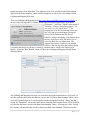
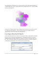
To access Gridding and Mapping go to http://www.kgs.ku.edu/PRS/Ozark/Software/GRID/ at
the top of the web page there is a menu "Main Page|Description|Applet|Help|Copyright &
Disclaimer|". Select the "Applet" menu option a
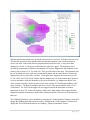
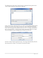
"Warning - Security" Dialog will appear (“Do
you want to run this application?”). The
program has to be able to read and write to the
user’s PC and access the Kansas Geological
Survey (KGS) Database and File Server,
ORACLE requires this dialog. The program does
not save your files to KGS, but allows you to
access the KGS for well information. The
program does not use Cookies or any hidden
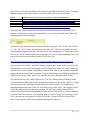
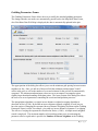
software. The blue shield on the warning dialog
is a symbol that the Java web app is created by a trusted source, which is the University of
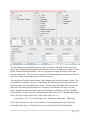
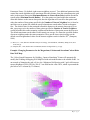
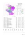
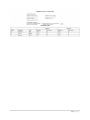
Kansas. Select the "Run" Button, which will show the Gridding and Mapping Module Panel
illustrated below,
The Gridding and Mapping Web App was created for the South-central Kansas CO2 Project, so
only the wells that have brine data that are saved to the CO2 Brine Data Database Tables can be
accessed. Presently there are 2 search engines with this dialog the Search By “Dates” and the
Search By “Formation”, but as more brine data is saved the search engine above will be modified
to reflect the data that is saved in the Brine Data Database Tables. Selecting any of the “Search
By” buttons will automatically search for data in the Brine Data Database Table based on the
2|Page