1
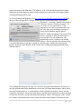
type of search. The following buttons will retrieve the available brine data by XML - Extensible
Markup Language data streams that are parsed. The XML calls are listed as follows:
Buttons
Sampled Date
Received Date
Reported Date
Buttons
Formations
ORACLE PL/SQL call to retrieve the number of wells and available dates
http://chasm.kgs.ku.edu/ords/iqstrat.co2_grid_brine_data_pkg.getDateListXML?iDate=0
http://chasm.kgs.ku.edu/ords/iqstrat.co2_grid_brine_data_pkg.getDateListXML?iDate=1
http://chasm.kgs.ku.edu/ords/iqstrat.co2_grid_brine_data_pkg.getDateListXML?iDate=2
ORACLE PL/SQL call to retrieve the number of wells and Formations (Tops)
http://chasm.kgs.ku.edu/ords/iqstrat.co2_grid_brine_data_pkg.getTopsListXML
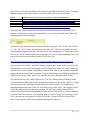
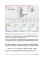
The Search By “Dates” returns the actual date entered for the brine data group and the total
number of wells that have brine data with that date, i.e., select the “Sampled Date” Button and
the following list will be displayed.
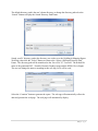
At the time of this document there are only 2 possible well groups, “2012-10-04” and “2012-0512”. The “2015-05-12” brine data well group has a total of 27 wells out of a possible 40 wells
with brine data sampled on this date. The user only needs to highlight the 2nd row in the list and
click on the “Select” button at the bottom of the panel. This action will automatically retrieve the
date as the search criteria and make an ORACLE PL/SQL call,
http://chasm.kgs.ku.edu/ords/iqstrat.co2_grid_brine_data_pkg.getDateXML?iDate=0&sTime=2015-05-12
This call will return a XML – Extensible Markup Language data stream with a list of wells and
the brine data of each well in the Sampled Date Well Brine Data Group. The “Map” button will
automatically become enabled, which indicates that the brine data was successfully downloaded
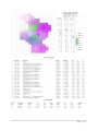
and parsed into the Brine Data List Structure. To plot the brine data to the Gridding & Mapping
Well Map click on the “Map” button. This will take you to the “Map Brine Data” Frame.
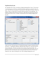
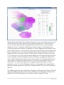
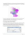
The other button above the “Map” button is the “Well List” Button which will display all the
CO2 wells that have Brine Data in the CO2 Brine Data Database Tables in the “Well List” Frame.
This Frame shows the well header information for the wells available. The Gridding and
Mapping Program require the UTM X & Y for each well to create a plot. The program will not
work if the wells do not have this data computed. The well list is coming from the KGS
ORACLE Well Header Information Database Table and the UTM X & Y are already computed
so the user really does not have to do anything with the well list. If any well is missing a UTM
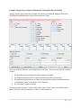
X & Y then the user can select the well and click on the “Compute UTM for Selected Well
Only” to compute the UTM from the latitude and longitude of the well.
3|Page