1
Seismic tomography tools in seismology
15
How to read result?
1.
2.
3.
4.
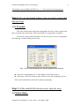
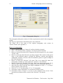
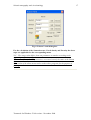
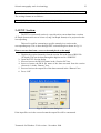
Browse or insert the “ResOut2” file name.
Insert the maximum perturbation range in the Range box.
Press “OK”.
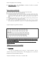
If the “ResOut2” file is in the correct format, the following files will be
constructed:
1-Depth files:
A set of files consists of the perturbations of the grid nodes that have hit counts
more than “NHITCT”, one file for every depth layer is constructed.
Depth file name is the “ResOut2” name appended by “Dxxx” where “xxx is
the depth value of this layer and has the extension “dat”.
Ex: The file name of the grid layer 10 km of the file ResOut2 is “ResOut2D010.dat”
Format of the depth file is as follows:
First line: A string of depth value
Next lines: Each line consists of the longitude, latitude, perturbation, hit count
of the given grid.
A typical depth file is shown below:
20.0-KM
137.66 34.9 -1.916 0.05 100
137.66 34.93 0.454 0.01 83
137.66 34.96 0.354 0.01 69
137.66 34.99 0.194 0.01 60
137.66 35.02 0.194 0.01 53
137.66 35.05 0.164 0.01 24
137.66 35.08 0.174 0.01 17
137.66 35.11 0.184 0.01 11
137.66 35.14 0.194 0.01 10
2-Name-list file:
A “name-list” file consists of the number of files constructed and their names.
This is only used for the plotting purpose. This file is requested by the Surfer script to
read all the depth files and plot the tomography images simultaneously.
The “Name-list” file name will be of the same name of “ResOut2” file but has
the extension”NAM”.
Format of the “Name-list” file:
First line: Number of files
Tomotools for Windows -Trial version – November 2004