1
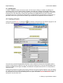
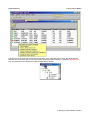
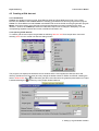
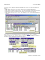
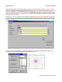
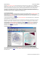
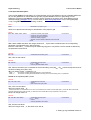
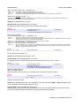
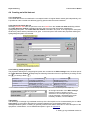
Royal Haskoning Triwaco User's Manual Summarizing, the four grid specific parameters which define the structure of the Finite Element/Difference Mesh are: BND : Map file containing one single polygon, defining the boundary of the model's domain POL : Map file containing a number of polygons, each defining an area with user defined node distances RIV : Map file containing a number of lines, each defining a river, channel or other waterway. SRC : Map file containing a number of points, each defining the location of a groundwater abstraction or infiltration Double clicking on one of the parameters causes the graphical editor DigEdit (How to use DigEdit is explained in chapter 8) to open. For each of the grid parameters the user creates a map file containing the topographical layout of that parameter within the model's domain. 4 Setting up a groundwater model-8