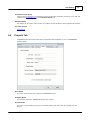
1
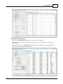
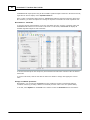
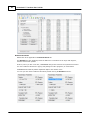
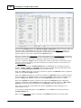
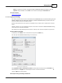
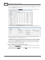
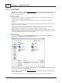
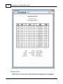
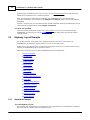
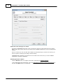
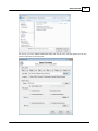
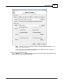
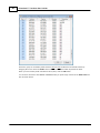
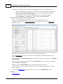
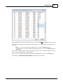
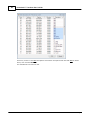
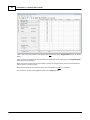
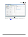
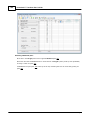
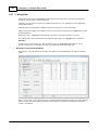
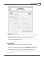
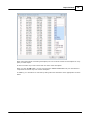
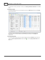
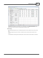
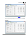
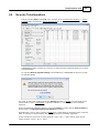
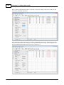
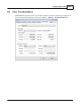
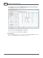
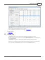
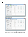
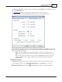
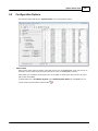
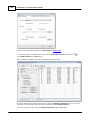
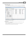
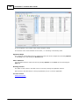
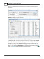
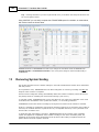
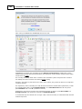
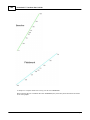
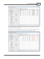
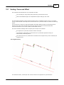
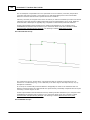
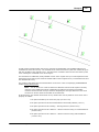
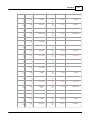
310
PrimaCode™ Transform User's Guide
While its nice to think that the measurements associated with an eminent domain proceeding have
more weight than other types of measurement, there are real problems with placing them above
monuments when reproducing the sidelines of the layout.
Suppose a highway layout was surveyed during extreme winter or summer temperatures in the
1950’s using a steel tape. Now suppose that due to sag corrections and inaccurate application of
temperature corrections, the survey’s measurements have a uniform scale error of about 200 partsper-million or 2 hundredths of a foot per 100 feet, which is not uncommon for surveys performed
without tension handles and when temperatures were not measured on-the-ground were the
measurements were actually made.
If this layout is several miles long, say three, and is reproduced from its beginning point using
modern measurements made with an EDM device and with all proper corrections applied, the
reproduced layout would overshoot the monuments set marking its other end by approximately 3.2
feet due to the scale error.
And since every land surveyor would have a slightly different interpretation of how to place those
measurements on the ground, the end result would be that no two surveyors would ever agree on
where that highway layout should be placed on the ground.
This could lead to encroachments, zoning setback violations and all sorts of other confusion, including
an inability for any land surveyor to securely fasten a boundary lines survey to the highway layout.
On the other hand, if every land surveyor complied with the “law of evidence” and gave the original
monuments more weight than the measurements used to describe them, then every land surveyor
would agree on the location of the highways sidelines, since it would be the locations of the
monuments themselves that would control.
Affect on issues of zoning
Lastly, a boundary line that cannot be pinned down to a single location on-the-ground is a boundary
line that cannot be used for zoning setbacks and other dimensional requirements.
By holding monuments instead of measurements, every land surveyor, land owner or builder has the
same perception of where the boundary line is located on the ground and can be confident that its
location line will not change with the next surveyor’s attempt to reproduce it.
19
Examples
Each of the examples contained in this section detail one typical use of TRANSFORM. Each example
provides a walk-through approach to using TRANSFORM to solve specific type of problem typical to
land surveying.
In This Section
Scaling: C ause and Affect
Merge AutoC AD Drawings
C onstruction Layout Example
Validating Tradition C omputations Example
© 2012 PrimaCode Technologies