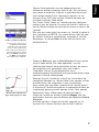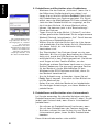
1
Mobile Mapping
Field Software
Getting Started Guide
English
Français
Deutsch
Español
English
Copyright Notice
Copyright 2007 Magellan Navigation, Inc. All rights
reserved.
Trademarks
All product and brand names mentioned in this publication are trademarks of their respective holders.
----------Magellan Professional Products - Limited Warranty
(North, Central and South America)
Magellan Navigation warrants their GPS receivers
and hardware accessories to be free of defects in material and workmanship and will conform to our published specifications for the product for a period of
one year from the date of original purchase. THIS
WARRANTY APPLIES ONLY TO THE ORIGINAL
PURCHASER OF THIS PRODUCT.
In the event of a defect, Magellan Navigation will, at
its option, repair or replace the hardware product
with no charge to the purchaser for parts or labor. The
repaired or replaced product will be warranted for 90
days from the date of return shipment, or for the balance of the original warranty, whichever is longer.
Magellan Navigation warrants that software products
or software included in hardware products will be
free from defects in the media for a period of 30 days
from the date of shipment and will substantially conform to the then-current user documentation provided with the software (including updates thereto).
Magellan Navigation's sole obligation shall be the
correction or replacement of the media or the software so that it will substantially conform to the thencurrent user documentation. Magellan Navigation
does not warrant the software will meet purchaser's
requirements or that its operation will be uninterrupted, error-free or virus-free. Purchaser assumes the
entire risk of using the software.
PURCHASER'S EXCLUSIVE REMEDY UNDER THIS
WRITTEN WARRANTY OR ANY IMPLIED WARRANTY SHALL BE LIMITED TO THE REPAIR OR REPLACEMENT, AT MAGELLAN NAVIGATION'S
OPTION, OF ANY DEFECTIVE PART OF THE RECEIVER OR ACCESSORIES WHICH ARE COVERED
BY THIS WARRANTY. REPAIRS UNDER THIS WARRANTY SHALL ONLY BE MADE AT AN AUTHORIZED
MAGELLAN NAVIGATION SERVICE CENTER. ANY
REPAIRS BY A SERVICE CENTER NOT AUTHORIZED BY MAGELLAN NAVIGATION WILL VOID
THIS WARRANTY.
gellan Navigation suggests using a trackable shipping method such as UPS or FedEx when returning a
product for service.
EXCEPT AS SET FORTH IN THIS LIMITED WARRANTY, ALL OTHER EXPRESSED OR IMPLIED
WARRANTIES, INCLUDING THOSE OF FITNESS
FOR ANY PARTICULAR PURPOSE, MERCHANTABILITY OR NON-INFRINGEMENT, ARE HEREBY
DISCLAIMED AND IF APPLICABLE, IMPLIED WARRANTIES UNDER ARTICLE 35 OF THE UNITED NATIONS CONVENTION ON CONTRACTS FOR THE
INTERNATIONAL SALE OF GOODS. Some national,
state, or local laws do not allow limitations on implied warranty or how long an implied warranty lasts,
so the above limitation may not apply to you.
The following are excluded from the warranty coverage: (1) periodic maintenance and repair or replacement of parts due to normal wear and tear; (2)
batteries and finishes; (3) installations or defects resulting from installation; (4) any damage caused by
(i) shipping, misuse, abuse, negligence, tampering,
or improper use; (ii) disasters such as fire, flood,
wind, and lightning; (iii) unauthorized attachments
or modification; (5) service performed or attempted
by anyone other than an authorized Magellan Navigations Service Center; (6) any product, components or
parts not manufactured by Magellan Navigation; (7)
that the receiver will be free from any claim for infringement of any patent, trademark, copyright or
other proprietary right, including trade secrets; and
(8) any damage due to accident, resulting from inaccurate satellite transmissions. Inaccurate transmissions can occur due to changes in the position,
health or geometry of a satellite or modifications to
the receiver that may be required due to any change
in the GPS. (Note: Magellan Navigation GPS receivers use GPS or GPS+GLONASS to obtain position,
velocity and time information. GPS is operated by the
U.S. Government and GLONASS is the Global Navigation Satellite System of the Russian Federation,
which are solely responsible for the accuracy and
maintenance of their systems. Certain conditions can
cause inaccuracies which could require modifications to the receiver. Examples of such conditions include but are not limited to changes in the GPS or
GLONASS transmission.) Opening, dismantling or
repairing of this product by anyone other than an authorized Magellan Navigation Service Center will void
this warranty.
To obtain warranty service the purchaser must obtain
a Return Materials Authorization (RMA) number prior
to shipping by calling 1-800-229-2400 (press option #1) (U.S.) or 1-408-615-3981 (International),
or by submitting a repair request on-line at:
http://professional.magellangps.com/en/support/
rma.asp. The purchaser must return the product
postpaid with a copy of the original sales receipt to
the address provided by Magellan Navigation with
the RMA number. Purchaser’s return address and the
RMA number must be clearly printed on the outside
of the package.
MAGELLAN NAVIGATION SHALL NOT BE LIABLE
TO PURCHASER OR ANY OTHER PERSON FOR ANY
INCIDENTAL OR CONSEQUENTIAL DAMAGES
WHATSOEVER, INCLUDING BUT NOT LIMITED TO
LOST PROFITS, DAMAGES RESULTING FROM DELAY OR LOSS OF USE, LOSS OF OR DAMAGES
ARISING OUT OF BREACH OF THIS WARRANTY OR
ANY IMPLIED WARRANTY EVEN THOUGH CAUSED
BY NEGLIGENCE OR OTHER FAULT OFMAGELLAN
NAVIGATION OR NEGLIGENT USAGE OF THE
PRODUCT. IN NO EVENT WILL MAGELLAN NAVIGATION BE RESPONSIBLE FOR SUCH DAMAGES,
EVEN IF MAGELLAN NAVIGATION HAS BEEN ADVISED OF THE POSSIBILITY OF SUCH DAMAGES.
Magellan Navigation reserves the right to refuse to
provide service free-of-charge if the sales receipt is
not provided or if the information contained in it is
incomplete or illegible or if the serial number is altered or removed. Magellan Navigation will not be responsible for any losses or damage to the product
incurred while the product is in transit or is being
shipped for repair. Insurance is recommended. Ma-
This written warranty is the complete, final and exclusive agreement between Magellan Navigation and
the purchaser with respect to the quality of performance of the goods and any and all warranties and
representations. This warranty sets forth all of Magellan Navigation's responsibilities regarding this product. This limited warranty is governed by the laws of
the State of California, without reference to its con-
This warranty gives the purchaser specific rights. The
purchaser may have other rights which vary from locality to locality (including Directive 1999/44/EC in
the EC Member States) and certain limitations contained in this warranty, including the exclusion or
limitation of incidental or consequential damages
may not apply.
For further information concerning this limited warranty, please call or write:
Magellan Navigation, Inc., 960 Overland Court, San
Dimas, CA 91773, Phone: +1 909-394-5000, Fax:
+1 909-394-7050 or
Magellan Navigation SAS - ZAC La Fleuriaye - BP
433 - 44474 Carquefou Cedex - France Phone: +33
(0)2 28 09 38 00, Fax: +33 (0)2 28 09 39 39.
Magellan Professional Products Limited Warranty
(Europe, Middle East, Africa)
All Magellan Navigation global positioning system
(GPS) receivers are navigation aids, and are not intended to replace other methods of navigation. Purchaser is advised to perform careful position charting
and use good judgment. READ THE USER GUIDE
CAREFULLY BEFORE USING THE PRODUCT.
1. MAGELLAN NAVIGATION WARRANTY
Magellan Navigation warrants their GPS receivers
and hardware accessories to be free of defects in material and workmanship and will conform to our published specifications for the product for a period of
one year from the date of original purchase or such
longer period as required by law. THIS WARRANTY
APPLIES ONLY TO THE ORIGINAL PURCHASER OF
THIS PRODUCT.
In the event of a defect, Magellan Navigation will, at
its option, repair or replace the hardware product
with no charge to the purchaser for parts or labor. The
repaired or replaced product will be warranted for 90
days from the date of return shipment, or for the balance of the original warranty, whichever is longer.
Magellan Navigation warrants that software products
or software included in hardware products will be
free from defects in the media for a period of 30 days
from the date of shipment and will substantially conform to the then-current user documentation provided with the software (including updates thereto).
Magellan Navigation's sole obligation shall be the
correction or replacement of the media or the software so that it will substantially conform to the thencurrent user documentation. Magellan Navigation
does not warrant the software will meet purchaser's
requirements or that its operation will be uninterrupted, error-free or virus-free. Purchaser assumes the
entire risk of using the software.
2. PURCHASER'S REMEDY
PURCHASER'S EXCLUSIVE REMEDY UNDER THIS
WRITTEN WARRANTY OR ANY IMPLIED WARRANTY SHALL BE LIMITED TO THE REPAIR OR REPLACEMENT, AT MAGELLAN NAVIGATION'S
OPTION, OF ANY DEFECTIVE PART OF THE RECEIVER OR ACCESSORIES WHICH ARE COVERED
BY THIS WARRANTY. REPAIRS UNDER THIS WARRANTY SHALL ONLY BE MADE AT AN AUTHORIZED
MAGELLAN NAVIGATION SERVICE CENTER. ANY
REPAIRS BY A SERVICE CENTER NOT AUTHORIZED BY MAGELLAN NAVIGATION WILL VOID
THIS WARRANTY.
3. PURCHASER'S DUTIES
To obtain service, contact and return the product
with a copy of the original sales receipt to the dealer
from whom you purchased the product.
Magellan Navigation reserves the right to refuse to
provide service free-of-charge if the sales receipt is
not provided or if the information contained in it is
incomplete or illegible or if the serial number is altered or removed. Magellan Navigation will not be responsible for any losses or damage to the product
incurred while the product is in transit or is being
shipped for repair. Insurance is recommended. Magellan Navigation suggests using a trackable shipping method such as UPS or FedEx when returning a
product for service.
4. LIMITATION OF IMPLIED WARRANTIES
EXCEPT AS SET FORTH IN ITEM 1 ABOVE, ALL
OTHER EXPRESSED OR IMPLIED WARRANTIES,
INCLUDING THOSE OF FITNESS FOR ANY PARTICULAR PURPOSE OR MERCHANTABILITY, ARE
HEREBY DISCLAIMED AND IF APPLICABLE, IMPLIED WARRANTIES UNDER ARTICLE 35 OF THE
UNITED NATIONS CONVENTION ON CONTRACTS
FOR THE INTERNATIONAL SALE OF GOODS.
Some national, state, or local laws do not allow limitations on implied warranty or how long an implied
warranty lasts, so the above limitation may not apply
to you.
5. EXCLUSIONS
The following are excluded from the warranty coverage:
(1) periodic maintenance and repair or replacement
of parts due to normal wear and tear;
(2) batteries;
(3) finishes;
(4) installations or defects resulting from installation;
(5) any damage caused by (i) shipping, misuse,
abuse, negligence, tampering, or improper use; (ii)
disasters such as fire, flood, wind, and lightning; (iii)
unauthorized attachments or modification;
(6) service performed or attempted by anyone other
than an authorized Magellan Navigations Service
Center;
(7) any product, components or parts not manufactured by Magellan Navigation,
(8) that the receiver will be free from any claim for
infringement of any patent, trademark, copyright or
other proprietary right, including trade secrets
(9) any damage due to accident, resulting from inaccurate satellite transmissions. Inaccurate transmissions can occur due to changes in the position,
health or geometry of a satellite or modifications to
the receiver that may be required due to any change
in the GPS. (Note: Magellan Navigation GPS receivers use GPS or GPS+GLONASS to obtain position,
velocity and time information. GPS is operated by the
U.S. Government and GLONASS is the Global Navigation Satellite System of the Russian Federation,
which are solely responsible for the accuracy and
maintenance of their systems. Certain conditions can
English
flict of law provisions or the U.N. Convention on Contracts for the International Sale of Goods, and shall
benefit Magellan Navigation, its successors and assigns.
English
cause inaccuracies which could require modifications to the receiver. Examples of such conditions include but are not limited to changes in the GPS or
GLONASS transmission.).
Opening, dismantling or repairing of this product by
anyone other than an authorized Magellan Navigation
Service Center will void this warranty.
6. EXCLUSION OF INCIDENTAL OR CONSEQUENTIAL DAMAGES
MAGELLAN NAVIGATION SHALL NOT BE LIABLE
TO PURCHASER OR ANY OTHER PERSON FOR ANY
INDIRECT, INCIDENTAL OR CONSEQUENTIAL
DAMAGES WHATSOEVER, INCLUDING BUT NOT
LIMITED TO LOST PROFITS, DAMAGES RESULTING FROM DELAY OR LOSS OF USE, LOSS OF OR
DAMAGES ARISING OUT OF BREACH OF THIS
WARRANTY OR ANY IMPLIED WARRANTY EVEN
THOUGH CAUSED BY NEGLIGENCE OR OTHER
FAULT OFMAGELLAN NAVIGATION OR NEGLIGENT
USAGE OF THE PRODUCT. IN NO EVENT WILL MAGELLAN NAVIGATION BE RESPONSIBLE FOR
SUCH DAMAGES, EVEN IF MAGELLAN NAVIGATION HAS BEEN ADVISED OF THE POSSIBILITY OF
SUCH DAMAGES.
Some national, state, or local laws do not allow the
exclusion or limitation of incidental or consequential
damages, so the above limitation or exclusion may
not apply to you.
7. COMPLETE AGREEMENT
This written warranty is the complete, final and exclusive agreement between Magellan Navigation and
the purchaser with respect to the quality of performance of the goods and any and all warranties and
representations. THIS WARRANTY SETS FORTH ALL
OF MAGELLAN NAVIGATION'S RESPONSIBILITIES
REGARDING THIS PRODUCT.
THIS WARRANTY GIVES YOU SPECIFIC RIGHTS.
YOU MAY HAVE OTHER RIGHTS WHICH VARY
FROM LOCALITY TO LOCALITY (including Directive
1999/44/EC in the EC Member States) AND CERTAIN LIMITATIONS CONTAINED IN THIS WARRANTY MAY NOT APPLY TO YOU.
8. CHOICE OF LAW.
This limited warranty is governed by the laws of
France, without reference to its conflict of law provisions or the U.N. Convention on Contracts for the International Sale of Goods, and shall benefit Magellan
Navigation, its successors and assigns.
THIS WARRANTY DOES NOT AFFECT THE CUSTOMER'S STATUTORY RIGHTS UNDER APPLICABLE LAWS IN FORCE IN THEIR LOCALITY, NOR
THE CUSTOMER'S RIGHTS AGAINST THE DEALER
ARISING FROM THEIR SALES/PURCHASE CONTRACT (such as the guarantees in France for latent
defects in accordance with Article 1641 et seq of the
French Civil Code).
For further information concerning this limited warranty, please call or write:
Magellan Navigation SAS - ZAC La Fleuriaye - BP
433 - 44474 Carquefou Cedex - France.
Phone: +33 (0)2 28 09 38 00, Fax: +33 (0)2 28 09
39 39
Installing Mobile Mapping...............................................1
Installation Instructions ..........................................1
Unlocking Mobile Mapping......................................2
Using Mobile Mapping....................................................3
Preliminary Steps ...................................................3
Logging New GPS/GIS Data .....................................3
Creating a Job and Selecting a Feature Library ..... 3
Logging and Describing a Point Feature ............... 4
Logging and Describing a Line Feature ................ 4
Logging and Describing an Area Feature .............. 6
Revisiting and Updating Existing GPS/GIS Jobs.........6
General Procedure ............................................. 6
Repositioning a Point Feature ............................. 8
Adding More Features and Attributes to the Job.... 8
Closing the Job.................................................. 8
Quitting Mobile Mapping.........................................8
Downloading Field Data to your PC...........................9
Exporting Data to a GIS......................................... 10
English
Table of Contents
English
Installing Mobile Mapping on Mobile Mapper CX is a threestep process:
1. Uploading Installation files from the Mobile Mapping CD
to the MobileMapper CX through Microsoft ActiveSync.
2. Installing Mobile Mapping in MobileMapper CX. This step
is automatically started in MobileMapper CX once all the
installation files have been uploaded.
3. Unlocking Mobile Mapping by entering a product key in
MobileMapper CX.
Installation Instructions
It is assumed that Microsoft ActiveSync is running on your office computer. ActiveSync can be installed using the installation files provided on the MobileMapper CX Companion CD.
It is also assumed that MobileMapper CX’s USB port has been
set to “USB serial for ActiveSync”. See “Setting the Mini-USB
Port” in your MobileMapper CX Getting Started Guide.
1. Attach the I/O module to the back of the MobileMapper CX
unit.
2. Connect the MobileMapper CX to your office computer
using the USB cable. The USB cable is plugged into
MobileMapper CX’s I/O module.
3. Turn on MobileMapper CX.
4. Insert the Magellan MobileMapping CD into your CD drive
of your office computer. Wait until the auto-run window
opens on the computer screen. If the auto-run file fails to
start automatically, browse the installation CD and run the
Setup.exe file.
5. Choose your language.
6. Click on the Install Mobile Mapping 1.3x with... option corresponding to your area (US or European map).
7. Click OK when the Install “Magellan Mobile Mapping 1.3x”
using the default application install directory message appears.
This starts the installation. The message Installing Magellan
Mobile Mapping 1.3x... is displayed while the installation
files are transferred to the MobileMapper CX.
1
English
1. Installing Mobile Mapping
English
8. At the end of the file transfer, the following message is
displayed on the computer: Please check your mobile device
screen to see if additional steps are necessary to complete this
installation. Click OK to close this message box.
During this time, the MobileMapper CX has started installing the software. A progress bar is displayed on the
MobileMapper screen to indicate the different phases of
the installation. The progress bar disappears when installation is complete. The MobileMapper CX workspace
screen then shows the Mobile Mapping shortcut icon.
Unlocking Mobile Mapping
1. Double-tap the Mobile Mapping icon. This opens the Unlock
MM Option screen.
2. Type the product key (a 13-character string) your Magellan
dealer provided to you when you purchased the option.
3. Tap OK. A message indicates that Mobile Mapping was
successfully unlocked.
4. Tap OK to close the message window.
5. Select the Mobile Mapping interface language from the
list of available languages.
6. Press ENTER to accept the license agreement and to start
using Mobile Mapping.
2
English
2. Using Mobile Mapping
Preliminary Steps
It is assumed that you have already run all the instructions
for a first-time use (see MobileMapper CX Getting Started
Guide, Chapter 3: Preparing for First-Time Use).
1. Turn on the receiver by pressing the
red button.
2. Double-tap the Mobile Mapping icon.
3. Press the NAV key until you see the Satellite Status screen
(see opposite) Wait until at least 4 satellites are received.
For best accuracy it is important to hold the receiver at an
angle of 45° from horizontal and not too close to you.
Satellite Status screen
45°
Logging New GPS/GIS Data
1. Creating a Job and Selecting a Feature Library
- Press the LOG button.
- Tap Create New Job.
- Enter the job name and press ENTER
- Tap the “TUTORIAL.MMF” feature library (or as
required).
- Tap the “Real-Time” job mode (or as required).
Entering a job name
3
English
Logging screen
The Logging screen also
displays the time elapsed
since you started logging at
this point feature, the
number of satellites currently received and the current value of PDOP.
2. Logging and Describing a Point Feature
- Highlight the “Str Light” feature (you are supposed to
be near one of these features) and tap the on-screen
Log button. This starts feature logging. A sound is
heard every time MobileMapper CX logs data.
The Logging screen is now displayed where you can
see the list of attributes pertaining to this feature. You
will now enter the “Description” phase of the feature
- Tap the first attribute (“Condition”) and then tap the
right attribute value describing the feature near you
(for example “Good”). This takes you back to the Logging screen.
- Select the next attribute in the list and repeat the previous step. Repeat this step until all the attributes
have been properly described.
“Describing” the feature only takes a few seconds. By
the time you are done with the feature description, the
feature’s GPS position will probably have been saved
in the job. You can also stay more time on the feature
to let the receiver determine several positions. This
will give an even more accurate position for the feature
as MobileMapper CX will average all the GPS positions
it has computed on the feature.
- To stop logging the feature, tap Done. This takes you
back to the Feature List screen
- Move to the next feature and resume the above
instructions to log this feature.
3. Logging and Describing a Line Feature
Basically, you use the same procedure as when you log a
point feature (see 2. above). There are however two differences when you log a line feature:
- You need to define a logging interval when you start
logging the feature
- And then you are supposed to move from the beginning to the end of the line feature before stopping the
logging.
These differences are explained below.
4
Selecting the logging interval option
Logging screen
The Logging screen also
displays the distance traveled since you started logging the line feature.
5
English
After tapping the “Road” line feature from the Feature
List screen and tapping the Log button, MobileMapper CX
starts logging GPS positions from the position where you
are. The default logging interval is 5 seconds. To change
this interval:
- Tap Options on the screen and highlight Logging Interval. Two options are then prompted:
By Time: Select this option when you want to log a new
GPS position at regular intervals of time regardless of
the distance traveled since the last position logged.
After tapping this option, tap the desired time interval.
This takes you back to the Logging screen where you
can see the list of attributes pertaining to the feature.
By Distance: Select this option when you want to log a
new GPS position only after you have moved by a certain distance since the last position logged. After tapping this option, tap the desired distance interval. This
takes you back to the Logging screen where you can
see the list of attributes pertaining to the feature.
- As you would for a point feature, describe the feature
by describing the different attributes pertaining to the
feature.
- When the description is finished, you can start walking
along the road.
- When you arrive at the end of the road, with MobileMapper CX still displaying the Logging screen, tap Done
to stop logging the feature.
English
4. Logging and Describing an Area Feature
Basically, you use the same procedure as when you log a
line feature, especially regarding the need for defining a
logging interval (see 3. above).
The only difference between a line and area feature is that
for an area feature, the first and last position calculated
by the receiver are connected when you close the feature.
Logging screen
This screen displays the
current values of perimeter and area measured
since you started logging
the feature (+ number of
satellites and PDOP)
Record the attributes of an area feature as you do for a
line feature (see page 4):
- Tap the name of the “Park” area feature from the list
of features and tap the Log button. MobileMapper CX
starts logging the area feature.
- Choose a logging interval using the Options button (see
explanations given for a line area on page 4). This
takes you back to the Logging screen where the list of
attributes for the feature is displayed
- Describe each attribute by selecting or entering the
appropriate attribute value for each of them.
Revisiting and Updating Existing GPS/GIS Jobs
You can use MobileMapper CX not only to position and describe new GIS features but also to update information gathered previously. This is particularly useful when collecting
data on things that change over time: streetlight bulbs burn
out, new roads are added to housing developments, new crops
are planted, etc.
Job List screen
6
1. General Procedure
Return to the area where the original job was recorded, turn
MobileMapper CX on and double-tap the Mobile Mapping icon.
When it has calculated a GPS position, follow the procedure
below to update the job or to append more data to it.
- Press the LOG button and tap Open Existing Job.
- Tap the name of the job you want to revisit.
- Unless this screen is already displayed, press NAV repeatedly until the Map screen is displayed.
Screen prompting you to go
to the selected feature
When you know which
attributes must be changed
for a point feature, which
means you don’t really
need to visit the point,
then tap Edit rather than
Goto and change the
attributes directly.
Map screen showing
straight line to target
- Tap Goto to ask MobileMapper CX to guide you to this feature. By doing this, you will make the selected feature
your destination and all the navigation screens will be set
to help you reach that feature. The Map screen will also be
automatically displayed showing a straight line connecting
your current position to the selected feature.
- Walk to the feature according to the navigation instructions provided on the Map screen. You can use other navigation screens if you prefer. You will know when you are
close to the feature when the distance to the feature goes
to zero or close to zero, or simply because you can identify
it visually. Another nice way of being informed that you
have arrived at the feature is to set the Alarms option (see
explanations in the Mobile Mapping Reference Manual)
- After arriving at the feature, press the LOG key. This takes
you to the Feature Attributes screen.
7
English
The Map screen provides a geographical view of the different features present in the job. From this screen, you will
now indicate the first feature you want to revisit. If necessary, press the IN or OUT button to adjust the scale so you
can see this feature.
- On the Map screen, tap on the feature you want to revisit
first. (The feature name appears in the lower part of the
screen when the cursor is positioned over the feature.)
- When the map cursor is positioned over the feature to be
updated, press ENTER. A new screen is displayed showing
the attribute values currently assigned to the feature. Note
that the Goto field is highlighted at the bottom of the
screen.
English
- Now that you are near the feature and you can see which
of its attributes need to be changed, tap successively each
of these attributes and change them.
- After reviewing the attributes, tap the Done field at the
bottom of the screen. This ends the review of this feature
and displays the Map screen again.
- Follow the same steps described above to revisit and
update the other features present in the job.
2. Repositioning a Point Feature
If a point feature appears to be mislocated on the Map screen,
do the following after you have arrived at the feature:
- Press the LOG key and tap the on-screen Log button. Let
the MobileMapper CX recompute the point position and
then tap the Done button to close the feature.
Note that only point features can be repositioned. If you
wish to reposition a line or area feature, you should record
a new feature and then delete the old one in MobileMapper Office.
3. Adding More Features and Attributes to the Job
If you want to add more features and descriptions to the existing job, you just have to record them exactly as you record features into a new job.
4. Closing the Job
To close a job, from the screen showing the list of attributes,
tap Done then confirm by tapping Yes.
Quitting Mobile Mapping
Press the MENU key and tap Exit. This takes you back to the
MobileMapper CX workspace screen.
8
The easiest way to download your field data from the MobileMapper CX to your PC is to remove the SD card from the
MobileMapper CX and insert it into your PC card reader. This
implies the following:
1. All your field data should have been saved on the SD card
(the storage medium used should be the SD card).
2. Your PC should be equipped with an SD card reader.
If you do not have a card reader on your PC, then you should
connect the MobileMapper CX to your PC via the USB cable
provided.
This section more particularly describes the download procedure based on the use of Active Sync and the USB cable provided.
1. On MobileMapper CX:
- Turn on MobileMapper CX.
2.
3.
4.
5.
6.
7.
8.
9.
- Tap
>Settings>Control Panel.
- Double-tap the USB device switcher icon and check that
the current setting is Serial for Active Sync. If it’s not,
tap the USB serial for ActiveSync button and then reboot the unit.
Attach the I/O module to the back of the MobileMapper CX
Connect the USB cable between MobileMapper CX and
your office computer. After a few seconds, MobileMapper
CX emits a sound indicating that an Active Sync link with
the office computer has been established. In the New
Partnership window that opens, select “No” and click
Next>.
In the task bar of the office computer, right-click on the
ActiveSync icon and select Explore. This opens a new window showing the file structure of MobileMapper CX.
Double-click the MyDevice/ folder.
Select the MMJ files you want to download.
Make a right-click and select Copy.
From the same window, browse to the desired folder on
the computer
Paste the files in this folder.
IMPORTANT: The MyDevice folder contains program files. Be
careful not to delete these files!
9
English
Downloading Field Data to your PC
English
Exporting Data to a GIS
The most important processing of your field data is its export
to a GIS. Exporting field data has two processes: conversion
of the data files to a standard format a GIS can read and then
the actual transfer of the file.
1. On your office computer, launch MobileMapper Office
2. From the menu bar, select File>Open
3. Select the folder where you downloaded your files.
4. Select the MMJ file you want to open and then click Open.
MobileMapper Office now views the data collected in the
field.
5. From the menu bar, select File>Export.
6. Select one of the formats displayed and you will see a
“Browse for Folder” window that allows you to select the
directory to which the reformatted file will be transferred.
If you don't know where to put this file, just select a temporary location.
7. Click Export. Your job will be automatically formatted and
transferred to the selected folder. You can select any
folder that is accessible by your PC - including any GIS
folders that may be on your network. When you start
recording real data to export to a GIS, you will typically
export data to a GIS database.
10
A
ActiveSync 1
Alarms 7
Area feature (logging) 6
Attributes (of a feature) 4
Averaging position of a point feature 4
B
By Distance 5
ByTime 5
C
CD (companion CD) 1
Close (GIS job) 8
E
Export 10
F
Feature library 3
G
GOTO 7
H
Holding the unit 3
I
I/O module 1
L
Line feature (logging) 4
Logging Interval 5
M
Mini-USB port 1
MMJ 10
MMJ file 9
P
Point feature (logging) 4
Product key 1
R
Revisit (features) 6
T
Tap 5
Target on Map screen 7
U
Unlock (Mobile Mapping) 2
Updating position of a point feature 8
USB device switcher 9
English
Index
Français
Mention de droits d’auteur
Copyright 2007 Magellan Navigation, Inc.
Tous droits réservés.
Marques commerciales
Tous les noms de produits et de marques mentionnés
dans cette publication sont des marques
commerciales déposées appartenant à leurs
propriétaires respectifs.
----------Produits professionnels de Magellan - Garantie
limitée (Amérique du Nord, Centrale et du Sud)
Magellan Navigation garantit que ses récepteurs GPS
et ses accessoires sont exempts de défauts matériels
et de fabrication et sont conformes aux
spécifications du produit publiées par nos soins pour
une période de un an à compter de la date initiale de
l’achat. LA PRÉSENTE GARANTIE S’APPLIQUE
UNIQUEMENT À L’ACHETEUR ORIGINAL DE CE
PRODUIT.
En cas de défaut, Magellan Navigation décidera, à sa
seule discrétion, de réparer ou de remplacer
l’appareil sans facturer à l’acheteur les pièces ni la
main d’œuvre. Le produit remplacé ou réparé sera
garanti pour une période de 90 jours à compter de la
date de renvoi, ou pour le reste de la durée de
garantie originale, selon la durée la plus longue.
Magellan Navigation garantit que le support des
produits logiciels ou des logiciels inclus dans
l’appareil sont exempts de défauts pour une période
de 30 jours à compter de la date d’expédition et sont
pour l’essentiel, conformes à la documentation de
l’utilisateur alors en vigueur fournie avec le logiciel
(y compris les mises à jour de celui-ci). La seule
obligation de Magellan Navigation consiste à rectifier
ou à remplacer les supports ou le logiciel de manière
à ce qu’ils soient, pour l’essentiel, conformes à la
documentation de l’utilisateur alors en vigueur.
Magellan Navigation ne garantit pas que le logiciel
sera conforme aux exigences de l’acheteur ni que son
fonctionnement sera ininterrompu, infaillible ou
exempt de virus. L’acheteur utilise ce logiciel sous sa
seule responsabilité.
LE RECOURS EXCLUSIF DE L’ACHETEUR AUX
TERMES DE LA PRÉSENTE GARANTIE ÉCRITE OU
DE TOUTE GARANTIE IMPLICITE EST LIMITÉ À LA
RÉPARATION OU AU REMPLACEMENT, À LA
DISCRÉTION DE MAGELLAN NAVIGATION, DE
TOUTE PIÈCE DÉFECTUEUSE DU RÉCEPTEUR OU
DES ACCESSOIRES COUVERTS PAR LA PRÉSENTE
GARANTIE. LES RÉPARATIONS COUVERTES PAR
LA PRÉSENTE GARANTIE DOIVENT UNIQUEMENT
ÊTRE EFFECTUÉES DANS UN CENTRE DE
SERVICE TECHNIQUE AGRÉÉ PAR MAGELLAN
NAVIGATION. TOUTE RÉPARATION EFFECTUÉE
PAR UN SERVICE TECHNIQUE NON AGRÉE PAR
MAGELLAN NAVIGATION INVALIDERA LA
PRÉSENTE GARANTIE.
Si l’acheteur souhaite s’adresser au service aprèsvente, il doit obtenir un numéro d’Autorisation de
retour de matériel (RMA) avant l’expédition, en
appelant le 1-800-229-2400 (option 1) (États-Unis)
ou le 1-408-615-3981 (International) ou en
envoyant un e-mail à :
http://professional.magellangps.com/en/support/
rma.asp. L’acheteur doit retourner le produit à ses
frais avec une copie de la facture originale à l’adresse
fournie par Magellan Navigation avec le numéro
RMA. L’adresse de retour de l’acheteur ainsi que le
numéro RMA doivent être clairement inscrits à
l’extérieur de l’emballage.
Magellan Navigation se réserve le droit de refuser
d’assurer gratuitement le service après-vente si la
facture n’accompagne pas le produit, si les
informations contenues sont incomplètes ou
illisibles, ou si le numéro de série a été modifié ou
effacé. MAGELLAN NAVIGATION NE POURRA ÊTRE
TENUE RESPONSABLE D’AUCUNE PERTE NI
D’AUCUN DOMMAGE DU PRODUIT LORS DE SON
TRANSIT OU DE SON EXPÉDITION POUR LA
RÉPARATION. Nous vous conseillons de souscrire
une assurance. Lorsque vous renvoyez un produit
pour réparation, Magellan Navigation vous conseille
d’utiliser une méthode d’expédition proposant le
suivi de votre colis, comme UPS ou FedEx.
À L’EXCLUSION DE CE QUI EST STIPULÉ DANS LA
PRÉSENTE GARANTIE, TOUTE AUTRE GARANTIE
EXPLICITE OU IMPLICITE, Y COMPRIS LES
GARANTIES D’ADÉQUATION À UNE UTILISATION
PARTICULIÈRE, DE VALEUR MARCHANDE OU DE
NON-CONTREFAÇON, EST EXCLUE PAR LA
PRÉSENTE AINSI QUE, SI APPLICABLE, LES
GARANTIES IMPLICITES STIPULÉES À L’ARTICLE
35 DE LA CONVENTION DES NATIONS UNIES SUR
LES CONTRATS POUR LA VENTE
INTERNATIONALE DE MARCHANDISES. Certaines
législations nationales, fédérales ou locales
n’autorisent pas les limitations de garantie implicite
ni la durée des garanties implicites, auquel cas la
limitation ci-dessus ne s’applique pas.
Ne sont pas couverts par la garantie : (1) l’entretien
périodique et la réparation ou le remplacement de
pièces liés à l’usure ou aux dommages normaux ;
(2) les piles et les finitions ; (3) les installations ou
les dysfonctionnements liés à l’installation ; (4) tout
dommage causé par (i) l’expédition, une mauvaise
utilisation, une utilisation abusive, la négligence, des
manipulations intempestives ou une utilisation
incorrecte ; (ii) les catastrophes telles que les
incendies, les inondations, le vent et la foudre ;
(iii) les branchements non autorisés ou les
modifications ; (5) les réparations effectuées par ou
tentées par toute autre personne autre qu’un Centre
de service après-vente Magellan Navigation agréé ;
(6) tous les produits, composants ou pièces non
fabriqués par Magellan Navigation ; (7) le fait que le
récepteur ne fera pas l’objet d’une action en
contrefaçon de brevet, marque commerciale, droit
d’auteur ou autre droit de propriété, y compris les
secrets commerciaux ; et (8) tout dommage lié à un
accident résultant de transmissions satellite
imprécises. Les transmissions sont parfois
imprécises en raison d’un changement de position,
de la mauvaise santé ou géométrie d’un satellite ou
de modifications devant être apportées au récepteur
en raison d’une modification du GPS. (Remarque :
Les récepteurs GPS de Magellan Navigation utilisent
le GPS ou GPS+GLONASS pour obtenir des
informations relatives à la position, la vitesse et
l’heure. Le GPS est géré par le gouvernement des
États-Unis et GLONASS est le Système satellite de
navigation mondial (Global Navigation Satellite
System) de la Russie, qui est seule responsable de la
précision et de la maintenance de ses systèmes.
Certaines conditions peuvent entraîner des
imprécisions pouvant nécessiter l’apport de
modifications au récepteur. Parmi ces conditions,
citons les changements relatifs à la transmission
GPS OU GLONASS.) L’ouverture, le démontage ou la
réparation de ce produit par toute personne étrangère
à un Centre de service après-vente Magellan
UNIQUEMENT À L’ACHETEUR ORIGINAL DE CE
PRODUIT.
MAGELLAN NAVIGATION NE SERA TENUE
RESPONSABLE ENVERS L’ACHETEUR OU TOUTE
AUTRE PERSONNE D’AUCUN DOMMAGE
ACCESSOIRE OU IMMATÉRIEL QUELS QU’ILS
SOIENT, Y COMPRIS MAIS SANS LIMITATION,
LA PERTE DE BÉNÉFICES, LES DOMMAGES
RÉSULTANT D’UN RETARD OU D’UNE
IMPOSSIBILITÉ D’UTILISATION DUS À UNE
VIOLATION DE CETTE GARANTIE OU DE TOUTE
GARANTIE IMPLICITE, MÊME SI CELLE-CI EST
LIÉE À LA NÉGLIGENCE OU À UNE AUTRE FAUTE
IMPUTABLE À MAGELLAN NAVIGATION OU À UNE
UTILISATION NÉGLIGENTE DU PRODUIT.
MAGELLAN NAVIGATION NE POURRA
AUCUNEMENT ÊTRE TENU RESPONSABLE DE
TELS DOMMAGES, MÊME APRÈS AVOIR ÉTÉ
INFORMÉE DE LA POSSIBILITÉ DE TELS
DOMMAGES.
En cas de défaut, Magellan Navigation décidera,
à sa seule discrétion, de réparer ou de remplacer
l’appareil sans facturer à l’acheteur les pièces ni la
main d’œuvre. Le produit remplacé ou réparé sera
garanti pour une période de 90 jours à compter de la
date de renvoi, ou pour le reste de la durée de
garantie originale, selon la durée la plus longue.
Magellan Navigation garantit que le support des
produits logiciels ou des logiciels inclus dans
l’appareil sont exempts de défauts pour une période
de 30 jours à compter de la date d’expédition et sont
pour l’essentiel, conformes à la documentation de
l’utilisateur alors en vigueur fournie avec le logiciel
(y compris les mises à jour de celui-ci). La seule
obligation de Magellan Navigation consiste à rectifier
ou à remplacer les supports ou le logiciel de manière
à ce qu’ils soient, pour l’essentiel, conformes à la
documentation de l’utilisateur alors en vigueur.
Magellan Navigation ne garantit pas que le logiciel
sera conforme aux exigences de l’acheteur ni que son
fonctionnement sera ininterrompu, infaillible ou
exempt de virus. L’acheteur utilise ce logiciel sous sa
seule responsabilité.
La présente garantie écrite constitue l’accord
complet, final et exclusif entre Magellan Navigation
et l’acheteur concernant la qualité de
fonctionnement des marchandises et toute autre
garantie et représentation. CETTE GARANTIE
ÉTABLIT L’ENSEMBLE DES RESPONSABILITÉS DE
MAGELLAN NAVIGATION CONCERNANT CE
PRODUIT. Cette garantie limitée est régie par les lois
de l’État de Californie, sans prendre en compte les
conflits de dispositions légales ou la convention des
N.U. sur les contrats pour la vente internationale de
marchandises, et doit bénéficier à Magellan
Navigation, ses successeurs et ayant droit.
Cette garantie octroie à l’acheteur des droits
spécifiques. L’acheteur peut disposer d’autres droits
variant d’une localité à l’autre (notamment la
Directive 1999/44/EC dans les états membres de la
CE) et certaines limitations inclues dans cette
garantie, y compris l’exclusion ou la limitation de
dommages accessoires ou immatériels, peuvent ne
pas s’appliquer à son cas.
Pour obtenir de plus amples informations concernant
cette garantie limitée, veuillez téléphoner ou écrire à :
Magellan Navigation, Inc., 960 Overland Court, San
Dimas, CA 91773, Tél. : +1 909-394-5000,
Fax : +1 909-394-7050 ou
Magellan Navigation SAS - ZAC La Fleuriaye BP 433 - 44474 Carquefou Cedex - France
Tél. : +33 (0)2 28 09 38 00,
Fax : +33 (0)2 28 09 39 39.
Produits professionnels de Magellan - Garantie
limitée (Europe, Moyen-Orient, Afrique)
Tous les récepteurs GPS (système de positionnement
global) de Magellan Navigation constituent des aides
à la navigation et ne sont pas destinés à remplacer
les autres méthodes de navigation. Nous conseillons
à l’acheteur de relever soigneusement sa position sur
une carte et de faire appel à son bon sens. Lisez
attentivement le Manuel Utilisateur avant d’utiliser
ce produit.
1. GARANTIE MAGELLAN NAVIGATION
Magellan Navigation garantit que ses récepteurs GPS
et ses accessoires sont exempts de défauts matériels
et de fabrication et sont conformes aux
spécifications du produit publiées par nos soins pour
une période d’un an, à compter de la date initiale de
l’achat. LA PRÉSENTE GARANTIE S’APPLIQUE
2. RECOURS DE L’ACHETEUR
LE RECOURS EXCLUSIF DE L’ACHETEUR AUX
TERMES DE LA PRÉSENTE GARANTIE ÉCRITE OU
DE TOUTE GARANTIE IMPLICITE EST LIMITÉ À LA
RÉPARATION OU AU REMPLACEMENT, À LA
DISCRÉTION DE MAGELLAN NAVIGATION, DE
TOUTE PIÈCE DÉFECTUEUSE DU RÉCEPTEUR OU
DES ACCESSOIRES COUVERTS PAR LA PRÉSENTE
GARANTIE. LES RÉPARATIONS COUVERTES PAR
LA PRÉSENTE GARANTIE DOIVENT UNIQUEMENT
ÊTRE EFFECTUÉES DANS UN CENTRE DE
SERVICE TECHNIQUE AGRÉÉ PAR MAGELLAN
NAVIGATION. TOUTE RÉPARATION EFFECTUÉE
PAR UN SERVICE TECHNIQUE NON AGRÉE PAR
MAGELLAN NAVIGATION INVALIDERA LA
PRÉSENTE GARANTIE.
3. OBLIGATIONS DE L’ACHETEUR
Si vous souhaitez vous adresser au service aprèsvente, contactez le distributeur auprès duquel vous
avez acheté le produit et retournez-lui le produit avec
une copie de la facture originale.
Magellan Navigation se réserve le droit de refuser
d’assurer gratuitement le service après-vente si la
facture n’accompagne pas le produit, si les
informations contenues sont incomplètes ou
illisibles, ou si le numéro de série a été modifié ou
effacé. MAGELLAN NAVIGATION NE POURRA ÊTRE
TENUE RESPONSABLE D’AUCUNE PERTE NI
D’AUCUN DOMMAGE DU PRODUIT LORS DE SON
TRANSIT OU DE SON EXPÉDITION POUR LA
RÉPARATION. Nous vous conseillons de souscrire
une assurance. Lorsque vous renvoyez un produit
pour réparation, Magellan Navigation vous conseille
d’utiliser une méthode d’expédition proposant le
suivi de votre colis, comme UPS ou FedEx.
4. LIMITATION DE GARANTIE IMPLICITE
À L’EXCLUSION DE CE QUI EST STIPULÉ À
L’ARTICLE 1 CI-DESSUS, TOUTE AUTRE
GARANTIE EXPLICITE OU IMPLICITE, Y COMPRIS
LES GARANTIES D’ADÉQUATION À UNE
UTILISATION PARTICULIÈRE OU DE VALEUR
MARCHANDE, SONT EXCLUES PAR LA PRÉSENTE
AINSI QUE, SI APPLICABLE, LES GARANTIES
IMPLICITES STIPULÉES À L’ARTICLE 35 DE LA
Français
Navigation agréé provoquera l’annulation de cette
garantie.
Français
CONVENTION DES NATIONS UNIES SUR LES
CONTRATS POUR LA VENTE INTERNATIONALE DE
MARCHANDISES.
Certaines législations nationales, fédérales ou
locales n’autorisent pas les limitations de garantie
implicite ni la durée des garanties implicites, auquel
cas la limitation ci-dessus ne s’applique pas.
5. EXCLUSIONS
Ne sont pas couverts par la garantie :
VIOLATION DE LA PRÉSENTE GARANTIE OU DE
TOUTE GARANTIE IMPLICITE, MÊME SI CELLE-CI
EST LIÉE À LA NÉGLIGENCE OU À UNE AUTRE
FAUTE IMPUTABLE À MAGELLAN NAVIGATION OU
À UNE UTILISATION NÉGLIGENTE DU PRODUIT.
MAGELLAN NAVIGATION NE POURRA
AUCUNEMENT ÊTRE TENU RESPONSABLE DE
TELS DOMMAGES, MÊME APRÈS AVOIR ÉTÉ
INFORMÉE DE LA POSSIBILITÉ DE TELS
DOMMAGES.
(1) l’entretien périodique et la réparation ou le
remplacement de pièces liés à l’usure ou aux
dommages normaux ;
Certains États n’autorisent pas l’exclusion ou la
limitation de dommages accessoires ou immatériels,
auquel cas, la limitation ou l’exclusion ci-dessus ne
s’applique pas.
(2) les piles ;
7. ACCORD COMPLET
(3) les finitions ;
La présente garantie écrite constitue l’accord
complet, final et exclusif entre Magellan Navigation
et l’acheteur concernant la qualité de
fonctionnement des marchandises et toute autre
garantie et représentation. CETTE GARANTIE
ÉTABLIT L’ENSEMBLE DES RESPONSABILITÉS DE
MAGELLAN NAVIGATION CONCERNANT CE
PRODUIT.
(4) les installations ou les dysfonctionnements liés à
l’installation ;
(5) tout dommage causé par (i) l’expédition, une
mauvaise utilisation, une utilisation abusive, la
négligence, des manipulations intempestives ou une
utilisation incorrecte ; (ii) les catastrophes telles que
les incendies, les inondations, le vent et la foudre ;
(iii) les branchements non autorisés ou les
modifications ;
(6) les réparations effectuées par ou tentées par
toute personne autre qu’un Centre de service aprèsvente Magellan Navigation agréé ;
(7) tous les produits, composants ou pièces non
fabriqués par Magellan Navigation ;
(8) le fait que le récepteur ne fera pas l’objet d’une
action en contrefaçon de brevet, marque
commerciale, droit d’auteur ou autre droit de
propriété, y compris les secrets commerciaux ;
(9) tout dommage lié à un accident résultant de
transmissions satellite imprécises. Les transmissions
sont parfois imprécises en raison d’un changement
de position, de la mauvaise santé ou géométrie d’un
satellite ou de modifications devant être apportées
au récepteur en raison d’une modification du GPS.
(Remarque : Les récepteurs GPS de Magellan
Navigation utilisent le GPS ou GPS+GLONASS pour
obtenir des informations relatives à la position, la
vitesse et l’heure. Le GPS est géré par le
gouvernement des États-Unis et GLONASS est le
Système satellite de navigation mondial (Global
Navigation Satellite System) de la Russie, qui est
seule responsable de la précision et de la
maintenance de ses systèmes. Certaines conditions
peuvent entraîner des imprécisions pouvant
nécessiter l’apport de modifications au récepteur.
Parmi ces conditions, citons les changements relatifs
à la transmission GPS OU GLONASS.)
L’ouverture, le démontage ou la réparation de ce
produit par toute personne étrangère à un Centre de
service après-vente Magellan Navigation agréé
provoquera l’annulation de cette garantie.
6. EXCLUSION DE DOMMAGES ACCESSOIRES OU
IMMATÉRIELS
MAGELLAN NAVIGATION NE SERA TENU
RESPONSABLE ENVERS L’ACHETEUR OU TOUTE
AUTRE PERSONNE D’AUCUN DOMMAGE
INDIRECT, ACCESSOIRE OU IMMATÉRIEL QUEL
QU’IL SOIT, Y COMPRIS MAIS SANS LIMITATION,
LA PERTE DE BÉNÉFICES, LES DOMMAGES
RÉSULTANT D’UN RETARD OU D’UNE
IMPOSSIBILITÉ D’UTILISATION DUS À UNE
Cette garantie octroie à l’acheteur des droits
spécifiques. VOUS POUVEZ DISPOSER D’AUTRES
DROITS VARIANT D’UNE LOCALITÉ À L’AUTRE
(notamment la Directive 1999/44/EC dans les états
membres de la CE) ET CERTAINES LIMITATIONS
INCLUES DANS CETTE GARANTIE PEUVENT NE
PAS S’APPLIQUER À VOTRE CAS.
8. DROIT APPLICABLE.
Cette garantie limitée est régie par la loi française,
indépendamment des conflits de dispositions légales
ou la convention des Nations Unies sur les contrats
pour la vente internationale de marchandises, et doit
bénéficier à Magellan Navigation, ses successeurs et
ayant droit.
CETTE GARANTIE N’AFFECTE PAS LES DROITS
STATUTAIRES DU CONSOMMATEUR CONFORMES
AUX LOIS EN VIGUEUR DANS SA LOCALITÉ, NI
LES DROITS DU CONSOMMATEUR ENVERS LE
DISTRIBUTEUR ÉTABLIS PAR LE CONTRAT DE
VENTE/ACHAT (notamment les garanties applicables
en France pour les vices cachés, conformément à
l’article 1641 et suivant du Code Civil français).
Pour obtenir de plus amples informations concernant
cette garantie limitée, veuillez téléphoner ou écrire à :
Magellan Navigation SAS - ZAC La Fleuriaye BP 433 - 44474 Carquefou Cedex - France.
Tél. : +33 (0)2 28 09 38 00,
Fax : +33 (0)2 28 09 39 39
Installer Mobile Mapping ................................................1
Instructions d’installation........................................1
Déverrouiller Mobile Mapping ..................................2
Utiliser Mobile Mapping..................................................3
Étapes préliminaires ...............................................3
Enregistrer de nouvelles données GPS/SIG................3
Créer un job et sélectionner une
bibliothèque d’entités ........................................ 3
Enregistrer et décrire une Entité Point ................. 4
Enregistrer et décrire une Entité Ligne................. 4
Enregistrer et décrire une Entité Surface.............. 6
Revoir et mettre à jour des jobs GPS/SIG existants ....6
Procédure générale ............................................ 6
Repositionner une entité point ............................ 8
Ajouter d’autres entités et attributs à un job......... 8
Fermer le job..................................................... 8
Quitter Mobile Mapping ..........................................8
Décharger les données collectées sur le terrain
sur votre PC ...........................................................9
Exporter des données vers un SIG .......................... 10
Français
Table des matières
Français
L’installation de Mobile Mapping sur le MobileMapper CX est
un processus en trois étapes :
1. Chargement des fichiers d’installation du CD Mobile
Mapping sur le MobileMapper CX à l’aide de Microsoft
ActiveSync.
2. Installation de Mobile Mapping sur le MobileMapper CX. Cette
étape se lance automatiquement lorsque tous les fichiers
d’installation ont été chargés sur le MobileMapper CX.
3. Déverrouillage de Mobile Mapping par la saisie d’une clé
produit dans le MobileMapper CX.
Instructions d’installation
Microsoft ActiveSync doit être installé sur votre ordinateur de
bureau. ActiveSync peut être installé à l’aide des fichiers
d’installation présents sur le CD d’accompagnement du
MobileMapper CX.
Le port USB du MobileMapper CX doit également avoir été
paramétré en « Série USB pour ActiveSync ». Voir « Configurer le
Port USB mini » dans le Guide de démarrage MobileMapper CX.
1. Fixez le module E/S au dos du récepteur MobileMapper CX.
2. Connectez le MobileMapper CX à votre ordinateur de
bureau à l’aide du câble USB. Le câble USB doit être
branché sur le module E/S du MobileMapper CX.
3. Allumez le MobileMapper CX.
4. Insérez le CD MobileMapping de Magellan dans le lecteur
CD de votre ordinateur de bureau. Patientez jusqu’à ce
que la fenêtre de lancement automatique s’ouvre sur
l’écran de l’ordinateur. Si le fichier ne se lance pas
automatiquement, recherchez dans le CD d’installation le
fichier Setup.exe et exécutez-le.
5. Choisissez votre langue.
6. Cliquez sur l’option correspondant à votre zone
géographique Installer Mobile Mapping 1.3x avec... (carte de
l’Europe ou des États-Unis).
7. Cliquez sur OK lorsque le message suivant apparaît :
Installer « Magellan Mobile Mapping 1.3x » dans le répertoire par
défaut de l’application d’installation. L’installation démarre.
Le message Installation de Magellan Mobile Mapping 1.3x...
s’affiche pendant que les fichiers d’installation sont
transférés vers le MobileMapper CX.
1
Français
1. Installer Mobile Mapping
Français
8. Le transfert terminé, le message suivant s’affiche sur
l’ordinateur : Contrôlez l’écran de votre récepteur ; il affiche
peut-être un message concernant des étapes supplémentaires à
suivre pour compléter l’installation. Cliquez sur OK pour
fermer cette boîte de dialogue.
Pendant ce temps, le MobileMapper CX a commencé
l’installation du logiciel. Une barre de progression
s’affiche à l’écran du MobileMapper pour indiquer les
différentes phases de l’installation. Cette barre disparaît
lorsque l’installation est terminée. L’écran de l’espace de
travail du MobileMapper CX affiche ensuite l’icône de
raccourci de Mobile Mapping.
Déverrouiller Mobile Mapping
1. Double-tapez sur l’icône Mobile Mapping.
L’écran Déverrouiller l’option MM s’affiche.
2. Saisissez la clé produit (chaîne de 13 caractères) qui vous
a été fournie par votre distributeur Magellan lors de
l’achat de cette option.
3. Tapez sur OK. Un message vous informe que Mobile
Mapping a été déverrouillé correctement.
4. Tapez sur OK pour fermer la fenêtre du message.
5. Sélectionnez la langue d’interface de votre choix pour
Mobile Mapping parmi celles disponibles.
6. Appuyez sur ENTER pour accepter le contrat de licence et
lancer Mobile Mapping.
2
Français
2. Utiliser Mobile Mapping
Étapes préliminaires
Vous êtes supposé avoir déjà suivi toutes les instructions
relatives à la première utilisation (voir le Guide de démarrage
du MobileMapper CX, chapitre 3 : Se préparer à la première
utilisation).
1. Allumez le récepteur en appuyant sur le bouton rouge
.
2. Double-tapez sur l’icône Mobile Mapping.
3. Appuyez sur la touche NAV jusqu’à ce que ce que l’écran
État des satellites s’affiche (voir ci-contre). Attendez la
réception d’au moins 4 satellites. Pour une précision
optimale, il est important de maintenir le récepteur à un
angle de 45º par rapport à l’horizontale et pas trop près de
vous.
Écran État des satellites
45°
Enregistrer de nouvelles données GPS/SIG
1. Créer un job et sélectionner une bibliothèque d’entités
- Appuyez sur le bouton LOG.
- Tapez sur Créer nouv. job.
- Saisissez le nom du job et appuyez sur ENTER.
- Tapez sur la bibliothèque d’entités « TUTORIAL.MMF »
(ou autre).
- Tapez « Temps réel » (ou autre).
Nommer un job
3
Français
Écran Enregistrement
L’écran Enregistrement
affiche également le temps
écoulé depuis que vous
avez commencé
l’enregistrement de cette
Entité point, le nombre de
satellites captés et la
valeur courante du PDOP.
2. Enregistrer et décrire une Entité Point
- Mettez l’entité « Str Light » (réverbère) en surbrillance
(vous êtes supposé vous trouver à proximité de l’une
de ces entités) et tapez sur le bouton Log à l’écran.
L’enregistrement de l’entité commence. Un son est
émis à chaque fois que le MobileMapper CX enregistre
des données.
L’écran Enregistrement s’affiche avec la liste de tous
les attributs associés à cette entité. Vous pouvez
maintenant entrer la description de l’entité.
- Tapez sur le premier attribut (« Condition ») puis sur la
valeur d’attribut de droite qui décrit l’entité à côté de
vous (par exemple « Good » (bon)). L’écran
Enregistrement s’affiche à nouveau.
- Mettez en surbrillance l’attribut suivant dans la liste et
répétez l’étape précédente. Répétez cette procédure
jusqu’à ce que tous les attributs aient été
correctement décrits.
Décrire une entité ne prend que quelques secondes.
Pendant ces quelques secondes consacrées à décrire
l’entité, sa position GPS aura probablement été
enregistrée dans le job. Vous pouvez également rester
plus longtemps sur l’entité pour permettre au
récepteur de calculer plusieurs positions.
Ceci permettra d’obtenir une position encore plus
précise car MobileMapper CX fera la moyenne de
toutes les positions GPS calculées pour l’entité.
- Pour cesser d’enregistrer l’entité, tapez sur OK.
La liste des entités s’affiche à nouveau.
- Déplacez-vous vers l’entité suivante et répétez la
procédure précédemment décrite.
3. Enregistrer et décrire une Entité Ligne
La procédure est largement similaire à celle suivie pour
enregistrer une Entité point (voir section 2. précédente). Il
existe cependant deux différences pour l’enregistrement
d’une Entité ligne :
- Vous devez définir une cadence d’enregistrement
lorsque vous commencez à enregistrer l’entité.
- Vous devez également vous déplacer du début vers la
fin de l’Entité ligne avant de stopper l’enregistrement.
Ces différences sont expliquées ci-après.
4
Sélectionner l’option
cadence d’enregistrement
Écran Enregistrement
L’écran Enregistrement
affiche également la
distance parcourue depuis
que vous avez commencé à
enregistrer l’entité ligne.
5
Français
Après avoir tapé sur l’entité ligne « Road » (Route) à partir
de l’écran Nouv. entité et sur le bouton Log, le
MobileMapper CX commence à enregistrer les positions du
GPS à partir de votre position courante. La cadence
d’enregistrement est de 5 secondes par défaut. Pour
modifier cette cadence :
- Tapez sur Options à l’écran et mettez l’option Cadence
enreg. en surbrillance. Deux options sont alors
proposées :
En temps : Sélectionnez cette option pour enregistrer
une nouvelle position GPS à des intervalles de temps
régulier, sans tenir compte de la distance parcourue
depuis la dernière position enregistrée. Après avoir
sélectionné cette option, tapez sur l’intervalle de
temps de votre choix. L’écran Enregistrement s’affiche
avec la liste des attributs associés à l’entité.
En distance : Sélectionnez cette option pour enregistrer
une nouvelle position GPS à chaque fois qu’une
distance fixe a été parcourue depuis la dernière
position enregistrée. Après avoir sélectionné cette
option, tapez sur l’intervalle de distance de votre
choix. L’écran Enregistrement s’affiche avec la liste
des attributs associés à l’entité.
- Comme vous le feriez pour une Entité point, décrivez
l’entité en renseignant chaque attribut qui lui est
associé.
- Lorsque votre description est terminée, déplacez-vous
le long de la route.
- Dès que vous atteignez le bout de la route avec le
MobileMapper CX affichant toujours l’écran
Enregistrement, tapez sur OK pour arrêter
l’enregistrement de l’entité.
Français
4. Enregistrer et décrire une Entité Surface
La procédure est largement similaire à celle de
l’enregistrement d’une entité ligne notamment dans la
nécessité de définir un intervalle d’enregistrement (voir
section 3. précédente).
La seule différence entre une entité ligne et une entité
surface réside dans le fait que pour une entité surface, la
première position et la dernière position calculées par le
récepteur sont reliées entre elles lorsque vous fermez
l’entité.
Écran Enregistrement
Cet écran affiche les
valeurs courantes de
périmètre et de surface
mesurées depuis que vous
avez commencé à enregistrer l’entité (ainsi que le
nombre de satellites et le
PDOP).
Enregistrez les attributs d’une surface de la même façon
que pour une entité ligne (voir page 4) :
- Tapez le nom de l’entité surface « Park » (Parc) à
partir de la liste des entités puis tapez sur le bouton
Log. MobileMapper CX commence à enregistrer l’entité
surface.
- Choisissez une cadence d’enregistrement en utilisant
le bouton Options (voir les explications relatives à
l’entité ligne page page 4). L’écran Enregistrement se
réaffiche avec la liste des attributs pour l’entité.
- Décrivez chaque attribut en sélectionnant ou
saisissant la valeur appropriée.
Revoir et mettre à jour des jobs GPS/SIG
existants
Vous pouvez utiliser MobileMapper CX non seulement pour
positionner et décrire de nouvelles entités SIG, mais
également pour mettre à jour des informations recueillies
précédemment. Cette option est particulièrement utile pour
collecter des données sur des objets non permanents : des
ampoules de réverbères grillent, de nouvelles routes sont
créées suite au développement urbain, de nouvelles
plantations sont faites, etc.
Écran Liste des Jobs
6
1. Procédure générale
Revenez à l’endroit où le job d’origine a été enregistré.
Allumez le MobileMapper CX et double-tapez sur l’icône
Mobile Mapping. Dès que l’appareil a calculé la position GPS,
suivez la procédure ci-après pour mettre le job à jour ou pour
ajouter d’autres données.
- Appuyez sur le bouton LOG et tapez sur Ouvrir job.
- Tapez sur le nom du job que vous souhaitez mettre à jour.
- Si l’écran Carte n’est pas déjà affiché, appuyez plusieurs
fois sur NAV jusqu’à ce qu’il s’affiche.
Écran vous invitant à vous
rendre à l’entité sélectionnée
Lorsque vous savez quels
attributs doivent être
changés pour une entité
point, ce qui signifie que
vous n’avez pas réellement
besoin de visiter le point,
tapez sur Éditer plutôt que
sur Goto puis modifiez
directement les attributs.
Écran Carte affichant une
ligne droite jusqu’à la cible
- Tapez sur Goto pour que le MobileMapper CX vous guide
jusqu’à cette entité. Par cette opération, l’entité
sélectionnée devient votre destination et tous les écrans
de navigation sont paramétrés pour vous aider à
l’atteindre. L’écran Carte réapparaîtra aussi
automatiquement et affichera une ligne droite reliant votre
position à l’entité sélectionnée.
- Marchez jusqu’à l’entité en suivant les instructions de
navigation données sur l’écran Carte. Vous pouvez utiliser
d’autres écrans de navigation si vous le souhaitez.
Vous saurez que vous êtes à proximité de l’entité quand
la distance à l’entité est égale ou se rapproche de zéro, ou
simplement parce que vous pouvez la voir. Vous pouvez
également choisir d’être averti de votre arrivée au
niveau de l’entité en activant l’option Alarmes (voir les
explications fournies dans le Manuel de Référence Mobile
Mapping).
- Une fois arrivé au niveau de l’entité, appuyez sur la
touche LOG. L’écran Attributs des entités s’affiche.
7
Français
L’écran Carte présente une vue géographique des
différentes entités présentes dans le job. Sur cet écran,
vous devez maintenant indiquer la première entité que
vous voulez mettre à jour. Appuyez au besoin sur les
touches IN ou OUT pour ajuster l’échelle de zoom de
manière à afficher cette entité.
- Sur l’écran Carte, tapez sur l’entité que vous souhaitez
mettre à jour en premier. (Le nom de l’entité s’affiche au
bas de l’écran lorsque vous placez le curseur au-dessus de
l’entité).
- Dès que vous avez placé le curseur sur l’entité à mettre à
jour, appuyez sur ENTER. Un nouvel écran s’affiche avec
les valeurs d’attribut actuellement assignées à l’entité.
Remarque : le champ Goto situé en bas de l’écran est
présélectionné.
Français
- Maintenant que vous vous trouvez près de l’entité et que
vous savez quels attributs doivent être modifiés, tapez
successivement sur chacun d’eux et modifiez-les.
- Après avoir revu les attributs, tapez sur le champ OK qui
se trouve au bas de l’écran. La révision de cette entité est
alors terminée et l’écran Carte s’affiche à nouveau.
- Répétez les étapes décrites ci-dessus pour revoir et mettre
à jour les autres entités du job.
2. Repositionner une entité point
Si une entité point semble mal placée sur l’écran Carte, suivez
la procédure ci-après dès que vous avez atteint cette entité :
- Appuyez sur la touche LOG puis tapez sur le bouton Log.
Laissez le MobileMapper CX recalculer la position du
point, puis tapez sur le bouton OK pour fermer l’entité.
Remarque : seules les entités point peuvent être
repositionnées. Si vous voulez repositionner une entité
ligne ou surface, vous devez enregistrer une nouvelle
entité puis supprimer l’ancienne dans MobileMapper
Office.
3. Ajouter d’autres entités et attributs à un job
Pour ajouter d’autres entités et descriptions à un job existant,
il vous suffit de les enregistrer comme vous le feriez dans un
nouveau job.
4. Fermer le job
Pour fermer un job à partir de l’écran qui affiche la liste des
attributs, tapez sur OK puis confirmez en tapant sur Oui.
Quitter Mobile Mapping
Appuyez sur la touche MENU et tapez sur Quitter. L’écran de
l’espace de travail du MobileMapper CX s’affiche à nouveau.
8
Français
Décharger les données collectées sur le
terrain sur votre PC
La manière la plus simple de décharger des données terrain
du MobileMapper CX sur votre PC est de retirer la carte SD du
MobileMapper CX et de l’insérer dans votre lecteur de carte
PC. Cela implique au préalable que :
1. toutes vos données terrain aient été enregistrées sur la
carte SD (et que le support de stockage soit la carte SD),
2. votre PC soit équipé d’un lecteur de carte SD.
Si vous n’avez pas de lecteur de carte sur votre PC, vous
devrez connecter le MobileMapper CX au PC via le câble USB
fourni.
Cette section décrit plus particulièrement les procédures de
déchargement à l’aide de ActiveSync et du câble USB fourni.
1. Sur le MobileMapper CX :
- Allumez le MobileMapper CX.
2.
3.
4.
5.
6.
7.
8.
9.
- Tapez sur
>Paramètres>Panneau de configuration.
- Double tapez sur l’icône du Commutateur périphérique
USB et vérifiez que le paramètre sélectionné est Série
pour ActiveSync. Si ce n’est pas le cas, tapez sur le
bouton Série USB pour ActiveSync, puis redémarrez le
récepteur.
Fixez le module E/S au dos du MobileMapper CX.
Connectez le MobileMapper CX à votre ordinateur de
bureau à l’aide du câble USB. Après quelques secondes,
le MobileMapper CX émet un son indiquant qu’une liaison
ActiveSync a été établie avec l’ordinateur de bureau. Dans
la fenêtre « Nouvelle association » qui s’ouvre,
sélectionnez « Non », puis cliquez sur Suivant>.
Dans la barre des tâches de votre PC, cliquez avec le
bouton droit de la souris sur l’icône ActiveSync, puis
sélectionnez Explorer. Une nouvelle fenêtre s’ouvre qui
affiche la structure des fichiers du MobileMapper CX.
Double-cliquez sur le dossier MyDevice.
Cliquez sur les fichiers MMJ à décharger.
Cliquez avec le bouton droit de la souris et sélectionnez
Copier.
Parcourez les fichiers affichés dans la fenêtre, jusqu’au
dossier souhaité de l’ordinateur.
Collez les fichiers dans ce dossier.
IMPORTANT : Le dossier MyDevice contient des fichiers
programme. Attention de ne pas les effacer !
9
Français
Exporter des données vers un SIG
Le traitement le plus important de vos données de terrain est
leur exportation vers un SIG. Deux opérations sont nécessaires
pour exporter ces données : la conversion des fichiers de
données vers un format standard susceptible d’être lu par un
SIG, puis le transfert du fichier à proprement parler.
1. Sur votre ordinateur de bureau, lancez MobileMapper
Office.
2. À partir de la barre de menu, sélectionnez Fichier>Ouvrir.
3. Sélectionnez le dossier dans lequel vous voulez décharger
les fichiers.
4. Sélectionnez le fichier MMJ que vous voulez ouvrir puis
tapez sur Ouvrir. MobileMapper Office affiche maintenant
les données collectées sur le terrain.
5. À partir de la barre de menu, sélectionnez Fichier>Exporter.
6. Sélectionnez l’un des formats affichés et vous verrez
s’ouvrir la fenêtre « Parcourir » qui vous permet de
sélectionner le répertoire vers lequel le fichier reformaté
sera transféré. Si vous ne savez pas où enregistrer ce
fichier, sélectionnez un emplacement temporaire.
7. Tapez sur Exporter. Votre job sera automatiquement
formaté et envoyé dans le dossier sélectionné. Vous
pouvez sélectionner n’importe quel répertoire accessible
depuis votre PC, y compris les répertoires SIG accessibles
via le réseau. Lorsque vous commencez à enregistrer des
données réelles à exporter vers un SIG, vous exportez
généralement les données vers une base de données SIG.
10
A
ActiveSync 1
Alarmes 7
Attributs (d’une entité) 4
B
Bibliothèque 3
C
Cadence d’enregistrement 5
CD (CD d’accompagnement) 1
Cible sur l’écran Carte 7
Clé produit 1
Commutateur périphérique USB 9
D
Déverrouiller (Mobile Mapping) 2
Distance 5
E
Entité ligne (enregistrement) 4
Entité point (enregistrement) 4
Entité surface (enregistrement) 6
Exportation 10
F
Fermer (job SIG) 8
Fichier MMJ 9
G
GOTO 7
M
Mettre à jour (entités) 6
Mettre à jour la position d’une entité point 8
MMJ 10
Module E/S 1
P
Port USB mini 1
Position moyenne d’une entité point 4
T
Tapez 5
Temps 5
Tenir l’appareil 3
Français
Index
Deutsch
Urheberrechtshinweis
Copyright 2007 Magellan Navigation, Inc. Alle
Rechte vorbehalten.
Marken
Alle in dieser Veröffentlichung erwähnten Produktund Markennamen sind Marken ihrer jeweiligen
Inhaber.
----------Magellan Professional Products - Eingeschränkte
Garantie (Nord-, Mittel- und Südamerika)
Magellan Navigation garantiert, dass ihre GPS
Empfänger und die Hardware-Zubehörteile keine
Material- und Herstellungsfehler aufweisen, und
leistet, gemäß unseren veröffentlichten
Spezifizierungen, für das Produkt vom Datum des
ursprünglichen Kaufs an Garantie auf eine Jahr oder
für einen allfälligen, durch das Gesetz geforderten,
längeren Zeitraum. DIESE GARANTIE BEZIEHT
SICH NUR AUF DEN URSPRÜNGLICHEN KÄUFER
DIESES PRODUKTS.
Im Fall eines Defekts wird Magellan Navigation das
Hardware-Produkt nach eigenem Ermessen entweder
reparieren oder ersetzen, ohne dem Käufer
Ersatzteile oder Arbeitszeit in Rechnung zu stellen.
Für das reparierte oder ersetzte Produkt wird eine
Garantie von 90 Tagen ab dem Rücksendedatum,
mindestens aber bis zum Ablauf der ursprünglichen
Garantie, gewährt. Magellan Navigation sichert zu,
dass die Softwareprodukte oder in
Hardwareprodukten enthaltene Software ab dem
Versanddatum 30 Tage in den Medien fehlerfrei sind
und dass sie im Wesentlichen der dann gültigen
Anwenderdokumentation entsprechen, die mit der
Software (einschließlich deren Aktualisierungen)
geliefert wurde). Magellan Navigation ist einzig zur
Korrektur oder dem Ersatz der Medien oder der
Software verpflichtet, so dass sie der dann gültigen
Anwenderdokumentation im Wesentlichen
entsprechen. Magellan Navigation sicher nicht zu,
dass die Software den Anforderungen des Käufers
entspricht, oder dass ihr Betrieb unterbrechungsfrei,
fehlerfrei oder frei von Viren bleibt. Der Käufer
übernimmt für die Benutzung der Software das volle
Risiko.
DAS AUSSCHLIESSLICHE RECHTSMITTEL DES
KÄUFERS UNTER DIESER GARANTIE ODER
UNTER EINER IMPLIZITEN GARANTIE IST, JE
NACH ENTSCHEIDUNG VON MAGELLAN
NAVIGATION, AUF REPARATUR ODER ERSATZ DES
EMPFÄNGERS ODER DER ZUBEHÖRTEILE
BESCHRÄNKT, DIE VON DIESER GARANTIE
ABGEDECKT SIND. REPARATUREN IM RAHMEN
DIESER GARANTIE DÜRFEN NUR IN EINEM VON
MAGELLAN NAVIGATION AUTORISIERTEN
KUNDENDIENSTZENTRUM DURCHGEFÜHRT
WERDEN. JEDE REPARATUR DURCH EIN NICHT
VON MAGELLAN NAVIGATION AUTORISIERTES
KUNDENDIENSTZENTRUM FÜHRT ZUM
ERLÖSCHEN DER GARANTIE.
Um Garantieleistungen zu erhalten, muss der Käufer
vor dem Versand eine MaterialrückgabeAutorisierungsnummer (RMA) einholen. Dies ist in
den USA telefonisch unter 1-800-229-2400 (Option
1 wählen) und international unter
+1-408-615-3981 sowie online möglich. Für die
Online-Reparaturanforderung besuchen Sie diese
Website:
http://professional.magellangps.com/en/support/
rma.asp. Der Käufer muss das Produkt frei mit einer
Kopie der Originalquittung an die von Magellan
Navigation mit der RMA-Nummer ausgegebene
Adresse schicken. Die Adresse des Käufers und die
RMA-Nummer müssen deutlich lesbar außen auf
dem Paket angebracht werden.
Magellan Navigation behält sich das Recht vor,
kostenlosen Service zu verweigern, wenn der
Kaufnachweis nicht vorgelegt wird, oder die in ihm
enthaltenen Informationen unvollständig oder
unleserlich sind, oder wenn die Seriennummer
verändert oder entfernt wurde. Magellan Navigation
haftet nicht für Verluste oder Schäden am Produkt,
die während des Lieferwegs des Produkts oder bei
seiner Einsendung zur Reparatur auftreten. Der
Abschluss einer Transportversicherung wird
empfohlen. Magellan Navigation empfiehlt einen
nachvollziehbaren Lieferweg wie UPS oder FedEx für
die Rücksendung des Produkts zum Service.
MIT AUSNAHME DER HIER GENANNTEN
EINGESCHRÄNKTEN HAFTUNG WERDEN ALLE
SONSTIGEN AUSDRÜCKLICHEN ODER
IMPLIZITEN GARANTIEN EINSCHLIESSLICH DER
ZUSAGE DER EIGNUNG FÜR EINEN BESTIMMTEN
ZWECK ODER DER NICHTBEEINTRÄCHTIGUNG
SOWIE, SOWEIT ANWENDBAR, IMPLIZITE
GARANTIEN AUS ARTIKEL 35 DER KONVENTION
DER VEREINTEN NATIONEN ÜBER DEN
INTERNATIONALEN WARENKAUF, HIERMIT
AUSGESCHLOSSEN. Einige nationale, Staats-, oder
lokale Gesetze gestatten keinen Ausschluss oder
Einschränkungen bei Neben- oder Folgeschäden. In
solchen Fällen trifft die obige Einschränkung oder
der Ausschluss nicht auf Sie zu.
Folgendes ist von der Garantie ausgeschlossen: (1)
regelmäßige Wartung und Reparatur oder Ersatz von
Teilen aufgrund normaler Abnutzung; (2) Batterien
und Verzierungen; (3) Installationen oder Defekte
aufgrund der Installation; (4) jeder Schaden, durch
(i) den Versand, Zweckentfremdung, Missbrauch,
Nachlässigkeit, Eingriffe, oder nicht
ordnungsgemäße Anwendung; (ii) Unglücke wie
Feuer, Flut, Wind und Blitzschlag; (iii) nicht
autorisierte Hinzufügungen oder Modifizierungen;
(5) einen von einem nicht durch Magellan Navigation
autorisierten Kundendienstzentrum durchgeführten
oder versuchten Service; (6) Produkte, Komponenten
oder Teile, die nicht von Magellan Navigation
hergestellt wurden; (7) dass der Empfänger frei von
jedem Anspruch aus der Verletzung eines Patents,
einer Handelsmarke, eines Copyrights oder anderen
Eigentumsrechts einschließlich von
Berufsgeheimnissen ist; und (8) jeder Schaden
aufgrund eines Unfalls, der durch ungenaue
Satellitenübertragungen entsteht. Ungenaue
Übertragungen können durch Veränderungen der
Position, des Betriebszustands oder der Geometrie
eines Satelliten oder durch Veränderungen an dem
Empfänger auftreten, die durch eine Veränderung an
dem GPS erforderlich werden können. (Anmerkung:
Magellan Navigation GPS Empfänger verwenden zum
Empfang der Daten über Position, Geschwindigkeit
und Zeit GPS oder GPS+GLONASS. GPS wird von der
Regierung der Vereinigten Staaten betrieben GPS
wird von der US-Regierung betrieben; GLONASS ist
das globale Satelliten-Navigationssystem der
Russischen Föderation. Beide sind allein für
Fehlerfreiheit und Wartung des jeweiligen Systems
zuständig. Bestimmte Bedingungen können
Ungenauigkeiten verursachen, welche
Modifikationen am Empfänger erforderlich machen.
Solche Bedingungen liegen insbesondere bei
Veränderungen in der Übertragung von GPS oder
MAGELLAN NAVIGATION IST GEGENÜBER DEM
KÄUFER ODER EINER ANDEREN PERSON FÜR
KEINE NEBEN- ODER FOLGESCHÄDEN
IRGENDEINER ART HAFTBAR, INSBESONDERE
ENTGANGENEN GEWINN, SCHÄDEN DURCH
VERZÖGERTE ODER NICHT MÖGLICHE NUTZUNG,
VERLUST ODER SCHÄDEN DURCH EINEN BRUCH
DIESER GARANTIE ODER EINER IMPLIZITEN
GARANTIE, UND DAS SELBST FÜR DEN FALL,
DASS DIESER DURCH EINE NACHLÄSSIGKEIT
ODER EINEN ANDEREN FEHLER VON MAGELLAN
NAVIGATION ZUSTANDEGEKOMMEN IST, ODER
DURCH NACHLÄSSIGE VERWENDUNG DES
PRODUKTS VERURSACHT WURDE. MAGELLAN
NAVIGATION HAFTET IN KEINEM FALL FÜR
SOLCHE SCHÄDEN, SELBST WENN MAGELLAN
NAVIGATION AUF DIE MÖGLICHKEIT SOLCHER
SCHÄDEN HINGEWIESEN WORDEN IST.
Diese schriftliche Garantie ist die vollständige,
endgültige und exklusive Vereinbarung zwischen
Magellan Navigation und dem Käufer hinsichtlich
der Leistungsqualität der Waren und aller und jeder
Garantien und Darstellungen. Diese Gewährleistung
umfasst alle Verpflichtungen von Magellan
Navigation für dieses Produkt. Diese beschränkte
Garantie steht unter dem Recht des Staates
Kalifornien, ohne Bezugnahme auf Rechtskonflikte
oder die U.N. Konvention über Verträge über den
internationalen Verkauf von Gütern, und soll
Magellan Navigation, seinen Nachfolgern und
Abtretungsempfängern zugutekommen.
DIESE GEWÄHRLEISTUNG GIBT IHNEN
BESTIMMTE RECHTE. Der Käufer kann andere
Rechte haben, die je nach Ort variieren
(einschließlich der Richtlinie 1999/44/EC in den
EU-Mitgliedsstaaten), und manche Einschränkungen
dieser Garantie, einschließlich der
Haftungseinschränkung oder des
Haftungsausschlusses für Neben- oder Folgeschäden
sind eventuell nicht anwendbar.
Für weitere Informationen zu dieser eingeschränkten
Garantie rufen Sie uns bitte an oder schreiben Sie
uns:
Magellan Navigation, Inc., 960 Overland Court, San
Dimas, CA 91773, Telefon: +1 909-394-5000,
Fax: +1 909-394-7050 oder
Magellan Navigation SAS - ZAC La Fleuriaye - BP
433 - 44474 Carquefou Cedex - Frankreich
Telefon: +33 (0)2 28 09 38 00,
Fax: +33 (0)2 28 09 39 39.
Magellan Professional Products - Eingeschränkte
Garantie (Europa, Naher Osten, Afrika)
Alle Empfangsgeräte für das globale
Positionsbestimmungssystem (GPS) von Magellan
Navigation sind Navigationshilfen und nicht dazu
gedacht, andere Navigationsmethoden zu ersetzen.
Dem Käufer wird angeraten, eine sorgfältige
Positionsbestimmung durchzuführen und gesunden
Menschenverstand walten zu lassen. LESEN SIE
VOR DER BENUTZUNG DES PRODUKTS DIE
GEBRAUCHSANLEITUNG SORGFÄLTIG DURCH.
1. GARANTIE DURCH MAGELLAN NAVIGATION
Magellan Navigation garantiert, dass GPSEmpfänger und Hardware-Zubehör keine Materialund Herstellungsfehler aufweisen, und leistet für das
Produkt gemäß den veröffentlichten Daten eine
Garantie von einem Jahr (oder für einen durch das
Gesetz geforderten längeren Zeitraum), gerechnet
vom Datum des ursprünglichen Kaufs. DIESE
GARANTIE BEZIEHT SICH NUR AUF DEN
URSPRÜNGLICHEN KÄUFER DIESES PRODUKTS.
Im Fall eines Defekts wird Magellan Navigation das
Hardware-Produkt nach eigenem Ermessen entweder
reparieren oder ersetzen, ohne dem Käufer
Ersatzteile oder Arbeitszeit in Rechnung zu stellen.
Für das reparierte oder ersetzte Produkt wird eine
Garantie von 90 Tagen ab dem Rücksendedatum,
mindestens aber bis zum Ablauf der ursprünglichen
Garantie, gewährt. Magellan Navigation sichert zu,
dass die Softwareprodukte oder in
Hardwareprodukten enthaltene Software ab dem
Versanddatum 30 Tage in den Medien fehlerfrei sind
und dass sie im Wesentlichen der dann gültigen
Anwenderdokumentation entsprechen, die mit der
Software (einschließlich deren Aktualisierungen)
geliefert wurde). Magellan Navigation ist einzig zur
Korrektur oder dem Ersatz der Medien oder der
Software verpflichtet, so dass sie der dann gültigen
Anwenderdokumentation im Wesentlichen
entsprechen. Magellan Navigation sicher nicht zu,
dass die Software den Anforderungen des Käufers
entspricht, oder dass ihr Betrieb unterbrechungsfrei,
fehlerfrei oder frei von Viren bleibt. Der Käufer
übernimmt für die Benutzung der Software das volle
Risiko.
2. RECHTSMITTEL DES KÄUFERS
DAS AUSSCHLIESSLICHE RECHTSMITTEL DES
KÄUFERS UNTER DIESER GARANTIE ODER
UNTER EINER IMPLIZITEN GARANTIE IST, JE
NACH ENTSCHEIDUNG VON MAGELLAN
NAVIGATION, AUF REPARATUR ODER ERSATZ DES
EMPFÄNGERS ODER DER ZUBEHÖRTEILE
BESCHRÄNKT, DIE VON DIESER GARANTIE
ABGEDECKT SIND. REPARATUREN IM RAHMEN
DIESER GARANTIE DÜRFEN NUR IN EINEM VON
MAGELLAN NAVIGATION AUTORISIERTEN
KUNDENDIENSTZENTRUM DURCHGEFÜHRT
WERDEN. JEDE REPARATUR DURCH EIN NICHT
VON MAGELLAN NAVIGATION AUTORISIERTES
KUNDENDIENSTZENTRUM FÜHRT ZUM
ERLÖSCHEN DER GARANTIE.
3. PFLICHTEN DES KÄUFERS
Um den Service in Anspruch zu nehmen, wenden Sie
sich an den Händler, bei dem Sie das Produkt
gekauft haben, und geben Sie das Produkt mit einer
Kopie der Originalquittung an ihn zurück.
Magellan Navigation behält sich das Recht vor,
kostenlosen Service zu verweigern, wenn der
Kaufnachweis nicht vorgelegt wird, oder die in ihm
enthaltenen Informationen unvollständig oder
unleserlich sind, oder wenn die Seriennummer
verändert oder entfernt wurde. Magellan Navigation
haftet nicht für Verluste oder Schäden am Produkt,
die während des Lieferwegs des Produkts oder bei
seiner Einsendung zur Reparatur auftreten. Der
Abschluss einer Transportversicherung wird
empfohlen. Magellan Navigation empfiehlt einen
nachvollziehbaren Lieferweg wie UPS oder FedEx für
die Rücksendung des Produkts zum Service.
4. EINSCHRÄNKUNG VON IMPLIZITEN
GARANTIEN
Deutsch
GLONASS vor.) Das Öffnen, Zerlegen oder die
Reparatur dieses Produkts durch andere als ein von
Magellan Navigation autorisiertes
Kundendienstzentrum führt zum Erlöschen der
Garantie.
Deutsch
MIT AUSNAHME DER OBEN IN PUNKT 1
DARGELEGTEN BESCHRÄNKTEN GARANTIE WIRD
HIERMIT JEGLICHE DARÜBER HINAUS GEHENDE
GEWÄHRLEISTUNG AUSGESCHLOSSEN. DAS GILT
SOWOHL FÜR AUSDRÜCKLICHE ALS AUCH
IMPLIZITE GARANTIEN, EINSCHLIEßLICH DER
ZUSICHERUNG DER EIGNUNG FÜR EINEN
BESTIMMTEN ZWECK ODER DER
MARKTFÄHIGKEIT UND, SOWEIT ANWENDBAR,
FÜR IMPLIZITE GARANTIEN GEMÄSS ARTIKEL 35
DER UN-KONVENTION ÜBER DEN
INTERNATIONALEN WARENKAUF.
Einige nationale, Staats-, oder lokale Gesetze
gestatten keinen Ausschluss oder Einschränkungen
bei Neben- oder Folgeschäden. In solchen Fällen
trifft die obige Einschränkung oder der Ausschluss
nicht auf Sie zu.
5. AUSSCHLIESSUNGEN
Folgendes ist von der Garantie ausgeschlossen:
(1) regelmäßige Wartung und Reparatur oder Ersatz
von Teilen aufgrund normaler Abnutzung;
(2) Batterien;
(3) Oberflächeneigenschaften;
(4) Installationen oder Defekte aufgrund der
Installation;
(5) jeder Schaden, durch (i) den Versand,
Zweckentfremdung, Missbrauch, Nachlässigkeit,
Eingriffe, oder nicht ordnungsgemäße Anwendung;
(ii) Unglücke wie Feuer, Flut, Wind und Blitzschlag;
(iii) nicht autorisierte Hinzufügungen oder
Modifizierungen;
(6) einen von einem nicht durch Magellan Navigation
autorisierten Kundendienstzentrum durchgeführten
oder versuchten Service;
(7) Produkte, Komponenten oder Teile, die nicht von
Magellan Navigation hergestellt wurden,
(8) die Zusicherung, dass der Empfänger frei von
jedem Anspruch aus der Verletzung eines Patents,
einer Handelsmarke, eines Copyrights oder anderen
Eigentumsrechts einschließlich von
Handelsgeheimnissen ist;
(9) jeder Schaden aufgrund eines Unfalls, der durch
ungenaue Satellitenübertragungen entsteht.
Ungenaue Übertragungen können durch
Veränderungen der Position, des Betriebszustands
oder der Geometrie eines Satelliten oder durch
Veränderungen an dem Empfänger auftreten, die
durch eine Veränderung an dem GPS erforderlich
werden können. (Anmerkung: Magellan Navigation
GPS Empfänger verwenden zum Empfang der Daten
über Position, Geschwindigkeit und Zeit GPS oder
GPS+GLONASS. GPS wird von der Regierung der
Vereinigten Staaten betrieben GPS wird von der USRegierung betrieben; GLONASS ist das globale
Satelliten-Navigationssystem der Russischen
Föderation. Beide sind allein für Fehlerfreiheit und
Wartung des jeweiligen Systems zuständig.
Bestimmte Bedingungen können Ungenauigkeiten
verursachen, welche Modifikationen am Empfänger
erforderlich machen. Solche Bedingungen liegen
insbesondere bei Veränderungen in der Übertragung
von GPS oder GLONASS vor.)
Das Öffnen, Zerlegen oder die Reparatur dieses
Produkts durch andere als ein von Magellan
Navigation autorisiertes Kundendienstzentrum führt
zum Erlöschen der Garantie.
6. AUSSCHLUSS VON NEBEN- ODER
FOLGESCHÄDEN
MAGELLAN NAVIGATION IST GEGENÜBER DEM
KÄUFER ODER EINER ANDEREN PERSON FÜR
KEINE NEBEN- ODER FOLGESCHÄDEN
IRGENDEINER ART HAFTBAR, INSBESONDERE
ENTGANGENEN GEWINN, SCHÄDEN DURCH
VERZÖGERTE ODER NICHT MÖGLICHE NUTZUNG,
VERLUST ODER SCHÄDEN DURCH EINEN BRUCH
DIESER GARANTIE ODER EINER IMPLIZITEN
GARANTIE, UND DAS SELBST FÜR DEN FALL,
DASS DIESER DURCH EINE NACHLÄSSIGKEIT
ODER EINEN ANDEREN FEHLER VON MAGELLAN
ZUSTANDEKOMMT, ODER DURCH NACHLÄSSIGE
VERWENDUNG DES PRODUKTS VERURSACHT
WURDE. MAGELLAN NAVIGATION HAFTET IN
KEINEM FALL FÜR SOLCHE SCHÄDEN, SELBST
WENN MAGELLAN NAVIGATION AUF DIE
MÖGLICHKEIT SOLCHER SCHÄDEN
HINGEWIESEN WORDEN IST.
Einige nationale, Staats-, oder lokale Gesetze
gestatten keinen Ausschluss oder Einschränkungen
bei Neben- oder Folgeschäden. In solchen Fällen
trifft die obige Einschränkung oder der Ausschluss
nicht auf Sie zu.
7. GESAMTVERTRAG
Diese schriftliche Garantie ist die vollständige,
endgültige und exklusive Vereinbarung zwischen
Magellan Navigation und dem Käufer hinsichtlich
der Leistungsqualität der Waren und aller und jeder
Garantien und Darstellungen. DIESE
GEWÄHRLEISTUNG UMFASST ALLE
VERPFLICHTUNGEN VON MAGELLAN NAVIGATION
FÜR DIESES PRODUKT.
DIESE GEWÄHRLEISTUNG GIBT IHNEN
BESTIMMTE RECHTE. SIE KÖNNEN ANDERE
RECHTE HABEN, DIE VON GEBIET ZU GEBIET
VARIIEREN, (einschließlich der Direktive 1999/44/
EC in den EG Mitgliedsstaaten), IN DIESEM FALL
GELTEN FÜR SIE BESTIMMTE
EINSCHRÄNKUNGEN, DIE DIESE GARANTIE
ENTHÄLT, NICHT.
8. WAHL DES RECHTS.
Diese eingeschränkte Garantie unterliegt den
Gesetzen von Frankreich ohne Bezugnahme auf
Widerspruch zu anderen gesetzlichen Bestimmungen
oder zur UN-Konvention über Verträge für den
Internationalen Warenhandel, und soll zugunsten
von Magellan Navigation, Nachfolgern und
Bevollmächtigten sein.
DIESE GARANTIE BERÜHRT WEDER DIE
GESETZLICHEN RECHTE DER VERBRAUCHER
UNTER DEN GELTENDEN, ANWENDBAREN
GESETZEN AN IHREM WOHNORT, NOCH DIE
RECHTE DES KUNDEN GEGENÜBER DEM
HÄNDLER, DIE SICH AUS DEM KAUFVERTRAG
ERGEBEN, (wie etwa die Garantien in Frankreich für
verborgene Defekte gemäß Paragraph 1641 ff. des
französischen Bürgerlichen Gesetzbuchs).
Für weitere Informationen zu dieser eingeschränkten
Garantie rufen Sie uns bitte an oder schreiben Sie
uns:
Magellan Navigation SAS - ZAC La Fleuriaye - BP
433 - 44474 Carquefou Cedex - Frankreich.
Tel.: +33 (0)2 28 09 38 00,
Fax: +33 (0)2 28 09 39 39
Installieren von Mobile Mapping ......................................1
Installationsanleitung .............................................1
Freischalten von Mobile Mapping.............................2
Verwenden von Mobile Mapping.......................................3
Vorbereitende Schritte ............................................3
Protokollieren neuer GPS/GIS-Daten.........................3
Erstellen eines Projektes und Auswählen
einer Featurebibliothek ...................................... 3
Protokollieren und Beschreiben
eines Punktfeatures ........................................... 4
Protokollieren und Beschreiben
eines Linienmerkmals ........................................ 4
Protokollieren und Beschreiben
eines Flächenfeatures ........................................ 6
Einsehen und Aktualisieren bestehender
GPS/GIS-Projekte ...................................................6
Allgemeines Verfahren........................................ 6
Repositionieren eines Punktfeatures .................... 8
Hinzufügen weiterer Merkmale
und Attribute zum Projekt .................................. 8
Schließen des Projekts ....................................... 8
Verlassen von Mobile Mapping.................................8
Übertragen von Felddaten zum PC ...........................9
Exportieren von Daten zu einem GIS ...................... 10
Deutsch
Inhalt
Deutsch
Das Installieren von Mobile Mapping auf dem Mobile Mapper
CX umfasst drei Schritte:
1. Übertragen der Installationsdateien von der MobileMapping-CD auf den MobileMapper CX mithilfe von
Microsoft ActiveSync.
2. Installieren von Mobile Mapping auf dem MobileMapper
CX. Dieser Schritt wird automatisch ausgeführt, nachdem
alle Installationsdateien auf den MobileMapper CX
übertragen sind.
3. Freischalten von Mobile Mapping durch Eingeben eines
Produktschlüssels am MobileMapper CX.
Installationsanleitung
Wir gehen davon aus, dass Microsoft ActiveSync bereits auf
dem Bürorechner installiert ist. ActiveSync kann mithilfe der
Installationsdateien von der Begleit-CD des MobileMapper CX
installiert werden.
Wir gehen außerdem davon aus, dass der USB-Anschluss des
MobileMapper CX auf die Betriebsart „USB-seriell für
ActiveSync“ eingestellt ist. Informationen hierzu finden Sie in
der Kurzanleitung des MobileMapper CX unter „Einrichten
des Mini-USB-Anschlusses“.
1. Schließen Sie das E/A-Modul auf der Rückseite des
MobileMapper CX an.
2. Verbinden Sie den MobileMapper CX über das USB-Kabel
mit dem Computer. Das USB-Kabel wird am E/A-Modul
des MobileMapper CX angeschlossen.
3. Schalten Sie den MobileMapper CX ein.
4. Legen Sie die CD „Magellan MobileMapping“ in das
CD-ROM-Laufwerk Ihres Bürocomputers ein. Warten Sie,
bis die automatische Installation beginnt. Wenn die
Installation nicht automatisch startet, suchen Sie auf der
CD die Datei Setup.exe und führen diese aus.
5. Wählen Sie Ihre Sprache.
6. Klicken Sie auf Installieren von Mobile Mapping 1.3x mit …
(US- oder Europakarte).
7. Klicken Sie auf OK, wenn „Magellan Mobile Mapping 1.3x“ im
Standardanwendungsverzeichnis installieren angezeigt wird.
Die Installation beginnt. Die Meldung Magellan Mobile
Mapping 1.3x wird installiert … wird angezeigt, während die
Installationsdateien zum MobileMapper CX übertragen
werden.
1
Deutsch
1. Installieren von Mobile Mapping
Deutsch
8. Nach der Übertragung wird die folgende Meldung am PC
angezeigt: Bitte prüfen Sie auf dem Bildschirm des mobilen
Geräts, ob weitere Schritte nötig sind, um die Installation
abzuschließen. Klicken Sie auf OK, um diese Meldung zu
bestätigen.
Mittlerweile sollte die Installation der Software auf dem
MobileMapper CX begonnen haben. Ein Fortschrittsbalken
für die Installation wird auf dem MobileMapper angezeigt.
Sobald die Installation abgeschlossen ist, verschwindet
der Balken. Nun enthält der Arbeitsbereich des
MobileMapper CX die neue Verknüpfung Mobile Mapping.
Freischalten von Mobile Mapping
1. Tippen Sie doppelt auf das Symbol Mobile Mapping.
Der Bildschirm „MM-Option freischalten“ wird geöffnet.
2. Geben Sie den 13-stelligen Produktschlüssel ein, den
Sie beim Kauf der Option von Ihrem Magellan-Händler
erhalten haben.
3. Tippen Sie auf OK. Das Freischalten der Mobile-MappingOption wird bestätigt.
4. Tippen Sie auf OK, um das Mitteilungsfenster zu
schließen.
5. Wählen Sie Sprache für Mobile Mapping aus der Liste der
verfügbaren Sprachen.
6. Mit ENTER akzeptieren Sie die Lizenzvereinbarung.
Sie können Mobile Mapping nun verwenden.
2
Deutsch
2. Verwenden von Mobile Mapping
Vorbereitende Schritte
Wir gehen davon aus, dass Sie bereits die Anleitungen für
die erste Verwendung des Gerätes befolgt haben (siehe
Kurzanleitung für den MobileMapper CX, Kapitel 3:
Vorbereiten für die erstmalige Verwendung).
1. Schalten Sie den Empfänger durch Drücken der roten
Taste
ein.
2. Tippen Sie doppelt auf das Symbol Mobile Kartierung.
3. Drücken Sie NAV, bis der Satellitenstatusbildschirm (siehe
Abbildung) angezeigt wird. Warten Sie, bis mindestens
vier Satelliten empfangen werden. Die beste Genauigkeit
erzielen Sie, wenn Sie den Empfänger im Winkel von 45°
von der Horizontalen und nicht zu dicht am Körper halten.
Bildschirm Satellitenstatus
45°
Protokollieren neuer GPS/GIS-Daten
1. Erstellen eines Projektes und Auswählen einer
Featurebibliothek
- Drücken Sie die Taste LOG.
- Tippen Sie auf Neues Proj. anl.
- Geben Sie den Projektnamen ein und drücken ENTER.
- Tippen Sie auf die Featurebibliothek
„TUTORIAL.MMF“ (oder eine andere).
- Tippen Sie auf den Projektmodus „Echtzeit“
(oder einen anderen benötigten Modus).
Eingeben eines
Projektnamens
3
Deutsch
Protokollbildschirm
Der Protokollbildschirm
zeigt ebenfalls die Zeit an,
die vergangen ist, seitdem
Sie an diesem
Punktfeature mit dem
Protokollieren begonnen
haben, die Anzahl der
Satelliten, die derzeit
empfangen werden, und
der aktuelle PDOP-Wert.
2. Protokollieren und Beschreiben eines Punktfeatures
- Markieren Sie das Feature „Lichtmast“ (wenn Sie in
der Nähe einer Straßenbeleuchtung stehen) und
tippen Sie auf die Schaltfläche Protokoll. Damit wird
das Protokollieren von Features gestartet. Ein Signal
ertönt, wenn der MobileMapper CX Daten aufzeichnet.
Jetzt wird der Protokollbildschirm angezeigt, wo Sie
die Liste der Attribute für dieses Merkmal sehen
können. Sie kommen jetzt in die "Beschreibungs"Phase des Features
- Tippen Sie auf das erste Attribut („Zustand“) und dann
auf den gewünschten Attributwert für das aufgenommene
Merkmal (Feature), beispielsweise „Gut“. Damit kommen
Sie zurück zum Protokollbildschirm.
- Wählen Sie das nächste Attribut auf der Liste hervor
und wiederholen Sie den letzten Schritt. Wiederholen
Sie diesen Schritt, bis alle Attribute richtig
beschrieben sind.
Das "Beschreiben" des Features dauert nur ein paar
Sekunden. Bis Sie mit dem Beschreiben des Features
fertig sind, wurde die GPS-Position des Features
wahrscheinlich in dem Projekt gespeichert. Sie können
auch länger auf dem Feature bleiben, um den
Empfänger mehrere Positionen bestimmen zu lassen.
Dadurch bekommen Sie eine noch genauere Position
für das Merkmal, da der MobileMapper CX den
Mittelwert aller GPS-Positionen ermittelt, die er für
das Merkmal berechnet hat.
- Um die Aufzeichnung zu beenden, tippen Sie auf
Fertig. Damit kommen Sie zurück zu dem Bildschirm
mit der Merkmalliste.
- Gehen Sie zum nächsten Merkmal und wiederholen
Sie die obigen Anweisungen, um dieses Merkmal zu
protokollieren.
3. Protokollieren und Beschreiben eines Linienmerkmals
Im Grunde verwenden Sie dasselbe Verfahren wie beim
Protokollieren eines Punktfeatures (siehe 2. oben). Es gibt
jedoch zwei Unterschiede, wenn Sie ein Linienfeature
protokollieren:
- Sie müssen ein Protokollintervall bestimmen, wenn
Sie mit dem Protokollieren des Features beginnen
- Und dann müssen Sie vom Anfang bis zum Ende des
Linienmerkmal gehen, bevor Sie das Protokollieren
beenden.
Diese Unterschiede werden unten erklärt.
4
Auswählen der
Option Protokollintervall
Protokollbildschirm
Der Aufzeichnungsbildschirm zeigt außerdem
die zurückgelegte Strecke
seit Aufzeichnungsbeginn
des Linienmerkmals an.
5
Deutsch
Nachdem Sie das Linienmerkmal „Straße“ in der
Featureliste gewählt und auf die Schaltfläche Protokoll
getippt haben, beginnt der MobileMapper CX mit der
Aufzeichnung von GPS-Positionen ab der aktuellen
Position. Das Standardaufzeichnungsintervall beträgt
5 Sekunden. So ändern Sie das Intervall:
- Tippen Sie auf Optionen und markieren Sie
Aufz.-Intervall. Es werden dann zwei Optionen
angeboten:
Nach Zeit: Wählen Sie diese Option, wenn Sie möchten,
in regelmäßigen Zeitabständen eine neue GPSPosition protokollieren, unabhängig von der
Entfernung, die seit der letzten protokollierten Position
zurückgelegt wurde. Wählen Sie für diese Option auch
das gewünschte Zeitintervall. Damit kommen Sie
zurück zum Protokollbildschirm, wo Sie die Liste der
zu dem Merkmal gehörigen Attribute sehen können.
Nach Entfernung: Wählen Sie diese Option, wenn Sie
möchten, eine neue GPS-Position protokollieren, wenn
Sie eine bestimmte Entfernung zurückgelegt haben
seit der letzten protokollierten Position. Wählen Sie für
diese Option auch das gewünschte Streckenintervall
(den Abstand). Damit kommen Sie zurück zum
Protokollbildschirm, wo Sie die Liste der zu dem
Merkmal gehörigen Attribute sehen können.
- Wie Punktmerkmale können Sie auch dieses Merkmal
mit verschiedenen Attributen belegen.
- Wenn die Beschreibung fertig gestellt ist, können Sie
dem Straßenverlauf folgen.
- Wenn Sie am Straßenende ankommen, tippen Sie auf
dem weiterhin angezeigten Aufzeichnungsbildschirm
des MobileMapper CX auf Fertig, um die Aufzeichnung
des Merkmals zu beenden.
Deutsch
4. Protokollieren und Beschreiben eines Flächenfeatures
Im Grunde verwenden Sie dasselbe Verfahren wie beim
Protokollieren eines Linienmerkmals, insbesondere in
Bezug auf die Notwendigkeit, ein Protokollintervall
festzulegen (siehe 3. oben).
- Der einzige Unterschied zwischen Linien- und
Flächenfeatures ist, dass bei einem Flächenfeature die
letzte mit der ersten Position verbunden wird.
Protokollbildschirm
Dieser Bildschirm zeigt die
aktuellen Werte für
Umfang und Fläche seit
Aufzeichnungsbeginn des
Features (sowie die Anzahl
der Satelliten und den
PDOP).
Zeichnen Sie die Attribute eines Flächenfeatures ebenso
auf wie die eines Linienfeatures (siehe Seite 4):
- Tippen Sie auf den Namen des Flächenmerkmals
„Park“ in der Featureliste und dann auf Protokoll.
Der MobileMapper CX beginnt, das Flächenfeature
zu protokollieren.
- Wählen Sie ein Aufzeichnungsintervall über die
Schaltfläche Optionen (siehe Anleitungen für
Linienflächen auf Seite 4). Damit kommen Sie zurück
zum Protokollbildschirm, wo die Liste der Attribute für
das Feature angezeigt wird
- Beschreiben Sie jedes Attribut, indem Sie den
entsprechenden Attributwert für jedes davon
auswählen oder eingeben.
Einsehen und Aktualisieren bestehender GPS/
GIS-Projekte
Sie können den MobileMapper CX nicht nur zum Positionieren
und Beschreiben neuer GIS-Merkmale verwenden, sondern
auch zum Aktualisieren zuvor gesammelter Informationen.
Dies ist besonders nützlich, wenn Sie Daten von Merkmalen
erfassen, die sich im Laufe der Zeit ändern: Leuchtmittel in
Straßenlaternen brennen durch, neue Straßen werden in
Baugebieten angelegt, neue Felder werden bestellt usw.
Projektlistenbildschirm
6
1. Allgemeines Verfahren
Kehren Sie in das Gebiet der ersten Erfassung zurück,
schalten Sie den MobileMapper CX ein und tippen Sie doppelt
auf das Symbol Mobile Mapping. Nachdem eine GPS-Position
berechnet ist, befolgen Sie den folgenden Anweisungen, um
das Projekt zu aktualisieren und weitere Daten anzuhängen.
- Drücken Sie die LOG-Taste und tippen Sie auf Vorh. Proj. öffn.
- Tippen Sie auf den Namen des zu aktualisierenden
Projekts.
Sie werden aufgefordert,
das Merkmal zu besetzen.
Wenn Sie wissen, dass die
Attribute eines
Punktmerkmals geändert
werden müssen (und es
somit nicht erneut
besetzen müssen), tippen
Sie auf Ändern statt auf
Goto, um die Attribute
direkt zu ändern.
Kartenbildschirm mit
gerader Linie zum Ziel
- Tippen Sie auf Goto, damit der MobileMapper CX Sie zur
Position des Merkmals führt. Damit wird das gewählte
Merkmal zum Zielpunkt und alle Navigationsbildschirme
helfen Ihnen, den Weg dorthin zu finden. Der
Kartenbildschirm zeigt automatisch eine Gerade zwischen
Ihrem aktuellen Standort und dem gewählten Feature an.
- Gehen Sie gemäß der auf dem Kartenbildschirm
gegebenen Navigationsanweisungen zu dem Feature.
Sie können auch einen anderen Navigationsbildschirm
verwenden. Sie merken, dass Sie nahe bei dem Feature
sind, wenn die Entfernung zu dem Feature auf oder gegen
Null geht, oder einfach, weil Sie es visuell erkennen
können. Sie können sich auch über die Option Alarm über
die Ankunft am Merkmal informieren lassen (Anleitungen
finden Sie im Mobile-Mapping-Referenzhandbuch).
- Drücken Sie nach Ihrer Ankunft am Merkmal die Taste
LOG. Der Attributbildschirm für das Merkmal erscheint.
7
Deutsch
- Wenn dieser Bildschirm nicht bereits angezeigt wird,
drücken Sie mehrmals NAV, bis der Kartenbildschirm
angezeigt wird.
Der Kartenbildschirm zeigt geografische Details der im
Projekt enthaltenen Merkmale. Von diesem Bildschirm aus
werden Sie jetzt das erste Feature angeben, das Sie
nochmals aufsuchen möchten. Wenn nötig, drücken Sie
die IN- oder OUT-Taste, um die Skala anzupassen, so dass
Sie dieses Feature sehen können.
- Tippen Sie auf dem Kartenbildschirm auf das Merkmal,
das Sie als erstes neu besetzen möchten. (Der Name des
Features erscheint auf dem Bildschirm unten, wenn der
Cursor über dem Feature ist.)
- Sobald der Cursor über dem zu aktualisierenden Feature
steht, drücken Sie ENTER. Ein Bildschirm mit den derzeit
zugewiesenen Attributwerten wird geöffnet. Beachten Sie,
dass das Feld Goto unten auf dem Bildschirm
hervorgehoben ist.
Deutsch
- Nachdem Sie nun sehen können, welche Attribute des
Features geändert werden müssen, tippen Sie
nacheinander auf diese Attribute und ändern Sie diese.
- Wenn Sie die Attribute überprüft haben, tippen Sie auf
Fertig am Seitenende. Damit wird das Überarbeiten dieses
Features beendet, und der Kartenbildschirm wird wieder
angezeigt.
- Befolgen Sie dieselben oben beschriebenen Schritte und
aktualisieren Sie die anderen Features in diesem Projekt.
2. Repositionieren eines Punktfeatures
Wenn ein Punktmerkmal auf dem Kartenbildschirm scheinbar
falsch liegt, führen Sie nach der Ankunft am Merkmal
folgende Schritte aus:
- Drücken Sie die LOG-Taste und tippen Sie auf die
Schaltfläche Protokoll. Der MobileMapper CX berechnet
die Punktposition neu. Tippen Sie zum Schließen des
Features auf Fertig.
Sie können nur die Position von Punktmerkmalen ändern.
Linien oder Flächen müssen erneut erfasst werden.
Das alte Feature kann später in MobileMapper Office
gelöscht werden.
3. Hinzufügen weiterer Merkmale und Attribute zum Projekt
Wenn Sie weitere Features und Beschreibungen zu dem
bestehenden Projekt hinzufügen wollen, brauchen Sie sie nur
genau so aufzuzeichnen, wie Sie Features in ein neues Projekt
aufzeichnen.
4. Schließen des Projekts
Um ein Projekt zu schließen, tippen Sie in der Attributliste
auf Fertig und dann auf Ja.
Verlassen von Mobile Mapping
Drücken Sie die MENU-Taste und tippen Sie auf Beenden.
Sie gelangen zurück zum MobileMapper-CX-Arbeitsbereich.
8
Der einfachste Weg zum Herunterladen von MobileMapperCX-Daten auf einen PC besteht im Entnehmen der SD-Karte
aus dem MobileMapper CX und Einlegen der Karte in ein
Kartenlesegerät am PC. Das setzt Folgendes voraus:
1. Alle Felddaten wurden auf der SD-Karte abgelegt (die
SD-Karte muss als Speichermedium gewählt sein).
2. Der PC ist mit einem SD-Kartenleser ausgestattet.
Wenn Sie keinen Kartenleser am PC besitzen, können Sie den
MobileMapper CX über das mitgelieferte USB-Kabel an den
PC anschließen.
Dieser Abschnitt beschreibt das Herunterladen mithilfe von
ActiveSync und des USB-Kabels.
1. Am MobileMapper CX:
- Schalten Sie den MobileMapper CX ein.
2.
3.
4.
5.
6.
7.
8.
9.
- Tippen Sie auf
>Einstellungen>Systemsteuerung.
- Tippen Sie doppelt auf das Symbol USB-Umschaltung
und vergewissern Sie sich, dass Seriell für Active Sync
gewählt ist. Falls nicht, tippen Sie auf die
Schaltfläche USB-seriell für ActiveSync; starten Sie das
Gerät anschließend neu.
Schließen Sie das E/A-Modul auf der Rückseite des
MobileMapper CX an.
Verbinden Sie den MobileMapper CX über das USB-Kabel
mit dem Bürorechner. Nach ein paar Sekunden gibt der
MobileMapper CX ein akustisches Signal aus, um
anzuzeigen, dass eine ActiveSync-Verbindung mit dem PC
hergestellt wurde. Wählen Sie im Dialog „Neue
Partnerschaft“ die Option „Nein“ und klicken Sie auf
Weiter>.
Klicken Sie in der Taskleiste des Bürorechners mit der
rechten Maustaste auf das ActiveSync-Symbol und wählen
Sie Durchsuchen. Ein neues Fenster mit der Dateistruktur
des MobileMapper CX wird geöffnet.
Klicken Sie doppelt auf den Ordner „Mein Gerät“.
Wählen Sie die zu übertragenden MMJ-Dateien.
Klicken Sie mit rechts und wählen Sie Kopieren.
Lassen Sie im selben Fenster den Inhalt des gewünschten
Ordners am PC anzeigen.
Fügen Sie die Dateien in diesen Ordner ein.
WICHTIG: Der Ordner „Mein Gerät“ enthält
Programmdateien. Löschen Sie diese Dateien auf keinen Fall!
9
Deutsch
Übertragen von Felddaten zum PC
Deutsch
Exportieren von Daten zu einem GIS
Die wichtigste Verarbeitung Ihrer Felddaten ist ihr Export zu
einem GIS. Das Exportieren von Felddaten besteht aus zwei
Prozessen: der Konvertierung der Dateien in ein GIS-lesbares
Standardformat und der eigentlichen Übertragung der Datei.
1. Starten Sie auf dem Bürocomputer MobileMapper Office.
2. Wählen Sie in der Menüleiste Datei>Öffnen
3. Wählen Sie den Ordner, in den Sie die Dateien übertragen
haben.
4. Wählen Sie die zu öffnende MMJ-Datei und klicken Sie
auf Öffnen. MobileMapper Office zeigt nun die im Feld
erfassten Daten an.
5. Wählen Sie im Menü Datei>Exportieren.
6. Wählen Sie eines der angezeigten Formate und Sie sehen
ein Fenster "Durchsuchen nach Ordner", das es Ihnen
erlaubt, das Verzeichnis auszuwählen, in das die
umformatierte Datei übertragen wird. Wenn Sie nicht
wissen, wohin mit dieser Datei, wählen Sie einfach einen
vorläufigen Ort.
7. Klicken Sie auf Exportieren. Ihr Projekt wird automatisch
formatiert und in den gewählten Ordner übertragen.
Sie können jeden Ordner wählen, der von Ihrem PC aus
zugänglich ist - einschließlich jedes GIS-Ordners im
Netzwerk. Wenn Sie anfangen, echte Daten aufzuzeichnen
zum Export zu einem GIS, werden Sie typischerweise
Daten in eine GIS-Datenbank exportieren.
10
A
ActiveSync 1
Aktualisieren der Position eines
Punktmerkmals 8
Alarm 7
Attribute (eines Features) 4
Aufzeichnungsintervall 5
B
Bibliothek 3
C
CD (Begleit-CD) 1
E
E/A-Modul 1
Exportieren 10
F
Flächenmerkmal (Aufzeichnen) 6
Freischalten (Mobile Mapping) 2
G
GOTO 7
H
Halten des Gerätes 3
L
Linienmerkmal (Aufzeichnen) 4
M
Mini-USB-Anschluss 1
Mitteln der Position eines Punktmerkmals 4
MMJ 10
MMJ-Datei 9
N
Nach Entfernung 5
Nach Zeit 5
Neu besetzen (Merkmale) 6
P
Produktschlüssel 1
Punktmerkmal (Aufzeichnen) 4
S
Schließen (GIS-Projekt) 8
T
Tippen 5
U
USB-Umschaltung 9
Z
Ziel auf Kartenbildschirm 7
Deutsch
Index
Español
Aviso de copyright
Copyright 2007 Magellan Navigation, Inc.
Todos los derechos reservados.
Marcas
Todos los nombres de marcas y productos
mencionados en esta publicación son marcas que
pertenecen a sus respectivos propietarios.
----------Productos Magellan Professional - Garantía Limitada
(Norteamérica, Centroamérica y Sudamérica)
Magellan Navigation garantiza que sus receptores
GPS y accesorios de hardware no presentan defectos
ni en el material ni en la fabricación, y que cumplen
con las especificaciones publicadas del producto
durante un período de un año desde la fecha de la
primera compra. ESTA GARANTÍA SE APLICA
SOLAMENTE AL COMPRADOR ORIGINAL DE ESTE
PRODUCTO.
En caso de existir un fallo, Magellan Navigation, a su
elección, reparará o sustituirá el hardware del
producto sin cargos al comprador por las piezas o la
mano de obra. El producto reparado o sustituido
tendrá una garantía de 90 días desde la fecha del
envío de devolución, o el resto de la garantía original,
cualquiera que sea mayor. Magellan Navigation
garantiza que los productos de software o el software
incluido en los productos físicos no tendrán defectos
en los medios durante un período de 30 días desde
la fecha de envío y fundamentalmente cumplirán con
lo expuesto en la documentación para el usuario
entonces vigente suministrada con el software
(actualizaciones posteriores incluidas). El único
compromiso de Magellan Navigation será la
corrección o sustitución del insumo o del software,
de modo que esencialmente cumpla con la
documentación para el usuario vigente en cada
momento. Magellan Navigation no garantiza que el
software cumpla con las demandas del comprador o
que su funcionamiento sea continuo, sin errores o sin
virus. El comprador asume el riesgo completo de
utilizar el software.
LA INDEMNIZACIÓN EXCLUSIVA DEL COMPRADOR
SEGÚN ESTA GARANTÍA POR ESCRITO O
CUALQUIER OTRA GARANTÍA IMPLÍCITA
QUEDARÁ LIMITADA A LA REPARACIÓN O
SUSTITUCIÓN, A ELECCIÓN DE MAGELLAN
NAVIGATION, DE CUALQUIER PIEZA DEFECTUOSA
DEL RECEPTOR O ACCESORIOS QUE QUEDEN
CUBIERTOS POR ESTA GARANTÍA. LAS
REPARACIONES CUBIERTAS POR ESTA GARANTÍA
SOLAMENTE SERÁN EFECTUADAS EN UN
SERVICIO TÉCNICO AUTORIZADO DE MAGELLAN
NAVIGATION. CUALQUIER OTRA REPARACIÓN
POR UN SERVICIO TÉCNICO NO AUTORIZADO POR
MAGELLAN NAVIGATION ANULARÁ ESTA
GARANTÍA.
Para obtener un servicio que entre dentro de la
garantía, el comprador debe obtener primero un
número de Autorización para la Devolución de
Materiales (Return Materials Authorization; RMA),
llamando al 1-800-229-2400 (pulse opción 1)
(EE. UU.) o al 1-408-615-3981 (internacional) o
enviando una solicitud de reparación online a través
de
http://professional.magellangps.com/en/support/
rma.asp. El comprador deberá enviar el producto ya
pagado junto con una copia del recibo de la venta
original a la dirección que Magellan Navigation
facilita con el número de RMA. La dirección del
comprador así como el número de RMA deberán
figurar en la parte exterior del paquete.
Magellan Navigation se reserva el derecho de no
proporcionar la reparación de forma gratuita si el
recibo de venta no se suministra o si la información
que contiene está incompleta o es ilegible, o si el
número de serie ha sido alterado o destruido.
Magellan Navigation no será responsable de las
pérdidas o daños causados al producto mientras éste
se encuentra en tránsito o está siendo enviado para
su reparación. Se recomienda un seguro. Magellan
Navigation sugiere utilizar un método de envío con
servicio de seguimiento como UPS o FedEx cuando
se devuelva un producto para su reparación.
SALVO POR LO ESTIPULADO EN LA PRESENTE
GARANTÍA LIMITADA, SE DECLINA TODA
GARANTÍA EXPLÍCITA O IMPLÍCITA, INCLUIDAS
LAS REFERIDAS A LA ADECUACIÓN PARA UN FIN
PARTICULAR, LA COMERCIALIZACIÓN O LA
AFECTACIÓN A TERCEROS, Y SI PROCEDE, LAS
GARANTÍAS IMPLÍCITAS EN VIRTUD DEL
ARTÍCULO 35 DE LA CONVENCIÓN DE LAS
NACIONES UNIDAS RELATIVA A LOS CONTRATOS
DE VENTA INTERNACIONAL DE PRODUCTOS.
Algunas leyes nacionales, estatales o locales no
permiten limitaciones sobre la garantía implícita o
sobre la duración de una garantía implícita, por lo
que en este caso la limitación arriba mencionada no
se aplicara a Vd.
Lo siguiente queda excluido de la cobertura de la
garantía: (1) mantenimiento periódico y reparación o
sustitución de piezas debido al uso normal y rotura;
(2) pilas y acabados; (3) instalación o defectos
resultantes de la instalación; (4) cualquier daño
resultante del (i) envío, uso incorrecto, abuso,
negligencia, manipulación o uso indebido; (ii)
desastres tales como incendio, inundación, viento y
relámpagos; (iii) adiciones o modificaciones no
autorizadas; (5) reparación efectuada o iniciada por
alguien diferente a un Servicio Técnico autorizado
por Magellan Navigation; (6) cualquier producto,
componentes o piezas no fabricados por Magellan
Navigation; (7) que el receptor estará libre de
cualquier reclamación por infracción de una patente,
marca registrada, derechos de autor o cualquier otro
derecho de propiedad, incluyendo secretos
industriales; y (8) cualquier daño debido a un
accidente, resultante de transmisiones del satélite
incorrectas. Las transmisiones incorrectas pueden
tener lugar debido a cambios en la posición, potencia
o geometría de un satélite o modificaciones al
receptor que puedan ser requeridos debido a un
cambio en el GPS. (Nota: Los receptores GPS de
Magellan Navigation utilizan GPS o GPS+GLONASS
para obtener la posición, velocidad e información
sobre el tiempo. El Gobierno de EE. UU. opera el
sistema GPS, y GLONASS es el Sistema Satelital
Global de Navegación de la Federación Rusa; ambos
países son los únicos responsables de la precisión y
mantenimiento de sus respectivos sistemas. Ciertas
condiciones pueden causar inexactitudes que
podrían requerir de modificaciones en el receptor.
Algunos ejemplos de dichas condiciones incluyen,
entre otros, las modificaciones en la transmisión GPS
o GLONASS.) Abrir, desmontar o reparar el producto
por parte de alguien que no sea un Servicio Técnico
Autorizado por Magellan Navigation anulará esta
garantía.
MAGELLAN NAVIGATION NO SERÁ RESPONSABLE
FRENTE AL COMPRADOR O CUALQUIER OTRA
PERSONA POR LOS DAÑOS FORTUITOS O
Esta garantía por escrito es el acuerdo completo,
final y exclusivo entre Magellan Navigation y el
comprador en cuanto a la calidad de funcionamiento
de la mercancía y de cualesquiera y todas las
garantías y representaciones. Esta garantía fija todas
las responsabilidades de Magellan Navigation en
relación con este producto. La presente garantía
limitada se rige según las leyes del estado de
California, sin referencia a su conflicto de
provisiones legales o a la Convención de la ONU
sobre Contratos para la venta internacional de
mercancías, y beneficiará a Magellan Navigation y a
sus sucesores y asignatarios.
ESTA GARANTÍA LE OTORGA DERECHOS
CONCRETOS. El comprador puede tener otros
derechos, que varían de unos lugares a otros
(incluyendo la Directiva 1999/44/EC en los Estados
Miembros) y puede que no sean aplicables ciertas
limitaciones contenidas en esta garantía, incluida la
exclusión o limitación de daños concomitantes o
emergentes.
Para más información referente a esta garantía
limitada, por favor llame o envíe una carta a:
Magellan Navigation, Inc., 960 Overland Court,
San Dimas, CA 91773, Voz: +1 909-394-5000,
Fax: +1 909-394-7050 o
Magellan Navigation SAS - ZAC La Fleuriaye BP 433 - 44474 Carquefou Cedex - Francia
Teléfono: +33 (0)2 28 09 38 00,
Fax: +33 (0)2 28 09 39 39.
Productos Magellan Professional - Garantía Limitada
(Europa, Oriente medio, África)
Todos los receptores de sistema global de
posicionamiento (GPS) de Magellan Navigation son
ayudas para la navegación, y no han sido proyectados
para sustituir otros sistemas de navegación. Se
aconseja al comprador realizar cálculos con
detenimiento de la posición y utilizar el sentido
común. LEA ATENTAMENTE EL MANUAL DEL
USUARIO ANTES DE UTILIZAR EL PRODUCTO.
1. GARANTÍA DE MAGELLAN NAVIGATION
Magellan Navigation garantiza que sus receptores
GPS y accesorios de hardware no presentan defectos
ni en el material ni en la fabricación, y que cumplen
con las especificaciones publicadas del producto
durante un período de un año desde la fecha de la
primera compra o un período superior según
demande la ley. ESTA GARANTÍA SE APLICA
SOLAMENTE AL COMPRADOR ORIGINAL DE ESTE
PRODUCTO.
En caso de existir un fallo, Magellan Navigation, a su
elección, reparará o sustituirá el hardware del
producto sin cargos al comprador por las piezas o la
mano de obra. El producto reparado o sustituido
tendrá una garantía de 90 días desde la fecha del
envío de devolución, o el resto de la garantía original,
cualquiera que sea mayor. Magellan Navigation
garantiza que los productos de software o el software
incluido en los productos físicos no tendrán defectos
en los medios durante un período de 30 días desde
la fecha de envío y fundamentalmente cumplirán con
lo expuesto en la documentación para el usuario
entonces vigente suministrada con el software
(actualizaciones posteriores incluidas). El único
compromiso de Magellan Navigation será la
corrección o sustitución del insumo o del software,
de modo que esencialmente cumpla con la
documentación para el usuario vigente en cada
momento. Magellan Navigation no garantiza que el
software cumpla con las demandas del comprador o
que su funcionamiento sea continuo, sin errores o sin
virus. El comprador asume el riesgo completo de
utilizar el software.
2. INDEMNIZACIÓN PARA EL COMPRADOR
LA INDEMNIZACIÓN EXCLUSIVA DEL COMPRADOR
SEGÚN ESTA GARANTÍA POR ESCRITO O
CUALQUIER OTRA GARANTÍA IMPLÍCITA
QUEDARÁ LIMITADA A LA REPARACIÓN O
SUSTITUCIÓN, A ELECCIÓN DE MAGELLAN
NAVIGATION, DE CUALQUIER PIEZA DEFECTUOSA
DEL RECEPTOR O ACCESORIOS QUE QUEDEN
CUBIERTOS POR ESTA GARANTÍA. LAS
REPARACIONES CUBIERTAS POR ESTA GARANTÍA
SOLAMENTE SERÁN EFECTUADAS EN UN
SERVICIO TÉCNICO AUTORIZADO DE MAGELLAN
NAVIGATION. CUALQUIER OTRA REPARACIÓN
POR UN SERVICIO TÉCNICO NO AUTORIZADO POR
MAGELLAN NAVIGATION ANULARÁ ESTA
GARANTÍA.
3. DERECHOS DEL COMPRADOR
Para poder disfrutar de la reparación póngase en
contacto con el distribuidor a quien compró el
producto y devuelva el producto junto con una copia
del recibo de venta original.
Magellan Navigation se reserva el derecho de no
proporcionar la reparación de forma gratuita si el
recibo de venta no se suministra o si la información
que contiene está incompleta o es ilegible, o si el
número de serie ha sido alterado o destruido.
Magellan Navigation no será responsable de las
pérdidas o daños causados al producto mientras éste
se encuentra en tránsito o está siendo enviado para
su reparación. Se recomienda un seguro. Magellan
Navigation sugiere utilizar un método de envío con
servicio de seguimiento como UPS o FedEx cuando
se devuelva un producto para su reparación.
4. LIMITACIÓN DE LAS GARANTÍAS IMPLÍCITAS
EXCEPTO SEGÚN SE INDICA EN EL PUNTO 1
ARRIBA MENCIONADO, TODAS LAS DEMÁS
GARANTÍAS EXPRESADAS O IMPLÍCITAS,
INCLUYENDO AQUELLAS SOBRE LA ADECUACIÓN
A ALGÚN TIPO CONCRETO DE COMERCIABILIDAD,
POR LA PRESENTE QUEDAN NEGADAS Y SI
FUESEN APLICABLES, TAMBIÉN LAS GARANTÍAS
IMPLÍCITAS DEL ARTÍCULO 35 DE LA
CONVENCIÓN DE NACIONES UNIDAS SOBRE
CONTRATOS PARA LA VENTA INTERNACIONAL DE
MERCANCÍAS.
Algunas leyes nacionales, estatales o locales no
permiten limitaciones sobre la garantía implícita o
sobre la duración de una garantía implícita, por lo
que en este caso la limitación arriba mencionada no
se aplicara a Vd.
Español
TRASCENDENTES EN ABSOLUTO, INCLUYENDO
PERO NO RESTRINGIDO A PÉRDIDA DE
BENEFICIOS, DAÑOS RESULTANTES DEL
RETRASO O PÉRDIDA DE USO, PÉRDIDA O DAÑOS
QUE SURJAN DEL INCUMPLIMIENTO DE ESTA
GARANTÍA O CUALQUIER GARANTÍA IMPLÍCITA
AUN CUANDO CAUSADOS POR LA NEGLIGENCIA
U OTRO FALLO DE MAGELLAN NAVIGATION O USO
NEGLIGENTE DEL PRODUCTO. EN NINGÚN CASO
MAGELLAN NAVIGATION SERÁ RESPONSABLE DE
TALES DAÑOS, AUNQUE MAGELLAN NAVIGATION
HAYA SIDO INFORMADO SOBRE LA POSIBILIDAD
DE LOS MISMOS.
Español
5. EXCLUSIONES
Lo siguiente queda excluido de la cobertura de la
garantía:
(1) mantenimiento periódico y reparación o
sustitución de piezas debido al uso normal y rotura;
(2) pilas;
(3) retoques;
(4) instalaciones o defectos resultantes de la
instalación;
(5) cualquier daño resultante del (i) envío, uso
incorrecto, abuso, negligencia, manipulación o uso
indebido; (ii) desastres tales como incendio,
inundación, viento y relámpagos; (iii) adiciones o
modificaciones no autorizadas;
(6) reparación efectuada o iniciada por alguien
diferente a un Servicio Técnico autorizado por
Magellan Navigation;
(7) cualquier producto, componentes o piezas no
fabricados por Magellan Navigation;
(8) que el receptor estará libre de cualquier
reclamación por infracción de una patente, marca
registrada, derechos de autor o cualquier otro
derecho de propiedad, incluyendo secretos
industriales;
(9) cualquier daño debido a un accidente, resultante
de transmisiones del satélite incorrectas. Las
transmisiones incorrectas pueden tener lugar debido
a cambios en la posición, potencia o geometría de un
satélite o modificaciones al receptor que puedan ser
requeridos debido a un cambio en el GPS. (Nota: Los
receptores GPS de Magellan Navigation utilizan GPS
o GPS+GLONASS para obtener la posición, velocidad
e información sobre el tiempo. El Gobierno de EE.
UU. opera el sistema GPS, y GLONASS es el Sistema
Satelital Global de Navegación de la Federación
Rusa; ambos países son los únicos responsables de
la precisión y mantenimiento de sus respectivos
sistemas. Ciertas condiciones pueden causar
inexactitudes que podrían requerir de
modificaciones en el receptor. Algunos ejemplos de
dichas condiciones incluyen, entre otros, las
modificaciones en la transmisión GPS o GLONASS.)
Abrir, desmontar o reparar el producto por parte de
alguien que no sea un Servicio Técnico Autorizado
por Magellan Navigation anulará esta garantía.
6. EXCLUSIÓN DE DAÑOS FORTUITOS O
TRASCENDENTES
MAGELLAN NAVIGATION NO SE
RESPONSABILIZARÁ FRENTE AL COMPRADOR NI
FRENTE A CUALQUIER OTRA PERSONA POR
DAÑOS INDIRECTOS, FORTUITOS O EMERGENTES
DE NINGÚN TIPO, INCLUYENDO, A TÍTULO
MERAMENTE ILUSTRATIVO, EL LUCRO CESANTE,
LOS DAÑOS RESULTANTES DEL RETRASO O
PÉRDIDA DE USO, LA PÉRDIDA O DAÑOS
DERIVADOS DEL INCUMPLIMIENTO DE ESTA
GARANTÍA O CUALQUIER GARANTÍA IMPLÍCITA,
AUN CUANDO SEAN CAUSADOS POR LA
NEGLIGENCIA U OTRO FALLO DE MAGELLAN
NAVIGATION, O EL USO NEGLIGENTE DEL
PRODUCTO. EN NINGÚN CASO MAGELLAN
NAVIGATION SERÁ RESPONSABLE DE TALES
DAÑOS, AUNQUE MAGELLAN NAVIGATION HAYA
SIDO INFORMADO SOBRE LA POSIBILIDAD DE
LOS MISMOS.
Algunas leyes nacionales, estatales o locales no
permiten la exclusión o limitación de daños
concomitantes o emergentes, por lo que la limitación
arriba mencionada no le será aplicable.
7. ACUERDO COMPLETO
Esta garantía por escrito es el acuerdo completo,
final y exclusivo entre Magellan Navigation y el
comprador en cuanto a la calidad de funcionamiento
de la mercancía y de cualesquiera y todas las
garantías y representaciones. ESTA GARANTÍA FIJA
TODAS LAS RESPONSABILIDADES DE MAGELLAN
NAVIGATION EN RELACIÓN CON ESTE PRODUCTO.
ESTA GARANTÍA LE OTORGA DERECHOS
CONCRETOS. PUEDE TENER VD. OTROS
DERECHOS QUE PUEDEN VARIAR DE LOCALIDAD
A LOCALIDAD (Directiva 1999/44/EC en los Estados
Miembros CE inclusive) Y CIERTAS LIMITACIONES
CONTENIDAS EN ESTA GARANTÍA PUEDE QUE NO
SE LE APLIQUEN A VD.
8. ELECCIÓN DE LEGISLACIÓN.
Esta garantía limitada está sometida a las leyes de
Francia, sin referencia a su conflicto de
disposiciones legales o de la Convención de
Naciones Unidas sobre Contratos de Venta
Internacional de Mercancía, y beneficiará a Magellan
Navigation, sus sucesores y cesionarios.
ESTA GARANTÍA NO AFECTA A LOS DERECHOS
QUE LE CORRESPONDEN POR LEY AL CLIENTE EN
VIRTUD DE LA LEGISLACIÓN VIGENTE APLICABLE
EN EL LUGAR EN EL QUE SE ENCUENTRE, NI A
LOS DERECHOS DEL CLIENTE RESPECTO AL
DISTRIBUIDOR DIMANANTES DEL CONTRATO DE
COMPRAVENTA FORMALIZADO ENTRE AMBOS
(como, por ejemplo, las garantías existentes en
Francia en cuanto a los vicios ocultos en virtud del
artículo 1641 y consecutivos del Código Civil
francés).
Para más información referente a esta garantía
limitada, por favor llame o envíe una carta a:
Magellan Navigation SAS - ZAC La Fleuriaye BP 433 - 44474 Carquefou Cedex - Francia.
Tel: +33 (0)2 28 09 38 00,
Fax: +33 (0)2 28 09 39 39
Instalación de Mobile Mapping........................................1
Instrucciones de instalación ....................................1
Desbloqueo de Mobile Mapping ...............................2
Utilización de Mobile Mapping ........................................3
Pasos preliminares .................................................3
Registro de nuevos datos GPS/SIG ...........................3
Crear un trabajo y seleccionar una lista
de entidades ..................................................... 3
Registrar y describir una entidad puntual ............. 4
Registrar y describir una entidad lineal ................ 4
Registrar y describir una entidad de área ............. 6
Revisar y actualizar trabajos GPS/SIG existentes........6
Procedimiento general........................................ 6
Reposicionar una entidad puntual ....................... 8
Añadir más entidades y atributos al trabajo .......... 8
Cerrar el trabajo................................................. 8
Salir de Mobile Mapping .........................................8
Descargar datos de campo al PC ..............................9
Exportar datos a un SIG ........................................ 10
Español
Índice
Español
La instalación de Mobile Mapping en el Mobile Mapper CX se
divide en tres pasos.
1. Carga de los archivos de instalación desde el CD de
Mobile Mapping en el MobileMapper CX a través de
Microsoft ActiveSync.
2. Instalación de Mobile Mapping en el MobileMapper CX.
Este paso se inicia automáticamente en el MobileMapper
CX una vez cargados todos los archivos de instalación.
3. Desbloqueo de Mobile Mapping introduciendo una clave
de producto en el MobileMapper CX.
Instrucciones de instalación
Se parte de la base de que Microsoft ActiveSync se ejecuta en
su ordenador de oficina. ActiveSync se puede instalar
utilizando los archivos de instalación suministrados en el CD
acompañante del MobileMapper CX.
También se parte de la base de que el puerto USB del
MobileMapper CX se ha ajustado a “Adaptador USB Serie
para ActiveSync”. Consulte “Ajuste del puerto Mini USB” en
la Guía de puesta en marcha del MobileMapper CX.
1. Conecte el módulo E/S a la parte trasera del dispositivo
MobileMapper CX.
2. Conecte el MobileMapper CX a su ordenador de oficina
utilizando el cable USB. El cable USB está enchufado al
módulo E/S del MobileMapper CX.
3. Encienda el MobileMapper CX.
4. Inserte el CD Magellan MobileMapping en la unidad de CD
de su ordenador de oficina. Espere a que la ventana de
ejecución automática aparezca en la pantalla del
ordenador. Si el archivo de ejecución automática no se
inicia automáticamente, localice el CD de instalación y
ejecute el archivo Setup.exe.
5. Escoja su idioma.
6. Haga clic en la opción Instalar Mobile Mapping 1.3x con...
correspondiente a su área (mapa de EE. UU. o de Europa).
7. Haga clic en OK cuando aparezca el mensaje Instalar
“Magellan Mobile Mapping 1.3x” utilizando el directorio de
instalación de aplicaciones predeterminado. De esta forma se
iniciará la instalación. El mensaje Instalando Magellan
Mobile Mapping 1.3x... aparecerá mientras que los archivos
de instalación se estén transfiriendo al MobileMapper CX.
1
Español
1. Instalación de Mobile Mapping
Español
8. Al final de la transferencia de archivos, el siguiente
mensaje aparecerá en el ordenador: Compruebe en la
pantalla de su dispositivo móvil si son necesarios pasos
adicionales para completar la instalación. Haga clic en OK
para cerrar este cuadro de mensaje.
Mientras tanto, el MobileMapper CX ha comenzado a
instalar el software. En la pantalla aparecerá una barra de
progreso que indicará las distintas fases de la instalación.
La barra de progreso desaparecerá cuando la instalación
haya terminado. A continuación, la pantalla del espacio de
trabajo del MobileMapper CX mostrará el icono de acceso
directo Mobile Mapping.
Desbloqueo de Mobile Mapping
1. Puntee dos veces el icono Mobile Mapping. De esta forma
se abrirá la pantalla de la opción de desbloqueo de MM.
2. Escriba la clave de producto (cadena de 13 caracteres)
que su distribuidor Magellan le proporcionó cuando
compró la opción.
3. Puntee OK. Un mensaje indicará que Mobile Mapping se
ha desbloqueado correctamente.
4. Puntee OK para cerrar la ventana del mensaje.
5. Seleccione el idioma de la interfaz de Mobile Mapping en
la lista de idiomas disponibles.
6. Puntee ENTER para aceptar el acuerdo de licencia y
comenzar a utilizar Mobile Mapping.
2
Español
2. Utilización de Mobile Mapping
Pasos preliminares
Se parte de la base de que usted ya ha ejecutado todas las
instrucciones para la primera utilización (véase la Guía de
puesta en marcha del MobileMapper CX, Capítulo 3:
Preparación para la primera utilización).
1. Encienda el receptor pulsando el
botón rojo.
2. Pulse dos veces en el icono Mobile Mapping.
3. Pulse la tecla NAV hasta ver la pantalla Estado de satélites
(véase al lado). Espere hasta que se reciban al menos
4 satélites. Para conseguir la mayor precisión, es
importante sostener el receptor con un ángulo de 45°
desde la horizontal, y no demasiado cerca de usted.
Pantalla
Estado de satélites
45°
Registro de nuevos datos GPS/SIG
1. Crear un trabajo y seleccionar una lista de entidades
- Pulse la tecla LOG.
- Puntee Crear nuevo trab.
- Introduzca el nombre del trabajo y pulse ENTER
- Puntee la lista de entidades “TUTORIAL.MMF” (o la
que proceda).
- Puntee el modo de trabajo “Tiempo real” (o lo que
proceda).
Introducción de
un nombre de trabajo
3
Español
Pantalla de Registro
La pantalla de Registro
muestra también el tiempo
transcurrido desde que
empieza a registrar la
entidad puntual en
cuestión, el número de
satélites recibidos en cada
momento y el valor del
PDOP.
2. Registrar y describir una entidad puntual
- Marque la entidad “Farola” (se supone que tiene que
estar cerca de una de esas entidades) y puntee el
botón Registro. Con ello iniciará el registro de datos.
Cada vez que MobileMapper CX registre datos, se
escuchará un sonido.
Aparecerá entonces la pantalla de Registro, donde
puede ver la lista de atributos correspondientes a
esta entidad. A continuación, entrará en la fase de
"Descripción" de la entidad
- Puntee el primer atributo (“Condición”) y luego puntee
el valor oportuno del atributo para describir la entidad
que tiene cerca (por ejemplo “Buena”). Esto le llevará
de nuevo a la pantalla de Registro.
- Seleccione el siguiente atributo de la lista y repita el
paso anterior. Repita este paso hasta haber descrito
adecuadamente todos los atributos.
La "descripción" de la entidad lleva solamente unos
segundos. Para cuando haya acabado con la
descripción de la entidad, es probable que ya se haya
guardado en el trabajo la posición GPS de la entidad.
También puede quedarse más tiempo en la entidad
para permitir que el receptor determine varias
posiciones. Así, obtendrá una posición aún más
precisa de la entidad, ya que el MobileMapper CX hará
un promedio de todas las posiciones GPS que ha
calculado para la misma.
- Para parar de registrar la entidad, puntee Listo. Esto le
llevará de nuevo a la pantalla Lista de entidades.
- Vaya hasta la siguiente entidad y repita las
instrucciones anteriores para registrarla.
3. Registrar y describir una entidad lineal
Básicamente, aplicará el mismo procedimiento que para
registrar una entidad puntual (véase 2. más arriba).
No obstante, existen dos diferencias a la hora de registrar
una entidad lineal:
- Necesita definir un intervalo de registro al empezar a
registrar la entidad
- A continuación, debe desplazarse desde el principio
hasta el final de la entidad lineal antes de detener el
registro.
A continuación se explican dichas diferencias.
4
Selección de la opción
Intervalo de registro
Pantalla de Registro
La pantalla Registro
muestra también
la distancia recorrida
desde que empezó a
registrar la entidad lineal.
5
Español
Después de puntear la entidad lineal “Carretera” de la
pantalla Lista de entidades y puntear el botón Registro, el
MobileMapper CX empezará a registrar posiciones GPS
desde la posición en la que se encuentra. El intervalo de
registro predeterminado es de 5 segundos. Para modificar
este intervalo:
- Puntee Opciones en la pantalla y marque Interv. registro.
Se ofrecerán entonces dos opciones:
Por tpo: Seleccione esta opción si desea que registrar
una nueva posición GPS a intervalos de tiempo
regulares, independientemente de la distancia
recorrida desde la última posición registrada. Una vez
punteada esta opción, puntee el intervalo de tiempo
deseado. Esto le devolverá a la pantalla de Registro,
donde puede ver la lista de atributos correspondientes
a la entidad.
Por dist.: Seleccione esta opción si desea registrar una
nueva posición GPS sólo cuando se haya desplazado
una cierta distancia desde la última posición
registrada. Una vez punteada esta opción, puntee el
intervalo de distancia deseado. Esto le devolverá a la
pantalla de Registro, donde puede ver la lista de
atributos correspondientes a la entidad.
- Del mismo modo que lo haría con una entidad
puntual, describa la entidad describiendo los
diferentes atributos correspondientes.
- Una vez finalizada la descripción, puede empezar a
caminar por la carretera.
- Cuando llegue al final de la carretera, aún con la
pantalla de Registro en el MobileMapper CX, puntee
Listo para detener el registro de la entidad.
Español
4. Registrar y describir una entidad de área
Básicamente, aplicará el mismo procedimiento que para
registrar una entidad puntual, especialmente en lo que se
refiere a la necesidad de definir un intervalo de registro
(véase 3. más arriba).
La única diferencia entre una entidad lineal y una de área
es que, en la de área, la primera y la última posición
calculadas por el receptor se enlazan al cerrar la entidad.
Pantalla de Registro
Esta pantalla muestra los
valores actuales de
perímetro y área medidos
desde que empezó a registrar la entidad (+ número
de satélites y PDOP)
Registre los atributos de una entidad de área como lo
haría para una entidad lineal (véase la página 4):
- Puntee el nombre de la entidad de área “Parque” en la
lista de entidades, y luego puntee el botón Registro.
El MobileMapper CX empezará a registrar la entidad
de área.
- Escoja un intervalo de registro mediante el botón
Options (véanse las explicaciones ofrecidas para una
entidad lineal en página 4). Esto le devolverá a la
pantalla de Registro, donde se visualiza la lista de
atributos de la entidad.
- Describa cada atributo seleccionando o introduciendo
el valor de atributo apropiado en cada caso.
Revisar y actualizar trabajos GPS/SIG
existentes
Puede utilizar MobileMapper CX no sólo para posicionar y
describir nuevas entidades SIG, sino también para actualizar
información recopilada con anterioridad. Esto resulta
particularmente útil al recoger datos de objetos que cambien
en el tiempo: bombillas fundidas de farolas, nuevas carreteras
añadidas a desarrollos urbanísticos, nuevos campos de
cultivo, etc.
Pantalla Lista de trabajos
6
1. Procedimiento general
Vuelva a la zona donde se grabó el trabajo original, encienda
el MobileMapper CX y puntee dos veces el icono Mobile
Mapping. Cuando haya calculado una posición GPS, siga este
procedimiento para actualizar el trabajo o para agregar más
datos al mismo.
- Pulse el botón LOG y puntee Abrir trab. exist.
- Puntee el nombre del trabajo que desea revisar.
- A menos que ya se visualice esta pantalla, pulse NAV
repetidamente hasta que aparezca la pantalla de Mapa.
Pantalla que le indica que
vaya a la entidad seleccionada.
Si sabe qué atributos se
deben cambiar para una
entidad puntual, lo que
significa que no es necesario que visite el punto,
puntee Editar en lugar de
Goto, y modifique los
atributos directamente.
Pantalla de Mapa con una
línea recta al objetivo
- Puntee Goto para pedirle al MobileMapper CX que le guíe
hasta esa entidad. Al hacerlo, convertirá la entidad
seleccionada en su destino, y todas las pantallas de
navegación se definirán para ayudarle a llegar a dicha
entidad. También aparecerá automáticamente la pantalla
de Mapa, mostrando una línea recta que conecta su
posición actual con la entidad seleccionada.
- Camine hasta la entidad de acuerdo con las instrucciones
de navegación proporcionadas en la pantalla de Mapa.
Puede utilizar otras pantallas de navegación si lo prefiere.
Sabrá que está cerca de la entidad cuando la distancia a
la misma llegue a cero o se aproxime a cero, o
simplemente porque puede identificarla visualmente. Otra
buena manera de ser informado de que ha llegado a la
entidad es ajustar la función Alarmas (véase las
explicaciones en el Manual de referencia Mobile Mapping)
- Una vez que llegue a la entidad, pulse la tecla LOG. Esto
le llevará a la pantalla Atributos de entidades.
7
Español
La pantalla Mapa proporciona una vista geográfica de las
distintas entidades presentes en el trabajo. A partir de
esta pantalla, deberá indicar la primera entidad que desea
revisar. Si es preciso, pulse el botón IN o OUT para ajustar
la escala de modo que pueda ver esta entidad.
- En la pantalla de Mapa, puntee la entidad que desea
revisar primero. (El nombre de la entidad aparece en la
parte inferior de la pantalla al colocar el cursor encima de
la entidad.)
- Cuando el cursor del mapa esté situado encima de la
entidad que hay que actualizar, pulse ENTER. Aparecerá
una nueva pantalla mostrando los valores de atributo
asignados en ese momento a la entidad. Observe que el
campo Goto aparece resaltado en la parte inferior de la
pantalla.
Español
- Ahora que está cerca de la entidad y puede ver cuál de sus
atributos hay que cambiar, puntee sucesivamente cada
uno de estos atributos y modifíquelos.
- Una vez revisados los atributos, puntee el campo Listo, en
la parte inferior de la pantalla. Con ello, finalizará la
revisión de esta entidad y se volverá a visualizar la
pantalla de Mapa.
- Siga los mismos pasos descritos anteriormente para
revisar y actualizar las demás entidades presentes en el
trabajo.
2. Reposicionar una entidad puntual
Si una entidad puntual parece estar mal situada en la pantalla
de Mapa, haga lo siguiente después de haber llegado a la
entidad:
- Pulse la tecla LOG y puntee el botón Registro en la
pantalla. Deje que el MobileMapper CX vuelva a calcular
la posición del punto y luego puntee el botón Listo para
cerrar la entidad.
Observe que sólo se pueden reposicionar las entidades
puntuales. Si desea reposicionar una entidad lineal o de
área, debe registrar una nueva entidad y luego eliminar la
anterior en MobileMapper Office.
3. Añadir más entidades y atributos al trabajo
Si desea añadir más entidades y descripciones al trabajo
existente, basta con grabarlas exactamente del mismo modo
en que graba entidades en un nuevo trabajo.
4. Cerrar el trabajo
Para cerrar un trabajo, en la pantalla que muestra la lista de
atributos, puntee Listo y luego puntee Sí para confirmar.
Salir de Mobile Mapping
Pulse la tecla MENU y puntee Salir. Esto le llevará de nuevo
al espacio de trabajo del MobileMapper CX.
8
La forma más fácil de descargar los datos de campo del
MobileMapper CX en el PC es retirar la tarjeta SD del
MobileMapper CX e insertarla en el lector de tarjetas del PC.
Esto implica lo siguiente:
1. Todos sus datos de campo deben estar guardados en la
tarjeta SD (el medio de almacenamiento utilizado debe ser
la tarjeta SD).
2. Su PC debe estar equipado con un lector de tarjetas SD.
Si no cuenta con un lector de tarjetas SD en su PC, debe
conectar el MobileMapper CX al PC a través del cable USB
suministrado.
Esta sección describe más a fondo el procedimiento de
descarga basado en el uso de ActiveSync y el cable USB
suministrado.
1. En el MobileMapper CX:
- Encienda el MobileMapper CX.
2.
3.
4.
5.
6.
7.
8.
9.
- Puntee
>Opciones>Panel de control.
- Puntee dos veces el icono del conmutador de dispositivo
USB y compruebe que el ajuste actual sea Serie para
Active Sync. Si no lo es, puntee el botón USB Serie para
ActiveSync y reinicie la unidad.
Conecte el módulo E/S a la parte trasera del
MobileMapper CX.
Conecte el cable USB entre el MobileMapper CX y su
ordenador de oficina. Tras unos segundos, MobileMapper
CX emite un sonido que indica que se ha establecido un
enlace ActiveSync con el ordenador de oficina. En la
ventana Asociación nueva que se abrirá, seleccione “No”
y haga clic en Siguiente>.
En la barra de tareas del ordenador de oficina, haga clic
con el botón derecho del ratón en el icono ActiveSync y
seleccione Explorar. Se abrirá una nueva ventana con la
estructura de archivos de MobileMapper CX.
Haga doble clic en la carpeta MyDevice.
Seleccione los archivos MMJ que desee descargar.
Haga clic con el botón derecho del ratón y seleccione
Copiar.
En la misma ventana, navegue hasta la carpeta deseada
en el ordenador.
Pegue los archivos en esa carpeta.
IMPORTANTE: La carpeta MyDevice contiene archivos de
programa. ¡Tenga cuidado de no eliminar esos archivos!
9
Español
Descargar datos de campo al PC
Español
Exportar datos a un SIG
El procesado más importante de los datos de campo es su
exportación a un SIG. La exportación de datos de campo
consta de dos procesos: la conversión de los archivos de datos
a un formato estándar que pueda ser leído por un SIG y
posteriormente la transferencia propiamente dicha del
archivo.
1. En su ordenador de oficina, inicie MobileMapper Office
2. En la barra de menús, seleccione Archivo>Abrir
3. Seleccione la carpeta donde ha descargado los archivos.
4. Seleccione el archivo MMJ que desea abrir y haga clic en
Abrir. MobileMapper Office verá entonces los datos
recogidos sobre el terreno.
5. En la barra de menús, seleccione Archivo>Exportar.
6. Seleccione uno de los formatos mostrados y verá una
ventana "Buscar carpeta" que le permitirá seleccionar el
directorio al que se transferirá el archivo reformateado.
Si no sabe dónde colocar este archivo, seleccione una
ubicación temporal.
7. Haga clic en Exportar. Su trabajo se formateará
automáticamente y se transferirá a la carpeta
seleccionada. Puede seleccionar cualquier carpeta
accesible a través de su PC, incluidas las carpetas de SIG
que puedan existir en su red. Cuando empiece a grabar
datos reales para exportarlos a un SIG, normalmente los
exportará a una base de datos de un SIG.
10
A
ActiveSync 1
Actualización de la posición de una entidad
puntual 8
Alarmas 7
Archivo MMJ 9
Atributos (de una entidad) 4
C
CD (CD acompañante) 1
Cerrar (trabajo SIG) 8
Clave de producto 1
Conmutador de dispositivo USB 9
D
Desbloquear (Mobile Mapping) 2
E
Entidad de área (registro) 6
Entidad lineal (registro) 4
Entidad puntual (registro) 4
Exportación 10
G
GOTO 7
I
Intervalo de registro 5
L
Lista de entidades 3
M
MMJ 10
Módulo E/S 1
O
Objetivo en pantalla de Mapa 7
P
Por dist. 5
Por tpo 5
Promedio de posición de una entidad
puntual 4
Puerto Mini USB 1
Puntee 5
R
Revisar (entidades) 6
S
Sujetar la unidad 3
Español
Índice
Mobile Mapping Field Software
Getting Started Guide
Guide de démarrage
Kurzanleitung
Guía básica de utilización
Magellan
Mobile Mapping Solutions Contact Information:
In USA +1 408 615 3970 I Fax +1 408 615 5200
Toll Free (Sales in USA/Canada) 1 800 922 2401
In South America +56 2 273 3214 I Fax +56 2 273 3187
Email [email protected]
In Singapore +65 9838 4229 I Fax +65 6777 9881
In China +86 10 6566 9866 I Fax +86 10 6566 0246
Email [email protected]
In France +33 2 28 09 38 00 I Fax +33 2 28 09 39 39
In Germany +49 81 6564 7930 I Fax +49 81 6564 7950
In Russia +7 495 956 5400 I Fax +7 495 956 5360
In the Netherlands +31 78 61 57 988 I Fax +31 78 61 52 027
Email [email protected]
www.pro.magellangps.com
Magellan follows a policy of continuous product improvement; specifications and descriptions are thus subject to change without notice. Please contact Magellan for the latest product information.
©2007 Magellan Navigation, Inc. All rights reserved. MobileMapper is a trademark of Magellan Navigation, Inc. All other product and brand names are trademarks of their respective holders.
P/N 631611-99A