1
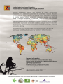
Advanced usages (with higher data requirements or more complex analysis setup) Biodiversity offsetting. Find areas that best compensate for ecological damage: how to expand the existing reserve network in a balanced manner to compensate for specific losses. Planning under climate change. Use present distributions and future distributions of biodiversity features, as well as connectivity between the present and future distributions to identify current and future areas of relevance. Targeting of habitat restoration or habitat management. Modeling of "difference made" by management/restoration is accounted for in a complicated and data demanding analysis. 4. Who can use Zonation? Zonation is available for free and can be used by anyone. Those working in conservation management, research, teaching, consulting, universities, NGOs, etc. may be interested in this software. There are no restrictions on the use of the software, except that the appropriate scientific references describing the methods used should be made in documents and presentations. While the Zonation software itself does not come with a license fee, there nevertheless is a price associated with using it. The time needed to understand and use the methods can, in fact, be quite long. Additionally, collating the input data is frequently a very time-consuming phase. Thus, Zonation is not a free lunch "do it all in a day" solution into spatial conservation planning. The structure of a Zonation project, resources needed, risks, and opportunities perceived by stakeholders are discussed in the open access article by Lehtomäki and Moilanen (2013). Zonation can be used by anyone working in systematic conservation planning, spatial conservation prioritization, reserve selection, site selection, reserve network design, or spatial conservation planning and related fields in general. Zonation can also be applied in the context of other land use planning where the focus is not on biodiversity conservation. While different methods and software implementations may have different strengths, we encourage you to compare alternatives in terms of the analytical options offered, size of data that can be analyzed, ease of use, etc. Zonation is also useful for teaching about spatial conservation prioritization. The Zonation v4 graphical user interface (GUI) is easy to use, and can also be used for investigating and visualizing input data. Quick introduction to Zonation - 6

![Final Report - [Almost] Daily Photos](http://vs1.manualzilla.com/store/data/005658230_1-ad9be13b69bd4f2e15f58148160b0f22-150x150.png)