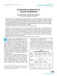
1
Analytical Methods for Dynamic Open
Channel Heat and Mass Transfer
Methodology for the Heat Source Model Version 7.0
Prepared by:
Matthew Boyd & Brian Kasper
The methods presented in this document formulate the programmed modules utilized by
Heat Source and TTools (versions 7.0). These computer models are used to create
spatial data sets for stream networks, simulate dynamic hydraulics and thermodynamics.
Appropriate use and application are the sole responsibility of the user.
This document may be downloaded from the web site at the following URL:
http://www.deq.state.or.us/wq/TMDLs/tools.htm
Updated February 12, 2003 & February 20, 2007
Cite this document as:
Boyd, M., and Kasper, B. 2003. Analytical methods for dynamic open channel
heat and mass transfer: Methodology for heat source model Version 7.0.
Analytical Methods for Dynamic Open Channel Heat and Mass Transfer
Methodology for the Heat Source Model Version 7.0
Table of Contents
CHAPTER I. INTRODUCTION
1.1 Overview of Methodology
1.1.1 The State of the Science
1.1.2 Acknowledgement of Limitations
1.2 Stream Heating and Cooling Processes
1.2.1 Common Nonpoint Sources of Stream Temperature Change
1.2.2 Point Sources of Stream Warming
1.2.3 Natural Sources of Stream Warming and Cooling
1.3 Model Application: Scope, Scale & Cumulative Effects
1.4 Salmonid Life Stage Thermal Ranges
1
2
6
7
9
20
21
23
24
CHAPTER II. HEAT TRANSFER
2.1 Overview
2.2 Solar Radiation
2.2.1 Solar Time Relative to Earth
2.2.2 Solar Position Relative to Earth
2.2.3 Solar Position Relative to Stream Position
2.2.4 Solar Radiation Heat above Topographic Features
2.2.5 Solar Radiation Heat below Topographic Features
2.2.6 Solar Radiation Heat below Land Cover
2.2.6 Solar Radiation Heat above Stream Surface
2.2.7 Solar Radiation Heat Penetrating the Stream Surface
2.2.8 Solar Radiation Heat Received by Water Column and Substrate
2.2 Longwave (Thermal) Radiation
2.3 Substrate Conduction Flux
2.4 Evaporation Flux
2.4.1 Evaporation Rate
2.4.2 Wind Functions
2.5 Convection Flux
2.6 Stream Temperature Simulation Method
2.6.1 Non-Uniform Heat Energy Transfer Methodology
2.6.2 Finite Difference Approximation
27
29
30
31
36
38
40
41
44
46
47
51
53
58
59
62
64
65
65
68
CHAPTER III. DYNAMIC MASS TRANSFER
3.1 Overview
3.2 Channel Geometry & Manning’s Relationships
3.3 Dynamic Hydraulic Flow Routing
3.3.2 Muskingum-Cunge Approximation
3.3.2 Explicit Finite Difference Method
3.3.3 Comparison of Methods
3.4 Quantifying External Mass Transfers
Page i
71
73
76
78
81
84
87
Table of Contents
Analytical Methods for Dynamic Open Channel Heat and Mass Transfer
Methodology for the Heat Source Model Version 7.0
3.4.1 Temperature Change Resulting from Mixing
3.4.2 Thermal Infrared Radiometry Derived Mass Balance Approach
3.4.3 Surface Inflows (Springs, Tributaries and Return Flows)
3.4.4 Subsurface Inflows (Seeps, Springs and Accretion Flows)
3.4.5 Hyporheic Flows
3.4.6 Evaporation Losses
3.5 Flow Volume Continuity
3.6 Controlled Flows and Depths
3.7 Dewatered Channels
3.8 Tendency to Stratify
87
88
92
93
94
97
98
99
99
99
CHAPTER IV. MODEL OPERATION
4.1 Overview
4.2 Finite Difference Steps
4.3 General Setup Procedure
4.3.1 General Inputs
4.3.2 Model Setup - Data Sheets
4.3.3 Model Setup – Continuous Data
4.3.4 Model Setup – Mass Transfer Data
4.3.5 Model Setup – TTools Data
4.3.6 Model Setup – Land Cover Codes and Attribute Associations
4.3.7 Model Setup – Morphology Data
4.3.8 Model Setup – Evaporation Rate Methods
4.3.9 Model Setup – Stream Bed Conduction
4.3.10 Model Setup – Physically Based Flow Routing Methods
4.3.11 Model Setup – Clear All Data Sheets
4.3.12 Model Setup – Validation Data
4.4 Executables
4.4.1 Executables – Shade-a-lator
4.4.2 Executables – Flow Router
4.4.3 Executables – Heat Source
4.5 Model Outputs
4.5.1 Chart – Diel Temperature
4.5.2 Chart – TIR Temperature
4.5.3 Chart – Longitudinal Temperature
4.5.4 Chart – Solar Flux
4.5.5 Chart – Heat Flux
4.5.6 Chart – Effective Shade
4.5.7 Other Output Data Worksheets
4.6 Common Sources of Problems
4.7 Dialogue Windows – Purpose and Meaning
4.7.1 Progress Window
4.7.2 Message Boxes
4.8 Other ‘Utility’ Applications
4.8.1 Land Cover Positioner
Page ii
101
102
102
103
104
105
108
111
111
113
118
119
120
121
122
123
124
125
126
127
127
128
129
129
130
131
131
133
134
134
134
137
137
Table of Contents
Analytical Methods for Dynamic Open Channel Heat and Mass Transfer
Methodology for the Heat Source Model Version 7.0
CHAPTER V. SPATIAL DATA DERIVATIONS
5.1 Introduction
5.2 Geospatial Data Overview
5.3 Aerial Imagery - Digital Orthophoto Quadrangles and Rectified Aerial Photos
5.3.1 Digitized Stream Position from Aerial Imagery
5.3.2 Stream Aspect
5.3.3 Channel Width from Aerial Imagery
5.3.4 Near Stream Land Cover Mapping from Aerial Imagery
5.4 Digital Elevation Model (DEM)
5.4.1 Stream Elevation
5.4.2 Stream Gradient
5.4.3 Topographic Shade Angle
5.5 Thermal Infrared Radiometry (TIR) Temperature Data
5.5.1 Overview of TIR Data
5.5.2 TIR Data Collection and Validation Methods
5.5.2 Interpretation of FLIR Images
5.5.3 TTools Sampling of TIR Data
5.6 Other TTools applications:
5.6.1 Stream Sinuosity
5.6.2 Meander Width Ratio
5.6.3 Entrenchment Ratio
5.7 Digitizing a Stream Layer
5.7.1 Cleaning and Unionizing a Stream Layer
5.7.2 Cleaning the Overshoots
5.7.3 Cleaning the Undershoots
5.7.4 Unionizing the Cleaned Stream Polyline
5.8 Digitizing Channel Width (Near Stream Disturbance Zone Width)
5.9 Digitizing Near Stream Land Cover
5.10 TTools Operation
Turning on the TTools Extension
Step 1: Segmenting the Stream and Calculating the Aspect
Step 2: Measuring Channel Widths
Step 3: Measuring Stream Elevation and Gradient
Step 4: Measuring Topographic Shade
Step 5: Sampling the Riparian Land Cover
Step 6: Sample FLIR Data
139
140
141
141
142
143
145
149
149
150
150
152
152
152
154
156
156
156
157
157
158
159
161
163
164
165
167
175
175
176
177
177
178
179
181
Symbols
183
References
189
Page iii
Table of Contents
Analytical Methods for Dynamic Open Channel Heat and Mass Transfer
Methodology for the Heat Source Model Version 7.0
Chapter
I
Introduction
Statement of Purpose, Acknowledgement of Limitations and
Overview of Heat and Mass Transfer
Varied landscapes, complex morphology and multiple land uses are common challenges in water
temperature analysis (Nehalem River, Oregon)
1.1 OVERVIEW OF METHODOLOGY
This document is intended to serve as a reference for the stream heat and
mass transfer analytical methodology Heat Source 1 . Chapters that follow
describe in detail the mathematics and solution techniques suited for heat and
mass transfer quantification. Simulation of water temperature and flow dynamics
over various scales (i.e. reach, watershed to basin scales) is made possible with
high resolution spatially continuous data, coupled with deterministic modeling of
hydrologic and landscape processes. These processes are often interrelated
and occur simultaneously (and can amplify or mask the effect of other
processes). The methods presented in this paper are predicated foremost on
data accuracy and resolution, and then analytical methodology robustness.
1
Heat Source model is comprised of modules that can simulate dynamic open channel hydraulics, flow
routing, heat transfer, effective shade and stream temperature. This documentation is developed to support
Heat Source version 7.0.
Page 1
Chapter I - Introduction
Analytical Methods for Dynamic Open Channel Heat and Mass Transfer
Methodology for the Heat Source Model Version 7.0
Methods for spatial data derivation have been developed and packaged as
an ArcView (version 3.0 or higher) extension, and is referred to as TTools 2 . The
sampling methods within TTools allow for continuous measurements of channel
morphology, land cover and topography. Spatial data derivations sampled and
calculated by TTools are then imported into Heat Source as data inputs.
Heat Source consists of a Microsoft Excel (version 2000 or higher)
spreadsheet that contains model input and output. No calculations are made in
the spreadsheet itself. Instead, Visual Basic programming computes all dynamic
mass and heat transfer simulation algorithms. Modules (executables) include
simulation of effective shade, comprehensive heat and mass transfer and water
temperature (these modules, along with setup routines, are controlled from a
central ‘Main Menu’).
1.1.1 THE STATE OF THE SCIENCE
The models used for stream temperature prediction are becoming
standardized and widely available. However, data availability and the increased
ease of monitoring, coupled with aerial imagery, GIS data and remote sensing,
and finally model operation considerations, offer significant advancements in
stream temperature analysis.
RIVERS AND STREAMS ARE THERMALLY UNIQUE
A definition of stream temperature uniqueness recognizes that the
longitudinal temperature profile, as well as spatial and temporal dynamics
defined at virtually any scale, applies only to one stream, river or network.
Recently published literature is offering the scientific community evidence that
stream and river systems are not only hydrologically and thermally unique, but
also complex (Boyd M. and B. Kasper 2002, Faux et al. 2001, Torgersen et al.
2001, Torgersen et al. 1999, Torgersen et al. 1995). Stream temperature
distributions are highly characteristic of individual stream/river reaches and these
unique temperature patterns are expressed inter-annually.
An example of unique thermal patterns between similar streams can be found
in the North and South Forks of the Sprague River. Thermal infrared radiometry
(TIR) measured stream temperature data suggest that the North and South Forks
of the Sprague River exhibit temperature dynamics specific to each stream
across multiple scales. Both stream have similar summertime low flows of ≈0.85
cms (≈30 cfs) and originate from similar sized drainages with similar topography,
geology and land use patterns. TIR sampling occurred within the same period of
the day ≈4:00 PM on August 12 and August 16, 1999 (see Figure 1.1). Despite
these apparent similarities, each stream exhibits different stream temperature
patterns. The reasons for these thermal differences are found in the cumulative
effects of highly variable characteristics of the land cover, morphology, mass
transfer inflow and withdrawal distributions (Boyd and Kasper 2002).
2
TTools sampling Tool samples spatial data sets such as stream position, elevation, gradient, channel
width, topographic shade and land cover types from GIS data at user defined intervals. This documentation
is developed to support TTools version 7.0.
Page 2
Chapter I - Introduction
Analytical Methods for Dynamic Open Channel Heat and Mass Transfer
Methodology for the Heat Source Model Version 7.0
24
TIR Measured Stream Temperature (oC)
South Fork
22
16:04-16:31 August 12, 1999
North Fork
20
18
16
FIGURE 1.1
TIR Sampled Stream
Temperature Patterns
for the North and
South Fork Sprague
River
14
16:20-16:44 August 16, 1999
12
10
0
5
10
15
20
25
30
35
40
45
50
8
Stream Kilometer
HOW DOES HEAT SOURCE ADDRESS THESE UNIQUE THERMAL PATTERNS?
With recognition of the unique thermal dynamics of streams and rivers comes
the need for an analytical framework that accommodates the variability and
spatial distributions inherent to land cover, morphology and hydrology. The past
ten years have brought about increased use of remote sensing, computational
power and ease of programming, ground level data collection methods, and other
improvements that are all part of the basis for proposing an improved stream
temperature analytical framework.
Analytical Methodology Robustness
Heat Source was born out of the exploration of the causal factors that affect
dynamic thermal regimes, with a focus on the data and methods suited for
riverine thermodynamics and hydrodynamics that capture complex analytical
procedures, robust and comprehensive methods and considerations for the
interrelatedness between parameters. Important processes are included in the
methodology, such as: mass transfers from tributaries, groundwater inflows,
landscape thermal radiation, adiabatic cooling, robust radiation modeling,
multiple evaporation methods, and complex hydrodynamic routing with hyporheic
exchange within the substrate, to name a few. Very few efforts of simplification
are evident in the methodology, and instead, the inclusion of all complex
processes is generally the guiding principle in the methodology development and
application.
Aside from computational speed, analytical modeling can be performed using
deterministic methods over relatively small time and distance finite difference
steps. Model operation resolution should match the dynamic nature of stream
temperature that tends to occur over small scales across a variable landscape,
and sometimes in a brief period of time.
High Resolution Application of the Methodology
By design, spatial input data is derived and sampled at a high resolution,
offering a second source of robustness. This method of stream temperature
simulation minimizes assumptions and includes all input parameters, even those
Page 3
Chapter I - Introduction
Analytical Methods for Dynamic Open Channel Heat and Mass Transfer
Methodology for the Heat Source Model Version 7.0
considered by some to be less important and/or too difficult to quantify. Simply
stated, model robustness is also derived from high input data resolution (in
addition to the analytical methodology, scope and input data types).
The authors contend that coarse application of the methodology will cause
output errors (the model will perform poorly) because the impacts of human,
landscape and hydrologic influences often occur at a high spatial resolution.
Observed or simulated stream temperatures result from a multitude of
parameters and processes. Even small changes (or omissions) in these
parameters or processes (both thermal and hydrologic) may cause significant
temperature changes. By definition, such changes are cumulative effects. The
methodology is intended to be applied over large scales (i.e. network scale) with
the intent of capturing cumulative effects.
These forms of robustness manifest themselves with results that are typically
accurate, data driven and inherently unbiased by underlying simplifications or
assumptions (because they are minimized to the best practical extent).
A New Way to Model Hydrology and Water Quality
For these reasons, Heat Source represents part of a growing shift in stream
temperature analytical approach. This shift is facilitated by the application of
model inputs derived from rich spatial data sources and analytically robust
methods designed to analyze stream temperature dynamics at any level of
complexity. Rejection of model simplification, and instead, embracing the rigors
of data and analytical complexity is the basis for the model. Generalizations only
apply to basic thermodynamic (heat transfer physics) and physically based
processes (mass transfer physics). Generalizations of thermodynamic behavior
cannot be made at all, until that is, a comprehensive data rich analysis has been
conducted at a network scale. An acknowledgement of thermal uniqueness
requires investigators of water temperature dynamics to challenge
generalizations in the literature and perform analysis without preconceived
notions of parameter and process sensitivity, and ultimately, model outputs.
A COMPREHENSIVE ANALYTICAL APPROACH
As a rule, a comprehensive analysis should be data rich, draw from deterministic
methods, operated at high resolution and provided statistically validated results.
So you want to complete a comprehensive stream temperature assessment?
Or perhaps you need to calculate the thermal effect of solar radiation exposure to
a water body? What is the thermal effect of a point source? Each question
raises others. What are the flow dynamics inherent to a stream? What heat
transfer processes dominate, and which are of lesser importance? Which
parameters are within human control? What are the cumulative impacts of mass
and heat transfer? The list of questions directed at a stream temperature
analytical effort can often be quite long (and is always much longer than the list
of preceding questions).
Regardless of whether the study area is large and complex or simply a
stream segment, a primary question posed in this section is, “what is a
comprehensive assessment?” The answer to this question seems to have
changed recently, as data collection and analytical techniques have evolved over
past several years. A comprehensive assessment utilizes integrated remotely
Page 4
Chapter I - Introduction
Analytical Methods for Dynamic Open Channel Heat and Mass Transfer
Methodology for the Heat Source Model Version 7.0
sensed and ground level continuous temperature data, weather data, channel
morphology, hydraulics and near stream land cover data. Sampled GIS data
should be incorporated into the analysis for many of these parameters. When
possible, thermal infrared remote sensing should be used to quantify stream
mixing, thermal gradients and mass transfer processes that cannot be measured
at the ground level. Other forms of spatial data allow quantification of topography
and land form. Model inputs can be dramatically improved simply by drawing
from morphologic and land cover assessments methods (i.e. Kovalchik 1987,
Hall 1998, Rosgen 1996).
Amidst these advances, some factors have remained constant. You will not
have all the data that you want. Unresolved questions will remain when you are
finished with your analytical effort. While our ability to measure and quantify
landscape and hydrologic processes has dramatically improved over the last
decade, there remain several limitations for some parameters, and these are
often compounded by the limited resources often available for these analytical
efforts. Therefore, we simply cannot address stream temperature in all of its
complexity. Although analytical modeling is helpful in understanding the
interrelated hydrodynamic and thermodynamic processes associated with stream
temperature, it is not a panacea. Let me quickly explain before you toss this
document in the recycling bin.
While many heat and mass transfer processes are well understood and even
easily measured (and independently modeled) at various levels of complexity
(i.e. flow, shade, humidity, wind speed, etc.), the variation and interdependence
of some of these parameters across a drainage is poorly documented. For
example, near stream microclimates that control humidity, wind speed and air
temperature are a function of the near stream land cover type and condition, as
well as topography and atmospheric processes. Since the physical attributes of
both land cover and topography vary in spatial distributions, often dramatically,
we should assume that microclimates also vary across the landscape. Spatial
variability is compounded by the temporal variation associated with atmospheric
parameters. Now consider that data collection methods are not available to
quantify this variability. Consequently, such complexity (variability and
interdependence) is not easily accounted for in most analytical methods, at least
in a practical sense. Further, even if algorithms are developed to simulate these
processes, validation of model performance will be difficult due to the
aforementioned data and instrumentation limitations, along with methodology
limitations. The result is that microclimates are not included in stream
temperature analysis in a complete fashion.
Changes in rates of heat transfer can vary considerably across relatively
small spatial and temporal scales. In quantifying and understanding stream heat
and mass transfer processes, the challenge is not represented in theoretical
conceptions of thermodynamics and relations to flowing water. Thermodynamics
is a well-established academic discipline that offers a scientifically tested
methodology for understanding stream temperature. In fact, the methodology
used to evaluate stream temperature is quite simple when compared to other
thermodynamic applications that have become common technological
necessities to the American way of life (i.e. a car radiators, cooling towers, solar
thermal panels, insulation, etc.). Instead, the true challenge in understanding
stream temperature materializes with the recognition that thermally significant
heat and mass transfer processes occur in very fine spatial and temporal scales.
Tremendous spatial variability occurs across a watershed, and is compounded
Page 5
Chapter I - Introduction
Analytical Methods for Dynamic Open Channel Heat and Mass Transfer
Methodology for the Heat Source Model Version 7.0
by adding the temporal component. At any stream reach, thermal processes
constantly change throughout the day, month and year. Stream temperatures
are a result of a multitude of heat transfer and mass transfer process. The
conceptual and analytical challenge is to develop a framework that captures
these forms of variability to the best possible extent while constantly investigating
potential analytical improvements.
The recognition of limitations, such as those presented by microclimates, is
important for several reasons. While these limitations outline potential areas of
weakness in the methodology presented in this document, acknowledgement of
data and methodology weaknesses makes it possible to undertake a
comprehensive approach, define the limitations, maintain credibility and identify
future research needs. Acknowledgement of the limitations is in accordance with
the scientific method and recognizes that analytical efforts should provide a
rigorous, comprehensive, statistically valid and advanced treatment of stream
temperature dynamics.
1.1.2 ACKNOWLEDGEMENT OF LIMITATIONS
Capturing and understanding the thermally important parameter variation
across a complex landscape, coupled with quantifying hydrology and morphology
parameters and variation, is a common challenge before us. Identifying specific
limitations, increases analytical credibility and focuses our efforts on future
monitoring and analytical advancements.
Page 6
•
At any scale, it is challenging to capture spatial variability in stream and
landscape data. Ground level measurements are particularly unsuited for
detecting spatial variability.
•
Simple instream measurements of flow above and below a study reach can
be insufficient to detect subsurface interactions with the stream due to
instrumentation limitations. Without remote sensing, such data may not
describe high-resolution instream flow conditions making validation of derived
mass balances difficult. While analytical techniques exist for describing
subsurface/stream interactions, they may be beyond the scope of an effort
with regard to data availability, technical rigor and resource allocations.
•
Water quality issues are complex and interrelated. The state of the science is
still evolving in the context of landscape scaled water quality analysis. The
degree to which one parameter affects another, may not be fully understood.
Analytical methods may capture primary effects, but miss secondary (more
subtle) effects. An example is the relationship between channel form/function
and flood plain land cover distributions. While both can be quantified
independently, the extent that each affects the other may be variable and/or
site specific, and therefore not easily quantified in a broad application such as
Heat Source.
•
Land use patterns often vary through any drainage from heavily impacted
areas to areas with little human impacts. However, it is often difficult to find
large areas without some level of either current, past or upstream human
impacts. Few sites represent historical conditions. Further, some human
impacts are ‘permanent’ in the context of geologic time scales. Attempts at
simulating historical conditions cannot be validated and are likely inadequate
Chapter I - Introduction
Analytical Methods for Dynamic Open Channel Heat and Mass Transfer
Methodology for the Heat Source Model Version 7.0
on multiple counts. Modeling applications should consider the degree of
divergence between the hypothetical simulation conditions and the calibrated
model condition.
•
Uncertainties will persist, since stream temperature dynamics are complex
and analytical methods have limitations. With this acknowledgement of
limitations comes the responsibility to use your experience, consult with
others when needed, engage in scientific reviews of your work and document
limitations inherent to model output and interpretations of results. Always
statistically validate model results so that others can easily recognize model
performance and advise others to use your results appropriately.
•
With recognition of inherent complexity in mass and heat transfer, avoid
simple analytical techniques that fail to capture the multitude of important
stream parameters and processes that affect stream thermodynamics.
Stream temperature does not easily lend itself to simple statistical analysis.
For example, simple regression analysis can result in spurious correlations
that offer limited or poor insight into the complex thermodynamic and
hydrologic processes that vary over space and time.
•
As a general rule, do not use a model to create data that can be measured. It
is usually cheaper to measure stream temperature via ground level and
remote sensing than to derive simulated temperature data. Obviously,
measured values (i.e. ground level and remotes sensing) are more accurate
than modeled results.
1.2 STREAM HEATING AND COOLING PROCESSES
Parameters that affect stream temperature can be grouped as near stream
land cover (vegetation), channel morphology and hydrology. Many of these
stream parameters are interrelated (i.e., the condition of one may impact one or
more of the other parameters). These parameters affect stream heat transfer
processes and stream mass transfer processes to varying degrees. The
analytical techniques employed to evaluate stream temperature can be designed
to include all of the parameters that affect stream temperature provided that
available data and methodologies allow accurate quantification.
Page 7
Chapter I - Introduction
Analytical Methods for Dynamic Open Channel Heat and Mass Transfer
Methodology for the Heat Source Model Version 7.0
Factors that Affect Stream
Temperature
Channel
Morphology
•Gradient/Sinuosity
•Bank Erosion
•Stream/Floodplain Connection
•Channel Width/Depth
Hydrology
•Channel Geometry
•Flow Volume/Regime
•Substrate
•Shear Velocity
•Point Sources
•Withdrawals/Augmentation
Near Stream
•Hyporheic Flows
Vegetation
•Sedimentation
•Vegetation Condition/Type
•Effective Shade
•Floodplain Roughness
•Bank Stability
•Microclimate
(Many of these parameters are interrelated)
Regardless of scale, stream temperature dynamics are complicated when
these three parameters (i.e. near stream land cover, channel morphology and
hydrology) are evaluated. Many parameters exhibit considerable spatial
variability. For example, channel width measurements can vary greatly over
small stream lengths. Some parameters can have a diurnal and seasonal
temporal component as well as spatial variability. Analytical approaches
developed for stream temperature assessment that consider all of these
parameters must rely on ground level, GIS data and remotely sensed spatial
data. To understand temperature on a landscape scale is a difficult and often
resource intensive task. General analytical techniques employed to evaluate
stream temperature are statistical and deterministic modeling of hydrologic and
thermal processes.
Water temperature change (ΔTw) is a function of the heat transfer in a
discrete volume and may be described in terms of changes in heat per unit
volume. With this basic conceptual framework of water temperature change it is
possible to discuss stream temperature change as a function of two variables:
heat and mass transfer.
Water Temperature Change as a Function of Heat Exchange per Unit Volume,
ΔTw ∝
ΔHeat
Volume
(1-1)
1. Heat transfer relates to processes that change heat in a defined water
volume. There are several thermodynamic pathways that can introduce or
remove heat from a stream. For any given stream reach heat exchange is
closely related to the season, time of day and the surrounding environment
and the stream characteristics. Heat transfer processes can be dynamic and
Page 8
Chapter I - Introduction
Analytical Methods for Dynamic Open Channel Heat and Mass Transfer
Methodology for the Heat Source Model Version 7.0
change over relatively small distances and time periods. Several heat
transfer processes can be affected by human activities.
2. Mass transfer relates to transport of flow volume downstream, instream
mixing and the introduction or removal of water from a stream. For instance,
flow from a tributary will cause a temperature change if the temperature is
different from the receiving water. Mass transfer commonly occurs in stream
systems as a result of advection, dispersion, groundwater exchange,
hyporheic flows, surface water exchange and other human related activities
that alter stream flow volume.
1.2.1 COMMON NONPOINT SOURCES OF STREAM TEMPERATURE CHANGE
A dominant purpose for analytical modeling is to quantify human-related
stream change. Brown (1969) identified temperature change as a function of
heat and stream volume (1-1). Using this simple relationship, it becomes
apparent that stream temperature change is a function of the heat transfer
processes and mass transfer processes. To isolate the human influence on this
expression, it is important to associate the human influence on the heat transfer
processes and/or mass transfer processes.
Effective shade is consistently identified in the literature as an important
thermal control that is often influenced by human activity. The combined effect of
land cover physical attributes and channel morphology control the timing and
extent of effective shade cast upon the stream surface. It is important to
consider that land cover type and condition affects, and is affected by, channel
morphology (bank stability, shallow ground water characteristics, riparian nutrient
cycles, aerobic or anaerobic rooting conditions, etc.). A meaningful assessment
of effective shade should include both land cover and morphologic spatial data
and analysis.
Flow volume is also an important thermodynamic and hydrologic parameter
that is subject to obvious human manipulations. Many parameters are affected
by flow volume. In fact, the flow regime of a riverine system formulates the basic
connectivity of instream and riparian processes. The thermodynamic influences
of the flow regime cannot be easily summarized simply because of the wide and
diverse influences that flow has upon the thermal regime.
Page 9
Chapter I - Introduction
Analytical Methods for Dynamic Open Channel Heat and Mass Transfer
Methodology for the Heat Source Model Version 7.0
Factors that Affect Stream
Temperature
Channel
Morphology
•Gradient/Sinuosity
•Bank Erosion
•Stream/Floodplain Connection
•Channel Width/Depth
Hydrology
•Channel Geometry
•Flow Volume/Regime
•Substrate
•Shear Velocity
•Point Sources
•Withdrawals/Augmentation
•Hyporheic Flows
•Sedimentation
•Vegetation Condition/Type
•Effective Shade
•Floodplain Roughness
•Bank Stability
•Microclimate
Near Stream
Vegetation
Important thermal parameters
that are highly sensitive to
human activities and that
significantly affect the stream
temperature regime include:
• Effective Shade (Controlled
by near stream vegetation
and channel morphology)
• Stream Flow (Controlled by
withdrawals, augmentation
and discharge from point
sources)
(Many of these parameters are interrelated)
The following subsections expand upon the role of effective shade and flow
volume in recognition that these two parameters are often implicated in human
caused stream temperature modifications.
LAND COVER, MORPHOLOGY AND EFFECTIVE SHADE
The solar radiation heat process considered in the stream thermal budget is
often the most significant heat transfer process and can be highly influenced by
human-related activity. Decreased levels of stream shade increase solar
radiation loading to a stream. The primary factors that determine stream surface
shade are near stream land cover type (and associated physical characteristics)
and channel morphology. Near stream land cover height controls the shadow
length cast across the stream surface and the timing of the shadow. Channel
width determines the shadow length necessary to shade the stream surface.
Near stream land cover and channel morphology are often interrelated.
Stream bank erosion rates are often a partial function of near stream land cover
type and condition. Similarly, the type of land cover that can establish, grow and
reproduce at any given near stream site is a partial function of the hydrologic
regime, the subsurface water table dynamics and the floodplain condition. An
obvious feedback mechanism exists between channel morphology and land
cover establishment and success. Human activities that change the type or
condition of near stream land cover and/or alter stream channels (beyond what is
considered channel equilibrium dimensions) will likely result in altered stream
surface shading patterns. By definition, a decrease in stream surface effective
shade will have a warming effect upon water temperature.
Page 10
Chapter I - Introduction
Analytical Methods for Dynamic Open Channel Heat and Mass Transfer
Methodology for the Heat Source Model Version 7.0
Examples of Two Different Land Cover and Morphology Conditions
Meadow complex with high rates of summertime heating, little effective shade, unstable
stream banks, a pattern of downcutting, lowered floodplain water tables and wide/shallow
morphology (Sycan River, Oregon)
Another meadow complex with minimal summertime heating, moderate effective shade,
stable stream banks, high flood plain water table (Sprague River, Oregon)
Page 11
Chapter I - Introduction
Analytical Methods for Dynamic Open Channel Heat and Mass Transfer
Methodology for the Heat Source Model Version 7.0
Relationships Between Effective Shade, Near Stream Vegetation and
Channel Morphology
Effective Shade is a Function of Two Interrelated Parameters:
Land Cover and Morphology
Page 12
Chapter I - Introduction
Analytical Methods for Dynamic Open Channel Heat and Mass Transfer
Methodology for the Heat Source Model Version 7.0
EFFECTIVE SHADE: DEFINED AND DESCRIBED
Stream surface shade is an important parameter that controls the stream
heating derived from solar radiation. Recall that solar radiation has the potential
to be the largest heat transfer mechanism in a stream system. Human activities
can degrade near stream land cover and/or channel morphology, and in turn,
decrease effective shade. It follows that human-caused reductions in stream
surface shade have the potential to cause significant increases in heat delivery to
a stream system. Stream shade levels can also serve as an indicator of near
stream land cover and channel morphology condition. For these reasons, stream
shade is traditionally a focus of stream temperature analysis.
Table 1.1
Factors that Influence Stream Surface Shade
Blue – Not Influenced by Land Management
Red - Influenced by Land Management
Season/Time:
Stream Morphology:
Geographic Position:
Land Cover:
Solar Position:
Date/Time
Aspect, Channel Width, Incision
Latitude, Longitude, Topography
Near Stream Land cover Height, Width, Density
Solar Altitude, Solar Azimuth
In the Northern Hemisphere, the earth tilts on its axis toward the sun during
summertime months allowing longer day length and higher solar altitude, both of
which are functions of solar declination (i.e., a measure of the earth’s tilt toward
the sun). Geographic position (i.e., latitude and longitude) fixes the stream to a
position on the globe, while aspect provides the stream/riparian orientation. Near
stream land cover height, width and density describe the physical barriers
between the stream and sun that can attenuate and scatter incoming solar
radiation (i.e., produce shade). The solar position has a vertical component (i.e.,
solar altitude) and a horizontal component (i.e., solar azimuth) that are both
functions of time/date (i.e., solar declination) and the earth’s rotation (i.e., hour
angle measured as 15o per hour). While the interaction of these shade variables
may seem complex, the mathematics that describes them is relatively
straightforward geometry (see Figure 1.2). Using solar tables or mathematical
simulations, the potential daily solar load can be quantified. The measured solar
load at the stream surface can easily be measured with a Solar Pathfinder©,
hemispherical canopy photography or estimated using mathematical shade
simulation computer programs (Boyd, 1996, Chen 1994, Park, 1993).
Page 13
Chapter I - Introduction
Analytical Methods for Dynamic Open Channel Heat and Mass Transfer
Methodology for the Heat Source Model Version 7.0
FIGURE 1.2
Shade geometric relationships and effective shade definition
Page 14
Chapter I - Introduction
Analytical Methods for Dynamic Open Channel Heat and Mass Transfer
Methodology for the Heat Source Model Version 7.0
EFFECTIVE SHADE: CASE STUDIES
Recent studies have isolated the thermal effects of solar loading, and
consequently, the importance of stream surface shade in moderating localized
increases in water temperature. Through controlled water bath studies Moore et
al. (1999) found solar radiation to be a warming influence in both daily maximum
and daily minimum water temperatures. The study was conducted in varying
locations (at various elevationsand climatic conditions) in Oregon and found
similar results at each study site (see Figure 1.3).
The Effect of Shade on Water: A Tub Study
J. Moore, J. Miner and R. Bower
Department of Bioresource Engineering
Oregon State University - 1999
Two tanks with equal volumes of water and similar initial temperatures were insolated on
the sides and bottom. One was exposed to August solar radiation, while the other was
completely shaded. Results are presented in the graph below.
FIGURE 1.3
Solar Radiation ‘Tub’ Study: Effect of Shade on Water is Apparent (Moore et al. 1999)
Page 15
Chapter I - Introduction
Analytical Methods for Dynamic Open Channel Heat and Mass Transfer
Methodology for the Heat Source Model Version 7.0
Petersen et al. (1999) closely monitored central Oregon irrigation ditches in
control and shaded test conditions and found that shade overwhelmingly
influenced flowing water heating rates. Of particular importance was the
discovery that even small increases in shade produced measurable decreases in
water temperature. The study also found that air temperature is a minor thermal
parameter.
The Impact of Shade on the Temperature of Running Water
B. Petersen, T. Stringham and W. Krueger
Department of Rangeland Resources
Oregon State University - 1999
Results
"Shade from tarps provided a significant amount of protection from additional heating of
the water at all shade levels tested… affirms the importance of even small amounts of
shade in moderating stream heating."
Conclusion
"At the scale of this study, air temperature appears to have a minor impact on the
temperature of water. The dominant factor seemed to be solar radiation."
In the Upper Grande Ronde River, remotely sensed TIR stream temperature
data and effective shade comparisons mimic the results found by Moore et al.
(1999) and Petersen et al. (1999). Lack of shade corresponds to increased rates
of stream temperature heating, while moderate increases in effective shade
correspond to lower rates of stream heating (see Figure 1.4). While we should
always start discussions of stream temperature with an acknowledgement of
complexity, simply matching observed (measured) thermal responses to
theoretical science can serve as a powerful method of assessment.
Poor shade results from near stream vegetation removal and is compounded by channel
morphology response to near stream vegetation removal (Vey Meadow, Grande Ronde
River, Oregon)
Page 16
Chapter I - Introduction
Analytical Methods for Dynamic Open Channel Heat and Mass Transfer
Methodology for the Heat Source Model Version 7.0
With this context, the TIR and instream temperature data was collected for
the Grande Ronde River on August 4, 1999. From the TIR data (flown around
4:00 PM) it is apparent that stream temperatures are warmer at the end of the
meadow by roughly 3oC where shade levels are very low (near zero) when
compared to the upstream temperatures entering the meadow. Stream heating
is moderated by increased shade levels (20% to 40%) in the forested
downstream reach. Further, a close inspection of the graph reveals
corresponding cooler temperatures associated with minor increases in shade
levels. This observation fits well with the accepted body of science; the literature
supports the theory that shade has a moderating effect upon stream
temperatures.
Forested
Meadow
100%
22
75%
Direction
of Flow
21
50%
Shade
20
25%
Effective Shade
TIR Stream Temperature (*C)
23
TIR Stream Temperature
196
195
194
193
192
191
190
0%
189
19
River Mile
FIGURE 1.4
TIR derive stream temperature data and effective shade modeling indicate that 3oC
stream heating corresponds to reduced shade distributions. Reduced rates of stream
heating are apparent in the shaded (forested) downstream reach (Vey Meadow, Grande
Ronde River, Oregon).
Terminology used to describe the observed thermal response can be
complex, and rather academic. Terms such as ‘cooling’ and ‘heating’ imply a
change over distance or time. The temporal change in temperature should be
referred to as a ‘rate’. The spatial change in temperature should be referred to
as a ‘gradient’. For example, in the meadow (unshaded) reach, the above plot
shows a 0.6oC change per river mile and 1.3oC change per hour. In the forested
(shaded) reach, the above plot shows a -0.4oC change per river mile and 1.2oC
change per hour. By definition, the meadow reach has a heating gradient and
the forested reach has a cooling gradient. Both reaches have rates of heating
Page 17
Chapter I - Introduction
Analytical Methods for Dynamic Open Channel Heat and Mass Transfer
Methodology for the Heat Source Model Version 7.0
(over the time period 8:00 to 16:00), however, the rate of heating is less in the
forested reach than in the meadow reach.
This discussion of semantics is necessary simply because the terms heating
and cooling are used so frequently without reference to the dimension (space or
time) over which the change is occurring. Statements are often made that shade
cannot cool water, but instead, shade only reduces stream warming. Such a
generalization is true as long as the dimension of change is time. Spatial
representations of shade-induced stream temperature change can, however,
represent cooling gradients (see Figure 1.5). It becomes easy to see that as
streams heat over time at variable rates, that actual temperatures at specific
locations will be different. With this background, the temperature change over
distance will likely represent cooling gradients in shaded stream reaches. In this
context the generalization that shade does not cool water is in fact incorrect,
overly simple and poorly defined.
Aside from the terminology of heating and cooling, we do not want to lose
focus of the primary finding represented in the temperature and shade
comparison. The lack of shade correlates to warmer stream temperatures. This
finding is consistent with the literature and theoretical constructs of stream
temperature dynamics.
Spatial and Temporal Stream Temperature Profile Changes
T16:00 = 22.8oC
T16:00 = 21.7oC
Direction
of Flow
Meadow
Reach
o
o
1 .3
191.9
189.0
C
hour
ΔT
Δx
o
o
1 .2
T16:00 = 20.0oC
C
0 .6
mile
C
− 0 .4
mile
C
hour
T8:00 = 12.2oC
ΔT
Δt
196.7
Forested
Reach
Distance (River Miles)
FIGURE 1.5
Rates of temperature change over time and distance (Vey Meadow, Grande Ronde
River, Oregon).
Page 18
Chapter I - Introduction
Analytical Methods for Dynamic Open Channel Heat and Mass Transfer
Methodology for the Heat Source Model Version 7.0
STREAM FLOW MODIFICATIONS
The simple relationship presented by Brown (1969) ( ΔTw ∝
ΔHeat
Volume
)
demonstrates that large volume streams are less responsive to temperature
change, and conversely, low flow streams will exhibit greater temperature
sensitivity (and greater rates of stream temperature change). Specifically,
stream flow volume will affect the wetted channel dimensions (width and depth),
flow velocity (and travel time) and the thermal assimilative capacity 3 . Human
related reductions in flow volume can have a significant influence on stream
temperature dynamics, most likely increasing diurnal variability in stream
temperature.
Beyond the simple conception of reduced flow and corresponding reduced
thermal assimilative capacity, flow modifications can be highly complex in nature.
Diversions can reroute surface waters through irrigation systems of various
efficiencies. Often a portion of irrigated water returns to the stream system at
some down gradient location. For example, diversions route water (over varying
distances) in canals and irrigation systems causing an immediate decrease in
instream flow volume. A secondary effect is that the portion of irrigation flows
returned to the stream system is often very warm, further increasing instream
temperatures. Remotely sensed TIR stream temperature data is particularly
suited to detecting these warmed return flows.
Other important considerations include altered instream hydraulics and
wetted channel dimensions. Flow velocity and travel times are highly related to
flow volume. Reduced flow velocity will translate to reduced shear stress and
dispersion, which result in obvious changes water column mixing. A well mixed
stream segment may become poorly mixed or stratified when flow volumes and
corresponding flow velocities are reduced from instream withdrawals or natural
low flow conditions.
3
The thermal assimilative capacity refers to an amount of heat a water column can receive to meat a
desired condition (i.e. temperature).
Page 19
Chapter I - Introduction
Analytical Methods for Dynamic Open Channel Heat and Mass Transfer
Methodology for the Heat Source Model Version 7.0
1.2.2 POINT SOURCES OF STREAM WARMING
Multi-Spectral and thermal infrared radiometry (TIR) of a point source discharge and
mixing zone measure the direct thermal effect (Tualatin River, Oregon). The warm waste
water discharge (22oC) is located at the white arrow and is received into 17.4oC river
water.
19.5
Waste Water Discharge
Temperature
(22oC)
Thermal Infrared Derived
Water Temperature (*C)
(8 Aug 1999)
19.0
Mixed Temperature
Increase Resulting
from Dischange
(1.6oC)
18.5
18.0
Flow
Receiving Water
(17.5oC)
17.5
17.0
Point of Waste
Water Discharge
65
64
63
62
61
60
59
58
57
56
16.5
Tualatin River (KM from mouth)
FIGURE 1.6
Measured TIR data indicates a 1.6oC increase in water temperature after complete mix
(Tualatin River, Oregon).
Page 20
Chapter I - Introduction
Analytical Methods for Dynamic Open Channel Heat and Mass Transfer
Methodology for the Heat Source Model Version 7.0
The discharge of waste water into receiving waters can affect a thermal
change if the two waterbodies have different temperatures. The receiving waters
will change heat as a function of thermal differences and mass transfer from
point sources. Associated temperature changes resulting from a discharge (after
complete mixing with the receiving water) will have a more profound thermal
effect when mass transfer rates are large and the temperature of the point source
is different than the receiving water. It is important to keep in mind that most
stream and river temperatures have daily and seasonal temperature fluctuations,
while point source discharges tend to remain fairly constant. Therefore, the
thermal effect of a point source on a receiving waterbody will also follow a diurnal
cycle, with maximum thermal effects occurring when the receiving water and
stream temperatures are most dissimilar (typically at night in the diurnal cycle or
seasonally in winter).
1.2.3 NATURAL SOURCES OF STREAM WARMING AND COOLING
Stream and river temperatures are dynamic over large spatial scales,
regardless of anthropogenic activities and human sources of heating/cooling.
Dynamic temperature change rates and gradients are reflective of variable
background conditions. And, the temporal variability in natural background
hydrology, land cover succession and morphology combine to create a complex
and somewhat dynamic background thermal condition. The thermal background
condition is a range instead of a static condition.
Natural sources that may elevate stream temperature above background
conditions include scouring effects on morphology and floodplain vegetation,
drought, fires, insect damage to near stream land cover, diseased near stream
land cover and windthrow and blowdown in riparian areas. The processes in
which natural sources affect stream temperatures include increased stream
surface exposure to heat transfer processes, altered microclimates and flow
modifications. Legacy morphology conditions and land cover distributions can
sometimes be caused by natural disturbances. Overall, the extent of natural
disturbances on near stream land cover, channel morphology and hydrology is
not well documented and complicated by geologic time scales.
Factors that cool streams and rivers that are of non-human origin can be
broken into mass and heat transfer sources. Conditions that reduce radiant heat
exposure will prevent or reduce rates of stream heating, and in some cases
reduce stream heating rates and gradients. Such conditions include the
persistent effects of shade produced from riparian vegetation, stream surface
area reduction via healthy equilibrium morphology, and cool near stream
microclimates that occur in well vegetated riparian corridors. There are also
episodic cooling effects that reduce radiant heat exposure such as cloudiness (or
any other form of vapor and particulate matter in the overlaying air mass) and
cool air temperatures that reduce thermal radiation emission from the
atmosphere, vegetation and topography that is received by a stream.
Natural mass transfers of inflow (tributaries, springs, etc.) can obviously heat
and cool the receiving water. Typically subsurface water is cooler than surface
water. Cooler subsurface waters tend to come from deeper ground water
sources and snowmelt sources. Shallow groundwater and hyporheic flows
typically have warmer temperatures relative to deep cold subsurface sources of
flow. As with any generalization, there are exceptions. And, no generalizations
Page 21
Chapter I - Introduction
Analytical Methods for Dynamic Open Channel Heat and Mass Transfer
Methodology for the Heat Source Model Version 7.0
can be made when considering the effects of surface inflows and confluences
since each stream system and waterbody has a unique thermal behavior. To the
extent that tributaries and subsurface flows are unaffected by human activities,
an argument can be made that changes from some mass transfers reflect
background conditions.
FIGURE 1.7
Subsurface inflows can significantly cool streams and rivers.
Page 22
Chapter I - Introduction
Analytical Methods for Dynamic Open Channel Heat and Mass Transfer
Methodology for the Heat Source Model Version 7.0
1.3 MODEL APPLICATION: SCOPE, SCALE & CUMULATIVE EFFECTS
"Cumulative effects are those effects on the environment that result from the
incremental effect of the action when added to past, present and reasonably
foreseeable future actions... Cumulative effects can result from individually minor
but collectively significant actions taking place over a period of time".
- Forest Ecosystem Management: An Ecological,
Economic and Social Assessment. Report of the Forest
Ecosystem Management Assessment Team
Analytical methods listed in this paper allow dynamic simulation of both heat
and mass transfer. Applications include open channel flows, distributed stream
networks, wetlands and large rivers systems. An obvious limitation is onedimensional flow routing. This methodology does not include vertical
temperature variations, but instead, simulates an average water column
temperature. This methodology is intended to simulate variable longitudinal
temperature gradients and temporal rate changes as a function of physically
based formulae to meet regulatory, agency and academic modeling needs. As
with any analytical model, the application (including spatial and temporal scales)
is determined at the discretion of the user, largely as a function of the model
application.
Stream temperature changes result from upstream and local conditions.
Incremental increases can combine to create relatively warm stream
temperatures. Water has a relatively high heat capacity (cp = 103 cal kg-1 K-1)
(Satterlund and Adams 1992). Conceptually, water is a heat sink. Heat energy
that is gained by the stream is retained and only slowly released back to the
surrounding environment. Any given measurement of stream temperature is the
result of a multitude of processes occurring upstream, as well as those
processes acting at the site of measurement. For this reason it is important to
consider stream temperature at a stream network scale.
In its current form, Heat Source is developed to simulate temperatures for
three weeks for any period of a year. The only limitation to the simulation
duration is output storage. Future modifications will include an output storage file
that will allow longer simulation periods.
By design, this methodology will simulate complex mass and heat transfers
over very large scales, at a very high resolution (≈1:5,000 scale). Limitations to
scale and resolution will largely depend on the complexity of the system and data
quality. It is recommended that users derive spatial data sets from high
resolution and accurate GIS and remotely sensed data, using the methods
outlined in this document.
Operation of the model should include acknowledgements of data quality and
quantity, a statement of assumptions and statistical validation (with measured
data) of simulation results. Users should be reminded that methodologies for
heat and mass transfer are largely physically based. When model output is
inaccurate, it is a common practice to ‘calibrate’ the model with calibration
parameters. By design, few calibration parameters are incorporated in this
methodology, with the exception being the mass transfer term for evaporation
rates. Evaporation varies regionally and warrants user calibration (a and b)
Page 23
Chapter I - Introduction
Analytical Methods for Dynamic Open Channel Heat and Mass Transfer
Methodology for the Heat Source Model Version 7.0
parameters. However, it is the author’s opinion that most forms of model
inaccuracy result from poor data input quality/quantity, rather than model
algorithm error. Users should consider that inaccurate model results may signal
a problem with data inputs. It is the experience of the authors that high
resolution and accurate data inputs facilitate straight forward model operation
and accurate simulation results.
1.4 SALMONID LIFE STAGE THERMAL RANGES
Salmonids and some amphibians are highly sensitive to temperature. In
particular, bull trout (Salvelinus confluentus) are among the most temperature
sensitive of the cold water fish species in the Pacifc Northwest. Water
temperature protective benchmarks usually employ logic that relies on using
indicator species, which are the most sensitive. If temperatures are protective of
indicator species, other species will share in this level of protection.
If water temperatures become too hot, fish die almost instantaneously due to
denaturing of critical enzyme systems in their bodies (Hogan, 1970). The
ultimate instantaneous lethal limit occurs in high temperature ranges (upper90oF). Such warm temperature extremes are rare natural aquatic systems. More
common and widespread are summertime water temperatures in the mid-70oF
range (mid- to high-20oC range). These temperatures cause death of cold-water
fish species during exposure times lasting a few hours to one day. The exact
temperature at which a cold water fish succumbs to such a thermal stress
depends on the temperature that the fish is acclimated, as well as, particular
development life-stages. This cause of mortality, termed the incipient lethal limit,
results from breakdown of physiological regulation of vital processes such as
respiration and circulation (Heath and Hughes, 1973). The most common and
widespread cause of thermally induced fish mortality is attributed to interactive
effects of decreased or lack of metabolic energy for feeding, growth or
reproductive behavior, increased exposure to pathogens (viruses, bacteria and
fungus), decreased food supply (impaired macroinvertebrate populations) and
increased competition from warm water tolerant species. This mode of thermally
induced mortality, termed indirect or sub-lethal, is more delayed, and occurs
weeks to months after
the onset of elevated
temperatures in the mid60oF to low-70oF (17.8oC
- 22oC).
The temperature
needs of aquatic
organisms are used
largely as a primary
design criterion for water
Cold water fish population protection and rehabilitation
temperature regulatory
is the primary purpose for stream temperature
programs. Summertime
assessments and modeling. Conclusions based on
temperatures tend to
analytical outputs should relate back to salmonid life
target sub-lethal ranges
stage thermal ranges.
(see table below).
Page 24
Chapter I - Introduction
Analytical Methods for Dynamic Open Channel Heat and Mass Transfer
Methodology for the Heat Source Model Version 7.0
Table 1.2
Modes of Thermally Induced Cold Water Fish Mortality
(Brett 1952, Bell 1986, Hokanson et al. 1977)
Temperature
Modes of Thermally Induced Fish Mortality
Range
> 90oF
> 32oC
Instantaneous
Incipient Lethal Limit – Breakdown of physiological
regulation of vital bodily processes, namely:
respiration and circulation
72oF - 77oF
22oC - 25oC
Hours to Days
Sub-Lethal Limit – Conditions that cause decreased
or lack of metabolic energy for feeding, growth or
reproductive behavior, encourage increased
exposure to pathogens, decreased food supply and
increased competition from warm water tolerant
species
64oF – 72oF
17.8oC - 22oC
Weeks to
Months
Instantaneous Lethal Limit – Denaturing of bodily
enzyme systems
Page 25
Time to
Death
Chapter I - Introduction
26
Analytical Methods for Dynamic Open Channel Heat and Mass Transfer
Methodology for the Heat Source Model Version 7.0
Chapter
II
Heat Transfer
Description of Processes, Analytical Methods and Finite
Difference Approximation
The ultimate source of terrestrial and atmospheric heat energy is solar radiation (images from
SOHO telescope and Apollo 17 mission).
2.1 OVERVIEW
Stream temperature change is an expression of heat exchange between a
stream and its environment. The heat transfer processes that control stream
temperature include solar radiation (Φsolar), longwave (thermal) radiation
(Φlongwave), streambed conduction (Φstreambed), stream/air convection 4 (Φconvection)
and evaporation (Φevaporation) (Wunderlich 1972, Jobson and Keefer 1979, Beschta
and Weatherred 1984, Sinokrot and Stefan 1993, Boyd 1996). Hence, the net
heat energy flux (Φtotal) consists of summation of these heat transfer processes.
With the exception of solar radiation, which only delivers heat energy, these
4
Air/Water convection includes both turbulent and free surface conduction.
Page 27
Chapter II – Heat Transfer
Analytical Methods for Dynamic Open Channel Heat and Mass Transfer
Methodology for the Heat Source Model Version 7.0
processes are capable of both introducing and removing heat from a stream.
Stream shade is an important regulator of shortwave radiation heat transfer to a
stream that can create significant instream temperature increases (i.e. by 1oC or
more) over spatial scales ranging from a stream segment (i.e. ≈1 km) to the
watershed scale (Brown 1969, Beschta and Weatherred, 1984, Boyd 1996).
Heat Transfer Processes
Net Heat Energy Continuity,
Φ total = Φ solar + Φ longwave + Φ evaporation + Φ convection + Φ streambed
(2-1)
Heat Transfer Flux Parameters
River KM 279.7
600
500
8:00 PM
10:00 PM
6:00 PM
10:00 PM
8:00 PM
6:00 PM
4:00 PM
2:00 PM
12:00 PM
8:00 AM
10:00 AM
6:00 AM
4:00 AM
-400
2:00 AM
-400
12:00 AM
-300
4:00 PM
-200
-300
2:00 PM
-200
0
-100
12:00 PM
-100
100
8:00 AM
0
200
10:00 AM
100
300
6:00 AM
200
4:00 AM
300
400
2:00 AM
400
12:00 AM
Heat Flux (J/m 2 per sec)
500
Heat Flux (J/m 2 per sec)
River KM 243.3
600
FIGURE 2.1
Heat Transfer Terms (Grande Ronde River, Oregon - August 20, 1999). Note the
variability between sites, the temporal variability and the combined effect (i.e. total energy
budget term) of the five heat transfer mechanisms.
Page 28
Chapter II – Heat Transfer
Analytical Methods for Dynamic Open Channel Heat and Mass Transfer
Methodology for the Heat Source Model Version 7.0
The ultimate source of heat energy to a stream is solar radiation (both diffuse
and direct). Secondary sources of heat energy include longwave radiation, from
the atmosphere and near stream vegetation, streambed conduction and in some
cases, groundwater exchange at the water-substrate interface. Several
processes dissipate heat energy at the air-water interface, namely: evaporation,
convection and back radiation. Heat energy is acquired by the stream system
when the flux of heat energy entering the stream is greater than the flux of heat
energy leaving. The net heat energy flux provides the rate at which energy is
gained or lost per unit area and is represented as the instantaneous summation
of all heat energy components (see Equation 2-1). Examples of heat transfer
processes developed for the Grande Ronde River in ODEQ (2000) are presented
in Figure 2.1.
2.2 SOLAR RADIATION: ΦSOLAR
Water column solar radiation exposure rates can be simulated at a various
scales (stream segment to landscape scales) with prediction algorithms and
methods. Stream surface shade production is a function of geometric
relationships between the predictable nature of the sun's position and
topography, near stream land cover and morphology. Provided an accurate
location description (i.e. latitude and longitude), the exact position of the sun for
any given time can be simulated as a function of time (i.e. season and time of
day). Topographic, land cover and/or stream channel features that obstruct the
sun→stream vector create shade. Opaque features that obstruct solar radiation,
such as topography and channel banks, completely attenuate received direct
beam and diffuse solar radiation. The atmospheric air mass and land cover
exhibits some level of transparency and these bodies only partially attenuate
received direct beam and diffuse solar radiation. Routing the direct solar beam
through these partially transparent mediums results in attenuation and scattering
of only portions of the direct beam and diffuse solar flux. Diffuse solar radiation
is received from all directions above a stream surface, and will penetrate to the
stream through openings in canopy. While shade is occurring, there is still light
penetrating to the stream derived from diffuse sources. Shading algorithms
mimic the travel direction of photons from the sun to the stream for both direct
beam and diffuse solar radiation.
Radiation penetration through the water surface is largely a function of solar
altitude and transmission through the water column is more of a function of water
column depth. Water column turbidity will also alter attenuation and scattering,
and thus the water transmission of radiation.
The stream bed will reflect a portion of received solar radiation as a function
of received radiation, solar altitude and substrate properties. All radiant heat that
is absorbed by the stream bed is treated separately in the stream bed conduction
heat transfer pathway. Radiation reflected from the stream bed is subjected to
the same path length and transmission rates through the water column
experienced from the surface to the stream bed.
Page 29
Chapter II – Heat Transfer
Analytical Methods for Dynamic Open Channel Heat and Mass Transfer
Methodology for the Heat Source Model Version 7.0
2.2.1 SOLAR TIME RELATIVE TO EARTH
All expressions presented in this section are taken from Meeus (1988 and 1991).
Definition of terminology taken largely from The Astronomical Almanac 5 (1998)
The Gregorian calendar time corrected for daylight savings refers to the
calendar introduced by Pope Gregory XIII in 1582 to replace the Julian calendar.
Every year that is exactly divisible by four is a leap year (except for centurial
years, which instead must be divisible by 400 to be leap years). By this
definition, the year 2000 is a leap year.
Daylight Savings Corrected Time 6 ,
t DST = t +
1
hours
24
(2-2)
Greenwich mean time is the corresponding time in Greenwich, England,
calculated as a function of daylight savings time and the time zone correction
factor.
Greenwich Mean Time,
t GMT = t DST +
t zone
24 hours
(2-3)
Table 2.1
Time Zone Correction and Meridian as a Function of Time Zone
United States Time
Zone Name
East
Central
Mountain
Pacific
Time Zone Correction
Factor (tzone)
5 hours
6 hours
7 hours
8 hours
Central Meridian
-75o
-90o
-105o
-120o
The Julian day is commonly used to calculate solar parameters as a
continuous numeric expression of calendar day. The Julian (ephemeris) date is
then converted in Julian centuries (units of 36525 ephemeris days) from the
epoch 1900 January 0.5 ET. Julian centuries are calculated since epoch 1900
January 0.5 ET (this time variable will be used heavily in calculating the earth’s
position).
Julian Day,
t JD = INT[365.25 ⋅ (Y + 4716 )] + INT[30.6001 ⋅ (M + 1)] + D + B − 1524.5
(2-4)
5
United States Government Printing Office. The Astronomical Almanac for the Year 1998.
Washington, DC: Navy Dept., Naval Observatory, Nautical Almanac Office.
6
If the date is between the first Sunday in April and the last Sunday in October then a correction
for daylight savings time is made.
Page 30
Chapter II – Heat Transfer
Analytical Methods for Dynamic Open Channel Heat and Mass Transfer
Methodology for the Heat Source Model Version 7.0
where,
⎛ Y ⎞
A = INT⎜
⎟
⎝ 100 ⎠
⎛A⎞
B = 2 − A + INT⎜ ⎟
⎝4⎠
Julian Century,
t JDC =
[(t JD + t GMT ) − 2451545]
(2-5)
36525
Variables,
Measured/Known
D: Day of Month (1 to 31)
M: Month (1 to 12)
t : Time (day fraction)
tzone: Time Zone (see Table 2.1)
Y: Year (If month is less than 2, then Y = Year-1)
Calculated
tJD:
tJDC:
tDST:
tGMT:
Julian days since epoch 1900 January 0.5 ET
Julian centuries since epoch 1900 January 0.5 ET
Daylight Savings Time (day fraction)
Greenwich Mean Time (day fraction)
2.2.2 SOLAR POSITION RELATIVE TO EARTH
All expressions presented in this section are taken from Meeus (1988 and 1991).
Definition of terminology taken largely from The Astronomical Almanac (1998)
The mean plane of the Earth's orbit around the Sun is called the elliptic.
Obliquity refers to the angle between the equatorial and orbital planes of the
Earth, which is equivalently between the rotational and orbital poles. Specifically,
for the Earth, the obliquity of the ecliptic is the angle between the planes of the
equator and the ecliptic. The obliquity of the elliptic is a function of the mean
obliquity ( θ OB ) and time measured in Julian centuries ( t JDC ).
Mean Obliquity of the Elliptic (degrees),
θ OB
S⎤
⎡
⎢26 + 60 ⎥
⎣
⎦
= 23 +
60
(2-6)
where,
S = 21.448 − t JDC ⋅ (46.815 + t JDC (0.00059 − (t JDC ⋅ 0.001813 )))
Obliquity of the Elliptic (degrees),
π
⎛
θ OB = θ OB + 0.00256 ⋅ Cos⎜⎜125.04 − 1934.136 ⋅ t JDC ⋅
180 o
⎝
Page 31
⎞
⎟⎟
⎠
(2-7)
Chapter II – Heat Transfer
Analytical Methods for Dynamic Open Channel Heat and Mass Transfer
Methodology for the Heat Source Model Version 7.0
Eccentricity is a parameter that specifies the shape of a conic section, which
is one of the standard elements used to describe an elliptic orbit (position and
motion of the Earth’s orbit). The eccentricity ( Ε C ) of the Earth's orbit relative to
the earth-sun distance is calculated as a function of time measured in Julian
centuries ( t JDC ). The eccentric anomaly accounts for an undisturbed elliptic
motion as the angle measured at the center of the ellipse from pericenter to the
point on the circumscribing auxiliary circle from which a perpendicular to the
major axis would intersect the orbiting body.
Earth’s Eccentricity of Orbit,
Ε C = 0.01670863 4 - t JDC ⋅ (0.00004203 7 + 0.00000012 67 ⋅ t JDC )
(2-8)
The angular distance of the solar sphere (sun) is measured eastward along
the ecliptic from the dynamical equinox to the circle passing through the poles of
the ecliptic and the sun. The term geometric mean refers to the average
geometric position, which can be conceptualized as the geocentric position of an
object on the celestial sphere (which is the true equator and equinox, but without
the displacement due to planetary aberration). Therefore a geometric mean of
the longitude describes the geocentric position as the Earth’s mean equator and
equinox of a standard epoch (on the celestial sphere) centered at the Sun. A
mean position is determined by removing the effects of refraction, geocentric and
stellar parallax, and stellar aberration from the directly observed position, and by
referring to the coordinates to the mean equator and equinox of a standard
epoch. The geometric mean of the longitude of the sun ( θ LS ) is a function of time
measured in Julian centuries ( t JDC ).
Geometric Mean of the Longitude of the Sun ( 0 ≥ θ LS ≤ 360 ),
θ LS = 280.46646 + t JDC ⋅ (36000.7698 3 + 0.0003032 ⋅ t JDC )
(2-9)
The geocentric position of the anomaly ( θ AS ) is an angular measurement of
the Earth in its orbit from its perihelion (the point at which the Earth most closely
approaches the sun) and is calculated as a function of time measured in Julian
centuries ( t JDC ).
Geometric Mean of Anomaly of the Sun (degrees),
θ AS = 357.52911 + t JDC ⋅ (35999.0502 9 - 0.0001537 ⋅ t JDC )
(2-10)
Variables,
Calculated
Ε C : Eccentricity of Earth’s Orbit (unitless)
θ AS : Geometric Mean of Anomaly of the Sun (degrees)
θ LS : Geometric Mean of the Longitude of the Sun (degrees)
θ OB :
Mean Obliquity of the Elliptic (degrees)
θ OB :
Obliquity of the Elliptic (degrees)
Julian centuries since epoch 1900 January 0.5 ET
t JDC :
Page 32
Chapter II – Heat Transfer
Analytical Methods for Dynamic Open Channel Heat and Mass Transfer
Methodology for the Heat Source Model Version 7.0
Consider a celestial sphere as an imaginary sphere of arbitrary radius upon
which celestial bodies (in this case Earth) may be located (the celestial sphere is
centered at the observer’s position). The equation of center of the Sun ( θCS ) is
calculated as a function of the geometric mean of anomaly of the sun ( θ AS ) and
time measured in Julian centuries ( t JDC ).
Equation of Center of the Sun (degrees),
θ CS = B ⋅ [1.914602 - t JDC ⋅ (0.004817 + 0.000014 ⋅ t JDC )]
+ C ⋅ (0.019993 - 0.000101 ⋅ t JDC ) + D ⋅ 0.000289
(2-11)
where,
π ⎞
⎛
A = ⎜ θ AS ⋅
⎟
180 o ⎠
⎝
B = sin(A )
C = sin(B ⋅ 2)
D = sin(C ⋅ 3 )
The true longitude of the Sun ( θLS ) is the sum of the geometric mean of the
longitude of the Sun ( θ LS ) and the equation for the center of the Sun ( θCS ).
True Longitude of the Sun (degrees),
θ LS = θ LS + θ CS
(2-12)
The true longitude of the Sun ( θLS ), centered at the Earth, is determined by
removing any topocentric effects of the observer from the directly observed
longitude of the Sun. True solar longitude is predicted as a function of time
measured in Julian centuries ( t JDC ).
Apparent Longitude of the Sun (degrees),
⎡
π
⎛
θ AL = θ LS − 0.00569 − ⎢0.00478 ⋅ Sin⎜⎜ (125.04 − 1934.136 ⋅ t JDC ) ⋅
180 o
⎝
⎣
⎞⎤
⎟⎟⎥
⎠⎦
(2-13)
Variables,
Calculated
θ AL : Apparent Longitude of the Sun (degrees)
θ AS : Geometric Mean of Anomaly of the Sun (degrees)
θ CS : Equation of the Center of the Sun (degrees)
θ LS : True Longitude of the Sun (degrees)
θ LS
: Geometric Mean of the Longitude of the Sun (degrees)
t JDC : Julian centuries since epoch 1900 January 0.5 ET
The angular distance on the celestial sphere north or south of the celestial
equator is measured along the hour circle passing through the celestial object.
Declination is usually given in combination with right ascension or hour angle and
can be visualized as the latitude at which the sun is directly overhead (Dingman
2002). The earth tilts on its axis, causing the solar declination to vary regularly
Page 33
Chapter II – Heat Transfer
Analytical Methods for Dynamic Open Channel Heat and Mass Transfer
Methodology for the Heat Source Model Version 7.0
between -23.5o and 23.5o. Solar declination ( δ ) is calculated as a function of the
obliquity of the elliptic ( θ OB ) and the apparent longitude of the sun ( θ AL ).
Solar Declination (degrees),
⎡ ⎛
π ⎞
π ⎞⎤ 180 o
⎛
Sin
δ = Sin −1 ⎢Sin⎜⎜ θ OB ⋅
⋅
θ
⋅
⎟
⎜
AL
⎟
⎜
⎟⎟⎥ ⋅ π
180 o ⎠
180 o ⎠⎦
⎝
⎣ ⎝
(2-14)
The true anomaly of the Sun ( θ SA ) is the sum of the geometric mean of the
longitude of the Sun ( θ LS ) and the equation for the center of the Sun ( θ CS ).
Solar True Anomaly (degrees),
θ TA = θ AS + θ CS
(2-15)
The distance to the sun, or radius vector ( Ρ ), is a function of eccentricity of
the Earth's Orbit ( Ε C ) and the true anomaly of the Sun ( θ SA ) and is measured in
AU 7 units.
Solar Radius Vector,
Ρ=
(
1.00000101 8 * 1 - Ε C
2
)
(2-16)
π ⎞
⎛
1 + Ε C ⋅ Cos⎜ θ TA ⋅
⎟
180 o ⎠
⎝
The Equation of time ( E t ) is the hour angle of the true position of the sun
minus the hour angle of the fictitious mean position of the sun. It can also be
explained as the apparent solar time minus mean solar time. The equation of
time is calculated as a fairly complex expression below.
Equation of time (minutes),
4
1
⎞ 180 o
⎛
2
E t = 4 ⋅ ⎜ A ⋅ B - 2 ⋅ Ε C ⋅ C + 4 ⋅ + 4 ⋅ Ε C ⋅ A ⋅ C ⋅ D - ⋅ A 2 ⋅ E - ⋅ Ε C ⋅ F⎟ ⋅
π
3
2
⎝
⎠
(2-17)
where,
2
π ⎞
⎛
B = Sin⎜ 2 ⋅ θLS ⋅
⎟
180 o ⎠
⎝
π ⎞
⎛
C = Sin⎜ θ AS ⋅
⎟
180 o ⎠
⎝
π ⎞
⎛
D = Cos⎜ 2 ⋅ θLS ⋅
⎟
180 o ⎠
⎝
π ⎞
⎛
E = Sin⎜ 4 ⋅ θLS ⋅
⎟
180 o ⎠
⎝
π ⎞
⎛
F = Sin⎜ 2 ⋅ θ AS ⋅
⎟
180 o ⎠
⎝
⎡ ⎛
π
A = ⎢tan⎜ θ OB ⋅
360 o
⎣ ⎝
⎞⎤
⎟⎥
⎠⎦
The apparent solar time is a measure of time based on the diurnal motion of
the true Sun. The rate of diurnal motion undergoes seasonal variation because of
the obliquity of the ecliptic and because of the eccentricity of the Earth's orbit.
Additional small variations result from irregularities in the rotation of the Earth on
it axis. Solar time ( t S ) is calculated as a function of the daylight savings time
7
Astronomical unit (AU) is the radius of a circular orbit in which a body of negligible mass, and free
of perturbations, would revolve around the Sun in 2π /k days, where k is the Gaussian gravitational
constant. This is slightly less than the semi major axis of the Earth's orbit.
Page 34
Chapter II – Heat Transfer
Analytical Methods for Dynamic Open Channel Heat and Mass Transfer
Methodology for the Heat Source Model Version 7.0
( t DST ), equation of time ( E t ), longitudinal position (on earth), longitude ( θ long ),
time zone ( t zone ) and of time measured in Julian centuries ( t JDC ).
Solar Time (minutes),
⎡ s ⎤
t S = [60 ⋅ h] + m + ⎢ ⋅⎥ + E t − 4 * θ long + 60 ⋅ t zone
⎣ 60 ⎦
(2-18)
Hour angle is the angular distance on the Earth’s sphere measured westward
along the equator from the meridian to the hour circle. The hour angle ( θ HA ) is
calculated solely as a function of solar time ( t S ).
Hour Angle ( 0 o ≥ θ HA ≤ 360 o ),
θ HA =
tS
− 180
4
(2-19)
Variables,
Measured/Known
h: Hour based on daylight savings time (hr)
m: Minute based on daylight savings time (min)
s: Second based on daylight savings time (sec)
tzone: Time Zone (see Table 2.1)
θlong : Longitude (degrees)
Calculated
δ : Solar Declination (degrees)
Ε C : Eccentricity of Earth’s Orbit (unitless)
E t : Equation of Time (minutes)
θ AL : Apparent Longitude of the Sun (degrees)
θ AS :
Geometric Mean of Anomaly of the Sun (degrees)
θ CS :
Equation of the Center of the Sun (degrees)
Hour Angle (degrees)
θ HA :
θ LS :
Geometric Mean of the Longitude of the Sun (degrees)
θ OB : Obliquity of the Elliptic (degrees)
θ TA :
Ρ:
ts :
Page 35
Solar True Anomaly (degrees)
Solar Radius Vector (AU)
Solar Time (minutes)
Chapter II – Heat Transfer
Analytical Methods for Dynamic Open Channel Heat and Mass Transfer
Methodology for the Heat Source Model Version 7.0
2.2.3 SOLAR POSITION RELATIVE TO STREAM POSITION
The uncorrected solar zenith refers to the point at which the sun is directly
overhead of the Earth’s sphere. The geocentric solar zenith is defined by the line
from the center of the Earth through the observer. The uncorrected solar
distance ( θ SZ' ) is the angular distance on the Earth’s sphere measured along the
great circle from the zenith to the sun calculated as a function of solar declination
( δ ), latitude ( θ lat ), and hour angle ( θ HA ). It may be easier to conceptualize the
solar zenith as the angular distance 90° minus solar altitude. The solar altitude is
a measure of the angular distance of the sun above or below the horizon,
measured along the great circle passing through the Earth and the zenith angle.
And, solar altitude is 90° minus the solar zenith angle. Refraction refers to the
change in direction of travel (bending) of a light ray as it passes obliquely through
the atmosphere. As a result of refraction, the observed altitude of a celestial
object is greater than its geometric altitude. The amount of refraction depends
on the altitude of the object and on atmospheric conditions. The solar zenith and
altitude comprise the vertical position of the sun relative to the stream segment.
Solar Zenith (Corrected for Refraction),
θ SZ = θ SZ' − C R
(2-20)
Solar Altitude (Corrected for Refraction),
θ SA = 90 o − θ SZ
(2-21)
Solar Zenith - Uncorrected for Refraction (Ibqal 1983),
θ SZ' = Cos −1 (A ) ⋅
180 o
π
(2-22)
where ( −1 ≤ A ≥ 1 ),
π ⎞
π ⎞
⎛
⎛
A = Sin⎜⎜ θ lat ⋅
⎟ ⋅ Sin⎜⎜ δ ⋅
⎟⎟
o ⎟
180 ⎠
⎝
⎝ 180 o ⎠
π ⎞
π ⎞
π ⎞
⎛
⎛
⎛
+ Cos⎜ θ lat ⋅
⎟ ⋅ Cos⎜ δ ⋅
⎟ ⋅ Cos⎜ θ HA ⋅
⎟
o
o
180 ⎠
180 o ⎠
⎝
⎝ 180 ⎠
⎝
Atmospheric Elevation 8 (Ibqal 1983),
α = 90 o − θ SZ '
8
(2-23)
Atmospheric elevation is simply the solar altitude uncorrected for refraction
Page 36
Chapter II – Heat Transfer
Analytical Methods for Dynamic Open Channel Heat and Mass Transfer
Methodology for the Heat Source Model Version 7.0
Refraction Correction Coefficient ( C R ) 9 ,
If α > 85 o then,
CR = 0 o
If 5 o > α ≤ 85 o then,
58.1
0.07
0.000086
+
3
5
π
π ⎞
π ⎞
⎛
⎛
α⋅
α⋅
α
⋅
⎜
⎟
⎜
⎟
o
180
⎝ 180 o ⎠
⎝ 180 o ⎠
CR =
3600 o
If − 0.575 > α ≤ 5 o then,
1735 + α ⋅ (− 518 .2 + α ⋅ (103 .4 + α ⋅ (− 12.79 + α ⋅ 0.711)))
CR =
3600 o
If α ≤ −0.575 then,
−20.774
CR =
π ⎞
⎛
Tan⎜⎜ α ⋅
⎟⎟ ⋅ 3600 o
⎝ 180 o ⎠
Atmospheric Refraction Coeff.
(degrees)
(2-24)
0.5
0.4
0.3
FIGURE 2.2
Calculated Refraction
Correction Coefficient ( C R )
Values Based in Equation 224.
0.2
0.1
0.0
0
20
40
60
80
Solar Altitude (degrees)
Solar azimuth is the angular distance measured clockwise along the horizon
from a specified location (stream segment) to the intersection with the great circle
drawn from the zenith through a body on the celestial sphere. The solar azimuth
comprises the horizontal position of the sun relative to the stream segment.
Solar Azimuth (Ibqal 1983) ( 0 o > θ AZ ≤ 360 o ),
θ AZ
9
π ⎞
π ⎞
π ⎞
⎛
⎛
⎛
Sin⎜ θ lat ⋅
⎟ ⋅ Cos⎜ θ SZ ⋅
⎟ - Sin⎜ δ ⋅
⎟
o
o
180 ⎠
180 ⎠
⎝
⎝
⎝ 180 o ⎠
=
π ⎞
π ⎞
⎛
⎛
Cos⎜ θ lat ⋅
⎟ ⋅ Sin⎜ θ SZ ⋅
⎟
o
180 ⎠
180 o ⎠
⎝
⎝
(2-25)
Taken from NOAA Surface Radiation Branch (http://www.srrb.noaa.gov/highlights/sunrise/azel.html)
Page 37
Chapter II – Heat Transfer
Analytical Methods for Dynamic Open Channel Heat and Mass Transfer
Methodology for the Heat Source Model Version 7.0
Variables,
Measured/Known
θ lat : Latitude (degrees)
Calculated
α:
CR :
δ:
θ AZ :
θ HA :
θ SA :
θ SZ' :
θ SZ :
Atmospheric Elevation (degrees)
Refraction Coefficient (degrees)
Solar Declination (degrees)
Solar Azimuth (degrees)
Hour Angle (degrees)
Solar Altitude (degrees)
Solar Zenith – Uncorrected (degrees)
Solar Zenith – Corrected (degrees)
2.2.4 SOLAR RADIATION HEAT ABOVE TOPOGRAPHIC FEATURES
Once emitted from the sun, photons travel through space to the outer edge of
the atmosphere, at an average vertical intensity referred to as the solar constant.
The solar constant is approximately 1367 W/m2 (Dingman 2002). The radius
vector (r) is the ratio of the actual distance to the mean distance between the
Earth and sun and is required for the calculation of extraterrestrial global solar
radiation ( Φ SRG ).
Global Solar Radiation Flux at the Edge of the Atmosphere (Wunderlich 1972),
Φ SRG =
Φ SRC
r2
sin θ SA
(2-26)
Solar Constant (Dingman 2002),
Φ SRC = 1367
W
(2-27)
m2
Radius Vector (Wunderlich 1972),
t
π ⎞ ⎛
⎞
⎛
r = 1 + 0.017 ⋅ Cos⎜ 2 ⋅
⎟ ⋅ ⎜⎜186 − JD + DST ⎟⎟
(2-28)
365
24
⎝
⎠ ⎝
⎠
While passing through the atmosphere solar radiation is absorbed and
scattered by ozone, water vapor, dry air and particulate (McCutcheon 1989).
The flux of direct beam solar radiation that traverses the atmospheric air mass
must account for attenuation and scattering induced by atmospheric
transmissivity ( ΤA ) and cloudiness ( C L ) along an instantaneous path length,
estimated as the optical air mass thickness ( Μ A ).
Direct Beam Solar Radiation above Topographic Features – Estimate
(Wunderlich 1972, Martin and McCutcheon 1999),
Φ SRB = Φ SRG ⋅ ΤA
Page 38
ΜA
(
⋅ 1 − 0.65 ⋅ C L
2
)
(2-29)
Chapter II – Heat Transfer
Analytical Methods for Dynamic Open Channel Heat and Mass Transfer
Methodology for the Heat Source Model Version 7.0
Atmospheric Transmissivity (Ibqal 1983),
⎡⎛
⎤
π ⎞
ΤA = 0.0685 ⋅ Cos ⎢⎜ 2 ⋅
⎟ ⋅ (JD + 10 )⎥ + 0.8
⎣⎝ 365 ⎠
⎦
(2-30)
Optical Air Mass Thickness (Ibqal 1983),
ΜA =
35 ⋅ e (−0.0001184 ⋅ΖS )
(2-31)
π ⎞
⎛
1224 ⋅ Sin⎜ θ SA ⋅
⎟ +1
180 o ⎠
⎝
Direct Beam Solar Radiation above Topographic Features (Chen 1994)
Φ SRB1 = Φ SRB ⋅ (1− DF )
(2-32)
Diffuse Solar Radiation above Topographic Features (Chen 1994)
Φ SRD1 = Φ SRB ⋅ DF
(2-33)
Clearness Index (Chen 1994),
CI =
Φ SRB
Φ SRG
(2-34)
Diffuse Fraction (Chen 1994),
(
) (
DF = (0.938 + 1.071⋅ CI ) − 5.14 ⋅ CI + 2.98 ⋅ CI
2
3
)
⎛
(JD − 40 ) ⎞⎟ ⎞⎟ ⋅ (0.009 − 0.078 ⋅ C )
⎛
− ⎜⎜ Sin⎜ 2π ⋅
I
365 ⎠ ⎟⎠
⎝
⎝
(2-35)
Variables,
Measured/Known
CL: Cloudiness (0 to 1)
Φ SRC : Solar Constant ( W2 )
m
JD:
tDST:
zs:
Julian Day (1 to 365)
Daylight Savings Time (day fraction)
Stream Elevation (m)
Calculated
C I : Clearness Index
D F : Diffuse Fraction of Solar Radiation
Φ SRB :
Direct Beam Solar Radiation Estimate above Topography (
Φ SRB1 :
Direct Beam Solar Radiation above Topography (
Φ SRD1 :
Diffuse Solar Radiation above Topography (
W
m2
W
m2
W
m2
)
)
)
Φ SRG : Global Solar Flux ( mW2 )
ΜA :
θ SA :
r:
ΤA :
Page 39
Air Mass Thickness
Solar Altitude (degrees)
Radius Vector (radians)
Air Mass Transmissivity
Chapter II – Heat Transfer
Analytical Methods for Dynamic Open Channel Heat and Mass Transfer
Methodology for the Heat Source Model Version 7.0
2.2.5 SOLAR RADIATION HEAT BELOW TOPOGRAPHIC FEATURES
In the direction from the sun to the water column, the first encountered
potential opaque barrier to direct beam and diffuse solar radiation is often a
topographic feature. If the solar altitude ( θ SA ) is greater than the topographic
shade angle 10 , then the stream is not shaded from direct beam solar radiation by
the surrounding topography. When localized topographic shading is occurs, the
direct beam solar radiation is assumed to be zero. Regardless of whether
topographic shading is occurring, diffuse solar radiation is reduced in proportion
to the horizon that is obscured by topography.
Direct Beam Solar Radiation below Topographic Features (Position 2)
When topographic shade is occurring ( θ SA ≤ θ TZ ),
Φ SRB2 = 0
(2-36)
When topographic shade is not occurring ( θ SA > θ TZ ),
Φ SRB2 = Φ SRB1
(2-37)
Diffuse Solar Radiation below Topographic Features (Position 2)
Φ SRD2 = Φ SRD1 ⋅
(θ T
W
+ θ TS + θ TE
270 o
)
(2-38)
10
Topographic shade angle: the angle between the center point of the stream and the highest topographic
feature. This measurement is performed in 90o intervals for the 360o representing all solar azimuth angles
(i.e. west, south and east). The topographic shade angle that is closest to the solar azimuth is used in the
model to determine whether topographic shade is occurring.
Page 40
Chapter II – Heat Transfer
Analytical Methods for Dynamic Open Channel Heat and Mass Transfer
Methodology for the Heat Source Model Version 7.0
Variables,
Measured/Known
θ TW : Topographic Shade Angle – West (degrees)
θ TS : Topographic Shade Angle – South (degrees)
θ TE :
Topographic Shade Angle – East (degrees)
Calculated
Φ SRB1 :
Direct Beam Solar Radiation above Topography (
Φ SRD1 :
Diffuse Solar Radiation above Topography (
Φ SRB 2 :
Direct Beam Solar Radiation below Topography (
Φ SRD 2 :
Diffuse Solar Radiation below Topography (
W
m2
W
m2
W
m2
)
W
m2
)
)
)
2.2.6 SOLAR RADIATION HEAT BELOW LAND COVER
Land cover physical attributes (height, overhanging distance and density) are
used as model inputs. These data are sampled using TTools in four consecutive
zones for seven directions (northeast, east, southeast, south, southwest, west,
northwest). Direct beam and diffuse solar radiation is routed through these land
cover zones and canopy openings. Direct beam radiation is routed through land
cover zones in the direction (i.e. southwest = aspect 225o) closest to the solar
azimuth (i.e. solar azimuth = 231o). Routing occurs from the outermost land
cover zone (zone 4) to the innermost zone (zone 1).
Page 41
Chapter II – Heat Transfer
Analytical Methods for Dynamic Open Channel Heat and Mass Transfer
Methodology for the Heat Source Model Version 7.0
Shadows that are cast from each land cover zone are calculated as a
function of solar altitude and azimuth, in addition to the physical attributes of the
land cover and terrain elevation. If the shadow length spans the width of the
stream then the stream is shaded. This methodology is based on simulation of
the sun → stream vector, and it follows that positional information for both the
sun and stream require highly accurate description and analytical methodology.
When stream surface shade is determined to be occurring, direct beam
attenuation occurs as a function of a light extinction coefficient and the path
length through the land cover zone. The path length through the land cover zone
is a function of zone width, stream aspect, solar altitude and solar azimuth.
Attenuation is calculated using Beer's Law (Oke, 1978). Direct beam radiant
energy that passes through
a land cover zone is then
routed to the next inner
land cover zone and the
process is repeated. Once
through all four land cover
zones, the remaining direct
beam solar radiation is
routed to the stream bank
elevation (Position 4).
Diffuse solar radiation
filters through the openings
in land cover and is
attenuated as a function of
canopy opening, estimated
with view to sky and
canopy density values for
each model node.
Direct Beam Solar Radiation below Land Cover (Position 3):
Step 1. Shadow Length ( SL LC ) for land cover zones is a function of the
sampled land cover height ( HLC ) and stream bank elevation ( Z LC ) for each
direction and zone, and the solar altitude ( θSA ).
For Zone = 4 To 1 Step -1
H (Zone) + Z LC (Zone)
SL LC (Zone) = LC
π ⎞
⎛
tan⎜ θ SA ⋅
⎟
180 o ⎠
⎝
Next Zone
Visual Basic Code
(2-39)
Step 2. If the shadow length ( SL LC ) from the zone in question is greater than
distance to the center of the stream, then shade is occurring. The path length
( PL LC ) over which the direct beam must travel through the land cover zone is
calculated as a function of the zone width ( WLC ) and the solar altitude ( θ SA ).
Shade density ( ΨLC ) is then calculated as a function of vegetation density
( VD ) and the path length over which the direct beam must travel through the
land cover zone (Zone).
Page 42
Chapter II – Heat Transfer
Analytical Methods for Dynamic Open Channel Heat and Mass Transfer
Methodology for the Heat Source Model Version 7.0
For Zone = 4 To 1 Step -1
If SL LC (Zone ) ≥ W (Zone ) ⋅ Zone then
PL LC (Zone ) =
WLC (Zone )
π
⎛
Cos⎜⎜ θ SA ⋅
180 o
⎝
⎞
⎟⎟
⎠
⎛ Log(1 − VD(Zone ))
⎞
ΨLC (Zone ) = 1 − Exp⎜
⋅ PL LC (Zone )⎟
10
⎝
⎠
Else
PL LC (Zone) = 0 : ΨLC (Zone) = 0
End If
Next Zone
Visual Basic Code
(2-40)
Step 3. Direct beam solar radiation is then calculated for each of the land
cover zones from the outer most zone to the inner land cover zone as a
function of the shade density ( Ψ ) and the direct beam solar flux leaving the
previous zone (A).
A = Φ SRB2
For Zone = 4 To 1 Step -1
A = A ⋅ (1 − ΨLC (Zone))
Next Zone: Φ SRB3 = A
Visual Basic Code
(2-41)
Diffuse Solar Radiation below Riparian Vegetation (Position 3)
Diffuse solar radiation penetrating below the land cover ( Φ SRD3 ) is calculated
as a function of the view to sky ( θ VTS ) and the diffuse radiation above riparian
vegetation ( Φ SRD2 ).
Φ SRD3 = Φ SRD2 ⋅ θ VTS
Page 43
(2-42)
Chapter II – Heat Transfer
Analytical Methods for Dynamic Open Channel Heat and Mass Transfer
Methodology for the Heat Source Model Version 7.0
Variables,
Measured/Known
HLC : Land Cover Height for each Zone (m)
VD : Land Cover Density (unitless)
WLC : Land Cover Zone Width (m)
Z LC : Ground Elevation Above Stream Surface for each Zone (m)
Zone: Land Cover Zone
Calculated
Φ SRB 2 :
Direct Beam Solar Radiation below Topography (
Φ SRD 2 :
Diffuse Solar Radiation below Topography (
Φ SRB 3 :
Direct Beam Solar Radiation below Land Cover (
Φ SRD3 :
Diffuse Solar Radiation below Land Cover (
ΨLC :
θ SA :
θ VTS :
PL LC :
SL LC :
W
m2
W
m2
W
m2
)
W
m2
)
)
)
Land Cover Shade Density (unitless)
Solar Altitude (degrees)
View to Sky (unitless)
Direct Beam Path Length through each land cover zone (m)
Shadow Length Cast from each Zone (m)
2.2.6 SOLAR RADIATION HEAT ABOVE STREAM SURFACE
To account for shade cast from a stream bank or a near stream topographic
feature, the shadow length ( SL SB ) originating from topography on the appropriate
stream bank is calculated for each of the land cover zones. If the bank is
shading the stream surface, then the direct beam flux is completely attenuated.
Direct Beam Solar Radiation below Stream Banks,
For Zone = 4 To 1 Step -1
Z LC ( Zone)
SL SB ( Zone) =
π ⎞
⎛
tan⎜ θ SA ⋅
⎟
180 o ⎠
⎝
If SL SB ( Zone) ≥ WLC ( Zone) ⋅ Zone then
Φ SRB 4 = 0
Else
Φ SRB 4 = Φ SRB 3
End If
Next Zone
Visual Basic Code
(2-43)
Diffuse Solar Radiation below Stream Banks,
Φ SRD 4 = Φ SRD 3
Page 44
(2-44)
Chapter II – Heat Transfer
Analytical Methods for Dynamic Open Channel Heat and Mass Transfer
Methodology for the Heat Source Model Version 7.0
If there are types of emergent vegetation (vegetation growing in the water
column and emerging over the stream surface) then shading from this vegetation
is also calculated as a function of path length ( PL LC ) and vegetation density
( VD ).
Direct Beam Solar Radiation below Emergent Vegetation,
PL LC (0) =
HLC (0 )
π ⎞
⎛
Sin⎜ θ SA ⋅
⎟
180 o ⎠
⎝
If PL LC (0) > W W then PL LC (0) = W W
⎛ Log(1 − VD(0 ))
⎞
ΨLC (0 ) = 1 − Exp⎜
⋅ PL LC (0 )⎟
10
⎝
⎠
Φ SRB4 = Φ SRB4 ⋅ (1 − ΨLC (0))
Visual Basic Code
(2-45)
Diffuse Solar Radiation below Emergent Vegetation,
PL LC (0) = HLC (0)
⎞
⎛ Log(1 − VD(0 ))
ΨLC (0 ) = 1 − Exp⎜
⋅ PL LC (0 )⎟
10
⎠
⎝
Φ SRD4 = Φ SRD4 ⋅ (1 − ΨLC (0))
Visual Basic Code
(2-46)
Variables,
Measured/Known
HLC : Emergent Vegetation Height (m)
VD : Emergent Vegetation Density (unitless)
WLC : Land Cover Zone Width (m)
Z LC : Ground Elevation Above Stream Surface for each Zone (m)
Zone: Land Cover Zone
Calculated
Φ SRB3 : Direct Beam Solar Radiation below Land Cover ( mW2 )
Φ SRD3 : Diffuse Solar Radiation below Land Cover ( mW2 )
Φ SRB4 : Direct Beam Solar Radiation above Stream Surface ( mW2 )
Φ SRD4 : Diffuse Solar Radiation above Stream Surface ( mW2 )
θ SA : Solar Altitude (degrees)
PL ZONE : Direct Beam Path Length through each Zone (m)
SL ZONE : Shadow Length Cast from each Zone (m)
WW :
ΨLC :
Page 45
Stream Surface Width (m)
Emergent Vegetation Shade Density (unitless)
Chapter II – Heat Transfer
Analytical Methods for Dynamic Open Channel Heat and Mass Transfer
Methodology for the Heat Source Model Version 7.0
2.2.7 SOLAR RADIATION HEAT PENETRATING THE STREAM SURFACE
A portion of solar radiation is reflected from the stream surface as a function
of reflection, also known as the stream surface albedo, and calculated as a
function of the angle of incidence upon the surface. Surface reflection of direct
beam solar radiation is calculated from the solar zenith angle ( θSZ ) and an
assumed 9% reflection rate applies for diffuse solar radiation (Sellers 1965). The
portion of solar radiation that is not reflected enters the water column.
Stream Surface Reflectivity
(Albedo)
100%
75%
FIGURE 2.3
Calculated Surface
Reflection ( R SS ) Values
Calculated from Equation
2-47.
50%
25%
0%
0
20
40
60
80
Solar Altitude (degrees)
Page 46
Chapter II – Heat Transfer
Analytical Methods for Dynamic Open Channel Heat and Mass Transfer
Methodology for the Heat Source Model Version 7.0
Stream Surface Reflectivity (Sellers 1965),
If θ SZ > 80 o then
π ⎞
⎛
R SS = 0.0515 ⋅ ⎜⎜ θ SZ ⋅
⎟⎟ - 3.636
180 o ⎠
⎝
ElseIf θ SZ ≤ 80 o then
⎡
π ⎞⎤
⎛
R SS = 0.091 ⋅ ⎢Cos⎜⎜ θ SZ ⋅
⎟⎟⎥
180 o ⎠⎦
⎝
⎣
-1
- 0.0386
End If
Visual Basic Code
(2-47)
Direct Beam Solar Radiation Penetrating the Stream Surface,
Φ SRB5 = Φ SRB 4 ⋅ (1 − R SS )
(2-48)
Direct Beam Solar Radiation Penetrating the Stream Surface,
Φ SRD5 = Φ SRD 4 ⋅ 0.91
(2-49)
Variables,
Calculated
Φ SRB4 : Direct Beam Solar Radiation above Stream Surface ( mW2 )
Φ SRD4 : Diffuse Solar Radiation above Stream Surface ( mW2 )
Φ SRB5 : Direct Beam Solar Radiation Penetrating Stream Surface ( mW2 )
Φ SRD5 : Diffuse Solar Radiation Penetrating Stream Surface ( mW2 )
θ SZ : Solar Zenith (degrees)
R SS :
Stream Surface Reflectivity (unitless)
2.2.8 SOLAR RADIATION HEAT RECEIVED BY WATER COLUMN AND
SUBSTRATE
Upon penetrating the water surface, the portion of the received direct beam
solar radiation absorbed by the water column is a function path length (PLW) and
the transmissivity ( ΤW ) of the water column, which in turn, are calculated from
the solar angle ( θ SA ) and average water depth ( dW ). Solar radiation is received
at the stream bed and absorbed as a function of solar angle and literature values
for reflectivity properties of quartz (Beschta and Weatherred, 1984). Heat
absorbed by the streambed will cause differential heating and become part of the
substrate⇔water column conduction pathway. The remaining portion of solar
direct beam radiation is reflected from the stream bed and travels towards the
surface of the water column, where again there is absorption of solar radiation as
a function of path length and stream transmissivity.
Page 47
Chapter II – Heat Transfer
Analytical Methods for Dynamic Open Channel Heat and Mass Transfer
Methodology for the Heat Source Model Version 7.0
Solar Radiation Flux Attenuated in Water Column,
Φ solar = Φ SR 6 = Φ SRB 6 + Φ SRD6
(2-50)
Solar Radiation Flux Attenuated in Stream Bed,
Φ SR7 = Φ SRB7 + Φ SRD7
(2-51)
DIRECT BEAM SOLAR RADIATION ROUTING THROUGH WATER COLUMN
Direct Beam Solar Radiation Water Column Path Length (Jerlov 1976),
PL W =
dW
⎛
⎡
π
⎛
⎜
⎢ Sin⎜⎜ θ SZ ⋅
⎜
180 o
⎝
Cos⎜ Sin −1 ⎢
⎢
1.333
⎜
⎢
⎜
⎣⎢
⎝
(2-52)
⎞ ⎤ ⎞⎟
⎟⎟ ⎥
⎠⎥⎟
⎥⎟
⎥ ⎟⎟
⎦⎥ ⎠
Transmissivity of Water for Direct Beam Solar Radiation (Austin and Halikas
1976),
B
ΤW
= 0.415 − (0.194 ⋅ Log 10 (PL W ))
(2-53)
Stream Bed Reflectivity (Beschta and Weathered 1984 adopted from Sellers
1965),
⎛
π
⎛
R BSB = Exp⎜⎜ 0.0214 ⋅ ⎜⎜ θ SZ ⋅
180 o
⎝
⎝
⎞
⎞
⎟⎟ - 1.941⎟⎟
⎠
⎠
(2-54)
Direct Beam Solar Radiation Attenuated from Surface to Stream Bed,
(
A1 = Φ SRB 5 ⋅ 1 − Τ WB
)
(2-55)
Direct Beam Solar Radiation Reaching Stream Bed,
A 2 = Φ SRB5 − A1
(2-56)
Direct Beam Solar Radiation Absorbed in Stream Bed,
(
A 3 = A 2 ⋅ 1 − R BSB
)
(2-57)
Direct Beam Solar Radiation Absorbed in Stream Bed and Immediately Returned
to Water Column as Heat,
A 4 = A 3 ⋅ 0.53 ⋅ (1 − η)
(2-58)
Direct Beam Solar Radiation Reflected from Stream Bed,
A 5 = A 2 ⋅ R BSB
(2-59)
Direct Beam Solar Radiation Attenuated from Stream Bed to Surface,
(
B
A 6 = A 5 ⋅ 1 − ΤW
)
(2-60)
Direct Beam Solar Radiation Attenuated in Water Column,
Φ SRB 6 = A1 + A 4 + A 6
Page 48
(2-61)
Chapter II – Heat Transfer
Analytical Methods for Dynamic Open Channel Heat and Mass Transfer
Methodology for the Heat Source Model Version 7.0
Direct Beam Solar Radiation Attenuated in Stream Bed,
Φ SRB7 = A 3 − A 4
(2-62)
DIFFUSE SOLAR RADIATION ROUTING THROUGH WATER COLUMN
Transmissivity of Water for Diffuse Solar Radiation (adopted from Austin and
Halikas 1976),
(
( ))
D
ΤW
= 0.415 − 0.194 ⋅ Log10 d W
(2-63)
Stream Bed Reflectivity (adopted from Beschta and Weathered 1984),
⎛
π
⎛
R DSB = Exp⎜⎜ 0.0214 ⋅ ⎜⎜ 0 o ⋅
180 o
⎝
⎝
⎞
⎞
⎟⎟ - 1.941⎟⎟
⎠
⎠
(2-64)
Diffuse Solar Radiation Attenuated from Surface to Stream Bed,
(
D
B1 = Φ SRD5 ⋅ 1 − ΤW
)
(2-65)
Diffuse Solar Radiation Reaching Stream Bed,
B2 = Φ SRD5 − B1
(2-66)
Diffuse Solar Radiation Absorbed in Stream Bed,
(
B3 = B2 ⋅ 1 − R DSB
)
(2-67)
Diffuse Solar Radiation Flux Absorbed in Stream Bed and Immediately Returned
to Water Column as Heat,
B4 = B3 ⋅ 0.53 ⋅ (1 − η)
(2-68)
Diffuse Solar Radiation Flux Reflected from Stream Bed,
B5 = B2 ⋅ R DSB
(2-69)
Diffuse Solar Radiation Flux Attenuated from Stream Bed to Surface,
(
D
B6 = B5 ⋅ 1 − ΤW
)
(2-70)
Diffuse Solar Radiation Flux Attenuated in Water Column,
Φ SRD6 = B1 + B4 + B6
(2-71)
Diffuse Solar Radiation Flux Attenuated in Stream Bed,
Φ SRD7 = B3 − B4
Page 49
(2-72)
Chapter II – Heat Transfer
Analytical Methods for Dynamic Open Channel Heat and Mass Transfer
Methodology for the Heat Source Model Version 7.0
Variables,
Measured/Known
η : Porosity of the Stream Bed (unitless)
Calculated
dW :
Average Water Column Depth (m)
Φ SRB 5 :
Direct Beam Solar Radiation Penetrating Stream Surface (
Φ SRD5 :
Diffuse Beam Solar Radiation Penetrating Stream Surface (
Φ SRB 6 :
Direct Beam Solar Radiation Attenuated in Water Column (
Φ SRD 6 :
Diffuse Solar Radiation Attenuated in Water Column (
Φ SR6 :
Solar Radiation Attenuated in Water Column (
W
m2
)
Φ solar :
Solar Radiation Attenuated in Water Column (
W
m2
)
W
m2
Φ SRB 7 :
Direct Beam Solar Radiation Attenuated in Stream Bed (
Φ SRD7 :
Diffuse Solar Radiation Attenuated in Stream Bed (
Φ SR7 :
θ SA :
Solar Radiation Attenuated in Stream Bed (
W
m2
W
m2
W
m2
W
m2
W
m2
)
)
)
W
m2
)
)
)
θ SZ :
Solar Altitude (degrees)
Solar Zenith (degrees)
R BSB :
Reflectivity of Stream Bed if Direct Beam Radiation (unitless)
R DSB
:
Reflectivity of Stream Bed if Diffuse Radiation (unitless)
:
Direct Beam Transmissivity of Water Column (unitless)
:
Diffuse Transmissivity of Water Column (unitless)
B
ΤW
D
ΤW
)
PL W : Direct Beam Path Length through Water Column (m)
Page 50
Chapter II – Heat Transfer
Analytical Methods for Dynamic Open Channel Heat and Mass Transfer
Methodology for the Heat Source Model Version 7.0
2.2 LONGWAVE (THERMAL) RADIATION: ΦLONGWAVE
The longwave radiation flux is comprised of a positive component
(atmospheric and land cover) and a negative component (back radiation). The
intensity of incoming atmospheric long wave radiation experienced by the stream
surface is a function of atmospheric moisture (Anderson et al. 1984). Humidity
and air temperature influence longwave radiation greatly, while carbon dioxide
and other molecules in the atmosphere have less of an influence. Further,
Anderson et al. (1984) found that the height of cloud cover affects the intensity of
longwave radiation. Thermal radiation emitted from surrounding land cover is
largely controlled by the physical characteristics (i.e. height and density), which
combine form the radiating surface area.
Longwave radiation emission from the surface of the stream, termed back
radiation, is the second most important component in dissipating heat energy
from the stream system (Parker & Krenkal 1969). Back radiation is best
described by the Stefan-Boltzmann Fourth Power Radiation Law for a blackbody
as a function of the emissivity water (0.96) and water temperature (McCutcheon
1989). The total longwave radiation flux is simply the instantaneous summation
of the positive longwave radiation flux (atmospheric and land cover) and the
negative longwave radiation flux (back radiation).
Longwave Radiation Flux Attenuated in Water Column (Longwave Continuity),
A
S
Φ longwave = Φ LW
+ Φ LC
LW + Φ LW
(2-73)
Atmospheric Longwave Radiation Flux Attenuated in Water Column
(McCutcheon 1989),
A
Φ LW
= 0.96 ⋅ ε atm ⋅ σ ⋅ (Ta + 273 .2)
4
(2-74)
Land Cover Longwave Radiation Flux Attenuated in Water Column (adopted frm
McCutcheon 1989),
Φ LC
LW = 0.96 ⋅ (1 - θ VTS ) ⋅ 0.96 ⋅ σ ⋅ (Ta + 273 .2 )
4
(2-75)
Longwave Radiation Flux Emitted from Water Column - Back Radiation (adopted
from McCutcheon 1989),
S
Φ LW
= −0.96 ⋅ σ ⋅ (TW + 273.2)
4
(2-76)
Atmospheric Emissivity (Dingman 2002, Kustas et al. 1994),
1
ε atm
(
⎛ 0 .1 ⋅ e a ⎞ 7
⎟ ⋅ 1 + 0.22 + C L 2
= 1.72 ⋅ ⎜⎜
⎟
+
T
273
.
2
⎝ a
⎠
)
(2-77)
Vapor Pressure (Bedient and Huber 1992),
ea =
Page 51
Η
⋅ es
100%
(2-78)
Chapter II – Heat Transfer
Analytical Methods for Dynamic Open Channel Heat and Mass Transfer
Methodology for the Heat Source Model Version 7.0
Saturation Vapor Pressure (modified from Chapra 1997 and Raudkivi 1979),
e s = 6.1275 ⋅ e
⎛ 17.27⋅Ta
⎜
⎜ 237.3 + T
a
⎝
⎞
⎟
⎟
⎠
(2-79)
Humidity
80
100%
Vapor Pressure
(mbar)
60
75%
40
50%
ress
nP
o
i
t
ura
Sat
20
ure
FIGURE 2.4
Calculated Vapor
Pressure ( e a ) Values
Calculated from
Equations 2-78 and 2-79.
25%
0
0
5
10
15
20
25
30
35
40
Air Temperature (o C)
Variables,
Measured/Known
C L : Cloudiness (unitless)
Η : Humidity (unitless)
σ:
Ta :
TW :
Stefan-Boltzmann Constant (0.0000000567
W
m 2 ⋅K 4
)
o
Air Temperature ( C)
Water Temperature (oC)
Calculated
ε atm : Emissivity of the Atmosphere (unitless)
e a : Vapor Pressure (mbar)
e s : Saturation Vapor Pressure (mbar)
Φ longwave :
Page 52
Water Column Received Longwave Radiation Flux (
W
m2
A
:
Φ LW
Atmospheric Emitted Longwave Radiation Flux (
Φ LC
LW :
Land Cover Emitted Longwave Radiation Flux (
S
:
Φ LW
Water Column Emitted Longwave Radiation Flux (
θ VTS :
View to Sky (unitless)
W
m2
W
m2
)
)
)
W
m2
)
Chapter II – Heat Transfer
Analytical Methods for Dynamic Open Channel Heat and Mass Transfer
Methodology for the Heat Source Model Version 7.0
2.3 SUBSTRATE CONDUCTION FLUX: ΦCONDUCTION
Heat exchange between alluvium and the water column acts as a heat buffer with the
stream and does so as a function of particle size, embeddedness and channel geometry.
Heat energy conduction between the stream bed and the water column is
driven by a heat gradient and is rate limited by the size and conductance
properties of the substrate. Conduction transfers heat to the stream during
periods of the day when thermal differences between the substrate and water
column are most pronounced. The effects of conduction can vary greatly. Heat
transfer to the water column from conduction typically broadens the diel
temperature profile, rather than increasing the maximum daily water temperature
(Beschta and Weatherred 1984). This is largely because a portion of incoming
solar heat is routed through the sediments to the water column, instead of
directly attenuating in the water column.
For the purposes of developing the conduction heat flux analytical
methodology, the morphologic terminology requires definition. Substrate is
comprised of various types and sizes of alluvium that occupies the stream bed.
Alluvium consists of depositional materials and substrate that underlies the
stream channel. Alluvium material is sorted to some degree by tractive forces
and shear stress associated with surface high flow conditions. The distribution of
alluvium can vary significantly within the channel and across the floodplain. The
depth of alluvium will vary by site and is not predictably quantified without
accurate ground level geologic and hydrologic information. The supply of
sediments and the flow patterns
TABLE 2.2
during peak events affect the
Bed
Particle Size
distribution and type of sediment
(Bedient
& Huber 1992,
found in the alluvium.
Rosgen 1996)
Porosity refers to the interstitial
Size Class
d50
spaces (void space) in the alluvium
and is assumed to be filled with fine
Silt
< 0.062 mm
sediments and water. Estimates of
Sand
0.062 - 2.0 mm
porosity are made as a function of
Gravel
2.0 - 63.5 mm
substrate size (with an
Cobble
63.5 - 254 mm
acknowledgement that such an
assumption is a simplification and
Boulder
> 254 mm
Page 53
Chapter II – Heat Transfer
Analytical Methods for Dynamic Open Channel Heat and Mass Transfer
Methodology for the Heat Source Model Version 7.0
may misrepresent local variations). Substrate size is typically sieved (measured
in terms of diameter) and quantified as a percentage of the total sampled volume.
A d50 measurement indicates an average alluvium particle size within a sample.
Embeddedness is a measure of the degree to which substrate is surrounded by
fine sediments (silt and sand). It is assumed that embedded fine sediments
occupy interstitial spaces in the alluvium. For example, 25% embeddedness
indicates that approximately one quarter of the void space in the alluvium is
occupied by fine sediments.
Porosity (adopted from Bedient and Huber 1992),
[
(
sand
η = 0.3683 ⋅ (d 50 ⋅ (1 − Ε )) + d 50
⋅Ε
)]
−0.0641
(2-78)
where,
sand
d50
:
d 50 :
Ε:
Particle Size of Fines (0.0622 mm)
Sediment Particle Zone (mm)
Embeddedness (unitless)
50%
[
(
sand
η = 0.3683 ⋅ (d 50 ⋅ (1 − Ε )) + d 50
⋅Ε
−0.0641
R2 = 0.965
45%
Porosity - η
)]
40%
0% Embeddedness
25% Embeddedness
35%
50% Embeddedness
75% Embeddedness
FIGURE 2.5
Estimated Porosity ( η )
Values as a Function of
Alluvium Particle Size and
Embeddedness (Values
from Bedient and Huber
1992).
30%
25%
0
50
100
150
200
250
Particle Size - d50 (mm)
Since both water and alluvium occupy the conduction interface, the thermal
conductivity ( K CL ) is calculated as the volume weighted average of each
medium. The thermal conductivity is a calculated as the product of density,
thermal diffusivity and specific heat capacity.
The conduction flux can be calculated as a function of the conductivity of the
conduction layer and difference between the conduction layer temperature and
water column temperature. Recall that during periods of solar exposure (i.e.
daytime) that the substrate will attenuate a portion of the radiant heat reaching
the stream bed. This heat changes the temperature of the conduction layer and
is accounted in the heat budget. A secondary heat transfer occurs between the
substrate conduction layer and deeper alluvium. The conduction layer
temperature will change at different rates than the water column, allowing for
Page 54
Chapter II – Heat Transfer
Analytical Methods for Dynamic Open Channel Heat and Mass Transfer
Methodology for the Heat Source Model Version 7.0
varying thermal gradients over time and space. The conduction layer initial
temperature condition is assumed to be equal with the stream node initial
condition. Conduction represents a change in heat and is accounted for in the
conduction layer heat budget and temperature. It should be noted that all solar
heat is conserved. In effect, a portion of solar heat energy is routed through the
substrate, and either remains in the substrate or is returned to the stream system
via conduction. Further, conduction can transfer heat from the water column
when substrate temperatures are less than the water column temperatures. In
essence, the conduction layer represents a heat buffer with the stream and does
so as a function of temperature differences between the water and substrate,
particle size, embeddedness and channel geometry.
Sediment Thermal Conductivity (Potter and Wiggert 1991),
K sed = ρ sed ⋅ c sed ⋅ α sed
= 1600
kg
m3
(2-79)
⋅ 2219
J
kg⋅o C
⋅ 0.0000045
2
m
s
= 15.977
J
m⋅s⋅o C
Water Thermal Conductivity (Potter and Wiggert 1991),
K H2 O = ρ H2 O ⋅ c H2 O ⋅ α H 2 O
= 1000
kg
m3
(2-80)
⋅ 4187
J
kg⋅o C
2
⋅ 0.0000001433 1 ms = 0.600
J
m⋅s⋅o C
Variables Used in Thermal Conductivity Calculations,
Density,
ρ sed = 1600
kg
ρ H2O = 1000
m3
kg
m3
Thermal Diffusivity,
α sed = 0.0000045
m2
s
Specific Heat Capacity,
c sed = 2219 Jo
kg⋅ C
2
α H2O = 0.0000001433 1 ms
c H2O = 4187
J
kg⋅o C
Conduction Layer (Assumes 100 Particles Thickness),
d CL =
100 ⋅ d 50
: (0.1 m < d50 < 0.3 m)
1000
(2-81)
Sediment Volume in Conduction Layer,
Vsed = (1 − η) ⋅ PW ⋅ d CL ⋅ dx
(2-82)
Water Volume in Conduction Layer,
VH2O = (η) ⋅ PW ⋅ d CL ⋅ dx
(2-83)
Total Volume in Conduction Layer,
VCL = PW ⋅ d CL ⋅ dx
(2-84)
Volumetric Composite Thermal Conductivity in Conduction Layer,
⎛
V
K CL = ⎜⎜ K sed ⋅ sed
VCL
⎝
Page 55
VH O
⎞ ⎛
⎟ + ⎜K H O ⋅ 2
⎟ ⎜ 2
VCL
⎠ ⎝
⎞
⎟ = (K sed ⋅ (1 − η)) + K H O ⋅ η
2
⎟
⎠
(
)
(2-85)
Chapter II – Heat Transfer
Analytical Methods for Dynamic Open Channel Heat and Mass Transfer
Methodology for the Heat Source Model Version 7.0
Volumetric Composite Heat Capacity in Conduction Layer,
⎛
V
c CL = ⎜⎜ c sed ⋅ sed
VCL
⎝
VH O
⎞ ⎛
⎟ + ⎜cH O ⋅ 2
⎟ ⎜ 2
VCL
⎠ ⎝
⎞
⎟ = (c sed ⋅ (1 − η)) + c H O ⋅ η
2
⎟
⎠
(
)
(2-86)
)
(2-87)
Volumetric Composite Density in Conduction Layer,
⎛
V
ρ CL = ⎜⎜ ρ sed ⋅ sed
VCL
⎝
VH O
⎞ ⎛
⎟ + ⎜ ρH O ⋅ 2
⎟ ⎜ 2
VCL
⎠ ⎝
⎞
⎟ = (ρ sed ⋅ (1 − η)) + ρ H O ⋅ η
2
⎟
⎠
(
Volumetric Composite Thermal Diffusivity in Conduction Layer,
⎛
V
α CL = ⎜⎜ α sed ⋅ sed
VCL
⎝
VH O
⎞ ⎛
⎟ + ⎜ αH O ⋅ 2
⎟ ⎜ 2
VCL
⎠ ⎝
⎞
⎟ = (α sed ⋅ (1 − η)) + α H O ⋅ η
2
⎟
⎠
(
)
(2-88)
Conduction Layer Depth,
d CL = 0.2 m
(2-89)
Substrate Conduction Flux with Water Column,
Φ conduction = ρ CL ⋅ c CL ⋅ α CL ⋅
(T
t
CL
− TW
d CL
2
t
) = K ⋅ (T
CL
Substrate Conduction Flux with Alluvium,
Φ alluvium
conduction = ρ CL ⋅ c CL ⋅ α CL ⋅
(T
CL
t
t
− TW
CL
)
t
)
(2-90)
d CL
2
(
− T Alluvium
− TCL
T
= K CL ⋅ Alluvium
d CL
d CL
2
2
t
)
(2-91)
Change in Conduction Layer Temperature from Heat Transfer,
(
)V
ΔTCL = Φ SR 7 − Φ conduction + Φ alluvium
conduction ⋅
(
ACL ⋅ dt
CL ⋅ ρ CL ⋅ c CL
)
= Φ SR 7 − Φ conduction + Φ alluvium
conduction ⋅
(
(PW
(d CL ⋅ PW
)
= Φ SR 7 − Φ conduction + Φ alluvium
conduction ⋅
⋅ dx ) ⋅ dt
⋅ dx ) ⋅ ρ CL ⋅ c CL
dt
d CL ⋅ ρ CL ⋅ c CL
(2-92)
Conduction Layer Temperature,
TCL
Page 56
t +1
t
= TCL + ΔTCL
(2-93)
Chapter II – Heat Transfer
Analytical Methods for Dynamic Open Channel Heat and Mass Transfer
Methodology for the Heat Source Model Version 7.0
Variables,
Measured/Known
d 50 : Substrate particle size (mm)
sand
:
d 50
dx :
Ε:
Fine sediment particle size (0.062 mm)
c sed :
Stream segment length (m)
Embeddedness (unitless)
Substrate Specific Heat Capacity ( 2219
c H2 O
Water Specific Heat Capacity ( 4187
α sed :
J
kg⋅o C
J
kg⋅o C
Substrate Thermal Diffusivity ( 0.0000045
)
)
m2
s
)
α H2 O :
Water Thermal Diffusivity ( 0.0000001433 1 ms )
ρ sed :
Substrate Density ( 1600
ρH2O :
Water Density ( 1000
K sed :
Sediment Thermal Conductivity ( 15.977
K H2 O :
Water Thermal Conductivity ( 0.600
t:
2
kg
m3
kg
m3
)
)
J
m⋅s⋅o C
J
m⋅s⋅o C
)
)
Time (s)
Calculated
Volumetric Weighted Thermal Diffusivity ( ms )
A CL :
Surface Area of Conduction Layer ( m 2 )
c CL
d CL :
Φ conduction :
Φ SR7 :
η:
K CL :
Volumetric Weighted Specific Heat Capacity (
J
kg⋅o C
)
Depth of Conduction Layer (m)
Conduction Flux (
W
m2
)
Solar Flux Attenuated in Conduction Layer
Porosity of the conduction layer (unitless)
Volumetric Weighted Thermal Conductivity (
PW :
Wetted Perimeter (m)
ρ CL :
Volumetric Weighted Density (
kg
m3
J
m⋅s⋅o C
)
)
solar
:
ΔTCL
Change in Conduction Layer Temperature from Solar Radiation (oC)
cond
:
ΔTCL
Change in Conduction Layer Temperature from Conduction (oC)
TCL :
Conduction Layer Temperature (oC)
solar
:
TCL
Conduction Layer Temperature Accounting for Solar Irradiance (oC)
cond
:
TCL
Conduction Layer Temperature Accounting for Conduction (oC)
TW :
T Alluvium :
Water Column Temperature (oC)
Deeper Alluvium Temperature (oC)
Vsed :
Substrate Volume in Conduction Layer ( m 3 )
VH2O :
Water Volume in Conduction Layer ( m 3 )
VCL :
Page 57
2
α CL :
Conduction Layer Volume ( m 3 )
Chapter II – Heat Transfer
Analytical Methods for Dynamic Open Channel Heat and Mass Transfer
Methodology for the Heat Source Model Version 7.0
2.4 EVAPORATION FLUX: ΦEVAPORATION
Evaporation represents the difference in enthalpy of the air near the water surface and
the ambient air. Evaporation raises the total energy content of the air near the
evaporating surface representing a heat loss to the water column.
As the molecular motion of a water molecule in the liquid phase increases, in
response to increased heat energy and aerodynamic energy, it begins to
overcome the molecular attraction to liquid water, causing water molecules to
escape as water vapor. When the vapor pressure of the air above the stream is
low, the released water vapor from the stream has a lower chance of colliding
with other molecules in the air, a greater chance of volatilizing away from the
water column surface, and thus, a greater chance of remaining in the gaseous
phase as water vapor. If the vapor pressure is high, the chance of molecular
collisions is greater, with a decreased tendency for the water vapor to remain
volatilized into the liquid phase. Saturation vapor pressure occurs when the air
mass contains the maximum water vapor content, determined as a function of air
temperature. Attainment of a saturated air vapor pressure implies that the rate of
water molecules leaving the stream surface is equal to the rate of water vapor
molecules being introduced back to the liquid phase of the stream. Under this
condition, evaporation stops. Condensation is the reversal of evaporation, and
instead the delivery of water vapor molecules to the water column, and
represents heat gain to the water column. Condensation occurs when the water
vapor deficit is directed form the overlaying air mass to the water column, and
predicted when the air temperature is below the dew point (i.e. the air mass is
saturated with water vapor).
Water molecules in the liquid phase require energy to overcome the
molecular bonds that bind the liquid molecules. The energy needed to change
water from a liquid to gaseous phase is known as the latent heat of vaporization.
Page 58
Chapter II – Heat Transfer
Analytical Methods for Dynamic Open Channel Heat and Mass Transfer
Methodology for the Heat Source Model Version 7.0
Heat energy necessary for the evaporative process is furnished by the stream
system and transferred to the surrounding air mass, representing a net heat
energy loss. Sensible heat exchange is an upward rate of turbulent heat transfer
and is limited by the density and heat capacity of air.
The evaporative heat flux across the air-water interface is generally the most
significant factor in dissipation of stream heat (Parker and Krenkel 1969).
Special consideration must be taken in addressing the simulation of evaporation
rates, since the evaporation flux is the energy process in which streams dissipate
most heat energy, and therefore, contributes most to decreases in water column
temperature. Further, the evaporation flux is utilized by the Bowen ratio to
approximate the convective heat energy flux, and thus, the accuracy of the
convection flux is dependent on accurate estimation of the evaporation energy
flux.
The vapor pressure gradient between the water surface (es) and the air (ea)
directly above the stream drives evaporation (i.e. the vaporization of water
molecules) when the gradient is positive ( e a < e s ). Only when the air is
saturated does evaporation cease to occur ( e a ≈ e s ). This condition is known as
the dew point temperature. The overlying air mass may become supersaturated
with resulting condensation when the vapor pressure gradient is negative
( e a ≥ e s ).
The evaporative flux can be calculated as a summation of the sensible heat
carried with evaporated water vapor and the product of the latent heat of
evaporation (LHV), density of water (ρw) and the rate of evaporation ( E ). The
energy needed for water to change from a liquid to a gas, the latent heat of
vaporization (LHV), is a function of water temperature (McCutcheon 1989).
Brown and Barnwell (1987) found that for practical modeling applications the
sensible heat term ( Φ convection ) is negligible, however, convection heat transfer is
included in this methodology and is described in the following section.
Evaporation Flux,
Φ evaporatio n = ρ H2 0 ⋅ L e ⋅ E
(2-94)
Latent Heat of Vaporization,
L e = 1000 ⋅ (2501 .4 + (1.83 + TW ))
(2-95)
Evaporation Rate ( E ) is defined in the following section
2.4.1 EVAPORATION RATE
The rate of evaporation is derived by assuming that heat transfer and
turbulent mixing are responsible for the transport of momentum, heat and water
vapor in the atmospheric boundary layer directly above the stream surface
(McCutcheon 1989). Evaporation is an extremely important area of hydrologic
study. For example, in the United States, 70% of the received precipitation is
returned to the atmosphere via evaporation and transpiration (Dingman 2002).
Accurate water balance and heat balance methods must devote considerable
attention to robust analytical treatment of evaporative water loss. It follows that
the evaporative process has been the topic of vigorous research. Several
Page 59
Chapter II – Heat Transfer
Analytical Methods for Dynamic Open Channel Heat and Mass Transfer
Methodology for the Heat Source Model Version 7.0
methods, namely the mass transfer method, energy budget method and the
combination method, are available in the literature and are described below.
MASS TRANSFER METHOD
A primary focus on the turbulent transfer of water vapor from a waterbody to
the atmospheric air mass allows a simple expression of evaporation as an
approximation of the vapor gradient ( e s − e a ) and the movement of the air ( W )
directly above the water surface width of exposure. Numerous expressions
closely follow Dalton type equations similar to Equation 2-96. Special attention
should be paid to the measurement height above the free water surface for the
input variables (wind speed, air temperature and humidity). Each expression
typically has unique data constraint and are developed for specific applications
and regions. The mass transfer evaporation rate method is available for use in
the model methodology.
Mass Transfer Evaporation Rate (Dingman 2002),
(
E = f ( W ) ⋅ e s* − e a*
)
(2-96)
Saturation Vapor Pressure Using Stream Temperature (modified for units from
Chapra 1997),
e s* = 6.1275
⎛ 17.27 ⋅TW t
i
⎜
⎜ 237.3 + T t
Wi
⋅ e⎝
(
⎞
⎟
)⎟⎠
(2-97)
Vapor Pressure Based on Saturation Vapor Pressure Using Stream Temperature
(Bedient and Huber 1992),
e a* =
Η
⋅e *
100% s
(2-98)
( )
Wind Function f ( W ) is described in detail in following section (Wind Functions)
ENERGY BUDGET METHOD
The energy budget method calculates the evaporation rate as a function of
heat transfer processes. It is the most accurate and complex method for
estimating evaporation dynamics (Bedient and Huber 1992). As would be
expected, application of this method requires accurate measurements of free
water surface temperature, radiation attenuation and emission. Atmospheric
data also must be detailed and highly accurate, and is considered a serious
limitation of application of this method (Bedient and Huber 1992). Despite these
limitations, the energy budget evaporation rate method is a widely used
methodology. However, the calculated evaporation rate is a function of surface
water temperature, which is often an estimated or simulated condition. A
feedback mechanism resulting from errors in temperature simulation may create
errors in evaporation simulation with a compounding effect. Lastly, unlike the
other two evaporation simulation methods presented in this section, there are not
calibration parameters (a and b), and results cannot be calibrated by the user.
Page 60
Chapter II – Heat Transfer
Analytical Methods for Dynamic Open Channel Heat and Mass Transfer
Methodology for the Heat Source Model Version 7.0
Energy Budget Evaporation Rate (Dingman 2002),
E=
Φ solar + Φ longwave + Φ conduction + Φ ΔM − Φ ΔQ
(2-99)
ρ H2O ⋅ L e ⋅ (1 + B R )
Water Advected Heat (Dingman 2002),
Φ ΔM =
ρH2O ⋅ c H2O
AW
⋅ [(QIN ⋅ TIN ) + (QGW ⋅ TGW ) − (QOUT ⋅ TOUT )]
(2-100)
Change in Stored Heat (Dingman 2002),
Φ ΔQ =
ρ H2 O ⋅ c H 2 O
AW
[
⋅ (Q ⋅ TW )i
t −1
− (Q ⋅ TW )i
t
]
(2-101)
Bowen’s Ratio of Sensible Heat to Evaporative Heat (modified for units from
Bedient and Huber 1992),
t
B R = 0.00061 ⋅ PA ⋅
TW i − TA
(e s
− e a*
*
)
(2-102)
Adiabatic Air Pressure (Dingman 2002),
PA = 1013 − 0.1055 ⋅ z
(2-103)
COMBINATION METHOD (PENMAN)
Penman (1948) developed a combination method to capture both the mass
transfer and the energy budget components involved in estimating evaporation
rates. This method does not require surface water temperatures, which
represents a considerable improvement over the energy budget method.
Further, heat energy terms are included, extending the simulation to diabatic
vaporization processes, as well as the mass transfer adiabatic/aerodynamic
processes. The Penman method is widely used since it eliminates the problems
associated with the mass transfer and energy budget methods.
Combination Method (Penman) Evaporation Rate (basic form),
E = Energy Input + Mass Transfer
(2-104)
Combination Method (Penman) Evaporation Rate (Dingman 2002),
E=
(Φ solar + Φ longwave )
ρ H2O ⋅ L e
⋅
γ
Δ
+ Ea ⋅
Δ+γ
Δ+γ
(Φ solar + Φ longwave )
=
ρ H2 O ⋅ L e
⋅ Δ + Ea ⋅ γ
(2-105)
Δ+γ
Slope of the Saturation Vapor v. Air Temperature Curve (Dunne and Leopold
1978),
Δ=
Page 61
e s* − e a*
Ts* − Ta*
= 6.1275 ⋅ e
⎛ 17.27⋅TA ⎞
⎜
⎟
⎜ (237.3 + T ) ⎟
A ⎠
⎝
− 6.1275 ⋅ e
⎛ 17.27⋅(TA −1) ⎞
⎜
⎟
⎜ (237.3 + (T −1)) ⎟
A
⎝
⎠
(2-106)
Chapter II – Heat Transfer
Analytical Methods for Dynamic Open Channel Heat and Mass Transfer
Methodology for the Heat Source Model Version 7.0
Psychrometric Constant (Cuenca 1989),
γ = 1003.5 ⋅
PA
0.62198 ⋅ L e
(2-107)
Aerodynamic Evaporation (Dingman 2002),
(
E a = f ( W ) ⋅ e s* − e a*
)
(2-108)
2.4.2 WIND FUNCTIONS
Both the mass transfer and the combination (Penman) method utilize a wind
function ( f ( W ) ) to estimate adiabatic portion of evaporation. In essence the wind
function has the following form.
Wind Function (Shanahan et al. 1984),
f(W ) = a + b ⋅ W
(2-109)
where,
a and b are coefficients (see Table 2.3)
W : Wind velocity measured at ≈2 meters above water surface ( ms )
Table 2.3
Wind Function Coefficients
Source
Meyer (1928)
Marciano and Harbeck (1952)
Harbeck et al. (1959)
Morton (1965)
Brady et al. (1969)
Brady et al. (1971)
Ryan and Harleman (1973)
Dunne and Leopold (1978) 11
Bowie et al. (1985)
Location
Lake Hefner
Colorado City
Canada
South U.S.
South U.S.
Australia
California
a
(mb-1m.s-1)
4.18 ⋅ 10 −9
0
0
2.21 ⋅ 10 −9
b
(mb-1)
0.95 ⋅ 10 −9
1.02 ⋅ 10 −9
1.51 ⋅ 10 −9
1.26 ⋅ 10 −9
0.14 ⋅ 10 −9
0
2.83 ⋅ 10 −9
1.26 ⋅ 10 −9
1.505 ⋅ 10 −9
1.600 ⋅ 10 −9
3.083 ⋅ 10 −9
5.845 ⋅ 10 −9
3.45 ⋅ 10 −9
2.81 ⋅ 10 −9
Wind velocity measured at a given elevation above the water surface may not
be representative of the wind velocity experienced by the water body surface
boundary. The expressions for the wind function are specifically developed to
account for this phenomenon and are highly dependent on wind speed sampling
elevation above the water surface (Dingman 2002). When emergent vegetation
is present, the attenuation of wind will be significant and since the vertical
distribution of wind velocity deceases at the water surface due to frictional forces
from the emergent vegetation. This wind attenuation is represented as a
logarithmic function. Specifically, the Prandtl-von-Karman Universal VelocityDistribution formulae for turbulent flows can effectively simulate the boundary
layer wind flows experienced by the stream surface (Dingman 2002).
11
Developed by Dunne and Leopold (1978) for the Penman Method
Page 62
Chapter II – Heat Transfer
Analytical Methods for Dynamic Open Channel Heat and Mass Transfer
Methodology for the Heat Source Model Version 7.0
Boundary Layer Wind Velocity Prandtl-von-Karman Universal VelocityDistribution (Dingman 2002),
⎛ z − zd
1
⋅ W ⋅ ln⎜⎜
k
⎝ z0
Ws =
⎞
⎟
⎟
⎠
(2-110)
Variables,
Measured/Known
c H2O : Specific Heat of Water
Η : Humidity (unitless)
HLC : Height of Emergent Vegetation (m)
k: Wind Velocity Coefficient (k = 0.4)
ρ H2O : Density of Water (998.2 kg3 )
m
TA :
Air Temperature (oC)
Calculated
a:
m
Wind Function Coefficient ( mb
)
⋅s
b:
1
Wind Function Coefficient ( mb
)
AW :
BR :
Δ:
E:
)
Slope of the Saturation Vapor v. Air Temperature Curve ( mb
o
C
Evaporation Rate (
m
s
)
Ea :
Aerodynamic Evaporation ( ms )
e a* :
Vapor Pressure Based on e s* ( mb )
e s* :
Saturation Vapor Pressure Based on TW ( mb )
Φ conduction :
Φ evaporation :
Φ longwave :
Φ solar :
W
m2
Substrate Conduction Flux (
Evaporation Flux (
W
m2
W
m2
Longwave Radiation Flux (
Solar Radiation Flux (
)
)
W
m2
Φ ΔQ :
Change in Stored Heat (
Φ ΔM :
Water Advected Heat (
γ:
)
)
W
m2
W
m2
)
)
)
Psychrometric Constant ( mb
o
C
Le :
J
Latent Heat of Vaporization ( kg
)
PA :
Adiabatic Atmospheric Pressure ( mb )
Q:
Q GW :
Q IN :
Q OUT :
TGW :
Page 63
Stream Segment Surface Area (m2)
Bowens Ratio (unitless)
Flow Rate ( m 3 )
Subsurface Inflow Rate ( m 3 )
Surface Inflow Rate ( m 3 )
Withdrawal Flow Rate ( m 3 )
Subsurface Inflow Temperature (oC)
Chapter II – Heat Transfer
Analytical Methods for Dynamic Open Channel Heat and Mass Transfer
Methodology for the Heat Source Model Version 7.0
Calculated (continued)
TIN : Surface Inflow Temperature (oC)
TOUT : Withdrawal Flow Temperature ≈ TW (oC)
TW : Water Temperature (oC)
f(W ) :
W:
Ws:
zd :
z0 :
z:
m
Wind Function ( mb
)
⋅s
Wind Velocity Measured at ≈2 meters Above Surface ( ms )
Wind Velocity Measured at Water Surface ( ms )
Zero-Plane Displacement (m)
z d = 0.7 ⋅ HLC
Roughness Height (m)
z d = 0.1 ⋅ HLC
Measurement Height (2 m)
z > zd + z0
2.5 CONVECTION FLUX: ΦCONVECTION
The convection heat flux (also known as sensible heat) at the air-water
interface is the result of turbulent and molecular heat exchange that occurs in
response to a heat energy gradient. Sensible heat will be transferred between
water and air when the respective temperatures are different. From Furrier's
heat transfer studies, the rate of heat energy transfer is proportional to the heat
gradient (McCutcheon 1989). The Bowen ratio is a constant of proportionality
between the convection flux and the evaporation flux at the air-water interface,
and is therefore, a function of stream and air temperature and vapor pressure
(Bowen 1926). It follows that the convection heat flux at the air-water interface is
the product of the Bowen ratio and the evaporative heat flux.
Convection Heat Flux (Bowen 1926),
Φ convection = B R ⋅ Φ evaporation
(2-111)
Variables,
Calculated
B R : Bowens Ratio Defined in Equation 2-102 (unitless)
Φ convection :
Φ evaporation
Page 64
:
Convection Flux (
W
m2
)
Evaporation Flux Defined in Equation 2-94 (
W
m2
)
Chapter II – Heat Transfer
Analytical Methods for Dynamic Open Channel Heat and Mass Transfer
Methodology for the Heat Source Model Version 7.0
2.6 STREAM TEMPERATURE SIMULATION METHOD
2.6.1 NON-UNIFORM HEAT ENERGY TRANSFER METHODOLOGY
The rate change in stream temperature is driven by the total heat flux ( Φ total ),
excluding mass transfer temperature effects. It is easily shown that when mass
transfer is excluded, a defined volume of water will attain a predictable rate
change in temperature, provided an accurate prediction of the heat energy flux.
Rate Change in Water Temperature from Heat Transfer,
A ⋅ Φ total
∂TW ⎛⎜
=
⎜ ρ H O ⋅ c H O ⋅ VW
∂t
2
⎝ 2
⎞
⎟
⎟
⎠
⎛
(W W ⋅ dx ) ⋅ Φ total
=⎜
⎜ρ
⎝ H2O ⋅ c H2O ⋅ d W ⋅ W W ⋅ dx
(
)
⎞
⎟
⎟
⎠
⎛
Φ total
=⎜
⎜ρ
⎝ H 2 O ⋅ c H2 O ⋅ d W
⎞
⎟
⎟
⎠
(2-112)
The advective movement of water is a function of the flow velocity (Ux) 12 .
Advection redistributes heat energy in the positive longitudinal direction. No heat
energy is lost or gained by the system during advection, and instead, heat energy
is transferred downstream as a function of flow velocity. Over a any scale, the
rate change in temperature due to advection is expressed in the following first
order partial differential equation.
Rate Change in Temperature from Advection,
∂TW
∂T
= −U ⋅ W
∂t
∂x
(2-113)
Dispersion processes occur in both the upstream and downstream direction
along the longitudinal axis 13 . Heat energy contained in the system is conserved
throughout dispersion, and similar to advection, heat energy is simply moved
throughout the system. The rate change in temperature due to dispersion is
expressed in the following second order partial differential equation.
Rate Change in Temperature from Dispersion,
∂TW
∂ 2 TW
= DL ⋅
dt
∂x 2
(2-114)
The dispersion coefficient (DL) may be calculated by stream dimensions,
roughness and flow (Fischer et. al. 1979). For streams that exhibit high flow
velocities and low longitudinal temperature gradients, it may be assumed that the
12
13
See Chapter 3 for a detailed description of advection.
See Chapter 3 for a detailed description of dispersion.
Page 65
Chapter II – Heat Transfer
Analytical Methods for Dynamic Open Channel Heat and Mass Transfer
Methodology for the Heat Source Model Version 7.0
system is advection dominated and the dispersion coefficient may approach zero
(Sinokrot and Stefan 1993). Regardless, dispersion is included in the simulation
methodology. The longitudinal dispersion coefficient is determined from stream
dimensions and flow velocity with a relationship developed by Fischer et al.
(1979).
Physical Dispersion Coefficient (Fischer et. al. 1979)
D L = 0.011 ⋅
U2 ⋅ W W
2
(2-115)
Us ⋅ d W
Shear velocities result from the frictional forces exerted upon flowing water at
the substrate boundary. Most formulations of shear velocity are based upon
representations of shear stress (Martin and McCutcheon 1999).
Shear Stress as a Function of Slope and Water Column Depth (Martin and
McCutcheon 1999),
τ = ρ H2 O ⋅ g ⋅ d W ⋅ S o
(2-116)
Shear Velocity as a Function of Shear Stress (Martin and McCutcheon 1999),
Us =
τ
ρ H2 O
=
g ⋅ dW ⋅ So
(2-117)
The simultaneous non-uniform one-dimensional transfer of heat energy is the
summation of the rate change in temperature due to heat energy
thermodynamics, advection and dispersion. Given that the stream is subject to
steady flow conditions and is well mixed, transverse temperature gradients are
negligible (Sinokrot and Stefan 1993). An assumption of non-uniform flow
implies that cross-sectional area and flow velocity vary with respect to
longitudinal position. Unsteady flow assumptions allow for flows, velocities and
wetted dimensions to change over time. The following second ordered parabolic
partial differential equation describes the rate change in temperature for nonuniform flow.
Non-Uniform One-dimensional Heat Energy Transfer,
Φ total
∂TW
∂T
∂ 2 TW
= −U ⋅ W + D L ⋅
+
2
∂t
∂x
∂x
c H 2 O ⋅ ρ H2 O ⋅ d W
Advection Dispersion
(2-118)
Heat Transfer
Mass Transfer
When combined with the dynamic flow routing (see Chapter 3),
Unsteady Flow:
Page 66
∂U
≠0
∂t
Non-Uniform Flow:
∂U
≠0
∂x
Chapter II – Heat Transfer
Analytical Methods for Dynamic Open Channel Heat and Mass Transfer
Methodology for the Heat Source Model Version 7.0
Variables,
Measured/Known
c H2O : Specific Heat of Water
dx : Model Distance Step (m)
g:
ρ H2 O :
So :
x:
t:
Acceleration of gravity (9.8
Density of Water (998.2
kg
m3
m
s2
)
)
Channel Slope (unitless)
Longitudinal Distance (m)
Time (s)
Calculated
A W : Surface Area (m2)
dW :
Average Water Column Depth (m)
DL :
Dispersion Coefficient ( ms )
Φ total :
TW :
Total Heat Flux (
W
m2
)
o
Water Temperature ( C )
kg
τ:
Shear Stress (
U:
Average Flow Velocity ( ms )
m⋅s2
)
Us :
Shear Velocity ( ms )
VW :
Water Reach Volume (m3)
Wetted Width (m)
WW :
Page 67
2
Chapter II – Heat Transfer
Analytical Methods for Dynamic Open Channel Heat and Mass Transfer
Methodology for the Heat Source Model Version 7.0
2.6.2 FINITE DIFFERENCE APPROXIMATION
The methods employed to approximate the one-dimensional heat energy
transfer equation (2-118) is essentially the summation of thermodynamic heat
energy exchange between the stream system and the surrounding environment
and physical processes that redistribute heat energy within the stream system
(Boyd 1996). It is important to note that all heat energy introduced into the
stream is conserved, hydraulically redistributed and partially lost to the
surrounding environment via heat transfer processes, with the net result reflected
in stream temperature magnitude. Heat energy is transient within the stream
system, due to longitudinal advective and dispersive transfer of heat energy. The
net heat energy flux ( Φ total ) is calculated at every distance step and time step
based on physical and empirical formulations developed for each heat
component. Any effort to accurately simulate stream temperatures must develop
a finite difference approximation to the three modes of heat energy transport and
change: advection, dispersion and heat transfer.
MacCormick (1969) demonstrates a predictor-corrector approach to
approximation of the non-uniform one-dimensional advection dispersion partial
differential form. Figure 2.6 displays the MacCormick solution scheme. In
summary the approximation uses two forward slope predictions along with
Euler’s method, and then averages the slope predictions to calculate a backward
difference (Chapra 1997). The MacCormick method is computationally efficient,
more stable than traditional explicit approximation solution methods and does not
introduce numerical dispersion (since the method uses a time-centered
approach). Chapra (1997) note that the MacCormick method is particularly
accurate since it employs a time-centered and space-centered approach. A
potential limitation is conditionally stability. However, stability greatly exceeds
that offered in explicit methods, and approaches constraints more commonly
found with Euler’s method. Numerical stability criterion cannot be calculated,
suffice to say it will be apparent when stability limits are exceeded (the model will
fluctuate temperature prediction wildly and then crash).
Forward - First Approximation (t) of the Slope (MacCormick 1969),
t
s 1,t = −U ⋅
t
TW i+1 − TW i
dx
t
t
+ DL ⋅
t
TW i+1 − 2 ⋅ TW i + TW i−1
dx 2
+
(Φ total )it
ρ H2 O ⋅ c H2 O ⋅ d W
(2-119)
Forward - First Approximation (t) Using Euler’s Method for Predictor Calculation
(MacCormick 1969),
t +1
TW i
Page 68
t
= TW i + s1,t ⋅ dt
(2-120)
Chapter II – Heat Transfer
Analytical Methods for Dynamic Open Channel Heat and Mass Transfer
Methodology for the Heat Source Model Version 7.0
Second Approximation (t+1) of the Slope (MacCormick 1969),
t +1
s 2,t = −U ⋅
TW i
t +1
− TW i−1
dx
t +1
+ DL ⋅
t +1
t +1
TW i+1 − 2 ⋅ TW i
+ TW i−1
dx 2
+
(Φ total )it +1
ρ H2 O ⋅ c H2 O ⋅ d W
(2-121)
Backward - Second Approximation (t) for Final Predictor Calculation
(MacCormick 1969),
⎛ s1,t + s 2,t
t
= TW i + ⎜⎜
2
⎝
t +1
TW i
⎞
⎟ ⋅ dt
⎟
⎠
(2-122)
Variables,
Measured/Known
c H2O : Specific Heat of Water
dx :
ρ H2 O :
x:
t:
Model Distance Step (m)
Density of Water (998.2
kg
m3
)
Longitudinal Distance (m)
Time (s)
Calculated
2
DL :
Dispersion Coefficient ( ms )
dW :
Average Water Column Depth (m)
Φ total :
s1,t , s 2,t :
TW :
U:
Total Heat Flux (
W
m2
)
Approximation of the Slope (
o
C
s
)
o
Water Temperature ( C )
Average Flow Velocity ( ms )
Boundary conditions are defined for the finite difference solution and
displayed in Figure 2.7. The temperatures at the upstream boundary (io) for all
time steps (to, t-1, t, t+1,…) are supplied by hourly temperature data inputs. It is
assumed at the downstream boundary (position x in Figure 2.7) that temperature
remains constant with respect to time. Initial values of the temperatures at each
distance node (io,i-1,i,i+1,…) occurring at the starting time (to) are equal to the
boundary condition at time to. The initial condition of the model is quite irrelevant,
since model convergence should be independent of the initial condition.
However, convergence will occur faster when the initial condition is a closer to
the convergence (final approximation) condition. Further, the substrate
temperature is also assumed to equal the initial condition temperatures and will
require more simulation time to reach a dynamic equilibrium heat transfer
condition (note: this does not imply thermal equilibrium) with the water column.
Page 69
Chapter II – Heat Transfer
Analytical Methods for Dynamic Open Channel Heat and Mass Transfer
Methodology for the Heat Source Model Version 7.0
t
t+1
t
dx
t -1
dt
i -1
i
i +1
x
Node used in time difference
)
t+1
Boundary Condition (
Boundary Condition (Data Input)
t
t
dx
t -1
dt
to
io
i -1
i
i +1
Initial Values ( TW = TW it==00
x
∂T
: W =0)
∂x
Node used in second derivative space difference
Node used in first derivative space difference
FIGURE 2.6
MacCormick Finite Difference Scheme
Page 70
FIGURE 2.7
Boundary Conditions and Initial Values
Chapter II – Heat Transfer
Analytical Methods for Dynamic Open Channel Heat and Mass Transfer
Methodology for the Heat Source Model Version 7.0
Chapter
III
Dynamic Mass Transfer
Description of Processes, Analytical Methods and Finite
Difference Approximation
Mass transfer is simulated as a function of the St. Venant equations which combine continuity
and momentum (picture Trask River, Oregon).
3.1 OVERVIEW
Mass transfer processes refer to the movement and mixing of water
throughout a stream system. The downstream transport of dissolved/suspended
substances and heat associated with flowing water is called advection.
Dispersion results from turbulent diffusion that mixes the water column. In fact,
flowing water is usually well mixed vertically, largely a result of dispersion.
Stream water mixing with inflows from surface tributaries and subsurface
groundwater sources moves water and heat within the stream system. These
processes (advection, dispersion and mixing of surface and subsurface waters)
redistribute the heat of a stream system via mass transfer.
Water that is transported by river flow is referred to as advection. It follows
that advection is a gravity driven process that can only occur in the downstream
direction. In the case of water temperature, no heat energy is lost or gained by
the system during advection, assuming the heat from mechanical processes,
such as friction and compression, is negligible. Advection is simply the rate at
which water and the dissolved/suspended substances and heat are transferred
downstream.
Dispersion refers to the mixing caused by turbulent diffusion. In natural
stream systems flows are often vertically mixed due to turbulent diffusion of water
molecules. Turbulent flows result from a multi-dimensional variable flow velocity
Page 71
Chapter III – Dynamic Mass Transfer
Analytical Methods for Dynamic Open Channel Heat and Mass Transfer
Methodology for the Heat Source Model Version 7.0
profile, with lower velocities occurring near the boundaries of the channel (i.e.
channel bottom and stream banks). Higher velocities occur farthest away from
channel boundaries, commonly at the top and center of the water column. The
velocity profile results from the friction between the flowing water and the rough
surfaces of the channel. Since water is flowing at different rates through the
channel cross-section, turbulence is created, and vertical mixing results.
Dispersion mixes water molecules at a much higher rate than molecular diffusion.
Turbulent diffusion can be calculated as a function of stream dimensions,
channel roughness and average flow velocity. Dispersion occurs in both the
upstream and downstream directions.
Advection + Dispersion + Tributaries + Groundwater
Downstream
transport
associated
with flowing
water
Mixing with
subsurface
flows
Mixing with
other
surface
flows
Turbulent
mixing
associated
with flowing
water
Hyporheic
Flows
Channel Bottom
FIGURE 3.1
Mass Transfer Processes: Advection, Dispersion, and Mixing
Lateral Velocity Distribution
Vertical Velocity Distribution
Channel Edge (Left Bank)
Flow
Water Surface
Flow
z
y
x
x
Channel Edge (Right Bank)
Channel Bottom
FIGURE 3.2
Dispersion Defined. Dispersion is the mixing that occurs from turbulence caused by
vertical and lateral flow variations. Velocity is a function of depth, width and channel
roughness (frictional forces at the boundaries). The vertical and horizontal gradient in
flow velocity causes tumbling and eddy effect mixing.
Page 72
Chapter III – Dynamic Mass Transfer
Analytical Methods for Dynamic Open Channel Heat and Mass Transfer
Methodology for the Heat Source Model Version 7.0
Mixing external flows (tributaries, groundwater inflows, point sources, etc.)
with a receiving water will change the heat when the respective temperatures are
different. Mixing simply changes the heat as a function of stream and inflow
volumes and temperatures. Remote sensing using thermal infrared radiometry
(TIR) can easily identify areas where heat change occurs due to mixing with
surface and subsurface waters.
3.2 CHANNEL GEOMETRY & MANNING’S RELATIONSHIPS
A trapezoidal channel shape can be used to estimate bankfull channel
dimensions represented by measured bankfull width (WBF) and channel side
slope ratio (Z), channel longitudinal slope (SO) and an assumed/measured width
to depth ratio (W:D). From these known values it is possible to calculate the
remaining unknown bankfull dimensions, namely: average bankfull depth ( dBF ),
bankfull depth (dBF) and bottom width (WB). Using the equations listed below it is
possible to calculate the bankfull channel dimensions for any segment over a
stream network.
Manning’s equation is commonly used to calculate flow rate and flow velocity
for flows as a function of wetted channel dimensions (d, W, Z) , roughness (n)
and slope (SO). Provided that flow rates are known, the wetted channel
dimensions are calculated using basic channel geometry and Manning’s
equation. A system of equations is developed for cross-sectional area (AW),
wetted perimeter (PW), hydraulic radius (Rh) and flow volume ( Q = A ⋅ U ) that
become a function of known variables and one unknown variable: wetted depth
(dW). Convergence on the value of wetted depth, the root for the system of
equations, is performed by the Newton-Raphson root finding iterative method.
The use of Manning’s equation relies on the assumption that flows are steady
⎛ dQ
⎞
⎛ dQ
⎞
= 0 ⎟ and uniform ⎜
= 0 ⎟ over the length of a stream segment (i) at any
⎜
B
⎝ dt
⎠
⎝ dx
⎠
particular time (t). 14 This methodology, when combined with a finite difference
approximation of the St. Venant Equations, allows for calculation of unsteady
flows ⎛⎜ dQ ≠ 0 ⎞⎟ between time steps (t1, t 2 ,...) and non-uniform flows ⎛⎜ dQ ≠ 0 ⎞⎟ for each
⎝ dt
⎠
⎝ dx
⎠
stream segment (i1, i2,...) (Bedient and Huber 1992).
FIGURE 3.3
Channel Cross-Section
Represented as a Trapezoid
and Calculated Dimensions
14
A stream segment is defined as the length of stream that spans one model distance step (dx) and is
denoted in listed equations with the subscript ‘i’.
Page 73
Chapter III – Dynamic Mass Transfer
Analytical Methods for Dynamic Open Channel Heat and Mass Transfer
Methodology for the Heat Source Model Version 7.0
Manning’s Equation,
U=
1
2
1
⋅ Rh 3 ⋅ So 2
n
(3-1)
Flow Volume,
Q = Ax ⋅U =
2
1
1
⋅ A x ⋅ Rh 3 ⋅ So 2
n
(3-2)
Hydraulic Radius,
Rh =
Ax
PW
(3-3)
Cross-Sectional Area,
A x = d W ⋅ (WB + Z ⋅ d W )
(3-4)
Wetted Perimeter,
PW = WB + 2 ⋅ d W ⋅ 1 + Z 2
(3-5)
Bottom Width,
WB = WBF − 2 ⋅ Z ⋅ dBF
(3-6)
Average Bankfull Depth,
dBF =
WBF
W :D
(3-7)
Bankfull Depth,
dBF =
dBF
⎛ W − WB
1 − ⎜⎜ BF
WBF
⎛ WBF − WB ⎞
⎝
⎟⎟ +
⎜⎜
2
WBF
⎠
⎝
(3-8)
⎞
⎟⎟
⎠
Wetted Width,
W W = WB + 2 ⋅ Z ⋅d W
(3-9)
Average Wetted Depth,
⎛ W − WB
d W = ⎜⎜ W
WW
⎝
⎞
⎟⎟ ⋅ d W
⎠
⎛ W − WB
1 − ⎜⎜ W
WW
⎝
+
2
⎞
⎟⎟
⎠
⋅ dW
(3-10)
Flow as a Function of Wetted Depth and Other Known Values for Trapezoidal
Channel (form of Manning’s Equation),
Q=
Page 74
1
⋅ dW
n
⎛ d ⋅ (W + Z ⋅ d )
B
W
⋅ (WB + Z ⋅ d W ) ⋅ ⎜⎜ W
⎜ W + 2 ⋅ d ⋅ 1+ Z2
W
⎝ B
2
⎞3
⎟ ⋅S 1
o2
⎟⎟
⎠
(3-11)
Chapter III – Dynamic Mass Transfer
Analytical Methods for Dynamic Open Channel Heat and Mass Transfer
Methodology for the Heat Source Model Version 7.0
Wetted Depth Calculation Performed with a Newton-Raphson Method,
The Newton-Raphson method offers a computationally efficient procedure
for determining the root of a complex mathematical expression. Solution for
wetted depth represented in Manning’s equation (3-11) offers an application
for the Newton-Raphson method that excels over other iterative methods.
Below is the technique employed throughout the model to calculate the
wetted depth from other wetted dimensions and instream hydraulics. This
slope predictor method projects the value of the root by estimating from the
first derivative of the function and can quickly converge on a solution
stepwise.
Step 1. Write the function so that all variables are on one side and
compute first guess of F(d W ) ,
Recall (3-2),
Q = Ax ⋅U =
2
1
1
⋅ A x ⋅ Rh 3 ⋅ So 2
n
Rearrange to Develop the Function of Depth,
2
F(d W ) = A x ⋅ R h 3 −
Q⋅n
1
So 2
Step 2. Compute the first derivative of function of depth F(d W ) as
follows,
First Derivative of the Function of Depth,
F' (d W ) =
F(d W + Δd W ) − F(d W )
Δd W
where,
Δd W = 0.005 m
Step 3. Calculate the new approximation for wetted depth ( d W k +1 ),
Approximation for Wetted Depth,
dW
k +1
k
= dW −
F(d W )
F' (d W )
Step 4. Use the new approximation for wetted depth ( d W k +1 ) to calculate
‘Step 1’ function of depth F( d W ) and ‘Step 2’ first derivative of the function
of depth F' (d W ) . Calculate the ‘Step 3’ new approximations for wetted
depth ( d W k +1,k + 2,... ). Repeat until convergence tolerance is achieved.
Convergence Tolerance,
dW
Page 75
k +1
− dW
k
< 0.0001 m
Chapter III – Dynamic Mass Transfer
Analytical Methods for Dynamic Open Channel Heat and Mass Transfer
Methodology for the Heat Source Model Version 7.0
Variables,
Measured/Known
n: Manning’s Roughness Coefficient
S o : Stream gradient (dimensionless)
WBF : Bankfull Width (m)
W : D : Bankfull width to depth ratio (dimensionless)
Z : Channel Side Slope Ratio (dimensionless)
Calculated
A x : Cross-Sectional Wetted Area (m2)
d BF : Bankfull Depth (m)
d W : Water Column Depth (m)
dBF :
Average Bankfull Depth (m)
d W : Average Water Column Depth (m)
PW : Wetted Perimeter (m)
Q : Flow Rate m3
s
( )
R h : Hydraulic Radius (m)
U:
Average Flow Velocity ( ms )
WB : Bottom Width (m)
WW :
Wetted Width (m)
3.3 DYNAMIC HYDRAULIC FLOW ROUTING
Dynamic water routing methods are based on simultaneous solution of the St.
Venant equations for continuity and one-dimensional momentum. Numeric
methods are available that approximate solutions two these governing equations.
Two such methods are developed and utilized in the Heat Source model and the
approximation methodology is discussed in detail in this section. The user has
the choice of using either the Muskingum-Cunge method or explicit finite
difference method for dynamic hydraulic flow routing approximation.
The Muskingum method uses storage assumptions to calculate the storage
terms in the continuity equation. Cunge (1969) modified this method to take the
finite difference form of the kinematic wave equation, and thus incorporate the
conservation of momentum. The Muskingum-Cunge method is a computationally
efficient, numerically stable, physically based numeric approximation. It is less
sensitive to bathometric data gaps or inaccuracies when compared to the explicit
finite difference approximation forms of the St. Venant and momentum equations.
The three point centered difference form of the explicit finite difference
numeric approximation of the continuity and momentum conservation equations
offers a straightforward finite element derivation. Due to stability limits, the
numerical approximation scheme is less computationally efficient than the
Muskingum-Cunge method. The time step used for the model is dynamic to
minimize the finite difference time steps, while ensuring numeric stability
(however, there are other forms of instability with this approximation method).
This explicit approximation is completely physically based and therefore highly
Page 76
Chapter III – Dynamic Mass Transfer
Analytical Methods for Dynamic Open Channel Heat and Mass Transfer
Methodology for the Heat Source Model Version 7.0
sensitive to bathometric data. It is fundamentally important that the quality and
spatial resolution of bathometric data is excellent. Other forms of instability may
result from rapidly varied flows (event driven, highly managed, major mass
transfers), which bolsters the concern of the suitability of this numerical solution
technique.
The overall performance of each method will vary based on the application.
Both methods are included in the model because strong cases can be made for
the selection of one method over the other based on the spatial scale of model
application, the complexity of system hydrodynamics and data availability.
ST. VENANT GOVERNING EQUATIONS
Continuity Equation (form 1) (Bedient and Huber 1992),
dS
= Q i − Q i+1
dt
(3-12)
Continuity Equation (form 2) (Bedient and Huber 1992),
∂d W
∂d
∂U
+ dW ⋅
+ U⋅ W = 0
∂t
∂x
∂x
(3-13)
Momentum Equation (Bedient and Huber 1992),
∂d
∂U
∂U
+ U⋅
+ g ⋅ W = g ⋅ (S O − S f )
∂t
∂x
∂x
(3-14)
Flows Assumed to be Unsteady and Varied (Non-Uniform)
∂d W
∂d W
∂U
∂U
≠ 0,
≠ 0 and
≠ 0,
≠0
∂t
∂t
∂x
∂x
(3-15)
Variables,
Measured/Known
g : Acceleration of Gravity (9.8
So :
t:
x:
m
s2
)
Stream gradient (unitless)
Time (s)
Longitudinal Distance (m)
Calculated
d W : Average Water Column Depth (m)
Q : Flow Rate m3
( )
s
S:
Sf :
U:
Page 77
3
Storage (m )
Friction slope (unitless)
Average Flow Velocity ( ms )
Chapter III – Dynamic Mass Transfer
Analytical Methods for Dynamic Open Channel Heat and Mass Transfer
Methodology for the Heat Source Model Version 7.0
3.3.2 MUSKINGUM-CUNGE APPROXIMATION
Conceptually the storage volume of water for any time ‘t’ is the prism and the
wedge storage of the stream segment ‘i’ (see Figure 3.4). The theoretical wedge
that forms the basis for the Muskingum Method can occur in the upstream or
downstream direction depending on whether flows are increasing (Qi > Qi+1) or
decreasing (Qi < Qi+1) over the longitudinal distance. A basic assumption of this
method is that the cross-sectional area (A) as defined by Manning’s equation is
proportional to flow rate for any give stream segment. Such an assumption
allows the volume storage (S) to become a function of discharge, the ratio of
storage to discharge (K) and a weighting factor (X) that controls the wedge height
and thus, the wedge storage that occurs in response to flow rate changes over a
stream segment. Cunge (1969) shows that the Muskingum expression
represents the kinematic wave equation when the effects of diffusion are
included.
The following derivation develops the Muskingum-Cunge finite difference
solution used to simulate dynamic flow routing. It is important to consider that
the calculation of wetted channel dimensions (dW, WW, Ax, PW, Rh) and Manning’s
velocity (U) at each distance and time steps is necessary for this method. Where
these terms are listed, such calculations are performed as a function of constant
and known parameters (WBF, WB, dBF, Z, So) and flow rate (Q).
The procedure for approximating the Muskingum-Cunge finite approximation
follows a three point scheme. The derivation of the partial derivatives relies on a
three point finite difference form, largely taken from Bedient and Huber (1992).
B
FIGURE 3.4
Muskingum-Cunge Wedge
and Prism Storage
Recall the Continuity Equation Form 1 (3-12),
dS
= Q i − Q i+1
dt
Volume Storage (S) (Bedient and Huber 1992),
S = K ⋅ Q i+1 + K ⋅ X ⋅ (Q i − Q i+1 )
Page 78
(3-16)
Chapter III – Dynamic Mass Transfer
Analytical Methods for Dynamic Open Channel Heat and Mass Transfer
Methodology for the Heat Source Model Version 7.0
Change in Flow (ΔQ) with Respect to Stream Segment (Cunge 1969),
ΔQ = (Q i − Q i+1 ) = K ⋅
d
[X ⋅ Q i + (1 − X) ⋅ Q i+1 ]
dt
(3-17)
Finite Difference Form of (3.17) (Bedient and Huber 1992),
[
K
⋅ X ⋅ Q it +1 + (1 − X ) ⋅ Q it++11 − X ⋅ Q it − (1 − X) ⋅ Q it+1
dt
=
]
[
1
⋅ Q it +1 − Q it++11 + Q it − Q it+1
2
]
(3-18)
It can be shown that when K = dx c k that equation (3-18) is the finite
difference form of the kinematic wave equation (3-19) provided that c K = dQ dA X
and diffusion is included (Bedient and Huber 1992).
Kinematic Wave Equation,
∂Q
∂Q
∂ 2Q
+ cK ⋅
= Dx ⋅ 2
∂t
∂x
∂x
(3-19)
Wave Celerity ( c K ) (Bedient and Huber 1992),
cK
2
1
dQ
5
5 ⎛⎜ R h 3 ⋅ S o 2
=
= ⋅U = ⋅
dA x
3
3 ⎜
n
⎝
⎞
⎟
⎟
⎠
(3-20)
Diffusion Coefficient ( D x ) (Bedient and Huber 1992),
⎛1
⎞
D x = ⎜ − X ⎟ ⋅ c K ⋅ dx
⎝2
⎠
(3-21)
The weighting factor 15 (0 ≤ X ≥ 0.5) can be calculated (or input by the user)
(Bedient and Huber 1992),
1
Q
Q
⎛
⋅
⎜
W ⋅ So
DX
1
1
1 2 WW ⋅ So
= −
= ⋅ ⎜⎜1 − W
X= −
c K ⋅ dx
2
c K ⋅ dx
2 c K ⋅ dx 2
⎜⎜
⎝
⎞
⎟
⎟
⎟
⎟⎟
⎠
(3-22)
15
The weighting factor (X) will be zero when there is no wedge storage (in most cases this term is zero in reservoirs and
greater than zero in flowing stream and river reaches. For natural river flows, X will usually be between 0.1 and 0.3, with
an average value of 0.2.
Page 79
Chapter III – Dynamic Mass Transfer
Analytical Methods for Dynamic Open Channel Heat and Mass Transfer
Methodology for the Heat Source Model Version 7.0
The Muskingum coefficients are calculated as follows (Bedient and Huber 1992),
C1 =
C3 =
dt − (2 ⋅ K ⋅ X )
D
C2 =
[2 ⋅ K ⋅ (1 − X )] − dt
dt + (2 ⋅ K ⋅ X )
D
D = 2 ⋅ K ⋅ (1 − X ) + dt
D
∑ C = C1 + C 2 + C 3 + C 4 = 0
(3-23)
The Muskingum method finite difference form of (3-19) then becomes,
Q it++11 = C1 ⋅ Q it +1 + C 2 ⋅ Q it + C 3 ⋅ Q it+1
(3-24)
t
t+1
FIGURE 3.5
Muskingum-Cunge Finite Difference
Scheme
t
dx
t -1
dt
i -1
Page 80
i
i +1
x
Chapter III – Dynamic Mass Transfer
Analytical Methods for Dynamic Open Channel Heat and Mass Transfer
Methodology for the Heat Source Model Version 7.0
Variables,
Measured/Known
dx: Model Distance Step (m)
dt: Model Time Step (s)
n: Manning’s Roughness Coefficient
S o : Stream gradient (unitless)
t: Time (s)
x: Longitudinal Distance (m)
Calculated
A x : Cross-Sectional Wetted Area (m2)
c K : Wave Celerity ( m )
s
C1...C 3 : Muskingum Coefficients
2
Dx :
Diffusion Coefficient ( ms )
dW :
K:
Rh :
Average Water Column Depth (m)
Travel time Parameter (s)
Hydraulic Radius (m)
( )
m3
s
Q:
Flow Rate
S:
Storage (m3)
U:
Average Flow Velocity ( ms )
X:
WW :
Wedge Weighting Coefficient
Wetted Width (m)
3.3.2 EXPLICIT FINITE DIFFERENCE METHOD
The derivation of the explicit method for flow routing based on the
equations of continuity and conservation of momentum originated with Stoker
(1957) and Issacson et al. (1956). While derivations of the finite forms are
limitless and computational power has increased dramatically, the basic
approach for approximating solutions using the explicit method has remained
unchanged. The following example is for a three point central difference
approximation. The governing equations are the St. Venant equations:
Recall the Continuity Equation (form 2) (3-13),
∂d W
∂d
∂U
+ d⋅
+U⋅ W = 0
∂t
∂x
∂x
Recall the Conservation of Momentum Equation (3-14),
∂d
∂U
∂U
+U⋅
+ g ⋅ W − g ⋅ (S O − S f ) = 0
∂t
∂x
∂x
The procedure for approximating the continuity equation and the conservation
of momentum equation follows basic finite approximation schemes. The partial
derivatives are written in three point finite difference forms with respect to
distance ‘i’ and time ‘t’. These forms are then substituted into the two governing
Page 81
Chapter III – Dynamic Mass Transfer
Analytical Methods for Dynamic Open Channel Heat and Mass Transfer
Methodology for the Heat Source Model Version 7.0
equations and rearranged to solve for the central difference parameter in time t.
The time step (dt) must be small relative to the distance step (dx) to calculate an
accurate approximate. The stability conditions listed in (3-30) and (3-31) will
ensure that this assumption is correct and prevent numeric instability and
minimize numerical diffusion. The smaller of the two time step values should be
used.
THE COMPUTATIONAL PROCEDURE CONSISTS OF THE FOLLOWING STEPS:
(1) Determine stability condition for each distance step ‘i’ for the time step ‘t’
using the Courant (3-30) and friction stability equations (3-31). For each time
‘t’ calculate the smallest dt value for all segments ‘i’.
(2) Solve for d W it using the finite difference form of the continuity equation (3-26)
(3) Calculate the friction slope( S f ) from equation (3-28)
(4) Solve for Uit using the finite difference form of the conservation of momentum
equation (3-29)
(5) Calculate Q it as a function of d W it and Uit
Finite Difference Form of the Derivatives,
∂U Uit+−11 − Uit−−11
=
∂x
2 ⋅ dx
∂U Uit −1 − Uit
=
∂t
dt
t −1
t −1
t −1
d W i+1 − d W i−1
∂d W
=
∂x
2 ⋅ dx
t
dW i − dW i
∂d W
=
dt
∂t
(3-25)
Substitution into the Continuity Equation (3-13) yields,
t −1
dW i
t
− dW i
dt
t −1
+ dW i
⎛ d t −1 − d W t −1 ⎞
⎛ U t −1 − Uit−−11 ⎞
i−1 ⎟
⎟ + U it −1 ⋅ ⎜ W i+1
=0
⋅ ⎜ i+1
⎜ 2 ⋅ dx ⎟
⎜
⎟
2
⋅
dx
⎝
⎠
⎝
⎠
Which is rearranged to represent the Finite Difference Form of the Continuity
Equation,
t
t −1
dW i = dW i
+
[
(
(
)
dt
t −1
t −1
t −1
⋅ d W i ⋅ Uit−−11 − Uit+−11 + Uit −1 ⋅ d W i−1 − d W i+1
2 ⋅ dx
)]
(3-26)
Substitution into (3-14) Conservation of Momentum Equation yields,
t −1
t −1
d W i+1 − d W i−1
Uit −1 − U it
U t −1 − Uit−−11
+ Uit −1 ⋅ i+1
+ g⋅
= g ⋅ (S O − S f )
dt
2 ⋅ dx
2 ⋅ dx
Which is rearranged to represent the Finite Difference Form of the Conservation
of Momentum Equation (3-14),
Uit = Uit −1 +
(
)
dt
⋅ Uit −1 ⋅ Uit+−11 − Uit−−11
2 ⋅ dx
dt ⋅ g
t −1
t −1
+
⋅ d W i+1 − d W i−1 − dt ⋅ g ⋅ (S O − S f )
2 ⋅ dx
(
Page 82
)
(3-27)
Chapter III – Dynamic Mass Transfer
Analytical Methods for Dynamic Open Channel Heat and Mass Transfer
Methodology for the Heat Source Model Version 7.0
For a trapezoidal channel where U =
Uit+−11` + Uit−−11`
the friction slope becomes,
2
2
Sf =
U2 ⋅ n 2
Rh
4
3
=
U2 ⋅ n 2
⎛ Ax
⎜⎜
⎝ PW
⎞
⎟⎟
⎠
4
3
=
U2 ⋅ n 2
4
⎛ Uit+−11` + Uit−−11` ⎞
⎜
⎟ ⋅ n2
⎜
⎟
2
⎝
⎠
=
(
)
⎛ d t ⋅ W + Z⋅d t
⎜ Wi
B
Wi
⎜⎜
t
2
⎝ WB + 2 ⋅ d W i ⋅ 1 + Z
Rh 3
(3-28)
4
⎞3
⎟
⎟⎟
⎠
Substitution of (3-28) into (3-27) provides the final finite difference form of the
Conservation of Momentum Equation,
Uit = Uit −1 +
(
(
)
)
dt ⋅ g
dt
t −1
t −1
⋅ Uit −1 ⋅ Uit+−11 − Uit−−11 +
⋅ d W i+1 − d W i−1
2 ⋅ dx
2 ⋅ dx
⎛
⎛
2
⎜
⎜
⎛ Uit+−11` + Uit−−11` ⎞
⎜
⎜
⎜
⎟ ⋅ n2
⎜
⎜
⎜
⎟
2
⎝
⎠
− dt ⋅ g ⋅ ⎜ S O − ⎜
⎜
⎜
⎜
⎜ ⎛⎜ d W it ⋅ WB + Z ⋅ d W it
⎜
⎜⎜
⎜ ⎜ WB + 2 ⋅ d W t ⋅ 1 + Z 2
⎜
i
⎝⎝
⎝
(
)
4
⎞3
⎟
⎟⎟
⎠
⎞⎞
⎟⎟
⎟⎟
⎟⎟
⎟⎟
⎟⎟
⎟⎟
⎟⎟
⎟⎟
⎠⎠
(3-29)
t
dx
dt
t
FIGURE 3.6
Explicit Finite Difference Scheme
t -1
i -1
i
x
i +1
COURANT STABILITY,
dt ≤
Page 83
dx
dx
≤
U + c U + g ⋅ dW
FRICTION STABILITY,
4
(3-30)
dt ≤
Rh 3
g ⋅ n2 ⋅ U
(3-31)
Chapter III – Dynamic Mass Transfer
Analytical Methods for Dynamic Open Channel Heat and Mass Transfer
Methodology for the Heat Source Model Version 7.0
Variables,
Measured/Known
dx: Model Distance Step (m)
dt: Model Time Step (s)
g : Acceleration of Gravity (9.8
m
s2
)
n: Manning’s Roughness Coefficient
Stream gradient (unitless)
t: Time (s)
x: Longitudinal Distance (m)
Z : Channel Side Slope Ratio (dimensionless)
So :
Calculated
A x : Cross-Sectional Wetted Area (m2)
dW :
PW :
Rh :
Q:
Sf :
Average Water Column Depth (m)
Wetted Perimeter (m)
Hydraulic Radius (m)
Flow Rate
( )
m3
s
Friction Slope (unitless)
U: Average Flow Velocity ( ms )
WB : Bottom Width (m)
W W : Wetted Width (m)
3.3.3 COMPARISON OF METHODS
The Muskingum-Cunge method simulates volume storage and dynamic flow
routing using a finite difference solution that is based on the continuity and
kinematic wave equations. There are several methods available for dynamic flow
routing, each requiring different kinds of data input and each offering varying
degrees computational stability and accuracy. Of these, the Muskingum-Cunge
method is particularly suited for simulation of hydrodynamics over large and
complex stream systems. Channel bathymetric data is often unavailable over a
large hydrologic scale. While such data is required for accurate explicit solutions
to complete unsteady hydraulic models, the Muskingum-Cunge method allows
for less bathymetric detail since segment storage is approximated (Bedient and
Huber 1992). Segment storage and flow routing is simulated as a function of
derived spatial channel data (geometry and slope) and input values for channel
roughness (n) and wedge storage (X). The numeric approximation is relatively
efficient and stable, even in highly varied flow regimes. The methodology is
fundamentally dependent on the assumption of wedge storage and travel time
approximations. Inherent to these approximations are Manning’s based
calculations that span time and distance steps, for which it is assumed that flows
are steady and uniform. The duration of the time step may become a limiting
factor, if in fact, flows vary over the course of any one time step. The same
concern also applies to the distance step. However, it is likely that finite
difference mesh size will not pose these limiting factors when time and distance
steps are small (for example: dt = one minute, dx = 100 meters).
Page 84
Chapter III – Dynamic Mass Transfer
Analytical Methods for Dynamic Open Channel Heat and Mass Transfer
Methodology for the Heat Source Model Version 7.0
The explicit finite difference method simulates storage of volume in stream
segments and dynamic flow routing using an approximation that is based on the
continuity and conservation of momentum equations. In general, the explicit
method is used to simulate dynamic flows over well defined river reaches where
channel data is robust. Storage within a segment is completely dependent on
channel bathometry and frictional forces. Therefore, the sensitivity to
bathometric data is very high, facilitating the need for accurate and spatially
varied channel geometry and elevation data. The need for such data can create
a potential problem when applying this method since it is likely that such data (in
the detail required) is not available for most stream systems over a large spatial
extent. It is generally not acceptable to rely on assumed input values for data
parameters in which model sensitivity is high. For this reason alone, it may prove
difficult to apply the explicit finite difference method to large stream/river systems
or in stream/river segments where bathometric data is limited.
An additional limitation to the explicit finite difference approximation is model
stability. Both the Courant and frictional stability conditions must be met at all
times, adding several important consequences. Depending on wave celerity and
flow velocity, computational efficiency may be reduced since the time step must
change to accommodate variations in these parameters. Beyond these
traditional explicit method stability concerns, the method is not stable when flows,
velocities or depths are highly variable. Therefore highly managed flows
(withdrawals, point sources, etc.) or naturally variable flows (springs, large
tributaries, flashy flows, etc.) become difficult to simulate using the explicit
method.
Page 85
Chapter III – Dynamic Mass Transfer
Analytical Methods for Dynamic Open Channel Heat and Mass Transfer
Methodology for the Heat Source Model Version 7.0
Table 3.1
Summary of Muskingum-Cunge and Explicit Finite Difference Methods
Muskingum-Cunge
Explicit Finite Difference
-Continuity Equation
-Kinematic Wave Equation
-Continuity Equation
-Conservation of Momentum
Equation
-Moderate
-Very High
Computational
Efficiency
-Efficient
-Low to Moderately Efficient
-Variable time step is required for
model stability
Stability
Requirements
-Highly Stable
-Moderately Stable
-Courant Stability Condition
-Friction Stability Condition
-Unstable with Variable Flows
-None (Provided that Q > 0)
-Severely Limited
-Flows, velocity and depths must
vary gradually
Assumptions
-Wedge storage is accurately
represented
-Travel time is accurately
represented
-Manning’s calculations are
appropriate over any given time
and distance step
-Vertical acceleration is negligible
when compared to total
acceleration
-Boundary friction is accurately
represented
-Manning’s calculations are
appropriate over any given time
and distance step
-Tributary flows or withdrawals do
not significantly change instream
flows
-Flows are not highly managed
-Manning’s calculations are
appropriate over any given time
and distance step
Common
Applications
-Watershed Scaled Modeling
-Stream Network Modeling
-River Reach Modeling
-Flood waves
-Tidal flows
-Waves generated by slow control
structures (sluice gates, gates,
locks, etc.)
Governing
Equations
Bathometric Data
Requirements
Varied Flow
Limitations
Page 86
Chapter III – Dynamic Mass Transfer
Analytical Methods for Dynamic Open Channel Heat and Mass Transfer
Methodology for the Heat Source Model Version 7.0
3.4 QUANTIFYING EXTERNAL MASS TRANSFERS
FIGURE 3.7
Example of mixing at a confluence (North and South Forks of the Sprague River, Oregon)
3.4.1 TEMPERATURE CHANGE RESULTING FROM MIXING
Receiving water mixing of inflows from surface and subsurface sources will
result in the change in temperature and heat as a function of flow volumes and
associated water temperatures. Such mass transfers occur at specific locations
and can have pronounced heating or cooling effects. The thermal effect of
mixing is more localized and pronounced than temperature changes resulting
from heat transfer process. The temperature resulting from mixing two volumes
(or flow rates) is easily calculated.
Resulting Temperature after Complete Mix with Inflow,
TW i =
Page 87
(TW i ⋅ Q i ) + (TIN ⋅ QIN )
(Q i + QIN )
(3-32)
Chapter III – Dynamic Mass Transfer
Analytical Methods for Dynamic Open Channel Heat and Mass Transfer
Methodology for the Heat Source Model Version 7.0
Variables,
Calculated
Q : Flow Rate
Q IN :
( )
Inflow Rate ( )
m3
s
m3
s
TIN : Inflow Temperature ( o C )
TW : Water Temperature ( o C )
FIGURE 3.8.
Temperature Changes that
Accompany Mixing
3.4.2 THERMAL INFRARED RADIOMETRY DERIVED MASS BALANCE APPROACH
Remote sensing using thermal infrared radiometry (TIR) can easily identify
areas where heat change occurs due to mixing with surface and subsurface
waters. All water temperatures are apparent in TIR sampled stream temperature
data, and provided that at least one instream flow rate is known, the other flow
rates can be calculated. In this fashion, TIR sampled stream temperature data
can be used to develop a mass balance for stream flow using minimal ground
level data collection points. Simply identifying mass transfer areas is an
important step in quantifying heat transfer within a stream network. For example,
using TIR data, thirty-one discrete mass transfer processes were located and
quantified in the North Fork Sprague River, Oregon (Boyd and Kasper 2002).
Several of the subsurface mass transfer areas were unmapped and the relative
thermal and hydrologic impact to the stream system was not previously
quantified. Further, surface returns from agriculture irrigation were previously
unmapped, and consequently were not quantified in terms of flow rates or
temperatures.
Page 88
Chapter III – Dynamic Mass Transfer
Analytical Methods for Dynamic Open Channel Heat and Mass Transfer
Methodology for the Heat Source Model Version 7.0
FIGURE 3.9
(Above) Instream and TIR Monitoring Data. (Below) An Example of TIR Imagery –
Cooling from a Spring (River Miles 80.41 to 80.65 Williamson River, Oregon)
Page 89
Chapter III – Dynamic Mass Transfer
Analytical Methods for Dynamic Open Channel Heat and Mass Transfer
Methodology for the Heat Source Model Version 7.0
FIGURE 3.10
Water Withdrawal and Return Flows Located and Measured with TIR remote sensing
(Williamson River, Oregon)
Water volume losses are often visible in TIR imagery since diversions and
water withdrawals usually contrast with the surrounding thermal signature of
landscape features (see Figure 3.10). Highly managed stream flow regimes can
become complicated where multiple diversions and return flows mix or where
flow diversions and returns are unmapped and undocumented. In such cases it
becomes important to establish the direction of flow (i.e. influent or effluent).
With the precision afforded by TIR sampled stream temperatures, effluent flows
can be determined when temperatures are the same. Temperature differences
indicate that the flow is influent. This holds true even when observed
Page 90
Chapter III – Dynamic Mass Transfer
Analytical Methods for Dynamic Open Channel Heat and Mass Transfer
Methodology for the Heat Source Model Version 7.0
temperature differences are very small. The rate of water loss from diversions or
withdrawals cannot be easily calculated. Oregon DEQ estimates water
withdrawal flow rates from the water right information maintained by Oregon
Water Resources Department (OWRD).
A mass balance can be developed from relatively few instream
measurements, FLIR stream temperature data and water rights data. Potential
flow rates 16 are easily calculated by removing all water withdrawals and
agriculture return flows. An example of a derived mass balance is presented in
Figure 3.11.
N.F. Sprague River
10 tributary inflows
6 agriculture related return flows
9 subsurface inflows
+ 6 water withdrawals
31 Mass Transfer Processes
60
Flow Volume (cfs)
50
40
Potential Flow Volume
30
20
Current Flow Volume
Measured Flow
10
0
30
25
20
15
10
5
0
River Mile
FIGURE 3.11
Mass balance developed using instream gage data, TIR temperature data and water
rights data (North Fork Sprague River, Oregon)
16
In this case, potential flow rate refers to the flow condition that would exist without anthropogenic
modifications (withdrawals, returns, discharges, augmentation).
Page 91
Chapter III – Dynamic Mass Transfer
Analytical Methods for Dynamic Open Channel Heat and Mass Transfer
Methodology for the Heat Source Model Version 7.0
DISCUSSION OF ASSUMPTIONS AND LIMITATIONS FOR TIR DATA BASED
MASS BALANCE METHODOLOGY
Small mass transfer processes cannot be accounted since TIR data often has
an accuracy of ±0.5oC. A limitation of the methodology is that only mass transfer
processes with measured ground level flow rates or those that cause a TIR
quantifiable change in stream temperature with the receiving waters (i.e.
identified by TIR data) can be analyzed and included in the mass balance. For
example, a tributary with an unknown flow rate that cause small temperature
changes (i.e. less than ±0.5oF) to the receiving stream cannot be accurately
included. This assumption can lead to an under estimate of influent mass
transfer processes.
Limited ground level flow data limit the accuracy of derived mass balances.
Errors in the calculations of mass transfer can become cumulative and propagate
in the methodology since validation can only be performed at sites with known
flow rates. These mass balance profiles should be considered estimates of a
steady state flow condition.
Water withdrawals are not directly quantified. Instead, water right data is
simply the upper limit of volume allowed to be withdrawn. An assumption is
made that these water rights are being used if water availability permits. This
assumption can lead to an over estimate of water withdrawals.
Water withdrawals are assumed to occur only at mapped points of diversion
sites or those visible in TIR data. There may be additional diversions occurring
throughout the stream network (small pumps, piped flows, etc.). This assumption
can lead to an underestimate of water withdrawals and an under estimate of
potential flow rates.
Return flows may deliver water that is diverted from another watershed. In
some cases, irrigation canals transport diverted water to application areas in
another drainage. This is especially common in low gradient meadows,
cultivated fields and drained wetlands used for agriculture production. When
return flows are removed in the potential flow condition this assumption can lead
to an under estimate of potential tributary flow rates.
3.4.3 SURFACE INFLOWS (SPRINGS, TRIBUTARIES AND RETURN FLOWS)
Surface inflows (tributaries, springs, and return flows) are associated in the
model with longitudinal stream distances, and thus, with model reaches. The
total number of model reaches is a function of the distance step (dx), which is
user defined, and the simulation longitudinal distance. Several surface inflows in
close proximity creates a possibility that more than one surface inflow is
associated with any given model reach over the distance step. The methodology
accounts for all surface inflows and their associated temperatures, and mixes
these inflows with the water column.
Instantaneous Flow Summation of Surface Inflows,
t
Q TRIB i =
Page 92
i
∑ Q TRIB
t
*
(3-33)
i−1
Chapter III – Dynamic Mass Transfer
Analytical Methods for Dynamic Open Channel Heat and Mass Transfer
Methodology for the Heat Source Model Version 7.0
Instantaneous Flow Weighted Temperature of Surface Inflows,
∑ (TTRIB
i
t
TTRIB i =
⋅ Q TRIB *
t
*
i−1
t
)
(3-34)
i
∑ Q TRIB
t
*
i−1
Resulting Temperature after Complete Mix with Surface Inflow,
t
TW i =
(T
t
Wi
) (
t
t
⋅ Q it + TTRIB i ⋅ Q TRIB i
(
Q it
t
Q TRIB i
+
)
)
(3-35)
Variables,
Measured/Known
dx: Model Distance Step (m)
Q TRIB * : Surface Inflow Flow Rate
TTRIB * :
m3
s
Surface Inflow Temperature ( o C )
Calculated
Q:
( )
Flow Rate
( )
m3
s
( )
m3
s
Q TRIB :
Instantaneous Flow Summation of Surface Inflows
TTRIB :
Instantaneous Flow Weighted Temperature of Surface Inflows ( o C )
TW :
Water Column Temperature ( o C )
3.4.4 SUBSURFACE INFLOWS (SEEPS, SPRINGS AND ACCRETION FLOWS)
In a similar fashion as used for surface inflows, subsurface inflows (seeps,
spring and accretion flows) are associated with model reaches. The total
subsurface inflow rate and the flow volume weighted average temperature are
mixed with the model reach water column.
Instantaneous Summation of Subsurface Inflows,
t
Q GW i =
i
∑ Q GW
t
(3-36)
*
i−1
Instantaneous Flow Weighted Temperature of Subsurface Inflows,,
∑ (TGW
i
t
TGW i
=
t
*
i−1
⋅ Q GW *
t
)
(3-37)
i
∑ Q GW *
t
i−1
Resulting Temperature after Complete Mix with Subsurface Inflows,
t
TW i =
Page 93
(T
t
Wi
) (
t
t
⋅ Q it + TGW i ⋅ Q GW i
(
Q it
+
t
Q GW i
)
)
(3-38)
Chapter III – Dynamic Mass Transfer
Analytical Methods for Dynamic Open Channel Heat and Mass Transfer
Methodology for the Heat Source Model Version 7.0
Variables,
Measured/Known
dx: Model Distance Step (m)
Q GW * : Subsurface Inflow Flow Rate
TGW * :
m3
s
Subsurface Inflow Temperature ( o C )
Calculated
Q:
( )
Flow Rate
( )
m3
s
( )
3
Q GW :
Instantaneous Flow Summation of Subsurface Inflows ms
TGW : Instantaneous Flow Weighted Temperature of Subsurface
Inflows ( o C )
TW :
Water Column Temperature ( o C )
3.4.5 HYPORHEIC FLOWS
Hyporheic flows occur when surface water from a stream or river infiltrates
into the alluvial aquifer and eventually travel back to the surface water column
down gradient (Poole and Berman 2001, Poole et al. 2000). Alluvium comprised
of depositional materials and substrate underlies the stream channel. This
material is sorted to some degree by tractive forces and shear stress associated
with surface high flow conditions. The distribution of alluvium can vary
significantly within the channel and across the floodplain. The supply of
sediments and the flows patterns during peak flow events affect the distribution
and type of sediment found in the alluvium.
The alluvial aquifer refers to the water that occupies the interstitial spaces in
the alluvium. This water moves directionally based on the elevation of the
stream water column relative to the shallow groundwater elevation. If the shallow
ground water elevation is lower than the surface water column elevation, the
potential energy gradient will be directed away from the stream. In this case,
water will likely be lost from the stream to the alluvial aquifer. If this water stays
in the alluvial aquifer, and is not lost to deeper subsurface storage less prone to
be connected to down gradient surface waters, it will reemerge back to the
surface water column when the potential energy gradient is directed from the
alluvial aquifer to the stream. The rate of hyporheic water movement depends on
the hydraulic head (potential energy) and physical properties of the alluvium.
Consider that water is incompressible. If we assume that water lost to deeper
ground water sources is negligible, then a discrete volume transferred to the
alluvial aquifer from surface waters must result in an equal volume transferred
back to surface waters from the alluvial aquifer.
Page 94
Chapter III – Dynamic Mass Transfer
Analytical Methods for Dynamic Open Channel Heat and Mass Transfer
Methodology for the Heat Source Model Version 7.0
FIGURE 3.12
Hyporheic flows through stream bar substrate (Squaw Creek, Oregon)
Sf
Flow
hD i
hD i+1
Channel Bottom
Porosity (P)
Hydraulic Conductivity (KS)
Embeddedness (E)
Page 95
SO
Vertical Hyporheic
Flows Exchanging
with Stream
(QS)
FIGURE 3.13
Surface and
subsurface
parameters used to
calculate hyporheic
exchange
Chapter III – Dynamic Mass Transfer
Analytical Methods for Dynamic Open Channel Heat and Mass Transfer
Methodology for the Heat Source Model Version 7.0
Darcy’s Law is used to calculate the seepage flow exchange with water
column flows as a function of hydraulic head, seepage cross-sectional area and
hydraulic conductivity. It is assumed that hyporheic flows are conserved (volume
is not lost from the water column or saturated streambed via this process). This
assumption allows that hyporheic flow additions at the downstream boundary of a
stream segment are accompanied by equal water column additions at the
upstream boundary. The cross-sectional area of the seepage face (AS) is the
product of the seepage face thickness (hS) and the wetted perimeter (PW) of the
channel. The hydraulic head is calculated as a function of streambed slope,
friction slope and stream depth.
Darcy’s Law for Calculating for Hyporheic Flow (Domenico and Schwartz 1990),
Q hyp = A S ⋅ K S ⋅
dh D
dx
(3-33)
Change in hydraulic head per unit distance,
(h D i − hD i+1 )
dh D
=
dx
dx
(3-34)
Cross-Sectional Area of the Seepage Face,
A S = h S ⋅ PW
(3-35)
Seepage Face Thickness,
h S = dx ⋅ S o
(3-36)
Hydraulic Head Calculations,
hD i = d W i
h D i+1 = d W i+1 − dx ⋅ S O = d W i − dx ⋅ (S O − S f )
(3-37)
(3-38)
Composite Substrate Hydraulic Conductivity,
K S = K S * ⋅ (1 − C E ) + K E ⋅ C E
Page 96
(3-39)
Chapter III – Dynamic Mass Transfer
Analytical Methods for Dynamic Open Channel Heat and Mass Transfer
Methodology for the Heat Source Model Version 7.0
Variables,
Measured/Known
CE : Embeddedness
dx: Model Distance Step (m)
K S * : Dominant Substrate Hydraulic Conductivity
(ms )
K E : Embedded Substrate Hydraulic Conductivity for Silt/Sand
So :
Stream gradient (unitless)
Calculated
A s : Cross-Sectional Across Seepage Face (m2)
KS :
(ms )
Composite Substrate Hydraulic Conductivity
(ms )
h D : Hydraulic Head for Darcy Calculation (m)
h S : Hydraulic Head Across Seepage Face (m)
dW :
Water Column Depth (m)
PW : Wetted Perimeter (m)
Q hyp :
Sf :
Hyporheic Exchange Rate Across Seepage Face
( )
m3
s
Friction Slope (unitless)
3.4.6 EVAPORATION LOSSES
Loss from the mass transfer (liquid phase change to gas) associated with
evaporation (calculated in order to account for heat transfer) from the water
column is included as a negative term. The rate of water loss that accompanies
the phase change and mass transfer from water column to the overlying air mass
is a function of the evaporation rate and water surface area. The evaporative
process is described in detail in Section 2.4.1.
Q evap = E ⋅ W W ⋅ dx
(3-40)
Variables,
Measured/Known
dx: Model Distance Step (m)
Calculated
E : Evaporation Rate
(ms )
Q evap : Evaporation Loss Rate
( )
m3
s
W W : Wetted Width (m)
Page 97
Chapter III – Dynamic Mass Transfer
Analytical Methods for Dynamic Open Channel Heat and Mass Transfer
Methodology for the Heat Source Model Version 7.0
3.5 FLOW VOLUME CONTINUITY
Mass transfer to and from the water column, coupled with dynamic flow
routing, makes it possible to account for volumes of water at any time (t) and
location (model node ‘i’). Inflows ( ∑ IN ) are the summation of surface tributary
flows, subsurface springs, seeps and accretion flows, and hyporheic flow. Flow
Q
losses ( ∑ OUT ) are simply the summation of withdrawal rates and evaporation
losses. The flow rate ( Qit ) presented in (3-44) is calculated from the dynamic flow
routing methods discussed in Section 3.2.
Q
Instantaneous Summation of Inflows,
t
Q IN i =
(
∑ Q TRIB i + ∑ Q GW i
t
t
t
t
+ Q hyp i−1 − Q hyp i
)
(3-41)
Instantaneous Summation of Outflows,
t
Q OUT i =
∑ Q WITH i
t
t
+ Q evap i
(3-42)
Instantaneous Model Reach Volume When Flow Rate ( Q it−1 ) is Known,
[
]
VW i−1 = Q it−1 + ∑ Q IN i−1 − ∑ Q OUT i−1 ⋅ dt
t
t
t
(3-43)
Instantaneous Model Reach Volume When Flow Rate ( Qit ) is Unknown),
[
]
VW i = Q it + ∑ Q IN i − ∑ Q OUT i ⋅ dt
t
t
t
(3-44)
Variables,
Measured/Known
dt: Model Time Step (s)
Calculated
Q:
Q evap :
( )
m3
s
Evaporation Loss Rate
( )
m3
s
Q GW :
Instantaneous Flow Summation of Subsurface Inflows
Q hyp :
Hyporheic Exchange Rate Across Seepage Face
Q IN :
Q OUT :
( )
Q TRIB :
Instantaneous Flow Summation of Surface Inflows
VW :
m3
s
m3
s
Withdrawal Flow Rate ( m 3 )
Q OUT :
Q WITH :
( )
Surface Inflow Rate ( m 3 )
( )
Outflow Rate ( )
Q IN :
Page 98
Flow Rate
Inflow Rate
m3
s
m3
s
Withdrawal Flow Rate
( )
( )
m3
s
m3
s
Instantaneous Model Reach Volume ( m 3 )
Chapter III – Dynamic Mass Transfer
Analytical Methods for Dynamic Open Channel Heat and Mass Transfer
Methodology for the Heat Source Model Version 7.0
3.6 CONTROLLED FLOWS AND DEPTHS
Controlled flows are common where instream structures meter flow releases.
Obvious examples include dams, weirs, irrigation pushups, etc. It is
recommended that these control flows be associated with the appropriate
modeled stream reach. As with controlled flows, depth is often also controlled by
instream structures. For example, a reservoir, wetland, or backwater depth can
be entered to override the simulated condition if needed. Model accuracy will be
enhanced by accounting for controlled flows and/or depths.
3.7 DEWATERED CHANNELS
Inherent to all of the flow routing methods presented in this Chapter is
requirement that flow volumes are greater than zero. Unfortunately, in the
western United States, this some stream and river reaches are completely
dewatered through diversions and withdrawals. In these cases, flow routing
cannot be performed in the traditional manners outlined in this Chapter. In terms
of modeling, low flows are extremely difficult to simulate (recall that stream
temperature change is inversely proportional to flow volume).
A method is developed in Heat Source that allows flow volumes to reach zero
without model failure (i.e. division by zero errors). Heat Source will notify the
user once stream flows have reached ¼ cfs (0.0071 cms), or less, and will ask
whether the operator would like to continue. This message is basically asking
the user whether the low flows being simulated reflect the true condition. At this
time the model operator can either stop the model run or continue the simulation.
The model will not ask the user again about encountered flow volumes for the
duration of the simulation.
Once a user selects to continue the simulation, the model simply skips the
stream nodes without sufficient flows to route (i.e. less than ¼ cfs). In these
stream nodes, hydrologic and heat processes are not calculated and output
variables are assumed to be zero. Proceeding downstream, the model will
detect when flows become sufficient to commence flow routing again (i.e. greater
than ¼ cfs).
Of particular concern is the estimation of the water temperature in this first
stream node below the dewatered section, where flows are sufficient for flow
routing and heat transfer modeling. In essence, this stream node represents a
boundary condition. The model estimates this stream node temperature as the
last known stream temperature value in the closest proximity to the stream node.
It is likely that this assumption will be minimized since instream flows will be very
small relative to the inflows and the inflow temperatures should dominate.
3.8 TENDENCY TO STRATIFY
Martin and McCutcheon (1999) present the densiometric Froude number as a
measure of the tendency of a water body to stratify. Norton et al. (1968) first
developed the densiometric Froude number and used it for prediction of
stratification potential of reservoirs.
Page 99
Chapter III – Dynamic Mass Transfer
Analytical Methods for Dynamic Open Channel Heat and Mass Transfer
Methodology for the Heat Source Model Version 7.0
Densiometric Froude Number,
Fd =
1
dx ⋅ Q
⋅
=
g ⋅ e dW ⋅ V
1
Q
⋅
g ⋅ e dW ⋅ A x
(3-45)
Variables,
Measured/Known
dx: Model Distance Step (m)
g : Acceleration of Gravity (9.8
e: Density Gradient (
10 −6 m1
m
s2
)
)
Calculated
A x : Cross-Sectional Wetted Area (m2)
d W : Average Water Column Depth (m)
Fd : Densiometric Froude Number (unitless)
Fd > 1.25
0.75 ≥ Fd ≤ 1.25
Fd < 0.75
Q : Flow Rate
( )
Low Tendency to Stratify
Moderate Tendency to Stratify
High Tendency to Stratify
m3
s
V: Water Column Volume ( m 3 )
Page 100
Chapter III – Dynamic Mass Transfer
Analytical Methods for Dynamic Open Channel Heat and Mass Transfer
Methodology for the Heat Source Model Version 7.0
Chapter
IV
Model Operation
Input Data, Procedures and Modules
4.1 OVERVIEW
Important: Analytical methods are presented in preceding Chapters I-III and can
be found in the Visual Basic programming in the model. Since this model is
shareware, we invite user suggestions for improvements in methodology and
coding. The collective intuition of the modeling community can contribute to the
refinement of these and related analytical methods. Please let us know what
improvements or changes you have made or are considering (our contact
information is listed on the cover page).
The Heat Source methodology is unique and will prove to be a different
modeling experience, especially to the uninitiated. Microsoft Excel is used to
store and configure the model inputs and chart/store the model outputs. Visual
Basic programming is utilized from all of the model functions (model setup,
executables and data formatting). The ‘Main Menu’ can be accessed from all of
the worksheets, except those containing charts and contains all of the model
functions, as well as the fundamental general inputs. This model format has
been selected for the ease of model design, programming and the widespread
availability of Excel. The large quantity of input and output data required for Heat
Source modeling is easily handled by using multiple worksheets in Excel for
storage. No calculations are performed within the spreadsheets to minimize
model size and maximize computational efficiency. Further, cell formatting is
minimized due to Excel’s tendency to count formatted cells as occupied and
greatly increase the Excel file size (a phenomenon widely known as spreadsheet
bloat). The only way to remove unwanted formatted or occupied cells is to delete
them completely. For this reason, when Heat Source asks the user to delete/or
clear data from the worksheets, the cells are in fact deleted.
TTools is designed to develop the spatial data inputs for Heat Source. It is
necessary to use TTools to operate Heat Source in the fashion in which it is
designed (i.e. the use of multiple spatial data sets). In particular, the land cover
information can only developed with the sampling routines contained in TTools.
The variability inherent to spatial data parameters warrants the measurement
capability afforded by TTools. Assuming such data is not an appropriate use of
this methodology.
A utility program called the ‘Land Cover Positioner’ is packaged with Heat
Source to help users to reposition typical transverse land cover data (i.e. left
bank and right bank) to the radial sampling pattern used by Heat Source.
Further, the ‘Land Cover Positioner’ also can be used to position land cover
inputs following changes to the bankfull morphology (i.e. bankfull width narrowing
or widening).
Page 101
Chapter IV – Model Operation
Analytical Methods for Dynamic Open Channel Heat and Mass Transfer
Methodology for the Heat Source Model Version 7.0
4.2 FINITE DIFFERENCE STEPS
Important: The distance step should always be equal to or greater than the
longitudinal spatial data sampling rate used in TTools. A typical distance step is
100 meters and with a corresponding time step of one minute.
Model time and distance steps are left to the user’s discretion. These finite
difference steps are used for all finite element methods (Heat and Mass Transfer,
Dynamic Flow Routing) and thus, have multiple stability criteria 17 . Familiarity
with the methods, and the analytical needs of the user, are fundamental to the
selection of appropriate time and distance steps. As a basic rule the distance
step should always be equal to or greater than the longitudinal spatial data
sampling rate used in TTools. Keep in mind that the longitudinal spatial data
sampling rate used in TTools should always be equal to or greater than the data
resolution (including horizontal accuracy). Time and distance steps are
interrelated and changes in one will affect the limits applied to the other. While
changes in time and distance steps should not significantly affect
(mathematically) simulation results, other effects may manifest altered simulation
results. Heat Source averages spatial data inputs between finite difference
nodes (as determined by the selected distance step). Therefore, a large distance
step (relative to the sampling step) will reduce data resolution and spatial
accuracy simply by averaging the uniqueness and variability. Further, a larger
distance step often requires a large corresponding time step, which decreases
model temporal resolution. Ultimately, the selection of time and distance steps is
left to the user’s discretion, creating a tradeoff between model resolution and
computational efficiency.
4.3 GENERAL SETUP PROCEDURE
A general setup stepwise procedure can be summarized as follows:
Step 1. Complete data fields (text boxes) found in the ‘General Inputs’ tab from
the ‘Main Menu’
Step 2. Setup the spatial data worksheets from the ‘Data Sheets’ tab
Step 3. Setup the temporal data worksheet from the ‘Continuous Data’ tab
Step 4. Setup the flow data worksheet from the ‘Mass Transfer Data’ tab
Step 5. Assign physical attributes to land cover classifications
⇒ Enter codes and associated physical attribute information into the
‘Land Cover Codes’ worksheet
⇒ Run ‘Vegematic’ to assign height, density and overhang information to
sampled land cover classifications
17
Stability criteria are a function of the selected finite approximation methods. Heat transfer methods are
highly stable. Mass transfer stability criteria are listed in Table 3.1.
Page 102
Chapter IV – Model Operation
Analytical Methods for Dynamic Open Channel Heat and Mass Transfer
Methodology for the Heat Source Model Version 7.0
Step 6. Enter morphology input data
⇒ Either enter or assign W:D based on Rosgen Level I information
under the ‘Associate W:D’ tab
⇒ Calculate the bankfull morphology under the ‘Bankfull Morph.’ tab.
Step 7. Select evaporation rate model and ‘a’ and ‘b’ constants under the
‘Evaporation’ tab
Step 8. Select dynamic flow routing method under the ‘Flow Routing’ tab
4.3.1 GENERAL INPUTS
The first step in the model setup is to enter the general information that will
be used to setup input data sheets, control the model simulation length and finite
difference time and distance steps. To access the ‘Main Menu’, click on the
‘Main Menu’ buttons located on most worksheets (except those containing
charts) and then select the ‘General Model Input’ tab. Enter the data with
attention to units of measurement. The ‘Time Inputs’ list drop boxes contain the
input information for the simulation per and the time zone. Selections are made
by double clicking (and should be done after the other inputs are entered). The
information entered as ‘General Model Inputs’ will be visible on most of the
worksheets (except those containing charts), listed as ‘Simulation Information’.
Important:
• Do not change the
‘General Model
Inputs’ on the
worksheets. Instead
use the text boxes
and list boxes found
under the ‘General
Model Inputs’ tab in
the ‘Main Menu’.
• Be exact when
entering stream
length and
longitudinal sampling
distance.
• Make sure that you
double click on the
‘Time Inputs’. You
may want to check
the worksheet input
summaries to see if
these have been
properly selected.
Page 103
Chapter IV – Model Operation
Analytical Methods for Dynamic Open Channel Heat and Mass Transfer
Methodology for the Heat Source Model Version 7.0
4.3.2 MODEL SETUP - DATA SHEETS
The next step for model setup includes developing the longitudinal input
distance and model node information for the ‘TTools Data’, ‘Morphology Data’
and ‘Validation Data’. Model nodes should match those created by TTools. The
distance information is the longitudinal distance from the upstream boundary
condition and the stream kilometer, which is the distance from the downstream
boundary condition. These longitudinal distances and model nodes must match
those found in the TTools derived database. Check the entered values for
‘Stream Length’ and ‘Longitudinal Sampling Dist’ if there are discrepancies.
Important:
• Do not proceed until
you have confirmed
that distance
information matches
the TTools derived
database.
A message box will ask the user to confirm that they want to delete input
data. Configuring the longitudinal data involves changing location data in the
model. The user is asked whether they want to delete the current inputs
associated with existing longitudinal data, since these data are about to be
changed. If the user can keep track of existing data associations, it may be
easier to choose not to delete existing data and simple move it appropriately after
the longitudinal setup configuration.
Page 104
Chapter IV – Model Operation
Analytical Methods for Dynamic Open Channel Heat and Mass Transfer
Methodology for the Heat Source Model Version 7.0
4.3.3 MODEL SETUP – CONTINUOUS DATA
Important: Since continuous data are time dependent, make sure that you have
entered the appropriate date in the ‘Starting Date’ text box located under the
‘General Model Input’ tab. The first time will be 12:00 AM for the starting date
and incrementally increase one hour to the ending date (determined by the
‘Simulation Period’).
Continuous data refers to ground level information (measured over time) such
as flow rate, stream temperature, air temperature, wind speed and relative
humidity. These data are used for boundary conditions, heat transfer
calculations and validation data. Select the ‘Continuous Data’ tab under the
‘Model Setup’ tab in the ‘Main Menu’ and then double click on the number of
continuous data sites that contain any data that you intend to include as
validation data or atmospheric inputs. This step will format the worksheet
‘Continuous Data’, which is then ready for input of these data.
Important:
• The maximum
number of
‘Continuous Nodes’ is
100. This is a large
number of continuous
data nodes.
• A more typical
number of nodes
would be roughly one
per ten kilometers.
• Data availability
largely determines the
number of
‘Continuous Data
Nodes’.
CONTINUOUS DATA NODE LOCATIONS
Continuous data node locations must be associated with longitudinal
positional data (i.e. stream KM), in the upper (headwaters) to lower (mouth)
downstream direction. ‘Continuous Node’ number 1 is the data site that will be
used for atmospheric data, until the model (simulating in the downstream
direction) encounters the next continuous data node, where the data associated
with that node will then be used as atmospheric data. Climatic variations such as
Page 105
Chapter IV – Model Operation
Analytical Methods for Dynamic Open Channel Heat and Mass Transfer
Methodology for the Heat Source Model Version 7.0
microclimate, adiabatic air temperature effects, etc. should be represented in the
continuous data.
BOUNDARY CONDITIONS
The stream temperature boundary conditions for flow and stream
temperature should be entered in columns H⇒I. Column J represents the
cloudiness index (the percentage of average daily cloudiness). Boundary
conditions should consist of measured values. Due to the cumulative effects, the
boundary conditions may seriously alter simulations outputs.
DELETE CONTINUOUS DATA?
A message box will ask the user to confirm that they want to delete existing
continuous data. Configuring the number of continuous data sites data involves
changing the entire continuous worksheet. If the user can keep track of existing
data associations, it may be easier to choose not to delete existing data and
simple move it appropriately after the continuous data setup configuration. If the
setup involves significant changes in the number of continuous sites, then you
may want to delete all of the data and reenter this information.
Page 106
Chapter IV – Model Operation
Analytical Methods for Dynamic Open Channel Heat and Mass Transfer
Methodology for the Heat Source Model Version 7.0
‘Continuous Data’ Worksheet
Continuous Data Node
Locations will control
where these data are used
in the model.
Page 107
Chapter IV – Model Operation
Analytical Methods for Dynamic Open Channel Heat and Mass Transfer
Methodology for the Heat Source Model Version 7.0
4.3.4 MODEL SETUP – MASS TRANSFER DATA
Mass transfer data include site specific (at discrete locations) surface and
subsurface inflows. These flows do not including hyporheic exchange inflows,
accretion (distributed) inflows and withdrawals. Double clicking on the ‘number
of inflow data sites’ allows the model to format the ‘Flow Data’ worksheet. On
this worksheet there are longitudinal inputs for accretion flows and withdrawals,
which are handles separately from site specific (at discrete locations) surface and
subsurface inflows.
Important:
• You can always come
back to add or delete
inflow data sites
without deleting the
data on the
worksheet.
• These data need to
be in longitudinal
order from upper
(headwaters) to lower
(mouth) longitudinal
position.
• The maximum
number of localized
inflow processes is
100.
INFLOW DATA SITES
Inflows rates and temperatures can be associated with location information
and entered at a one-hour interval. It is important to differentiate between
localized inflows and accretion flows (see following subsections). ‘Inflow Data
Sites’ refers to localized (non-accretion) type flows such as tributaries, springs,
returns, point sources, etc. Double click on the ‘number of inflow data sites from’
the list located in the ‘Mass Transfer Data’ tab of the ‘Main Menu’. This will
trigger the automated setup of the ‘Flow Data’ worksheet for localized inflow data
with a time/date interval of one-hour.
The next step is to input the localized inflow positional information in columns
I⇒L. This data associates a localized inflow to a point in the longitudinal stream
length. For each inflow data site, you need to enter (in columns O⇒…) the time
series inflow rates and inflow temperatures (at a one-hour interval) for the entire
Page 108
Chapter IV – Model Operation
Analytical Methods for Dynamic Open Channel Heat and Mass Transfer
Methodology for the Heat Source Model Version 7.0
simulation period. When inflows are close enough, so that more than one occurs
in a model distance step, the inflow rates will be summed and a flow based
average inflow temperature will be derived and used in the mixing calculations.
ACCRETION (DISTRIBUTED) FLOWS
Accretion flows are inflows that enter the stream over more than one stream
data node, and typically are subsurface seeps that occur over longer distances
than discrete subsurface inflows (i.e. a spring). The temperature of the accretion
flows, along with the flow rates, should be input in columns E⇒F in the ‘Flow
Data’ worksheet. When accretion flows are close enough so that more than one
occurs in a model distance step, the accretion flow rates will be summed and a
flow based average accretion temperature will be derived and used in the mixing
calculations.
Important: Zero values indicate that no accretion flow is occurring.
FLOW WITHDRAWALS
Withdrawals can be entered to represent known flow losses such as
diversions from the stream or other human caused flow reductions. Withdrawal
flow rates are assumed to remain constant throughout the simulation period.
Withdrawal flows should be input in column G in the ‘Flow Data’ worksheet.
When withdrawal flows are close enough so that more than one occurs in a
model distance step, the withdrawal flow rates will be summed.
Important: Zero values indicate that no withdrawal is occurring.
DELETE INFLOW DATA?
A message box will ask the user to confirm that they want to delete existing
inflow data. Configuring the number of inflow data sites data involves changing
the entire Inflow worksheet. If the user can keep track of existing data
associations, it may be easier to choose not to delete existing data and simply
move it appropriately after the continuous data setup configuration. If the setup
involves significant changes in the number of inflow sites, then you may want to
delete all of the data and reenter this information.
Page 109
Chapter IV – Model Operation
Analytical Methods for Dynamic Open Channel Heat and Mass Transfer
Methodology for the Heat Source Model Version 7.0
‘Flow Data’ Worksheet
Important:
• Zero values indicate that no
accretion flows or
withdrawals are occurring.
• Mass Transfer Inflow
Locations should be input in
the downstream direction.
Page 110
Chapter IV – Model Operation
Analytical Methods for Dynamic Open Channel Heat and Mass Transfer
Methodology for the Heat Source Model Version 7.0
4.3.5 MODEL SETUP – TTOOLS DATA
The data in the TTools database file is formatted to be simply copied and
pasted into the appropriate ‘TTools Data’ worksheet columns. Starting with
longitude (column F), the columns are arranged in the same order so that
multiple columns of data can be inserted (copied and pasted) directly from the
TTools derived dbf file. After you have inserted the data, scroll down to the
bottom of data set and check to see that the data row count matches the
longitudinal row count (red font color, columns B⇒E).
Important: To minimize spreadsheet bloat, you should copy only the cells that
have data and then paste special⇒values into Heat Source. If you choose to
numerically format the cells on this page, keep in mind that you will increase the
spreadsheet file size.
‘TTools Data’ Worksheet
4.3.6 MODEL SETUP – LAND COVER CODES AND ATTRIBUTE ASSOCIATIONS
The ‘TTools Data’ worksheet should now contain all of the TTools data. A
portion of these data are the sampled land cover classifications. The ‘Land
Cover Codes’ worksheet will contain the physical attribute information associated
with each classification. Data entry is fairly straightforward. Land cover codes
must be integers (non zero values) and physical attribute data must be numeric.
There cannot be skipped rows (i.e. rows without information in between rows with
information) because the model routines see a blank row as the end of the data
sequence. These land cover physical attribute data will be associated with the
classification data in the next step.
Due to the radial sampling pattern utilized (where directional sampling occurs
around each data node), the data are well suited for directional shade simulation,
but are not easily summarized for graphical presentation. Part of ‘Vegematic’
accounts for the stream aspect and land cover orientation/location and creates a
left /right bank summary of the land cover height and density. While these data
are not used in the simulations, they should be used to quantify the spatial
distributions of land cover physical attributes. See columns DX ⇒ EN on the
‘TTools Data’ worksheet for these data.
Page 111
Chapter IV – Model Operation
Analytical Methods for Dynamic Open Channel Heat and Mass Transfer
Methodology for the Heat Source Model Version 7.0
‘Vegematic’ is a simple routine that associates, organizes and summarizes
the land cover physical attribute information. Output data from ‘Vegematic’ will
be located in the ‘TTools Data’ worksheet in columns BS ⇒ FE. Land cover
physical attribute data used in solar routing and shade simulations can be found
in columns BS ⇒ DV in the ‘TTools Data’ worksheet.
Important:
• Run ‘Vegematic’ only
after all TTools data
and the physical
attribute codes/data
are entered.
• If you are missing a
code, ‘Vegematic’ will
stop and identify the
cell with the undefined
land cover code.
‘Land Cover Codes’ Worksheet
Page 112
Chapter IV – Model Operation
Analytical Methods for Dynamic Open Channel Heat and Mass Transfer
Methodology for the Heat Source Model Version 7.0
4.3.7 MODEL SETUP – MORPHOLOGY DATA
DEVELOPMENT OF WIDTH TO DEPTH RATIO INFORMATION
The data contained in the ‘Morphology’ worksheet
contain both measured TTools data and assumed or
derived values. The general procedure for setting up this
sheet should start with inserting gradient and bankfull
width data from the TTools database. The next step is to
assign a width to depth ratio (W:D) to each model data
node. There are two ways to provide the needed W:D
information.
The first method (and easiest method) is to simply
insert the W:D values directly into the worksheet. There
is an optional procedure that can be used to associate
W:D values based on Rosgen level I information. To
associate W:D data to a Rosgen stream type, press the
‘Enter W:D Data’ button and change the W:D data
manually. Notice that the ‘Rosgen Level I Stream Type’
column is optional. This column must be completely
filled in with the stream types (A ⇒ G) before you can
proceed, after which you can access ‘Associate W:D’ tab
in the ‘Main Menu’ to assign Rosgen based W:D values.
Users can enter W:D
values to associate
with Level I Rosgen
stream types.
Important:
• Do not spend too
much time with W:D
or channel angle-z
values right now. You
will have the
opportunity to fine
turn this information
once the model is
completely setup.
• You will need to
estimate the Rosgen
Level I stream type.
Page 113
Chapter IV – Model Operation
Analytical Methods for Dynamic Open Channel Heat and Mass Transfer
Methodology for the Heat Source Model Version 7.0
If the letters used for stream typing are not found in the listed Rosgen stream
types (see graphic above), then a message will appear and stop the association
routine. The cell that contains the unrecognizable stream type leter will be
identified.
BANKFULL CHANNEL GEOMETRY – CHANNEL SIDE SLOPE ‘Z’
The next step is to input the ‘Channel Angle – z’ data to represent the
channel side slope ratio. The ultimate goal is to configure a basic trapezoidal
channel dimension to match the basic channel geometry. Channel profile
information (commonly measured when collecting instream flow data) can be
useful for estimating the channel side slope angle.
‘Morphology Data’ Worksheet – Channel Side Slope ‘Z’
Page 114
Chapter IV – Model Operation
Analytical Methods for Dynamic Open Channel Heat and Mass Transfer
Methodology for the Heat Source Model Version 7.0
CALCULATE BANKFULL CHANNEL DIMENSIONS
With these data inputs entered, the next step is to calculate the bankfull
channel bottom width, bankfull depth and average bankfull depth. Select the
‘Bankfull Morph.’ tab from the ‘Main Menu.’ If the channel ‘Channel Angle – z’ is
too large (i.e. the channel sides converge) then the morphology determined to
resemble a ‘V’ shape and the bankfull bottom width is zero.
Important:
• Make sure that you
have entered stream
gradient, bankfull
width and channel
slope z-angle before
you press the
‘Calculate Bankfull
Morphology’ button.
• You will be able to
modify these inputs
later, so do not spend
too much time on this
step right now.
‘Morphology Data’ Worksheet –Bankfull Morphology
Known/Estimated Values of Bankfull Morphology
Page 115
Calculated Values of Bankfull
Morphology
Chapter IV – Model Operation
Analytical Methods for Dynamic Open Channel Heat and Mass Transfer
Methodology for the Heat Source Model Version 7.0
MUSKINGUM ‘X-FACTOR’
Users should reference Section 3.3.2 Muskingum-Cunge Approximation
(used for dynamic flow routing) for an overview of the Muskingum-Cunge Method
and the importance of the X-factor parameter. In summary the X-factor ranges
between 0 and 0.5, where a 0 value represents no wedge storage (in reservoirs
for example) and 0.5 represents full wedge storage in the finite element method.
The average X-factor in a flowing river reach is often approximately 0.3. If you
plan to use the Muskingum-Cunge dynamic
flow routing method (and we recommend
that for distributed stream network
modeling that you use this method) then
you will either need to enter X-factor values
(that can be used as a calibration
parameter) or leave these values blank and
select ‘Calculate Muskingum Storage
Factor ‘X’ from the ‘Flow Router’ tab in the
‘Main Menu’.
Important: If you do not understand the Muskingum Storage X-Factor select the
option so to calculate the appropriate values (for more information see Section
3.3.2 Muskingum-Cunge Approximation)
SUBSTRATE INFORMATION: HYDRAULIC CONDUCTIVITY, BED PARTICLE
SIZE AND PERCENT EMBEDDEDNESS
Heat energy conduction between the alluvium and the water column and
hyporheic flow methodologies utilize substrate data. Hydraulic conductivity can
be estimated from the dominant bed particle size (silt, sand, gravel, cobble and
boulder). Embeddedness refers to the ratio of fine sediment occupying the
interstitial spaces in the alluvium. Input of these data is very straightforward,
however, derivations of data values can become complex and should draw from
advanced morphology classifications and/or measured instream data. In the
state of Oregon, many stream networks have been surveyed for aquatic habitats,
and substrate measurements have been summarized in GIS databases.
Important: In the state of Oregon, many stream networks have been surveyed
for aquatic habitat and substrate measurements have been summarized in GIS
databases (use this link to check GIS habitat survey availability:
http://oregonstate.edu/Dept/ODFW/freshwater/inventory/habitgis.html.
Page 116
Chapter IV – Model Operation
Analytical Methods for Dynamic Open Channel Heat and Mass Transfer
Methodology for the Heat Source Model Version 7.0
‘Morphology Data’ Worksheet – Substrate Information
Important:
• You must input substrate information. Either use
stream survey information or assume values
based on your knowledge of the substrate types.
THERMAL INFRARED (TIR) DATA
Thermal infrared stream temperature data serves as a valuable tool for model
validation. Input of these data is optional; however, it is strongly recommended
by the authors that efforts to obtain remotely sensed TIR data. In fact, TIR data
alone usually proves to be more informative than any modeling effort in
assessing the current spatial distribution of stream temperatures, and should be
a primary focus stream temperature assessments. TTools should be used to
associate TIR sampled temperature data with individual stream data nodes.
These data can then be directly entered into column U from the TTools database.
Important: Pay particular attention to entering exact times for sampling over the
stream length. Heat Source will match the closest simulated values (both
temporal and spatial) the time and location represented by the TIR data points.
A statistical comparison between simulated values and TIR data is provided as
model output.
CONTROLLED FLOW, TEMPERATURE AND DEPTH DATA
Most stream and river systems have control structures where hydraulics are
subjected to natural, or more commonly, human controls, such as: reservoirs,
weirs, check dams, diversion structures, etc. The user has the ability to add
these features to the instream hydraulics and flow routing routines, where they
cannot be calculated from traditional gravity and friction based methods. Where
data are entered, these values become fixed flows, temperatures and depths.
For example, behind a bottom release dam there will be a controlled flow that
has a fairly constant temperature, and likely, a constant wetted depth. In this
case it would be appropriate to add these data to override the other hydraulic
Page 117
Chapter IV – Model Operation
Analytical Methods for Dynamic Open Channel Heat and Mass Transfer
Methodology for the Heat Source Model Version 7.0
data calculated in the tradition flow routing methods. Any one of these control
parameters (flow, temperature, depth) can be added, without the others. Further,
any combination can be used, as long as values are realistic and appropriate.
Using these control parameters allows the model to simulate through a reservoir
(or other control structure) without introducing model error in the heat or mass
transfer methods.
‘Morphology Data’ Worksheet – Controlled Flows, Depths and Temperatures
Important:
• Zero (or null) values
indicates that no
control flows,
temperatures or
depths are occurring
at the corresponding
data node.
4.3.8 MODEL SETUP – EVAPORATION RATE METHODS
Heat Source allows the user to select the evaporation rate method as either
the mass transfer method or the combination method (Penman). For a
comprehensive review of these methods see Section 2.4.1 Evaporation Rate.
Both methods rely on a wind function that utilizes coefficients ‘a’ and ‘b’ (See
Table 2.3 Wind Function Coefficients for appropriate ‘a’ and ‘b’ values).
Values for these coefficients can be either input by the user or restored by hitting
the default button.
Important:
• Many wind function
coefficients are
available in the
literature.
• Make sure that you
have correctly
accounted for the
units (a = mb-1m.s-1
and b = mb-1)
Page 118
Chapter IV – Model Operation
Analytical Methods for Dynamic Open Channel Heat and Mass Transfer
Methodology for the Heat Source Model Version 7.0
4.3.9 MODEL SETUP – STREAM BED CONDUCTION
Heat Source allows the user to select the alluvium temperature for stream
bed conduction. Recall that stream bed conduction is dependent on the stream
bed temperature (substrate conduction layer temperature), as well as the water
column and underlying alluvium temperatures. For a comprehensive review of
these methods see Section 2.3 Substrate Conduction Flux.
Important:
• The alluvium
temperature will serve
as the conduction
temperature below
the substrate
conduction layer.
Page 119
Chapter IV – Model Operation
Analytical Methods for Dynamic Open Channel Heat and Mass Transfer
Methodology for the Heat Source Model Version 7.0
4.3.10 MODEL SETUP – PHYSICALLY BASED FLOW ROUTING METHODS
Two flow routing models are available: Muskingum-Cunge Flow Routing and
Explicit Hydraulic Model Routing. Each method has strengths and weaknesses
as outlined in Table 3.1 Summary of Muskingum-Cunge and Explicit Finite
Difference Methods. If using the Muskingum-Cunge Flow Routing method, the
user will have the chance to have the model calculate the Muskingum Storage
Factor ‘X’, which simplifies the model inputs and is physically based. One
drawback may be a reduction in calibration parameters. Aside from the
Muskingum Storage Factor ‘X’, user’s should use morphology and roughness
parameters to calibrate flow routing.
Important:
• Carefully select the
mass transfer
methodology based
on the model
application
• Select to Calculate
Muskingum Storage
Factor ‘X’ if you are
unfamiliar with the
methodology.
Page 120
Chapter IV – Model Operation
Analytical Methods for Dynamic Open Channel Heat and Mass Transfer
Methodology for the Heat Source Model Version 7.0
4.3.11 MODEL SETUP – CLEAR ALL DATA SHEETS
This model function will clear all of data in all of the worksheets in the model.
Use this function when you want to start over or create a new model. Be careful!
Important:
• Be Careful!
The user is prompted before the model deletes all of the data from all
worksheets. This process cannot be undone.
Page 121
Chapter IV – Model Operation
Analytical Methods for Dynamic Open Channel Heat and Mass Transfer
Methodology for the Heat Source Model Version 7.0
4.3.12 MODEL SETUP – VALIDATION DATA
Hydraulic and shade information can be entered in to the ‘Validation Data’
worksheet and the model will pair simulated values to the location and date of the
measured values. Flow rate, velocity and wetted channel dimensions will be
paired with measured data at the completion of a simulation.
‘Validation Data’ Worksheet
Measured and simulated data
are paired for validation
Page 122
Chapter IV – Model Operation
Analytical Methods for Dynamic Open Channel Heat and Mass Transfer
Methodology for the Heat Source Model Version 7.0
4.4 EXECUTABLES
Three executables can be accessed and run independently from the ‘Main
Menu’: Shade-a-lator, Flow Router and Heat Source. Shade-a-lator is the solar
routing routine from the sun to the stream surface. It can be used to simulate
effective shade and stream surface solar exposure. Flow Router is the dynamic
flow routing methodology that can be used to simulate hydraulics and wetted
channel dimensions. Heat Source simulates water column temperature, dynamic
flow routing and heat transfer processes. Model inputs and outputs are unique
for all three executables.
Model performance will vary by computer type and software installations.
Microsoft Excel has some issues that may create problems with the model.
Namely, model bloat can quickly grow the file to large sizes in the course of one
model run. There is not an easy way to prevent this phenomenon, except to
manually delete worksheet cells that are not in use by the model. The minimum
model size is roughly 5 megabytes, but a model setup and simulation may
commonly approach 20 megabytes. We recommend that you run Office2000 or
later. Sharing Excel files from a network can cause documented problems from
the auto save functions and read/write privileges. These problems can degrade
the Excel files. Virus protection programs can prevent VBA code from executing
or can cause documented problems with saving Excel files.
Since the models utilize Visual Basic programming, it will be helpful for users
to familiarize themselves with the computer code. In general, the code structure
relies on descriptively labeled subroutines (i.e. SubSolarFlux). With this
document as a guide, the code should be accessible and moderately easy to
follow.
Important:
(1) To stop an executable press Ctrl-Break,
(2) To speed simulation run times increase distance step size,
(3) To increase model resolution decrease distance step size,
(4) Be aware of the stability constraints of the models,
(5) Familiarize yourself with the Visual Basic code,
(6) Identify causes of code interruptions by inserting a code break above a the
problem area and then step through the code,
(7) A common source of problems is missing data or division by zero errors,
(8) Submit concerns, suggestions, improvements and/or bugs to the authors.
Page 123
Chapter IV – Model Operation
Analytical Methods for Dynamic Open Channel Heat and Mass Transfer
Methodology for the Heat Source Model Version 7.0
4.4.1 EXECUTABLES – SHADE-A-LATOR
Shade-a-lator is a solar routing model that calculates the potential and received
solar radiation flux at the stream surface and also provides effective shade output
data. Note that there is an option to account for emergent vegetation in the solar
routing calculations.
•Application:
Simulate water surface
solar exposure and
effective shade
•Inputs: All
parameters found in
the ‘TTools Data’
worksheet and
Cloudiness (Column J)
in the ‘Continuous
Data’ worksheet.
•Outputs: ‘Chart –
Solar Flux’, ‘Chart Shade’, ‘Output – Solar
Potential’ and ‘Output –
Solar Surface’
Page 124
Chapter IV – Model Operation
Analytical Methods for Dynamic Open Channel Heat and Mass Transfer
Methodology for the Heat Source Model Version 7.0
4.4.2 EXECUTABLES – FLOW ROUTER
Flow Router is the hydraulic flow routing model (either Muskingum-Cunge or
Explicit Finite Difference Method).
•Application:
Simulate dynamic flow
routing, wetted channel
dimensions and
hydraulics (including
hyporheic flows).
•Inputs: All
parameters found in
the ‘Morphology Data’
worksheet, ‘Flow Data’
worksheet and ‘Flow
Boundary Conditions’
in the ‘Continuous
Data’ worksheet. If
evaporation losses are
included, all of the
input sheets should be
completed.
•Outputs: ‘Output –
Hydraulics’
Page 125
Chapter IV – Model Operation
Analytical Methods for Dynamic Open Channel Heat and Mass Transfer
Methodology for the Heat Source Model Version 7.0
4.4.3 EXECUTABLES – HEAT SOURCE
Heat Source is the combination heat and mass transfer models.
•Application:
Simulate heat transfer,
dynamic flow routing,
wetted channel
dimensions and
hydraulics (including
hyporheic flows) and
water column
temperature.
•Inputs: All of the
input sheets should be
completed.
•Outputs: All of the
output sheets will be
completed.
Page 126
Chapter IV – Model Operation
Analytical Methods for Dynamic Open Channel Heat and Mass Transfer
Methodology for the Heat Source Model Version 7.0
4.5 MODEL OUTPUTS
4.5.1 CHART – DIEL TEMPERATURE
Measured hourly stream temperatures can be plotted against the simulated
values for each ‘Continuous Monitoring Node’. When a model run is completed,
the ‘Continuous Monitoring Node’ list box is updated; however, when the model
is opened, and not run, it will be necessary to press the ‘Update List Box’ button.
Validation statistics are provided.
Important: Use this worksheet to validate the model output against measured
temporal data.
‘Chart – Diel Temp’ Worksheet
Page 127
Chapter IV – Model Operation
Analytical Methods for Dynamic Open Channel Heat and Mass Transfer
Methodology for the Heat Source Model Version 7.0
4.5.2 CHART – TIR TEMPERATURE
Measured TIR stream temperature data can be plotted against the simulated
values that are paired with the closest location and time to the TIR measurement.
Pairings are made during the simulation when and where they occur. Validation
statistics are provided.
Important: Use this worksheet to validate the model output against measured
spatial data. The example provided below would be considered a ‘poor’ result.
‘Chart – TIR’ Worksheet
Page 128
Chapter IV – Model Operation
Analytical Methods for Dynamic Open Channel Heat and Mass Transfer
Methodology for the Heat Source Model Version 7.0
4.5.3 CHART – LONGITUDINAL TEMPERATURE
The spatial distribution of stream temperature can be plotted for any hour
within the simulation period. You will need to press ‘Update List Box’ after each
simulation run to populate the list box with the hourly data.
‘Chart – Long Temp’ Worksheet
4.5.4 CHART – SOLAR FLUX
The hourly simulated solar heat flux can be plotted for any river kilometer (as
determined by the model distance step) by double clicking on the list box.
o
Potential - represents the solar heat flux (both diffuse and direct beam) that
would reach the stream surface without shading or obstructions of any kind
attenuate or scatter shortwave radiation (i.e. without land cover, topography,
stream banks, etc.). Cloudiness is accounted for in the ‘Potential’ solar heat
flux.
o
Directly Above Stream - represents the solar heat flux that reaches the
stream surface with shading and obstructions that attenuate and scatter
shortwave radiation (i.e. with land cover, topography, stream banks, etc.).
Cloudiness is accounted for in the ‘Directly Above Stream’ solar heat flux.
o
Received by Stream - represents the solar heat flux that enters the water
column after accounting for the surface reflection, transmission through the
water column and substrate absorption.
Page 129
Chapter IV – Model Operation
Analytical Methods for Dynamic Open Channel Heat and Mass Transfer
Methodology for the Heat Source Model Version 7.0
‘Chart – Solar Flux’ Worksheet
4.5.5 CHART – HEAT FLUX
The hourly simulated heat flux parameters can be plotted for any river
kilometer (as determined by the model distance step) by double clicking on the
list box. These heat flux values represent water column heat transfer.
‘Chart – Heat Flux’ Worksheet
Page 130
Chapter IV – Model Operation
Analytical Methods for Dynamic Open Channel Heat and Mass Transfer
Methodology for the Heat Source Model Version 7.0
4.5.6 CHART – EFFECTIVE SHADE
Recall that effective shade is a ratio of potential and received solar radiation
heat. Effective shade data is calculated at each model distance step and plotted
longitudinally.
‘Chart – Shade’ Worksheet
4.5.7 OTHER OUTPUT DATA WORKSHEETS
OUTPUT – HYDRAULICS
Daily hydraulics data are listed in the “Output – Hydraulics’ worksheet. The
daily data that can be found on this worksheet are:
o
o
o
o
o
o
o
Flow Volume (cms)
Flow Velocity (m/s)
Wetted Width (m)
Average Wetted Depth (m)
Maximum Wetted Depth (m)
Hyporheic Exchange Volume (cms)
Tendency to Stratify (via Densiometric Froude Number)
OUTPUT – TEMPERATURE
Hourly water temperature output data are listed in the “Output – Temperature’
worksheet.
Page 131
Chapter IV – Model Operation
Analytical Methods for Dynamic Open Channel Heat and Mass Transfer
Methodology for the Heat Source Model Version 7.0
OUTPUT – SOLAR POTENTIAL
Hourly solar heat flux (both diffuse and direct beam) data that would reach
the stream surface without shading or obstructions of any kind attenuate or
scatter shortwave radiation (i.e. without land cover, topography, stream banks,
etc.). Cloudiness is accounted for in the ‘Potential’ solar heat flux.
OUTPUT – SOLAR SURFACE
Hourly solar heat flux output data that reaches the stream surface with
shading and obstructions that attenuate and scatter shortwave radiation (i.e. with
land cover, topography, stream banks, etc.). Cloudiness is accounted for in the
‘Directly Above Stream’ solar heat flux.
OUTPUT – SOLAR RECEIVED
Hourly solar heat flux output data that enters the water column after
accounting for the surface reflection, transmission through the water column and
substrate absorption.
OUTPUT – SOLAR LONGWAVE
Hourly longwave (thermal) radiation heat flux output data that accounts for
atmospheric and land cover sources and the backradiation emission from the
water surface.
OUTPUT – EVAPORATION
Hourly evaporation heat flux output data at the water surface - air column
interface.
OUTPUT – CONVECTION
Hourly convection heat flux output data at the water surface - air column
interface.
OUTPUT – CONDUCTION
Hourly conduction heat flux output data at the water column - substrate
interface.
OUTPUT – TOTAL HEAT
Hourly total heat flux output data between the water column and the
surrounding environment (air column and substrate).
OUTPUT – EVAPORATION RATE
Hourly evaporation rate output data resulting from diabatic and adiabatic
processes.
Page 132
Chapter IV – Model Operation
Analytical Methods for Dynamic Open Channel Heat and Mass Transfer
Methodology for the Heat Source Model Version 7.0
OUTPUT – DAILY HEAT FLUX
Daily output data are listed in the “Output – Daily Heat Flux’ worksheet. The
daily data that can be found on this worksheet are:
o
o
View to Sky (%) 18
Effective Shade (%)
o
Potential Solar Radiation Heat Flux ( mW2 )
o
Solar Radiation Heat Flux Above Stream Surface ( mW2 )
o
Solar Radiation Heat Flux Received by Stream ( mW2 )
o
Longwave Heat Flux ( mW2 )
o
Convection Heat Flux ( mW2 )
o
Conduction Heat Flux ( mW2 )
o
Evaporation Heat Flux ( mW2 )
o
Total Heat Flux ( mW2 )
4.6 COMMON SOURCES OF PROBLEMS
o
o
o
o
18
Poor Output Resolution: Finite difference distance and time steps too
coarse.
Model Instability (Crashes): Combinations of finite difference distance and
time steps may be creating model instability. If the problem persists when
distance steps and time steps are reduced (i.e. dx = 100 m and dt = 1
minute), then the source of the instability is likely an input entry error.
Nonnumeric input values will cause model problems. Null values in the input
data set also may crash the model. Unless noted in the worksheets, all white
cells should contain the appropriate model input (except in the ‘Land Cover
Codes’ and ‘Validation Data’ worksheets).
Inaccurate or Sparse Meteorological Data: When simulating over long
distances in the Pacific Northwest, you will likely traverse variable land cover
and topographic conditions that will affect the local microclimates. Further,
the adiabatic lapse rate will generally reduce atmospheric pressure (affecting
vapor pressures and the vapor pressure deficit), cool the air temperature as a
function of increasing elevation and affect wind speed variability. This
problem is only truly addressed with multiple atmospheric data measurement
locations along the simulated stream network. However, such data will often
be a limiting factor in model accuracy.
Diurnal Water Temperature: Sometimes simulated stream temperatures
will under or over predict when compared to measured diurnal changes.
Recall that stream temperature change is inversely proportional to flow
View to sky is not a function of time/day.
Page 133
Chapter IV – Model Operation
Analytical Methods for Dynamic Open Channel Heat and Mass Transfer
Methodology for the Heat Source Model Version 7.0
volume and water column depth. An over prediction of the diurnal
temperature change indicates that either too much heat transfer to the water
column or that the flow rate and/or water column depths are too low.
Similarly, an under prediction of the diurnal temperature change indicates that
either too little heat is transferred to the water column or that the flow rate
and/or water column depth are too large.
4.7 DIALOGUE WINDOWS – PURPOSE AND MEANING
Many dialogue windows and message boxes will appear to help the user
make decisions or explain problems. While the meaning is likely fairly clear, the
purpose for these windows is explained briefly below.
4.7.1 PROGRESS WINDOW
There is a standard progress bar window that will appear during all model
processes that take time to complete. Features of the progress bar window
include the title of the procedure, the specific executable that is running, the
specific process of the executable, and finally, the progress of the ‘process’
measured in terms of percentage competed.
4.7.2 MESSAGE BOXES
CLEARING INPUT DATA
The user will be asked before operations that delete or change model inputs.
Now is a good time to suggest that the users save the model frequently and on
local drives. Be careful before deleting data and be sure that you always have a
previous version of your work saved. Excel has known bugs that will crash the
model unexpectedly, and you should anticipate such problems. The authors also
recommend that you refrain from working directly from networks or servers, due
to a known Excel problem with completing large saves over networks.
Several message boxes will ask the user to confirm that they want to delete
input data. Configuring the longitudinal data, inflow data sites and continuous
data sites involves changing location and temporal data in the model. The user
is asked whether they want to delete the current inputs associated with existing
longitudinal or temporal data, since these data are about to be changed. If the
user can keep track of existing data associations, it may be easier to choose not
to delete existing data and simply move it appropriately after the location or
temporal setup configuration.
Page 134
Chapter IV – Model Operation
Analytical Methods for Dynamic Open Channel Heat and Mass Transfer
Methodology for the Heat Source Model Version 7.0
Code Execution Has Been Interrupted
This is a very common Microsoft message box that notifies the user when
VBA code has been stopped. You can trigger a code interruption by pressing the
control and break keys at the same time (ctrl-break). This message will also
appear when an irresolvable error occurs, such as division by zero, illegal math
function (i.e. the arctangent of zero, square root of a negative number, etc.), or
with illegal code syntax (i.e. open loops and logic statements). Unless triggered
by the user, this message signifies serious problems with either the code or the
input data that cannot be resolved without changes that address the underlying
problem(s).
ERROR MESSAGES
There are embedded in the code several error messages that will notify the
user that a problem has occurred. All of these error messages terminate with an
end to the model run. Examples of such error message boxes are presented
below.
Page 135
Chapter IV – Model Operation
Analytical Methods for Dynamic Open Channel Heat and Mass Transfer
Methodology for the Heat Source Model Version 7.0
FLOWS ARE APPROACHING ZERO – MODEL OPTIONS
A method is developed in Heat Source that allows flow volumes to reach zero
without model failure (i.e. division by zero errors). Heat Source will notify the
user once stream flows have reached ¼ cfs (0.0071 cms), or less, and will ask
whether the operator would like to continue. This message is basically asking
the user whether the low flows being simulated reflect the true condition. At this
time the model operator can either stop the model run or continue the simulation.
The model will not ask the user again about encountered flow volumes for the
duration of the simulation.
Once a user selects to continue the simulation, the model simply skips the
stream nodes without sufficient flows to route (i.e. less than ¼ cfs). In these
stream nodes, hydrologic and heat processes are not calculated and output
variables are assumed to be zero. Proceeding downstream, the model will
detect when flows become sufficient to commence flow routing again (i.e. greater
than ¼ cfs).
Of particular concern is the estimation of the water temperature in this first
stream node below the dewatered section, where flows are sufficient for flow
routing and heat transfer modeling. In essence, this stream node represents a
boundary condition. The model estimates this stream node temperature as the
last known stream temperature value in the closest proximity to the stream node.
It is likely that this assumption will be minimized since instream flows will be very
small relative to the inflows and the inflow temperatures should dominate.
Page 136
Chapter IV – Model Operation
Analytical Methods for Dynamic Open Channel Heat and Mass Transfer
Methodology for the Heat Source Model Version 7.0
CALCULATED WETTED WIDTHS ARE EXCEEDING BANKFULL WIDTHS
Both Heat Source and Flow Router calculate wetted channel dimensions. If
the flows exceed bankfull, per the bankfull channel design and flow inputs, the
model will provide a message that warns the user of potential problems.
Specifically, the user is notified where the location of the first bankfull flow. The
user can choose to ignore this problem, and the model will simply calculate the
appropriate wetted width for the flows (which will exceed the bankfull width), or
the user can stop the model run and modify inputs. The model will list
recommended bankfull cross-sectional areas in column Z in the morphology data
worksheet. By changing W:D or channel side slope Z, the user can create a
channel that will accommodate flows.
4.8 OTHER ‘UTILITY’ APPLICATIONS
A utility application (with VBA macros) is available (on the distribution CD) as
a stand alone program to help manipulate input data. To date the ‘Land Cover
Poistioner’ is the only utility application packaged with Heat Source v. 7.0.
4.8.1 LAND COVER POSITIONER
TRANSVERSE TO RADIAL LC VALUES
This worksheet macro will radially distribute transverse land cover inputs for
Heat Source v. 7.0. Ttools v. 7.0 samples in a radial pattern and creates land
cover data that is formatted for Heat Source. In the event that TTools 7.0 is not
used to sample land cover, or a previous version of TTools is used to sample
land cover values, this worksheet macro can transform transverse land cover
data into radial sampled data.
Page 137
Chapter IV – Model Operation
Analytical Methods for Dynamic Open Channel Heat and Mass Transfer
Methodology for the Heat Source Model Version 7.0
Input Condition
Model
Node
i+1
Output Condition
Model
Node
i+1
Model
Node
i
Model
Node
i
Transverse
Land Cover
Samples
Radial
Land Cover
Samples
UPDATE RADIAL LC VALUES
This worksheet macro will calculate whether radial sampled land cover and
water sampled values will fall within or outside the channel boundary following a
change in bankfull width. Points that are not within the bankfull channel are
denoted with ‘LC’ (for Land Cover) and points that fall within the bankfull channel
are denoted with ‘W’ (for Wet). A comparison of the current and the new channel
width output (made by the macro for you) identifies the 'Dried' (no longer within
the bankfull channel and the 'Wetted' (now in the bankfull channel) locations.
You can then search for these values ('Dried' and 'Wetted') and make
appropriate changes (for example associate the nearest neighboring value).
Input Condition
Output Condition
Bankfull W idth
Reduction
Page 138
Sample Points that
w ere previously
w ithin the bankfull
dimension
Chapter IV – Model Operation
Analytical Methods for Dynamic Open Channel Heat and Mass Transfer
Methodology for the Heat Source Model Version 7.0
Chapter
V
Spatial Data Derivations
TTools Input Data, Procedures and Methods
Spatial Data Derivations Involved Automated Sampling of Spatial Databases and Performing
Simple Calculations
5.1 INTRODUCTION
TTools 7.0 is an ArcView extension developed by the Oregon Department of
Environmental Quality. This ArcView extension contains a suite of tools
designed to automatically sample spatial data sets used in water quality
modeling (mainly stream temperature modeling). TTools 7.0 is designed to
assemble high-resolution (1:5,000 geographic scale) spatial databases.
This user manual is divided into three parts, which discuss 1) the types of
geospatial data required 2) development of the core geospatial data sets, and 3)
the TTools operating instructions. This user manual was written under the
assumption that the reader has ArcView experience. Basic skills such as
creating and editing themes, mosaicing DEMs, and obtaining and preparing
aerial imagery are necessary.
Creating and sampling geospatial data sets requires creativity and the ability
to “think outside the box”. This user manual is not going to answer every
question that will arise when preparing data for TTools sampling. For example,
you may need to figure out how to convert a DEM from one format to another in
order for ArcView to recognize it, or you may obtain raw color aerial photographs
that need to be scanned into the computer, georeferenced, and rectified before
use. Often times, you may encounter a sub-basin that has an existing vegetation
layer for the upper watershed area, and you will need to figure out how to
incorporate that into the vegetation digitization process.
Once the user has the digitized stream, digitized banks, vegetation grid, and
mosaiced DEM, TTools 7.0 may be used. The TTools 7.0 extension contains
graphical dialogs and error-checks that prompt the user for inputs. The actual
sampling procedure is consistent time after time, and the results are as good as
the geospatial data sets that are sampled.
Page 139
Chapter V – Spatial Data Derivations
Analytical Methods for Dynamic Open Channel Heat and Mass Transfer
Methodology for the Heat Source Model Version 7.0
5.2 GEOSPATIAL DATA OVERVIEW
TTools is designed to sample high-resolution spatial data sets. Several GIS
data sources that can be used are listed in Table 5.1. Developing spatial data
sets from existing GIS or remotely sensed data must consider data resolution
(map scale and positional accuracy). GIS data sources that describe landscape
parameters can be developed at a high resolution (i.e., less than 1:5,000),
however, many of the existing spatial data sets are coarse and may fail to
capture variable landscape parameters. Modules contained in TTools can
employ high-resolution sampling, provided that high-resolution (1:5,000) spatial
data sets are available. It should be noted that the sampling density is userdefined and should be scaled to match GIS data resolution/accuracy.
FLIR Imagery
Digitized Vegetation
Digitized Stream Layer
Orthophoto
Rectified Aerial Photo
Landsat Vegetation
DEM
Horizontal
Accuracy
± 417.0 feet
± 167.0 feet
± 82.0 feet
± 40.1 feet
± 33.4 feet
± 8.4 feet
± 3.5 feet
± 1.75 feet
Available Stream Layer
Map Scale
1:250,000
1:100,000
1:50,000
1:24,000
1:20,000
1:5,000
1:2,000
1:1,000
Gap Vegetation
Table 5.1
Spatial Data Types and Applications
Spatial Data
Application
• Measure Valley Morphology
Digital Elevation Model
• Measure Topographic Shade Angles
(DEM)
• Measure Stream Elevations and Gradients
• Map Streams (1:5,000 scale)
Aerial Imagery
(Digital Orthophoto
• Map Near Stream Vegetation (1:5,000 scale)
Quadrangles and
• Map Channel Morphology
Rectified Aerial Photos)
• Map Roads, Development, Structures
• Measure Surface Water Temperatures
Thermal Infrared
• Develop Longitudinal Temperature Profiles
Radiometry Temperature
• Identify Subsurface Hydrology, Groundwater Inflow,
Data (TIR)
Springs
Recommended
Map Scale &
Horizontal Accuracy
FIGURE 5.1
Widely Available Spatial Data Types and the Associated Resolution
Page 140
Chapter V – Spatial Data Derivations
Analytical Methods for Dynamic Open Channel Heat and Mass Transfer
Methodology for the Heat Source Model Version 7.0
5.3 AERIAL IMAGERY - DIGITAL ORTHOPHOTO QUADRANGLES AND
RECTIFIED AERIAL PHOTOS
Spatial data sets derived from Aerial Imagery include:
• Stream Position
• Stream Aspect
• Channel Width
• Near Stream Riparian Land Cover
A digital orthophoto quadrangle (DOQ) is a digital aerial photograph in which
displacements caused by the camera angle and the terrain have been removed.
It combines the image characteristics of a photograph with the geometric
qualities of a map. The standard DOQ is black-and-white, with a one-meter pixel
resolution (color DOQs are also available for some locations).
Standard color aerial photographs can be digitally scanned, georeferenced,
and rectified. The product is similar to a DOQ, but is multispectral and usually
has less than one-meter resolution. In the very near future high-resolution (onemeter or two-meter pixel) satellite imagery should become available . Certain
satellites can record full spectrum imagery for large geographic areas. This
imagery is most often georeferenced and can be collected at almost any
moment. Hence, the satellite imagery is seamless and can be collected and
available in very short time spans.
DOQs and rectified aerial photographs are used to map streams, delineate
riparian land cover, and to identify previously unmapped features such as
diversions, small dams, etc.
5.3.1 DIGITIZED STREAM POSITION FROM AERIAL IMAGERY
Stream polyline accuracy is a function of the mapping scale. For example,
the figure below demonstrates that a stream polyline at 1:100,000 mapping scale
(red line) simplifies sinuosity and has local horizontal inaccuracies of over 200
feet. Sampling with a 1:100,000 stream polyline will result in inaccurate sampling
reference points and simplified stream sinuosity. As can be seen in the figure
below, a stream polyline digitized at 1:5,000 mapping scale will properly identify
stream position and will yield accurate reference points for sampling.
FIGURE 5.2
Comparison of Stream Position
Mapped at 1:100,000 and 1:5,000
Scales – Measurements (in white)
Indicate Horizontal Positional
Errors in the 1:100,000 Scaled
Stream Layer
Page 141
Chapter V – Spatial Data Derivations
Analytical Methods for Dynamic Open Channel Heat and Mass Transfer
Methodology for the Heat Source Model Version 7.0
Digitized stream position is used to develop data nodes (reference points) for
sampled/derived data generated with the TTools extension. Once a stream
polyline has been digitized, it is segmented at a user defined interval to produce
a point data layer (shapefile). This point data theme is then used to sample other
parameters (and data generated is associated with these discrete points). A
common longitudinal sampling distance is 50 meters.
FIGURE 5.3
Digitized Stream Position Polyline and Segmented Stream Data Nodes Point Layer
Segmented at 50 meter Interval (Mapped at 1: 5,000 Scale)
5.3.2 STREAM ASPECT
The stream aspect is defined as the angle that exists between the velocity
vector ( U ) and true north ( 0 o ). TTools calculates this angle as the angle
between each of the stream data nodes (see Figure 5.4).
FIGURE 5.4
Stream aspect is calculated by calculating the angle
between two stream nodes.
Page 142
Chapter V – Spatial Data Derivations
Analytical Methods for Dynamic Open Channel Heat and Mass Transfer
Methodology for the Heat Source Model Version 7.0
5.3.3 CHANNEL WIDTH FROM AERIAL IMAGERY
Channel width can be measured from digitized channel edge polylines. At
each stream segment node TTools measures the distance between the left and
right channel edge polylines in the transverse direction (i.e. perpendicular to the
aspect).
Channel morphology is largely a function of high flow volume
magnitude/frequency, stream gradient, sediment supply and transportation,
stream bed and bank materials and stream bank stability (Rosgen 1996 and
Leopold et al. 1964). The predominant thermodynamic influence of channel
morphology is quite simple. Wider channels result in the combined effect of
increased solar radiation loading via decreased stream surface shade and
increased stream surface area exposed to solar radiation loading. A wider
stream has a larger surface and a corresponding decrease in depth (more water
is exposed to surface heat transfer processes). Stream hydraulics are a function
of wetted perimeter (bathymetry), gradient and channel roughness. Surface and
groundwater interactions may change with channel morphology modifications
(relations to alluvial aquifer, groundwater inflow, hyporheic flows, etc.). Figure
5.6 displays longitudinally sampled channel width for the Williamson River,
Oregon.
FIGURE 5.5
Channel Width Sampling from Digitized Channel Edges at
Each Stream Data Node
Page 143
Chapter V – Spatial Data Derivations
Analytical Methods for Dynamic Open Channel Heat and Mass Transfer
Methodology for the Heat Source Model Version 7.0
Digitized Channel Edges and Stream
Data Nodes (Williamson River,
Oregon)
Sampled Channel Width
(Williamson River, Oregon)
Statistically Assess Sampled Channel
Width Accuracy (Williamson and
Sprague Rivers, Oregon)
FIGURE 5.6
Digitized Channel Width Sampling, Results and Validation Statistics
Page 144
Chapter V – Spatial Data Derivations
Analytical Methods for Dynamic Open Channel Heat and Mass Transfer
Methodology for the Heat Source Model Version 7.0
5.3.4 NEAR STREAM LAND COVER MAPPING FROM AERIAL IMAGERY
The role of near stream land cover in maintaining a healthy stream condition
and water quality is well documented and accepted in scientific literature
(Beschta et al. 1987). Near stream land cover has several influences upon the
stream and the surrounding environment that warrant listing:
•
•
•
•
Near stream land cover plays an important role in regulating radiant heat in
stream thermodynamic regimes.
Channel morphology is often highly influenced by land cover type and
condition by affecting flood plain and instream roughness, contributing coarse
woody debris and influencing sedimentation, stream substrate compositions
and stream bank stability.
Near stream land cover creates a thermal microclimate that generally
maintains cooler air temperatures, higher relative humidity and lower wind
speeds along stream corridors.
Riparian and instream nutrient cycles are affected by near stream land cover.
With the recognition that near stream land cover is an important parameter in
influencing water quality, the development of land cover data sets should be a
high priority. Variable land cover conditions require a higher resolution than most
currently available GIS land cover data sources. To meet this need, one may
need to map near stream land cover using rectified color aerial imagery. Using
physical attributes associated with land cover classifications, sampling can be
completed across a large landscape scale. Summarized land cover attributes
(e.g. height, density and overhang data) can then be used to populate the
digitized land cover polygons.
The high resolution of orthorectified aerial photographs allows for detailed
analysis and mapping of riparian land cover within ArcView. A trained technician
can digitize a 600-foot wide riparian corridor for a 50-mile stream in about one
day. Ground level data must be applied to determine species composition and
height values. Canopy densities can be visually determined from the aerial
photographs.
An additional benefit of using orthorectified aerial photographs is that the true
color or panchromatic images allow visual decipherment of tree types and
canopy densities. Features such as roads and buildings are also easy to map
from aerial photographs as opposed to alternative spectrum (i.e., infrared)
images. Aerial photograph analysis facilitates the development of dozens of
riparian vegetation classes, whereas most alternative spectrum satellite data can
be translated into fewer and more general land cover classes. The image below
exemplifies some riparian classifications that were developed from black and
white DOQ interpretation at a 1:5,000 scale.
Near stream land cover vegetation mapping can be completed on a subbasin (fourth field watershed) scale. Large rivers/streams (third order and higher)
and selected major tributaries are typically the focus. Total river miles mapped
may be up to approximately 200 to 500 miles in larger sub-basins.
Page 145
Chapter V – Spatial Data Derivations
Analytical Methods for Dynamic Open Channel Heat and Mass Transfer
Methodology for the Heat Source Model Version 7.0
FIGURE 5.7
Digitized Near Stream Land Cover from a DOQ at 1:5,000 (Trask River, Oregon)
There are a number of potential imagery sources for riparian vegetation
mapping (aerial near infrared classified data, satellite classified data, etc.).
Accuracy of the mapped riparian vegetation coverage depends upon the spatial
resolution, aerial extent of analysis, and spectral resolution of the imagery used.
When mapping vegetation in narrow riparian corridors (typically less than 100
meters from the stream), a pixel size of one meter or smaller is desirable to
maintain a high spatial resolution.
Regardless of the data or imagery source, there are generally three steps
associated with near stream land cover quantification. First, the land cover must
be mapped (remotely sensed or digitized) and classified. This basically involved
developing polygons and populating each with a numeric code representing a
near stream land cover type. Second, TTools sampling of the polygon
representations of land cover type at user defined intervals allows the derivation
of a landscape scaled land cover type data set. To this point, the discussion has
focused on land cover types, and not the physical attributes of each type. The
third basic step is then to assign physical attributes (height, canopy density and
overhang) to each of the land cover types. Physical attribute information can be
a summary of ground level information and data (measurements, growth curves,
best professional judgment, etc.) With this association, an estimate of both land
cover type and physical dimension is available for assessment and input into the
Heat Source methodology.
Page 146
Chapter V – Spatial Data Derivations
Analytical Methods for Dynamic Open Channel Heat and Mass Transfer
Methodology for the Heat Source Model Version 7.0
Example of Polygon Mapping of Near
Stream Land Cover from Aerial Color
Imagery (Williamson River, Oregon)
(At this point only the line work is complete
and no data is associated with the
polygons.)
Example of Classification of the Land Cover Polygons Associating a
Land Cover Type to Each of the Polygons (Williamson
River, Oregon)
(At this point a land cover type numeric code is
associated with each polygon.)
TTools radial sampling pattern for near stream land
cover (sampling interval is user defined). Radial
land cover sampling occurs for every stream data node at four
user-defined intervals in the northwest, west, southwest,
south, southeast, east, and north east directions (North is
not sampled since the sun does not shine from that
direction in the northern hemisphere, and shadows will
hence not be cast in a southerly direction). A database of
land cover type in created for each stream data node.
Page 147
Chapter V – Spatial Data Derivations
Analytical Methods for Dynamic Open Channel Heat and Mass Transfer
Methodology for the Heat Source Model Version 7.0
FIGURE 5.8
Example of Near Stream Land Cover Ground Level Monitoring Sites and Summarized
Physical Attribute Data (Williamson and Sprague Rivers, Oregon). These data allow the
near stream land cover classifications to be associated with local physical attribute
information specific to the basin of interest.
FIGURE 5.9
Near Stream Land Cover Height (Upper Williamson River, Oregon)
Page 148
Chapter V – Spatial Data Derivations
Analytical Methods for Dynamic Open Channel Heat and Mass Transfer
Methodology for the Heat Source Model Version 7.0
5.4 DIGITAL ELEVATION MODEL (DEM)
Spatial data sets derived from DEMs include:
• Stream Elevation
• Stream Gradient
• Maximum Topographic Shade Angles (East, South, West),
The Digital Elevation Model (DEM) data files are grids, in which each cell
contains a land surface elevation value. The U.S. Geological Survey, as part of
the National Mapping Program produces these digital cartographic/geographic
data files. DEMs typically have either a 30-meter cell size or a 10-meter cell size.
DEMs are used to determine stream elevation, stream gradient, valley gradient,
valley shape/landform and topographic shade angles.
5.4.1 STREAM ELEVATION
Stream elevation is measured from a DEM. TTools will auto-detect the pixel
size (either 10 meter or 30 meter) of the DEM. In order to find the lowest pixel
nearest to the stream segment node, TTools samples 25 pixels: the pixel that
falls directly on the stream segment node and two pixels in each direction
surrounding it. The lowest elevation sampled is assigned to the stream segment
node.
FIGURE 5.10
The procedure for sampling stream
elevation involves twenty five discrete
samples in a radial pattern to locate the
lowest datum.
Page 149
Chapter V – Spatial Data Derivations
Analytical Methods for Dynamic Open Channel Heat and Mass Transfer
Methodology for the Heat Source Model Version 7.0
5.4.2 STREAM GRADIENT
Stream gradient is calculated from the elevation of the stream node and the
distance between nodes. The DEMs have a 3.3 feet (one meter) elevation
resolution. It commonly occurs that a measurable (i.e. greater than 3.3 feet)
elevation drop spans several of the stream segment nodes. Gradients are
calculated as:
Stream Gradient Calculation,
So =
z i − z i*
(i − i ) ⋅ dx
(5-1)
*
Variables,
Measured/Known
dx : Distance Step (m)
i : Stream Data Node
*
i : Last Stream Node Where ( z i* > z i )
z : Elevation (s)
Calculated
S o : Stream Gradient (unitless)
5.4.3 TOPOGRAPHIC SHADE ANGLE
The maximum topographic shade angle is calculated to the east, south and
west, relative to the stream segment node. In each direction (east, south and
west) TTools steps away from the stream sampling the DEM pixels for elevation
and calculating topographic shade angle. TTools records the value and the X
and Y coordinates of the point that represents maximum topographic shade
angle. While this description is fairly simple, the methodology is actually quite
complex.
The overriding intent of topographic shade calculation focuses on locating the
local maximum associated with each data node in the three direction (East, West
and South). Generally, there are near field (stream bank, valley morphology,
etc.) and far field (hills, mountains, etc.) topographic features that combine to
form topographic shade. In terms of the local effect of topographic shade, only
the highest directional topographic angle (and not necessarily the highest
topographic feature) is a controlling factor. With this background, it becomes
apparent that the search regime for the maximum topographic feature must
include both the near and far field.
A near field search must be high resolution, because the distance from the
stream is small, increasing the importance of even small elevation differences
from stream banks and morphology. The near field search directionally samples
each DEM pixel for a total of twenty five pixels 19 . The highest near field
19
For a 10-meter DEM, the near field search distance is 250 meters (820 feet). For a 30-meter DEM, the
near field search distance is 750 meters (2460 feet).
Page 150
Chapter V – Spatial Data Derivations
Analytical Methods for Dynamic Open Channel Heat and Mass Transfer
Methodology for the Heat Source Model Version 7.0
topographic shade angle, for all three directions, is stored in memory for each
stream node.
The far field search for the maximum topographic shade angle typically
targets large features (hills, mountains, etc.) and spans greater distances from
the stream. These factors allow fewer restrictions for sampling resolution (and
allow greater sampling interval distances). Computationally, this is very
important because grid data sampling can be long and expose ArcView bugs that
may interfere with application functions. The user is allowed to enter the far field
sampling interval and the distance to sample. The higher of the two maximum
topographic shade angles (near field and far field) is entered in the stream node
database.
FIGURE 5.11
Near and Far Field
Topographic Shade Angle
Calculations from DEM Data
Near-field:
Far-Field:
Each of first 25 DEM User determines sample
cells is sampled.
distance and interval
TTools records the max topographic shade angle.
Topographic Shade Calculation,
⎛ z − zi
θ T = tan −1 ⎜⎜ T
⎝ LT
⎞
⎟⎟
⎠
(5-2)
Variables,
Measured/Known
dx : Distance Step (m)
i : Stream Data Node
L T : Distance from Stream Data Node ‘i’ to topographic feature
z : Elevation (s)
z T : Elevation of Topographic Feature (s)
Calculated
θ T : Topographic Shade (degrees)
Page 151
Chapter V – Spatial Data Derivations
Analytical Methods for Dynamic Open Channel Heat and Mass Transfer
Methodology for the Heat Source Model Version 7.0
5.5 THERMAL INFRARED RADIOMETRY (TIR) TEMPERATURE DATA
5.5.1 OVERVIEW OF TIR DATA
TIR thermal imagery measures the temperature of the outermost portions of
the bodies/objects in the image (i.e., ground, riparian vegetation, stream, etc.).
The bodies of interest are opaque to longer wavelengths (Atwell et al. 1971). On
free flowing streams, water columns are usually well mixed and surface
temperatures represent the temperature of the water column. The exception is in
thermally stratified areas, which may occur in slow, deep channels or upstream
of impoundments.
For Oregon DEQ TIR remote sensing, a sensor mounted on a helicopter
records digital data to an on-board computer at a rate that insures the imagery
maintains a continuous image overlap of at least 40%. The radiometer detects
emitted radiation at wavelengths from 8-12 microns (long-wave) and records the
level of emitted radiation as a digital image across the full 12-bit dynamic range
of the sensor. Each image pixel contains a measured value that is directly
converted to a temperature. Each thermal image has a spatial resolution of less
than one-half meter per pixel. A visible wavelength video sensor captures the
same field-of-view as the TIR sensor. Geographic position system (GPS) time is
encoded on the recorded video as a means to correlate visible video images with
the TIR images during post-processing.
Data collection is timed to capture maximum daily stream temperature, which
typically occur between 14:00 and 18:00 hours. The helicopter is flown
longitudinally over the center of the stream channel with the sensors in a vertical
(or near vertical) position. In general, the flight altitude is selected so that the
stream channel occupies approximately 20-40% of the image frame. A minimum
altitude of approximately 300 meters is used both for maneuverability and for
safety reasons. If the stream splits into two channels that cannot be covered in
the sensor’s field of view, the survey is conducted over the larger of the two
channels.
5.5.2 TIR DATA COLLECTION AND VALIDATION METHODS
A calibrated FLIR radiometer is used to collect a series of digital thermal
infrared images along a stream reach with the sensor maintained at a normal
angle of incidence (approx. 90o) to minimize the variability in emissivity (and
hence reflectivity) at the water surface. Sensing in the 8-12μ wavelengths
minimizes shortwave reflections (i.e. the solar spectrum occurs between 0.3 to
2.2 μ, with a peak at 0.5 μ) from the water surface (Wunderlich 1972).
Prior to the airborne survey, in-stream data loggers are distributed in the
basin in order to ground truth (i.e. verify the accuracy) of the TIR images. Data
loggers are placed evenly over the planned flight area with three to six in situ
measurements per survey. Weather conditions including sky conditions, air
temperature, and relative humidity are collected for the times of the survey at
fixed weather stations (e.g. USFS remote automated weather stations, RAWS,
Agrimet, local airports) or using portable weather stations. The recorded TIR
images contain measured radiance values that are then converted to surface
temperatures based on the calibration factor of the sensor, emissivity of natural
Page 152
Chapter V – Spatial Data Derivations
Analytical Methods for Dynamic Open Channel Heat and Mass Transfer
Methodology for the Heat Source Model Version 7.0
water, atmospheric transmission, and ambient reflections (multi-scattering). For
the calculations, the emissivity of the stream is assumed to be 0.96, which is the
within the 0.92 to 0.96 range published for natural water (Avery and Berlin 1992).
This assumption is made while also recognizing that slight changes in emissivity
result from differences in surface roughness (Torgersen et. al. 2001) and
suspended sediments (Wen-Yao et al. 1987). The error contribution from these
factors in TIR derived stream temperature measurement is quite small (i.e. less
than 0.5oC). The atmospheric transmission of the emitted energy between the
water surface and the sensor is simulated with the MODTRAN atmospheric
transmission model and using the measured weather conditions at the time of the
survey (Berk et al. 1989). The ambient reflection component is modeled using
an estimation of average longwave energy emitted from bank side vegetation
and the reflectivity of natural water at normal viewing angles (i.e. 4%). Variable
near stream land cover and topography over the survey extent can alter the
reflective component. However, the reflected energy from the stream surface is
4% or less of the energy received at the sensor. If reflections from land cover
were not accounted for, the calculated apparent temperature of the water could
potentially increase by 0.4oC (Kay et. al. 2001). Including a calculated estimate
for the reflected component received at the sensor improves the absolute
accuracy of the radiant temperature.
For validation purposes, the calibrated radiant water temperatures are then
compared to in situ measurements from the instream data loggers at the time of
the over-flight. If a consistent difference is observed between the radiant
temperature and the in-stream temperatures, the atmospheric transmittance, as
the most sensitive variable, is adjusted to provide a more accurate measurement
of temperature. The resultant accuracy is then reported for each airborne TIR
survey as a validation statistic that quantifies error. In most cases, the radiant
temperatures are further validated against independent instream data collected
by various federal and state agencies as part of ongoing monitoring efforts.
Stream temperatures are sampled from the imagery through the center of the
stream channel to derive spatial temperature patterns over the surveyed reach.
Derived stream temperature profiles illustrate how stream temperatures vary
longitudinally along the stream course.
Kay et al. (2001) suggests that an accuracy of 1.0oC is required to quantify
stream temperature gradients, identify ground and surface water inputs, and
create a boundary condition for basin scale hydrologic models. In the Upper
Grande Ronde River subbasin, Oregon, ODEQ found radiant measurements of
stream temperatures, to be accurate within 0.5oC ( Figure 5.12). Torgersen et
al. (2001) report similar levels of TIR data accuracy.
1:1 Line
Radiant Measurement (*C)
30
25
20
n = 28
R2 = 0.98
Se = 0.52oC
Significant at 0.05
15
FIGURE 5.12
TIR Data Validation - Instream measured and
radiant measured stream water temperatures in
the Grande Ronde Basin, Oregon, excluding
stratified areas (August 19-20, 1999).
10
10
15
20
25
30
Instream Measurement (*C)
Page 153
Chapter V – Spatial Data Derivations
Analytical Methods for Dynamic Open Channel Heat and Mass Transfer
Methodology for the Heat Source Model Version 7.0
5.5.2 INTERPRETATION OF FLIR IMAGES
What temperature does TIR data actually measure? In short, the answer to
this question is that TIR images represent water surface (or skin) temperatures
because water is essentially opaque to the electromagnetic spectrum greater
than 2.65μ (Wunderlich 1972). By measuring surface temperature the accuracy
of the radiant temperature is not influenced by a transmissive component from
the stream bed and is therefore not a function of stream depth.
TIR images measure the global water temperatures in stream systems where
turbulent mixing occurs (Torgersen et. al. 2001, ODEQ 2000, Boyd and Kasper
2002). The instream data loggers that are used to calibrate and validate the TIR
images also can be used to confirm that the water column is mixed and that the
measured radiant temperatures are representative of the global water
temperatures. Furthermore, visible band color video is collected simultaneously
with the TIR images and directly shows areas of obvious mixing such as riffles
and rapids.
Flowing water is inherently mixed from dispersion (i.e. turbulent diffusion) and
the vertical mixing that occurs from a variable flow profile (i.e. slower velocities
occur near the stream boundaries and faster velocities occur away from channel
boundaries) (Martin and McCutcheon 1999). Thermal stratification often
develops in areas where little or no mixing occurs such as behind impoundments
or in deeper low velocity channels. When a stream is stratified, TIR
measurements represent only the surface temperatures. It follows that
recognition of a thermally stratified, as opposed to a mixed water column, will
control how TIR images are interpreted. Under mixed flow conditions visible
shadows have no influence on thermal infrared signatures at the stream surface
(Figure 5.13).
FIGURE 5.13
An Example of Mixed Stream with Shaded Surface from TIR Image without Differential
Surface Heating (Faux, personal communication)
Even heavily stratified stream reaches have some level of mixing that is
visible where cooler deeper water mixes to the surface around bends, instream
objects or from wind kinetic energy. As a result, TIR imagery can be used to
Page 154
Chapter V – Spatial Data Derivations
Analytical Methods for Dynamic Open Channel Heat and Mass Transfer
Methodology for the Heat Source Model Version 7.0
identify thermal stratification ( Figure 5.14). The presence or absence of a
thermal stratification provides information about both flow conditions and stream
temperature. Over a stream network, a portion of the stream segments will tend
to display thermal stratification. For example, of the 442 km stream length
surveyed in the upper Grande Ronde River sub-basin, Oregon, a total of 67 km
(15%) were determined to be thermally stratified (ODEQ 2000).
Modern TIR sensors have sensitivities from 0.2 to 0.02oC. Under thermally
stratified conditions, the TIR sensor detects surface temperature patterns that
result from slight mixing (from wind and flow) and differential heating
relationships in multiple directions (i.e. longitudinal and transverse). Under these
conditions, differential heating at the stream surface results from large variations
in rates of heat transfer, such as solar heat and the absence of solar heat in
shade. A TIR image of a stratified stream reach can be interpreted to show
differential heating (shade versus no shade) at the stream surface. However,
these images should not be interpreted to suggest that these differences
represent short scale cooling in bulk water temperatures.
FIGURE 5.14
An Example of Thermal Stratification Identified from FLIR Image - Willow Creek and Mill
Creek Confluence, Grande Ronde River Basin, Oregon (~16:40, August 25, 1999)
(Watershed Sciences, LLC 1999)
Page 155
Chapter V – Spatial Data Derivations
Analytical Methods for Dynamic Open Channel Heat and Mass Transfer
Methodology for the Heat Source Model Version 7.0
5.5.3 TTOOLS SAMPLING OF TIR DATA
TIR grid data contain surface water temperatures that can be sampled and
statistically summarized. These data are then converted to a GIS point data
layer, where the positional data represents the position of the sample (helicopter
position) and the temperature data is the ten sample median of the water surface
temperature. The TIR point data layer offers very high resolution and needs to
be associated with the stream data nodes created by TTools. A procedure is
available to associate TIR temperature data to stream segment data nodes,
where the closest TIR temperature value is associated (recorded) to the most
proximate stream data node.
FIGURE 5.14
Method Used to Associate FLIR
Temperatures
5.6 OTHER TTOOLS APPLICATIONS:
In addition to the standard suite of sampling operations, TTools can be used
to sample other geographic parameters. One can digitize the valley edges, flood
prone widths, bankfull widths, or meander widths according to Rosgen (1996)
stream channel classification protocols. These widths can then be sampled with
TTools, and the results can be manipulated within a spreadsheet (i.e., Excel) to
calculate sinuosity, meander width ratio, and entrenchment ratios.
5.6.1 STREAM SINUOSITY
Several morphology assessment methods
consider stream sinuosity, especially in
unconfined stream reaches, as an important
parameter of stream health. With data
compiled with Tools, sinuosity becomes a fairly
easy parameter to quantify. Stream sinuosity is
the stream length to valley length ratio.
Sinuosity is calculated as,
Stream Length
Stream Sinuosity =
Valley Length
Page 156
(5-3)
Chapter V – Spatial Data Derivations
Analytical Methods for Dynamic Open Channel Heat and Mass Transfer
Methodology for the Heat Source Model Version 7.0
5.6.2 MEANDER WIDTH RATIO
Meander width ratio is the meander width to bankfull width ratio. Meander
width is the belt width or amplitude of the meander geometry.
Meander Width Ratio,
Meander Width
Meander Width Ratio =
Bankfull Width
(5-4)
5.6.3 ENTRENCHMENT RATIO
Entrenchment ratio refers to the vertical
containment of the channel. It is quantified as
the flood prone width to bankfull width ratio.
Entrenchment Ratio,
Flood Prone Width
Entrenchment Ratio =
Page 157
Bankfull Width
(5-5)
Chapter V – Spatial Data Derivations
Analytical Methods for Dynamic Open Channel Heat and Mass Transfer
Methodology for the Heat Source Model Version 7.0
5.7 DIGITIZING A STREAM LAYER
Conceptually, what you need to do to create a stream layer from the aerial
imagery by tracing the stream. Following are the steps that need to be
completed:
1. Add an existing 1:100,000 or 1:24,000 stream coverage to your view.
2. Add the appropriate aerial imagery to your view.
Now you have a view containing the aerial imagery and coarse stream
coverage. The coarse stream coverage will help guide you during digitization in
case you lose track of the stream and/or its tributaries. (You may be required to
re-project the coarse stream coverage in order to match the aerial imagery
projection.) Now, you are ready to begin creating your 1:5,000 digitized stream
layer.
1. Zoom in to 1:5,000 or closer if the aerial imagery resolution is sufficient.
2. Go to View/New Theme...
3. In the Feature Type dialog box, select Line.
4. Give your theme a name and save it.
5. Go into the Legend Editor for this new line theme and make it easier to see.
That is, change the line width from 0.1 to 2 and make the color something
that will show up against the aerial imagery.
6. Go to Theme/Properties...
7. Select the Editing button on the left side of the dialog box.
8. Under “Snapping”, check the boxes next to both “General” and “Interactive”
and in each of the “Tolerance” dialog boxes. Then click OK to get out of this
dialog box.
9. Now click on the Interactive Snap tool, which appears in your Toolbar as
follows:
10. Now right-mouse-click in
the view, holding the
button down, and this
will create a circle
(snapping radius)
around your cursor.
This will help you
connect the ends of two
lines, by making sure
that the end of a
previously drawn line is
within the circle when
you start the new line.
Page 158
Chapter V – Spatial Data Derivations
Analytical Methods for Dynamic Open Channel Heat and Mass Transfer
Methodology for the Heat Source Model Version 7.0
11. Select the Draw Line tool, which looks like:
12. Beginning at the mouth of the stream, start tracing the center of the wetted
channel.
13. Click whenever the stream channel makes a bend (since you can’t draw
curves with your mouse).
14. When you get close to the edge of the screen frame, right-mouse-click and
select “Pan”. This will move the frame over so you can continue digitizing.
15. To stop drawing the stream line, double-click.
HERE ARE SOME TIPS REGARDING THIS STREAM DIGITIZING PROCESS:
•
Save your work often. To do this, go to Theme/Save Edits.
•
Save each stream that you digitize as a separate theme.
•
If the channel splits, trace only one channel, whichever appears to be the
main one.
•
Remember to use that Snap tool, in order to minimize “cleaning up” that
you have to do later.
•
If you are trying to digitize a stream in a heavily forested area, which is
likely to be the case in an upper watershed area, you may also need
DRGs for the area. DRG stands for Digital Raster Graphic. The DRG for
a particular quad is simply the scanned version of the USGS topo map for
that area. The scale for DRGs is therefore the same as that for USGS
topo maps, or 1:24,000. Because we are interested in developing
stream and vegetation layers that will be accurate to 1:5000, DRGs
may be used as a point of reference when the aerial imagery for a
particular area is difficult to read, but they are not a substitute for
developing stream or vegetation layers from aerial imagery.
You will not know if you need to obtain DRGs to create a stream layer until
you have worked with the aerial imagery for awhile. If you do decide you need
them, they can be obtained through the following website: www.reo.gov. This is
the website for the Regional Ecosystem Office, which is part of the Northwest
Forest Plan. To get the quad maps you want, you must know either the lat/long
or the map names.
5.7.1 CLEANING AND UNIONIZING A STREAM LAYER
TTools requires that your stream layer be cleaned of all
undershoots/overshoots, and then unionized into a single line (i.e., merge the
separate segments). This section describes how to check your stream layer for
overshoots/undershoots, and how to fix those errors.
1. Make sure that you have your stream layer selected in your view.
2. Select the TTools menu.
Page 159
Chapter V – Spatial Data Derivations
Analytical Methods for Dynamic Open Channel Heat and Mass Transfer
Methodology for the Heat Source Model Version 7.0
3. Select the “Show Loose Ends” option in the TTools menu.
4. Click the “Show Me” button to identify overshoots/undershoots within your
stream polyline.
Now your stream polyline will have all of its nodes highlighted in red or blue.
Blue is good and red is bad. Red indicates that you have an
overshoot/undershoot that needs to be fixed. You are only allowed to have a red
dot at each terminal end of the stream polyline in your finished product.
Page 160
Chapter V – Spatial Data Derivations
Analytical Methods for Dynamic Open Channel Heat and Mass Transfer
Methodology for the Heat Source Model Version 7.0
5.7.2 CLEANING THE OVERSHOOTS
Now that you have highlighted the overshoots/undershoots with the Show
Loose Ends tool, you can
get to work fixing the
stream polyline.
Remember, you will have
to click the “Show Me”
button each time you pan
or zoom in/out of your
view.
Use your magnifying
glass tool to zoom in to
an overshoot/undershoot.
The image below
illustrates an overshoot,
which was highlighted in
red by the “Show Loose
Ends” tool.
SO NOW YOU NEED TO MAKE SOME REPAIRS.
1. Select your stream polyline theme in your view.
2. Go to Theme/Start Editing.
3. Go to Theme/Properties. In the pop-up window, select the Editing icon on the
left. Check both the interactive and general snapping boxes. Click OK.
4. Now you need to select the Line Splicing tool from your tool bar. It is in the
drop-down of the line-drawing button, and looks like this:
5. Use your cursor to draw splicing lines on each side of the overshoot, as seen
below:
Page 161
Chapter V – Spatial Data Derivations
Analytical Methods for Dynamic Open Channel Heat and Mass Transfer
Methodology for the Heat Source Model Version 7.0
6. Now you can use the Select Feature tool to select each of the line segments
that you don’t want to appear in the end product. After you have selected
each one, hit the delete key to get rid of it.
Your goal is to delete the overlapping lines and the splice lines that you just
created. DO NOT delete the stream polylines outside of the splice lines that you
created!
FIGURE 5.15
Example of Delete the Overlapping Lines and the Splice Lines
Page 162
Chapter V – Spatial Data Derivations
Analytical Methods for Dynamic Open Channel Heat and Mass Transfer
Methodology for the Heat Source Model Version 7.0
5.7.3 CLEANING THE UNDERSHOOTS
Undershoots may occur during the digitizing process if you had forgotten to
turn on the snapping feature, or if you did not start a new line close enough to an
old line. Undershoots also are an intermediate product of cleaning an overshoot
(i.e., once you splice out the overshoot segments, you are left with an undershoot
that still needs to be fixed).
1. Make sure that your stream theme is the edit mode. (Theme/Start Editing).
2. Click on the Interactive Snapping Tool on the tool bar. It looks like this:
(If the Snapping Tool button is not visible, then go to Theme/Properties. In
the pop-up window, select the Editing icon on the left. Check both the
interactive and general snapping boxes. Click OK.)
3. Now, use the cursor to draw a snapping radius around one of the loose ends.
4. Click on the Draw Line button in the tool bar. It looks like this:
5. Draw a line that connects the two loose ends. (You should see your
snapping radius circles appear as your are drawing the connection line.)
You know you are done cleaning when…
A. You zoom out to the full extent of your digitized stream theme, and
B. You use the Show Loose Ends tool to identify overshoots/undershoots, and
C. There are no red dots within your stream polyline – only one on each terminal
end.
Page 163
Chapter V – Spatial Data Derivations
Analytical Methods for Dynamic Open Channel Heat and Mass Transfer
Methodology for the Heat Source Model Version 7.0
5.7.4 UNIONIZING THE CLEANED STREAM POLYLINE
Once you have cleaned your digitized stream polyline of all
undershoots/overshoots, you must unionize the records within the table. This
process essentially takes multiple segments that comprise your stream layer, and
“melts” them into one single, continuous line (i.e., it converts a multi-record
database table into a single-record database table). TTools only works on a
unionized line theme.
1. Open the TTools menu, and select the Unionize Polyline option.
2. Name the new file – this will be your cleaned and unionized stream polyline
that TTools sampling will be based from.
Helpful Hint: It is a good idea to use a naming convention like:
ColdCreek_clean_utm.
This file name includes the stream name, identifies it as cleaned, and
indicates the projection.
3. Now, open the Table of your new theme, and make sure that it consists of
only one single record. If there are multiple records, there is an error in your
stream polyline and you must repeat the cleaning process to check for
missed overshoots or undershoots.
Page 164
Chapter V – Spatial Data Derivations
Analytical Methods for Dynamic Open Channel Heat and Mass Transfer
Methodology for the Heat Source Model Version 7.0
5.8 DIGITIZING CHANNEL WIDTH (NEAR STREAM DISTURBANCE
ZONE WIDTH 20 )
The near stream disturbance zone width serves as an estimate of the bankfull
width. This parameter is used to determine the distance of the near stream
vegetation to the wetted channel. In essence, the near stream disturbance zone
allows for positioning of the
near stream land cover relative
to the stream channel. A
statistical validation of GIS
sampled channel width
polylines digitized from aerial
imagery and ground level
bankfull width measurements
is available in Figure 5.6.
Similarly, wetted widths
can be estimated using aerial
imagery. Because wetted
widths are highly dependent on
instream flow conditions, field
verification data must be used.
TTools has the capability to sample the NSDZ. The image below illustrates
the digitized right and left channel edges for a section of stream (red lines). The
blue dots in the image below indicate the 100-foot stream reaches.
FIGURE 5.16
Channel Width Polylines Digitized from Aerial Imagery (Wilson River, Oregon)
20
Near stream disturbance zone width is the measurement of channel width performed by TTools. It is
named (by the authors) because there is not an exact reference to GIS sampled channel width that
correlates with a commonly used ground level measurement. It is intended to serve as an estimate of the
bankfull width, but the authors acknowledge that measurement limitations may affect the accuracy of this
estimate. Statistical validation of derived channel widths with ground level measurements is highly
recommended.
Page 165
Chapter V – Spatial Data Derivations
Analytical Methods for Dynamic Open Channel Heat and Mass Transfer
Methodology for the Heat Source Model Version 7.0
The following steps will guide you digitizing channel width:
1. Select your cleaned 1:5,000 stream theme in your view.
2. Go to Theme/Convert to Shapefile…
3. Name the new theme (this will be either your right bank or left bank theme).
4. Select your new bank theme in your view.
5. Zoom to the beginning of your stream (at least 1:5,000). (You should have
your aerial photograph or DOQ turned on as well.)
6. Go to Theme/Start Editing.
7. Click on the Vertex Editing tool in your button bar:
8. Now click on your bank polyline with the cursor. All the nodes will now be
highlighted with a small box (see image below).
9. Center your Vertex Editing cursor on a node, and you will see cross-hairs
appear. Click and hold while you move the vertex to the desired location on
the channel edge.
10. In order to add a node to a section of the line that needs a bend, place your
Vertex Editing cursor over the desired location on the line and right-mouseclick once.
11. Repeat this process for both the right bank and the left bank, until you have
moved the polyline theme to the appropriate location.
Page 166
Chapter V – Spatial Data Derivations
Analytical Methods for Dynamic Open Channel Heat and Mass Transfer
Methodology for the Heat Source Model Version 7.0
Helpful Hint:
In some areas, the channel edges may be obscured by vegetation canopy
closure, or the stream may be too narrow to interpret the channel edges from the
aerial imagery. You should leave the nodes in such locations undisturbed. The
result will be a bank line that is exactly on top of your digitized stream line (i.e.,
you will have moved the line ONLY where the channel edges are visible in the
aerial imagery). When you run TTools to sample the channel widths, the values
recorded will be ZERO where you could not digitize the channel edge. You may
then modify the TTools database manually, and insert ground level
measurements into the segments where the channel widths could not be
interpreted from the aerial imagery.
5.9 DIGITIZING NEAR STREAM LAND COVER
You must have digitized your stream polyline and the channel edge (NSDZ)
polylines before attempting to digitize vegetation. TTools uses your digitized
stream polyline as a reference point for sampling vegetation.
CREATING THE BUFFER - IF YOU COULD NOT DIGITIZE THE CHANNEL
EDGES…
Follow these steps if you could not digitize the NSDZ anywhere along your
stream. You need to create a buffer that extends 300 feet from the stream center
line.
1. Add your digitized stream theme and the aerial imagery to your view.
2. In the View menu, select the Properties option, and make sure that your “map
units” correspond to those of the projection you are in.
3. In the Theme menu, select the Create Buffers option. (If this option is grayed
out, you probably have not set your view and map units.)
4. Choose your stream polyline theme.
5. Choose “At a specified distance”, and type in 300.
6. Set the “Distance Units” to feet.
7. Select “In a new theme”, and name the new file.
Now you have a buffer that extends 300 feet from your digitized stream. The
next step will be to cut that buffer into multiple polygons that represent the
riparian vegetation.
Page 167
Chapter V – Spatial Data Derivations
Analytical Methods for Dynamic Open Channel Heat and Mass Transfer
Methodology for the Heat Source Model Version 7.0
CREATING THE BUFFER - IF YOU COULD DIGITIZE THE CHANNEL EDGES…
Follow these steps if you could digitize the NSDZ, even if there are some
stream reaches that you could not. You need to create the buffer to extend 300
feet from the bank edges, not from the stream center line.
1. Add you Right Bank polyline and your Left Bank Polyline to your view.
2. In the View menu, select the Properties option, and make sure that your “map
units” correspond to those of the projection you are in.
3. Make sure that you have the Xtools (not TTools) extension installed and
turned on. (You can download this free extension from the Oregon
Department of Forestry website at http://www.odf.state.or.us)
4. In the Xtools menu, select the Merge Themes option.
5. When asked which theme to preserve output from, choose either your Right
Bank polyline theme, or your Left Bank polyline theme.
6. When asked which theme to merge with, choose the other bank polyline
theme.
7. Name the output file (this is a temporary file that you can eventually delete
after this).
8. Go to the “Theme/Create Buffers…” . (If this option is grayed out, you
probably have not set your view and map units.)
9. Choose your merged banks theme that you just created.
10. Choose “At a specified distance”, and type in 300.
11. Set the “Distance Units” to feet.
12. Select “In a new theme”, and name the new file.
Now you have a buffer that will be the basis for your riparian vegetation map.
Since you have digitized the banks, you know that the area between the banks is
stream channel. This needs to become a single polygon within the riparian
vegetation map, and here is how to do it:
13. Under the “XTools” drop-down menu, select “Make one polygon from
polylines”.
14. Select the MERGED stream banks theme that you created in step 7.
15. Name the new file (this is also a temporary file that can eventually be
deleted).
Page 168
Chapter V – Spatial Data Derivations
Analytical Methods for Dynamic Open Channel Heat and Mass Transfer
Methodology for the Heat Source Model Version 7.0
Now you have your 300-foot “riparian buffer” polygon and a “stream channel”
polygon. Your next task is to combine these polygons. (See image below.)
16. Turn on the extension called “Geoprocessing”.
17. In the View menu, select the Geoprocessing Wizard option.
18. Select “Union two themes”.
19. The “input theme to union” must be your stream channel polygon. The
“polygon overlay theme to union” must be your riparian buffer polygon. Name
the output file. (This output file will become your working riparian vegetation
map.)
The new buffer is like a “donut”, and there is one last step before it is ready
for vegetation mapping.
20. Zoom somewhere near the middle of the buffer.
21. Go to “Theme/Start Editing”.
22. On the tool button bar, select your polygon splicing tool (it is a drop-down
button beneath the rectangle graphic button). It looks like this:
23. Now draw a line all the way across the middle of your buffer polygon theme
(see image below). This will separate the continuous “donut” polygon,
preparing it for the mapping process. Be patient, splitting may take a few
minutes to appear in your view.
Page 169
Chapter V – Spatial Data Derivations
Analytical Methods for Dynamic Open Channel Heat and Mass Transfer
Methodology for the Heat Source Model Version 7.0
You now have a base polygon layer that will be used to map the riparian
vegetation. The following steps will get you started on the aerial imagery
interpretation and mapping process.
DELINEATING RIPARIAN LAND COVER POLYGONS
Vegetation mapping should be done using the highest resolution and most
recent aerial imagery available. Streams change over time, and so does the
riparian vegetation. Higher resolutions allow you to see more detail, such as
smaller willow galleries along a stream bank. Multispectral, or color imagery
enhances the vegetation mapping process by making the various riparian
communities more decipherable. A typical view extent for mapping riparian
vegetation is between 1:2,500 and 1:5,000 maximum.
The image below shows an example of mapped riparian features along the
Williamson River in southern Oregon. Mapped features in this image include a
road, house, farm field, willows along the bank, grassy areas, dense conifer
stands, less dense conifer stands, and the river itself. The basic rule of thumb
when delineating riparian vegetation polygons is to identify areas with the
following three distinctions:
1. Species Composition
2. Canopy Density
3. Height
Page 170
Chapter V – Spatial Data Derivations
Analytical Methods for Dynamic Open Channel Heat and Mass Transfer
Methodology for the Heat Source Model Version 7.0
It may be difficult to identify species and heights from the aerial imagery, but
that is where GROUND LEVEL DATA comes into play. It is critical that you have
collected a sufficient amount of ground level riparian information so that you can
comfortably assign species compositions and heights to the vegetation map that
you are creating. While collecting the data (species, height, density), be sure to
record the precise location so that you can match that data to the aerial imagery.
The steps for creating the vegetation polygons from your buffer are described
below.
1. Make sure that your aerial imagery and buffer polygon theme are in the view.
2. Zoom to one end of the buffer theme.
3. Open the table to your vegetation buffer theme.
4. Go to “Table/Start Editing”.
5. Go to “Edit/Add Field…”.
6. Name the field something like “Vegcode”, as a number field with zero decimal
places.
7. Go to “Table/Stop Editing”, and save the changes.
8. Return to your view.
9. Go to “Theme/Start Editing”.
10. Select the polygon splicing tool:
Page 171
Chapter V – Spatial Data Derivations
Analytical Methods for Dynamic Open Channel Heat and Mass Transfer
Methodology for the Heat Source Model Version 7.0
11. Working from the outside of your buffer, inward, begin outlining the various
riparian features.
IMPORTANT NOTE: Only create one polygon at a time (i.e., do not splice
more than one polygon) or the records within the theme’s table will be linked
and adding the polygon attributes will not be easy.
12. Now you have a choice. You can draw all of the polygons in your riparian
vegetation map, then add the codes. Or you can add the codes to the
polygons as you do the digitizing.
CODING YOUR RIPARIAN FEATURE POLYGONS
There should be one field within your riparian vegetation theme that will
contain a numeric code, which describes the species, canopy density, and height
of the riparian feature.
Species: Species identification relies on the ground level data and knowledge of
the area in which you are mapping vegetation. In forested areas, you are often
only able to distinguish between conifer and deciduous species compositions.
Therefor, an example of species classes to map would be conifer, deciduous,
and mixed conifer/deciduous.
Canopy Density: This is an ocular estimate of the canopy closure, as observed
from the aerial imagery. Precise measurements are not possible, so it is
sufficient to derive classes such as: 0-25%, 25-50%, 50-75%, 75-100%.
Height: Since you cannot measure precise stand height from the aerial imagery,
it is sufficient to derive a few different height classes for your vegetation, such as
tall, medium, and short. You can eventually apply your ground level data to
estimate height ranges or values for these classes.
The table on the following page lists some example riparian vegetation codes
and their corresponding species, canopy density, and height values. The codes
may cover narrower ranges of the attributes, depending upon the aerial imagery
quality, experience of the person doing the mapping, and amount of ground level
data collected.
Remember: These are some simple examples of riparian feature codes and
descriptions. They may vary in type and complexity, depending upon the subbasin or stream that is being analyzed.
Page 172
Chapter V – Spatial Data Derivations
Analytical Methods for Dynamic Open Channel Heat and Mass Transfer
Methodology for the Heat Source Model Version 7.0
Code
301
3011
302
3025
303
304
305
306
307
308
309
321
400
401
402
403
500
501
550
551
600
601
650
651
700
701
750
751
800
850
900
3248
3249
3252
3253
3254
Page 173
Riparian Feature Description
Water
River Bottom - Floodplain
Pastures/Cultivated Field/Lawn
Young Orchard
Mature Orchard
Barren - Rock
Barren - Embankment
Barren - Campground/Park
Barren - Gravel Pit
Barren - Clearcut
Clearcut, below 50% dense
regeneration
Lumber Yard
Barren - Road
Barren - Forest Road
Barren - Railroad
Barren - Ag. Road
Large Mixed Conifer/Hardwood
(>75% Canopy)
Small Mixed Conifer/Hardwood
(>75% Canopy)
Large Mixed Conifer/Hardwood
(>25% Canopy)
Small Mixed Conifer/Hardwood
(>25% Canopy)
Large Hardwood
Small Hardwood
Large Hardwood
Small Hardwood
Large Conifer
Small Conifer
Large Conifer
Small Conifer
Shrubs
Shrubs
Grasses
Developed – Residential buildings
Developed – Industrial buildings
Dam
Pipeline
WWTP
Height
(m)
0.0
0.0
0.0
3.0
12.2
0.0
0.0
0.0
0.0
0.0
4.6
Density
(%)
0%
0%
0%
75%
75%
0%
0%
0%
0%
0%
25%
0.0
0.0
0.0
0.0
0.0
24.4
0%
0%
0%
0%
0%
75%
12.2
75%
24.4
25%
12.2
25%
22.9
12.2
22.9
12.2
27.4
12.2
27.4
12.2
4.6
4.6
1.0
6.1
9.1
0.0
0.0
0.0
75%
75%
25%
25%
75%
75%
25%
25%
75%
25%
75%
100%
100%
0%
0%
0%
Chapter V – Spatial Data Derivations
Analytical Methods for Dynamic Open Channel Heat and Mass Transfer
Methodology for the Heat Source Model Version 7.0
The image below demonstrates the codes assigned to riparian feature
polygons. It is essential that each and every polygon within your riparian
vegetation polygon layer has a value associated with it. The value MUST also be
a number, and not a string.
CONVERTING THE RIPARIAN POLYGON THEME INTO A GRID:
Now that you have completed the riparian vegetation mapping, you must
convert the polygon theme into a GRID so that TTools can sample it. Here is the
way to do it:
1. Make sure that your riparian vegetation polygon theme is in the projection
that you want to use TTools in. Since re-projecting grids requires ArcInfo,
you may not have the ability to do so. Thus whatever projection your mosaic
DEM is in, will determine the projection that you will be using TTools in.
2. Turn on the Spatial Analyst extension if you have not already done so.
3. Select your riparian vegetation polygon theme in your view (make sure that
none of the features are highlighted).
4. In the Theme menu, select the Convert to Grid option.
5. Name your output file. IMPORTANT: Do not have a space anywhere in the
path to your file. Do not have a space in the name of the file. Underscore is
OK. Do not have a path to your file that is extremely long. All of these issues
will result in a corrupt conversion process.
Page 174
Chapter V – Spatial Data Derivations
Analytical Methods for Dynamic Open Channel Heat and Mass Transfer
Methodology for the Heat Source Model Version 7.0
6. In “Output grid extent”, choose “same as ‘your_veg_shapefile’.shp” (i.e., the
extent should be same as your vegetation polygon layer).
7. In “Output Grid Cell Size” enter 1 meter (3.28 feet). THEN HIT THE ENTER
KEY. Failure to hit the enter key after typing in the number will not update
the “number of rows” and “number of columns” fields, and your conversion
will crash.
8. Now click OK.
9. Under “Pick field for cell values” select the name of the field in your riparian
vegetation polygon layer that contains your vegetation code numbers.
10. Then wait a minute or two.
5.10 TTOOLS OPERATION
TURNING ON THE TTOOLS EXTENSION
PREREQUISITES:
•
•
You must have the Spatial Analyst extension. TTools will not work without it.
You must have a copy of “TTools7.avx” within the following folder:
Esri/Av_gis30/Arcview/Ext32/ (probably located on your C drive).
STEPS:
1. In the “File” drop-down, select “Extensions…”
2. Check the box next to TTools 7.0 and click “OK” (see picture below).
3. Click the TTools 7.0 menu for a drop-down of the TTools sampling options.
Page 175
Chapter V – Spatial Data Derivations
Analytical Methods for Dynamic Open Channel Heat and Mass Transfer
Methodology for the Heat Source Model Version 7.0
STEP 1: SEGMENTING THE STREAM AND CALCULATING THE ASPECT
PREREQUISITES:
•
1:5000 digitized and cleaned stream polyline theme.
STEPS:
1. Check the Map Units under View/Properties. You MUST be in a projection
that uses the Map Units of FEET or METERS (for example, OGIC has feet for
Map Units, while UTM has meters for Map Units). Plan to stay in this
projection/Map Units for the remainder of using TTools.
2. Highlight your 1:5000 stream theme in your view’s table of contents.
3. Select the Segment/Calculate Aspect option in the TTools
4. You will be asked to select the projection properties that you are in. (If you
are using Ogic, and Oregon Lambert is not an option, you must cancel. Then
load the “Projector! OL” extension and click on its button (the hourglass) in
the view. This will load Oregon Lambert projection properties into your
project.)
5. Name the point coverage that you are creating. This will be the database file
that TTools uses from here on out. (Do not use spaces in your file name or in
the path to your file.)
6. You will be asked if you want to “Reverse Line Segments”. If you digitized
your stream from the mouth up, choose “Yes”. Otherwise, choose “No”. (If
you are unsure, just guess, and you can check the results shortly.)
7. You will be asked to input the spacing distance. This determines the
longitudinal distance between the nodes that will be placed on your stream
polyline. The units must be meters.
The Length column of your TTools point coverage now contains the
cumulative longitudinal distance, in meters. The Aspect column contains the
downstream segment direction (units are degrees from north).
Important: You MUST now double-check the TTools point coverage that you
created to be sure you did not select the wrong option when you were asked to
Reverse Line Segments. The following steps will guide you:
1. Select your TTools point theme in your View.
2. Select the uppermost point visible in your view (the point nearest the
headwaters).
3. Open the Table to your TTools point theme.
Page 176
Chapter V – Spatial Data Derivations
Analytical Methods for Dynamic Open Channel Heat and Mass Transfer
Methodology for the Heat Source Model Version 7.0
4. If the first record (Id = 0) is not highlighted, then you made the wrong choice
when asked if you want to reverse line segments. You will need to delete this
TTools point coverage from the ArcView project, and start the
“Segment/Calculate Aspect” step over.
The first record in the TTools point theme table (Id = 0) MUST correspond to
your uppermost node (nearest the headwaters). The remainder of TTools uses
this information to determine which direction is downstream.
STEP 2: MEASURING CHANNEL WIDTHS
PREREQUISITES:
•
•
•
You must have performed Step 1 of TTools – “Segment/Calculate Aspect”.
You need a Right Bank polyline theme and a Left Bank polyline theme. Both
must have been cleaned and unionized like your stream polyline was.
The bank polylines must extend the full length on both sides of your TTools
point coverage (i.e., extend the entire length of the stream).
STEPS:
1. Select the “Measure Channel Widths” option on the TTools menu.
2. Select your TTools point theme.
3. Select your Right Bank polyline theme.
4. Select your Left Bank polyline theme.
5. When asked whether to overwrite existing data. If you choose "Yes", all
channel width data will be erased and re-sampled. If you choose “No”,
sampling will be performed only where there are zero values in the Channel
column of the TTools data table.
Helpful Hint:
• The output units in the field titled “Channel” will be meters.
• Remember that areas where you could not interpret the NSDZ from the aerial
imagery, you did not move the bank line away from the stream line. Thus,
TTools will report values of ZERO in the channel width column for such
locations. It is your responsibility to manually insert field-measured NSDZ
values into the TTools database file.
STEP 3: MEASURING STREAM ELEVATION AND GRADIENT
This procedure uses Spatial Analyst to sample a grid theme. Spatial Analyst
can perform a limited number of commands (about 32,000) in a given ArcView
session before causing a “Segmentation Violation”, and crashing ArcView.
Therefor, it is strongly recommended that you save the project, completely
close out of ArcView, and re-open the project before beginning this step of
TTools. Doing so will clear ArcView and Spatial Analyst memory, and TTools will
then be able to accurately predict and prevent a potentially disastrous crash.
Page 177
Chapter V – Spatial Data Derivations
Analytical Methods for Dynamic Open Channel Heat and Mass Transfer
Methodology for the Heat Source Model Version 7.0
PREREQUISITES:
•
•
You must have your TTools point theme in the view.
You must have a 10-meter or 30-meter DEM in the view. The DEM must
have been mosaiced and must extend at least nine miles around the stream
that is being sampled.
Helpful Hint:
Before proceeding with TTools sampling, make sure that your DEM and TTools
point coverage are located on your local hard drive. If your DEM resides on a
network drive, TTools sampling will take about three times longer.
STEPS:
1. Select the “Measure Elevation/Gradient” option in the TTools menu.
2. Select your TTools point theme.
3. Select your DEM grid theme.
4. When asked to “select your DEM elevation units”, choose the units of the
values that are in the actual DEM that you are using. Be careful – depending
on the source, your DEM may have elevations in feet or meters.
5. When asked whether to overwrite existing data – if you choose "Yes", all
elevation and gradient data will be erased and re-sampled – if you choose
No, sampling will begin at the first zero value.
6. Spatial Analyst (developed by ESRI) has a bug, which limits the number of
grid samples that it may perform. Beyond which, ArcView fatally crashes and
reports a “Segmentation Violation” error. TTools will prevent this disaster
from happening. Depending on the size of your TTools point theme, you may
get a message that says, “Spatial Analyst has reached its sampling
capacity….”. Click OK, and TTools will automatically save your project and
close your ArcView session. At this point, re-open your ArcView project and
start the measuring elevation/gradient process again. This time, DO NOT
overwrite existing values, and TTools will begin sampling where it left off last
time.
7. Repeat this process as many times as necessary, until you see a window pop
up that says, “Elevations and gradients have been sampled…”.
STEP 4: MEASURING TOPOGRAPHIC SHADE
This procedure uses Spatial Analyst to sample a grid theme. Spatial Analyst
can perform a limited number of commands in a given ArcView session before
causing a “Segmentation Violation”, and crashing ArcView. Therefor, it is
strongly recommended that you save the project, completely close out of
ArcView, and re-open the project before beginning this step of TTools. Doing so
will clear ArcView and Spatial Analyst memory, and TTools will then be able to
accurately predict and prevent a potentially disastrous crash.
Page 178
Chapter V – Spatial Data Derivations
Analytical Methods for Dynamic Open Channel Heat and Mass Transfer
Methodology for the Heat Source Model Version 7.0
PREREQUISITES:
•
•
•
You must have your TTools point theme in the view.
You must have a mosaiced 10-meter or 30-meter DEM in the view. The DEM
must cover the entire 4th field subbasin that you are sampling within.
You must have performed the “Measure Elevation/Gradient” step of TTools.
Helpful Hint:
Before proceeding with TTools sampling, make sure that your DEM and TTools
point coverage are located on your local hard drive. If your DEM resides on a
network drive, TTools sampling will take about three times longer.
STEPS:
1. Select the “Measure Topographic Shade” option in the TTools menu.
2. Select your TTools point theme.
3. Select your DEM grid theme.
4. When asked to “select your DEM elevation units”, choose the units of the
values that are in the actual DEM that you are using. Be careful – depending
on the source, your DEM may have elevations in feet or meters.
5. When asked whether to overwrite existing data – if you choose "Yes", all
elevation and gradient data will be erased and re-sampled – if you choose
No, sampling will begin at the first zero value.
6. Spatial Analyst (developed by ESRI) has a bug, which limits the number of
grid samples that it may perform. Beyond which, ArcView fatally crashes and
reports a “Segmentation Violation” error. TTools will prevent this disaster
from happening. Depending on the size of your TTools point theme, you may
get a message that says, “Spatial Analyst has reached its sampling
capacity….”. Click OK, and TTools will automatically save your project and
close your ArcView session. At this point, re-open your ArcView project and
start the “Measure Topographic Shade” process again. This time, DO NOT
overwrite existing values, and TTools will begin sampling where it left off last
time.
7. Repeat this process as many times as necessary, until you see a window pop
up that says, “Topographic Shade Angles have been calculated…”.
STEP 5: SAMPLING THE RIPARIAN LAND COVER
This procedure uses Spatial Analyst to sample a grid theme. Spatial Analyst
can perform a limited number of commands in a given ArcView session before
causing a “Segmentation Violation”, and crashing ArcView. Therefore, it is
strongly recommended that you save the project, completely close out of
ArcView, and re-open the project before beginning this step of TTools. Doing so
will clear ArcView and Spatial Analyst memory, and TTools will then be able to
accurately predict and prevent a potentially disastrous crash.
Page 179
Chapter V – Spatial Data Derivations
Analytical Methods for Dynamic Open Channel Heat and Mass Transfer
Methodology for the Heat Source Model Version 7.0
PREREQUISITES:
•
•
•
You must have your TTools point theme in the view.
You must have a riparian vegetation grid theme in the view.
You must have your DEM in the view.
Helpful Hint:
Before proceeding with TTools sampling, make sure that your DEM, vegetation
grid, and TTools point coverage are located on your local hard drive. If your
DEM or vegetation grid resides on a network drive, TTools sampling will take
about three times longer.
STEPS:
1. Select the “Sample Riparian Land Cover” option in the TTools menu.
2. Select your TTools point theme.
3. Select your 1:5000 digitized riparian vegetation grid theme.
4. Select your DEM.
5. Select your DEM elevation units.
6. Type in your sampling distance interval (in meters). This is the distance
between sampling steps.
7. Spatial Analyst (developed by Esri) has a bug, which limits the number of grid
samples that it may perform. Beyond which, ArcView fatally crashes and
reports a “Segmentation Violation” error. TTools will prevent this disaster
from happening. Depending on the size of your TTools point theme, you may
get a message that says, “Spatial Analyst has reached its sampling
capacity….” Click OK, and TTools will automatically save your project and
close your ArcView session. At this point, re-open your ArcView project and
start the “Sample Vegetation Grid” process again. This time, DO NOT
overwrite existing values, and TTools will begin sampling where it left off last
time.
8. Repeat this process as many times as necessary, until you see a window pop
up that says, “Riparian land cover has been sampled…”
Page 180
Chapter V – Spatial Data Derivations
Analytical Methods for Dynamic Open Channel Heat and Mass Transfer
Methodology for the Heat Source Model Version 7.0
STEP 6: SAMPLE FLIR DATA
PREREQUISITES:
•
•
You must have your TTools point theme in the view.
You must have your FLIR point theme in the view.
STEPS:
1. Select the “Sample FLIR Data” option in the TTools menu.
2. Select your TTools point theme.
3. Select the FLIR point coverage that you will be sampling.
4. Select the field from your FLIR point theme that contains the temperature
values you wish to sample. (Typically, the “Median” field is sampled from
Watershed Sciences, LLC data sources.)
5. Select the temperature units that exist in the FLIR point coverage.
Page 181
Chapter V – Spatial Data Derivations
Analytical Methods for Dynamic Open Channel Heat and Mass Transfer
Methodology for the Heat Source Model Version 7.0
SYMBOLS
a: Wind Function Coefficient (m/mb.s)
α : Atmospheric Elevation (degrees)
2
α CL : Volumetric Weighted Thermal Diffusivity ( ms )
α H2O : Water Thermal Diffusivity (0.0000001433m2/s)
α sed : Substrate Thermal Diffusivity (0.0000045m2/s)
A CL : Surface Area of Conduction Layer ( m 2 )
A s : Cross-Sectional Across Seepage Face (m2)
A W : Stream Segment Surface Area (m2)
A x : Cross-Sectional Wetted Area (m2)
b: Wind Function Coefficient (mb-1)
B R : Bowens Ratio (unitless)
CE : Embeddedness
CI : Clearness Index
CL: Cloudiness (0 to 1)
C1...C 4 : Muskingum Coefficients
C R : Refraction Coefficient (degrees)
c CL
c H2 O
Volumetric Weighted Specific Heat Capacity (
J
kg⋅o C
)
Water Specific Heat Capacity (4187 J/kg.oC)
c K : Wave Celerity ( m )
s
c sed : Substrate Specific Heat Capacity (2219 J/kg.oC)
D: Day of Month (1 to 31)
DF : Diffuse Fraction of Solar Radiation
2
D L : Dispersion Coefficient Used in MacCormick Method ( ms )
2
D x : Diffusion Coefficient Used in Muskingum-Cunge Method ( ms )
dt : Model Time Step (s)
dx : Model Distance Step (m)
d BF : Bankfull Depth (m)
dBF : Average Bankfull Depth (m)
d CL : Depth of Conduction Layer (m)
d W : Water Column Depth (m)
d W : Average Water Column Depth (m)
δ : Solar Declination (degrees)
mb
Δ : Slope of the Saturation Vapor v. Air Temperature Curve ( o C )
ε atm : Emissivity of the Atmosphere (unitless)
m
E : Evaporation Rate ( s )
Ε C : Eccentricity of Earth’s Orbit (unitless)
E t : Equation of Time (minutes)
E a : Aerodynamic Evaporation ( ms )
Page 183
Symbols
Analytical Methods for Dynamic Open Channel Heat and Mass Transfer
Methodology for the Heat Source Model Version 7.0
SYMBOLS
e a : Vapor Pressure (mbar)
e s : Saturation Vapor Pressure (mbar)
e a* : Vapor Pressure Based on e s* ( mb )
e s* : Saturation Vapor Pressure Based on TW ( mb )
−6
e: Density Gradient ( 10 m1 )
Φ convection : Convection Flux (
W
m2
)
W
Φ conduction : Substrate Conduction Flux ( m 2 )
Φ evaporation : Evaporation Flux (
W
m2
)
Φ longwave : Longwave Radiation Flux (
Φ ΔQ : Change in Stored Heat (
Φ ΔM : Water Advected Heat (
W
m2
W
m2
W
m2
)
)
)
W
A
: Atmospheric Emitted Longwave Radiation Flux ( m 2 )
Φ LW
W
Φ LC
LW : Land Cover Emitted Longwave Radiation Flux ( m 2 )
W
S
: Water Column Emitted Longwave Radiation Flux ( m 2 )
Φ LW
g: Acceleration of gravity (9.8 (m/s2))
Φ SRG : Global Solar Flux ( mW2 )
Φ SRB : Direct Beam Solar Radiation Estimate above Topography (
Φ SRB1 : Direct Beam Solar Radiation above Topography (
Φ SRD1 : Diffuse Solar Radiation above Topography (
W
m2
W
m2
W
m2
W
m2
)
W
m2
)
)
Φ SRB3 : Direct Beam Solar Radiation below Land Cover (
Φ SRD3 : Diffuse Solar Radiation below Land Cover (
)
)
)
Φ SRB 2 : Direct Beam Solar Radiation below Topography (
Φ SRD 2 : Diffuse Solar Radiation below Topography (
W
m2
W
m2
)
Φ SRB4 : Direct Beam Solar Radiation above Stream Surface ( mW2 )
Φ SRD4 : Diffuse Solar Radiation above Stream Surface ( mW2 )
Φ SRB5 : Direct Beam Solar Radiation Penetrating Stream Surface ( mW2 )
Φ SRD5 : Diffuse Solar Radiation Penetrating Stream Surface ( mW2 )
Φ SRB 6 : Direct Beam Solar Radiation Attenuated in Water Column (
Φ SRD 6 : Diffuse Solar Radiation Attenuated in Water Column (
Φ SR6 : Solar Radiation Attenuated in Water Column (
W
m2
W
m2
)
)
)
Φ SRB7 : Direct Beam Solar Radiation Attenuated in Stream Bed (
Page 184
W
m2
W
m2
)
Symbols
Analytical Methods for Dynamic Open Channel Heat and Mass Transfer
Methodology for the Heat Source Model Version 7.0
SYMBOLS
Φ SRD7 : Diffuse Solar Radiation Attenuated in Stream Bed (
Φ SR7 : Solar Radiation Attenuated in Stream Bed (
W
m2
Φ solar : Solar Radiation Attenuated in Water Column (
Φ total : Total Heat Flux (
W
m2
W
m2
)
)
W
m2
)
)
Fd : Densiometric Froude Number (unitless)
γ : Psychrometric Constant ( mb
)
o
C
k: Wind Velocity Coefficient (k = 0.4)
K: Travel time Parameter (s)
K CL : Volumetric Weighted Thermal Conductivity (
K H2O : Water Thermal Conductivity ( 0.600
J
m⋅s⋅o C
K sed : Sediment Thermal Conductivity ( 15.977
J
m⋅s⋅o C
)
)
J
m⋅s⋅o C
K S*
)
: Dominant Substrate Hydraulic Conductivity (m/s)
K S : Composite Substrate Hydraulic Conductivity ms
h:
hD :
hS :
HLC :
η:
JD:
( )
Hour based on daylight savings time (hr)
Hydraulic Head for Darcy Calculation (m)
Hydraulic Head Across Seepage Face (m)
Land Cover Height for each Zone (m)
Porosity of the Stream Bed (unitless)
Julian Day (1 to 365)
J
L e : Latent Heat of Vaporization ( kg
)
Μ A : Air Mass Thickness
m:
n:
θ AL :
θ AS :
Minute based on daylight savings time (min)
Manning’s Roughness Coefficient
Apparent Longitude of the Sun (degrees)
Geometric Mean of Anomaly of the Sun (degrees)
θ AZ : Solar Azimuth (degrees)
θ CS : Equation of the Center of the Sun (degrees)
θ HA : Hour Angle (degrees)
θ LS : True Longitude of the Sun (degrees)
θ LS : Geometric Mean of the Longitude of the Sun (degrees)
θ OB : Mean Obliquity of the Elliptic (degrees)
θ OB : Obliquity of the Elliptic (degrees)
θ SA : Solar Altitude (degrees)
θ SZ' : Solar Zenith – Uncorrected (degrees)
θ SZ : Solar Zenith – Corrected (degrees)
θ TA : Solar True Anomaly (degrees)
θ TW : Topographic Shade Angle – West (degrees)
θ TS : Topographic Shade Angle – South (degrees)
Page 185
Symbols
Analytical Methods for Dynamic Open Channel Heat and Mass Transfer
Methodology for the Heat Source Model Version 7.0
SYMBOLS
θ TE : Topographic Shade Angle – East (degrees)
θ VTS : View to Sky (unitless)
PA : Adiabatic Atmospheric Pressure ( mb )
Ρ : Solar Radius Vector (AU)
PW : Wetted Perimeter (m)
PL LC : Direct Beam Path Length through each land cover zone (m)
PL W : Direct Beam Path Length through Water Column (m)
Q : Flow Rate ( m 3 )
Q evap : Evaporation Loss Rate
Q TRIB * :
( )
Surface Inflow Flow Rate ( )
m3
s
m3
s
Q GW : Subsurface Inflow Rate ( m 3 )
Q hyp : Hyporheic Exchange Rate Across Seepage Face
( )
m3
s
Q IN : Surface Inflow Rate ( m 3 )
Q OUT : Withdrawal Flow Rate ( m 3 )
Q TRIB : Instantaneous Flow Summation of Surface Inflows
Q WITH : Withdrawal Flow Rate
( )
( )
m3
s
m3
s
R SS : Stream Surface Reflectivity (unitless)
R BSB : Reflectivity of Stream Bed if Direct Beam Radiation (unitless)
R DSB : Reflectivity of Stream Bed if Diffuse Radiation (unitless)
r : Radius Vector (radians)
ρ CL : Volumetric Weighted Density (
kg
m3
)
3
S : Storage (m )
S f : Friction slope (unitless)
SL LC : Shadow Length Cast from each Zone (m)
s1,t , s 2,t : Approximation of the Slope (
o
C
s
)
ΤA : Air Mass Transmissivity
B
ΤW
: Direct Beam Transmissivity of Water Column (unitless)
D
ΤW
: Diffuse Transmissivity of Water Column (unitless)
τ : Shear Stress (
tJD:
tJDC:
tDST:
tGMT:
ts :
tzone:
Ta :
kg
m⋅s2
)
Julian days since epoch 1900 January 0.5 ET
Julian centuries since epoch 1900 January 0.5 ET
Daylight Savings Time (day fraction)
Greenwich Mean Time (day fraction)
Solar Time (minutes)
Time Zone (see Table 2.1)
Air Temperature (oC)
TGW *
o
: Subsurface Inflow Temperature ( C )
TTRIB * : Surface Inflow Temperature ( o C )
TW : Water Temperature (oC)
Page 186
Symbols
Analytical Methods for Dynamic Open Channel Heat and Mass Transfer
Methodology for the Heat Source Model Version 7.0
SYMBOLS
solar
: Change in Conduction Layer Temperature from Solar Radiation ( C)
ΔTCL
o
cond
: Change in Conduction Layer Temperature from Conduction ( C)
ΔTCL
o
TCL : Conduction Layer Temperature (oC)
o
solar
: Conduction Layer Temperature Accounting for Solar Irradiance ( C)
TCL
o
cond
: Conduction Layer Temperature Accounting for Conduction ( C)
TCL
TGW : Subsurface Inflow Temperature (oC)
TIN : Surface Inflow Temperature (oC)
o
TOUT : Withdrawal Flow Temperature ≈ TW ( C)
TTRIB : Instantaneous Flow Weighted Temperature of Surface Inflows ( o C )
U: Average Flow Velocity ( ms )
U s : Shear Velocity ( ms )
V: Water Column Volume ( m 3 )
VD : Land Cover Density (unitless)
Vsed : Substrate Volume in Conduction Layer ( m 3 )
VH2O : Water Volume in Conduction Layer ( m 3 )
VCL : Conduction Layer Volume ( m 3 )
V W : Water Reach Volume (m3)
WB : Bottom Width (m)
W W : Stream Surface Width (m)
W:D: Bankfull width to depth ratio (dimensionless)
m
f ( W ) : Wind Function ( mb⋅s )
m
W : Wind Velocity Measured at ≈2 meters Above Surface ( s )
Wedge Weighting Coefficient
Land Cover Shade Density (unitless)
Year (If month is less than 2, then Y = Year-1)
Channel Side Slope Ratio (dimensionless)
Elevation (m)
Zero-Plane Displacement (m) z d = 0.7 ⋅ HLC
z0 :
Roughness Height (m) z d = 0.1 ⋅ HLC
zM :
Measurement Height (2 m) z M > z d + z 0
Stream Elevation (m)
zs:
Page 187
Wind Velocity Measured at Water Surface ( ms )
Ws:
X:
ΨLC :
Y:
Z:
z:
zd :
Symbols
Analytical Methods for Dynamic Open Channel Heat and Mass Transfer
Methodology for the Heat Source Model Version 7.0
References
Adams, T.A. and K. Sullivan. 1990. The physics of forest stream heating: a simple
model. Timber-Fish-Wildlife Report No. TFW-WQ3-90-007. Washington Department of
Natural Resources, Olympia, Washington.
Anderson, D.A., J.C. Tannehill and R.H. Pletcher. 1984. Computational Fluid
Mechanics and Heat Transfer. McGraw-Hill, New York.
Anderson, E.R. 1954. Energy-budget studies. In: Water Loss Investigations, Lake
Hefner Studies Technical Report. Prof. Pap. 269, US Geological Survey, Department of
the Interior, Washington D.C.
Atwell, B. H., McDonald, R. B., & Bartolucci, L. A. 1971. Thermal remote sensing of
streams from airborne radiometric scanning. Water Resources Bulletin, 7 228-243.
Austin, R. W. and G. Halikas. 1976. The index of refraction of seawater. Scripps
Instit. Oceanogr., San Diego, CA., Tech. Report SIO 76-1. 121 pp.
Avery, T. E. and Berlin, G. L. 1992. Fundamentals of remote sensing and airphoto
interpretation. New York: Mcmillan.
Bedient, P.B. and W.C. Huber. 1992. Hydrology and Floodplain Analysis. Reading,
Massachusetts: Addison-Wesley Publishing Company.
Bell, M.C. 1986. Fisheries handbook of engineering requirements and biological
criteria. Fish Passage Development and Evaluation Program, U. S. Army Corps of
Engineers, North Pacific Division. Portland, Oregon, 290 pp.
Berk, A., Bernstien, L. S., and Roberson, D. C. 1989. MODTRAN: A Moderate
Resolution Model for LOWTRAN 7, Tech. Rep. GL-TR-89-0122, Geophys. Lab., HAFB,
Bedford, MA.
Beschta, R. L., R. E. Bilby, G. W. Brown, L. B. Holtby, and T. D. Hofstra. 1987.
Stream temperature and aquatic habitat: Fisheries and forestry interactions. Pages 191232 in E. O. Salo and T. W. Cundy, eds. Streamside management: Forestry and fishery
interactions. University of Washington, Institute of Forest Resources, Seattle, USA.
Beschta, R.L. and J. Weatherred. 1984. A computer model for predicting stream
temperatures resulting from the management of streamside vegetation. USDA Forest
Service. WSDG-AD-00009.
Bowie, G.L., Mills, W.B., Porcella, D.B., Campbell, C.L., Pagenkopf, J.R., Rupp,
G.L., Johnson, K.M.,Chan, P.W., and Gherini, S.A. 1985. Rates, Constants and
Kinetics Formulations in Surface Quality Modeling, 2nd Edition, EPA/600/3-85/040, U.S.
Environmental Protection Agency, Athens, GA.
Bowen, I.S. 1926. The ratio of heat loss by convection and evaporation from any water
surface. Physical Review. Series 2, Vol. 27:779-787.
Boyd M. and B. Kasper. 2002. Upper Klamath Lake Drainage: Vegetation, Hydrology
and Morphology. Oregon Department of Environmental Quality.
Boyd, M. 1996. Heat Source: stream temperature prediction. Master’s Thesis.
Departments of Civil and Bioresource Engineering, Oregon State University, Corvallis,
Oregon.
Page 189
References
Analytical Methods for Dynamic Open Channel Heat and Mass Transfer
Methodology for the Heat Source Model Version 7.0
Brady, D.K., W.L. Graves and J.C. Geyer. 1969. Surface heat exchange at power
plant cooling lakes, cooling water studies for Edison Electric Institute. Report No. 5,
John Hopkins University.
Brett, J.R. 1952. Temperature Tolerance in Young Pacific Salmon, Genus
Oncorhynchus. J. Fish. Res. Bd. Can., 9(6):265-323.
Brown, G.W. 1983. Chapter III, Water Temperature. Forestry and Water Quality.
Oregon State University Bookstore. Pp. 47-57.
Brown, G.W. 1970. Predicting the effects of clearcutting on stream temperature.
Journal of Soil and Water Conservation. 25:11-13.
Brown, G.W. 1969. Predicting temperatures of small streams. Water Resour. Res.
5(1):68-75.
Brown, L. and Barnwell, T.O., Jr. 1987. The Enhanced Stream Water Quality Models
QUAL2E and QUAL2E-UNCAS: Documentation and USER Manual, Report EPA/600/387/007, U.S. Environmental Protection Agency, Athens, GA.
Chapra, S.C. 1997. Surface Water-Quality Modeling. Boston: WCB/McGraw-Hill.
Chen, Y. 1994. Hydrologic and water quality modeling for aquatic ecosystem protection
and restoration in forest watersheds: a case study of stream temperature in the Upper
Grande Ronde River, Oregon. PhD Dissertation. University of Georgia. Athens,
Georgia.
Cuenca, R.H. 1989. Irrigation System Design: An Engineering Approach. Englewood
Cliffs, New Jersey, Prentice-Hall, Inc.
Cunge, K.A. 1969. On the subject of a flood propagation method (Muskingum Method).
J. Hyd. Res., vol. 7, no. 2, pp. 205-230.
Dingman, S.L. 2002. Physical Hydrology. 2nd Ed. New Jersey: Prentice Hall.
Domenico P.A. and F.W. Scwartz. 1990. Physical and Chemical Hydrogeology. New
York, John Wiley and Sons, Inc.
Dunne, T. and L.B. Leopold. 1978. Water in Environmental Planning. San Francisco,
California, W.H. Freeman and Company.
Faux, R. N., P. Maus, C. Torgersen, and M. Boyd. 2001. Airborne Thermal Infrared
(TIR) Remote Sensing Application to USDA USFS Stream Temperature Monitoring
Programs: New Approaches for monitoring thermal variability. USFS Remote Sensing
Applications Center, Salt Lake City, Utah.
Fisher, H. B., E. J. List, R. C. Koh, J. Imberger, and N. H. Brooks. 1979. Mixing in
Inland and Coastal Waters. Academic Press, New York, 1979.
Hall. F.C. 1998. Pacific Northwest Ecoclass Codes for Seral and Potential Natural
Communities. USDA Forest Service. Pacific Northwest Research Station. PNW-GTR418.
Harbeck, G.E. and J.S. Meyers. 1970. Present day evaporation measurement
techniques. J. Hydraulic Division. A.S.C.E., Prceed. Paper 7388.
Harbeck, G.E., Kohler, M.A. Koberg, G.E., and others, 1958. Water-Loss
Investigations: Lake Mead Studies: USGS Prof. Pap. 298, 100 p.
Page 190
References
Analytical Methods for Dynamic Open Channel Heat and Mass Transfer
Methodology for the Heat Source Model Version 7.0
Heath A.G. and G.M. Hughes. 1973. Cardiovascular and respiratory changes during
heat stress in rainbow trout (Salmo gairneri). J. Exp. Biol., 59:323-338.
Hogan, J.W. 1970. Water temperature as a source of variation in specific activity of
brain acetylcholinesterase of bluegills. Bull. Environment. Contam. Toxicol., 5:347-353.
Hokanson, K., C.F. Kleiner and T.W. Thorslund. 1977. Effects of Constant
Temperatures and Diel Temperature Fluctuations on Specific Growth and Mortality
Rates and Yield of Juvenile Rainbow Trout, Salmo gairdneri. J. Fish. Res. Bd. Can.,
34:639-648.
Ibqal, M. 1983. An Introduction to Solar Radiation. Academic Press. New York. 213
pp.
Issacson, E., J.J. Stoker and B.A. Troesch. 1956. Numerical solutionof flood
prediction and river regulation problems. Inst. Math. Sci., Report No. IMM-235, New
York University, New York.
Jerlov, W.G. 1976. Marine optics. Elsevier Scient. Publ. Comp., Elseveir
Oceanography Series, 14. 231 p.
Jobson, H.E. and T.N. Keefer. 1979. Modeling highly transient flow, mass and heat
transfer in the Chattahoochee River near Atlanta, Georgia. Geological Survey
Professional Paper 1136. U.S. Gov. Printing Office, Washington D.C.
Kay, J, Allen, T., Fraser, R., Luvall, J., Ulanowicz, R., 2001. "Can we use energy
based indicators to characterize and measure the status of ecosystems, human,
disturbed and natural?" in Ulgiati, S., Brown, M.T., Giampietro, M., Herendeen, R.,
Mayumi, K., (eds) Proceedings of the international workshop: Advances in Energy
Studies: exploring supplies, constraints and strategies, Porto Venere, Italy, 23-27 May,
2000 pp. 121-133.
Kovalchik, B.L. 1987. Riparian zone associations. R6 ECOL TP-279-87. USDA
Forest Service. Pacific Northwest Region.
Kustas, W.P., A Rango and R. Uijlenhoet. 1994. A simple energy balance algorithm
for snowmelt runoff model. Water Resources Research 30:1515-1527.
Leopold, L. B., M. G. Wolman and J. P. Miller. 1964. Fluvial Processes in
Geomorphology. Freeman, San Francisco, California. 522 pp.
MacCormick, R.W. 1969. The effect of viscosity in hypervelocity impact cratering. Am.
Inst. Aeronaut. Astronaut. Paper 69-364.
Marciano, J.J. and G.E. Harbeck. 1952. Mass transfer studies in water loss
investigations: Lake Hefner studies. USGS Prof. Paper 269.
Martin, J. L. and McCutcheon, S. C. 1999. Hydrodynamics and Transport for Water
Quality Modeling, Lewis Publishers, New York, NY, 1999.
McCutcheon, S.C. 1989. Water Quality Modeling: Vol. 1, Transport and Surface
Exchange in Rivers. CRC Press, Boca Raton. pp. 183-209.
Meeus, J. 1988. Astronomical Formulae for Calculators. 4th Ed. Richmond, Virginia:
Willmann-Bell Inc.
Meeus, J. 1991. Astronomical Algorithms. 2nd Ed. Richmond, Virginia: Willmann-Bell
Inc.
Page 191
References
Analytical Methods for Dynamic Open Channel Heat and Mass Transfer
Methodology for the Heat Source Model Version 7.0
Meyer, A. F. 1928. Elements of hydrology: 2d ed. revised, New York, John Wiley &
Sons, 522 p.
Meyer, A.F. 1942. Evaporation from lakes and reservoirs. Minnesota Resources
Commission, St. Paul, MN.
Moore, J., Miner, J. and R. Bower. 1999. The effect of shade on water: a tub study.
Department of Rangeland Resources. Oregon State University.
Morton, F.I. 1965. Potential evaporation and river basin evaporation. J. Hydraul. Dive
Prac. Am. Soc. Civ. Eng. 91(HY96)67-97.
National Oceanic and Atmospheric Administration. Surface Radiation Branch, Solar
position calculator website. (http://www.srrb.noaa.gov/highlights/sunrise/azel.html)
Norton, W.R., L.A. Roesner and G.T. Orlob. 1968. Mathematical models for
predicting thermal changes in impoundments, EPA Water Pollution Control Research
Series, U.S. Environmental Protection Agency, Washington D.C.
Oke, T. R. 1978. Boundary Layer Climates. Maethuen and Company, Ltd. London,
England. 372 pp.
Oregon Department of Environmental Quality. 2000. Upper Grande Ronde River
Subbasin Total Maximum Daily Load.
Park, C. 1993. SHADOW: stream temperature management program. User's Manual
v. 2.3. USDA Forest Service. Pacific Northwest Region.
Parker, F.L. and P.A. Krenkel. 1969. Thermal pollution: status of the art. Rep. 3.
Department of Environmental and Resource Engineering, Vanderbilt University,
Nashville, TN.
Penman, H.L. 1948. Natural evaporation from open water, bare soil, and grass. Royal
Society of London Proceedings, Series A, 193:120-145.
Petersen, B., T. Stringham and W. Krueger. 1999. The impact of shade on the
temperature of running water. Department of Rangeland Resources. Oregon State
University.
Poole. G.C., J.A. Stanford, S.W. Running and C.A. Frissell. 2000. A linked
GIS/modeling approach to assessing the influences of flood-plain structure on surfaceand ground-water touting in rivers. Proceedings 4th International Conference on
Integrating GIS and Environmental Modeling (GIS/EM4).
Poole. G.C. and C.H. Berman. 2000. Pathways of human influence on water
temperature dynamics in stream channels. Submitted to Environmental Management
(pending publication).
Potter M.C. and D.C. Wiggert. 1991. Mechanics of Fluids. Englewood Cliffs, New
Jersey, Prentice Hall, Inc.
Raudkivi, A.J. 1979. Hydrology. Pergamon, Oxford, England.
Rishel, G.B., Lynch, J.A. and E.S. Corbett.. 1982. Seasonal stream temperature
changes following forest harvesting. J. Environ. Qual. 11:112-116.
Rosgen, D. 1996. Applied River Morphology. Wildland Hydrology. Pagosa Springs,
Colorada.
Page 192
References
Analytical Methods for Dynamic Open Channel Heat and Mass Transfer
Methodology for the Heat Source Model Version 7.0
Ryan, P.J. and D.F. Harleman. 1976. Transient cooling pond behavior. Hydraul. Eng.
and the Environ., Proc 21st Ann. Hydraul. Div. Specialty Conf., A.S.C.E., Boseman,
Montana.
Scatterlund, D. R. and P. W. Adams. 1992. Wildland watershed management. 2nd
edition. John Wiley and Sons, Inc.
Sellers, W.D. 1965. Physical Climatology. University of Chicago Press. Chicago, IL.
272 pp.
Shanahan, P. 1984. Water temperature modeling: a practical guide. Proceedings of
statormwater and water quality model users group meeting. April 12-13. U.S. EPA600/6-85-003.
Sinokrot, B.A. and H.G. Stefan. 1993. Stream temperature dynamics: measurement
and modeling. Water Resour. Res. 29(7):2299-2312.
Stoker, J.J. 1957. Water Waves. Intersciences Press, New York.
Torgersen, C.E., D.M. Price, H.W. Li, and B.A. McIntosh. 1995. Thermal refugia and
chinook salmon habitat in Oregon: Applications of airborne thermal videography.
Proceedings of the 15th Biennial Workshop on Color Photography and Videography in
Resource Assessment, Terre Haute, Indiana. May, 1995. American Society for
Photogrammetry and Remote Sensing.
Torgersen, C. E., D. M. Price, H. W. Li, and B. A. McIntosh. 1999. Multiscale thermal
refugia and stream habitat associations of chinook salmon in northeastern Oregon.
Ecological Applications 9: 301-319.
Torgersen, C.E., R. Faux, B.A. McIntosh, N. Poage, and D.J. Norton. 2001. Airborne
thermal remote sensing for water temperature assessment in rivers and streams.
Remote Sensing of Environment 76(3): 386-398.
United States Government Printing Office. 1998. The Astronomical Almanac for the
Year 1998. Washington, DC: Navy Dept., Naval Observatory, Nautical Almanac Office.
Watershed Sciences, LLC. 1999. Remote sensing survey of the Grande Ronde River
Basin: thermal infrared and color videography. Prepared for ODEQ. Corvallis, Oregon.
24 pp.
Wen-Yao, L., R. T. Field, R.G. Gantt R. G., and V. Klemas. 1987. Measurement of the
Surface Emissivity of Turbid Waters. Remote Sensing of the Enviornment 21:97-109.
Wunderlich, T.E. 1972. Heat and mass transfer between a water surface and the
atmosphere. Water Resources Research Laboratory, Tennessee Valley Authority.
Report No. 14, Norris Tennessee. Pp 4.20.
Page 193
References
The methods presented in this document formulate the programmed modules utilized by
Heat Source and TTools (versions 7.0). These computer models are used to create
spatial data sets for stream networks, simulate dynamic hydraulics and thermodynamics.
Appropriate use and application are the sole responsibility of the user.
This document may be downloaded from the web site at the following URL:
http://www.deq.state.or.us/wq/TMDLs/tools.htm
Updated February 12, 2003 & February 20, 2007
Cite this document as:
Boyd, M., and Kasper, B. 2003. Analytical methods for dynamic open channel
heat and mass transfer: Methodology for heat source model Version 7.0.