1
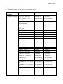
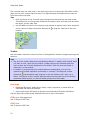
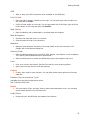
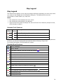
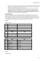
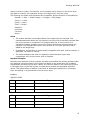
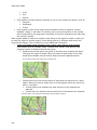
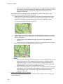
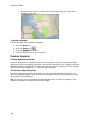
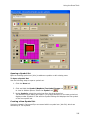
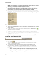
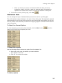
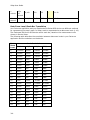
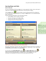
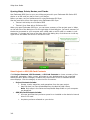
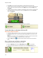
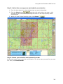
Using DeLorme PN-Series GPS Devices
•
To view a previously exported map, select it from the Saved Map Packages list and
•
To delete a previously exported map, select it from the Saved Map Packages list
then click View
and then click Delete
•
Vector data (points, lines, polygons) may look slightly different in the software than
on the device.
•
•
•
Lines
•
Blazed Trail
•
Sewer Line
•
Water Line
•
Drain Line
•
Gas Line
•
Electric Line
•
Telephone Line
•
Ticked Fence
•
Post and Rail Fence
•
Barbed Wire Fence
•
Guard Rail
•
Stone Wall
•
Vegetation Line
•
Completed Dozer Line
•
Line Break Completed
•
Highlighted Geographic Feature
•
Man Made Feature
•
Uncontrolled Fire Edge
•
Fire Break Incomplete
•
Directional Arrow
Polygons
•
Wetlands
•
Bare Ground
•
Rock, Lake or Pond
•
Island
•
Land
•
Mixed Forest
•
Evergreen Forest
Points
•
Only Earthmate PN-Series point symbols are supported on PN-Series
GPS devices. If you use other symbols, they will be changed to PN
symbols for display on the device.
Data and Zoom Level Information
•
IMPORTANT The data types listed may not exist in your project. The data shown in
307