1
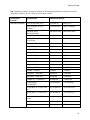
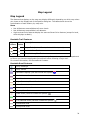
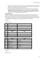
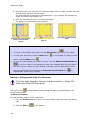
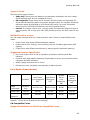
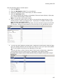
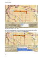
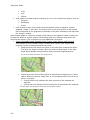
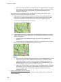
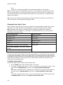
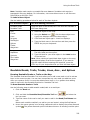
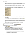
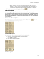
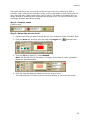
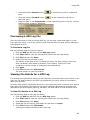
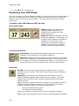
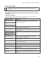
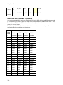
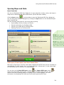
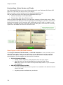
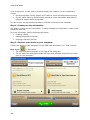
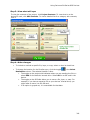
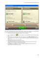
XMap User Guide
15
small
squares only
name of the
POI and a
small square
symbol
name of the
POI and the
large symbol
name of the
POI and the
large symbol
name of the
POI and the
large symbol
16
N/A
small square
symbols
only
name of the
POI and a
small square
symbol
name of the
POI and the
large symbol
name of the
POI and the
large symbol
17, 18,
19, or 20
N/A
small square
symbols and
some names
of POIs
name of the
POI and a
small square
symbol
name of the
POI and a
small square
symbol
name of the
POI and the
large symbol
Setting Units of Measure Preferences
You can change the units of measure used to represent how coordinate formats, distance,
datum, and bearing listings display. Changing these preferences affects how units of
measure display in several areas of the program: such as on the map and in the Control
Panel.
As you change your unit of measure preferences, a description of each choice displays in the
information box (in the center of the Options dialog box) immediately after you select it.
To Change the Coordinate Preferences
Changing the coordinate preferences affects the:
•
Coordinates display on the Control Panel.
•
Coordinate MapNotes.
•
Grid label display, if Grids are selected in Map Features.
•
Any other place where coordinates display or print.
Use the following steps to change how coordinate measurement units display.
1. Click the Options button
on the toolbar.
OR
Click the arrow next to the Options toolbar button to open the menu. Then, click
Options to open the dialog box.
2. Click the Display tab.
3. Select the coordinate display format from the Coordinates drop-down list.
42
•
Degrees
•
Degrees, Minutes
•
Deg, Min, Sec
•
UTM/UPS (Universal Transverse Mercator/Universal Polar Stereographic)
•
MGRS (Military Grid Reference System)
•
USNG (United States National Grid)