1
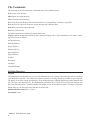
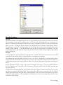
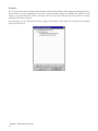
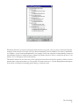
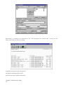
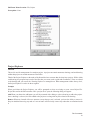
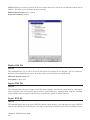
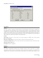
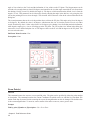
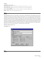
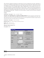
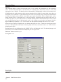
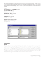
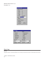
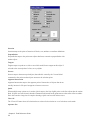
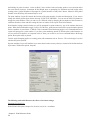
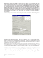
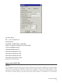
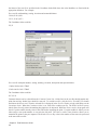
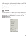
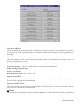
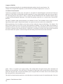
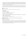
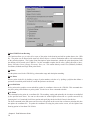
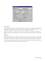
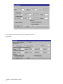
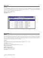
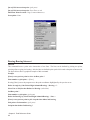
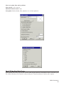
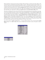
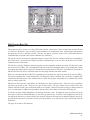
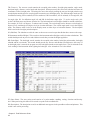
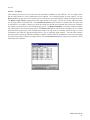
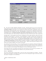
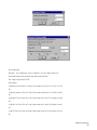
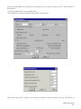
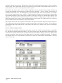
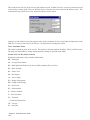
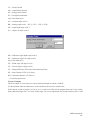
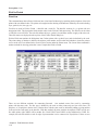
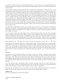
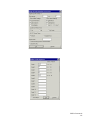
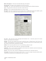
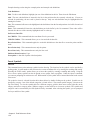
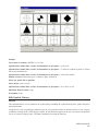
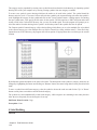
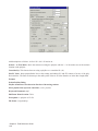
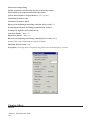
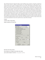
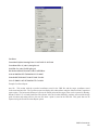
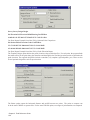
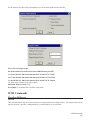
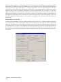
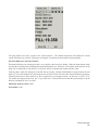
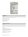
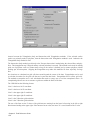
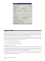
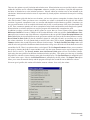
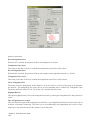
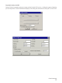
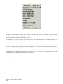
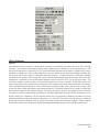
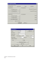
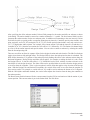
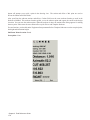
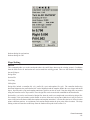
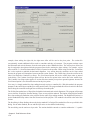
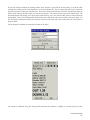
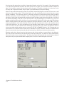
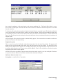
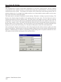
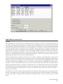
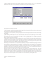
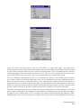
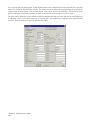
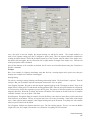
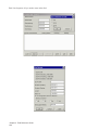
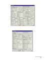
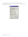
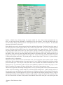
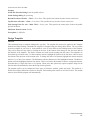
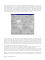
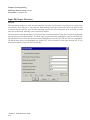
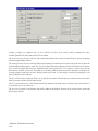
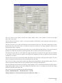
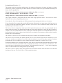
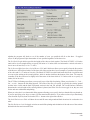
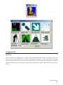
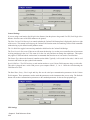
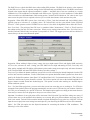
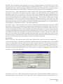
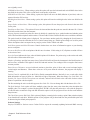
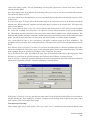
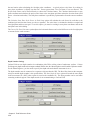
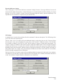
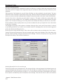
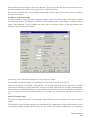
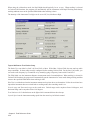
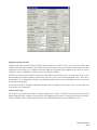
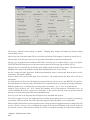
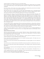
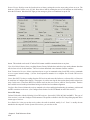
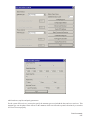
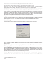
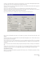
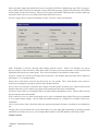
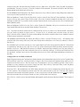
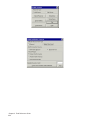
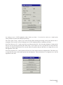
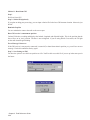
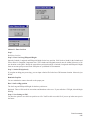
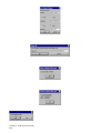
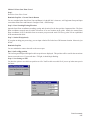
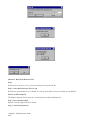
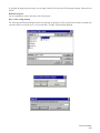
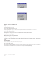
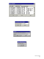
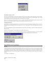
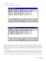
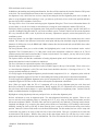
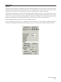
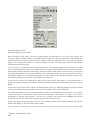
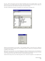
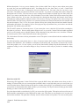
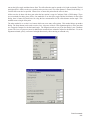
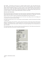
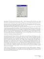
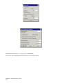
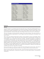
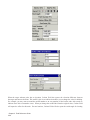
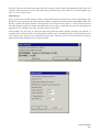
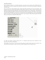
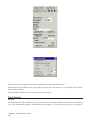
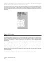
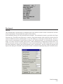
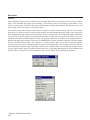
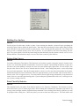
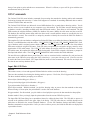
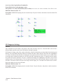
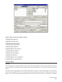
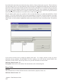
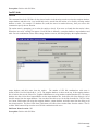
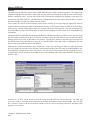
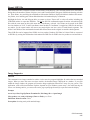
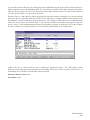
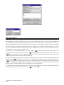
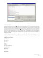
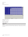
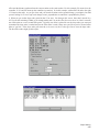
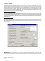
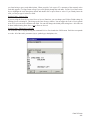
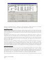
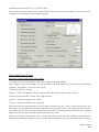
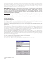
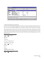
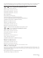
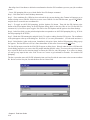
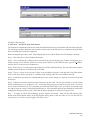
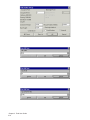
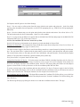
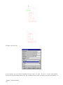
GIS Data Collection Page
5A. One ASCII GIS Prompting File for All Collected Points.
Step 1) Pick the check box for Store Data in Note File (ASCII method).
Step 2) Hit Select File. This brings up a pop-up dialog box titled GIS File Name.
Step 3) Choose one GIS filename for prompting. Browse to the drive and subdirectory where the GIS prompting
files reside and highlight one. Pick Open to load the selected GIS filename and close the pop-up box. The GIS
filename selected should be displayed in the GIS Options dialog pop-up box after GIS File:
This ASCII method will prompt for the same GIS information for every point stored, regardless of description. For
example, a FH.GIS (Fire Hydrant) file selection would have the prompting for fire hydrant GIS fields for every point
stored.
5B. Select ASCII GIS Prompting File Automatically by Point Description.
Step 1) Pick the check box for Store Data in Note File.
Step 2) Pick the check box for Select GIS File Automatically by Point Description. The GIS file name displayed after
GIS File will change to AUTOMATIC. GIS prompting will only appear if the stored point's description corresponds
exactly to an existing GIS prompting filename (excluding the GIS extension). For example, if the point description
is SMH, then Carlson Field looks for SMH.GIS for the GIS fields. If a point's description has no corresponding GIS
file name, Carlson Field briefly displays ''No GIS File Found'' and continues automatically.
5C. ASCII GIS Prompting File Structure
The .GIS file defines the GIS fields and prompting for one GIS feature. This file is a ASCII file where each line
contains a field definition. The definition line has the field name, prompt and default value separated by commas.
If the field is a choice of options, the definition line also has each choice separated by commas. If the field's value
is to be calculated automatically by an equation, the equation takes the place of the default value. The field's value
is calculated automatically once the point is stored or edited. An example ASCII GIS file for Sewer Cleanout GIS
prompting (SCO.GIS), is displayed below for a detailed explanation on ASCII GIS prompting file structure.
SCO,SCO (#), ,
SIZE,Size (4/6/8/10/12),4,4,6,8,10,12
TYPE,Type (L/M),L,L,M
COMMENTS,Comments, ,
SCO.GIS is an ASCII file. It is displayed here as it would appear in any text editor. Each line in the GIS file is
a GIS prompt in SurvStar and Carlson Field. Each line consists of four items separated by commas. The first is
Field Name (SIZE). The second is the prompt, including allowed input in parentheses and separated by slashes
(Size (4/6/8/10/12)). The next is the default value (4). This is followed by the allowed values, separated by commas
(4,6,8,10,12).
Descriptions for each of the four items and naming conventions for GIS prompting files are described in
detail below:
Item 1 - Field Name: Field 1 is never displayed to the operator in Carlson Field. The Field Name is inserted at the
beginning of each line in the Note file before the input GIS data. This Field Name corresponds to a column name
in a Microsoft Access database table. If you convert GIS ASCII Note data files to MDB tables, the Field Name will
become the column name. Converting collected Note files to MDB tables is only an option, not a requirement. The
Field Name must be unique for the GIS file and is not allowed to have spaces or special characters.
Item 2 - Prompt: This is the prompt that actually appears when storing ASCII GIS information. It is usually the
same name as Field 1 but can include spaces or special characters. Also displayed in the Prompt within parentheses
GIS Data Collection
307