1
4.4 Intersect Tool
Intersect creates a new feature from the common areas or edges of any two selected features of the
same geometry type. You can create a new feature from the intersection of features of different layers,
but the layers must be of the same geometry type (point, line or polygon).
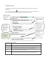
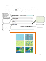
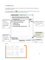
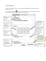
Click on the Intersect
tool on the Analysis toolbar. Note: Input for this tool must be vector. The
following window opens and allows you to perform an intersect between vector layers.
Specify the target
layer from which
features will be
intersected with.
Specify the source
layer that will be used
to intersect features
from the target layer.
Specify an output
filename. The new
data layer with your
intersect will appear in
your My Data (vector)
folder.
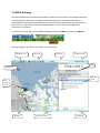
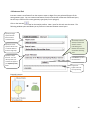
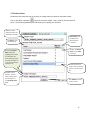
This example intersect
will export a vector file
with the common
(intersecting) area
between mineral claims
and muskox harvesting
areas.
Click Submit to perform
the intersection.
Progress bar
appears when the
tool is processing.
Example intersect:
14