1
2.0 Navigation Tools
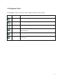
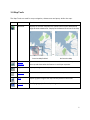
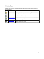
The Navigation Tools are used for map navigation within the map window.
Icon
Name
Function
Zoom In
Zoom in by dragging a box on the map or by double clicking on the map.
Zoom Out
Zoom out by dragging a box on the map.
Pan
Pan the map by dragging the map.
Full Extent
Zoom to the full extent of the map. By default, this is the extent of the
BREA study area.
Back Extent
Go back to the previous extent of the map after navigating.
Next Extent
Go forward again through the sequence of extents you have been viewing
on the map.
4