1
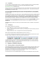
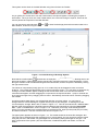
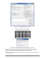
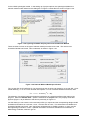
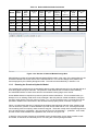
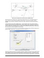
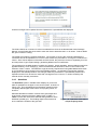
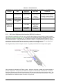
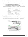
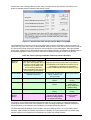
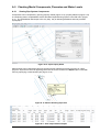
Surface levels can be entered at given chainages along the line of the pipe, so that the design procedure
can allow for minimum cover all along the pipe. Intermediate points can be plotted in a long-section
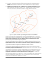
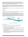
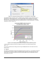
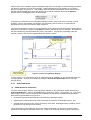
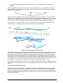
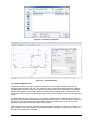
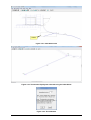
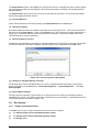
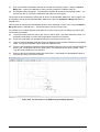
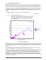
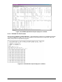
drawing, as shown in Figure 2.14. This property sheet also allows the positions of other services to be
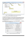
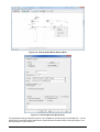
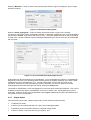
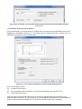
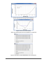
defined so that DRAINS can avoid these (allowing for a vertical clearance defined in the Options…
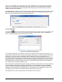
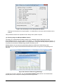
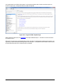
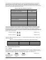
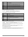
property sheet in the Project menu, as shown below.
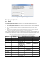
In Design runs, DRAINS tries to locate pipes between services, going under them if no other route is
possible. If this is unacceptable, the designer can selectively remove services, or make manual
adjustments to the pipe cross-section and/or alignment.
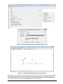
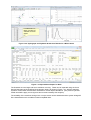
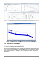
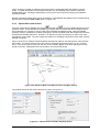
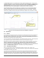
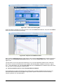
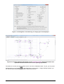
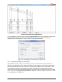
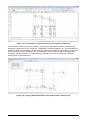
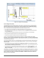
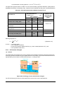
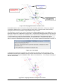
The long section display in Figure 2.14 shows how the ground levels and service positions appear after a
Design run is carried out, using the Long Section option in the pop-up menu for the pipe. The position of
the pipe is defined by the intermediate low point in the surface. The pipe fits comfortably under the
services, shown in red, and the required clearance, shown in yellow.
Intermediate Survey
Points on Surface
Surface Ponding
Level at a Sag Pit
Figure 2.14 Pipe Long Section Display
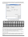
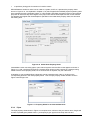
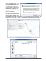
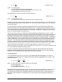
In some cases, a non-return device such as a flap gate may be installed in a pipe, preventing flows from
moving upstream. This can be modelled by ticking the Include Non Return Valve box in the Pipe
property sheet.
2.3.5
(a)
Sub-Catchments
ILSAX Model Sub-Catchments
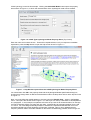
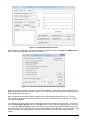
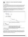
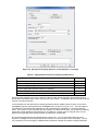
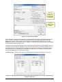
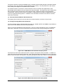
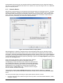
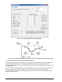
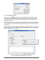
The form of the property sheet for a sub-catchment depends on the hydrological model defined in the
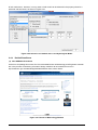
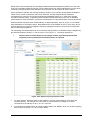
Hydrological Models… option in the Project menu, as shown in Figure 1.4 and Figure 1.5. If an ILSAX
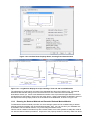
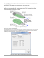
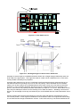
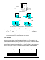
type model is chosen, the sub-catchment can be divided into the paved, grassed and supplementary
land-surface types illustrated in Figure 2.15:
•
paved area (impervious areas directly connected to the drainage system),
•
supplementary areas (impervious areas not directly connected to the drainage system), and
•
grassed areas (pervious areas, which can be lawn, bare earth, landscaped areas, bushland, porous
pavement or any other pervious surface).
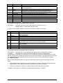
The supplementary area models any impervious surfaces that drain onto pervious or grassed areas,
where the runoff might be absorbed into the soil. These could be sheds, swimming pools, parking lots
DRAINS User Manual
2.11
November 2014