1
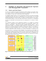
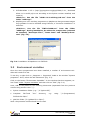
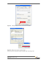
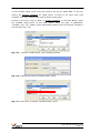
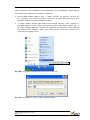
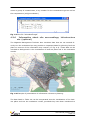
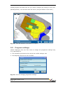
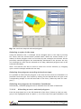
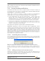
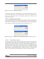
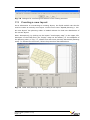
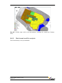
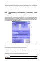
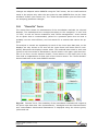
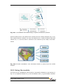
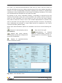
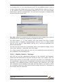
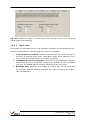
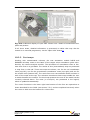
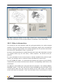
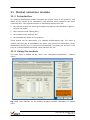
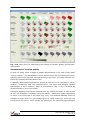
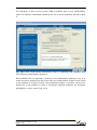
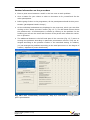
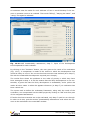
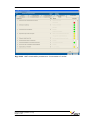
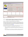
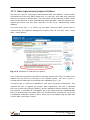
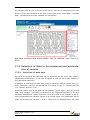
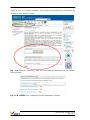
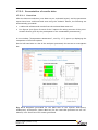
Fig. 11.2 Input form for determining the factors of location quality and development status.
Assessment of location quality
It does not make sense to apply a spatial differentiation in the case of the factor
“macro-location”. The assessment is done for the entire site by entering the corresponding point score per land-use type directly in the form. The entry must be confirmed by pressing the Enter/Return key.
A spatially differentiated assessment should be carried out for the factors “Microlocation”, “Distances” and “plot characteristics”. The input help dialogue “Spatial
specification of site’s location / state of development” (Fig. 11.2) is accessed by
double-clicking on one of the maps.
Individual planning units can be selected here (by clicking on them) or else several
at once (by dragging a rectangle using the mouse). These then appear highlighted
in colour in the map and in the table (Fig. 11.3). The selected planning units are
allocated a point score or a percentage figure by either entering a score into the
text field on the left or, more quickly, by clicking on the coloured legend buttons
User’s Guide (Version 1.2.0)
Page 11-3