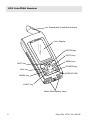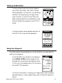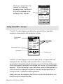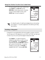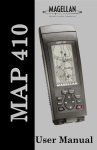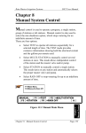
1
GPS ColorTRAK
MAGELLAN
Satellite Navigator
User Manual
LICENSE AGREEMENT
Magellan grants you, the purchaser, the right to use the software supplied in and with MAGELLAN GPS products (the "SOFTWARE") in the
normal operation of the equipment. You may make copies only for your
own personal use and for use within your organization.
The SOFTWARE is the property of MAGELLAN and/or its suppliers and is
protected by United States copyright laws and international treaty provisions; therefore, you must treat this SOFTWARE like any other copyright
material.
You may not use, copy, modify, reverse engineer or transfer this SOFTWARE except as expressly provided in this license. All rights not expressly
granted are reserved by MAGELLAN and/or its suppliers.
* * *
No part of this handbook may be reproduced or transmitted in any form
or by any means, electronic or mechanical, including photocopying and
recording, for any purpose other than the purchaser's personal use
without the prior written permission of Magellan Systems Corporation.
© 1998 by Magellan Systems Corporation. All rights reserved.
Magellan™ and GPS ColorTRAK™ are trademarks of Magellan Systems
Corporation.
22-10303-001
WARNINGS
USE GOOD JUDGEMENT
This product is an excellent navigation aid, but does not replace the need for
careful orienteering and good judgement. Never rely solely on one device for
navigating.
USE CARE
The Global Positioning System (GPS) is operated by the U.S. Government, which is
solely responsible for the accuracy and maintenance of GPS.
The accuracy of position fixes can be affected by the periodic adjustments to GPS
satellites made by the U.S. Government and is subject to change in accordance
with the Department of Defense civil GPS user policy and the Federal
Radionavigation Plan.
USE CAUTION
Accuracy can also be affected by poor satellite geometry. When the accuracy
warnings appear on the screen, use the data with extreme caution.
USE PROPER ACCESSORIES
Use only Magellan cables and antennas; the use of non-Magellan cables and
antennas may severely degrade performance or damage the receiver, and will void
the warranty.
Table of Contents
Introduction ............................... 1
Packing List ............................................ 1
Features of Your GPS ColorTRAK ............... 2
Conventions Used in this Manual .............. 2
Getting Started/Initialize ............ 3
GPS ColorTRAK Description ..................... 3
Receiver Accuracy ................................... 3
GPS ColorTRAK Receiver ......................... 4
Using the Keypad.................................... 5
Installing the Batteries .............................. 6
Using your GPS ColorTRAK ...................... 7
Proper Handling - Signal Reception ........... 7
Clear View of the Sky ....................... 7
Holding the Receiver ......................... 8
First Time Use - Initializing the
Receiver ................................................. 8
Turn the Receiver On ............................... 8
Input Location Information ........................ 9
Setting Local Time and Date ..................... 9
Selecting Primary Usage ........................ 10
Getting a Fixed Position ......................... 11
Saving Your Waypoint ........................... 11
Creating a GOTO ................................. 12
i
Basic Operation ....................... 13
Power Up Sequence .............................. 13
Navigation Screens ............................... 13
Using the Status Screen .......................... 14
Selecting Temp Units and Calibration
in your Status Screen ............................. 15
Using the Position Screen ....................... 16
Viewing Secondary Coordinate System
from the Position Screen ......................... 16
Automatic Averaging in the Position
Screen ................................................. 16
Using the NAV 1 Screen ........................ 17
Customizing the NAV 1 Screen ............... 18
Using the Compass Screen ..................... 19
Customizing the Compass Screen............ 20
Using the NAV 2 Screen ........................ 21
Customizing the NAV 2 Screen ............... 21
Using the Plot Screen ............................. 22
Selecting PAN-N-SCAN ......................... 23
Displaying Waypoint Information ............ 23
Setting Track History .............................. 24
Clearing the Track ................................. 24
Setting Up the Plotter ............................. 24
Setting Hide Data/Show Data ................ 26
Using the Road Screen ........................... 26
Setting Hide WPTS/Show WPTS ............. 27
Customizing the Road Screen ................. 27
Using the Speed Screen ......................... 28
Resetting the Odometer .......................... 28
Resetting the Trip Odometer.................... 29
ii
Setting the Speed Average ..................... 29
Using the Time Screen ........................... 29
Selecting Time Format ............................ 30
Saving a Waypoint ............................... 30
Saving Your Position Fix with a
Receiver-Generated Name ..................... 30
Saving Your Position Fix with a
User-Created Name ............................... 31
Creating a Waypoint ............................. 31
Creating a GOTO ................................. 32
Working with Waypoints ......... 33
Editing a Waypoint ............................... 33
Editing a Selected Waypoint .................. 33
Editing Waypoint Fields .................. 33
Creating/Editing/Deleting a
Message in a Waypoint .................. 34
Saving Changes to the Selected
Waypoint ...................................... 34
Projecting a Waypoint ........................... 35
Sorting a Waypoint ............................... 36
Deleting a Waypoint ............................. 36
Working with Routes ............... 37
Creating/Clearing a GOTO ................... 37
Creating a Man Over Board Route .......... 38
Creating a Backtrack Route .................... 38
Creating a Multi-Leg Route ..................... 39
Viewing/Editing a Route ........................ 40
Inserting a Leg ............................... 40
Changing a Waypoint in a Route ..... 40
iii
Adding a Waypoint at the End of
a Route ......................................... 41
Deleting a Waypoint in a Route ........ 41
Saving a Route ............................... 42
Activating/Deactivating a Route.............. 42
Reversing a Route.................................. 43
Using Plot View in a Route...................... 43
Deleting a Route ................................... 43
Auxiliary Functions .................. 44
Working with Sun/Moon and Fish/Hunt .. 44
Selecting the Simulate Mode................... 45
Selecting Contrast ................................. 46
Selecting Alarm/Message ...................... 46
Accessing the Alarm/Message Screen ..... 46
Selecting Anchor Alarm ......................... 47
Selecting Arrival Alarm .......................... 47
Selecting XTE Alarm .............................. 48
Selecting Proximity Alarm ....................... 48
Viewing the Alarm/MSG Menu .............. 49
Selecting Alarm Defaults ........................ 50
Clearing Alarm Messages ...................... 50
Customizing (Setup) ................. 52
Selecting Setup ..................................... 52
Initializing ............................................ 52
Disabling NAV Screens .......................... 53
Selecting a Coordinate System ............... 53
Selecting Map Datum ............................ 54
Selecting Elevation Mode ....................... 54
iv
Selecting Time Format ............................ 55
Selecting NAV Units .............................. 56
Selecting North Reference ...................... 56
Selecting Light Timer .............................. 57
Selecting the Beeper .............................. 57
Selecting Personalize ............................. 58
Selecting Clear Memory ........................ 58
Selecting NMEA ................................... 59
Selecting Baud Rate............................... 59
Troubleshooting ....................... 60
Commonly Asked Questions ................... 61
Contacting Magellan ............................. 62
NMEA Data Messages .............. 63
Available Datums .................... 69
Specifications ........................... 70
Coordinate Systems ................. 71
What is GPS? ........................... 73
What is GPS? ....................................... 73
How Does GPS Work? ........................... 73
Accuracy ............................................. 74
DGPS .................................................. 74
More Information on GPS ....................... 75
Accessories .............................. 76
v
Antenna Removal .................... 77
Glossary .................................. 78
Index....................................... 83
vi
Introduction
1
Congratulations on your purchase of the GPS ColorTRAK. Since introducing the world’s very first commercial, hand-held GPS receiver in 1989,
Magellan has led the way with innovative GPS products to meet a wide
range of positioning and navigation needs.
The GPS ColorTRAK is the world’s first portable GPS receiver with a highresolution, color display. With a powerful 12-channel receiver and detachable signal-sensitive antenna, this pocket sized unit provides signal reception
for sure tracking.
Designed with both the Outdoor and Marine enthusiasts in mind, the GPS
ColorTRAK is ideal for hiking, mapping fishing hotspots, marking trails or
charting courses over bodies of water or land. To help you get started using
your new Magellan GPS ColorTRAK, read the sections titled Getting Started
and Basic Operation. These two sections will have you recording waypoints
and navigating in no time. The remainder of this manual gives you detailed
information about all the features and functions of your GPS ColorTRAK.
Packing List
Before you begin, make sure that your package includes the items listed on
the box. If any of these items are missing, please contact your local Magellan
dealer or distributor.
Magellan GPS ColorTRAK
1
Features of Your GPS ColorTRAK
• Powerful 12-channel receiver.
• High-resolution color display.
• Detachable super sensitive antenna for superior tracking.
• Industry record - 30 hours of continuous battery life.
• Backlit keypad and display.
• Rugged, durable and waterproof.
Conventions Used in this Manual
The reference section of this manual is designed to assist you in the use of
your GPS ColorTRAK. Each topic in the reference section includes a brief
description of the activity chosen and a detailed description with sample
screens of how to perform the activity. As you become more familiar with
your receiver, you will be able to use the pictorial view of the keys as a “quick
reference” to perform the desired activity.
Also in the reference section are alerts to inform you of some cautions and
notes that will assist you in using your GPS ColorTRAK.
2
Magellan GPS ColorTRAK
Getting Started/Initialize
2
This section shows you how to begin using your GPS ColorTRAK for the
first time. After a brief description of the receiver, it discusses:
• Installing batteries.
• First time use, initializing the receiver.
• Usage.
GPS ColorTRAK Description
The GPS ColorTRAK has a high-resolution color display, a detachable
antenna for exceptional tracking, a backlit keypad and an altimeter. Using
four AA batteries, the GPS ColorTRAK will operate continuously for up to
30 hours and the internal lithium back-up battery will keep the receiver’s
memory active for up to 10 years. The GPS ColorTRAK has a built-in
barometric pressure sensor to give you more accurate altitude readings. The
receiver does not need any calibration or activation, the altimeter function is
automatic. The receiver uses the combination of a pressure sensor and GPS
elevation to give altitude readings of about +/- 200 feet.
Receiver Accuracy
The satellite constellation that provides the GPS information your receiver
uses is maintained by the Department of Defense (DoD). GPS positioning,
for general use, provides 25 meter RMS accuracy or better. Since the signals
generated by these satellites are publicly accessible, the DoD has introduced
errors into the satellite signals for security reasons. These errors are referred
to as Selective Availability (SA).
At present, your GPS position will be accurate within 100 meters horizontally and 150 meters vertically. Due to the errors introduced by SA, it is
possible to get readings outside of these values at times.
Magellan GPS ColorTRAK
3
GPS ColorTRAK Receiver
Detachable Quadrifilar Antenna
Color Display
ENTER key
GOTO key
MENU key
QUIT key
POWER key
NAV key
ARROW PAD
MARK key
LIGHT key
Water Seal Battery Caps
4
Magellan GPS ColorTRAK
Using the Keypad
LIGHT - Turns back light off and on and offers two levels of
brightness adjustable with consecutive presses of the light key.
PWR
ENTER
QUIT
PWR - Turns the receiver on and off.
ENTER - Selects menu items, confirms changes and initiates
certain functions.
QUIT - Cancels the operation of the last key pressed.
ARROW PAD - Scrolls through screens, menus and enters
alphanumeric information. Up/Down Arrows scroll through
the alphanumeric characters. Right/Left Arrows page through
menus and adjust the scale on the Plot and Compass screens.
NAV
NAV - Scrolls through nine Navigation screens.
MENU
MENU - Accesses functions specific to the current display, as
well as other displays.
GOTO
MARK
GOTO - Allows selection of a destination for a single leg route
from a list of waypoints. This key also accesses the Man Over
Board function.
MARK - Creates waypoints or stores the current position.
Magellan GPS ColorTRAK
5
Installing the Batteries
The GPS ColorTRAK uses four AA alkaline batteries that are installed from
the bottom of the receiver. Use the rings to unscrew the water seal battery
caps. Insert the batteries into the battery tubes, with the positive end first,
two batteries in each side, and screw the battery caps until securely closed.
It is recommended that four batteries be used, however, in case of an
emergency, the receiver will operate with only two batteries if both are
inserted into one of the battery tubes.
AK
rTR
olo
SC
GP
+
+
-
+
+
If the batteries are left out of the unit for more than 30 minutes,
the unit may need to be reinitialized.
6
Magellan GPS ColorTRAK
Using your GPS ColorTRAK
The constellation of 24 GPS satellites circling the globe is in constant
motion, before your receiver can tell you where you are, it needs to know
where the satellites are relative to itself. It does this with the use of an
internal almanac, where it has stored in memory a general location for
each of the satellites. The almanac tells the receiver which satellites are in
view, based on the time, date and location of the receiver.
Until the ColorTRAK is initialized, it may not know its location, time or
date, therefore, it does not have a reference point to select which satellites
to use. Inputting the initial position, time and date is called initializing
your receiver, which will save you time. Initializing enables the receiver
to begin tracking satellites, and calculating your position, much faster.
Proper Handling - Signal Reception
Because the GPS ColorTRAK receives information it needs from
satellites orbiting the earth, the antenna needs to be raised with a
relatively unobstructed view of the sky.
Clear View of the Sky
The receiver needs a clear view of the sky, allowing it to choose from all
the satellites currently available.
If the view of the sky is poor, (large cliffs or buildings, heavy foliage or
other obstructions) the satellite signals can be blocked and the GPS
ColorTRAK may take longer to compute a position fix.
Magellan GPS ColorTRAK
7
Holding the Receiver
GPS ColorTRAK is designed to fit
comfortably in your hand. Hold the
receiver in the palm of your hand with
the antenna pointing towards the sky.
First Time Use - Initializing the Receiver
You do not need to initialize your receiver each time you use it
unless the receiver’s memory has been cleared or if it has been
transported more than 300 miles while turned off.
Turn the Receiver On
To turn your ColorTRAK on, press PWR.
Because this is the first time you have used
your receiver, a screen will be displayed
prompting you to initialize your receiver. Press
ENTER to begin the initialization process.
ATTENTION
UNIT IS NOT
INITIALIZED
PRESS
ENTER TO
INITIALIZE
If you do not see this screen once the receiver is turned on, then it was
initialized previously. To follow along, press MENU, highlight SETUP
and press ENTER. Highlight INITIALIZE and press ENTER and then
you will be taken through the steps to reinitialize the receiver.
8
Magellan GPS ColorTRAK
Input Location Information
A screen is displayed with a list of geographical regions. Use the UP/DOWN ARROWs
to highlight the region where you are located
and press ENTER.
As you proceed with the initialization
process, you can press QUIT at any time to
return to the previous screen or field.
REGION
ENTER COORD
USA
AMERICAS
EUROPE
ASIA EAST
ASIA WEST
AUSTRALIA
AFRICA
PACIFIC
A list of countries, provinces or states (depending upon which region you
select) will appear. Use the UP/DOWN ARROWs to select and press
ENTER.
The receiver displays the ELEVATION screen with the cursor in the first
character of the elevation field. Use the ARROWs to enter your present
elevation and press ENTER. If you do not know your elevation, press
ENTER.
If this is not the first time you have used your receiver or if it is the
first time but your receiver has already begun acquiring satellite
signals, time and date may have already been received from a
satellite and you will not be prompted for time and date.
Setting Local Time and Date
The cursor moves down to the time field,
ready for you to input your local time. Use
the ARROWs to change the time and to
toggle between AM and PM. Press ENTER.
TIME
34˚06.52N
117˚49.56W
00000FT
09:23AM
The GPS ColorTRAK will not automatically change due to
daylight savings. You will have to reset the time using SETUP as
explained in the Customizing section.
The cursor moves to the date field. Use the ARROWs to input the date and
press ENTER.
Magellan GPS ColorTRAK
9
Selecting Primary Usage
A screen will be displayed asking your primary
use for the receiver, MARINE or LAND. Use
the UP/DOWN ARROWs to select and press
ENTER.
PREFERENCE
SET DEFAULTS
FOR A
PRIMARY
USAGE OF:
MARINE
LAND
The default is MARINE.
The following chart shows the differences in terminology that your GPS
ColorTRAK uses while in land or marine mode. For purposes of this
manual, it will be assumed that the receiver is in the marine mode.
10
Land
Marine
Speed
SPD
SOG
Bearing
BRG
BRG
Distance
DST
DST
Heading
HDG
COG
Velocity Made Good
VMG
VMG
Course To Steer
CTS
CTS
Estimated Time of Arrival
ETA
ETA
Time To Go
TTG
ETE
Cross Track Error
XTE
XTE
Recorded Position
Landmark
Waypoint
Units of Measure
Miles/MPH or
KM/KPH
NM/KNOTS
Magellan GPS ColorTRAK
Getting a Fixed Position
Once you have chosen the primary usage for
your GPS ColorTRAK, the STATUS screen
will be displayed. At this point, you should go
outside in an area where you can get a clear
view of the sky. The GPS ColorTRAK will
begin receiving data from the satellites in view
and will display the progress on the STATUS
screen.
Once the receiver has computed a position fix
the POSITION screen will be displayed.
STATUS
3D
12
N
13
8
25
18
7
001112
782385
POWER
TEMP
15 HOURS
25 ˚c
POSITION
34˚06.52N
117˚49.56W
ELEV 900 FT
11:23:35 PM
23JAN97
EPE 112 FT
SPEED TRIP
n
5 . 3 8 KT
2 3 8 . 8m
COURSE 150°m
120 150
S
Saving Your Waypoint
Once the receiver has computed your current position, you may save this
position as a waypoint.
To save (MARK) your position as a waypoint,
press MARK, MARK and the waypoint will
be saved with an automatically assigned name.
If this is your first saved position fix, the name
will be WPT001 as shown.
MARK
WPT001
34˚06.56N
117˚49.60W
900 FT
11:23PM
12JUN97
CREATE MSG
SAVE WPT
SAVE TO RTE
For further information on saving your fixed position with a receivergenerated name or a user-created name, refer to the Basic Operations
section.
Magellan GPS ColorTRAK
11
Creating a GOTO
Once this fixed position has been saved in your receiver. Travel to
another location away from the saved position to create a route back to
the saved waypoint. To create this route, press GOTO.
Once GOTO is pressed, a menu will be
displayed with the waypoint that you just
saved (we are using WPT001 as an example).
Use the UP/DOWN ARROWs to highlight
WPT001 and press ENTER. The receiver
will begin calculating information to return
you to the saved position.
GOTO
MOB
WPT001
BRG
DST
027˚m
50.2 mn
You will be returned to the POSITION screen with the information on
the navigational requirements. Use the NAV key to view the other
Navigation screens.
12
Magellan GPS ColorTRAK
Basic Operation
3
Power Up Sequence
The receiver is powered up by pressing PWR
(power). On power up, the GPS ColorTRAK
will display the Magellan logo/start up animation momentarily and then switch to the
STATUS screen. The receiver begins searching
the sky for satellites and begins the process of
computing a position fix.
MAGELLAN
COLORTRAK
Navigation Screens
The nine NAV (navigation) screens (STATUS, POSITION, NAV 1, COMPASS, NAV 2, PLOT, ROAD, SPEED and TIME ) provide you with necessary information you will need to use the GPS ColorTRAK as a navigational
tool.
NAV screens can be viewed by pressing NAV from any screen. You can scroll
through the NAV screens by repeatedly pressing NAV or the UP/DOWN
ARROWs from any NAV screen.
All screens, except the STATUS and POSITION screens, can be disabled by
turning them off in the NAV SCREENS portion of SETUP.
Magellan GPS ColorTRAK
13
Using the Status Screen
The Status screen will be the first screen displayed, after the Magellan screen,
once the unit is turned on. This screen gives you the general well-being of
your GPS ColorTRAK by showing you satellite status and signal strengths,
battery life and temperature.
North Indicator
2D/3D Icon
Satellite
Positions
STATUS
3D
12
N
13
Satellite
Position Graph
8
25
18
7
Satellite
Signal
Strengths
Satellite
Signal Chart
001112
782385
POWER
TEMP
15 HOURS
25 ˚c
Satellite
Numbers
Temperature
Battery Life
Indicator
Light Icon
The satellite positions are displayed in the Satellite Position Graph with the
satellite signal strengths on the Satellite Signal Chart.
On the Satellite Position Graph and the Satellite Signal Chart, satellites
displayed in red are for weak signal strengths, green for satellites of strong
signal strengths and blue for no signal. On the Satellite Signal Chart,
satellites still receiving information will display an empty bar.
The bottom of the STATUS screen displays remaining battery power and
ambient temperature of the receiver. Power shown is the estimated battery
life when the receiver is operating on battery power.
Once the receiver has computed a position fix, the STATUS screen will be
replaced by the POSITION screen.
14
Magellan GPS ColorTRAK
Selecting Temp Units and Calibration in your Status Screen
You have two options for customizing the
STATUS screen, TEMP UNITS and
TEMP CALIB. Press MENU to display
the STATUS screen menu. Use the UP/
DOWN ARROWs to make your selection
and press ENTER. The other menu items
displayed will be discussed later in this
manual.
Setting Temperature Units. After
selecting TEMP UNITS from the STATUS screen menu, you can choose from
FAHRENHEIT or CELSIUS. Use the
UP/DOWN ARROWs to highlight your
choice and press ENTER.
MENU
TEMP UNITS
TEMP CALIB
WAYPOINTS
ROUTES
SETUP
SUN/MOON
CONTRAST
ALARM/MSG
TEMP UNITS
FAHRENHEIT
CELSIUS
Setting Temperature Calibration. The GPS ColorTRAK comes
with a factory default setting that can be changed to accommodate
the environment that you are in. This enables you to calibrate the
temperature creating an offset from the factory setting.
After selecting TEMP CALIB from the
STATUS screen menu, press ENTER to
turn the cursor on, allowing you to change
the temperature. Use the ARROWs to
change the temperature and press ENTER
to exit the edit mode.
TEMP CALIB
TEMP
25 ˚c
SAVE EDITS
RESET DFLT
Use the UP/DOWN ARROWs to highlight SAVE EDITS which
will save your changes or highlight RESET DFLT which returns the
temperature offset to its factory defaults. Press ENTER to return to
the STATUS screen saving your changes. Press QUIT to return to
the STATUS screen without saving changes.
Magellan GPS ColorTRAK
15
Using the Position Screen
The POSITION screen displays the coordinates of your last computed
position and basic navigation data. You also have the option of viewing your
present position using another coordinate system.
Current
Elevation
Current Date
Current Speed
Compass
Position
Coordinates
POSITION
34˚06.52N
117˚49.56W
Current Time
ELEV 900 FT
11:23:35 PM
23JAN97
EPE 112 FT
SPEED TRIP
n
5 . 3 8 KT
2 3 8 . 8m
Estimated Position
Error (may display
DGPS or Simulate)
COURSE 150°m
Distance Travelled
120 150
Course
S
Second Coordinate
System access
Position Icon
Viewing Secondary Coordinate System from the POSITION Screen
Press the LEFT/RIGHT ARROWs and the
lower half of the screen changes to display
your present position in secondary coordinate
system. The datums that have been selected
under SETUP for each coordinate system are
also displayed. In the example shown, we are
using the WGS84 datum for our LAT/LON
coordinates and NAD27 datum for the UTM
coordinates.
LAT/LON
34˚06.52N
117˚49.56W
900 FT
11:23:35 PM
23JAN97
EPE 112 FT
WGS84
UTM
11 4 23760W
37 74 479N
NAD27
Automatic Averaging in the POSITION Screen
Automatic averaging gives you greater position accuracy. When navigating,
your GPS ColorTRAK takes position fixes, however, when you are stationary, at zero speed, the receiver begins averaging mode. Once you begin
moving, position averaging ends and the receiver begins displaying instantaneous position fixes while you navigate.
16
Magellan GPS ColorTRAK
When your speed is zero, the
receiver is in automatic
averaging mode, the date and
EPE will be replaced by the
averaging timer, as shown.
POSITION
34˚06.52N
117˚49.56W
ELEV 10900 FT
11:23:35 PM
AVERAGING
00:00:35
SPEED
5 . 3 8 KT
TRIP
2 3 8 . 8 mn
COURSE 150 m°
120 150
S
Using the NAV 1 Screen
The NAV 1 screen displays your destination along with four selectable
navigation measurements and a graphical compass.
Destination
Name
TO: CAMP
50.2 mn
K
SOG 8.2T
n
XTE 3.80m R
K
VMG 7.2 T
BRG 127m°
DST
Destination Icon
Compass
120 150
COG
Selectable
Navigation
Data
S
150 °m
Position Icon
The NAV 1 screen displays a numerical reading at 30˚ increments with the
characters N (0°), S (180°), E (90°) and W (270°). Course is shown
numerically and represented by the Position Icon at the bottom of the screen.
Above the compass, bearing will be displayed with the icon of the destination
waypoint. When the bearing to your destination cannot be displayed within
the confines of the displayed compass, an arrow will be displayed either on
the right or left to indicate the steering direction.
Ideally, when you are navigating, the Position Icon and the Destination Icon
should line up, one above the other.
Magellan GPS ColorTRAK
17
Customizing the NAV 1 Screen
You can change the four navigational fields. You can choose from BRG,
DST, SOG, COG, VMG, CTS, ETA, ETE, XTE, TRN, ALT, TME, TMP
and Blank.
To customize your NAV 1 screen, press MENU while viewing the NAV
1 screen, select CUSTOMIZE and press ENTER.
Use the UP/DOWN ARROWs to select the
field you want to change and press ENTER.
TO: FISH
50.2 mn
K
SOG 8.2T
n
XTE 3.80m R
K
VMG 7.2 T
BRG 127m°
DST
120 150
COG
You are presented with a pop-up menu from
which you can make your selection. Use the
UP/DOWN ARROWs to highlight your
choice and press ENTER. You will return to
the NAV 1 screen, still in the customize mode.
You can continue to customize the display or
press QUIT to exit.
18
S
150 °m
CUSTOMIZE
WPT NAMES
BRG
OFF 027°m
DST
ON 50.2nm
SOG 8.2KT
COG 056°m
VMG 7.2KT
CTS 028°m
ETA 01:09P
ETE 02H24M
XTE L.2nm
TRN L26°
ALT 83 FT
TME 01:09P
TMP 36°C
BLANK
Magellan GPS ColorTRAK
Using the Compass Screen
As well as displaying four cutomizable navigation fields, the COMPASS
screen provides a pointer compass and Course Deviation Indicator (CDI) to
help you reach your destination.
Destination
Name
Steering Indicator to
Destination
TO: HOME
BRG
DST m
127°m
3.52 I
COG
SOGm
156°m
+
N
Moon Icon
2.7 H
CDI Scale
(L/R arrows to
change)
Destination
Icon
E
+
+
Course Deviation
Indicator
Sun Icon
W
2.0
+
S
Position Icon
m
I
Compass
The red Course Direction Icon displays your course over ground while the
large white Steering Indicator displays the bearing of the destination relative
to the course over ground. When the arrows are pointed in the same
direction, you are on course. The CDI indicates your distance left or right of
the courseline.
The NorthFinder ™ feature displays the position of the sun and moon
icons, when above the horizon, which allows you to determine the direction
of north and your destination while standing still. The destination icon
shows the general direction in which you should be travelling.
Magellan GPS ColorTRAK
19
The NorthFinder™ feature displays the position of the sun and moon icons,
when above the horizon, which allows youto determine the direction of
north and your destination. The destination icon shows the general direction
in which you should be travelling.
Sun Icon
Moon Icon
Align the sun on the COMPASS screen with the sun in the sky, as shown.
When aligned, the Steering Indicator will point you in the direction you
should be travelling in order to reach your destination.
Customizing the Compass Screen
You can change the four navigational fields. You can choose from BRG,
DST, SOG, COG, VMG, CTS, TMP and Blank.
To customize your COMPASS screen, press MENU while viewing the
COMPASS screen. Highlight CUSTOMIZE and press ENTER.
Use the UP/DOWN ARROWs to select the field you want to change and
press ENTER.
20
Magellan GPS ColorTRAK
You are presented with a pop-up menu from
which you can make your selection. Use the
UP/DOWN ARROWs to highlight your
choice and press ENTER. You will return to
the COMPASS screen, still in the customize
mode. You can continue to customize the
display or press QUIT to exit.
CUSTOMIZE
WPT NAMES
BRG 027°m
DST 50.2nm
SOG 8.2KT
COG 056°m
VMG 7.2KT
CTS 028°m
TMP 36°C
BLANK
Using the NAV 2 Screen
The NAV 2 screen displays four customizable
information fields. The NAV 2 screen is
designed to help you to see the screen when
your receiver is mounted at a distance from
you.
TO: CAMP
BRG
14.2˚M
171˚M
SOG
11.2 KT
DST
50.2NM
COG
Customizing the NAV 2 Screen
You can change the four navigational fields. You can choose from BRG,
DST, SOG, COG, VMG, CTS, ETA, ETE, XTE, TRN, ALT, TME, TMP
and Blank. To customize your NAV 2 screen, press MENU while viewing
the NAV 2 screen. Highlight CUSTOMIZE and press ENTER.
Use the UP/DOWN ARROWs to select the
field you want to change and press ENTER.
You are presented with a pop-up menu from
which you can make your selection. Use the
UP/DOWN ARROWs to highlight your
choice and press ENTER. You will return to
the NAV 2 screen, still in the customize
mode. You can continue to customize the
display or press QUIT to exit.
Magellan GPS ColorTRAK
CUSTOMIZE
WPT NAMES
BRG
OFF 027°m
DST
ON 50.2nm
SOG 8.2KT
COG 056°m
VMG 7.2KT
CTS 028°m
ETA 01:09P
ETE 02H24M
XTE L.2nm
TRN L26°
ALT 83 FT
TME 01:09P
TMP 36°C
BLANK
21
Using the Plot Screen
The PLOT screen is a mini map that shows where you have travelled and
where you want to travel. You can view the active route, your current
position as well as the other waypoints and destination in the PLOT screen.
Destination
Name
Bearing to
Destination
Destination
Icon
Distance to
Destination
TO: FISH
BRG
DST m
351°m 3.52 I
N
FISH
Active
Route
North Indicator
Waypoint Icon
FISH 2
DOCK
BUOY
Current
Position Icon
HOME
Plot Scale
2.0
m
I
Track History
At the top of the screen, the destination name is displayed along with the
bearing and distance from the present position to the destination. The active
route leg is displayed by a green line indicating the direction required in
order to reach your destination. The plot scale appears at the bottom of the
screen and can be changed by using the RIGHT/LEFT ARROWs.
An additional feature of the PLOT screen is PAN-N-SCAN. PAN-N-SCAN
allows you to use the ARROWs to scroll through the PLOT screen enabling
you to create waypoints and routes graphically.
22
Magellan GPS ColorTRAK
Selecting PAN-N-SCAN
By using PAN-N-SCAN, you can look ahead or review where you have
travelled according to waypoints, routes and track history. PAN-N-SCAN
allows you to view the area from .20 miles to 320 miles, depending on your
selection.
While viewing the PLOT screen, press
MENU, highlight PAN-N-SCAN and press
ENTER. Use the ARROWs to move the
cursor. When the cursor is placed over the
waypoint icon, the header will read TO:
(waypoint name) and the BRG and DST will
show that of the waypoint.
While in PAN-N-SCAN, press MENU to
reveal the menu screen. If the cursor is over a
waypoint when MENU is pressed, the menu
will be displayed with WPT INFO added to
the list.
PAN-N-SCAN
BRG
DST
n
000 °m 0.0m
N
2.0
m
I
Displaying Waypoint Information
As you navigate using PAN-N-SCAN, it might be useful to have the name of
the waypoint you are heading towards appear at the top of the screen.
While in the PAN-N-SCAN screen, the
waypoint name can be inserted at the top of
the screen. Place the crosshair over the
waypoint and press MENU. Highlight WPT
INFO and press ENTER. The waypoint
information screen will appear in place of the
PAN-N-SCAN screen. Press QUIT to return
to PAN-N-SCAN with the waypoint name at
the top of the screen.
WPT001
BRG
DST
n
000 °m 0.0m
N
2.0
m
I
Default setting is ON.
Magellan GPS ColorTRAK
23
Setting Track History
Using TRACK HISTORY records where you have been by automatically
storing locations, as “dropping bread crumbs” from your starting point as
you travel. This will be especially useful when you want to return to your
starting point, the receiver uses these points to return using the same path to
your starting point.
You can set the distance at which the receiver drops these points by
selecting TRACK HISTORY. You can choose from OFF, AUTO, and a
list of other distance units. If AUTO is chosen, the receiver will
automatically store track history points based on your speed and
direction of travel. Therefore, when travelling a straight distance fewer
track points will be dropped than when you are turning
While in the PLOT screen press MENU. Highlight TRACK HIST and
press ENTER. You are presented with a pop-up menu from which you
can make your selection. Use the UP/DOWN ARROWs to highlight
your choice and press ENTER. You will return to the PLOT screen,
still in the customize mode. You can continue to customize the display
or press QUIT to exit.
Clearing the Track
Sometimes your screen may be cluttered with your track history. The CLR
TRACK option allows you to clear your track history, i.e., clear your “bread
crumbs”.
While viewing the PLOT screen, press MENU. Highlight CLR
TRACK and press ENTER. Use the UP/DOWN ARROWs to select
YES or NO and press ENTER. You are returned to the PLOT screen.
Setting Up the Plotter
This menu allows you to change the orientation, to turn the waypoint names
on or off, to turn the plot rings on or off and set the course projection.
Setting Plotter Orientation. Under Plotter Orientation, you have three
choices TRACK UP (direction you are moving is at the top of the
screen), COURSE UP (the destination of the current leg is at the top of
the screen) and NORTH UP (North is at the top of the screen).
24
Magellan GPS ColorTRAK
While viewing the PLOT screen, press
MENU. Highlight PLOT SETUP and press
ENTER. Use the UP/DOWN ARROWs to
select ORIENTATION and press ENTER. A
pop-up menu appears allowing you to select
TRACK UP, COURSE UP or NORTH UP.
ORIENT
TRACK UP
COURSE UP
NORTH UP
Turning Waypoint Names On or Off. You may have too many
waypoints names that clutter your screen. To remove these waypoint
names, you can turn the WPT NAMES off.
While viewing the PLOT screen, press MENU. Highlight PLOT
SETUP and press ENTER. Use the UP/DOWN ARROWs to select
WAYPOINT NAMES and press ENTER. A pop-up menu appears
allowing you to select OFF or ON.
Turning Plot Rings On or Off. When navigating, you may want to
know the distance you will travel to reach a certain destination. To find
out, you can turn the PLOT RINGS option on.
While viewing the PLOT screen, press MENU. Highlight PLOT
SETUP and press ENTER. Use the UP/DOWN ARROWs to select
PLOT RINGS and press ENTER. A pop-up menu appears allowing
you to select OFF or ON.
Setting Up Course Projection. You may want to know how long it will
take you to reach a certain distance. Under Course Projection, you can
choose from OFF or 1, 2, 5 and 10 minutes.
While viewing the PLOT screen, press
MENU. Highlight PLOT SETUP and press
ENTER. Use the UP/DOWN ARROWs to
select COURSE PROJECTION and press
ENTER. A pop-up menu appears allowing
you to select OFF or a time.
Magellan GPS ColorTRAK
PROJECTION
OFF
1 MINUTE
2 MINUTES
5 MINUTES
10 MINUTES
25
Setting Hide Data/Show Data
When using the PLOT screen, you may want bearing and distance to be
hidden. You can choose to hide these information fields or have the fields
present. Under HIDE DATA/SHOW DATA, you can turn the data fields
on or off.
While viewing the PLOT screen, press MENU. Highlight HIDE
DATA or SHOW DATA (depending on which has been selected
previously) and press ENTER. You are returned to the PLOT screen.
Using the Road Screen
The ROAD screen displays four customizable navigation fields, at the top of
the screen, as well as a display to show your position on the travelled course.
Destination
Name
TO: FISH
BRG
DST
COG
SOG
Navigation Data
127m° 3.52 mn
156°m 2.7 KT
Destination
Icon
Desired Route
Position Icon
At the top of the screen, the destination name is displayed along with
navigation data fields. The pictorial road screen shows your position in
relation to your desired route, as well as your cross track error. The road
shows the direction in which you should be travelling to reach your destination, when the destination icon is straight ahead, you are on course. If you
are off course, such that the destination icon is off the screen, an arrow icon
will appear to point you in the direction to get back on course.
26
Magellan GPS ColorTRAK
Setting Hide WPTS/Show WPTS
When using the ROAD screen, you may want the waypoints to be hidden.
You can choose to hide the waypoints or have the waypoints present. Under
HIDE WPTS/SHOW WPTS, you can turn the waypoints on or off.
While viewing the ROAD screen, press MENU. Highlight HIDE
WPTS or SHOW WPTS (depending on which has been selected
previously) and press ENTER.
If SHOW WPTS is chosen, you are presented
with a pop-up window from which you can
make your selection. Use the UP/DOWN
ARROWs to highlight your choice and press
ENTER. You are returned to the ROAD
screen. If HIDE WPTS is chosen, you are
returned to the ROAD screen.
SHOW WPTS
ICONS ONLY
ICON/NAMEUT
Customizing the Road Screen
You can change the four navigational fields. You can choose from BRG,
DST, SOG, COG, VMG, CTS,TMP and Blank. To customize your ROAD
screen, press MENU while viewing the ROAD screen. Highlight CUSTOMIZE and press ENTER.
Use the UP/DOWN ARROWs to select the
field you want to change and press ENTER.
You are presented with a pop-up menu from
which you can make your selection. Use the
UP/DOWN ARROWs to highlight your
choice and press ENTER. You will return to
the ROAD screen, still in the customize
mode. You can continue to customize the
display or press QUIT to exit.
Magellan GPS ColorTRAK
CUSTOMIZE
WPT NAMES
BRG 027°m
DST 50.2nm
SOG 8.2KT
COG 056°m
VMG 7.2KT
CTS 028°m
TMP 36°C
BLANK
27
Using the Speed Screen
While using the SPEED screen, you can view the graphical speedometer,
odometer and trip odometer as well as the numerical bearing, course over
ground and speed over ground.
Destination
Name
TO: CAMP
BRG
027°m
Average Speed Icon
COG
056°m°m
Circumference Bar
Navigation Data
10
5 15
0
20
Graphical
Speedometer
SOG 14.2 KT
ODOMETER
Odometer
2
0 0 5 4 2 3 mn
TRIP
2
0 5 4 3 mn
Trip Odometer
The top of the screen displays the destination name, bearing and course.
The Graphical Speedometer is shown with a green Circumference Bar
that moves clockwise around the Speedometer to indicate instantaneous
speed. The scale for the Speedometer is adjustable by using the
RIGHT/LEFT ARROWs to increase or decrease the scales. The
Average speed is represented by the red icon on the Speedometer and
can be customized.
Resetting the Odometer
You may want to reset the Odometer field to zero.
While viewing the SPEED screen, press MENU, highlight ODOM
RESET to zero and press ENTER.
A pop-up window will appear. Select YES or
NO and press ENTER.
28
WARNING
RESET
ODOMETER
TO 000?
YES
NO
Magellan GPS ColorTRAK
Resetting the Trip Odometer
You may want to reset the Trip field to zero.
While viewing the SPEED screen, press MENU, highlight TRIP RESET
and press ENTER. A pop-up window will appear. Highlight YES or
NO and press ENTER.
Setting the Speed Average
You may want to reset the Speed Average field in your receiver. You can
choose from TRIP, 5, 30 seconds, 1, 5 minutes or 1 hour.
While viewing the SPEED screen, press
MENU, highlight SPEED AVG and press
ENTER. A pop-up window will appear.
Highlight the desired time frame over which
averaging will be performed and press
ENTER.
SPEED AVG
TRIP
5 SECONDS
30 SECONDS
1 MINUTE
5 MINUTES
1 HOUR
The default is 30 seconds.
Using the Time Screen
The TIME screen displays the current time,
estimated time enroute (ETE), time of arrival
and elapsed time in regards to the route you
are navigating in. The first data field can be
customized to correct the current time and to
select the time format.
TIME
03:54:21PM
ETE
01:09:24
OF ARRIVAL
04:34:20PM
ELAPSED
02:24:56
Magellan GPS ColorTRAK
29
Selecting Time Format
You may need to correct the current time or change the time format. Your
choices for time format are LOCAL 24HR, LOCAL AM/PM and UTC.
While you are viewing the TIME screen, press
MENU, highlight FORMAT and press
ENTER.
TIME FORMAT
LOCAL 24HR
LOCAL 12HR
UTC
A screen will appear with your format selection and the current time
with a cursor. Use the ARROWs to make any changes to the current
time and press ENTER.
Saving a Waypoint
Waypoints are used to create routes and GOTOs. Before you can set a route
or GOTO, you must have a saved waypoint in your receiver. You have two
options when naming waypoints. You can create waypoints with either a
receiver-created name or with a name you create yourself.
Saving Your Position Fix with a Receiver-Generated Name
From anywhere in the receiver, you can save (MARK) your position with a
receiver created name. This is the fastest way to save your position.
To save a waypoint with a receiver-created name, press MARK, MARK.
The waypoint will be saved with a receiver-generated name beginning
with WPT001, WPT002 and so on.
30
Magellan GPS ColorTRAK
Saving Your Position Fix with a User-Created Name
To save a waypoint with a user-created name,
press MARK, press ENTER and the
ARROWs to enter alphanumeric characters.
Once you have entered the name, press
MARK again to save the waypoint.
MARK
DOCK
34˚06.56N
117˚49.60W
900 FT
11:23:35PM
12JUN97
CREATE MSG
SAVE WPT
SAVE TO RTE
You have the option of creating a message when you are naming
your waypoint. This will be explained in the Working with Waypoints section.
Creating a Waypoint
A waypoint is a recorded position that can be used in a route or a GOTO.
You can save up to 500 waypoints in your GPS ColorTRAK and refer back
to them at any time, as long as the waypoints have been saved.
Press MARK. To create the waypoint,
highlight the data field you wish to change
and press ENTER. Use the ARROWs to
input the data and press ENTER to exit the
edit mode for that data field. To save the
changes you have made, press MARK or
highlight SAVE WPT and press ENTER.
MARK
DOCK
34˚06.56N
117˚49.60W
900 FT
11:23:35PM
12JUN97
CREATE MSG
SAVE WPT
SAVE TO RTE
Magellan GPS ColorTRAK
31
Creating a GOTO
A GOTO is a route which guides you from your current position to any
waypoint in the receiver’s memory. As an example, you can save a waypoint
at your home. No matter where you go, you will always be able to navigate
back home by using GOTO.
To create a GOTO, press GOTO and the
GOTO MENU will be displayed. Use the
UP/DOWN ARROWs to highlight the
desired waypoint destination and press
ENTER. The scroll bar, on the right,
indicates the approximate position on the
waypoint list.
GOTO
MOB
DOCK
CAMP
WPT001
HOTSPT
LTEHSE
JETTY
You are returned to the last viewed NAV
screen. The name of the waypoint is at the
top of the screen with navigation information
that you can use.
BRG
DST
027˚m
50.2 mn
TO: CAMP
COG
BRG
056°mm
027°m
5
0
10
15
20
SOG 14.2 KT
ODOMETER
0 0 5 4 2 2 mn
3
TRIP
2
0 5 4 3 mn
This completes the basic operation of the GPS ColorTRAK. From the
information provided, you can now navigate from place to place quickly and
easily.
The following chapters provide you with additional information on using
your GPS ColorTRAK that build upon what you have learned.
32
Magellan GPS ColorTRAK
Working with Waypoints
4
This section tells you how to edit, delete, project and sort waypoints. You
can store up to 500 positions which can be used to build routes for navigation.
Editing a Waypoint
Under editing a waypoint, you have the following options:
• Editing a waypoint name.
• Editing the waypoint icon.
• Editing coordinates.
• Editing elevation.
• Editing a message.
Editing a Selected Waypoint
From any NAV screen, press MENU, highlight
WAYPOINTS and press ENTER. Highlight
the waypoint you wish to edit and press
ENTER. Press MENU, highlight EDIT
WPT and press ENTER.
MENU
EDIT WPT
SORT WPT
DELETE WPT
PROJECTION
WAYPOINTS
ROUTES
SETUP
SUN/MOON
CONTRAST
ALARM/MSG
Editing Waypoint Fields
Following the instructions on selecting a
waypoint, select the waypoint you wish to edit.
Use the ARROWs to highlight the data field
you wish to change and press ENTER. Again,
use the ARROWs to make your changes.
Press ENTER to exit the edit mode for that
data field.
Magellan GPS ColorTRAK
EDIT WPT
WPT003
34˚06.56N
117˚49.60W
900FT
11:23:35PM
12JUN97
NO CAMP
FIRES
SAVE EDITS
DELETE MSG
33
Creating/Editing/Deleting a Message in a Waypoint
To create a message, follow the instructions on selecting a waypoint.
Use the DOWN ARROW to highlight CREATE MSG and press
ENTER. Use the ARROWs to input alphanumeric characters. Your
message may contain up to twenty characters. When your message is
complete, press ENTER.
To edit a message, follow the instructions on selecting a waypoint. Use
the DOWN ARROW to scroll to the message and press ENTER to turn
the cursor on and use the ARROWs to input your changes. When your
message is complete, press ENTER.
To delete a message, follow the instructions on selecting a waypoint. Use
the DOWN ARROW to highlight CLEAR MSG and press ENTER.
Saving Changes to the Selected Waypoint
To save your edits, follow the instructions on
selecting a waypoint. Highlight SAVE EDITS
and press ENTER.
EDIT WPT
CAMP
34˚06.56N
117˚49.60W
900 FT
11:23:35PM
12JUN97
CREATE MSG
SAVE EDITS
34
Magellan GPS ColorTRAK
Projecting a Waypoint
This function allows you to create a waypoint at a certain distance and
direction from an existing waypoint or from your current position.
From any NAV screen, press MENU, highlight WAYPOINTS and press
ENTER. Highlight the waypoint you wish to project and press
ENTER. Press MENU, highlight PROJECTION and press ENTER.
The PROJECTION screen will be displayed.
Use the UP/DOWN ARROWs to highlight
the field where you want to make changes and
press ENTER.
PROJECTION
FROM
WPT003
G.C. BRG/DST
BRG 000˚M
DST 000 MI
LAT/LON
34˚08.56N
117˚50.60W
UTM
11 4 23760W
37 74 479N
You can change any of the four sections in the
PROJECTION screen. The FROM data field
can be changed to your current position or to
any saved waypoint. A pop-up window
appears when ENTER is pressed when the
FROM waypoint is highlighted.
WAYPOINTS
POS
CAMP
HOTSPT
FISH
In the G.C. (Great Circle) BRG/DST field, you can input the bearing
and distance into the data fields in order to compute the projection.
You can also input information into the coordinate fields.
Once you have the necessary information in the data fields and the
receiver has projected the position, you can save the position by pressing
MARK.
Magellan GPS ColorTRAK
35
Sorting a Waypoint
You may want to change how the waypoints are sorted. You have the options
of ALPHABETIC, NEAREST and ICON/NAME.
From any NAV screen, press MENU, highlight WAYPOINTS and press
ENTER. Press MENU, highlight SORT WPT and press ENTER.
A pop-up window will appear with options.
Use the UP/DOWN ARROWs and press
ENTER. The sorting process may take more
than a few seconds to complete.
WPT SORT
ALPHABETIC
NEAREST
ICON/NAME
Deleting a Waypoint
You may find that you have too many saved waypoints that you no longer
use. In this case, you can delete these unnecessary waypoints. Once these
waypoints are deleted, you cannot undo this process or retrieve these
deleted waypoints.
From any NAV screen, press MENU, highlight WAYPOINTS and press
ENTER. Highlight the waypoint you wish to delete and press ENTER.
Press MENU, highlight DELETE WPT and press ENTER.
A pop-up window will appear. Use the UP/
DOWN ARROWs to select YES or NO and
press ENTER.
36
DELETE
DELETE
WPT023?
YES
NO
Magellan GPS ColorTRAK
5
Working with Routes
A route is a planned course of travel defined by a series of waypoints stored in
the receiver’s memory. These waypoints are connected to form the segments
or “legs” of the route. There are 4 different types of routes consisting of
GOTO, BACKTRACK, MOB and MULTI-LEG ROUTE. The GPS
ColorTRAK holds 20 routes with 30 legs. The route function allows you to
activate, create, view/edit or delete any one of the 20 routes.
Creating/Clearing a GOTO
A GOTO is a route which guides you from your current position to any
waypoint in the receiver’s memory. As an example, you can save a waypoint
at your home. No matter where you go, you will always be able to navigate
back home by using GOTO.
To create a GOTO, press GOTO and the
GOTO MENU will be displayed. Use the
UP/DOWN ARROWs to highlight your
destination waypoint and press ENTER.
GOTO
MOB
DOCK
CAMP
WPT001
HOTSPT
LTEHSE
JETTY
BRG
DST
027˚m
50.2 mn
To clear a GOTO. The CLEAR GOTO function allows you to delete
an active GOTO route.
While in the GOTO screen, press MENU, highlight CLEAR GOTO
and press ENTER. Your GOTO will be deleted.
If there are no active GOTOs, then Clear GOTO will not be
displayed in the MENU.
Magellan GPS ColorTRAK
37
Creating a Man Over Board Route
Another type of route is Man Over Board (MOB). The MOB route is useful
when you want to instantly create a route.
To activate MOB, press GOTO. A GOTO
MENU will appear with MOB (the first on
the menu) highlighted. Press ENTER and the
receiver will store the position and set a
GOTO route to it. MOB waypoints will be
created and titled MOB001, MOB002 and so
on. If a MOB already exists, the receiver will
give you the option of replacing the MOB.
GOTO
MOB
DOCK
CAMP
WPT001
HOTSPT
LTEHSE
JETTY
BRG
DST
027˚m
50.2 mn
To clear a MOB. The CLEAR MOB
function allows you to delete an active MOB
route. While in the GOTO screen, press MENU, highlight CLEAR
MOB and press ENTER. Your MOB will be deleted.
Creating a Backtrack Route
Backtrack creates a route that starts from the last point recorded in track
history, using the “bread crumbs” saved, to the first point recorded for track
history. By following this route, you “retrace your steps” back to the starting
point.
Press MENU, highlight ROUTES and press
ENTER. Press MENU and highlight
BACKTRACK. A route will be created and
given a name in the format of BXXPxx. XX is
the BACKTRACK number and xx is the
waypoint number ranging from 01 to 31. For
example, yout first backtrack will read
B01P01. The backtrack waypoints will be
listed in the menu just as other waypoints.
MENU
ACTIVATE
VIEW/EDIT
REVERSE
DELETE
BACKTRACK
PLOT VIEW
WAYPOINTS
ROUTES
SETUP
SUN/MOON
CONTRAST
ALARM/MSG
BACKTRACK routes can be deleted just as other routes.
38
Magellan GPS ColorTRAK
Creating a Multi-Leg Route
You may want to create a route with your saved waypoints. For example, if
you want to create a route from your home, to a campsite and then to a great
fishing spot, you can create a route that would take you to each place.
Press MENU, highlight ROUTES and press
ENTER. A ROUTE MENU will appear.
Highlight an empty route and press MENU,
highlight CREATE. A screen will appear with
the first dotted line highlighted. Press
ENTER to display your list of waypoints.
Highlight the first waypoint for your route
and press ENTER.
CREATE
1
2
3
4
5
6
7
8
SAVE ROUTE
LEG
BRG
DST
n
m
˚m
The receiver will display the selected waypoint
in the starting location and will highlight the
destination for leg 2. Press ENTER for your
next selection. Continue this process until
you have completed the route. To end the
creation process, use the UP/DOWN
ARROWs to highlight SAVE ROUTE and
press ENTER.
CREATE
1 HOME
2
3
4
5
6
7
8
SAVE ROUTE
LEG
BRG
DST
˚m
n
m
Or
Press MENU, highlight SAVE ROUTE and
press ENTER.
MENU
INSERT
SAVE ROUTE
WAYPOINTS
ROUTES
SETUP
SUN/MOON
FISH/HUNT
CONTRAST
ALARM/MSG
Magellan GPS ColorTRAK
39
Viewing/Editing a Route
MENU
From any screen, press MENU, highlight
ROUTES and press ENTER. Highlight the
route you wish to edit and press ENTER or
press MENU, highlight VIEW/EDIT and
press ENTER.
ACTIVATE
VIEW/EDIT
REVERSE
DELETE
BACKTRACK
PLOT VIEW
WAYPOINTS
ROUTES
SETUP
SUN/MOON
FISH/HUNT
CONTRAST
ALARM/MSG
Inserting a Leg
With the route you have created, from your home to a campsite, you can
insert a leg in the route. For example, on your way to the campsite, you find
a stream that you want to stop at on your way back. You can add the
waypoint for the stream to your route.
While viewing the route you wish to insert a
leg into, use the UP/DOWN ARROWs to
highlight the waypoint that you want to insert
a leg before and press MENU. Highlight
INSERT and press ENTER. A list of
waypoints will appear, highlight the waypoint
you want to insert and press ENTER.
VIEW/EDIT
1 HOME
2 CAMP
3
4
5
6
7
8
SAVE ROUTE
LEG
BRG
30˚m
DST
10 MI
Changing a Waypoint in a Route
Using your home to campsite route, you may decide that you want to go to
the fishing spot on the way to the campsite and not stop at the stream. You
can replace the waypoint representing the stream with the fishing spot.
While viewing the route you wish to change a waypoint in, use the UP/
DOWN ARROWs to highlight the waypoint that you want to change
and press ENTER.
40
Magellan GPS ColorTRAK
Or
Press MENU, highlight REPLACE and press ENTER.
A list of waypoints will appear, highlight the waypoint you want to be
replaced and press ENTER.
Adding a Waypoint at the End of a Route
You may be navigating using the home to campsite route and find a great
picnic spot. You would want to add this to the end of your route.
When viewing the route you wish to add a waypoint to the end of, use
the UP/DOWN ARROWs to highlight the first dotted line of the route
and press ENTER. A list of waypoints will appear, highlight the
waypoint you want to add to the end of your route and press ENTER.
Deleting a Waypoint in a Route
On your next trip while navigating from the home to campsite route, you
find the campsite has been closed. You may want to delete the campsite leg
from your route.
While viewing the route you wish to delete a
waypoint from, use the UP/DOWN
ARROWs to highlight the waypoint you want
to delete and press MENU. Highlight
DELETE and press ENTER.
VIEW/EDIT
1 HOME
2 CAMP
3
4
5
6
7
8
SAVE ROUTE
LEG
BRG
30˚m
Magellan GPS ColorTRAK
DST
10 MI
41
Saving a Route
Once you have made changes to your route, you may want to save those
changes.
While viewing the route, press MENU,
highlight SAVE ROUTE and press ENTER.
The changes you have made to your route will
now be saved until you delete them.
MENU
INSERT
DELETE
REPLACE
SAVE ROUTE
WAYPOINTS
ROUTES
SETUP
SUN/MOON
CONTRAST
ALARMS/MSGS
Activating/Deactivating a Route
While navigating in your route from home to campsite, you may decide you
want to activate (turn on) the home to campsite route and begin navigating.
Press MENU and select ROUTES. Highlight
the route that you wish to activate, press
MENU and highlight ACTIVATE. Activating a route will automatically deactivate any
other route or GOTO.
MENU
ACTIVATE
VIEW/EDIT
REVERSE
DELETE
BACKTRACK
PLOT VIEW
WAYPOINTS
ROUTES
SETUP
SUN/MOON
CONTRAST
ALARM/MSG
While navigating in your route from home to campsite, you may decide
you want to deactivate (turn off ) the route and return to it later.
Press MENU and highlight ROUTES. Highlight the route that you
wish to deactivate. Press MENU, highlight DEACTIVATE and press
ENTER.
42
Magellan GPS ColorTRAK
Reversing a Route
Once you have reached the end of your route, you can reverse the route to
return home. For example, Camp...Fish, goes from point A to B to C to D,
reversed would read from D to C to B to A and the title would read
Fish...Camp.
Press MENU, highlight ROUTES and press
ENTER. Highlight the route that you wish
to reverse and press MENU. Highlight
REVERSE and press ENTER. The screen
will display the ROUTE MENU and the
waypoints in the titles will reverse.
ROUTE MENU
1 FISH
...CAMP
2
EMPTY
3
EMPTY
4
EMPTY
LEGS
DISTANCE
2
0.00 mn
Using Plot View in a Route
While navigating in your route, you can view the entire route in a small
screen overview with the use of Plot View.
Press MENU, highlight ROUTES and press
ENTER. Highlight the route that you wish
to view, press MENU, highlight PLOT VIEW
and press ENTER.
MENU
ACTIVATE
VIEW/EDIT
REVERSE
DELETE
BACKTRACK
PLOT VIEW
WAYPOINTS
ROUTES
SETUP
SUN/MOON
FISH/HUNT
CONTRAST
ALARM/MSG
Deleting a Route
After your last trip using your home to campsite route, you decide you no
longer want to visit those sites. You can delete the route from your receiver.
Press MENU, highlight ROUTES and press ENTER. Highlight the
route that you wish to delete, press MENU, highlight DELETE and
press ENTER.
Magellan GPS ColorTRAK
43
Auxiliary Functions
6
Working with Sun/Moon and Fish/Hunt
The Sun/Moon function displays solar and lunar calculations and the Fish/
Hunt function displays times for excellent and good Fishing/Hunting. The
default will be the current position unless the function is accessed from a
waypoint menu or waypoint information screen.
Working with Sun/Moon. From any NAV
screen, press MENU, highlight SUN/MOON
and press ENTER. You can change the
location (AT) and/or the date (ON) for this
calculation. The UP/DOWN ARROWs will
move the highlight between the AT and ON
fields (shown at the top of the screen) to allow
you to change the location and date. To
change the location, highlight the AT field
and press ENTER to display your saved
waypoints. Highlight your choice and press
ENTER. To change the date, highlight the
ON field and press ENTER. Use the
ARROWs to enter the new date and press
ENTER.
Working with Fish/Hunt. From any NAV
screen, press MENU, highlight FISH/HUNT
and press ENTER or use the LEFT/RIGHT
ARROWs to toggle between the Sun/Moon
data screen and the Fish/Hunt data screens.
You can change the AT and ON fields just as
you did previously, if desired.
44
SUN/MOON
AT: POS
ON: 23MAR98
RISE/SET
SUN
RISE 06:55AM
SET 05:08PM
MOON
RISE 07:32PM
SET 01:49AM
PHASE
SUN/MOON
AT: POS
ON: 23MAR98
FISH/HUNT
EXCELLENT
FROM 06:15AM
TO
07:45 AM
FROM 10:24PM
TO
11:58PM
GOOD
FROM 04:12PM
TO
07:40PM
FROM 06:37AM
TO
10:05AM
Magellan GPS ColorTRAK
Selecting the Simulate Mode
The Simulate mode will help you become familiar with your receiver and
how it works by generating artificial position fixes. By utilizing Simulate, the
receiver will create a route and will continue until you end it. In order to end
and delete the route created, you can return to the window (where you
initiated the mode) and select OFF or power the receiver off. It is important
to reset the receiver to your current position and not the position that was
created in the Simulate mode.
To begin, press MENU from any NAV screen,
highlight SETUP and press ENTER. The
SETUP menu will appear. Highlight
SIMULATE and press ENTER.
SETUP
INITIALIZE
NAV SCREENS
COORD SYSTEM
MAP DATUM
ELEV MODE
TIME FORMAT
NAV UNITS
TEMP UNITS
NORTH REF
LIGHT TIMER
BEEPER
PERSONALIZE
CLEAR MEMORY
NMEA
BAUD RATE
SIMULATE
A pop-up window will be displayed giving a list of options consisting of
OFF, AUTO and USER. Highlight OFF to turn the Simulator mode
off. Highlight AUTO to turn the Simulate on and set a simulated route.
If USER is selected, you will be asked to input
COG and press ENTER, then input SOG
and press ENTER to display a simulate
activated window.
USER
COG
SOG
000˚M
025 M
H
Default setting is OFF.
Magellan GPS ColorTRAK
45
Selecting Contrast
You may want to change the contrast of your receiver. The colors consist of
RED, BLUE and GREEN. You can adjust the lightness or darkness of the
colors, depending on your preference.
WPT
CONTRAST
NAMES
From any NAV screen, press MENU, highlight CONTRAST and press ENTER. A
pop-up window will be displayed. Use the
LEFT/RIGHT ARROWs to adjust the
contrast and press ENTER.
OFF
ON
RED
GREEN
BLUE
Selecting Alarm/Message
Accessing the Alarm/Message Screen
While navigating, you may decide to set an alarmin your GPS ColorTRAK.
The GPS ColorTRAK has four types of alarms: Anchor alarm, which will
notify you when your anchored boat has drifted; Arrival alarm, which will
notify you when you are within the arrival circle of your destination ; XTE
alarm, which will notify you when you have gone off course; and Proximity
alarm, which will notify you when you are within the proximity of any
waypoints you have chosen.
From any NAV screen press, MENU and highlight ALARM/MSG. A
screen will appear with your choice of alarms and messages. Use the
UP/DOWN ARROWs to highlight your choice and press ENTER.
Sample. When the pop-up window for an
alarm is displayed, the distance and a message,
if there are any available, will appear. A
sample is shown.
46
WPT
NAMES
ATTENTION
P WPT001 IS
OFF
F
ONWITHIN 100 T
ROCKS ON
LEFT
Magellan GPS ColorTRAK
Selecting Anchor Alarm
The Anchor alarm will notify that you have moved from the set position.
For example, while boating, you can set your Anchor alarm. Once your boat
begins to drift from the set position, your receiver will sound to notify that
you are moving.
While viewing the Alarm/Message screen,
highlight the ANCHOR ALARM and press
ENTER. A pop-up screen will appear with
your choices for alarm settings of OFF, 100,
250 or 500 feet. Highlight your selection and
press ENTER. The beeper will sound when
the GPS position is at a distance greater than
the distance you have chosen. The alarm will
sound until you turn it off or the condition is
corrected.
ANCHOR
OFF
100 FT
250 FT
500 FT
The default is OFF.
Selecting Arrival Alarm
The Arrival alarm will notify you when you are within the arrival circle of the
destination waypoint.
While viewing the Alarm/Message screen,
highlight the ARRIVAL ALARM and press
ENTER. A pop-up screen will appear with
your choices for alarm settings of OFF, 100,
250, 500 feet, 0.2, 0.5 and 1.0 miles. Highlight your selection and press ENTER.
ARRIVAL
OFF
100FT
250FT
500FT
0.2 MI
0.5 MI
1.0 MI
The alarm will sound and a pop-up window will appear when the GPS
position is within the arrival circle distance you have chosen. The popup window will display the arrival circle distance as well as any message
you have inputted for the waypoint. The alarm will sound until you
turn it off.
The default is OFF.
Magellan GPS ColorTRAK
47
Selecting XTE Alarm
The XTE (Cross Track Error) alarm will notify you when you have gone off
your set course.
While viewing the Alarm/Message screen,
highlight the XTE ALARM and press
ENTER. A pop-up screen will appear with
your choices for alarm settings of OFF, 100,
250, 500 feet, 0.2, 0.5 and 1.0 miles. Highlight your selection and press ENTER. The
alarm will sound when the GPS position is off
your set course within the distance you have
chosen. The alarm will sound until you turn
it off or the condition is corrected.
XTE
OFF
100FT
250FT
500FT
0.2 MI
0.5 MI
1.0 MI
The default is OFF.
Selecting Proximity Alarm
The Proximity alarm will sound when you are within the proximity of any
waypoints you have chosen that are not on the active route or GOTO.
While viewing the Alarm/Message screen,
highlight PROXIMITY ALARM and press
ENTER. A pop-up screen will appear with
your choices for alarm settings of OFF, 100,
250, 500 feet, 0.2, 0.5 and 1.0 miles. Highlight your selection and press ENTER.
48
PROXIMITY
OFF
100FT
250FT
500FT
0.2 MI
0.5 MI
1.0 MI
Magellan GPS ColorTRAK
The PROXIMITY WPTS menu will be
displayed for you to select proximity waypoints. Highlight the empty field, as shown,
and press ENTER. Your saved waypoints
will appear. Highlight a waypoint and press
ENTER. The selected waypoint will appear.
To continue this process, use the DOWN
ARROW to make the next selection. When
you have completed your selection, use the
UP/DOWN ARROWs to highlight SAVE
WPTS and press ENTER.
PROXIMITY WPTS
FISH
SHARKS
WPT001
WPT002
SAVE WPTS
Or
Press MENU, highlight SAVE WPTS and
press ENTER.
The alarm will sound when the GPS position is within the proximity
distance you have chosen. The alarm will sound until you turn it off.
The default is OFF.
Due to government imposed Selective Availability, the alarm
figures, under 100 feet, may have errors. Do not rely on this
feature for precise navigation.
Viewing the Alarm/MSG Menu
While viewing the Alarm/MSG screen, press
MENU. A menu will display a screen option
to DEFAULTS and CLEAR MSG.
MENU
DEFAULTS
CLEAR MSG
WAYPOINTS
ROUTES
SETUP
SUN/MOON
CONTRAST
ALARM/MSG
Magellan GPS ColorTRAK
49
Selecting Alarm Defaults
After a memory clear, you may want to restore the alarm default settings.
While viewing the Alarm/MSG menu,
highlight DEFAULTS and press ENTER. A
pop-up window will be displayed, select YES
or NO and press ENTER.
DEFAULTS
RESTORE
DEFAULT
SETTINGS?
YES
NO
Clearing Alarm Messages
The message buffer may become cluttered with information. You can use the
CLR MSG to delete the messages.
While viewing the Alarm/MSG menu,
highlight CLR MSG and press ENTER. A
pop-up window will be displayed, select YES
or NO and press ENTER.
50
CLR MSG
CLEAR
ALL
MESSAGES?
YES
NO
Magellan GPS ColorTRAK
Magellan GPS ColorTRAK
51
Customizing (Setup)
7
Selecting Setup
Setup allows you to initialize the receiver and set system parameters to your
preference.
To view the Setup Menu, from any screen
press the MENU and highlight SETUP and
press ENTER.
MENU
COORD SYS
MAP DATUM
ELEV MODE
PROJECTION
WAYPOINTS
ROUTES
SETUP
SUN/MOON
CONTRAST
ALARM/MSG
Initializing
By initializing your receiver, you establish the initial position for the receiver.
This will enable the receiver to search the sky for available satellites. You will
need to reinitialize if you have travelled more than 300 miles while the
receiver is turned off.
To reinitialize, press MENU, highlight
SETUP and press ENTER. The Setup Menu
will appear, highlight INITIALIZE and press
ENTER. Follow the steps requested to
initialize, as done when the receiver was
initialized the first time (see Getting Started).
52
SETUP
INITIALIZE
NAV SCREENS
COORD SYSTEM
MAP DATUM
ELEV MODE
TIME FORMAT
NAV UNITS
TEMP UNITS
NORTH REF
LIGHT TIMER
BEEPER
PERSONALIZE
CLEAR MEMORY
NMEA
BAUD RATE
SIMULATE
Magellan GPS ColorTRAK
Disabling NAV Screens
You may find that you do not use one of the nine NAV screens provided in
the receiver. You have the option to disable NAV screens, except for the
Status and Position screens.
To disable a NAV screen, press MENU,
highlight SETUP and press ENTER. Highlight NAV SCREENS and press ENTER.
The NAV 1 screen will appear with a pop-up
menu asking if you want to turn this screen
off. Select OFF to disable the displayed screen
or ON and press ENTER. The COMPASS
screen is displayed with the same pop-up
menu. Select OFF or ON. You will continue
to be prompted for the other NAV screens.
WPT
NAMES
NAV
1
OFF
OFF
ON
ON
Selecting a Coordinate System
A Coordinate System is provided for you. This option allows you to select
primary and secondary coordinates used for entering and viewing position
information. The most common is LAT/LON. You can choose from LAT/
LON, TD, UTM, OSGB, IRISH, SWISS, SWEDISH, FINNISH,
FRENCH, GERMAN, MGRS and USER GRID.
Press MENU, from any screen, highlight
SETUP and press ENTER. Highlight
COORD SYSTEM and press ENTER. A
pop-up menu will be displayed, highlight your
choice and press ENTER.
If a format is required for the coordinate
system you have chosen, a pop-up menu will
be displayed. Highlight your selection and
press ENTER.
Magellan GPS ColorTRAK
WPT NAMES
COORD
SYS
PRIMARY
OFF
ON
SECONDARY
LAT/LON
DEG/MIN.MM
DEG/MIN.MMM
DEG/MIN/SEC
53
You would generally want the receiver to use position coordinates in
the same map datum that is used by your maps. For example, the
Irish Grid uses the Irish datum, Finnish Grid uses KKJ datum,
Swedish Grid uses the RT 90 datum and Swiss Grid uses the Swiss
datum.
The default primary coordinate system will be Lat/Lon in Degrees/
Minutes and the default secondary coordinate system will be UTM.
Selecting Map Datum
You can change the datum the receiver uses to compute position coordinates.
You will want your receiver’s datum to match the datum on the map or chart
you are using. Use the map “legend” to determine the datum required for
the map or chart. If you are not using a map or chart or are unsure which
datum to use, select WGS84.
Press MENU, from any screen, highlight
SETUP and press ENTER. Highlight MAP
DATUM and press ENTER. A pop-up menu
will be displayed, highlight PRIMARY or
SECONDARY and press ENTER.
WPT DATUM
MAP
NAMES
PRIMARY
OFF
ON
SECONDARY
A pop-up menu will appear. Highlight your choice and press ENTER.
Default setting is WGS84.
Selecting Elevation Mode
You have the option of changing your elevation mode to 2D (2-Dimensional) or 3D (3-Dimensional). You may find 2D useful if you know the
elevation of your position and the elevation will not change. For example, if
you are at sea level, you could use 2D because you know that your elevation
is zero.
54
Magellan GPS ColorTRAK
To change the Elevation Mode, press MENU,
highlight SETUP and press ENTER. Highlight ELEV MODE and press ENTER. A
pop-up menu will appear. Highlight 2D or
3D and press ENTER.
If you select 3D, the receiver will return to
SETUP. If 2D is selected, the receiver will ask
for elevation. A pop-up menu will appear, use
the ARROWs to input your elevation and
press ENTER.
ELEVATION
3D
2D
ELEVATION
00000FT
The default elevation mode will be 3D.
Selecting Time Format
You have the option of changing the format in which the time is given. Your
choices are LOCAL 24HR, LOCAL AM/PM and UTC.
Press MENU, from any screen, highlight
SETUP and press ENTER. Highlight TIME
FORMAT and press ENTER.
A pop-up menu will be displayed, highlight
your choice and press ENTER.
SETUP
INITIALIZE
NAV SCREENS
COORD SYSTEM
MAP DATUM
ELEV MODE
TIME FORMAT
NAV UNITS
TEMP UNITS
NORTH REF
LIGHT TIMER
BEEPER
PERSONALIZE
CLEAR MEMORY
NMEA
BAUD RATE
SIMULATE
TIME FORMAT
LOCAL 24HR
LOCAL 12HR
UTC
If UTC is selected, the receiver will return to Setup. If LOCAL24HR or
LOCAL AM/PM are selected, a pop-up menu will be displayed prompting you to input the correct time. Use the ARROWs and press ENTER.
Magellan GPS ColorTRAK
55
Selecting NAV Units
You can choose the units of measure used by your receiver. NAV
UNITS gives you the options of MILES/MPH, NM/KNOTS and KM/
KPH.
Press MENU, from any screen, highlight
SETUP and press ENTER. Highlight NAV
UNITS and press ENTER. A pop-up menu
will be displayed, highlight your choice and
press ENTER.
NAV UNITS
MILES/MPH
NM/KNOTS
KM/KPH
Default setting is MILES/MPH for land use in the United States and
KM/KPH for land use outside the United States.
Default setting is NM/KNOTS for marine use.
Selecting North Reference
The GPS ColorTRAK uses magnetic north as a default reference for all
navigation computations. You can change this to true north (good, if you are
using a map) or back to magnetic north (default, good to use if you are using
a compass) under SETUP.
Press MENU, from any screen, highlight SETUP and press ENTER.
Highlight NORTH REF and press ENTER.
A pop-up menu will be displayed, highlight
your choice and press ENTER.
NORTH REF
TRUE
MAGNETIC
Default setting is MAGNETIC.
56
Magellan GPS ColorTRAK
Selecting Light Timer
With the Light Timer function, you can choose the setting for the light
timer. You can choose from ALWAYS ON, 15 and 30 seconds, 1,2 and 4
minutes.
The light timer is a power saving function that automatically turns the
light off. Once the light has been turned off by the timer, it can be
turned on with the next key press. For example, suppose you select the
timer setting for 30 seconds. If you press the light key to turn the light
on, it will remain lit for 30 seconds, as you had selected. With the next
key press, the light will turn on again for 30 seconds. This process will
continue until you press the light key again to turn the light off or turn
the receiver off.
Press MENU, from any screen, highlight
SETUP and press ENTER. Highlight
LIGHT TIMER and press ENTER. A popup menu will be displayed, highlight your
choice and press ENTER.
LIGHT TIMER
ALWAYS ON
15 SECONDS
30 SECONDS
1 MINUTE
2 MINUTES
4 MINUTES
Selecting the Beeper
You can select the options for when the beeper will sound. Your choices are
OFF, KEYS ONLY, ALARM ONLY and KEYS/ALARM.
Press MENU, from any screen, highlight
SETUP and press ENTER. Highlight
BEEPER and press ENTER. A pop-up menu
will be displayed, highlight your choice and
press ENTER.
BEEPER
OFF
KEYS ONLY
ALARM ONLY
KEYS /ALARM
Default setting is ALARM ONLY.
Magellan GPS ColorTRAK
57
Selecting Personalize
With the personalize function, you have the option of inputting your name
into the ColorTRAK receiver.
Press MENU, from any screen, highlight SETUP and press ENTER.
Highlight PERSONALIZE and press ENTER. A pop-up menu will be
displayed, highlight OFF or ON and press ENTER.
If ON is selected, use the ARROWs to enter
your name, consisting of up to two lines of
ten characters and press ENTER.
PERSONALIZE
THIS
COLORTRAK
UNIT IS THE
PERSONAL
PROPERTY
OF
MICHAEL
SMIT
Selecting Clear Memory
The Clear Memory function allows you to delete track history, waypoints,
routes, back waypoints, as well as reset defaults to the factory defaults. There
is also an option to delete everything in the receiver’s memory. Use caution
when accessing the Clear Memory function. Once you have deleted, you
cannot undo the process or retrieve this deleted data.
Press MENU, from any screen, highlight SETUP and press ENTER.
Highlight CLEAR MEMORY and press ENTER.
A pop-up menu will be displayed, giving
options for clearing. Highlight your choice
and press ENTER.
CLEAR MENU
TRACK HIST
WPT/ROUTES
BACK WPTS
ROUTES
RESET DFALT
ALL
If you clear all memory, the receiver will clear everything and power
itself off.
58
Magellan GPS ColorTRAK
Selecting NMEA
Your GPS ColorTRAK receiver can be set to output GPS data to interface
with your personal computer. You can select from OFF, V1.5 APA, V1.5
XTE and V2.1 GSA.
Press MENU, from any screen, highlight SETUP and press ENTER.
Highlight NMEA and press ENTER.
A pop-up menu will be displayed, highlight
your choice and press ENTER.
Default setting is OFF.
NMEA
OFF
V1.5 APA
V1.5 XTE
V2.1 GSA
Selecting Baud Rate
Connection to external devices requires that the baud rate of the data being
sent or received by the GPS ColorTRAK be matched to the baud rate of the
external device. Your choices are 1200, 4800, 9600 and 19200 baud.
Press MENU, from any screen, highlight SETUP and press ENTER.
Highlight BAUD RATE and press ENTER.
A pop-up menu will be displayed, highlight
your choice and press ENTER.
BAUD RATE
1200 BAUD
4800 BAUD
9600 BAUD
19200 BAUD
Default setting for baud rate is 4800.
Magellan GPS ColorTRAK
59
Troubleshooting
8
Receiver will not turn on:
1. Check to see if batteries are installed correctly.
2. Replace with four new AA alkaline batteries.
Takes more than 10 minutes to get a position fix:
1. If there are any obstacles nearby or overhead, move to a new location.
2. Make sure that the antenna is pointing up, has a clear view of the sky
and is a reasonable distance away from your body.
3. Check Sat Status to see where the satellites are and if the receiver is
acquiring data.
4. If the receiver still does not get a position fix within 10 minutes, you
may wish to repeat the initialization procedure.
Elevation jumps up and down:
1. Errors induced by the Department of Defense called Selective
Availability (SA) can cause the elevation values to fluctuate.
Battery life seems shorter than it should be:
1. Make sure that you are using four AA alkaline batteries. Magellan
System recommends Eveready Energizers ™ for use in the GPS
ColorTRAK.
2. Shorter life span of the batteries can be due to excessive use of the
backlight. Turn the backlight off when not needed.
Position coordinates on your receiver do not match the location on your
map.
1. Make sure that your receiver is set up to use the same datum as your
map. The map datum is generally shown in the map legend. See Map
Datum under Auxiliary Functions for instructions on selecting the map
datum in your receiver.
2. Check your LAT/LON format. Make sure that the format selected
in COORDINATE SYSTEM (DEG/MIN/SEC or DEG/MIN.MM) is
in the same format as the map you are using.
60
Magellan GPS ColorTRAK
Commonly Asked Questions
Does the receiver adjust itself for daylight savings time?
No. You need to reset the time for changes in your area. (see Changing
Time Display).
Will my receiver function correctly in the year 2000?
Absolutely. Even though the last two digits of the year are displayed, the
full year designator is stored in memory.
Why won’t the receiver accept the coordinates I am inputting?
The most common cause is that you are trying to enter coordinates that
are in degrees/minutes while your receiver is set to degrees/minutes/
seconds. Because the last two digits in degrees/minutes is in hundredths
(00-99) and degrees/minutes/seconds can be no higher than 59 (00-59),
inputting a number higher than 59 while in deg/min/sec results in an
error and the receiver does not accept the entry.
Can I use NiCad batteries in my GPS ColorTRAK?
Yes. However, the battery life of your GPS ColorTRAK will be diminished as well as the possibility of an incorrect reading on the battery life
gauge with the use of NiCad batteries.
Can I attach my GPS ColorTRAK to external power?
Yes. However, this requires the optional external power cable available
from your dealer or Magellan Systems.
Why doesn’t the temperature reading match the external temperature?
The reason for a different temperature reading is due to solar heat or
heat from your hand as you hold the unit. These factors can cause an
increase in the temperature. You can reset your receiver to its factory
settings for a more accurate reading (see Setting Temperature Calibration).
Magellan GPS ColorTRAK
61
You say my receiver should work for 30 hours on four batteries, mine
doesn’t last that long?
There can be two reasons. The first, and most common, reason is that
you have the display backlight on. The light increases the drain on the
batteries causing the decrease in battery life. The second reason is that
you are using NiCad batteries. As mentioned before, while your GPS
ColorTRAK will operate on NiCad batteries, the battery life is diminished.
Contacting Magellan
If after using the troubleshooting section, you are still unable to solve
your operation problems, please call Magellan’s Technical Service
at (800) 707-9971 or via e-mail at [email protected].
Representatives are available Monday through Friday from 7 AM to 5 PM,
PST. Faxes can be sent to Customer Service at (909) 394-7070 .
If necessary, you can also return your unit to Magellan for repair (Please call
for assistance first). If possible, please notify us before shipping the unit by
Parcel Post or UPS, and include a description of the problem, your name,
address and a copy of your sales receipt. If your return shipping address is
different, please let us know.
Please return the enclosed registration card in order to have your information on file.
With all correspondence, please state the model of your receiver and if
calling, please have your unit with you.
Packages should be sent to:
Magellan Systems Corporation
960 Overland Court
San Dimas, CA 91773
ATTN: Warranty/Repair
62
Magellan GPS ColorTRAK
NMEA Data Messages
Your GPS receiver can be set to output GPS data in the NMEA 0183 version 1.5
or version 2.1 format to interface with other marine devices or equipment.
NMEA DATA MESSAGES. NMEA data is output at 4800 baud, 8, N, 1,
checksum off. These settings are acceptable to most equipment and software applications. The baud rate can also be set to 1200, 9600 or 19200.
There are several NMEA output message sets, each with a slightly different application. Check documentation for your external equipment to choose the appropriate message set.
SET
OUTPUT/USAGE
V1.5.APA
BWC, APA, GLL, VTG
Remote displays, version 1.5 marine autopilots
V1.5 XTE
XTE, BWC, GLL, VTG
Version 1.5 Marine autopilots
V2.1 GSA
GSA, GSV, GLL, GGA, RMB, RMC, APB, and autopilots.
Vers. 2.1 NMEA recommended navigation data, satellite
data and autopilots.
NMEA Message Definitions
APA
APB
BWC
GGA
GLL
GSA
GSV
RMB
RMC
VTG
Autopilot cross track error, direction to steer, status of GPS, route status,
destination waypoint name, and bearing from origin to destination (old
format).
Revised autopilot message contains all of the above plus: heading to steer
toward destination, bearing from the present position to the destination
(magnetic or true).
Range and bearing to a waypoint.
GPS position, time, fix quality, number of satellites used, HDOP (Horizontal Dilution of Precision), differential reference information, and age.
GPS-derived latitude, longitude, and time of fix.
GPS receiver operating mode, satellites used in the navigation solution
reported by the $--GGA sentence and DOP (Dilution of Precision) values.
Number of satellites in view, satellite numbers, elevation, azimuth, and
SNR value.
Data status, cross track error, direction to steer, origin, destination landmark, landmark location, bearing to destination, and velocity toward the
destination.
Time, latitude, longitude, speed, heading, and date.
Track (magnetic and true) and groundspeed (knots and KPH).
Magellan GPS ColorTRAK
63
NMEA OUTPUT DATA FORMAT - VERSION 1.5
APA
Autopilot Format A
1 2 3
4 5 6 7 8
9 10
APA,A,A,X.XX,L,N,A,A,XXX.,M,CCC
1
OR’ed Blink and SNR
2
Cycle Lock
(A = valid, V = invalid)
(A = valid, V = invalid)
3-5 Cross Track, Sense (L = steer left, R = steer Right), N.Mi.
Units
6-7 Arrival Circle, Arrival Perpendicular (crossing of the line
which is perpendicular to the course line and which passes
through the destination waypoint.
8-9 Bearing dest. WPT. from origin WPT., Magnetic
10 Dest WPT. identifier
BWC
To Selected Waypoint, Great Circle
1
2
3 4
5 6
7 8
9 10
11 12
BWC,XXXXXX,XXXX.XX,N,XXXXX.XX,W,XXX.,T,XXX.,M,XXX.X,N,CCCC
1
UTC of Bearing
2-3 Lat, N or S of waypoint
4-5 Long, E or W of waypoint
6-7 Bearing, True
8-9 Bearing, Magnetic
10-11Distance, naut. miles
12
GLL
Waypoint identifier
Geographic Position — Latitude/Longitude
1
2 3
4 5
6
GLL,1111.11,a,yyyyy.yy,a,hhmmss.ss,A*hh
64
1-2
Latitude, N/S
2-3
Longitude, E/W
4
UTC of position
6
Status
A = Data valid
Magellan GPS ColorTRAK
VTG
1
Actual Track and Ground Speed (SPD)
2 3
4 5
6 7
8
VTG,XXX.,T,XXX.,M,XX.X,N,XX.X,K
1-2
Track degrees, True
3-4
Track degrees, Magnetic
5-6
Speed, knots
7-8
Speed, kilometers/hour
XTE
Cross Track Error
1 2
3
4 5
XTE, A,A,X.XX, L,N
1
Or’ed value Blink and SNR (A=Valid, V=Invalid)
2
Cycle Lock, (A=Valid, V=Invalid)
3
Cross Track Error
4
Steer Left of Right (L = Left, R = Right)
5
Units (N.Mi.)
NMEA 0183 VERSION 2.1
APB
Autopilot Sentence “B”
1 2 3
4 5 6 7 8
9 10
11
12 13 14
APB,A,A,x.x,a,N,A,A,x.x,a,c—c,x.x,a,x.x,a*hh
1
Status: A = Data valid
V = Loran-C Blink or SNR warning
V = general warning flag for other
navigation systems when a
reliable fix is not available.
2
Status: V = Loran-C cycle lock warning flag
A = OK or not used
3
Magnitude of XTE
4
Direction to steer (L, R)
5
XTE units, nautical miles
6
Status:
A = arrival circle entered
7
Status:
A = perpendicular passed at waypoint
8-9
Bearing origin to destination, M/T
10
Destination waypoint ID
11-12 Bearing, present position to destination, Magnetic or True
13-14 Heading to steer to destination waypoint, Magnetic or True
Magellan GPS ColorTRAK
65
GGA
Global Positioning System Fix Data
1
2
3
4
5 6 7
8
9
10 11
GGA, hhmmss.ss,1111.11,a,yyyyy.yy,a,x,xx,x.x,x.x,M,x.x,
12 13
14
M,x.x,xxxx*hh
1
UTC of Position
2-3 Latitude - N/S
4-5 Longitude - E/W
6
GPS Quality Indicator
0 = fix not available or invalid
1 = GPS SPS Mode, Fix valid
2 = Differential GPS, SPS Mode, fix valid
3 = GPS PPS Mode, fix valid
7
Number of satellites in use (00-12, may be different from
the number in view)
8
Horizontal dilution of precision
9
Antenna altitude above/below mean sea level
10
Units of antenna altitude, meters
11
Geoidal separation - difference between the WGS-84 earth
ellipsoid and mean sea level (geoid), “-” = mean sea level
below ellipsoid
12
Units of geoidal separation, meters.
13
Age of Differential GPS data - Time in seconds since last
SC104 Type 1 or 9 update, null field when DGPS is not used
14
Differential reference station ID, 0000-1023
GLL
Geographic Position — Latitude/Longitude
1
2
3
4
5
6
GLL,1111.11,a,yyyyy.yy,a,hhmmss.ss,A*hh
1-2
Latitude, N/S
2-3
Longitude, E/W
4
UTC of position
6
Status
A = Data valid
V = Data not valid
66
Magellan GPS ColorTRAK
GSA
GPS DOP and Active Satellites
GPS receiver operating mode, satelites used in the navigation solution reported by the $--GGA sentence, and DOP
values.
1 2 3
4 5
6
7
GSA,a,x,xx,xx,xx,xx,xx,xx,xx,xx,xx,xx,xx,xx,x.x,x.x,x.x*hh<CR><LF>,
1
Mode: M=Manual, forced to operate in 2D or 3D mode,
A=Automatic, allowed to automatically switch 2D/3D
2
Mode: 1= Fix not available, 2=2D, 3=3D
3-4 PRN numbers of satellites used in solution (null for
unused fields)
5
PDOP
6
HDOP
7
VDOP
GSV
GPS Satellites in View
Number of satellites (SV) in view, PRN numbers, elevation,
azimuth and SNR value. Four satellites maximum per transmission, additional satellite data sent in second or their
message. Total number of messages being transmitted and the
number of messages being transmitted is indicated in the
first two fields.
1 2 3
4
5
6
7 8
910
11
GSV,x,x,xx,xx,xx,xxx,xx..........xx,xx,xxx,xx*hh<CR><LF>
1
Total number of messages, 1 to 3
2
Message number, 1 to 3
3
Total numer of satellites in view
4
Satellite PRN number
5
Elevation, degrees, 90° maximum
6
Azimuth, degrees True, 000 to 359
7
SNR (C/No) 00-99 dB, null when not tracking
8-9 2nd-3rd SV
10-11 4th SV
Notes: 1) Satellite information may require the transmission
of multiple messages. The first field specifies the total
number of messages, minimum value 1. The second field identifies the order of this message (message number), minimum
value 1.
2) A variable number of “PRN-Elevation-Azimuth-SNR” sets are
allowed up to a maximum of four sets per message. Null
fields are not required for unused sets when less than four
sets are transmitted.
Magellan GPS ColorTRAK
67
RMB
1
Generic Navigation Information (immediately follows RMC)
2
3
4
5
6
7
8
9
10
11
12 13 14
RMB,A,X.XX,a,c--c,c--c,1111.11,a,yyyyy.yy,a,x.x,x.x,x.x,A *hh
1
Data Status
(A = valid,
V = invalid)
2-3 XTE, naut. miles and direction to steer (L or R)
exceeds 9.99 NM, display 9.99 in field 2.]
4
Origin waypoint ID
5
Destination waypoint ID
[If XTE
6-7 Destination Waypoint Latitude (N or S)
8-9 Destination Waypoint Longitude (E or W)
10
Range naut. miles, present fix to destination waypoint
Great Circle. [If range exceeds 999.9 nm, display 999.9.]
11
Bearing, True, Great Circle, Present fix to dest. waypoint
12
Closing velocity to destination, knots
13
14
RMC
Arrival (OR’ed arrival circle and crossing of line which
is perpendicular to the course line and which passes
through the destination waypoint.)
CHECKSUM
(Mandatory in this sentence.)
Transit Specific (to be followed by RMB)
1
2
3
4
5
6
7
8
9
10
RMC,hhmmss.ss,A,1111.11,a,yyyyy.yy,a,x.x,x.x,xxxxxx,x.x,a *hh
1
Time, UTC of position fix
2
Status
(A = valid,
V = Navigation receiver warning)
3-4 Latitude at UTC time, N or S
5-6 Longitude at UTC time, E or W
7
Speed over ground, knots
8
Course over ground, degrees
9
Date
10
Magnetic variation, degrees
11
Magnetic variation, sense (E or W)
12
CHECKSUM
(DDMMYY)
(Mandatory in this sentence)
The formats listed are NMEA formats and Magellan receivers may not output all of the
information listed for a particular format.
A complete copy of the NMEA specifications can be obtained from:
NMEA, PO Box 3435 New Bern, NC 28564-3435
68
Magellan GPS ColorTRAK
Available Datums
Datum
Full Name
Datum
Full Name
WGS84
NAD27
NAD83
ADIND
ALASK
ARC50
ARC60
ASTRO
AUS66
AUS84
BOGOT
BUKIT
CAMPO
CANAD
CAPE
CARTH
CENAM
CHATH
CHUAA
CORRE
CYPRU
DJAKA
EGYPT
EUROP
World Geodetic System
North America 1927
North American 1983
Adinda
Alaska
Arc 1950
Arc 1960
Camp Area Astro
Australian Geodetic 1966
Australian Geodetic 1984
Bogota Observatory
Bukit Rimpah
Campo Inchauspe
Canada
Cape
Carthage
Central America
Chatham 1971
Chau Astro
Corrego Alegre
Cyprus
Djakarta (Batavia)
Egypt
European 1950 (All of
Europe)
European 1950 (W. Europe)
European 1979
Gandajika Base
Geodetic Datum 1949
INDIA
IRAN
IRELA
KAUAI
KERTA
KKJ
LIBER
LUZON
MASSA
MAUI
MERCH
MINNA
MONTJ
NAHRW
OAHU
OEGYP
OHAWA
OMAN
PITCA
QATAR
QORNO
RT90
SAM56
SAM69
SCHWA
SICIL
SIERR
SWISS
TANAN
Indian (India, Nepal)
Iran
Ireland 1965
Kauai
Kertau 1948
KKJ (Finland)
Liberia 1964
Luzon
Massawa
Maui
Merchich
Minna
EUR50
EUR79
GANDA
GEO49
GHANA
GRB36
GUAM
GUNSG
GUNSR
HAWAI
HERAT
HJORS
HUTZU
Ordinance Survey of GB,
1936
Guam
G. Segara
Hawaii
Herat North
Hjorsey 1955
Hu-tzu-shan
Magellan GPS ColorTRAK
Nahrwan, Saudi Arabia
Oahu
Old Egyption
Old Hawaiian
Oman
Pitcairn Astro 1967
Qatar National
Qornoq
RT90 (Sweden)
Provisional So. Am. 1956
South American 1969
Schwarzeck
Sicily
Tananarive Observatory
1925
THAI
Indian (Thailand,
Vietnam)
TIMBA
Timbalai
TOKYO
Tokyo
USER DEFINED
VOIRO
WGS72
World Geodetic System
1972
YACAR
Yacare
ZANDE
Zanderij
69
Specifications
CHARACTERISTICS
Performance
Receiver:
12-channel technology, tracks up to 12 satellites to
compute and update information with detachable
quadrifilar antenna
Acquisition Times (under optimal conditions):
Warm
Approximately 15 seconds
Cold
Approximately 1 minute
Update Rate
1 second continuous
Accuracy:
Position
49 feet (15 meters) RMS (with Selective Availability
turned off).
Velocity
0.1 knot RMS steady state (with Selective Availability
turned off.)
Limits:
Speed
Altitude
951 mph
17,500 meters
Physical:
Size
6.88” x 2.5” x 1.1” [h] x [w] x [d]
17.48 cm x 6.35 cm x 2.79 cm
Weight
12 ounces (340.2 grams) with 4 AA batteries installed
Display
1.8” x 1.4” [h] x [w]
4.6 cm x 3.6 cm
high contrast color LCD with EL backlit display
Housing
Waterproof construction, wraparound rubber armor
Temp. Range:
Operating 14˚F to 140˚F to (-10˚C to 60˚C)
Storage
-40˚F to 167˚F (-40˚C to 75˚C)
Power:
70
Source
4 AA alkaline batteries or 9-35 VDC with optional
power cable
Battery Life
Up to 30 hours continuous operation
Magellan GPS ColorTRAK
Coordinate Systems
Positions are locations that are described in a unique way so that one location cannot be confused with another. This is done by using a coordinate
system to describe locations. Your Magellan receiver has the ability to use
any one of seven different coordinates systems; LAT/LON (latitude and
longitude), UTM (Universal Transverse Mercator), OSGB, Irish Grid,
Finnish Grid, Swedish Grid, or Swiss Grid. The one you select (in SETUP)
will be determined by the maps and charts you use; you would generally
want the receiver to display position coordinates in the same system that is
used by your maps.
W
.00
°00
115
42°30.
00N
EQUATOR
IAN 0°
ERID
EM
IM
PR
Latitude
de
Longitu
LAT/LON Coordinate System. LAT/LON
is the most commonly used coordinate system today. It projects lines of latitude (parallels) and lines of longitude (meridians) onto
the earth’s surface. Lines of latitude are the
equator and the horizontal lines that are parallel to it. Lines of longitude are the vertical
lines that are perpendicular to the equator and
pass through the poles. A position is described
as being the intersection of a line of latitude
and a line of longitude.
0°
Specifically, a position is up to 90 degrees north or south of the equator
(up to the poles, which are 90˚N and 90˚S; the equator is 0˚ latitude), and
up to 180 degrees east or west of the Prime Meridian, which is 0˚ longitude. (The Prime Meridian passes through Greenwich, England.) Parts of
a degree are minutes; there are 60 minutes (written as 60') to a degree.
Minutes can also be divided into smaller units. Fractions of a minute can
be expressed as decimals or as seconds. (There are 60 seconds to one minute,
written as 60"). So a Lat/Lon position coordinate can be expressed in two
ways, which your Magellan GPS receiver displays as 25°47.50 or 25°47’30.
UTM Coordinate System. Another commonly used coordinate system is
UTM (Universal Transverse Mercator), which is generally found on landbased maps and quad sheets that are produced by government map providers. On land, you may find that UTM coordinates are easier to use
than Lat/Lon.
Instead of projecting an imaginary grid of intersecting lines onto the globe,
UTM projects sections of the globe onto a flat surface. Each of these sections is called a “zone.” There are 60 zones to cover the entire earth between 84˚N and 80˚S (polar areas are not described by UTM). Each zone
is 6˚ wide as projected from the earth’s center.
Magellan GPS ColorTRAK
71
A UTM position is described by three elements; the zone it is in, the
easting, and the northing. Eastings and northings measure how far into a
zone a position is in meters. Eastings are an east/west measurement, and
correspond roughly to longitude. Northings are a north/south measurement, and correspond to latitude.
This chart shows the position of Magellan Systems described in both Lat/
Lon and UTM coordinates.
LAT/LON
DEG/MIN
34˚06.58N
34˚06’35"N
117˚49.56W
180°
UTM
DEG/MIN/SEC
150°
11
117˚49’34"W
120°
90°
60°
30°
0°
4 23 818 E
37
30°
60°
90°
120°
74 624 N
150°
180°
1 2 3 4 5 6 7 8 9 10 11 12 13 14 15 16 17 18 19 20 21 22 23 24 25 26 27 28 29 30 31 32 33 34 35 36 37 38 39 40 41 42 43 44 45 46 47 48 49 50 51 52 53 54 55 56 57 58 59 60
0°
3000 Km
3000 Mi.
Scale at the Equator.
NOTE: The area described by the UTM coordinate system extends to 84°N and to 80°S.
Other Coordinate Systems. OSGB coordinates are similar to UTMs, but
they describe only Great Britain. They must be used with the GRB36
datum, which also describes Great Britain. This coordinate system cannot
be used in any other part of the world. The GPS ColorTRAK automatically selects the GRB36 datum when the OSGB coordinate system is selected in Setup. (While OSGB coordinates must be used with the GRB36
datum, the GRB36 datum can be used with LAT/LON coordinates; just
be sure the map you are using uses both LAT/LON and GRB36.)
If you select OSGB in the COORD SYS portion of the Setup
Menu be sure to change the map datum back to the one you
will be using (WGS84 is the default) when changing to
another coordinate system.
Irish Grid uses the Ireland datum, Swedish Grid uses the RT90 datum,
and Swiss Grid uses the Swiss datum. Under USER DATUM you may
also use another datum you are familiar with (but which is not listed).
72
Magellan GPS ColorTRAK
What is GPS?
9
What is GPS?
GPS is a constellation of navigation satellites that orbit the earth. The
precise time and position information transmitted by these satellites is used
by a GPS receiver to triangulate a position fix.
GPS was developed by the United States Department of Defense to provide
consistent, reliable navigation information that is unaffected by rough terrain
and bad weather, and is highly resistant to multipath errors and interference.
The DoD continues to administer and control the Global Positioning
System.
Although GPS was developed as a military navigation system, its civilian and
commercial uses were recognized. The satellites transmit two codes, a
military-only encrypted code (PPS) and a civilian-access, Standard Positioning Service (SPS) code. All commercial and consumer GPS receivers are SPS
receivers.
How Does GPS Work?
Each GPS satellite transmits its precise location (position and elevation) and
the start time of the transmission. A GPS receiver acquires the signal, then
measures the interval between transmission and receipt of the signal to
determine the distance between the receiver and the satellite, a process called
ranging. Once the receiver has computed range for at least three satellites, its
location on the surface of the earth can be determined.
Each satellite transmits two types of data, almanac and ephemeris. Almanac
data is general information on the location and health of each satellite in the
constellation. Since it contains general information, an almanac can be
collected from any satellite. A receiver with a current almanac in its memory
knows to look for satellites, given its last position and the time of day.
Magellan GPS ColorTRAK
73
Ephemeris data is the precious satellite positioning information that is used
for ranging. Each satellite transmits its own ephemeris data.
Both almanac and ephemeris data are required for a GPS receiver to locate
and acquire satellites quickly and compute a position fix.
Accuracy
GPS positioning with an SPS receiver that is intended for general use will
produce accuracies of 25 meters or better.
In fact, SPS receivers have proven to be far more accurate than anticipated.
DoD has decided that 25-meter accuracy is a potential risk, and has introduced Selective Availability (SA) to maintain a military advantage. SA is a
random error that is introduced to the SPS code ephemeris data and reduces
the accuracy of any SPS receiver. The size of the error changes, but rarely
exceeds 100 meters.
The DoD civil GPS under policy is that GPS accuracy, as affected by SA, is
sufficient for general navigation. In an open environment, it usually is. Even
with SA, a GPS receiver will bring you within visual range of a destination or
target, and GPS remains the best available source for accurate, repeatable
navigation and positioning information.
DGPS
Differential GPS (DGPS) computes the size of the error and applies it to
positioning information. There are several ways to perform DGPS, one of
which is broadcast differential. Broadcast differential uses GPS receivers at
control sites to measure the range of errors for all visible satellites and
determines a correction for each satellite. These corrections are broadcast in
the RTCM SC-104 format by a radio beacon at the control site to any
differential beacon receiver that is within range of the signal.
The differential beacon receiver receives and demodulates the signal, then
relays it to the user’s differential-ready GPS receiver. The user’s GPS receiver
applies the corrections to the positioning information it collects to compute
74
Magellan GPS ColorTRAK
differentially corrected position and navigation data.
This technique requires that your GPS receiver be connected to a compatible
differential beacon receiver. You must also be within range of a differential
radio beacon.
More Information on GPS
For information relating to the operation of your Magellan GPS receiver, call
Magellan at (800) 707-9971 and ask for Technical Support.
General information on the Global Positioning System and satellite status is
available from the Civil GPS Information Center (GPSIC) in Virginia. It is
operated by the United States Coast Guard for the Department of Transportation and was established to provide information and to serve as a point of
contact. There are three ways to reach the GPSIC via telephone:
1. 24-hour recorded message at (703) 313-5907
2. Web site at www.navcen.uscg.mil
3. 24-hour live operator at (703) 313-5900
Navtech provides seminars and books on GPS and navigation. The Navtech
bookstore can be reached at (800) NAV-0885 or (703) 931-0500 or FAX to
(703) 931-0503.
Magellan GPS ColorTRAK
75
10
Accessories
Accessories for your GPS ColorTRAK are available from your
Magellan dealer or you can order directly from Magellan using the
order card supplied with your receiver or call Magellan at
(800) 669-4477 (press 3 twice to place an order).
Carrying Case: The carrying case protects your GPS
ColorTRAK from the elements and allows you to
carry your GPS ColorTRAK on your belt.
Swivel Mounting Bracket: Mounts the GPS ColorTRAK
on a dashboard or other surface, allowing for hands-free
operation.
Power/Data Cable: Allows you to connect your
GPS ColorTRAK to external power, external
alarm and data.
External Power Cable with Cigarette Lighter Adapter:
Allows you to connect the GPS ColorTRAK to a
cigarette lighter for external power.
PC Kit: Includes all necessary hardware to connect to your PC
and detailed street mapping software that enables trip
planning, trip recording and in-vehicle navigation capability.
PC Interface Cable with Cigarette Lighter Adapter:
Connects the GPS ColorTRAK to your PC for data
transfer and to a cigarette lighter for external power.
Differential Beacon Receiver (DBR): Connects to
your GPS ColorTRAK to receive differential
corrections for 5-10 meter accuracy.
76
Magellan GPS ColorTRAK
Antenna Removal
11
Antenna Removal. The GPS ColorTRAK has a quadrifilar antenna
that can be removed. The antenna may be removed in order to connect an
external antenna.
To remove the antenna, hold the receiver in one hand and rotate the antenna
to the stop at the 1 o’clock position (as shown below). Firmly grip the
antenna with the other hand and pull the antenna from the receiver.
To replace the antenna. Remove any external antenna that you have
connected. Place the antenna at the 1 o’clock position and connect the
antenna to the receiver.
Pull to remove
from receiver
Turn to
stop at
1 o’clock
AK
rTR
Colo
GPS
Magellan GPS ColorTRAK
77
Glossary
12
Active Leg
The segment of a route currently being travelled.
Altitude
The current elevation above sea level.
BRG
Bearing. The compass direction from your position
to a destination, measured to the nearest degree.
CDI
Course Deviation Indicator. A graphical representation of your position relative to your planned course,
giving you an indication of how far left or right of the
planned course you are and how to get to the
destination.
COG
Course Over Ground. The direction the receiver is
moving. COG can be reported in true or magnetic
north values.
Coordinates
A unique numeric or alphanumeric description of the
position.
CTS
Course to Steer. The direction you should be
travelling in order to return to the course while
proceeding towards the destination. It is a “compromise” course bearing that projects from your current
position to a point on the courseline mid-way
between a point perpendicular to your position and
the current leg destination waypoint.
Datum
78
Refers to the theoretical mathematical model of the
earth’s sea level surface. Map makers may use a
different model to chart their maps, so position
coordinates will differ from one datum to another.
The datum for the map you are using can be found in
the legend of the map.
Magellan GPS ColorTRAK
Default
The value or setting automatically chosen by the unit
unless otherwise directed. Can be changed in Setup.
DST
Distance. Distance from position to destination.
ETA
Estimated Time of Arrival. The estimated time of day
the leg’s destination waypoint will be reached.
ETE
Estimated Time Enroute. The estimated time
remaining to reach the next waypoint in a route.
HDG
Heading. The direction you are facing, defined as an
angle from North.
Latitude
The angular distance north or south of the equator
measured by lines encircling the earth parallel to the
equator from 0˚ to 90˚.
LAT/LON
Coordinate system using latitude and longitude
coordinates to define a position on the earth.
Leg (Route)
A segment of a route that has a starting (FROM)
waypoint and a destination (TO) waypoint. A route
may consist of 1 or more legs. A route that is from
waypoint A to waypoint B to waypoint C to
waypoint D has three legs with the first being from
waypoint A to waypoint B.
LMK
Landmark. A location saved in the unit’s memory
which is obtained by entering data, editing data,
calculating data or saving a current position. Used to
create routes. Same as a waypoint.
Longitude
The angular distance east or west of the prime
meridian (Greenwich Meridian) as measured by lines
perpendicular to the parallels and converging at the
poles from 0˚to 180˚.
Magnetic North
The direction relative to a magnetic compass.
Magellan GPS ColorTRAK
79
80
NMEA
National Marine Electronics Association. A professional organization that defines and maintains the
standard serial format used by marine electronic
navigation equipment and computer interfaces.
OSGB
A coordinate system describing only Great Britain,
similar to UTMs. Used with GRB36 datum.
Position fix
Position coordinates as computed by the GPS
ColorTRAK.
SOG
Speed Over Ground. The speed at which the receiver
is moving.
TRN
Turn. Degress or direction to turn.
True North
The direction to North Pole from an observer’s
position. The north direction on any geographical
meridian.
TTG
Time To Go. The measurement of how long it will
take you to arrive at your destination. TTG is based
on how fast you are moving towards the destination
and the distance remaining.
UTC
Universal Time Coordinated. Formerly referred to as
Greenwich Mean Time (GMT).
UTM
Universal Transverse Mercator metric grid system
used on most large and intermediate scale land
topographic charts and maps.
VMG
Velocity Made Good. The component of the velocity
that is in the direction of the destination.
Waypoint
WPT. A location saved in the receiver’s memory
which is obtained by entering data, editing data,
calculating data or saving a current position. Used to
create routes.
Magellan GPS ColorTRAK
XTE
Magellan GPS ColorTRAK
Cross Track Error. The perpendicular distance
between the present position and the courseline.
Given as a distance, right or left, of course when
facing the destination.
81
82
Magellan GPS ColorTRAK
Index
A
Accessories 76
Accuracy 3, 74
Alarms 46
accessing 46; anchor 47;
arrival 47; clearing 50; defaults
50; proximity 48; selecting
46; viewing 48; XTE 48
Altimeter 3
Antenna 4; reception 7-8;
removal 77; troubleshooting
59
Automatic Averaging 16
Auxiliary Functions 44
B
Backtrack creating 38
Batteries 3; installing 6;
troubleshooting 60, 61; NiCad
warning 61
Baud Rate 59
Bearing 17, 18, 19, 20, 21, 22,
26, 27, 28
Beeper 57
C
Clear Memory 58
Coordinate System 71
selecting 53; viewing secondary
16
Contrast 46
Cross Track Error (XTE) 10, 18,
21, 26, 48
Course over Ground (COG)
17, 19, 26, 27, 28
Course Projection 25
Customer Service 62
Magellan GPS ColorTRAK
Customize NAV screens (see
Disable NAV screens)
Customizing 53
D
Date see Time and Date
Datums see Map Datums
Demo Mode see Simulate
DGPS 16, 74
Disable NAV screens 53
E
Elevation 9; 54-55
F
Fish/Hunt 44
G
Global Positioning System (GPS)
73
Glossary 78
GOTO clearing 37; creating
12, 30, 32, 37
I
Initializing 7, 8-10, 52
K
Keys 4-5
L
Landmark (LMK) 10
LAT/LON 16, 53;
troubleshooting 60
Light Timer 57
83
M
Magnetic North 56
Man Over Board (MOB)
clearing 38; creating 38
Map Datums available datums
69; selecting 54
Message accessing 46; clearing
49-50; viewing 49;
Multi-Leg route 37; creating
39; see Routes, creating
N
Navigation screens 13; Compass
19; disabling 53; Nav 1 17;
Nav 2 21; Plot 22; Position
16; Road 26; Speed 28; Status
14; Time 29
Nav Units 56
NMEA 59; Data Messages 6368
North Reference 56
O
Odometer 28; resetting 28
P
PAN-N-SCAN 22, 23
Personalize 57
Plot Rings 25
Position fix 11; troubleshooting
60
Primary Usage 10
Projecting a Waypoint 35
Power On 8, 13
R
Reception 7
Routes 37; activating/deactivat
ing a route 42; adding a
84
waypoint at the end of a route
41; changing a waypoint in a
route 40; creating/clearing 37;
deleting a waypoint in a route
41; deleting a route 43; editing
40; inserting a leg into a route
40; reversing 43; saving 42;
viewing 40
S
Satellite signals 14
Setup 52
Simulate Mode 45
Specifications 70
Speed 28; setting average 29
Sun/Moon 44
T
Temperature
Temp Calibration 15; Temp
Units 15
3D 14, 54-55
Time and Date setting 9
Time Format 55
Track History 24; clear 24, 58
True North 56
Troubleshooting 60
2D 14, 54-55
U
Universal Time Coordinated
(UTC) 30, 55
W
Waypoint creating 31; editing
33; hide/show 27; naming 30,
31; saving 11, 30, 34
X
XTE see Cross Track Error
Magellan GPS ColorTRAK
S Y S T E M S C O R P O R AT I O N
960 Overland Court, San Dimas, CA 91773
(909) 394-5000
22-10303-001