1
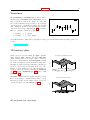
142
gnuplot 4.6
ps allcF writes postscript definitions of all formulae. This you may find interesting if you want to edit the
postscript file in order to have different palettes for different surfaces in one graph. Well, you can achieve
this functionality by multiplot with fixed origin and size.
If pm3d map has been plotted from gridded or almost regular data with an output to a postscript file,
then it is possible to reduce the size of this postscript file up to at about 50% by the enclosed awk script
pm3dCompress.awk. This you may find interesting if you intend to keep the file for including it into your
publication or before downloading a very large file into a slow printer. Usage:
awk -f pm3dCompress.awk thefile.ps >smallerfile.ps
If pm3d map has been plotted from rectangular gridded data with an output to a postscript file, then it is
possible to reduce the file size even more by the enclosed awk script pm3dConvertToImage.awk. Usage:
awk -f pm3dConvertToImage.awk <thefile.ps >smallerfile.ps
You may manually change the postscript output from gray to color and vice versa and change the definition
of <maxcolors>.
Pointintervalbox
The pointinterval property of line types is used in plot style linespoints. A negative value of pointinterval,
e.g. -N, means that point symbols are drawn only for every Nth point, and that a box (actually circle) behind
each point symbol is blanked out by filling with the background color. The command set pointintervalbox
controls the radius of this blanked-out region. It is a multiplier for the default radius, which is equal to the
point size.
Pointsize
The set pointsize command scales the size of the points used in plots.
Syntax:
set pointsize <multiplier>
show pointsize
The default is a multiplier of 1.0. Larger pointsizes may be useful to make points more visible in bitmapped
graphics.
The pointsize of a single plot may be changed on the plot command. See plot with (p. 90) for details.
Please note that the pointsize setting is not supported by all terminal types.
Polar
The set polar command changes the meaning of the plot from rectangular coordinates to polar coordinates.
Syntax:
set polar
unset polar
show polar
In polar coordinates, the dummy variable (t) is an angle. The default range of t is [0:2*pi], or, if degree
units have been selected, to [0:360] (see set angles (p. 95)).
The command unset polar changes the meaning of the plot back to the default rectangular coordinate
system.
The set polar command is not supported for splots. See the set mapping (p. 125) command for similar
functionality for splot (p. 167)s.
While in polar coordinates the meaning of an expression in t is really r = f(t), where t is an angle of rotation.
The trange controls the domain (the angle) of the function. The r, x and y ranges control the extent of