1
Ag Data Mapping Solu on - ADMS User Manual
5
Creating Zones From Imagery—Manual Image Extraction
4 Band Images
Four band images (Landsat) usually have the Red, Green, Blue, and an Inferred band in the image. The bands can be
extracted out individually, or a vegeta ve index like NDVIR or NDVIG can be used.
Using NDVI
1. Turn on a field boundary.
2. Select inside the boundary so it turns green.
3. Turn on the image to be extracted.
- Make sure it is the ac+ve layer
4. On the bo7om toolbar select the Vegeta ve Index icon.
5. Choose either the Red NDVI or Green NDVI op on
6. Go to “Field Data.”
7. Refresh the data tree.
8. The extracted surface will be automa cally saved in a folder called “Images.”
3 Band Images
Three band images most commonly have the Red, Green, and Blue bands in the image. Each of the bands can be
extracted out individually, or a visible vegeta ve index (Visible VI) can be used. By using the visible vegeta on
index it will enhance the vegeta on that is in the field.
Using Visible VI
1. Turn on a field boundary.
2. Select inside the boundary so it turns green.
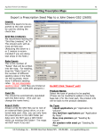
RGB NAIP Image
Visible VI Extrac on
3. Turn on the image to be extracted.
- Make sure it is the ac+ve layer
4. On the bo7om toolbar select the
Vegeta ve Index icon.
5. The extracted image will be saved to “Field Data” in a folder
called images. It will have an ending of filename_RGBVI.grd
GK Technology, Inc. - 204 Fi h Street East, Halstad, MN - 855-458-3244 - www.gktechinc.com