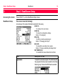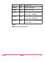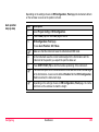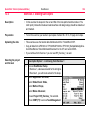
1
Leica RoadRunner
Technical Reference Manual
Version 6.1
English
Introduction
RoadRunner
2
Introduction
Purchase
Congratulations on the purchase of a RoadRunner application.
)
To use the product in a permitted manner, please refer to the detailed safety directions in the
User Manual.
Product identification
Symbols
The type and the serial number of your product are indicated on the type plate. Enter the type
and serial number in your manual and always refer to this information when you need to
contact your agency or Leica Geosystems authorized service workshop.
Type:
_________________________
Serial No.:
_________________________
The symbols used in this manual have the following meanings:
Type
)
Description
Important paragraphs which must be adhered to in practice as they enable
the product to be used in a technically correct and efficient manner.
Trademarks
• Windows and Windows CE are a registered trademark of Microsoft Corporation
• CompactFlash and CF are trademarks of SanDisk Corporation
• Bluetooth is a registered trademark of Bluetooth SIG, Inc
All other trademarks are the property of their respective owners.
Validity of this manual
This manual can apply to GPS900, GPS1200, all RX1250 controllers and TPS1200.
The following main softkeys refer to GPS900, GPS1200 and RX1250 in GPS mode.
They have the same functions in all manuals referring to GPS900, GPS1200, RX1250.
Introduction
Softkey
Description of Softkey
OCUPY (F1)
To start measuring the point being staked. The position
mode icon changes to the static icon. (F1) changes to
STOP. The difference between the current position and
the point being staked is still displayed.
STOP (F1)
To end measuring the point being staked. When Auto
STOP: Yes in CONFIGURE Point Occupation Settings,
recording of positions ends automatically as defined by
the stop criteria. The position mode icon changes to the
moving icon. (F1) changes to STORE. After ending the
measurements, the differences between the measured
point and the point to be staked are displayed.
STORE (F1)
To store the measured point. When Auto STORE: Yes in
CONFIGURE Point Occupation Settings, the measured
point is stored automatically. (F1) changes to OCUPY.
RoadRunner
3
Introduction
RoadRunner
4
Softkey
Description of Softkey
SHIFT CONEC (F3)
and
SHIFT DISCO (F3)
To dial the number of the reference station configured in
the active configuration set and to hang up immediately
after the survey is completed. Available for OCUPY (F1)
or STORE (F1) being displayed and for real-time devices
of type digital cellular phone or modem. Available for
Auto CONEC: No in CONFIGURE GSM Connection.
SHIFT INIT (F4)
To select an initialisation method and to force a new
initialisation. Available for OCUPY (F1) or STORE (F1)
being displayed and for configuration sets allowing phase
fixed solutions. Refer to the "Technical Reference
Manual".
The following main softkeys refer to TPS1200 and RX1250 in TPS mode
They have the same functions in all manuals referring to TPS1200, RX1250.
Introduction
Softkey
Description of Softkey
ALL (F1)
To measure/record distances and angles.
DIST (F2)
To measure and display distances.
REC (F3)
To record/store the measured data.
SHIFT POSIT (F4)
To position the instrument, depending on the Auto Position setting.
RoadRunner
5
Table of Contents
RoadRunner
6
Table of Contents
In this manual
Chapter
Page
1
Step 1 - RoadRunner Begin
12
2
Step 2 - RoadRunner Setup
16
3
Step 3 - Working in Standard mode
22
3.1
3.2
3.3
3.4
3.5
3.6
3.7
3.8
3.9
3.10
22
23
26
28
29
31
33
34
36
37
4
An Overview of the Define Page
Selecting Layers and Stringlines/2nd Stringlines
The Define Page for Stringlines
The Define Page for Individual Stringlines
The Define Page for Cross Slopes
The Define Page for Manual Slopes
The Define Page for Design Slopes
The Define Page for Crowns
The Define Page for Layers
The Define Page for Digital Terrain Models (DTM)
Step 3 - Working in Advanced mode
38
4.1
4.2
4.3
38
40
41
41
43
46
48
An Overview of Tasks
Selecting Layers and Stringlines
Creating/Editing Tasks with the Selection Wizard
4.3.1
Overview
4.3.2
Selection Wizard - Start Screen
4.3.3
Selection Wizard - View Screen
4.3.4
Selection Wizard - Select Screen
4.4
4.5
4.6
4.7
4.8
4.9
4.10
4.11
4.12
5
Step 4 - Measuring
5.1
5.2
5.3
5.4
5.5
5.6
5.7
5.8
5.9
5.10
Table of Contents
4.3.5
Selection Wizard - Define Screen
4.3.6
Selection Wizard - Slope Screen
4.3.7
Selection Wizard - Shift Screen
Selecting Stringlines, Indiv Stringlines or Centrelines
Selecting X-Slopes
Selecting Slopes
Selecting Manual Slopes
Selecting Layers
Selecting Digital Terrain Models (DTM)
Selecting Road Crowns
The Zig Zag Mode
Chainage Range
Staking/Checking the Road - An Overview of the Pages
The General Page
The Stake Page
The Info Page
The Plot Page
Measuring Points by Chainage and Offset
Measuring Stringlines Relative to a Centre Line
Measuring Individual Stringlines without Centre Lines
Measuring Cross Slopes
Measuring Manual Slopes and Design Slopes
5.10.1 Overview
5.10.2 Defining the Slope Type - Using no Slope
5.10.3 Defining the Slope Type - Using a Reference Point
5.10.4 Defining the Slope Type - Using a Ref. Point Surface
5.10.5 Defining the Slope Type - Using a Batter Rail
RoadRunner
51
59
63
66
68
70
75
77
79
80
82
84
86
86
88
93
96
97
101
103
105
108
110
110
112
113
117
121
7
Table of Contents
RoadRunner
5.11
5.12
5.13
6
5.10.6 Defining the Slope Type - Using a Reference Batter
Measuring Road Crowns
Measuring Road Layers
Measuring Digital Terrain Models (DTM)
8
125
129
131
132
Configuring
134
6.1
6.2
134
136
136
141
144
144
150
154
156
158
158
160
162
167
174
180
187
194
199
202
202
204
206
6.3
6.4
6.5
Overview of all Configuration Settings
Configuration Settings for the Project - Project Config
6.2.1
The General Page
6.2.2
The Posit Page (for TPS only)
Configuration Settings for the Program - Road Config
6.3.1
The General Page
6.3.2
The Check Page
6.3.3
The Info&Plot Page
6.3.4
The Logfile Page
Road Stake Out Info Page and Road Check Info Page
6.4.1
Overview
6.4.2
Changing Display Items of the Info Page
6.4.3
Info Page for Stringline
6.4.4
Info Page for Individual Stringline
6.4.5
Info Page for X-Slope
6.4.6
Info Page for Slope Manual and Slope
6.4.7
Info Page for Crown
6.4.8
Info Page for Layer
6.4.9
Info Page for DTM
Auto Positioning (TPS only)
6.5.1
Overview
6.5.2
Auto Position 2D + Measure
6.5.3
Auto Position Advanced
7
8
9
10
Table of Contents
Managing the Project
208
7.1
7.2
7.3
7.4
7.5
7.6
208
211
212
213
214
216
Overview
Selecting a Project from Task Management
Selecting a Project by Resuming the Last Task (Advanced Mode)
Creating a New Project
Editing an Existing Project
Deleting an Existing Project
Managing the Road Job
218
8.1
8.2
8.3
8.4
8.5
8.6
218
219
222
223
225
226
Overview
Working with the Design Data (Stringlines and Layers)
Working with the Tasks (Advanced Mode)
Creating a New Road Job
Deleting an Existing Road Job
Working with a DTM Job
Viewing and Editing the Design Data
228
9.1
9.2
9.3
228
230
236
Overview
Viewing the Design Data
Editing the Design Data
Working with the Extras Menu
240
10.1
10.2
10.3
10.4
10.5
10.6
10.7
240
241
244
248
249
260
262
Overview
Common Extras - DTM Height
Common Extras - Shift Reference Line
Common Extras - Reinitialise Search
Extras for Stringline
Extras for X-Slope, Layer and Crown
Extras for Slope
RoadRunner
9
Table of Contents
RoadRunner
11
Understanding Stake and Check Basics
268
11.1
11.2
11.3
11.4
268
269
271
275
275
278
279
281
283
283
285
289
289
291
292
294
296
297
299
302
11.5
11.6
11.7
11.8
11.9
12
10
Overview
Basic Terms
Basic Elements for Road Stake and Check Measurements
Shifts
11.4.1 Overview
11.4.2 Shifts for Stringlines, Slopes, Layers and DTM’s
11.4.3 Shift for X-Slopes and Road Crowns
Stake Offset and Stake Height Difference
Stake and Info Screens
11.6.1 Overview
11.6.2 Stake Offset / Height Difference Working Example
Methods for Slope Staking
11.7.1 Overview
11.7.2 General Slope Stake Out
11.7.3 Slope Staking Using a Reference Point
11.7.4 Slope Staking Using a Reference Point Surface
11.7.5 Slope Staking With Batter Rails
11.7.6 Staking Batter Rails Using a Reference Point
Chainage or Station Equations
Working Corridor
Understanding the Geometry
304
12.1
12.2
12.3
304
305
308
Horizontal and Vertical Geometry Elements
Horizontal and Vertical Shifts
Extension of the Centreline
13
Quick Start Tutorial (Advanced Mode)
310
13.1
13.2
13.3
13.4
13.5
13.6
13.7
310
313
319
328
334
341
348
Overview
Exercise 1a: Setting Up and Getting Started
Exercise 1b: Creating the Project and Task and also Configuring
Exercise 2: Staking the Centre Line
Exercise 3: Staking Out Slopes
Exercise 4: Checking Road Layer Surface
Exercise 5: Shifting Design to Fit Existing Road Level
Index
Table of Contents
354
RoadRunner
11
Step 1 - RoadRunner Begin
1
RoadRunner
12
Step 1 - RoadRunner Begin
Accessing the screens
Start the RoadRunner application or press ESC on the RoadRunner Setup screen.
Positioning the GPS
This screen shows the following:
To select the coordinate system, codelist, configuration set and antenna for the survey.
CONT (F1)
To continue to the next screen.
CONF (F2)
To access the configuration settings.
Refer to "6 Configuring".
RESUM (F4)
To resume the last used and stored task. This is a
recommended feature when using Advanced mode.
DATA (F5) (for GPS900 receivers)
To view/edit the road data in the road job.
Refer to "9 Viewing and Editing the Design Data".
CSYS (F6)
To change the current coordinate system.
Field
Description of Field
Coord System
Output. The active coordinate system. Use CSYS
(F6) to change the coordinate system.
Road jobs are defined in local grid coordinates.
The right coordinate system must be chosen for the
road job.
Positioning the TPS
Field
Description of Field
Codelist
Choicelist. The active codelist. All codelists from
Main Menu: Manage...\Codelists can be selected.
Config Set (for GPS1200 receivers)
Choicelist. The active configuration set. All configuration sets from Main Menu: Manage...\Configuration Sets can be selected.
Antenna (for GPS1200 receivers)
Choicelist. The antenna currently set in the
selected configuration set. All antennas from Main
Menu: Manage...\Antennas may be selected.
This screen shows the following:
To select the coordinate system, codelist, configuration set and reflector for the survey.
CONT (F1)
To continue to the next screen.
CONF (F2)
To access the configuration settings.
Refer to "6 Configuring".
SETUP (F3)
To set up an instrument station by determining the
station coordinates and orienting the horizontal circle.
RESUM (F4)
To resume the last used and stored task. This is a
recommended feature when using Advanced mode.
CSYS (F6)
To change the current coordinate system.
Step 1 - RoadRunner Begin
RoadRunner
13
Step 1 - RoadRunner Begin
RoadRunner
14
Field
Description of Field
Coord System
Output. The active coordinate system. Use CSYS
(F6) to change the coordinate system.
Road jobs are defined in local grid coordinates.
The right coordinate system must be chosen for
the road job.
Codelist
Choicelist. The active codelist. All codelists from
Main Menu: Manage...\Codelists can be selected.
Config Set
Choicelist. The active configuration set. All configuration sets from Main Menu: Manage...\Configuration Sets can be selected.
Reflector
Choicelist. The reflector currently set in the
selected configuration set. All reflectors from Main
Menu: Manage...\Reflectors may be selected.
Add. Constant
Output. The additive constant stored with the
chosen reflector.
Step 1 - RoadRunner Begin
RoadRunner
15
Step 2 - RoadRunner Setup
2
RoadRunner
16
Step 2 - RoadRunner Setup
Accessing the screens
Press CONT (F1) on the RoadRunner Begin screen.
RoadRunner Setup
This screen shows the following:
An overview of the setup information selected for the survey.
CONT (F1)
To continue to the next screen.
CONF (F2)
To access the configuration settings.
Refer to "6 Configuring".
PROJ (F4)
To edit the currently selected project.
Refer to "7 Managing the Project".
DATA (F5)
To view/edit the road data in the road job.
Refer to "9 Viewing and Editing the Design Data".
SHIFT METHD (F2)
To show/hide the relevant stake/check methods.
Field
Description of Field
Application
To select the relevant program. This field lists all of
the programs that have been loaded into the RoadRunner group. Ensure that RR Road is selected.
Step 2 - RoadRunner Setup
Field
Description of Field
Stake/Check
To select either Stake or Check for the survey.
Method
To select the relevant method for the survey. All
stake/check methods are listed. This list can be
configured, so that only the relevant methods for
the survey are shown.
Mode
To select either Standard mode or Advanced mode
Project
To select the relevant project for the survey.
Fixpoint Job
The fixpoint job, as defined by the project.
Meas Job
The measure job, as defined by the project.
RoadRunner
17
Step 2 - RoadRunner Setup
Displaying the methods
RoadRunner
18
Field
Description of Field
Road Job
The road job, as defined by the project.
DTM (Digital Terrain Model) Job
The DTM job, as defined by the project.
1
Press SHIFT METHD (F2) to show/hide the relevant
stake/check methods.
2
Choose to display only those methods which will be
used for the survey. These settings can always be
changed later. These settings apply only to
RR Road and not to RR Tunnel or RR Rail. These
settings will apply to both Stake and Check.
Describing the methods
Step 2 - RoadRunner Setup
Field
Description of Field
Stringline
For Stake or Check. To stake/check any type of
line, for example a centre line or kerb.
Individual Stringline
For Stake or Check. Similar to the previous
method when staking/checking any line of a layer.
With this method, no centre line needs to be
defined for the layer. The stake/check is therefore
always in relation to the chainage of the line itself
and not the centre line of the layer.
X-Slope
For Stake or Check. To stake/check a X-slope
defined by the road design.
Manual Slope
For Stake or Check. To stake/check a manually
defined slope relative to an existing centre line.
Slope
For Stake or Check. To stake/check a slope
defined by the 3D road design.
Crown
For Stake or Check. To stake/check a road crown
defined by the road design.
Layer
For Stake or Check.To stake/check a layer
surface defined by the road design.
DTM (Digital Terrain Model)
For Check only. To checks a DTM surface.
RoadRunner
19
Step 2 - RoadRunner Setup
Comparing the modes
RoadRunner
20
RoadRunner may be operated in two modes - Standard mode and Advanced mode.
Feature
Touch screen functionality
This is supported in all screens, except in displays with graphics.
Standard Advanced
9
Resuming a project
It is possible to resume an existing project quickly and conveniently
9
9
Displaying/Hiding the stake/check methods
RoadRunner can be configured so that only those stake/check
methods which are relevant to the user are displayed.
9
Selecting layers and stringlines during a survey
Layers and stringlines can be easily and quickly selected while
staking and checking.
9
9
Working with tasks
User defined tasks are generated for each stringline when staking
and checking. These tasks may always be edited and deleted.
9
Shifting a stringline (related to a task)
It is possible to enter horizonal and/or vertical shifts for stringlines.
9
Entering chainage limits for a stringline (related to a task)
It is possible to enter min. and max. chainages for a stringline.
9
Staking a stringline in 2D/3D (related to a task)
It is possible to stake a stringline in either 2D (X,Y) or 3D (X,Y,Z).
3D only
9
Standard mode
For standard mode, ensure that Mode=Standard is set in RoadRunner Setup.
Setting the definitions for the survey
• All of the road element definitions for a survey are
available in the Define page.
Working with the Define page
• This is the page which is displayed before
starting a stake/check survey in Standard mode.
• The layers and stringlines contained in the active
road job can be selected from this page. These
elements, combined with other settings on this
page can easily be changed during the survey.
Advanced mode
For advanced mode, ensure that Mode=Advanced is set in RoadRunner Setup.
Setting the definitions for the survey
• All of the road element definitions for a survey are
available from tasks, which are created and
edited using the Selection Wizard.
Working with Tasks
• Tasks are an integral part of all stake/check
surveys in Advanced mode.
• The layers and stringlines contained in the active
road job are selected from tasks. A task is
created for each stringline which is required for
the survey. These elements, combined with other
definitions can easily be changed during a
survey.
Step 2 - RoadRunner Setup
RoadRunner
21
Step 3 - Working in Standard mode
3
RoadRunner
22
Step 3 - Working in Standard mode
3.1
An Overview of the Define Page
Accessing the screens
Press CONT (F1) on the RoadRunner Setup screen (using Standard mode).
The Define page
This screen shows the following:
Layers and stringlines contained in the active road job can be selected from this page. These
elements, combined with other settings on the page can easily be changed during the survey
)
CONT (F1)
To continue to the next screen.
SHIFT CONF (F2)
To access the configuration settings.
Refer to "6 Configuring".
Refer to "2 Step 2 - RoadRunner Setup" for further details on Standard mode.
3.2
Selecting Layers and Stringlines/2nd Stringlines
Layers and Stringlines/2nd Stringlines
In Standard mode the layers and stringlines/2nd stringlines are selected from the Define
screen.
Selecting a layer
Screen
Description
Layers can be selected from the choicelist. The
choicelist can only be opened when more than one
layer is contained in the active road job.
Selecting a stringline/2nd stringline
Screen
Step 3 - Working in Standard mode
Step Description
1
Click on the choicelist containing the stringlines/2nd
stringlines. A line can then be selected from either:
2a) the Lines page, or
2b) the Plot page.
RoadRunner
23
Step 3 - Working in Standard mode
Screen
RoadRunner
24
Step Description
2a
Selecting a stringline/2nd stringline from the Lines
page:
Line Name
Names of all stringlines in the selected layer.
CL Off
Offset from the centre line of the selected layer
at the current chainage.
Ht Diff (Press MORE (F5) to switch this column)
Height difference of the stringline to the centre
line at the current chainage.
Height (Press MORE (F5) to switch this column)
Absolute height of the stringline at the current
chainage.
2b
Selecting a stringline/2nd stringline from the Plot
page:
<-- (F2)
To change to the previous object.
--> (F3)
To change to the following object.
ZOOM+ (F4)
To zoom in at the highlighted object.
ZOOM- (F5)
To zoom out from the highlighted object.
Screen
Step Description
SHIFT FIT (F3)
To view the whole X-section.
SHIFT INIT (F5)
To force a re-calculation of all values.
Step 3 - Working in Standard mode
RoadRunner
25
Step 3 - Working in Standard mode
RoadRunner
26
3.3
The Define Page for Stringlines
Using this Define page
for a stake or check
survey
For this method, ensure that Method=Stringline is set in RoadRunner Setup.
SHIFT
CONT (F1)
To continue to the next screen.
SHIFT CONF (F2)
To access the configuration settings.
Refer to "6 Configuring".
Field
Description of Field
Layer
Choicelist. To select a layer in the active road job.
Def Chainage (for Stake)
Chainage (for Check)
User Input. To define a chainage for the
stake/check survey. The chainage can range
between the start chainage and the end chainage.
Line
Choicelist. To select a stringline.
2
nd
Line
Choicelist. To select a 2nd stringline. It allows to
obtain chainage, offset and height difference to
any other string of the layer independent from
those currently used. For example: Staking an XSlope where the height information comes from
the X-Slope but the chainage information comes
from a string which is not the centre line of the
current layer.
Field
Description of Field
Use Zig zag
Choicelist. Yes or No. To stake/check points on
the left/right side of the centre line in one process.
Refer to "4.11 The Zig Zag Mode" for details.
Step 3 - Working in Standard mode
RoadRunner
27
Step 3 - Working in Standard mode
RoadRunner
28
3.4
The Define Page for Individual Stringlines
Using this Define page
for a stake or check
survey
For this method, ensure that Method=Indiv Stringline is set in RoadRunner Setup.
CONT (F1)
To continue to the next screen.
SHIFT CONF (F2)
To access the configuration settings.
Refer to "6 Configuring".
Field
Description of Field
Layer
Choicelist. To select a layer in the active road job.
Line
Choicelist. To select a stringline.
2nd
Choicelist. To select a 2nd stringline.
Line
Refer to "3.3 The Define Page for Stringlines" for
details.
Use Zig zag
Choicelist. Yes or No. To stake/check points on
the left/right side of the centre line in one process.
Refer to "4.11 The Zig Zag Mode" for details.
3.5
The Define Page for Cross Slopes
Using this Define page
for a stake or check
survey
For this method, ensure that Method=X-Slope is set in RoadRunner Setup.
CONT (F1)
To continue to the next screen.
SHIFT CONF (F2)
To access the configuration settings.
Refer to "6 Configuring".
Field
Description of Field
Layer
Choicelist. To select a layer in the active road job.
Def Chainage (for Stake)
Chainage (for Check)
User Input. The values are limited to the start
chainage and end chainage.
Left Strln
Choicelist. The name of the left stringline defining
the X-slope.
Right Strln
Output. The name of the right stringline defining
the X-slope.
Refrence Line
Choicelist. Left Strln or Right Strln. To select one
of the stringlines to be used as the reference line.
2nd Line
Choicelist. To select a 2nd stringline.
Refer to "3.3 The Define Page for Stringlines" for
details.
Step 3 - Working in Standard mode
RoadRunner
29
Step 3 - Working in Standard mode
RoadRunner
30
Field
Description of Field
Use Zig zag
Choicelist. Yes or No. To stake/check points on
the left/right side of the centre line in one process.
Refer to "4.11 The Zig Zag Mode" for details.
3.6
The Define Page for Manual Slopes
Using this Define page
for a stake or check
survey
For this method, ensure that Method=Manual Slope is set in RoadRunner Setup.
CONT (F1)
To continue to the next screen.
SLOPE (F2)
To define the slope parameters.
SHIFT CONF (F2)
To access the configuration settings.
Refer to "6 Configuring".
Field
Description of Field
Layer
Choicelist. To select a layer in the active road job.
Def Chainage (for Stake)
Chainage (for Check)
User Input. The values are limited to the start
chainage and end chainage.
Hng Reference
Choicelist. To select the hinge point of the slope.
Hinge Type
Choicelist. Relative or Absolute. To select the
vertical offset type for the hinge point.
Def Hng Off
User Input. The horizontal offset of the hinge point
from the centre line/reference line.
Def Hng HtD
User Input. The height difference of the hinge point
from the centre line/reference line. This field is
visible if Hinge Type=Relative
Step 3 - Working in Standard mode
RoadRunner
31
Step 3 - Working in Standard mode
RoadRunner
32
Field
Description of Field
Def Hng Elev
User Input. The elevation of the hinge point (absolute height). This field is visible if Hinge
Type=Absolute
Slope Type
Choicelist. Cut Right/Left or Fill Right/Left.
Differentiates if the defined slope is a cut/fill and
left/right.
Hinge Point
Left cut
Right cut
Left fill
Right fill
RR12_079
Slope Ratio
Defines the ratio of the slope. The format of Slope
Ratio depends on the settings chosen in RoadRunner Project Configuration for Slope Format.
3.7
The Define Page for Design Slopes
Using this Define page
for a stake or check
survey
For this method, ensure that Method=Slope is set in RoadRunner Setup.
CONT (F1)
To continue to the next screen.
SLOPE (F2)
To define the slope parameters.
SHIFT CONF (F2)
To access the configuration settings.
Refer to "6 Configuring".
Field
Description of Field
Layer
Choicelist. To select a layer in the active road job.
Def Chainage (for Stake)
Chainage (for Check)
User Input. The values are limited to the start
chainage and end chainage.
Left Strln
Choicelist. The name of the left stringline defining
the slope.
Right Strln
Output. The name of the right stringline defining
the slope.
Hinge
Choicelist. Left Strln or Right Strln. To select the
hinge point of the slope.
Step 3 - Working in Standard mode
RoadRunner
33
Step 3 - Working in Standard mode
RoadRunner
34
3.8
The Define Page for Crowns
Using this Define page
for a stake or check
survey
For this method, ensure that Method=Crown is set in RoadRunner Setup.
CONT (F1)
To continue to the next screen.
SHIFT CONF (F2)
To access the configuration settings.
Refer to "6 Configuring".
Field
Description of Field
Layer
Choicelist. To select a layer in the active road job.
Def Chainage (for Stake)
Chainage (for Check)
User Input. The values are limited to the start
chainage and end chainage.
Left Strln
Output. To select the left stringline defining the Xslope.
Crown Line
Choicelist. To select the common stringline
between the left X-slope and right X-slope.
Right Strln
Output. To select the right stringline defining the Xslope.
Refrence Line
Choicelist. Left Strln or Right Strln. To select one
of the stringlines to be used as the reference line.
2nd Line
Choicelist. To select a 2nd stringline.
Field
Description of Field
Refer to "3.3 The Define Page for Stringlines" for
details.
Use Zig Zag
Choicelist. Yes or No. To stake/check points on
the left/right side of the centre line in one process.
Refer to "4.11 The Zig Zag Mode" for details.
Step 3 - Working in Standard mode
RoadRunner
35
Step 3 - Working in Standard mode
RoadRunner
36
3.9
The Define Page for Layers
Using this Define page
for a stake or check
survey
For this method, ensure that Method=Layer is set in RoadRunner Setup.
CONT (F1)
To continue to the next screen.
SHIFT CONF (F2)
To access the configuration settings.
Refer to "6 Configuring".
Field
Description of Field
Layer
Choicelist. To select a layer in the active road job.
Centre line
Output. Active centre line of the selected layer.
Exp endSlp
Choicelist. Yes or No. To expand the left most and
right most end slopes of the design.
3.10
The Define Page for Digital Terrain Models (DTM)
Using this Define page
for a check survey (only
applicable to check
surveys)
For this method, ensure that Method=DTM is set in RoadRunner Setup
CONT (F1)
To continue to the next screen.
SHIFT CONF (F2)
To access the configuration settings.
Refer to "6 Configuring".
Field
Description of Field
DTM
Choicelist. A list of all DTM surfaces available in
the selected DTM job.
#Triangles
Output. Number of triangles the selected DTM
consists of.
Step 3 - Working in Standard mode
RoadRunner
37
Step 3 - Working in Advanced mode
4
RoadRunner
38
Step 3 - Working in Advanced mode
4.1
An Overview of Tasks
Accessing the screens
Press CONT (F1) on the RoadRunner Setup screen (using Advanced mode).
Task management
This screen shows the following:
In order to stake/check a road, a task needs to be created or selected. A task is created by
using the Selection Wizard. A task is selected from Task Management. The task defines
which road is to be staked/checked and defines any shifts that are to be used during the
survey. This screen shows a list of all existing tasks stored with the selected project.
CONT (F1)
To continue to the next screen.
NEW (F2)
To create a new task with the Selection Wizard.
EDIT (F3)
To edit an existing task with the Selection Wizard.
DEL (F4)
To delete an existing task.
MORE (F5)
To toggle between the task date and task time.
TEMP (F6)
To create a temporary task with the Selection Wizard.
This task is identical to any other task but is not stored
for later use.
SHIFT HOME (F2)
To go to the top of the list.
SHIFT END (F3)
To go to the end of the list.
SHIFT TIME/NAME (F5)
To sort the list by time or name.
Column
Description of column
Name
The name of the working task.
The following columns/values can be toggled, by using the MORE (F5) softkey:
Date
The creation date of the working task.
Time
The creation time of the working task.
)
Refer to "2 Step 2 - RoadRunner Setup" for further details on Advanced mode.
Step 3 - Working in Advanced mode
RoadRunner
39
Step 3 - Working in Advanced mode
RoadRunner
40
4.2
Selecting Layers and Stringlines
Layers and Stringlines
In Advanced mode a task is created, edited or selected in order to stake/check elements of
a road. The task defines which road is to be staked/checked, including which layers and stringlines are to be used.
Selecting a layer
Screen
Description
Layers can be selected from the choicelist in the
View screen of the Selection Wizard. The choicelist
can only be opened when more then one layer is
contained in the active road job.
Selecting a stringline
Screen
Description
Stringlines can be selected from the Select screen
of the Selection Wizard.
4.3
Creating/Editing Tasks with the Selection Wizard
4.3.1
Overview
General
The element to stake out or check is selected at the start of the stake out and check process.
This selection is made at the same time as the definition of the parameters for the stake
out/check.The selection wizard guides you through the process of selecting and defining the
elements to stake out or check. The selected element to stake out/check and all the parameters defined are stored as a new working task. Tasks created with the selection wizard are
stored as part of the project and may be called up again.
Two types of tasks
•
•
Description
RoadRunner distinguishes between two types of tasks:
• Persisted tasks, these tasks are stored as part of the project and can be re-called.
Persisted tasks should be created if you will have to come back to complete this
stake/check survey.
• Temporary tasks, these tasks are not persisted. They are used if you have to
stake/check only a few points.
Temporary tasks will not show up in Task Management and cannot be re-called.
The basic steps and dialogs are common for every selection although, depending on the
chosen settings, certain screens of the wizard are skipped.
Step 3 - Working in Advanced mode
RoadRunner
41
Step 3 - Working in Advanced mode
Start
(Name,
element type,
offset types)
RoadRunner
42
Define
only
Yes
centreline
?
(Stake mode,
min/max
chainage)
No
Slopes ?
No
Shifts ?
Yes
View
Select
(Layer,
Selection
view...)
(Graphic
selection)
Yes
Slope
Shift
Settings
(Batter rails,
reference
points)
( horizontal/
vertical)
RR12_074
IF the task is to
THEN
step from one screen of the wizard to the next one
NEXT (F1).
to return to the previous wizard screen
BACK (F2).
exits the wizard on the last screen of the wizard
FINSH (F1).
No
4.3.2
Selection Wizard - Start Screen
Description
Selection Wizard-Start is the first screen accessed by the selection wizard.
Access
The screen is accessed as part of the selection wizard.
RR
Selection Wizard-Start
NEXT (F1)
To move to the next screen of the selection.
Field
Option
Task Type
Step 3 - Working in Advanced mode
Description of Field
The task type to select. Options will vary depending
upon from which stake out/check method the
selection wizard is accessed.
Centreline
Selection of a stringline to be used as centre line.
Stringline
Selection of a stringline part of a layer with defined
centreline.
Indiv Stringline
Selection of a stringline within a layer, independent
if a centreline is defined.
Slope
Selection of a slope.
Manual Slope
Selection of the centre line for a manual slope.
RoadRunner
43
Step 3 - Working in Advanced mode
Field
RoadRunner
44
Option
Description of Field
X-Slope
Selection of a X-slope.
Crown
Selection of a road crown.
Layer
Selection of a design layer.
DTM
Selection of a DTM/TIN surface.
)
The list of stake out and check methods is
not identical with the available task types.
For example, Stringline uses centreline and
stringline.
Task Name
User input
The name of the task to be stored.
Use Zig zag
Yes or No
The zig zag mode is used to stake out points on the
left and right hand side of the centre line in one
process.
The zig zag mode is available for stakeout/check
methods:
• Stringline/Indiv Stringline
• X-Slope
• Road Crown.
Refer to "4.11 The Zig Zag Mode" for more information on the zig zag mode.
Field
Option
Description of Field
5
4
1
6
3
RR12_048
Shift Horiztl
None,
Linear,
Constant,
Parabolic or
Reverse Curve
2
Type of horizontal shift applied to the object.
constant
linear
parabolic
& reverse curve
RR12_049
Shift Verticl
None,
Linear,
Constant,
Parabolic or
Reverse Curve
Type of vertical shift applied to the object.
constant
linear
parabolic
& reverse curve
RR12_050
Next step
NEXT (F1) to move to the next step of the selection wizard.
Step 3 - Working in Advanced mode
RoadRunner
45
Step 3 - Working in Advanced mode
RoadRunner
46
4.3.3
Selection Wizard - View Screen
Description
Selection Wizard-View defines the layer and its graphic appearance for the selection.
Access
The screen is accessed as part of the selection wizard.
RR
Selection Wizard-View
NEXT (F1)
To move to the next screen of the selection.
DEFLT (F5)
To reset the Plot Chainage to the start chainage of
the layer centre line.
BACK (F6)
To move back to the previous screen of the wizard.
Field
Option
Description of Field
Layer
Choicelist
The layer the object to select belongs to.
Select View
The selection view used for picking the objects.
Cross-Section
Plan
Cross section view of the design data.
)
The cross section view is available for all
working methods.
2D plan view of the design data.
)
The plan view is only available for the
working methods Stringline and Individual
Stringline.
Field
Option
Description of Field
Plot Chainage
User input
With Select View: Cross-Section, it defines the
chainage at which the cross section for the graphical selection is created.
With Select View: Plan, it defines the chainage
which is to be marked and displayed by a triangle.
This allows easier user orientation within a project.
)
Plot Step
User input
Plot Chainage is only used for Select View:
Cross Section and the working method
Individual Stringline.
To define a chainage increment. This is the amount
by which the Plot Chainage is to be incremented
and updated on the screen display.
)
Plot Step is only used for Select View:
Cross Section and the working method
Individual Stringline.
Next step
NEXT (F1) to move to the next step of the selection.
RR
Selection Wizard-DTM
Unlike all other objects, DTM’s are selected by name.
Step 3 - Working in Advanced mode
RoadRunner
47
Step 3 - Working in Advanced mode
RoadRunner
48
4.3.4
Selection Wizard - Select Screen
Description
This screen allows the object to be used for the chosen task to be selected. Depending on
the chosen Selection View on the previous screen, this screen shows either a plan or a
cross section view.
Access
The screen is accessed as part of the selection wizard.
RR
Selection Wizard-Select
cross section view
The graphic shown is a cross section view of the layer selected in the previous step of the
selection wizard. The name of the stringline/s defining the highlighted element are shown at
the top of the screen.
.
NEXT (F1)
To move to the next screen of the selection.
<-- (F2)
To change to the previous object.
--> (F3)
To change to the following object.
ZOOM+ (F4)
To zoom in at the position of the current highlighted
object.
ZOOM- (F5)
To zoom out at the position of the current highlighted
object.
BACK (F6)
To move back to the previous screen of the wizard.
SHIFT FIT (F3)
To view the whole X-section.
Next step
NEXT (F1) to move to the next step of the selection wizard.
RR
Selection Wizard-Select
plan view
Description
The graphic shown is a plan view of the layer selected in the previous step of the Selection
Wizard. The name of the stringline/s defining the highlighted element are shown at the top
of the screen. For easier orientation within a project, the plan view includes a triangle which
represents the Plot Chainage, as selected in the previous screen of the Selection Wizard.
This selection method is available for the individual stringline work method.
If the instrument has a touch screen the desired line can be selected by clicking at the
graphic.
Screen
.
Step 3 - Working in Advanced mode
NEXT (F1)
To move to the next screen of the selection.
<-- (F2)
To change to the previous object.
--> (F3)
To change to the following object.
ZOOM+ (F4)
To zoom in at the position of the current highlighted
object.
ZOOM- (F5)
To zoom out at the position of the current highlighted
object.
BACK (F6)
To move back to the previous screen of the wizard.
SHIFT CH+ (F2)
To increment.the Plot Chainage by the Plot Step.
SHIFT FIT (F3)
To view the whole alignment.
RoadRunner
49
Step 3 - Working in Advanced mode
RoadRunner
50
SHIFT CENTR (F4)
To centre the plot at the selected element.
SHIFT LIST (F5)
To list the plot at the selected element.
Next step
NEXT (F1) to move to the next step of the selection wizard.
4.3.5
Selection Wizard - Define Screen
Description
RR Selection Wizard-Define allows parameters relevant to the task to be defined.
RR Selection Wizard-Define varies for each of the following elements:
• Stringlines and centre lines
• X-slopes and road crowns
• Slopes
• Layers
RR Selection Wizard-Define does not exists for DTM’s.
Access
The screen is accessed as part of the selection wizard.
RR
Selection Wizard-Define
for stringlines and
individual stringlines
NEXT (F1)
To move to the next screen of the selection.
DEFLT (F5)
To reset the Min Chainage and Max Chainage to the
start/end chainage of the layer centre line.
BACK (F6)
To move back to the previous screen of the wizard.
Field
Option
Description of Field
Line Name
Output
The name of the selected stringline.
Stake Mode
The stake out mode used for the selected object.
3D
Step 3 - Working in Advanced mode
Full 3D stake out or check of the selected object.
RoadRunner
51
Step 3 - Working in Advanced mode
Field
RoadRunner
52
Option
Description of Field
2D
Stake out or check of the selected object in position
only.
Use Min/Max
Yes or No
Define a maximum and minimum working
chainage. Refer to "4.12 Chainage Range" for
more information.
Min Chainage
User input
Minimum chainage of the chainage range.
Refer to "4.12 Chainage Range" for more information.
Max Chainage
User input
Maximum chainage of the chainage range.
Refer to "4.12 Chainage Range" for more information.
Next step
IF the task is to
THEN
move to the next step of the selection wizard
NEXT (F1).
to confirm all steps of the selection wizard and exit it, if it is the FINSH (F1).
last screen of the selection wizard
RR
Selection Wizard-Define
for X-slopes
NEXT (F1)
To move to the next screen of the selection.
DEFLT (F1)
To reset the Min Chainage and Max Chainage to the
start/end chainage of the layer centre line.
BACK (F6)
To move back to the previous screen of the wizard.
Field
Option
Description of Field
Left Strgl
Output
The name of the left stringline defining the X-slope.
Right Strgl
Output
The name of the right stringline defining the Xslope.
Refrence Line
Left Strgl or
Right Strgl
The stringline the stake out of the X-slope is relative to.
Use Min/Max
Yes or No
Define a maximum and minimum working
chainage.
Refer to "4.12 Chainage Range" for more information.
Min Chainage
User input
Minimum chainage of the chainage range.
Refer to "4.12 Chainage Range" for more information.
Max Chainage
User input
Maximum chainage of the chainage range.
Refer to "4.12 Chainage Range" for more information.
Step 3 - Working in Advanced mode
RoadRunner
53
Step 3 - Working in Advanced mode
RoadRunner
54
Next step
IF the task is to
THEN
move to the next step of the selection wizard
NEXT (F1).
to confirm all steps of the selection wizard and exit it, if it is the FINSH (F1).
last screen of the selection wizard
RR
Selection Wizard-Define
for slopes
NEXT (F1)
To move to the next screen of the selection.
DEFLT (F5)
To reset the Min Chainage and Max Chainage to the
start/end chainage of the layer centre line.
BACK (F6)
To move back to the previous screen of the wizard.
Field
Option
Description of Field
Left Strgl
Output
Name of the slopes left stringline.
Right Strgl
Output
Name of the slopes right stringline.
Hinge
Left Strgl or
Right Strgl
The stringline of the slope on which the hinge point
lies.
Use Min/Max
Yes or No
Define a maximum and minimum working
chainage. Refer to "4.12 Chainage Range" for
more information.
Min Chainage
User input
Minimum chainage of the chainage range. Refer to
"4.12 Chainage Range" for more information.
Field
Option
Description of Field
Max Chainage
User input
Maximum chainage of the chainage range. Refer
to "4.12 Chainage Range" for more information.
Next step
IF the task is to
THEN
move to the next step of the selection wizard
NEXT (F1).
to confirm all steps of the selection wizard and exit it, if it is the FINSH (F1).
last screen of the selection wizard
RR
Selection Wizard-Define
for crowns
RR Selection Wizard-Define of the selection wizard for crowns is identical to RR Selection
Wizard-Define for X-slopes, the difference being the behavior of the reference line. The left
most and right most line of the two X-slopes may be chosen as the reference line. The stake
offsets and stake height difference applied to the road crown are relative to this reference
line. For the second X-slope of the road crown, stake offsets/height difference are added
symmetrically.
a
d
b
e
c
f
RR12_078
Step 3 - Working in Advanced mode
RoadRunner
a)
b)
c)
d)
e)
f)
Centre line
Left X-slope of the road crown
Right X-slope of the road crown
Left Strgl, left most stringline
Mid Strgl, mid stringline
Right Strgl, right most stringline
55
Step 3 - Working in Advanced mode
RoadRunner
RR
Selection Wizard-Define
for layers
56
NEXT (F1)
To move to the next screen of the selection.
DEFLT (F5)
To reset the Min Chainage and Max Chainage to the
start/end chainage of the layer centre line.
BACK (F6)
To move back to the previous screen of the wizard.
Field
Option
Description of Field
Centre-line
Output
Active centre line of the selected layer.
Exp endSlp
To expand the left most and right most end slopes
of the design.
Yes
Prolong end slopes of the layer.
No
End-slopes will not be prolonged.
Use Min/Max
Yes or No
Define a maximum and minimum working
chainage.
Refer to "4.12 Chainage Range" for more information.
Min Chainage
User input
Minimum chainage of the chainage range.
Refer to "4.12 Chainage Range" for more information.
Max Chainage
User input
Maximum chainage of the chainage range.
Refer to "4.12 Chainage Range" for more information.
Next step
IF the task is to
THEN
move to the next step of the selection wizard
NEXT (F1).
to confirm all steps of the selection wizard and exit it, if it is the FINSH (F1).
last screen of the selection wizard
RR
Selection Wizard-Define
for DTM’s
NEXT (F1)
To move to the next screen of the selection.
BACK (F6)
To move back to the previous screen of the wizard.
Field
Option
Description of Field
DTM
Choicelist
A list of all DTM surfaces available in the selected
DTM job.
# Triangles
Output
Number of triangles the selected DTM consists of.
Step 3 - Working in Advanced mode
RoadRunner
57
Step 3 - Working in Advanced mode
RoadRunner
58
Field
Option
Description of Field
Shift Verticl
User input
Vertical shift for the DTM. A positive shift moves
the DTM up. A negative shift moves it down.
+
_
RR12_051
Next step
IF the task is to
THEN
move to the next step of the selection wizard
NEXT (F1).
to confirm all steps of the selection wizard and exit it, if it is the FINSH (F1).
last screen of the selection wizard
4.3.6
Selection Wizard - Slope Screen
Description
Depending on the Slope method chosen in RR Road Configuration, General page the
following screens appear.
IF
THEN
Slope method: None
and
Slope method: Ref. Point
Surf
•
No screen for slope stake definition is available.
Slope method: Batter rail
•
The screen to define batter rails for cut and fill slopes
is used.
Refer to "RR Selection Wizard-Slope batter rails
screen" for information on defining the batter rail.
•
Access
Slope method: Reference
Point
•
•
The screen to define the reference point is used.
Refer to "RR Selection Wizard-Slope reference peg
screen" for information on defining the reference peg.
Slope method: Reference
Batter
•
•
The screen to define the reference batter is used.
Refer to "RR Selection Wizard-Slope reference batter
screen" for information on defining the batter rail.
The screen is accessed as part of the Selection Wizard.
Step 3 - Working in Advanced mode
RoadRunner
59
Step 3 - Working in Advanced mode
RoadRunner
60
RR
Selection Wizard-Slope
batter rails screen
NEXT (F1)
To confirm all steps of the wizard and exit the selection
wizard.
BACK (F6)
To move back to the previous screen of the wizard.
Field
Option
Description of Field
Batter Type
Cut or Fill
Toggle between the definition for cut and fill batter
rails.
Rail ov Batt
User input
The height of the rail over the slope. Represents
the "traveller" height if working with "travellers".
Rail ov Grnd
User input
The height of the rail over ground. Used to make
sure that the stake used is long enough.
RR
Selection Wizard-Slope
reference peg screen
NEXT (F1)
To confirm all steps of the wizard and exit the selection
wizard.
BACK (F6)
To move back to the previous screen of the wizard.
Field
Option
Description of Field
Ref Offset
User input
The horizontal offset of the reference point from the
catch point.
)
For Ref Offset the sign depends on the side
of the centreline.
In the direction of increasing chainage the
offset is negative for the left side.
In the direction of increasing chainage the
offset is postive for the right side.
RR
Selection Wizard-Slope
reference batter screen
NEXT (F1)
To confirm all steps of the wizard and exit the selection
wizard.
BACK (F6)
To move back to the previous screen of the wizard.
Field
Option
Description of Field
Ref Offset
User input
The horizontal offset of the reference point from the
catch point.
Traveller Ht
User input
The "Traveller" height. Height of the rail above the
slope.
Step 3 - Working in Advanced mode
RoadRunner
61
Step 3 - Working in Advanced mode
RoadRunner
62
Next step
IF the task is to
THEN
move to the next step of the selection wizard
NEXT (F1).
to confirm all steps of the selection wizard and exit it, if it is the FINSH (F1).
last screen of the selection wizard
4.3.7
Selection Wizard - Shift Screen
Description
Horizontal and vertical shifts can be applied to the selected element. By using these shifts
the design can be lifted/lowered and moved horizontally.
Access
These screens of the selection wizard are only accessed if in the first step of the selection
wizard in RR Selection Wizard-Start the selections are different to Shift Horiztl: None or
Shift Verticl: None. The screen is accessed as part of the selection wizard.
RR
Selection Wizard-Shift
NEXT (F1)
To move to the next screen of the selection.
BACK (F6)
To move back to the previous screen of the wizard.
Field
Option
Description of Field
Shift Type
Output
Type of shift selected for the object on the first
screen of the wizard.
Horiz- ReCurve
Horizontal reverse curve
Vert-ReCurve
Vertical reverse curve
Refer to "12.2 Horizontal and Vertical Shifts" for
more information on shifts.
Beg Chainage
Step 3 - Working in Advanced mode
User input
RoadRunner
Chainage from which on the shift is added.
63
Step 3 - Working in Advanced mode
RoadRunner
64
Field
Option
Description of Field
Beg Shift
User input
Shift of the object at Beg Chainage.
End Chainage
User input
Chainage till which the shift is added.
End Shift
User input
Shift of the object at End Chainage.
Before/After
Defines the object outside of the defined shift
range.
None
The object only exists within the defined shift
range.
Steps
Before/after the defined shift range no shift is
added.
Parallel
The Beg Shift/End Shift are continued parallel.
None
Step
Parallel
RR12_057
Next step
IF the task is to
THEN
move to the next step of the selection wizard
NEXT (F1).
to confirm all steps of the selection wizard and exit it, if it is the FINSH (F1).
last screen of the selection wizard
Define horizontal and/or
vertical shift
step-by-step
Description
1.
)
Refer to
chapter
RR Selection Wizard-Shift is accessed as part of the selection
wizard.
Depending on the selection for Shift Horiztl, Shift Verticl for the stringline
in RR Selection Wizard-Start the next steps vary.
2.
•
Unless Shift Horiztl: None, continue with step 2.
•
If Shift Horiztl: None, continue with step 3.
RR Selection Wizard-Shift
4.3.7
Define the horizontal shift.
3.
Depending on the selection for Shift Verticl for the stringline in RR Selection Wizard-Start the next steps vary.
•
Unless Shift Verticl: None, continue with step 4.
•
If Shift Verticl: None, continue with step 6.
4.
Press NEXT (F1)
5.
RR Selection Wizard-Shift
4.3.7
Define the vertical shift.
6.
Step 3 - Working in Advanced mode
Continue with the next step of the selection.
RoadRunner
65
Step 3 - Working in Advanced mode
RoadRunner
66
4.4
Selecting Stringlines, Indiv Stringlines or Centrelines
Description
Stringlines are always defined relative to the centre line of the layer. Refer to "11.3 Basic
Elements for Road Stake and Check Measurements" for information on stringlines.
Stringline selection
step-by-step
1.
Description
Refer to
chapter
RR Selection Wizard-Start
4.3.2
Choose Task Type: Stringline
Choose Task Type: Centreline.
If the road job consists of no other stringlines than one centreline then Task
Type: Centreline is fixed.
Define Task Name, Use Zig zag and select the type of shifts to add Shift
Horiztl and Shift Verticl.
2.
Press NEXT (F1)
3.
RR Selection Wizard-View
4.3.3
Define Select View, Plot Chainage and select the Layer.
4.
Press NEXT (F1)
5.
RR Selection Wizard-Select
<-- (F2) and --> (F3) to select the stringline by moving right and left or click
at a line. If Task Type: Centreline the selection is fixed to the centre line of
the layer.
6.
Press NEXT (F1)
4.3.4
7.
Description
Refer to
chapter
RR Selection Wizard-Define
4.3.5
Define Stake Mode, Use Min/Max, Min Chainage and Max Chainage
8.
9.
Step 3 - Working in Advanced mode
Depending on the selection for Shift Horiztl and Shift Verticl the next
steps vary.
•
If Shift Horiztl: None, Shift Verticl: None continue with step 9.
•
If Shift Horiztl and Shift Verticl are not set to None, then press NEXT
(F1) to define the shifts and then continue with step 9.
4.3.7
Press FINSH (F1) to confirm all wizard steps and exit the wizard.
RoadRunner
67
Step 3 - Working in Advanced mode
RoadRunner
68
4.5
Selecting X-Slopes
Description
X-slopes consist of two stringlines representing their left and right edge. Refer to "11.3 Basic
Elements for Road Stake and Check Measurements" for information on X-slopes.
X-slope selection
step-by-step
1.
Description
Refer to
chapter
RR Selection Wizard-Start
4.3.2
Choose Task Type: X-Slope.
Define Task Name, Use Zig zag and select the type of shifts to add Shift
Horiztl and Shift Verticl.
2.
Press NEXT (F1)
3.
RR Selection Wizard-View
4.3.3
Select the Layer and Plot Chainage.
Select View: Cross-Section is fixed.
4.
Press NEXT (F1)
5.
RR Selection Wizard-Select
4.3.4
<-- (F2) and --> (F3) to select the X-slope by moving right and left.
6.
Press NEXT (F1)
7.
RR Selection Wizard-Define
4.3.5
Define Refrence Line, Use Min/Max, Min Chainage and Max Chainage.
8.
Depending on the selection for Shift Horiztl and Shift Verticl the next
steps vary.
4.3.7
Description
9.
Step 3 - Working in Advanced mode
Refer to
chapter
•
If Shift Horiztl: None, Shift Verticl: None continue with step 9.
•
If Shift Horiztl and Shift Verticl are not set to None, then press NEXT
(F1) to define the shifts and then continue with step 9.
Press FINSH (F1) to confirm all wizard steps and exit the wizard.
RoadRunner
69
Step 3 - Working in Advanced mode
RoadRunner
4.6
Selecting Slopes
Description
Slopes consist of two stringlines, the hinge point lies on one of the stringlines.
)
70
To avoid errors and minimise the number of keystrokes, the vertex of the slope closer to the
centreline is chosen as default for the hinge point during the definition in the Selection
Wizard.
Slope selection
step-by-step
1.
Description
Refer to
chapter
RR Selection Wizard-Start
4.3.2
Choose Task Type: Slope.
Define Task Name and select the type of shifts to add Shift Horiztl and
Shift Verticl.
Zig zag mode can not be used with slopes.
2.
Press NEXT (F1)
3.
RR Selection Wizard-View
4.3.3
Choose the Layer and Plot Chainage.
Select View: Cross-Section is fixed.
4.
Press NEXT (F1)
5.
RR Selection Wizard-Select
<-- (F2) and --> (F3) to select the slope by moving right and left.
6.
Press NEXT (F1)
4.3.4
7.
Description
Refer to
chapter
RR Selection Wizard-Define
4.3.5
Define Hinge, Use Min/Max, Min Chainage and Max Chainage.
8.
Press NEXT (F1)
9.
Depending on Slope method chosen in RR Project Configuration,
General the next steps vary.
10.
11.
Step 3 - Working in Advanced mode
•
If Slope method: None, continue with step 10.
•
If Slope method: Batter rails, continue with paragraph "Batter rail definition step-by-step".
•
If Slope method: Ref Point, continue with paragraph "Reference point
definition step-by-step".
•
If Slope method: Ref Point Surf, continue with paragraph "Reference
point surface definition step-by-step".
•
If Slope method: Ref Batter, continue with paragraph "Reference point
definition step-by-step".
Depending on the selection for Shift Horiztl and Shift Verticl the next
steps vary.
•
If Shift Horiztl: None, Shift Verticl: None continue with step 11.
•
If Shift Horiztl and Shift Verticl are not set to None, then press NEXT
(F1) to define the shifts and then continue with step 11.
4.3.7
Press FINSH (F1) to confirm all wizard steps and exit the wizard.
RoadRunner
71
Step 3 - Working in Advanced mode
Batter rail
definition step-by-step
RoadRunner
Description
1.
Press NEXT (F1)
2.
RR Selection Wizard-Slope
72
Refer to
chapter
4.3.6
Define Rail ov Batt and Rail ov Grnd.
3.
Press NEXT (F1)
4.
Depending on the selection for Shift Horiztl and Shift Verticl the next
steps vary.
5.
Reference point
definition step-by-step
•
If Shift Horiztl: None, Shift Verticl: None continue with step 5.
•
If Shift Horiztl and Shift Verticl are not set to None, then press NEXT
(F1) to define the shifts and then continue with step 5.
4.3.7
Press FINSH (F1) to confirm all wizard steps and exit the wizard.
Description
1.
Press NEXT (F1)
2.
RR Selection Wizard-Slope
Refer to
chapter
4.3.6
Define Ref Offset.
3.
Press NEXT (F1)
4.
Depending on the selection for Shift Horiztl and Shift Verticl the next
steps vary.
•
If Shift Horiztl: None, Shift Verticl: None continue with step 5.
4.3.7
Description
•
5.
Reference point surface
definition step-by-step
Refer to
chapter
If Shift Horiztl and Shift Verticl are not set to None, then press NEXT
(F1) to define the shifts and then continue with step 5.
Press FINSH (F1) to confirm all wizard steps and exit the wizard.
Description
Refer to
chapter
1.
Press NEXT (F1)
2.
Depending on the selection for Shift Horiztl and Shift Verticl the next
steps vary.
3.
Reference batter
definition step-by-step
•
If Shift Horiztl: None, Shift Verticl: None continue with step 3.
•
If Shift Horiztl and Shift Verticl are not set to None, then press NEXT
(F1) to define the shifts and then continue with step 3.
4.3.7
Press FINSH (F1) to confirm all wizard steps and exit the wizard.
Description
Refer to
chapter
1.
Press NEXT (F1)
2.
RR Selection Wizard-Slope
4.3.6
Define Ref Offset and Traveller Height.
3.
Step 3 - Working in Advanced mode
Press NEXT (F1)
RoadRunner
73
Step 3 - Working in Advanced mode
4.
5.
RoadRunner
74
Description
Refer to
chapter
Depending on the selected Shift Horiztl and Shift Verticl the next steps
will vary.
4.3.7
•
If Shift Horiztl: None, Shift Verticl: None continue with step 5.
•
If Shift Horiztl and Shift Verticl are not set to None, then press NEXT
(F1) to define the shifts and then continue with step 5.
Press FINSH (F1) to confirm all wizard steps and exit the wizard.
4.7
Selecting Manual Slopes
Description
Manual slopes are defined relative to a stringline. The creation of the task is therefore quite
similar to the one of a stringline.
Manual slope selection
step-by-step
1.
Description
Refer to
chapter
RR Selection Wizard-Start
4.3.2
Choose Task Type: Manual Slope.
2.
Define Task Name: and select the type of shifts to add Shift Horiztl: and
Shift Verticl.
Zig zag mode can not be used with manual slopes.
3.
Press NEXT (F1)
4.
RR Selection Wizard-View
4.3.3
Define Select View, Plot Chainage and select the Layer:.
5.
Press NEXT (F1)
6.
RR Selection Wizard-Select
4.3.4
<-- (F2) and --> (F3) to select the stringline by moving right and left or click
at a line. If Task Type: Centreline the selection is fixed to the centre line of
the layer.
7.
Press NEXT (F1)
8.
RR Selection Wizard-Define
4.3.5
Define Use Min/Max:, Min Chainag and Max Chainage
Step 3 - Working in Advanced mode
RoadRunner
75
Step 3 - Working in Advanced mode
RoadRunner
Description
76
Refer to
chapter
Stake Mode: 3D is fixed.
9.
10.
Depending on the selection for Shift Horiztl and Shifts Verticl the next
steps vary.
•
If Shift Horiztl: None, Shift Verticl: None continue with step 10.
•
If Shift Horiztl and Shift Verticl are not set to None, then press NEXT
(F1) to define the shifts and then continue with step 10.
Press FINSH (F1) to confirm all wizard steps and exit the wizard.
4.3.7
4.8
Selecting Layers
Description
Layers consist of a various number of stringlines representing the layer surface, for example,
one centre line and the right and left edge of the road. Refer to "11.3 Basic Elements for Road
Stake and Check Measurements" for information on layers.
Slope selection
step-by-step
1.
Description
Refer to
chapter
RR Selection Wizard-Start
4.3.2
Choose Task Type: Layer.
2.
Define Task Name and select the type of shifts to add Shift Verticl. No
horizontal Shift Horiztl can be added to a layer.
Zig zag mode can not be used with slopes.
3.
Press NEXT (F1)
4.
RR Selection Wizard-View
4.3.3
Choose the Layer and Plot Chainage.
Select View: Cross-Section is fixed.
5.
Press NEXT (F1)
6.
RR Selection Wizard-Select
4.3.4
Graphical representation of the selected layer at the defined
Plot Chainage.
7.
Press NEXT (F1)
8.
RR Selection Wizard-Define
Step 3 - Working in Advanced mode
RoadRunner
4.3.5
77
Step 3 - Working in Advanced mode
RoadRunner
Description
78
Refer to
chapter
Define Exp endSlp, Use Min/Max, Min Chainage and Max Chainage
9.
10.
Depending on the selection for Shift Horiztl and Shift Verticl the next
steps vary.
•
If Shift Horiztl: None, Shift Verticl: None continue with step 10.
•
If Shift Horiztl and Shift Verticl are not set to None, then press NEXT
(F1) to define the shifts and then continue with step 10.
Press FINSH (F1) to confirm all wizard steps and exit the wizard.
4.3.7
4.9
Selecting Digital Terrain Models (DTM)
Description
Unlike all other objects DTM’s are not related to a centre line. Therefore it is not necessary
to define chainage related settings, and hence, some steps of the selection wizard are
skipped. Refer to "11.3 Basic Elements for Road Stake and Check Measurements" for information on DTM’s.
DTM selection
step-by-step
1.
Description
Refer to
chapter
RR Selection Wizard-Start
4.3.2
Choose Task Type: DTM.
Define Task Name.
2.
Press NEXT (F1).
3.
RR Selection Wizard.
4.3.3
Select the DTM and define the vertical shift Shift Verticl.
4.
Step 3 - Working in Advanced mode
Press FINSH (F1) to confirm all wizard steps and exit the selection wizard.
RoadRunner
79
Step 3 - Working in Advanced mode
RoadRunner
80
4.10
Selecting Road Crowns
Description
Road crowns consist of two X-slopes. They are a combined stake out of two X-slopes at
once. Refer to "11.3 Basic Elements for Road Stake and Check Measurements" for information on road crowns.
Road crown
step-by-step
1.
Description
Refer to
chapter
RR Selection Wizard-Start
4.3.2
Choose Task Type: Crown
2.
Define Task Name and select the type of shifts to add Shift Horiztl and
Shift Verticl.
11.4.3
The horizontal shift is added along the X-slope for the defined reference
line.
3.
Press NEXT (F1)
4.
RR Selection Wizard-View
4.3.3
Choose the Layer and define the Plot Chainage.
Select View: Cross-Section is fixed.
5.
Press NEXT (F1)
6.
RR Selection Wizard-Select
4.3.4
<-- (F2) and --> (F3) to select the crown.
7.
Press NEXT (F1)
8.
RR Selection Wizard-Select
4.3.5
Description
9.
Refer to
chapter
Define Refrence Line, Use Min/Max, Min Chainage and Max Chainage.
Only the left most and right most stringline of the crown may be selected as
reference line. Stake offsets / height differences are relative to the reference line and symmetric to the middle stringline of the road crown.
10.
11.
Step 3 - Working in Advanced mode
Depending on the selection for Shift Horiztl and Shift Verticl the next
steps vary.
4.3.7
•
If Shift Horiztl: None, Shift Verticl: None continue with step 10.
•
If Shift Horiztl and Shift Verticl are not set to None, then press NEXT 11.4.3
(F1) to define the shifts and then continue with step 10.
Press FINSH (F1) to confirm all wizard steps and exit the wizard.
RoadRunner
81
Step 3 - Working in Advanced mode
RoadRunner
82
4.11
The Zig Zag Mode
Description
If staking out a street that is defined as a centre line with offsets of 2.5 m left and right, the
zig zag mode allows you to toggle between the two lines to stake out.
a
d
b
b
c
a)
b)
c)
d)
RR12_073
Centre line
Defined Stake Offset
Parallel right stringline
Parallel left stringline
The zig zag mode is available for the following stake out/check methods:
Type
Description
Stringline
Toggle between parallel stringline left and right.
X-slope
Toggle between left and right stringline of the X-slope.
Road crown
Toggle between left and right X-slope
RoadRunner automatically detects which side of the centre line is being used and selects the
appropriate stringline as a reference.
Auto position with zig
zag
When pressing auto position SHIFT POSIT (F4) a message box comes up prompting you if
either the left or right side should be staked out/checked.
Step 3 - Working in Advanced mode
RoadRunner
83
Step 3 - Working in Advanced mode
RoadRunner
84
4.12
Chainage Range
Description
The chainage range is chosen during task creation with the selection wizard. By defining a
chainage range it is possible to limit which part of the design will be stake out or checked. If
the defined chainage range is exceeded during stake out/check a warning appears.
Chainage range fields
The following fields are used for the chainage range definition:
Field
Option
Use Min/Max
Description
To define the used chainage range.
No
No chainage range is applied. The whole length of
the stringline is used.
Yes
A chainage range is applied. If the defined range is
acceded a warning appears.
)
DEFLT (F5) to use the start/end chainage of
the centre line as Min Chainage / Max
Chainage.
Min Chainage
User input
Minimum chainage of the chainage range.
Max Chainage
User input
Maximum chainage of the chainage range.
Step 3 - Working in Advanced mode
RoadRunner
85
Step 4 - Measuring
5
5.1
The Stake pages
RoadRunner
86
Step 4 - Measuring
Staking/Checking the Road - An Overview of the Pages
Screen
Description
The General page
Stake out settings for the point to stake out, for
example, point ID or reflector height.
The Stake page
Displays the differences between the measured
points and stake out points (delta values). If these
values are zero, the measured point coincides with
the stake out point.
The Info page
A user definable page displaying values relevant to
the measured point.
The Plot page
A graphical representation of the current design in
relation to the measured point.
The Check pages
Screen
Description
The General page
Stake out settings for the point to stake out, for
example, point ID or reflector height.
The Info page
A user definable page displaying values relevant to
the measured point.
The Plot page
A graphical representation of the current design in
relation to the measured point.
Step 4 - Measuring
RoadRunner
87
Step 4 - Measuring
5.2
The General page
RoadRunner
88
The General Page
Road Stake
Description
This page defines the point to be staked.
Refer to "Introduction" for details of the main keys.
CH+ (F4)
To increase Def Chainage by the Ch Increment.
SHIFT CONF (F2)
To access configuration settings.
Refer to "6 Configuring".
SHIFT POSIT (F4)
To enable automatic instrument positioning.
Refer to "6.2.2 The Posit Page (for TPS only)".
SHIFT EXTRA (F5)
To access the Extras Menu.
Refer to "10 Working with the Extras Menu".
Road Check
Description
This page defines the point to be checked.
Refer to "Introduction" for details of the main keys.
SHIFT CONF (F2)
To access configuration settings.
Refer to "6 Configuring".
SHIFT EXTRA (F5)
To access the Extras Menu.
Refer to "10 Working with the Extras Menu".
Field
)
Description of Field
The following fields are always shown in all Stake and Check methods, unless Offset
Direc.: Perp to Align in RR Road Configuration, General page.
Point ID
User input. Name of the next point to be stored.
The Point ID will be incremented/decremented
whenever a point gets stored with ALL (F1) or REC
(F3). Refer to the "TPS1200 Technical Reference
Manual" for information on defining the point increment and point ID.
Antenna Ht
User input. Height of the antenna.
Reflector Ht
User input. Height of the reflector.
)
The following fields are always shown in all Stake methods, unless Offset Direc.:
Perp to Align in RR Road Configuration, General page.
Def Chainage
User input. Nominal chainage of the point to be
staked out.
If staking out random chainages and no nominal
chainage is defined, for example Def Chainage=----, no value for ΔChainage will be displayed on the
Stake page. All values will be displayed relative to
the current chainage.
Ch Increment
Step 4 - Measuring
User input. Chainage increment. Value by which
the nominal chainage Def Chainage
increases/decreases when pressing CH+ (F4).
RoadRunner
89
Step 4 - Measuring
RoadRunner
Field
90
Description of Field
When working with random chainages, for example
Def Chainage=-----, this line is disabled.
)
The following fields may be shown in the Stake methods.
Stake Offset
User input. Horizontal offset from the reference
stringline (as defined by the chosen method) of the
point to stake.
Stake Ht Diff
User input. Vertical offset from the reference stringline or surface (as defined by the chosen method)
of the point to stake.
)
The following fields may be shown in the Check methods, unless Offset Direc.: Perp
to Align in RR Road Configuration, General page.
Check Offset
User input. Horizontal offset for stringlines defined
by manual offset. Refer to "11.6.2 Stake Offset /
Height Difference Working Example" for more
information on stake offsets.
Check Ht Diff
User input. Vertical offset for stringlines defined by
manual height difference. Refer to "11.6.2 Stake
Offset / Height Difference Working Example" for
more information on stake height differences.
)
The following fields are shown in the Stringline, Individual Stringline, X-Slope and
Crown methods with a selection for 2nd Line: in RR Define.
2nd Line Off
Horizontal stake/check offset for 2nd string
Field
Description of Field
2nd Line HtD
Vertical stake/check height difference for 2nd string
)
The following field is shown in the Stake and Check methods except for the Slope
and Manual Slope, unless Offset Direc.: Perp to Align in RR Road Configuration,
General page.
Manual Height
)
User input. A height which is entered manually by
the user. The value typed in is used instead of
design height or DTM height.
If no value is typed in, the height from design is
used.
The following field is shown for the Stake methods Stringline, Individual Stringline
and Manual Slope, with Offset Direc.: Angle to Align in RR Road Configuration,
General page.
Angle to Alig
Understanding priorities of various heights
Step 4 - Measuring
User input. The value in clockwise direction in relation to the element tangent.
Type of height
Overrules
Stake Height Diff
Manually entered
OR
Obtained from individual point
All other heights
Considered
From height layer of DTM
Design height
Considered
From design
No other heights
Considered
RoadRunner
91
Step 4 - Measuring
RoadRunner
92
Type of height
Overrules
Stake Height Diff
2nd height from info layer of DTM
No influence on priorities
For additional info only
-
5.3
The Stake Page
)
Press
The Stake page (only
applicable to stake
surveys)
/
to de-/increase the Def Chainage by the Ch Increment.
Road Stake
Description
The values on this page guide you to the position to
stake out. All stake out methods share a common
Stake page. However the values shown differ,
being related to different elements for each stake
out method. Variations to the following definitions
are indicated in the relevant chapters for each
stake out method.
Depending on the Orientation and Guidance, as
selected in RR Road Configuration, the appearance of this page may vary.
Refer to "Introduction" for details of the main keys.
CH+ (F4)
To increase Def Chainage by the Ch Increment.
SHIFT CONF (F2)
To access configuration settings.
Refer to "6 Configuring".
SHIFT POSIT (F4)
To enable automatic instrument positioning.
Refer to "6.2.2 The Posit Page (for TPS only)".
Step 4 - Measuring
RoadRunner
93
Step 4 - Measuring
RoadRunner
Road Stake
94
Description
SHIFT EXTRA (F5)
To access the Extras Menu.
Refer to "10 Working with the Extras Menu".
Field
Description of Field
Chainage or Ch
Output. The current chainage. This field is independent of the chosen Orientation and Guidance in
RR Road Configuration.
CL Offset or CL O
Output. Perpendicular horizontal offset from the
centre line. This field is independent of the chosen
Orientation and Guidance in RR Road Configuration.
ΔChainage or ΔCh
Output. Difference between the defined chainage
Def Chainage on the General page and the current
chainage Chainage of the Stake page.
If no defined chainage exists, e.g. if staking out
random chainages or checking, this field shows
ΔChainage:----.
ΔOffset or ΔOff
Output. Horizontal offset between the defined position and the current position. The Stake Offset
defined on the General page is taken into account.
ΔHeight or ΔHt
Output. Vertical offset between the defined position
and the current position. The Stake Ht Diff defined
on the General page is taken into account.
Field
Description of Field
Near Tang Pt or NrTP
Output. Chainage difference between the measured point and the nearest tangent point (start/end
point of a road segment) of the design. This field is
independent of the chosen Orientation and Guidance in the RR Road Configuration.
a b
TPS12_233
a) Vertical alignment
b) Horizontal alignment
Only tangent points (start/end point of a road segment)
are detected.
Step 4 - Measuring
RoadRunner
95
Step 4 - Measuring
RoadRunner
5.4
The Info Page
Description
•
•
96
A user defineable Info page exists for each of the stake methods and check methods.
Refer to "6.4 Road Stake Out Info Page and Road Check Info Page" for information on
all available items for the Info page and how to select them.
5.5
The Plot page
The Plot Page
Road Stake
Description
The Plot page for Road Stake shows information
about the measured point relative to the design (as
defined by the selected layer and stringline, and the
values entered on the General page).
The following information is shown:
1. Chainage difference between the measured
point and the defined chainage. When working
with random chainages (that is, when no
defined chainage has been entered on the
General page), ΔCh changes to Ch (the current
chainage as shown on the Stake page).
2. Horiz. distance (left/right arrow) to the design.
3. Vert. distance (up/down arrow) to the design.
4. The measured point.
5. The element to stake is shown in bold. The
position to stake is marked with a cross.
6. The plot can be shown as a cross plot, plan
view or profile view (as defined by the Plot Type
setting in RR Road Configuration, Info&Plt
page).
Step 4 - Measuring
RoadRunner
97
Step 4 - Measuring
RoadRunner
Road Stake
98
Description
The information at the top of the plot corresponds
with the information on the Stake page, only when
Orientation=To Alignment is set in RR Road
Configuration, General page.
Road Check
Description
The Plot page for Road Check is similar to Road
Stake. The only difference is that the current
chainage is always shown, as shown on the Info
page.
Refer to "11.4" and "11.5" for details on plots with shifts and stake offsets/height differences.
The cross plot view
zoom in
zoom out
.
Refer to "Introduction" for details of the main keys.
CH+ (F4) (only available for Road Stake)
To increase Def Chainage by the Ch Increment.
SHIFT CONF (F2)
To access configuration settings.
Refer to "6 Configuring".
SHIFT FIT (F3)
To fit all data into the screen area.
SHIFT CENTR (F4)
To centre the plot at the selected element.
SHIFT EXTRA (F5)
To access the Extras Menu.
Refer to "10 Working with the Extras Menu".
The profile view
zoom in
zoom out
.
Refer to "Introduction" for details of the main keys.
CH+ (F4) (only available for Road Stake)
To increase Def Chainage by the Ch Increment.
SHIFT CONF (F2)
To access configuration settings.
Refer to "6 Configuring".
SHIFT FIT (F3)
To fit all data into the screen area.
SHIFT CENTR (F4)
To centre the plot at the selected element.
Step 4 - Measuring
RoadRunner
99
Step 4 - Measuring
RoadRunner
100
SHIFT EXTRA (F5)
To access the Extras Menu.
Refer to "10 Working with the Extras Menu".
The plan view
For <Stake/Check: Check> and <Method: DTM> in RR RoadRunner Setup, a Plot page
is added to the measurement screen if a DTM layer has been selected for display. The page
shows the DTM and the centre line of the alignment - always in plan view. At the top of the
page chainage, DTM height and ΔHeight are shown.
zoom in
zoom out
.
Refer to "Introduction" for details of the main keys.
CH+ (F4) (only available for Road Stake)
To increase Def Chainage by the Ch Increment.
SHIFT CONF (F2)
To access configuration settings.
Refer to "6 Configuring".
SHIFT FIT (F3)
To fit all data into the screen area.
SHIFT CENTR (F4)
To centre the plot at the selected element.
SHIFT EXTRA (F5)
To access the Extras Menu.
Refer to "10 Working with the Extras Menu".
5.6
Measuring Points by Chainage and Offset
Graphical overview
Road Stake
Road Check
b
b
f
f
e
e
i
c
c
d
RR12_034
a
h
Step 4 - Measuring
•
d
g
a) Position to stake out, defined by chainage,
stake offset and, optionally, stake height
difference
b) Centre line/stringline the position is defined
relative to
c) Stake Offset
d) Stake Ht Diff
e) Chainage
f) CL Offset
g) ΔChainage
h) ΔOffset
i) ΔHeight
Description
h
RR12_080
a
g
a) Position to check, defined by check offset
and, optionally, check height difference
b) Centre line/stringline the position is defined
relative to
c) Check Offset
d) Check Ht Diff
e) Chainage
f) CL Offset
g) Strgl Offset
h) Strgl Ht Diff
When staking points, these are points that have been defined manually by chainage and
offset relative to an existing 2D or 3D centre line or stringline.
RoadRunner
101
Step 4 - Measuring
Required elements
RoadRunner
102
•
When checking points, these are points that have been defined manually by chainage
and offset relative to an existing 2D or 3D centre line or stringline.
•
•
For Method: 2D a horizontal centre line is required.
For Method: 3D a 3D centre line is required.
5.7
Measuring Stringlines Relative to a Centre Line
Graphical overview
Road Stake
Road Check
c
b
d
a
c
a
e
e
f
f
g
h
h
d
i
b
g
e
c
f
f
a=b h
RR12_035
Description
Step 4 - Measuring
h
i
c=d
a=b g
RR12_066
a)
b)
c)
d)
e)
f)
g)
h)
i)
Position to stake out
Stringline to stake out
Centre line
Def Chainage
Chainage
CL Offset
ΔChainage
ΔOffset
ΔHeight
•
Stringlines define various elements, including:
• Centre line of the design.
• Change in slope ratio, for example, the edge of a carriage way.
• Gutter, cable, pipeline or any other type of alignment element.
a)
b)
c)
d)
e)
f)
g)
h)
RoadRunner
Stringline to check
Projected point on stringline
Centre line
Chainage
CL Offset
CL Ht Diff
Strgl Offset
Strgl Ht Diff
103
Step 4 - Measuring
Required elements
RoadRunner
104
•
Refer to "11.3 Basic Elements for Road Stake and Check Measurements" for information
on the usage of stringlines.
•
•
For Method: 2D at least a 2D stringline and a 2D centre line are required.
For Method: 3D a 3D stringline and a 3D centre line are required.
5.8
Measuring Individual Stringlines without Centre Lines
Graphical overview
Road Stake
Road Check
c
b
e
d
a
f
c
b
g
d
e
a
RR12_085
Stake Out of Roundabout
a) Position to stake out
b) Stringline to stake out
c) Centre line of the layer- is not used for the
individual stringline
d) Chainage
e) ΔChainage
f) ΔOffset
g) ΔHeight
Description
Step 4 - Measuring
RR12_084
Checking a Roundabout
a) Stringline to check
b) Chainage
c) Centreline of the layer- is not used for the
individual stringline
d) Strgl Offset
e) Strgl Ht Diff
Different to stringlines, where the stake/check is always relative to the centre line defined for
the layer, individual stringlines have no longer a relation to an overall centre line. Individual
RoadRunner
105
Step 4 - Measuring
RoadRunner
106
stringlines are used to check roundabouts, parking bays, subdivision works and any other
type of lines. The different stringlines to stake/check can be stored within one layer, which
does not require a defined centre line. This is different to the stake/check of any other type
which always require a centre line.
Required elements
A 2D or 3D design of the line to stake/check is required.
Indefinite triangle
Description
In almost all situations, a measured position is shown relative to the individual stringline by
the stringline chainage and a square offset to the stringline. However, situations may arise
where a road design has extreme changes in the deflection angle of tangent points. In these
cases it is not always possible to show a measured position by the nominal chainage and
offset. An indefinite triangle is a region in which these situations arise. Points measured
within an indefinite triangle are shown relative to the tangent point.
Graphic
b
a
RR12_091
b
b‘
b
a
b“
Road Design A
a) Individual stringline
b) Measured position (displayed relative to the stringline by chainage and square offset)
Road Design B
a) Individual stringline with extreme changes in the deflection angle of tangent points
b) Measured position within indefinite triangle
This position cannot be shown in the usual manner and is displayed relative to the tangent point
b") Measured position within indefinite traingle
This position can be shown in the usual manner and is displayed by chainage and square offset
Screen
Points measured within an indefinite triangle are always
shown relative to the tangent point.
Step 4 - Measuring
RoadRunner
107
Step 4 - Measuring
RoadRunner
5.9
Measuring Cross Slopes
Graphical overview
Road Stake
Road Check
b
f
e
j
e
k
d
h
c
Position to stake out
X-slope to stake out
Left stringline
Right stringline
Centre line
Def Chainage
Chainage
CL Offset
ΔChainage
ΔOffset
ΔHeight
i
a
e
RR12_036
h
g
i
k
a)
b)
c)
d)
e)
f)
g)
h)
i)
j)
k)
f
c
h
c
d b
d
a
g
108
j
b
a=d
f
b
k
RR12_067
a)
b)
c)
d)
e)
f)
g)
h)
i)
X-slope to check
Left stringline
Right stringline
Centre line
Chainage
CL Offset
CL Ht Diff
X-Slp Offset
X-Slp Ht Diff
h
a
c
i
Description
•
Required elements
A 3D design of the road is required.
Step 4 - Measuring
Surfaces such as the final carriage way, are often staked/checked using X-slopes. A Xslope consists of a combination of two stringlines. Refer to "11.3 Basic Elements for Road
Stake and Check Measurements" for information on the usage of X-slopes.
RoadRunner
109
Step 4 - Measuring
RoadRunner
110
5.10
Measuring Manual Slopes and Design Slopes
5.10.1
Overview
Graphical overview
Road Stake
b
Road Check
g
b
d
d
c
f
h
a
Description
g
e
c
f
h
a
i
e
i
RR12_037
RR12_037
a)
b)
c)
d)
e)
f)
g)
h)
i)
Catch point
Centre line
Slope to stake out
Hinge point = left stringline
Second / right stringline
Natural surface
CL Offset
ΔOffset
ΔHeight
a)
b)
c)
d)
e)
f)
g)
h)
i)
•
•
Surfaces, such as the end slopes of a cut or fill, are staked/checked using slope methods.
Slopes are defined by two stringlines. Refer to "11.3 Basic Elements for Road Stake and
Check Measurements" for information on the usage of slopes.
Catch point
Centre line
Slope to check
Hinge point
Second stringline of the slope
Natural surface
CL Offset
Slope Offset
Slope Ht Diff
•
•
When staking slopes, the point of interest is the intersection of the defined slope with the
natural surface ( = catch point). Refer to "11.7 Methods for Slope Staking" for information
on the slope staking methods supported by RoadRunner.
When checking slopes, the slope check is independent of the Slope Method chosen in
RoadRunner Road Configuration.
Description of
manual slopes
•
For this method the slope is defined manually relative to an existing centre line.
Description of
design slopes
•
For this method a 3D representation of the slope is required.
Step 4 - Measuring
RoadRunner
111
Step 4 - Measuring
5.10.2
Configuring the slope
RoadRunner
112
Defining the Slope Type - Using no Slope
Screen
Step Description
1
Select Road Config.
Press CONT (F1) to continue to the next screen.
2
Entering the values
(Standard Mode)
Screen
When no slope type is required:
set Slope Method=None.
Description
After setting Slope Method=None, the SLOPE (F2)
key in the Define screen is disabled and no slope
values can be entered.
5.10.3
Configuring the slope
Defining the Slope Type - Using a Reference Point
Screen
Step Description
1
Select Road Config.
Press CONT (F1) to continue to the next screen.
2
Step 4 - Measuring
RoadRunner
When a reference point is required:
set Slope Method=Reference Point.
113
Step 4 - Measuring
Entering the values
(Standard Mode)
RoadRunner
Screen
114
Step Description
1
After setting Slope Method=Reference Point in the
configuration screen, the SLOPE (F2) key in the
Define screen is enabled and slope values for the
reference point can be entered.
Press SLOPE (F2) to continue to the next screen.
2
It is now possible to stake out a reference point with
a defined offset from the catch point. Enter the
appropriate values.
Entering the values
(Advanced Mode)
Screen
Step Description
1
After setting Slope Method=Reference Point in the
configuration screen, a task is created or selected
and then the instrument is positioned and oriented.
Press CONT (F1) to go to Task Management.
2
Enter appropriate values for the slope definition.
Refer to "10.7 Extras for Slope" for details of the
fields in this screen.
Refer to "11.7.3 Slope Staking Using a Reference
Point" for further details on using a reference point.
Press CONT (F1) to continue to the next screen.
3
It is now possible to stake out a reference point with
a defined offset from the catch point. Enter the
appropriate values.
Refer to "4.3.6 Selection Wizard - Slope Screen"
for further details on using the Task selection
wizard.
Step 4 - Measuring
RoadRunner
115
Step 4 - Measuring
Workflow
RoadRunner
•
•
116
Refer to "11.7.3 Slope Staking Using a Reference Point" for more information on the
reference point method.
The first position to stake out is the catch point.
Step
Description
1.
Stake out the position of the catch point by using ΔOffset and/or ΔHeight. When
ΔOffset and ΔHeight are equal to zero, the catch point has been located.
2.
SHIFT EXTRA (F5) to access RR Extras- Slope.
3.
Select Place Reference Point to access the stake out screen for the reference
peg RR Stake - Refpoint. The measured position from step 1 is used as the catch
point for the stake out of the reference point.
4.
Stake out the reference point using ΔOffset. When ΔOffset is equal to zero the
reference peg position has been found. ΔHeight shows the height difference relative to the catch point. Note that all values shown on the Info page are relative to
the original slope.
5.
ESC to return to RR Stake Slope. Stake out the next catch point from this screen.
5.10.4
Configuring the slope
Defining the Slope Type - Using a Ref. Point Surface
Screen
Step Description
1
Select Road Config.
Press CONT (F1) to continue to the next screen.
2
Step 4 - Measuring
RoadRunner
When a reference point at the slope surface is
required:
Set Slope Method=Ref. Point Surf.
117
Step 4 - Measuring
Entering the values
(Standard Mode)
RoadRunner
Screen
118
Step Description
1
After setting Slope Method=Ref. Point Surface in
the configuration screen, the SLOPE (F2) key in
the Define screen is disabled. Slope values for the
reference point can not be entered.
Press CONT (F1) to continue to the next screen.
2
It is now possible to stake out. Enter the appropriate values.
Entering the values
(Advanced Mode)
Screen
Step Description
1
After setting Slope Method=Ref. Point Surf in the
configuration screen, a task is created or selected
and then the instrument is positioned and oriented.
Press CONT (F1) to go to Task Management.
2
Enter appropriate values for the slope definition.
Refer to "4.3.6 Selection Wizard - Slope Screen"
for further details on using the Task selection
wizard.
Refer to "10.7 Extras for Slope" for details of the
fields in this screen.
Refer to "11.7.4 Slope Staking Using a Reference
Point Surface" for further details on using a reference point.
Press CONT (F1) to continue to the next screen.
Workflow
Step 4 - Measuring
•
Refer to "11.7.4 Slope Staking Using a Reference Point Surface" for more information on
the reference point surface method.
RoadRunner
119
Step 4 - Measuring
RoadRunner
•
120
The first position to find is the catch point.
Step
Description
1.
Stake out the position of the catch point by using ΔOffset and/or ΔHeight. When
ΔOffset and ΔHeight are equal to zero, the catch point has been located.
2.
SHIFT EXTRA (F5) to access RR Extras- Slope.
3.
Select Place Surface Reference Peg to access the define screen for the reference peg field. The measured position from step 1 is used as the catch point for
the stake out of the reference point.
The Act Hinge Height Diff field displays the Hinge Ht Diff value from RR StakeSlope, Info page.
Type in the appropriate value for Def Hinge Ht Diff.
4.
Stake out the surface reference peg relative to the projected catch point. You are
guided to the position.
Values in RR Stake Slope Ref. Point Surf, Stake page guide you to the position
to place the peg. The defined hinge height difference is taken into account.
5.
ESC to return to RR Stake Slope. Stake out the next catch point from this screen.
5.10.5
Configuring the slope
Defining the Slope Type - Using a Batter Rail
Screen
Step Description
1
Select Road Config to continue to the Road Configuration screen.
Press CONT (F1) to continue to the next screen.
2
Step 4 - Measuring
RoadRunner
When a batter rail is required:
set Slope Method=Batter Rail.
121
Step 4 - Measuring
Entering the values
(Standard Mode)
RoadRunner
Screen
122
Step Description
1
After setting Slope Method=Batter Rail in the
configuration screen, the SLOPE (F2) key in the
Define screen is enabled and slope values for the
batter rail can be entered.
Press SLOPE (F2) to continue to the next screen.
2
It is now possible to stake out a batter rail with a
defined peg height. Enter the appropriate values.
Entering the values
(Advanced Mode)
Screen
Step Description
1
After setting Slope Method=Batter Rail in the
configuration screen, a task is created or selected
and then the instrument is positioned and oriented.
Press CONT (F1) to continue to the next screen.
2
Enter appropriate values for the slope definition.
Refer to "10.7 Extras for Slope" for details of the
fields in this screen.
Refer to "11.7.5 Slope Staking With Batter Rails"
for further details on using a batter rail.
Press CONT (F1) to continue to the next screen.
3
It is now possible to stake out a batter rail with a
defined peg height. Enter the appropriate values.
Refer to "4.3.6 Selection Wizard - Slope Screen"
for further details on using the Task selection
wizard.
Step 4 - Measuring
RoadRunner
123
Step 4 - Measuring
Workflow
RoadRunner
•
•
124
Refer to "11.7.5 Slope Staking With Batter Rails" for more information on the batter rail
method.
The first peg to stake out is always the peg closest to the hinge point.
Step
Description
1.
Stake out the position of the first peg of the batter by using ΔOffset. The height of
the rail over ground Rail over Grd is taken into account for ΔOffset. This means
that when ΔOffset is equal to zero the first peg is in the correct position.
2.
Place the pole on top of the first peg. The value for ΔHeight indicates how far
below the top of the peg the batter has to be placed.
3.
Stake out the second peg of the batter rail by using ΔChainage and place the peg.
4.
Place the pole on the position of the batter rail to be used as a reference for the
slope values to mark on the batter rail. ΔHeight should read now zero. Note that
all values shown under the Info page are relative to the original slope.
5.10.6
Configuring the slope
Defining the Slope Type - Using a Reference Batter
Screen
Step Description
1
Select Road Config to continue to the Road Configuration screen.
Press CONT (F1) to continue to the next screen.
2
Step 4 - Measuring
RoadRunner
When a reference batter is required:
set Slope Method=Reference Batter.
125
Step 4 - Measuring
Entering the values
(Standard Mode)
RoadRunner
Screen
126
Step Description
1
After setting Slope Method=Batter Rail in the
configuration screen, the SLOPE (F2) key in the
Define screen is enabled and slope values for the
batter rail can be entered.
Press SLOPE (F2) to continue to the next screen.
2
It is now possible to stake out a batter rail with a
defined offset from the catch point. Enter the
appropriate values.
Entering the values
(Advanced Mode)
Screen
Step Description
1
After setting Slope Method=Batter Rail in the configuration screen, a task is created or selected and then
the instrument is positioned and oriented.
Press CONT (F1) to continue to the next screen.
2
Enter appropriate values for the slope definition.
Refer to "10.7 Extras for Slope" for details of the
fields in this screen.
Refer to "11.7.6 Staking Batter Rails Using a Reference Point" for further details on using a batter rail.
Press CONT (F1) to continue to the next screen.
3
It is now possible to stake out a batter rail with a
defined offset from the catch point. Enter the
appropriate values.
Refer to "4.3.6 Selection Wizard - Slope Screen"
for further details on using the Task selection
wizard.
Step 4 - Measuring
RoadRunner
127
Step 4 - Measuring
Workflow
RoadRunner
•
•
128
Refer to "11.7.6 Staking Batter Rails Using a Reference Point" for more information on
the reference batter rail method.
The first position to stake out is the catch point.
Step
Description
1.
Stake out the position of the catch point by using ΔOffset and/or ΔHeight. When
ΔOffset and ΔHeight are equal to zero, the catch point has been located.
2.
SHIFT EXTRA (F5) to access RR Extras- Slope. The measured position is used
as the catch point for the stake out of the reference point.
3.
Select Place Reference Point to access the stake out screen for the reference
peg RR Stake - Refpoint.
4.
Stake out the reference point using ΔOffset. When ΔOffset is equal to zero the
reference peg position has been found.
5.
Place the pole on top of the reference peg. The value for ΔHeight indicates how
far below the top of the peg the batter has to be placed.
6.
Place the pole on the position of the batter rail to be used as a reference for the
slope values to mark on the batter rail. ΔHeight should now read zero. Note that
all values shown under the Info page are relative to the original slope.
7.
ESC to return to RR Stake Slope. Stake out the next catch point from this screen.
5.11
Measuring Road Crowns
Graphical overview
Road Stake
Road Check
e
h
g
a
Description
c
b
d
f
g
a
c
b
d
RR12_040
RR12_076
a) Position to stake out, in this case the left
stringline of the crown
b) Middle stringline of the crown, in this case
also the centre line
c) Left X-slope to stake out
d) Right X-slope to stake out
e) CL Offset
f) ΔOffset
g) ΔHt Left
h) ΔHt Right
a) Left stringline of the crown
b) Middle stringline of the crown, common for
both X-slopes
c) Left X-slope to check
d) Right X-slope to check
e) CL Offset
f) ΔOffset
g) ΔHt Left
h) ΔHt Right
•
•
Step 4 - Measuring
e
h
f
When staking road crowns, it allows the stake out of two X-slopes at the same time. If the
zig zag mode is selected, RoadRunner automatically switches between the right and left
X-slope as the reference for ΔOffset depending on whether the measured position is to
the left or right of the middle stringline.
When checking road crowns, it allows the check of two X-slopes at the same time. The
information for both X-slopes is shown at the same time.
RoadRunner
129
Step 4 - Measuring
RoadRunner
130
Required elements
A 3D design of the road is required.
Specific fields
The following fields vary from the description used in "5.2 The General Page":
Field
Option
Description
ΔHt Left,
ΔHt Right, or
ΔHt L / ΔHt R
Output
Vertical offset to the left/right X-slope defining the
road crown.
5.12
Measuring Road Layers
Graphical overview
Road Stake
Road Check
b
a
RR12_068
b
d
e
a
c
RR12_068
a) Relevant part of the layer for the current
position
b) Left stringline Left Name
c) Right stringline Right Name
d) ΔOffset
e) ΔHeight
Description
•
Required elements
A 3D design of the road is required.
Step 4 - Measuring
d
e
c
a) Relevant part of the layer for the current
position
b) Left stringline Left Name
c) Right stringline Right Name
d) Slope Offset
e) Layer Ht Diff
All stringlines are grouped in layers. Such a layer describes a surface of the road. When
staking/checking out a layer, RoadRunner automatically detects the stringline left and
right of the measured position.
RoadRunner
131
Step 4 - Measuring
RoadRunner
132
5.13
Measuring Digital Terrain Models (DTM)
Graphical overview
Road Stake
Road Check
e
a
b
g
d
f
c
RR12_046
a)
b)
c)
d)
e)
f)
g)
Description
•
Required elements
A DTM job is required.
Relevant triangle of the DTM
Projected point on DTM
Easting
Northing
DTM Ht Diff
Flow Directn
Flow Ratio
A DTM check returns the height difference between the current height and the height the
DTM at the measured position.
Step 4 - Measuring
RoadRunner
133
Configuring
6
RoadRunner
134
Configuring
6.1
Overview of all Configuration Settings
Accessing the screens
Press CONF (F2) on the RoadRunner Begin screen or RoadRunner Setup screen, or
Press SHIFT CONF (F2) on the Define page and on any page of the measurement screen.
Description
The RoadRunner configurations are separated in three different groups:
RR Configuration
Type
Description
System configuration
General parameters.
For example, angle and distance units.
Project configuration
Project parameters.
For example, the display format used for chainages.
Road configuration
Road parameters.
For example, the vertical exaggeration of cross section plots.
The option Tunnel Config is only available if the Tunnel program has been loaded (for TPS).
The option Rail Config is only available if the Rail program of has been loaded.
CONT (F1)
To access the highlighted configuration type.
Configuring
Screen
Description
Project Config
These configuration settings refer to general
parameters that apply to all projects (road, tunnel
and rail projects). They define the appearance and
behaviour common for all parts of the RoadRunner
program.
Road Config
These configuration settings refer to parameters
that apply only to Road projects.
Tunnel Config
These configuration settings refer to parameters
that apply only to Tunnel projects (for TPS).
Rail Config
These configuration settings refer to parameters
that apply only to Rail projects. The Rail configuration consists of four pages where parameters
relating to the configuration of the program may be
modified.
RoadRunner
135
Configuring
RoadRunner
136
6.2
Configuration Settings for the Project - Project Config
6.2.1
The General Page
Accessing the screens
Select Project Config on the RoadRunner Configuration screen and press CONT (F1).
Description
This defines the appearance/behaviour common to all parts of the RoadRunner program.
The General page
CONT (F1)
To confirm the changes and move to the previous
screen.
DMASK (F3)
To configure the selected display mask. Refer to the
"Technical Reference Manual".
Field
Option
Description of Field
Display Mask
Choicelist
Selects the user defined display mask shown in the
RoadRunner application for all stake out and check
methods. All display masks of the active configuration set can be selected.
Chain Format
Selects display format for all chainage information
fields.
+123456.789
Default chainage display form.
Field
Option
Description of Field
+123.4+56.789
Separator between tens and hundreds with additional decimal point.
+123+456.789
Separator between hundreds and thousands.
+1234+56.789
Separators between tens and hundreds.
Slope Format
X-Slp Format
Configuring
)
The distance units Int Ft/Inch (fi), US
Ft/Inch (ft), Kilometres (km) and US Miles
(mi) are only supported by the first chainage
format. All other chainage formats are
restricted to the base units Metre (m), Int Ft
(fi) and US Ft (ft).
Selects the display format for all slope values.
h:v
Horizontal:Vertical; for example 5:2.
v:h
Vertical:Horizontal; for example 2:5.
% (v/h * 100)
For example 40%.
Elev Angle
Angle, format depends upon system configuration.
For example 21.8014 deg, 21°48’05’’, 24.2238 gon.
Refer to the "Technical Reference Manual" for information on available angle formats.
h:v, v:h,
% (v/h * 100) or
Elev Angle
Same as Slope Format. Refer to " Slope Format"
above.
RoadRunner
137
Configuring
RoadRunner
Field
Option
Slope Signs
138
Description of Field
Selects sign definition method for slopes and Xslopes.
mathematical
All slopes sign defines from left to right, independent of whether left or right of the centre line.
relative to CL / Slope signs defined relative to/from the centre line.
relative from CL relative to CL
relative from CL
+
+
+
+
+
+
+
mathematic
+
RR12_054
Show Tang Pt
+
+
To define if a message box should be shown when
a tangent point has been detected within the
chainage increment range. This tangent point can
be selected for stake-out.
Refer to "5.3 The Stake Page" for further details.
None
No tangent points will be indicated.
Hz
Indicate tangent points of the horiz. alignment only.
Vt
Indicate tangent points of the vert. alignment only.
Hz and Vt
Indicate all tangent points.
Field
Option
Expand Lines
Description of Field
Expand each stringline at its beginning and end with
a tangent. The extension is used for projecting a
point to the stringline and for intersecting the stringline.
Yes
a
b
c
RR12_094
)
a) Centreline
b) Extended
centreline
c) Projected point
on extended
centreline
Intersection points on extended stringlines
are not shown in cross-sections and can’t be
staked out.
No
a
RR12_095
Configuring
RoadRunner
b
a) Centreline
b) Projected point
on centreline
139
Configuring
RoadRunner
Field
Option
Next step
PAGE (F6) changes to the Posit page.
140
Description of Field
)
It is recommended to use Expand Lines: No
when working with closed alignments (e.g.
roundabout, slip road, motorway exit).
6.2.2
The Posit Page (for TPS only)
Description
This allows the instrument to aim at the position to stake/check. Refer to "6.5 Auto Positioning (TPS only)" for information on the different positioning types. This functionality is only
available for motorised instruments.
The Posit page
CONT (F1)
To confirm the changes and move to the previous
screen.
Field
Option
Auto Position
Configuring
Description of Field
Type of automatic positioning used.
None
No auto position.
2D (Hz)
Instrument positions horizontally.
3D (Hz & V)
Instrument positions horizontally and vertically.
2D + Meas
Instrument positions horizontally and finds the
height by iterative distance measurements. Refer to
"6.5.2 Auto Position 2D + Measure".
Advanced
Allows to keep certain values of the current position
to remain constant. Refer to "6.5.3 Auto Position
Advanced".
RoadRunner
141
Configuring
RoadRunner
Field
Option
142
Description of Field
)
The following lines will only be enabled for
Auto Position: 2D + Meas or Auto Position: Advanced.
Position Tol
From
0.001 to 10
2D distance tolerance to the position to stake out.
Height Tol
From
0.001 to 10
Height tolerance of the position to stake out.
Chainage Tol
From
0.001 to 10
Chainage tolerance of the position to stake out.
Offset Tol
From
0.001 to 10
Offset tolerance of the position to stake out.
Laser
Defines when the red laser is turned on during the
automatic search of the position.
Always off
Visible red laser is turned off.
On at Point
Visible red laser is turned on as soon as the point is
found.
Always on
Visible red laser is turned on during the whole
search.
)
The laser can also be permanently turned on
by using the instrument settings. Refer to the
"Technical Reference Manual" for more
information.
Field
Option
Description of Field
Max Iteration
From 2 to 10
Maximum number of iterations for the distance
measurement before stopping.
Next step
CONT (F1) to accept the changes and continue.
Configuring
RoadRunner
143
Configuring
RoadRunner
144
6.3
Configuration Settings for the Program - Road Config
6.3.1
The General Page
Accessing the screens
Select Road Config on the RoadRunner Configuration screen and press CONT (F1).
The General page
CONT (F1)
To confirm the changes and move to the previous
screen.
Field
Description of Field
Orientation
The reference direction used to stake out points.
The stake out elements and the graphics displayed
are based on this selection.
to Alignment
The stake out is relative to the alignment. When the
stake out mode Stake Mode: Chain&Offset is
chosen, this method is selected automatically.
to North
The north direction of the active coordinate system
is used as the reference direction.
Field
Description of Field
to Sun
The position of the sun calculated from the almanac
in the receiver, irrespective of the local time or position.
to Last point
Use the last recorded point. All point filter settings
are ignored. Orientation is truly to the last point
stored in the active job. If no last point is available,
Orientate: To Station is used for the first point to
stake out.
to Known Point
A point from the Meas Job selected.
to Arrow
The direction of the orientation is from the current
position to the position to stake out. The graphic
displays a moving arrow pointing in the direction of
the position to stake out.
from Station
The reference direction is from the station to the
current position.
to Station
The reference direction is from the current position
to the station.
Configuring
RoadRunner
145
Configuring
RoadRunner
146
Field
Description of Field
Stake Mode
Selects the stake out method. Defines the
displayed type for the point to stake out.
Polar
The angular difference from the orientation direction, the horizontal distance and the cut/fill is
displayed.
Orthogonal
The distance forwards/backwards and right/left to
the point and the cut/fill is displayed.
Chain&Offset
Difference in chainage and offset to the stake out
position. Only available for Orientate: To Alignment.
Guidance
Off
Turns off the bulls-eye view on all stake out
screens.
Arrows
Height differences are shown using arrows up and
down. Horizontal differences are represented with
arrows left and right.
Graphics
Bulls-eye view is turned on for all stake out screens.
Field
Description of Field
Arrows & Graphics
Horizontal and height differences are shown using
arrows up/down and left/right. The bulls-eye view
on all stake out screens is turned on.
Work Corrid
User Input
Valid offset range defined by the working corridor
left and right of the centre line. Refer to "11.9
Working Corridor" for more information on the
working corridor.
Slope Method
None,
Reference Point, Ref. Point Surf, Batter Rail or
Reference Batter
Selects the working method used for slope staking.
Refer to "11.7 Methods for Slope Staking" for information on the different methods of slope staking.
Slope Expand
To configure the warning handling for slope stakeout. This allows the workflow of slope stake-out to
be optimised. Three methods are available.
YES + Warning
The slope is expanded beyond and above or below
the hinge point. A warning is shown as soon as
leaving the defined area.
Configuring
RoadRunner
147
Configuring
RoadRunner
Field
148
Description of Field
YES
The slope is expanded beyond and above or below
the hinge point. No warning is when leaving the
defined area.
NO
The slope is not expanded beyond and above or
below the hinge point.
Update Angle
YES
Angles are updated with telescope movement after
a distance was measured.
NO
Angles and stake out values are updated after a
distance measurement. All values are then frozen
until the next distance is taken. When Automation:
LOCK is selected and the instrument is locked onto
a target the angular values do not change.
Offset Direc
Perp to Align
The offset angle is handled perpendicular to the
alignment.
Field
Description of Field
Angle to Align
The offset angle is handled in relation to the tangent
direction of the segment at the defined chainage, in
clockwise direction. This option is taken into
account for stakeout/check methods:
• Stringline
• Indiv Stringline
• Manual Slope
Next step
PAGE (F6) changes to the Check page.
Configuring
RoadRunner
149
Configuring
RoadRunner
150
6.3.2
The Check Page
The Check page
Description
Especially when checking points in an as-built control it is useful to enable the Quality Check
criteria available under RoadRunner Road Configurations. For every point stored the chosen
parameters are checked and if the check limits are exceeded a warning is shown. This guarantees a higher productivity as it is no longer necessary to check the values for every shot
taken. When checking layers of a road a too thick layer results in higher costs as more material is used, a too thin layer can lead to problems and might cause serious damage. Therefore
RoadRunner enables you to define different check limits for above and below the design.
Graphic
a
b
c
RR12_087
d
e
a)
b)
c)
d)
e)
Layer is too thick
Design surface
Layer is too thin
Height tolerance Height tolerance Be aware that height tolerances below the design surface are entered as negative values (for
example, the Height Tol with -10mm from above).By using the signs of the height tolerances it is also possible to cover situations like the one shown below with a valid range
between -10 to -50mm below the design surface.
a
b
c
a) Design surface
b) Height tolerance c) Height tolerance RR12_088
Like all configurations the settings for Height Tol and Height Tol are stored as part of the
configuration set.
Screen
CONT (F1)
To confirm the changes and move to the previous
screen.
Field
Option
Quality Check
Activates a position check when storing a staked or
checked point. When the defined tolerance is
exceeded, the stake out/check can be repeated,
skipped or stored.
None
Configuring
Description of Field
RoadRunner
No quality check during stake out/check of points.
151
Configuring
RoadRunner
Field
152
Option
Description of Field
Ch&Off&Ht
Check for chainage, horizontal offset and height.
Ch&Off
Check for chainage and horizontal offset.
Pos&Ht
Check for 2D position and height.
Position
Check for 2D position.
Height
Check for height.
)
Depending on this selection the lines below
are enabled/disabled.
Chainage Tol
From
0.001 to 100
Maximum difference in chainage.
Offset Tol
From
0.001 to 100
Maximum horizontal offset from defined position.
Position Tol
From
0.001 to 100
Maximum radial horizontal distance.
Height Tol From
0.001 to 100
Maximum height difference.
Height Tol From
0.001 to 100
Maximum height difference.
Beep near Pt
On or Off
Activates an acoustic warning signal when the horizontal radial distance from the current position to
the point to stake out is equal or less than defined
in Dist from Pt.
Field
Option
Description of Field
Dist from Pt
User input
Available when Beep near Pt: On is selected. The
horizontal radial distance from the current position
to the point to stake out within which the acoustic
warning signal is active.
Next step
PAGE (F6) changes to the Info&Plt page.
Configuring
RoadRunner
153
Configuring
6.3.3
RoadRunner
154
The Info&Plot Page
The Info&Plt page
CONT (F1)
To confirm the changes and move to the previous
screen.
EDIT (F3)
To edit the highlighted Info Type.
Field
Option
Description of Field
Info Type
Choicelist
List of the different info pages available for stakeout and check. Refer to "6.4 Road Stake Out Info
Page and Road Check Info Page" for information on
how to define info pages.
Plot Type
To configure the required plot view.
Cross Plot
The Plot page in stake out and check shows a cross
plot of the design at the current chainage.
Plan view
The Plot page in stake out and check shows the
design from a birds eye view. The plan view
includes the current station setup point, the point to
stake out and the projected point on the stringline.
Profile view
The Plot page in stake out and check shows a longsection (height over chainage) of the design.
Field
Option
Description of Field
Pole Graphic
Std Bitmap
The pole indicating the current position in the stake
out and check Plot page is shown as a standard
bitmap.
Actual Height
The pole indicating the current position in the stake
out and check Plot page is scaled depending on the
choosen pole height.
0.5m or 10s,
1.0m or 30s or
5.0m or 1min
Update frequency of the cross section view on the
Plot page when working in tracking mode.
Update X-Sec
)
)
)
Vertical Exg.
The current position is updated with the
selected frequency. Also all values shown for
stake out or on the info pages are permanently updated. Only the representation of
the cross section is updated after a chainage
difference of X m and any X s/min.
If not working in tracking mode the cross
section view is updated with every measurement.
A high update frequency can result in a lower
measurement performance.
0.5, 1, 2, 5 or 10 Vertical exaggeration for cross section plots.
Vertical plot scale relative to horizontal.
Next step
PAGE (F6) changes to the Logfile page.
Configuring
RoadRunner
155
Configuring
6.3.4
RoadRunner
156
The Logfile Page
The Logfile page
CONT (F1)
To confirm the changes and move to the previous
screen.
Field
Option
Description of Field
Write Logfile
Yes or No
Activates the generation of a logfile using the
selected Format File and the storage of measured
points. The logfile is generated when the application
program is exited.
File Name
User input
Available for Write Logfile: Yes. The name of the
file to which the data should be written. A logfile has
the extension *.log and is stored in the \DATA directory of the active memory device. The data is
always appended to the file.
Opening the choicelist accesses XX Logfiles where
a name for a new logfile can be created and an
existing logfile can be selected or deleted.
Field
Option
Description of Field
Format File
Choicelist
Available for Write Logfile: Yes. A format file
defines which and how data is written to a logfile.
Format files are created using LGO. A format file
must first be transferred from the CompactFlash
card to the System RAM before it can be selected.
Refer to the "Technical Reference Manual" for information on how to transfer a format file.
Opening the choicelist accesses MANAGE Format
Files where an existing format file can be selected
or deleted.
Next step
CONT (F1) to accept the changes and continue.
Configuring
RoadRunner
157
Configuring
RoadRunner
158
6.4
Road Stake Out Info Page and Road Check Info Page
6.4.1
Overview
Description
Depending on the working method used on the construction site, different information is
written on the stakes. RoadRunner displays the information to be written on the stake on the
Info page. The Info page can be customised to display the required information for each
stake out and check method.
)
Defining Info pages for RoadRunner follows the same philosophy used for display masks.
Refer to the "Technical Reference Manual" for information on display masks.
Info pages
Road Check: Info Pages and corresponding Methods
Nr
Method
Info Page type
Description
1
Stringline
Check Strgl
Used for Stringline.
2
Individual Stringline
Check Ind Strgl
Used for Individual Stringline.
3
X-Slope
Check X-Slope
Used for X-Slope.
4
Slope Manual
Check Man Slp
Used for Slope manual.
5
Slope
Check Slope
Used for Slope.
6
Crown
Check Crown
Used for Crown.
7
Layer
Check Layer
Used for Layer.
8
DTM
Check DTM
Used for DTM.
Road Stake: Info Pages and corresponding Methods
Configuring
Nr
Method
Info Page type
Description
1
Stringline
Stake Strgl
Used for Stringline.
2
Individual Stringline
Stake Ind Strgl
Used for Individual Stringline.
3
X-Slope
Stake X-Slope
Used for X-Slope.
4
Slope Manual
Stake Man Slp
Used for Slope Manual.
5
Slope
Stake Slope
Used for Slope.
6
Crown
Stake Crown
Used for Crown.
7
Layer
Stake Layer
Used for Layer.
RoadRunner
159
Configuring
RoadRunner
6.4.2
Changing Display Items of the Info Page
Description
The different info pages are part of the road configuration.
Changing items
step-by-step
Step
Description
1.
Refer to "6.1 Overview of all Configuration Settings".
2.
Press PAGE (F6) until the Info&Plt page is active.
3.
RR Road Configuration, Info&Plt page
Choose the Info Type to change.
4.
Press EDIT (F3) to move to RR Define Info Display.
Modifying of the selected Info Type can now begin.
160
Next step
Configuring
IF selected
Info Type is
THEN
Check Strgl
refer to "6.4.3 Info Page for Stringline".
Check Ind Strgl
refer to "6.4.4 Info Page for Individual Stringline".
Check X-Slope
refer to "6.4.5 Info Page for X-Slope".
Check Man Slp
refer to "6.4.6 Info Page for Slope Manual and Slope".
Check Slope
refer to "6.4.6 Info Page for Slope Manual and Slope".
Check Crown
refer to "6.4.7 Info Page for Crown".
Check Layer
refer to "6.4.8 Info Page for Layer".
Check DTM
refer to "6.4.9 Info Page for DTM".
Stake Strgl
refer to "6.4.3 Info Page for Stringline".
Stake Ind Strgl
refer to "6.4.4 Info Page for Individual Stringline".
Stake X-Slope
refer to "6.4.5 Info Page for X-Slope".
Stake Man Slp
refer to "6.4.6 Info Page for Slope Manual and Slope".
Stake Slope
refer to "6.4.6 Info Page for Slope Manual and Slope".
Stake Crown
refer to "6.4.7 Info Page for Crown".
Stake Layer
refer to "6.4.8 Info Page for Layer".
RoadRunner
161
Configuring
RoadRunner
162
6.4.3
Info Page for Stringline
Description
This info page is used for the following methods:
• Road Check Stringline
• Road Stake Stringline.
Access step-by-step
Step
Description
1.
Select Road Config in RR Configuration.
2.
Press PAGE (F6) until the Info&Plt page is active.
3.
RR Road Configuration, Info&Plt page
Choose the Info Type to change:
• for Road Check Info Type: Check Strgl
• for Road Stake-Out Info Type: Stake Strgl
4.
Press EDIT (F3) to move to RR Define Info Display.
Modifying of the selected Info Type can now begin.
Available items
e
b
f
d
c
a
RR12_043
a)
b)
c)
d)
e)
f)
Stringline to stake out
Centre line
Strgl Offset
Strgl Ht Diff
CL Offset
CL Ht Diff
All fields from RR Stake-Stringline, Stake page are available for the Info page.
Field
Option
Description of Field
Strgl Task
Output
Name defined for the stringline/centre line task.
ΔOffset
Output
Horizontal offset between the defined position and
the current position.
)
ΔHeight
Output
Vertical offset between the defined position and the
current position.
)
ΔChainage
Output
Refer to the different stake out methods for
more details.
Difference between the defined chainage def
Chainage on the General page and the current
chainage Chainage shown on the Stake page.
)
Configuring
Refer to the different stake out methods for
more details.
If no defined chainage exists, e.g. if staking out
random chainages or checking, this field reads
ΔChainage:----.
Chainage
Output
The current chainage. This field is independent of the
chosen Orientation and Guidance in Road Configuration.
def Chainage
Output
Chainage to stake-out.
Strgl Offset
Output
Horizontal offset from the stringline.
Strgl Ht Diff
Output
Height difference from the defined stringline.
RoadRunner
163
Configuring
RoadRunner
164
Field
Option
Description of Field
Strgl Name
Output
Name of the stringline to stake out or the stake out is
relative to.
2nd Line Name
Output
Name of the 2nd stringline.
2nd Line Ch
Output
Current chainage at 2nd stringline, considering station
start information if available.
2nd Line Off
Output
Current perpendicular offset to the 2nd stringline
including the defined stake/check 2nd Line Off of the
General page.
2nd Line HtD
Output
Current height difference to the 2nd stringline
including the defined stake/check 2nd Line HtD of the
General page.
CL Ht Diff
Output
Height difference from the centre line.
CL Height
Output
Height of the centre line at the current chainage.
CL Radius
Output
Radius of the centre line at the current chainage.
CL Type
Output
Curve type of the centre line.
CL Offset
Output
Perpendicular horizontal offset from the centre line.
This field is independent of the chosen Orientation
and Guidance in Road Configuration.
CL Tangent
Output
Tangent direction of the centre line at the current
chainage.
Angle to Alig
Output
The defined value for the angle to alignment.
Act Angle to Alig
Output
The current angle to alignment.
Field
Option
Description of Field
Near Tang Pt
Output
Refer to "5.3 The Stake Page" for details on this field.
Near Vt TngPt
Output
Distance to the nearest vertical tangent point of the
design.
Vert Sqr Off
Output
Offset perpendicular to the vertical component of the
centreline.
This value may be useful when dealing with pipelines,
cables and in the construction segment.
Vert Chainage
Output
Chainage the measured point is project to perpendicular to the vertical component of the centreline.
e
a
d
c
b
RR12_089
a)
b)
c)
d)
e)
Configuring
Vertical chainage Vert Chainage
Chainage Chainage
Centreline
Centreline height difference CL Ht Diff
Vertical square offset Vert Sqr Off
CL Grade
Output
Grade of the centre line at the current position.
Dirc to Point
Output
Direction from the current position to the point to
stake out.
RoadRunner
165
Configuring
RoadRunner
166
Field
Option
Description of Field
Dist to Point
Output
Distance from the current position to the point to
stake out.
Def Easting
Output
Easting of the point to stake out.
Def Northing
Output
Northing of the point to stake out.
Def Height
Output
Height of the point to stake out.
Act Easting
Output
Easting of the current position.
Act Northing
Output
Northing of the current position.
Act Height
Output
Height of the current position.
Curr Des Est
Output
Easting of the design for the current position (relevant
point at the centreline).
Curr Des Nor
Output
Northing of the design for the current position (relevant point at the centreline).
Curr Des Hgt
Output
Height of the design for the current position (relevant
point at the centreline).
Quality 3D
Output
The 3D coordinate quality of the point coordinates.
Refer to "5.3 Point Management" of the "Technical
Reference Manual" for detailed information.
Next step
CONT (F1) to confirm the changes and continue.
6.4.4
Info Page for Individual Stringline
Description
This info page is used for the following working methods:
• Road Check Individual Stringline.
• Road Stake Individual Stringline
Access step-by-step
.
Step
Description
1.
Select Road Config in RR Configuration.
2.
Press PAGE (F6) until the Info&Plt page is active.
3.
RR Road Configuration, Info&Plt page
Choose the Info Type to change:
• for Road Check Info Type: Check Ind Strgl
• for Road Stake-Out Info Type: Stake Ind Strgl
4.
Configuring
Press EDIT (F3) to move to RR Define Info Display.
Modifying of the selected Info Type can now begin.
RoadRunner
167
Configuring
RoadRunner
168
Available items
c
b
e
d
f
g
a
RR12_085
Stake Out of Roundabout
a) Position to stake out
b) Stringline to stake out
c) Centreline
d) Chainage
e) ΔChainage
f) ΔOffset
g) ΔHeight
All fields from RR Stake-Stringline, Stake page are available for the Info page.
Field
Option
Description of Field
Strgl Task
Output
Name defined for the stringline/centre line task.
2nd Line Name
Output
Name of the 2nd stringline.
2nd Line Ch
Output
Current chainage at 2nd stringline, considering station
start information if available.
2nd Line Off
Output
Current perpendicular offset to the 2nd stringline
including the defined stake/check 2nd Line Off of the
General page.
Field
Option
Description of Field
2nd Line HtD
Output
Current height difference to the 2nd stringline
including the defined stake/check 2nd Line HtD of the
General page.
ΔOffset
Output
Horizontal offset between the defined position and
the current position.
)
ΔHeight
Output
Vertical offset between the defined position and the
current position.
)
ΔChainage
Output
Refer to the different stake out methods for
more details.
Difference between the defined chainage def
Chainage on the General page and the current
chainage Chainage shown on the Stake page.
)
Configuring
Refer to the different stake out methods for
more details.
If no defined chainage exists, e.g. if staking out
random chainages or checking, this field reads
ΔChainage:----.
Chainage
Output
The current chainage. This field is independent of the
chosen Orientation and Guidance in Road Configuration.
def Chainage
Output
Chainage to stake-out.
Strgl Offset
Output
Horizontal offset from the stringline.
Strgl Ht Diff
Output
Height difference from the defined stringline.
RoadRunner
169
Configuring
RoadRunner
170
Field
Option
Description of Field
Strgl Name
Output
Name of the stringline to stake out or the stake out is
relative to.
CL Ht Diff
Output
Height difference from the centre line.
CL Height
Output
Height of the centre line at the current chainage.
CL Radius
Output
Radius of the centre line at the current chainage.
CL Type
Output
Curve type of the centre line.
CL Offset
Output
Perpendicular horizontal offset from the centre line.
This field is independent of the chosen Orientation
and Guidance in Road Configuration.
CL Tangent
Output
Tangent direction of the centre line at the current
chainage.
Angle to Alig
Output
The defined value for the angle to alignment.
Act Angle to Alig
Output
The current angle to alignment.
Near Tang Pt
Output
Refer to "5.3 The Stake Page" for details on this field.
Near Vt TngPt
Output
Distance to the nearest vertical tangent point of the
design.
Vert Sqr Off
Output
Offset perpendicular to the vertical component of the
centreline.
This value may be useful when dealing with pipelines,
cables and in the construction segment.
Vert Chainage
Output
Chainage the measured point is project to perpendicular to the vertical component of the centreline.
Field
Option
Description of Field
e
a
d
c
b
RR12_089
a)
b)
c)
d)
e)
Configuring
Vertical chainage Vert Chainage
Chainage Chainage
Centreline
Centreline height difference CL Ht Diff
Vertical square offset Vert Sqr Off
CL Grade
Output
Grade of the centre line at the current position.
Dirc to Point
Output
Direction from the current position to the point to
stake out.
Dist to Point
Output
Distance from the current position to the point to
stake out.
Def Easting
Output
Easting of the point to stake out.
Def Northing
Output
Northing of the point to stake out.
Def Height
Output
Height of the point to stake out.
Act Easting
Output
Easting of the current position.
Act Northing
Output
Northing of the current position.
Act Height
Output
Height of the current position.
RoadRunner
171
Configuring
RoadRunner
172
Field
Option
Description of Field
Curr Des Est
Output
Easting of the design for the current position (relevant
point at the stringline).
Curr Des Nor
Output
Northing of the design for the current position (relevant point at the stringline).
Curr Des Hgt
Output
Height of the design for the current position (relevant
point at the stringline).
Hgt EndVAlign
Output
Height at the endpoint of the vertical alignment of the
stringline.
ΔHt EndVAlign:
Output
Height difference to the endpoint of the vertical alignment of the stringline.
Quality 3D
Output
The 3D coordinate quality of the point coordinates.
Refer to "5.3 Point Management" of the "Technical
Reference Manual" for detailed information.
Next step
CONT (F1) to confirm the changes and continue.
Working with pipelines
Description
When staking/checking pipes a common task is to use height differences to the start/end of
the pipe. The two Info page items for individual Stringlines enable you to add the height difference to the end of the vertical alignment (ΔHt EndVAlign) as well as the height of the end
of the vertical alignment (Ht EndVAlign).
Screen
Configuring
RoadRunner
173
Configuring
RoadRunner
6.4.5
Info Page for X-Slope
Description
This info page is used for the following working methods:
• Road Check X-Slope.
• Road Stake X-Slope
Access step-by-step
.
Step
Description
1.
Select Road Config in RR Configuration.
2.
Press PAGE (F6) until the Info&Plt page is active.
3.
RR Road Configuration, Info&Plt page
Choose the Info Type to change:
• for Road Check Info Type: Check X-Slope
• for Road Stake-Out Info Type: Stake X-Slope
4.
Press EDIT (F3) to move to RR Define Info Display.
Modifying of the selected Info Type can now begin.
174
Available items
e
d
i
c
f
j
g
m
a
b
k
o
l
h
n
RR12_044
a) X-slope to stake out
b) Right stringline of the Xslope Right Name
c) Left stringline of the X-slope
Left Name
d) Centre line
e)
f)
g)
h)
i)
j)
CL Offset
CL Ht Diff
X-Slp Offset
X-Slp Ht Diff
Left Offset
Left Ht Diff
k)
l)
m)
n)
o)
Right Offset
Right Ht Diff
Slope Ratio
Width
Square Off
All fields from RR Stake-X-Slope, Stake page are available for the Info page.
Configuring
Field
Option
Description of Field
X-Slope Task
Output
Name defined for the X-slope task.
2nd Line Name
Output
Name of the 2nd stringline.
2nd Line Ch
Output
Current chainage at 2nd stringline, considering station
start information if available.
RoadRunner
175
Configuring
RoadRunner
176
Field
Option
Description of Field
2nd Line Off
Output
Current perpendicular offset to the 2nd stringline
including the defined stake/check 2nd Line Off of the
General page.
2nd Line HtD
Output
Current height difference to the 2nd stringline
including the defined stake/check 2nd Line HtD of the
General page.
ΔOffset
Output
Horizontal offset between the defined position and
the current position.
)
ΔHeight
Output
Vertical offset between the defined position and the
current position.
)
ΔChainage
Output
Output
Refer to the different stake out methods for
more details.
Difference between the defined chainage def
Chainage on the General page and the current
chainage Chainage shown on the Stake page.
)
Chainage
Refer to the different stake out methods for
more details.
If no defined chainage exists, e.g. if staking out
random chainages or checking, this field reads
ΔChainage:----.
The current chainage. This field is independent of the
chosen Orientation and Guidance in Road Configuration.
Configuring
Field
Option
Description of Field
def Chainage
Output
Chainage to stake-out.
X-Slp Offset
Output
Horizontal offset from the X-slope.
X-Slp Ht Diff
Output
Height difference to the X-slope. If no stake height
difference is used X-Slp Ht Diff = ΔHeight.
Left Name
Output
Name of the left stringline defining the X-slope.
Left Offset
Output
Horizontal offset from the left point of the X-slope.
Left Ht Diff
Output
Height difference from the left point of the X-slope.
Right Name
Output
Name of the right stringline defining the X-slope.
Right Offset
Output
Horizontal offset from the right point of the X-slope.
Right Ht Diff
Output
Height difference from the right point of the X-slope.
Ref Line
Output
Indicates which side of the X-slope the stake out is
relative to.
Ref Offset
Output
Horizontal offset from the stringline of the X-slope
used as reference. Depends on Ref Line and is identical to Right Offset or Left Offset.
Ref Ht Diff
Output
Height difference from the stringline of the X-slope
used as reference. Depends on Ref Line and is identical to Right Ht Diff or Left Ht Diff.
X-Slope Ratio
Output
Slope ratio of the X-slope.
Square Offset
Output
Offset from the X-slope, perpendicular to the X-slope.
CL Ht Diff
Output
Height difference from the centre line.
RoadRunner
177
Configuring
RoadRunner
178
Field
Option
Description of Field
CL Height
Output
Height of the centre line at the current chainage.
CL Radius
Output
Radius of the centre line at the current chainage.
CL Type
Output
Curve type of the centre line.
CL Offset
Output
Perpendicular horizontal offset from the centre line.
This field is independent of the chosen Orientation
and Guidance in Road Configuration.
CL Tangent
Output
Tangent direction of the centre line at the current
chainage.
Width
Output
Horizontal width of the X-slope.
Near Tang Pt
Output
Refer to "5.3 The Stake Page" for details on this field.
Near Vt TngPt
Output
Distance to the nearest vertical tangent point of the
design.
CL Grade
Output
Grade of the centre line at the current position.
Dirc to Point
Output
Direction from the current position to the point to
stake out.
Dist to Point
Output
Distance from the current position to the point to
stake out.
Def Easting
Output
Easting of the point to stake out.
Def Northing
Output
Northing of the point to stake out.
Def Height
Output
Height of the point to stake out.
Act Easting
Output
Easting of the current position.
Field
Option
Description of Field
Act Northing
Output
Northing of the current position.
Act Height
Output
Height of the current position.
Curr Des Est
Output
Easting of the design for the current position (relevant
point on the X-Slope = Act Easting).
Curr Des Nor
Output
Northing of the design for the current position relevant
point on the X-Slope = Act Northing).
Curr Des Hgt
Output
Height of the design for the current position (relevant
point on the X-Slope).
Next step
CONT (F1) to confirm the changes and continue.
Configuring
RoadRunner
179
Configuring
RoadRunner
6.4.6
Info Page for Slope Manual and Slope
Description
This info page is used for the following working methods:
• Road Check Slope Manual, Slope.
• Road Stake Slope Manual, Slope.
Access step-by-step
.
Step
Description
1.
Select Road Config in RR Configuration.
2.
Press PAGE (F6) until the Info&Plt page is active.
3.
RR Road Configuration, Info&Plt page
Choose the Info Type to change:
• for Road Check
Info Type: Check Man Slope, Info Type: Check Slope
• for Road Stake-Out
Info Type: Stake Man Slope, Info Type: Stake Slope
4.
Press EDIT (F3) to move to RR Define Info Display.
Modifying of the selected Info Type can now begin.
180
Available items
g
e
m
k
b
h
p
a
n
l
i
f
d
r
q
j
o
c
RR12_045
a) Slope to stake out/check
b) Hinge point Hinge Name
c) Second stringline of slope
2nd Name
d) Real catch point
e) Centre line
f) Natural surface
g)
h)
i)
j)
k)
l)
m)
CL Offset
CL Ht Diff
Slope Offset
Slope Ht Diff
Hinge Offset
Hinge Ht Diff
Slope Dist Hg
n)
o)
p)
q)
r)
Slope Ratio
Square Offset
Current Ratio
2nd Offset
2nd Ht Diff
All fields from RR Stake-Slope, Stake page are available for the Info page.
Configuring
Field
Option
Description of Field
Slope Task
Output
Name defined for the slope task.
RoadRunner
181
Configuring
RoadRunner
182
Field
Option
Description of Field
ΔOffset
Output
Horizontal offset between the defined position and
the current position.
)
ΔHeight
Output
Vertical offset between the defined position and the
current position.
)
ΔChainage
Output
Refer to the different stake out methods for
more details.
Refer to the different stake out methods for
more details.
Difference between the defined chainage def
Chainage on the General page and the current
chainage Chainage shown on the Stake page.
)
If no defined chainage exists, e.g. if staking out
random chainages or checking, this field reads
ΔChainage:----.
Chainage
Output
The current chainage. This field is independent of the
chosen Orientation and Guidance in Road Configuration.
def Chainage
Output
Chainage to stake-out.
Slope Offset
Output
Horizontal offset from the slope.
Slope Ht Diff
Output
Height difference from the slope. If no stake height
difference is used Slope Ht Diff = ΔHeight.
Ht Diff Rail
Output
Height difference from the batter rail to mark the slope
(for Slope Method: Batter Rail).
Field
Option
Description of Field
Hinge Name
Output
Name of the stringline defining the hinge of the slope.
Hinge Offset
Output
Horizontal offset from the hinge point of the slope.
Hinge Ht Diff
Output
Height difference from the hinge point of the slope.
2nd Name
Output
Name of the second stringline defining the slope.
2nd Offset
Output
Horizontal offset from the second stringline of the
slope.
2nd Ht Diff
Output
Height difference from the second stringline of the
slope.
Slope Ratio
Output
Ratio of the slope.
Slope Dist Hg
Configuring
Output
)
The display format depends on the type
chosen for Slope Format on the Project
Configuration, General page.
Slope distance to the hinge point.
)
All defined settings for a batter rail or reference
point are already taken into account. This is the
information to write on the stake.
Slope Rat Gon
Output
Slope ratio in gon.
Slope Rat Deg
Output
Slope ratio in decimal degrees.
Slope Rat %
Output
Slope ratio in percent.
Current Ratio
Output
Ratio of the slope from the current position to the
hinge.
RoadRunner
183
Configuring
RoadRunner
Field
Option
184
Description of Field
)
For the catch point the Actual Ratio is identical
to the Slope Ratio.
Square Offset
Output
Offset from the slope, perpendicular to the slope.
CL Ht Diff
Output
Height difference from the centre line.
CL Height
Output
Height of the centre line at the current chainage.
CL Radius
Output
Radius of the centre line at the current chainage.
CL Type
Output
Curve type of the centre line.
CL Offset
Output
Perpendicular horizontal offset from the centre line.
This field is independent of the chosen Orientation
and Guidance in Road Configuration.
CL Tangent
Output
Tangent direction of the centre line at the current
chainage.
Angle to Alig
Output
Available for Manual Slope. The defined value for the
angle to alignment.
Act Angle to Alig
Output
Available for Manual Slope. The current angle to
alignment.
Traveler Ht
Output
Height of the traveller in use.
Refer to "11.7 Methods for Slope Staking" for information on the different methods of slope staking.
Near Tang Pt
Output
Refer to "5.3 The Stake Page" for details on this field.
Near Vt TngPt
Output
Distance to the nearest vertical tangent point of the
design.
Configuring
Field
Option
Description of Field
CL Grade
Output
Grade of the centre line at the current position.
Dirc to Point
Output
Direction from the current position to the point to
stake out.
Dist to Point
Output
Distance from the current position to the point to
stake out.
Def Easting
Output
Easting of the point to stake out.
Def Northing
Output
Northing of the point to stake out.
Def Height
Output
Height of the point to stake out.
Act Easting
Output
Easting of the current position.
Act Northing
Output
Northing of the current position.
Act Height
Output
Height of the current position.
Curr Des Est
Output
Easting of the design for the current position (relevant
point on the X-Slope = Act Easting).
Curr Des Nor
Output
Northing of the design for the current position relevant
point on the X-Slope = Act Northing).
Curr Des Hgt
Output
Height of the design for the current position (relevant
point on the slope).
Quality 3D
Output
The 3D coordinate quality of the point coordinates.
Refer to "5.3 Point Management" of the "Technical
Reference Manual" for detailed information.
RoadRunner
185
Configuring
RoadRunner
Next step
CONT (F1) to confirm the changes and continue.
186
6.4.7
Info Page for Crown
Description
This info page is used for the following working methods:
• Road Check Crown.
• Road Stake Crown
Access step-by-step
.
Step
Description
1.
Select Road Config in RR Configuration.
2.
Press PAGE (F6) until the Info&Plt page is active.
3.
RR Road Configuration, Info&Plt page
Choose the Info Type to change:
• for Road Check Info Type: Check Crown
• for Road Stake-Out Info Type: Stake Crown
4.
Configuring
Press EDIT (F3) to move to RR Define Info Display.
Modifying of the selected Info Type can now begin.
RoadRunner
187
Configuring
RoadRunner
Available items
188
v
c
d
g
m
j
e
n
k
o
r
i
l
f
q
u
b
p
h
a
t
s
RR12_056
a)
b)
c)
d)
e)
f)
Left X-slope of road crown
Right X-slope of road crown
Centre line
CL Offset
CL Ht Diff
Left most stringline of the
crown Left Name
g) Middle stringline of the
crown Mid Name
h) Right most stringline of the
crown Right Name
i) Left XS Ht D
j) Right XS Ht D
k) Left Offset
l) Left Ht Diff
m) Mid Offset
n) Mid Ht Diff
o) Right Offset
p)
q)
r)
s)
t)
Right Ht Diff
L X-Slp Ratio
R-X-Slp Ratio
Left Width
Right Width
All fields from RR Stake-Crown, Stake page are available for the Info page.
Field
Option
Description of Field
Crown Task
Output
Name defined for the road crown task.
2nd Line Name
Output
Name of the 2nd stringline.
Configuring
Field
Option
Description of Field
2nd Line Ch
Output
Current chainage at 2nd stringline, considering station
start information if available.
2nd Line Off
Output
Current perpendicular offset to the 2nd stringline
including the defined stake/check 2nd Line Off of the
General page.
2nd Line HtD
Output
Current height difference to the 2nd stringline
including the defined stake/check 2nd Line HtD of the
General page.
ΔOffset
Output
Horizontal offset to the stringline of the crown defined
as the reference line.
If working in the zig zag mode, RoadRunner automatically selects the correct stringline as the reference
depending on whether the measured point is to the
left or right of the middle stringline. Refer to "4.11 The
Zig Zag Mode" for more information on the zig zag
mode.
ΔHt Left
Output
Vertical offset to the left/right X-slope defining the
road crown.
ΔHt Right
Output
Vertical offset to the left/right X-slope defining the
road crown.
ΔChainage
Output
Difference between the defined chainage def
Chainage on the General page and the current
chainage Chainage shown on the Stake page.
RoadRunner
189
Configuring
RoadRunner
Field
Option
190
Description of Field
)
If no defined chainage exists, e.g. if staking out
random chainages or checking, this field reads
ΔChainage:----.
Chainage
Output
The current chainage. This field is independent of the
chosen Orientation and Guidance in Road Configuration.
def Chainage
Output
Chainage to stake-out.
Left XS Ht D
Output
Height difference from the road crowns left X-slope.
Right XS Ht D
Output
Height difference from the road crowns right X-slope.
Ht Diff Crown
Output
Height difference from Active X-Slp of the crown.
Active X-Slp
Output
Indicates if you are on the left or right X-slope of the
road crown.
Active XS Rat
Output
Slope ratio of Active X-Slp. This value is equal to L
X-Slp Ratio or R X-Slp Ratio depending on the value
of Active X-Slp.
Left Name
Output
Name of the left most stringline defining the road
crown.
Left Offset
Output
Horizontal offset from the left stringline of the road
crown.
Left Ht Diff
Output
Height difference from the left stringline of the road
crown.
Right Name
Output
Name of the left most stringline defining the road
crown.
Configuring
Field
Option
Description of Field
Right Offset
Output
Horizontal offset from the right stringline of the road
crown.
Right Ht Diff
Output
Height difference from the right stringline of the road
crown.
Mid Name
Output
Name of the mid stringline defining the road crown.
Mid Offset
Output
Horizontal offset from the mid stringline of the road
crown.
Mid Ht Diff
Output
Height difference from the mid stringline of the road
crown.
L X-Slp Ratio
Output
Slope ratio of the road crowns left X-slope.
R X-Slp Ratio
Output
Slope ratio of the road crowns right X-slope.
Left Width
Output
Horizontal width of the road crowns left X-slope.
Right Width
Output
Horizontal width of the road crowns right X-slope.
CL Ht Diff
Output
Height difference from the centre line.
CL Height
Output
Height of the centre line at the current chainage.
CL Radius
Output
Radius of the centre line at the current chainage.
CL Type
Output
Curve type of the centre line.
CL Offset
Output
Perpendicular horizontal offset from the centre line.
This field is independent of the chosen Orientation
and Guidance in Road Configuration.
CL Tangent
Output
Tangent direction of the centre line at the current
chainage.
RoadRunner
191
Configuring
RoadRunner
192
Field
Option
Description of Field
Near Tang Pt
Output
Refer to "5.3 The Stake Page" for details on this field.
Near Vt TngPt
Output
Distance to the nearest vertical tangent point of the
design.
CL Grade
Output
Grade of the centre line at the current position.
Dirc to Point
Output
Direction from the current position to the point to
stake out.
Dist to Point
Output
Distance from the current position to the point to
stake out.
Def Easting
Output
Easting of the point to stake out.
Def Northing
Output
Northing of the point to stake out.
Def Height
Output
Height of the point to stake out.
Act Easting
Output
Easting of the current position.
Act Northing
Output
Northing of the current position.
Act Height
Output
Height of the current position.
Curr Des Est
Output
Easting of the design for the current position (relevant
point on the crown = Act Easting).
Curr Des Nor
Output
Northing of the design for the current position relevant
point on the crown = Act Northing).
Curr Des Hgt
Output
Height of the design for the current position (relevant
point on the crown).
Next step
CONT (F1) to confirm the changes and continue.
Configuring
RoadRunner
193
Configuring
RoadRunner
6.4.8
Info Page for Layer
Description
This info page is used for the following working methods:
• Road Check Layer.
• Road Stake Layer
Access step-by-step
.
Step
Description
1.
Select Road Config in RR Configuration.
2.
Press PAGE (F6) until the Info&Plt page is active.
3.
RR Road Configuration, Info&Plt page
Choose the Info Type to change:
• for Road Check Info Type: Check Layer
• for Road Stake-Out Info Type: Stake Layer
4.
Press EDIT (F3) to move to RR Define Info Display.
Modifying of the selected Info Type can now begin.
194
Available items
b
c
n
e
k
i
h
f
l
g
o
d
a
m
j
RR12_047
a)
b)
c)
d)
e)
f)
Relevant part of the layer
Centre line
CL Offset
CL Ht Diff
Slope Offset
Layer Ht Diff
g)
h)
i)
j)
k)
l)
Right Name
Right Offset
Right Ht Diff
Left Name
Left Offset
Left Ht Diff
m) Width
n) Slope Ratio or X-Slope
Ratio
o) Square Off
All fields from RR Stake-Layer, Stake page are available for the Info page.
Configuring
Field
Option
Description of Field
Layer Task
Output
Name defined for the layer task.
Layer Name
Output
Name of the layer to check.
Chainage
Output
Chainage of the current measured position.
RoadRunner
195
Configuring
RoadRunner
196
Field
Option
Description of Field
ΔChainage
Output
Difference between the defined chainage def
Chainage on the General page and the current
chainage Chainage shown on the Stake page.
)
If no defined chainage exists, e.g. if staking out
random chainages or checking, this field reads
ΔChainage:----.
def Chainage
Output
Chainage to stake-out.
Layer Offset
Output
Horizontal offset from the layer. Surface between the
left line Left Line and the right line Right Line.
Layer Ht Diff
Output
Height difference to the layer.
ΔHeight
Output
Height difference to the layer.
Left Name
Output
Name of the stringline next to the current position on
the left hand side.
Left Offset
Output
Horizontal offset from the left stringline Left Name.
Left Ht Diff
Output
Height difference to the left stringline Left Name.
Right Name
Output
Name of the stringline next to the current position on
the right hand side.
Right Offset
Output
Horizontal offset from the right stringline Right
Name.
Right Ht Diff
Output
Height difference to the right stringline Right Name.
Slope Ratio
Output
Ratio of the slope between the left stringline Left
Name and the right stringline Right Name.
Field
X-Slope Ratio
Option
Output
Description of Field
)
Ratio of the X-slope between the left stringline Left
Name and the right stringline Right Name.
)
Configuring
The display format of the Slope Ratio depends
on the type chosen for Slope Format on
Project Configuration, General page.
The display format of the X-Slope Rat
depends on the type chosen for X-Slope
Format on Project Configuration, General
page.
Square Offset
Output
Offset from the slope, perpendicular to the slope.
CL Ht Diff
Output
Height difference from the centre line.
CL Height
Output
Height of the centre line at the current chainage.
CL Radius
Output
Radius of the centre line at the current chainage.
CL Type
Output
Curve type of the centre line.
CL Offset
Output
Horizontal offset from the centre line at the current
chainage.
CL Tangent
Output
Tangent direction of the centre line at the current
chainage.
Near Tang Pt
Output
Refer to "5.3 The Stake Page" for details on this field.
Near Vt TngPt
Output
Distance to the nearest vertical tangent point of the
design.
CL Grade
Output
Grade of the centre line at the current position.
RoadRunner
197
Configuring
RoadRunner
198
Field
Option
Description of Field
Act Easting
Output
Easting of the current position.
Act Northing
Output
Northing of the current position.
Act Height
Output
Height of the current position.
Curr Des Est
Output
Easting of the design for the current position (relevant
point on the layer = Act Easting).
Curr Des Nor
Output
Northing of the design for the current position relevant
point on the layer = Act Northing).
Curr Des Hgt
Output
Height of the design for the current position (relevant
point on the layer).
Next step
CONT (F1) to confirm the changes and continue.
6.4.9
Info Page for DTM
Description
This info page is used for the following working methods:
• Road Check DTM.
Access step-by-step
.
Step
Description
1.
Select Road Config in RR Configuration.
2.
Press PAGE (F6) until the Info&Plt page is active.
3.
RR Road Configuration, Info&Plt page
Choose the Info Type to change:
• for Road Check Info Type: Check DTM
4.
Configuring
Press EDIT (F3) to move to RR Define Info Display.
Modifying of the selected Info Type can now begin.
RoadRunner
199
Configuring
RoadRunner
200
Available items
e
a
b
g
d
f
c
RR12_046
a)
b)
c)
d)
e)
f)
g)
Relevant triangle of the DTM
Projected point on DTM
Easting
Northing
DTM Ht Diff
Flow Directn
Flow Ratio
Field
Option
Description of Field
DTM Task
Output
Name defined for the DTM task.
DTM Ht Diff
Output
Vertical height difference to the DTM.
ΔHeight
Output
Height difference to the layer.
DTM Height
Output
Height of the DTM at the current measured position.
Flow Directn
Output
Direction of maximum slope ratio on the current DTM
triangle. This is the direction water would flow
towards from the projected point.
Flow Ratio
Output
Slope ratio of the DTM. This is the maximum slope
ratio of the triangle.
DTM Name
Output
Name of the DTM surface.
Act Easting
Output
Easting of the current position.
Field
Option
Description of Field
Act Northing
Output
Northing of the current position.
Act Height
Output
Height of the current position.
Curr Des Est
Output
Easting of the DTM for the current position (= Act
Easting).
Curr Des Nor
Output
Northing of the DTM for the current position (= Act
Northing).
Curr Des Hgt
Output
Height of the DTM for the current position.
Quality 3D
Output
The 3D coordinate quality of the point coordinates.
Refer to "5.3 Point Management" of the "Technical
Reference Manual" for detailed information.
Next step
CONT (F1) to confirm the changes and continue.
Configuring
RoadRunner
201
Configuring
RoadRunner
202
6.5
Auto Positioning (TPS only)
6.5.1
Overview
Description
To make stake out of points even more efficient a motorised instrument offers you the possibility to automatically aim to the stake out position. Various auto positioning methods are
available:
Type
Description
2D
The instrument positions horizontally in the direction of the point to stake out.
3D
The instrument positions horizontally and vertically to the point to stake out.
2D + Meas Positions the instrument using iterative measurements.
Advance
Offers the possibility of fixing certain stake out values.
When using the 3D method the instrument will only point to the correct position on the ground
if the point to stake out has the same height as the natural surface. If the natural surface is
higher than the point to stake out, the measured point would be closer than the stake out
point. If the natural surface is lower than the point, the measured point would be further away.
b
a
c
RR12_071
a) Point to stake out, defined with 3D coordinates
b) Position if natural surface is higher than point
to stake out
c) Position if natural surface is lower than point to
stake out
To avoid this problem RoadRunner offers the possibility of iterative positioning using the auto
position method 2D + Meas.
Configuring
RoadRunner
203
Configuring
RoadRunner
204
6.5.2
Auto Position 2D + Measure
Description
This auto position method 2D + Meas allows the instrument to aim at a 2D position. As the
natural surface height is unknown the correct position is calculated via iterations.
Workflow
The first position (b) the instrument points to is defined by the 2D coordinates (a) of the point
to stake out ( = horizontal direction) and the current vertical angle. Therefore, aim the instrument at the approximate position of the point to stake out.
RoadRunner then compares the measured 2D position with the stake out position to determine a new position (c) to aim at. As no information about the natural surface is available,
RoadRunner calculates a point at the same height as the measured position. The new position (d) is measured and compared again with the point to stake out (a).
This iteration process runs until the tolerances defined for the stake out are reached.
a
f
d
e
b
c
a
d
RR12_064
e
c
b
a) 2D position to stake out
b) First position measured defined by 2D coordinates and current vertical angle
c) New position calculated based on height of b
d) Second position measured
e) New position calculated base on height of d. The
measured position for this point is within the
defined tolerance, the correct position is found.
Depending on the settings chosen on RR Configuration, Posit page the instrument will turn
on the red laser as soon as the position is found.
Auto position
step-by-step
Step
1.
Select Project Config in RR Configuration.
2.
Press PAGE (F6) until the Posit page is active.
3.
RR Configuration, Posit page.
)
Choose Auto Position: 2D + Meas.
Make sure that the instrument uses the reflectorless EDM mode.
4.
As the instrument uses the current vertical angle for the first iteration aim the
instrument at the position you expect the point to stake out.
5.
Press SHIFT POSIT (F4) to start the iterative positioning of the instrument.
)
)
Configuring
Description
The instrument spins to the horizontal direction and uses the current vertical angle
for the first iteration. As soon as the defined Position Tol from RR Configuration,
Posit is reached, the instrument stops.
Depending on the settings chosen on RR Configuration, Posit page, the instrument turns on the red laser to mark the height.
RoadRunner
205
Configuring
RoadRunner
206
6.5.3
Auto Position Advanced
Description
The advanced option for auto positioning allows you to let the instrument aim at positions
with certain parameters fixed. For example, let the instrument find the height on the peg.
Auto position
step-by-step
In this example, the height of the X-slope should be marked on a peg by using the auto position function.
a
c
b
RR12_072
Step
a) Peg placed at the correct position
b) First height, manually chosen direction
c) Required height on the peg
Description
1.
Select Project Config in RR Configuration.
2.
Press PAGE (F6) until the Posit page is active.
3.
RR Configuration, Posit page.
)
Choose Auto Position: Advanced.
Make sure that the instrument uses the reflectorless EDM mode.
4.
After stake out of the peg at the correct position with RR Stake X-Slope aim the
instrument at the peg.
5.
Press SHIFT POSIT (F4) to start the iterative positioning of the instrument.
6.
RR Auto Position
Step
Description
Highlight Height (Dir = fixed).
7.
)
)
)
Configuring
Press CONT (F1)
The instrument will search for the point on the peg at the required height without
changing the horizontal direction.
As soon as the defined Height Tol from RR Configuration, Posit is reached, the
instrument stops.
Refer to "6.5 Auto Positioning (TPS only)" for more information.
Depending on the settings chosen on RR Configuration, Posit page, the instrument turns on the red laser to mark the height.
RoadRunner
207
Managing the Project
7
RoadRunner
Managing the Project
7.1
Overview
Description
•
•
Project
208
•
•
Working on a construction site implies working with various data such as:
• Control points as reference
• Data for road stake out
• Measurement data
• DTM’s etc.
To avoid having to select individual data sets each time the application is used, data can
be grouped into projects. This makes the selection much easier and reduces the risk of
selecting wrong data set.
A project consists of different kinds of jobs that belong together. By selecting a project
automatically all referenced jobs are selected as well. A project can reference:
• one fixpoint job
• one measurement job
• one road job
• one DTM job.
Since jobs are just referenced by a project, they can be used in more than one RoadRunner project, as well as in other applications. For example the same collection of control
points may be used in two different projects.
Project A
DTM-Job A
Meas-Job A
Project B
Data-Job A
Road-Job MY
Meas-Job B
RR12_028
Project A and Project B reference the same fixpoint job (Data-Job A) and road job (Road-Job
MY), however, their results are stored into different measurement jobs (Meas-Job A; MeasJob B).
.
Fixpoint job
The fixpoint job holds all control point information needed in the field. Control points are, for
example, points with known coordinates used for a TPS set-up or points used to determine
a GPS coordinate system. The fixpoint job is a source of information. Data is read from it, but
not written to it.
Measurement job
The measurement job is where information generated in the field is recorded. All measurements, points and other values stored in the field are added to this job.
Road job
All road design information, either typed in manually or exported from a design package is
stored in the road job. Like the fixpoint job, it is a source of information. Refer to "8 Managing
the Road Job" for more information on road jobs.
DTM job
Holds DTM or TIN data (Digital Terrain Model; Triangular Irregular Network). Like a fixpoint
job or road job, the DTM job is a source of information. Refer to "8.6 Working with a DTM
Job" for more information on DTM jobs.
Managing the Project
RoadRunner
209
Managing the Project
)
)
RoadRunner
The same job can be used as a fixpoint and measurement job.
Road jobs and DTM jobs cannot be selected as a fixpoint or a measurement job. When
selecting a job, a filter is applied to show only the relevant jobs in the selection list.
210
7.2
Selecting a Project from Task Management
Accessing the screens
Highlight the Project on the RoadRunner Setup screen and press ENTER.
RR
Projects (Device)
Managing the Project
CONT (F1)
To select the highlighted project and to continue.
NEW (F2)
To create a new project.
Refer to "7.4 Creating a New Project".
EDIT (F3)
To edit the highlighted project. This project also
becomes the active project.
Refer to "7.5 Editing an Existing Project".
DEL (F4)
To delete the highlighted project.
Refer to "7.6 Deleting an Existing Project"
MORE (F5)
To toggle between the project date and project time.
CFCRD (F6) or INTL (F6)
To switch between the CompactFlash card and
internal memory as the active device.
SHIFT TIME/NAME (F5)
To sort the list by time or name.
RoadRunner
211
Managing the Project
RoadRunner
212
7.3
Selecting a Project by Resuming the Last Task (Advanced Mode)
Description
RoadRunner remembers the last active task used on the project. When the application is
resumed, the last active task is remembered and can be accessed again. This avoids the
selection of project, method and task to be staked out or checked every time after turning off
the instrument.
Accessing the screens
Press RESUM (F4) on the RoadRunner Begin screen.
7.4
Creating a New Project
Accessing the screens
Press NEW (F2) on the RoadRunner Projects screen.
Description
Projects group the different kinds of jobs to give fast access and manage complex sites.
Create a project
step-by-step
Step
Description
1.
Press NEW (F2) in Projects Management.
2.
RR New Project, General page.
Define the following:
• Name (This field is mandatory),
• Description,
• Creator and
• Device for the project.
3.
Press PAGE (F6) changes to the Jobs page.
4.
RR New Project, Jobs page.
Choose the following jobs to be used in the new project:
• Fixpoint Job,
• Meas Job,
• Road Job and
• DTM Job.
It is possible to add or remove jobs to the project at a later stage.
5.
Managing the Project
Press STORE (F1) to accept the changes and continue.
RoadRunner
213
Managing the Project
RoadRunner
214
7.5
Editing an Existing Project
Accessing the screens
Highlight the desired project and press EDIT (F3) on the RoadRunner Projects screen.
Description
The project details contain general information about the project as well as the list of jobs
referenced by the project.
RR
Edit Project Job Name,
General page
STORE (F1)
To accept changes and continue.
Field
Option
Description of Field
Name
User input
Project name, must be unique. This field is mandatory.
Description
User input
Two line description of the project.
Creator
User input
Name of the creator of the project.
Device
CF Card or
The device on which the job is stored.
Internal Memory
Next step
PAGE (F6) changes to the Jobs page.
RR
Edit Project: Job Name,
Jobs page
STORE (F1)
To accept changes and continue.
Field
Option
Description of Field
Fixpoint Job
Choicelist
The job that contains the point data to be used.
Meas Job
Choicelist
The active job which also determines the coordinate
system. Points which are occupied in staking out or
check are stored in this job. The data from this job
is shown in MANAGE Data: Job Name.
Road Job
Choicelist
The active road job. Refer to "8 Managing the Road
Job".
DTM Job
Choicelist
The active DTM job. DTM jobs may be created in
LGO. Refer to "8.6 Working with a DTM Job".
Next step
CONT (F1) to accept the changes and continue.
)
)
Managing the Project
Selecting a Fixpoint Job and a Meas Job is mandatory.
Every job selection will bring up only the jobs that are valid. For example, the list of Road
Job is different to the one for Meas Job and Fixpoint Job.
RoadRunner
215
Managing the Project
RoadRunner
216
7.6
Deleting an Existing Project
Accessing the screens
Highlight the desired project and press DEL (F4) on the RoadRunner Projects screen.
Description
Deleting a project will not delete the measurement job, fixpoint job, road job and DTM job that
it references.
)
If two projects use the same control points by referencing the same fixpoint job, deleting one
project and will not delete the control points for the other project.
Delete project
step-by-step
Step
1.
Description
RR Projects (Device name).
Highlight the project to delete.
2.
Press DEL (F4) to delete the project.
Next step
CONT (F1) to accept changes and continue.
Managing the Project
RoadRunner
217
Managing the Road Job
8
RoadRunner
218
Managing the Road Job
8.1
Overview
Two parts
Each road job consists of two major parts:
• Design data: Contain all the information about the road design. For example, the
geometry of the centre line or the formation layer of the road. These data are either
typed in manually or converted from a road design package. Refer to "8.4 Creating a
New Road Job" for information on how to create road jobs.
• Working tasks: Define how the different elements of the road design are used within
the stake out or check situations. For example, the same edge of the road is staked out
once to define the shoulder and a second time with a certain offset as the gutter. Refer
to "4 Step 3 - Working in Advanced mode" for more information on tasks.
Tasks define how the design elements of the road are staked out or checked in the field.
8.2
Working with the Design Data (Stringlines and Layers)
Description
Depending on the complexity of the road job, the design data may vary from being a single
horizontal alignment to a design containing profiles with dozens of defined vertices. RoadRunner offers the possibility of grouping these design elements logical for faster access.
Stringlines
When manually typing in a road job, alignments and cross sections are used. Alignments are
defined by geometric elements, for example straights and arcs, and the cross sections by
vertices. Furthermore, one defines at which chainage a certain cross section is used. By
doing this the vertices are connected to create a series of lines representing the three dimensional design of the road.
Stringline representation of a road design.
RR12_029
In RoadRunner such lines defining the design are called stringlines. Stringlines are the base
elements used for stake out and check activities. Stringlines have a project unique name by
which they are identified and selected. Whenever a new road design is typed in or imported
from a design package these stringlines are generated automatically in the background.
Managing the Road Job
RoadRunner
219
Managing the Road Job
)
RoadRunner
220
A cross section may be derived from the stringline model by slicing the group of stringlines
with a vertical plane orthogonal to the centre line.
Vertical cut of a stringline
group defines a cross section.
RR12_030
Layers
Roads generally consist of layers made of different materials, for example road surface of
asphalt or concrete, layers of different gravel and so on. At different times throughout a
project it may be required to work with different layers of the road. RoadRunner allows the
possibility of creating such layers by grouping together sets of stringlines.
SL
2L
1L
1R
HL
2R
HR
SL
SR
RR12_031
Type
Example for a road with three different
layers (general fill, gravel, final surface).
Description
Layer one - general Defined by the two hinge points HL, HR and the slope points SL, SR.
fill
Layer two - gravel
Defined by the two hinge points HL, HR and 2L, 2R.
)
)
Managing the Road Job
Type
Description
Layer three - final
surface
Defined by the centre line CL and by 1L, 2L, 1R, 2R.
Stringlines are referenced by layers and can be used in more than one layer.
Every layer is relative to a centre line. This centre line does not have to be a part of the layer.
In the previous example, layer one - general fill - uses the centre line for calculation even
though the centre line is not part of the layer surface. Whereas the centre line is part of layer
three - final surface.
RoadRunner
221
Managing the Road Job
RoadRunner
222
8.3
Working with the Tasks (Advanced Mode)
Description
When staking out or checking a road, it is often the case that it is not possible to finish a
particular task in one go. RoadRunner gives you the possibility of storing the element to be
staked out or checked together with all defined settings as a work task. Tasks are stored as
a part of the project.
Such tasks are also useful when working in a noisy and rough environment where it is not
possible to reflect on whether a particular parameter should be used or not. In this case, you
can define a task in the office and simply call-up the task in the field.
Every element defined for stake out or check, independent of whether it is a stringline, slope,
X-slope, crown, layer or DTM, may be stored as a task. Tasks are created in the same way
as elements are selected, during stake out or check. Refer to "4 Step 3 - Working in
Advanced mode" for more information on creating tasks using the selection wizard.
)
)
Tasks use the basic elements of every road job: stringlines. Deleting or modifying a stringline
used for a task automatically affects the task.
The seven last used tasks used on the project of each stake out/check type are remembered.
For example the stake out method Stringline retains the last seven stringlines staked
out/checked in this project.
8.4
Creating a New Road Job
Description
There are two ways of creating road jobs:
Typing them in manually by using the Alignment Tool Kit (ATK) program.
OR
Converting data created in a design package.
Manually entered data
Data can be typed in and edited with ATK or via RoadEd. Refer to "Alignment Tool Kit" and
"RoadEd" for information on how to enter data manually.
Converted data
The Design to Field component of LGO offers converters from several road design and CAD
packages. Several design packages also include a built in converter to RoadRunner. As
different design packages follow different philosophies in representation, creation and
storage of data the conversion process differs slightly.
LEICA Geo Office
RR12_065
The LGO, LEICA Geo Office, can be found on the "System 1200 Office SW" CD.
Managing the Road Job
RoadRunner
223
Managing the Road Job
RoadRunner
224
The latest version of the Design to Field importers may be found in the downloads section of
the Leica Geosystems website:
http://www.leica-geosystems.com/s-e/en/downloads/lgs_page_catalog.htm?cid=3291
8.5
Deleting an Existing Road Job
Accessing the screens
Highlight the desired job and press DEL (F4) on the RoadRunner Jobs screen.
Description
Road jobs, like measurement jobs, fixpoint jobs and DTM jobs, are only referenced by a
project, this means that it is possible to use one job in more than one project. Deleting a road
job deletes it from all projects that may reference it.
RR
Road Jobs (Device)
Delete road job
step-by-step
CONT (F1)
To select the highlighted road job and return to the
previous screen.
DEL (F4)
To delete the highlighted road job.
DATA (F5)
To view/edit the data from the road job.
Refer to "9 Viewing and Editing the Design Data".
CFCRD (F6) or INTL (F6)
To switch between the CompactFlash card and the
internal memory as the active device.
Step
1.
Description
RR Road Jobs (Device).
Highlight the road job to delete.
2.
Press DEL (F4) to delete the road job.
Next step
CONT (F1) to accept the changes and continue.
Managing the Road Job
RoadRunner
225
Managing the Road Job
RoadRunner
226
8.6
Working with a DTM Job
Accessing the screens
Highlight the DTM Job on the New Project or Edit Project, Jobs page and press ENTER.
Description
A DTM job (Digital Terrain Model) may consist of multiple DTM layers or surfaces. These
DTM layers may cover either different locations, be on top of each other or even intersect
each other. Refer to "11.3 Basic Elements for Road Stake and Check Measurements" for
more information on DTM jobs in projects.
DTM jobs consist like road jobs of two major parts:
)
Type
Description
Design part
Contains all the information of the different triangle representing the
various DTM layers.
Work task part
Defines how the DTM represented in the design part should be used
in the field. For example which vertical shift should be added to the
defined DTM surface. Tasks are stored as a part of the project.
DTM’s are used in the RoadRunner check method DTM.
RR
DTM Jobs (Device)
Managing the Road Job
CONT (F1)
To select the highlighted DTM job and continue.
LAYER (F3)
To view the DTM layers of the highlighted DTM job.
DEL (F4)
To delete the highlighted DTM job.
CFCRD (F6) or INTL (F6)
To switch between the CompactFlash card and the
internal memory as the active device.
RoadRunner
227
Viewing and Editing the Design Data
9
RoadRunner
228
Viewing and Editing the Design Data
9.1
Overview
Accessing the screens
Press DATA (F5) on the RoadRunner Setup screen or Road Jobs screen.
Viewing and Editing
The design data stored within the road job contains all of the information about the road
design. This includes the stringlines and layers (for example, the geometry of the centre line
or the layers of the different materials/surfaces which form the road). The design data can be
viewed and partially edited in these View and Edit screens.
CONT (F1)
To return to the RoadRunner Setup screen.
EDIT (F3)
To edit the following design data:
1) to edit the general job details,
2) to select another centre line and include/exclude
stringlines from the selected layer,
3) to change the start chainage of the centre line of the
selected layer.
VIEW (F4)
To view the following design data in a selected layer:
1) to view specific details of the layer centre line,
2) to view the list of all stringlines in the layer,
3) to view cross-section plots.
Field
Description of field
Job Name
The name of the active road job, as defined in the project.
Layer
To select a layer from the active road job. All of the layers within the
active road job can be selected.
#Stringlines
The number of stringlines from the selected layer.
Centre line
The name of the layer centre line.
Chainage
To enter a start chainage to use when viewing the data. The default
value is the start chainage of the layer centre line.
Ch Increment
To enter a chainage increment to use when stepping through the data
)
Viewing and Editing the Design Data
If a centre line has not been defined, a start chainage cannot be entered and the field
will be shown as "----". If a centre line has not been defined, a chainage increment
cannot be entered and the field will be shown as "----".
RoadRunner
229
Viewing and Editing the Design Data
RoadRunner
230
9.2
Viewing the Design Data
Accessing the screens
Press VIEW (F4) on the RoadRunner View&Edit Data screen.
Viewing details of the
layer centre line
This page shows the following:
Geometrical details of the selected stringline at the selected chainage.
CONT (F1)
To return to the View&Edit Data screen.
CH+ (F2)
To increase the chainage by the chainage increment,
as defined in the View&Edit Data screen.
CH- (F3)
To decrease the chainage by the chainage increment,
as defined in the View&Edit Data screen.
SEG (F4)
To enter the Segment Info screen.
HZ/VT (F5)
To toggle between the vertical alignment data and the
horizontal alignment data.
PAGE (F6)
To move to the next page.
SHIFT INIT (F5)
To force a re-calculation of all values.
Field
Description of field
Line name
To select a stringline from the layer.
Easting
The East coordinate of the stringline.
Northing
The North coordinate of the stringline.
Field
Description of field
Height
The height of the stringline.
The following fields/values can be toggled, by using the HZ/VT (F5) softkey:
Hz Tangent/Grade The tangent direction or grade of the stringline.
Hz/Vt Radius
The horizontal/vertical radius of the stringline segment.
Hz/Vt Type
The horizontal/vertical segment type.
Hz/Vt Offset
The horizontal/vertical offset to the layer centre line.
)
Viewing a list of all
stringlines in the layer
If a value has not been defined, the field will be shown as "----".
This page shows the following:
A list of all stringlines in the current layer, their centre line offsets and height differences or
absolute heights at the selected chainage.
CONT (F1)
To return to the View&Edit Data screen.
CH+ (F2)
To increase the chainage by the chainage increment,
as defined in the View&Edit Data screen.
CH- (F3)
To decrease the chainage by the chainage increment,
as defined in the View&Edit Data screen.
SEG (F4)
To enter the Segment Info screen.
MORE (F5)
To toggle between the height differences or absolute
heights at the selected chainage.
Viewing and Editing the Design Data
RoadRunner
231
Viewing and Editing the Design Data
RoadRunner
232
PAGE (F6)
To move to the next page.
SHIFT HOME (F2)
To move to the start of the list of stringlines.
SHIFT END (F3)
To move to the end of the list of stringlines.
SHIFT INIT (F5)
To force a re-calculation of all values.
Column
Description of column
Line Name
The name of the stringline in the selected layer.
CL off
The offset of the stringline from the layer centre line.
The following columns/values can be toggled, by using the MORE (F5) softkey:
Viewing cross sections
Ht Diff
The height difference of the stringline to the layer centre line.
Height
The absolute height of the stringline.
This page shows the following:
A cross section view of the design data at the selected chainage and the name of the
selected stringline. Only stringlines with height information are shown. The displayed arrow
points at the centre line or at the stringline which was last selected. No selection or zoom/pan
functionality is available.
CONT (F1)
To return to the View&Edit Data screen.
CH+ (F2)
To increase the chainage by the chainage increment,
as defined in the View&Edit Data screen.
CH- (F3)
To decrease the chainage by the chainage increment,
as defined in the View&Edit Data screen.
SEG (F4)
To enter the Segment Info screen.
PAGE (F6)
To move to the next page.
SHIFT INIT (F5)
To force a re-calculation of all values.
Viewing the segment:
the Hz Alignment page
This page shows the following:
Detailed horizontal alignment information about the current stringline segment.
CONT (F1)
To return to the View screens.
SEG+ (F2)
To move to the next segment.
SEG- (F3)
To move to the previous segment.
ENDP/STRTP (F4)
To toggle between the start point and the end point of
the segment.
PAGE (F6)
To move to the next page.
Viewing and Editing the Design Data
RoadRunner
233
Viewing and Editing the Design Data
RoadRunner
234
Field
Description of field
Line Name
The name of the selected stringline.
The following fields/values can be toggled, by using the ENDP/STRTP (F4) softkey:
Chainage
The chainage of start/end point of the segment.
Easting
The East coordinate of the start/end point of the segment.
Northing
The North coordinate of the start/end point of the segment.
Height
The height of the start/end point of the segment.
Hz Tangent
The tangent direction at the start/end point of the segment.
Hz Radius
The radius at the start/end point of the segment (is not toggled).
Hz Type
The current segment type (is not toggled).
)
Viewing the segment:
the Vz Alignment page
If a value has not been defined, the field will be shown as "----".
This page shows the following:
Detailed vertical alignment information about the current stringline segment.
CONT (F1)
To return to the View screens.
SEG+ (F2)
To move to the next segment.
SEG- (F3)
To move to the previous segment.
ENDP/STRTP (F4)
To toggle between the start point and the end point of
the segment.
PAGE (F6)
To move to the next page.
Field
Description of field
Line Name
The name of the selected stringline.
The following fields/values can be toggled, by using the ENDP/STRTP (F4) softkey:
Chainage
The chainage of start/end point of the segment.
Easting
The East coordinate of the start/end point of the segment.
Northing
The North coordinate of the start/end point of the segment.
Height
The height of the start/end point of the segment.
Grade
The grade at the start/end point of the segment (is not toggled).
Vt Radius
The radius at the start/end point of the segment (is not toggled).
Vt Type
The current segment type (is not toggled).
)
Viewing and Editing the Design Data
If a value has not been defined, the field will be shown as "----".
RoadRunner
235
Viewing and Editing the Design Data
RoadRunner
236
9.3
Editing the Design Data
Accessing the screens
Press EDIT (F3) on the RoadRunner View&Edit Data screen.
Editing the job details
STORE (F1)
To return to the View&Edit Data screen.
PAGE (F6)
To move to the next page.
Field
Description of field
Name
The unique name of the road job. The name may be up to 16 characters long and may include spaces. This field is mandatory.
Description
A detailed description of the road job (two lines are available). This
field is optional.
Creator
The name of the person who created the road job. This field is
optional.
Device
CF Card or Internal Memory. The device on which the road job is
stored.
Selecting another
centre line and
including/excluding
stringlines from the
selected layer
STORE (F1)
To store data and return to the View&Edit Data screen.
CENTR (F4)
To set the highlighted stringline as the layer centre line.
IN/EX (F5)
To include/exclude the highlighted stringline from the
layer.
PAGE (F6)
To move to the next page.
Column
Description of column
Line Name
The column showing the names of the stringlines
CL
The column showing the stringline which is set as the layer centre line
In/Ex
The column showing which stringlines are excluded from the layer
Changing the start
chainage of the centre
line of the selected layer
STORE (F1)
To store data and return to the View&Edit Data screen.
RESET (F4)
To clear all changes made to the start chainage reset
to the original start chainage.
PAGE (F6)
To move to the next page.
Field
Description of field
Centreline
The name of the centre line.
Viewing and Editing the Design Data
RoadRunner
237
Viewing and Editing the Design Data
RoadRunner
238
Field
Description of field
StartChainage
To enter a start chainage for the layer centre line. By using the centre
line length, the end chainage is automatically calculated.
End Chainage
The end chainage of the layer centre line, as calculated from the start
chainage.
Viewing and Editing the Design Data
RoadRunner
239
Working with the Extras Menu
10
RoadRunner
240
Working with the Extras Menu
10.1
Overview
Accessing the screens
Press SHIFT EXTRA (F5) on any page of the measurement screen
Description
•
•
This menu contains additional functionality for each of the stake and check methods. This
functionality is additional to those already existing functions which are available via the
function keys.
The functionality differs between the stake and check methods.
10.2
Common Extras - DTM Height
Description
RoadRunner offers the possibility to
• switch to a height which is retrieved from an existing Height Layer, as defined in the DTM
job associated with the project. The layer from the DTM is applied and used as a height
reference for the staking out or checking of alignments.
• retrieve heights from an existing Info layer, as defined in the DTM job associated with the
project. The DTM used as Info layer will not be considered for the stake values. Three
new information lines are added to the Info page: DTM 2 Ht Diff, DTM 2 Height and DTM
2 Name.
Once defined, each layer remains active until it is turned off by selecting <None>. DTM
heights can be used for both 2D and 3D alignments.
Availability
•
This menu function is available to the following stake and check methods: Stringline, Individual Stringline, X-Slope, Crown, Layer.
RR
DTM Height
CONT (F1)
To apply the settings and return to Stake or Check
screen.
CLEAR (F2)
To select <None> for the Height and the Info Layer.
Working with the Extras Menu
RoadRunner
241
Working with the Extras Menu
RoadRunner
242
Description of fields
Field
Option
Description
DTM Name
Output
DTM from active DTM job.
Height Layer
Choicelist
Layer of the DTM to be used as a height reference.
When selecting a DTM layer the relevant triangle of
the DTM is shown on the Plot page. Refer to "Graphical display of current DTM element in cross-section
plot".
Info Layer
<None>
No DTM heights are applied for stake out or check.
Select this option to deactivate the function.
Choicelist
Layer of the DTM to be used as a height reference.
When selecting a DTM layer the relevant triangle of
the DTM is shown on the Plot page. Refer to "Graphical display of current DTM element in cross-section
plot".
The information lines DTM 2 Ht Diff, DTM 2 Height
and DTM 2 Name are automatically added to the end
of the Info page.
<None>
No additional lines are shown on the Info page.
Select this option to deactivate the function.
Graphical display of
current DTM element in
cross-section plot
When selecting an Info layer the relevant triangle of the DTM is shown on the Plot page.
Working with the Extras Menu
RoadRunner
243
Working with the Extras Menu
RoadRunner
244
10.3
Common Extras - Shift Reference Line
Description
•
Availability
This menu function is available to the following stake and check methods:
• Slope, X-Slope.
The Shift Reference Line item of the EXTRA menu stays disabled until the first measured position is available. The current chainage Chainage is used for the cross-section
shown to pick the reference line.
Example
In this example a gravel layer with a thickness of 10cm should be staked-out. Therefore a
negative vertical shift to the final design surface is applied. This shift is applied in the Selection Wizard by adding a vertical shift of -10cm. As shown below the selected X-Slope is
shifted by 10cm.
When staking-out or checking different layers of the road strata, such as the sub-grade,
gravel or asphalt, it is often found that not all of these layers are available in the design.
For such cases RoadRunner offers the possibility to apply either a negative or positive
height shift to the design values.
When staking-out the newly shifted X-Slope, the original
left edge of the shifted X-Slope is of little interest and it
is the intersection with the left end slope that is of
greater interest.
Screen
To apply these particular changes, the reference line for
the X-Slope can be shifted using the Shift Reference
Line menu function. Select the Ref Surface either via
the slide-bar or by using the graphical selection by
using SELCT (F4). The required element for the reference shift is then confirmed with CONT (F1).
Description of fields
Working with the Extras Menu
Field
Option
Ref Surface
Slide bar
Left Line
output
Shows the name of the left stringline from the with
slidebar selected surface.
Right Line
output
Shows the name of the right stringline from the with
slidebar selected surface.
Shift Mode
Choicelist
The vertical shift applied to the surface selected via
the slidebar.
Plumbline
The shift defined under Shift Value gets applied
following the plumbline.
RoadRunner
Description
245
Working with the Extras Menu
RoadRunner
Field
Shift Value
246
Option
Description
Perpendicular
The shift defined under Shift Value gets applied
perpendicular to the selected surface Ref Surface.
Input
Value the selected surface Ref Surface gets
shifted following the chosen Shift Mode.
The graphical selection is identical to the workflow
used in the Selection Wizard, with the original
element highlighted in grey.
The expanded element and the shifted reference line,
marked with a cross, are shown in the Plot page. The
ΔOffset and ΔHeight values displayed on the Stake
page guide you to the new shifted position.
In RR Reference Shift a shift for the reference surface can also be applied by using Shift
Value. This value can either be perpendicular to the reference surface or along the plumbline, depending on the selected Shift Mode.
The screen shows the previous X-Slope, with the 10cm
gravel layer and the reference surface shifted by 15cm
by applying with Shift Mode: Plumbline a Shift Value:
0.150m on the RR Reference Shift screen.
Graphic
c
a
d
15 cm
b
RR12_086
Working with the Extras Menu
RoadRunner
10 cm
a)
b)
c)
d)
Reference Surface
Shifted Reference Point
Original X-Slope
Shifted X-Slope
247
Working with the Extras Menu
RoadRunner
248
10.4
Common Extras - Reinitialise Search
Description
When staking or checking complex road designs it can happen that the actual position is not
projected to the desired segment of the alignment. The Reinitialise Search forces a reprojection of the actual position.
Availability
This menu function is available to the following stake and check methods:
• Stringline, Indiv Stringline, X-Slope, Manual Slope, Slope, Layer and Crown.
Example
Before initialisation
After initialisation
This screen shows the projection
of the actual position to the left
segment, although the distance
to the right segment is shorter.
This screen shows the projection
after the reinitialisation.
10.5
Extras for Stringline
Description
The extra functionality for the staking and checking of Stringlines is similar to the extra functionality for X-Slope, Layer and Crown.
Extras Menu
CONT (F1)
To start the highlighted extras item
Description of menu functions
Menu function
Description
DTM Height
Refer to "10.2 Common Extras - DTM Height".
ΔChainage = 0
To set def Chainage on the General page of the
stake out to the current Chainage.
)
Decrement Chainage
Working with the Extras Menu
This extra functionality is only available for
stake out methods.
To decrement the def Chainage on the General
page of the stake out by the Ch Increment.
RoadRunner
249
Working with the Extras Menu
RoadRunner
250
Menu function
Description
Get actual Angle to Alignment
To project a measured point to the alignment
considering the entered Def Chainage. This functionality is only available for Offset Direc.: Angle to
Alignment in RR Road Configuration, General
page.
Workflow:
1. Measure a point with DIST (F2) on TPS or
OCUPY (F1) and STOP (F1)on GPS.
2. Press SHIFT EXTRA (F5) to access the Extra
Menu.
3. Select Get actual Angle to Alignment.
4. At the defined chainage the angle between the
tangent direction and the direction to the actual
position is calculated. This angle is used as new
angle to alignment in RR Road Configuration,
General page.
5. Continue with staking out using the calculated
Def Chainage and Angle to Alig values. These
values are valid until new values are defined
manually or by using the Get actual Angle to
Alignment.
Menu function
Description
c
b
a
RR12_098
a) Alignment
b) Defined chainage
c) Current position
α Angle to alignment
To access RR Data: Fixpoint job name which allows
you to stake out points with known Easting,
Northing and Height. Points can either be selected
from the fixpoint job or manually typed in. The def
Chainage and Stake Offset on the General page of
the stake out are calculated based on the coordinates of the selected point. The height for the stake
out will be set as Manual Height.
If the chosen point has no height the design
height will be used. If the point has a height it
is possible to use that one or continue
working with the design height.
)
Working with the Extras Menu
RoadRunner
251
Working with the Extras Menu
RoadRunner
252
Menu function
Description
Change stringline
To access RR Selection Wizard-Select which
allows you to chose a different stringline for the
stake-out. This change is only temporary and will
not effect the task.
Additional Layer Info
This function allows additional road data to be
obtained during a check or stake survey of a
road element.
It is no longer required to change the layer or stringline in Standard Mode or to change to a different
task in Advanced Mode.
Road elements include centre lines, kerb and
gutters and slopes.
Box/Base Definition
This function allows a box or similar structure
to be set out (related to a stringline chainage
and parallel offset) during a check or stake
survey of a road element.
A base point of the box, user defined dimensions of
the box (a base distance and a base offset) are
required.
Menu function
Description
Road elements include centre lines, kerb and
gutters and slopes.
f
d
e
c
g
a
b
RR12_092
a)
b)
c)
d)
e)
f)
g)
Working with the Extras Menu
RoadRunner
Centre line
Defined chainage
Stake offset
Base point
Base offset
Base distance
Box to stake out
253
Working with the Extras Menu
Additional Layer Info
RoadRunner
254
1
Press SHIFT EXTRA (F5) to access Extras menu.
2
Select Additional Layer Info.
Press CONT (F1) to continue to the next screen.
3
Press <-- (F2) and --> (F3) to select the relevant
element in the plot. The information displayed
shows the current slope ratio of the element, the
height difference and the offset and height difference from the left and right vertices of the element.
Press CONT (F1) to store the selected element,
which is then automatically recalled.
Press RESET (F6) to move back to the originally
selected element.
Box/Base Definition
The following steps describe the stake out of two
reference pegs from a centre line chainage and
offset.
f
e+
d e-
c
f
a
b
RR12_093
a)
b)
c)
d)
e)
f)
Working with the Extras Menu
RoadRunner
Centre line
Defined chainage
Stake offset
Base point
Base distance, positive (e+), negative (e-)
Peg to stake out
255
Working with the Extras Menu
RoadRunner
1
256
Define the base point for the box/base stake-out
using Stake Offset and Stake Ht Diff from the
General page.
Press SHIFT EXTRA (F5) to access Extras menu.
2
Select Box/Base Definition.
Press CONT (F1) to continue to the next screen.
3
The position defined by Def Chainage and Stake
Offset is used as Base Chainage and Base Offset
when accessing Box/Base Definition for the first
time within a stake-out session.
4
Similar to the stake-out of individual points in the
Extras menu, the Box/Base functionality calculates
the new point to stake-out and changes the
according values of Def Chainage, Stake Offset
and activates the Manual Height functionality.
To avoid that these values are used as the next
base point when accessing the box/base menu
press BASE (F3) in the Box/Base Definition panel
to freeze the values of the base point. BASE (F3) is
now replaced by CLEAR (F3). If a different base
had been defined before, use DEF’N (F2) to overwrite the values before pressing BASE (F3).
5
Define the Base Distance and Base Offset in the
Box/Base definition panel. Base Distance and
Base Offset follow the same rules as used for the
definition of offsets and chainages in general,
(offset to the right = positive; distance in direction
of increasing chainage = positive).
Press CONT (F1) to continue to the next screen.
Working with the Extras Menu
RoadRunner
257
Working with the Extras Menu
RoadRunner
258
6
The values of Def Chainage, Stake Offset and the
Manual Height are adjusted accordingly.
7
The fields ΔChainage, ΔOffset and ΔHeight on the
Stake page guide you to the new position to stakeout.
Press SHIFT EXTRA (F5) to access Extras menu.
8
Select Box/Base Definition.
Press CONT (F1) to continue to the next screen.
9
The next point of the box to stake-out can now be
defined.
To change back to the original chainage and offset
defined for the base point definition use CLEAR
(F3) from the Box/Base Definition panel.
10
Working with the Extras Menu
RoadRunner
Start with step 1 to define a new box/base.
259
Working with the Extras Menu
RoadRunner
260
10.6
Extras for X-Slope, Layer and Crown
Description
The extra functionality for the staking and checking of X-Slope, Layer and Crown is similar
to the extra functionality for Stringlines.
Extras Menu
CONT (F1)
To start the highlighted extras item
Description of menu functions
Menu function
Description
DTM Height
Refer to "10.2 Common Extras - DTM Height".
ΔChainage = 0
To set def Chainage on the General page of the
stake out to the current Chainage.
)
This extra functionality is only available for
stake out methods.
Decrement Chainage
To decrement the def Chainage on the General
page of the stake out by the Ch Increment.
Shift Reference Line
Refer to "10.3 Common Extras - Shift Reference
Line".
Menu function
Description
Additional Layer Info
Refer to "10.5 Extras for Stringline" for details.
Working with the Extras Menu
RoadRunner
261
Working with the Extras Menu
RoadRunner
262
10.7
Extras for Slope
Description
The extra functionality for the staking and checking of Slopes is similar to the extra functionality for manually defined slopes and design slopes. Depending on the Slope Method
chosen in RR Road Configuration, the menu items may vary. Differences are pointed out
in the table below.
Extras Menu
CONT (F1)
To start the highlighted extras item
Description of menu functions
Menu function
Description
ΔChainage = 0
To set def Chainage on the General page to the
current Chainage.
)
Decrement Chainage
This extra functionality is only available for
stake out methods.
To decrement the def Chainage on the General
page of the stake out by the Ch Increment.
Menu function
Description
Manual Slope
To access RR Slope Definition which allows a
manual slope to be defined. The defined manual
slope is then used for all points to stake out or
check.
)
Get Current Slope
To access RR Slope Definition. The slope ratio
Current Ratio of the last measured position is used
as the defined Slope Ratio. All others values in RR
Slope Definition are filled in with the last measured
position. The defined manual slope is used for all
points to stake out or check.
)
Reset Slope to Design
The manual slope is active until it is turned of
with Reset Slope to Design from Extras.
To deactivate a manually defined slope and return
to the slope defined in the design.
)
Place Surface Reference Peg
Shift Reference Line
Working with the Extras Menu
The manual slope is active until it is turned off
with Reset Slope to Design from Extras.
Reset Slope to Design can be used as an
indicator if working with an manual slopes, as
it is only enabled if a manual slope is active.
To type in a define hinge height difference.
)
Place Surface Reference Peg is active for
Slope Method: Ref. Point Surf.
Refer to "10.3 Common Extras - Shift Reference
Line".
RoadRunner
263
Working with the Extras Menu
Defining
slopes manually
RoadRunner
264
Menu function
Description
Additional Layer Info
Refer to "10.5 Extras for Stringline" for details.
Description
Slopes are defined relative to the centre line.
a
d
e
b
f
c
RR12_038
a)
b)
c)
d)
e)
f)
Centre line
Hinge point
New slope
def Hng Off
def Hng HtD
Slope Ratio
Screen
CONT (F1)
To accept changes and move to the next screen
depending on the settings for slope staking.
CONF (F2)
To configure the RoadRunner application program.
Accesses RR Configuration.
Description of fields
Field
Option
Description
Ref Line
Output
The centre line the slope is defined relative to.
Field
Option
Description
Hinge Type
Choicelist
The vertical offset type for the hinge point.
Relative
Define the hinge point by the height difference relative to the selected reference line Ref Line.
Absolute
Define the hinge point using its absolute height.
Relative:
Absolute:
Hinge Point
Hinge Point
Slope
Slope
RR12_039
Hold Hinge
The hinge point of the slope stays fixed at the
defined stringline.
def Hng Off
User input
The horizontal offset of the hinge point from the
centre line/reference line.
def Hng HtD
User input
The height difference of the hinge point from the
centre line/reference line.
This field is visible if Hinge Type: Relative.
def Hng Elev
User input
The absolute height of the hinge point.
This field is visible if Hinge Type: Absolute.
Working with the Extras Menu
RoadRunner
265
Working with the Extras Menu
RoadRunner
266
Field
Option
Description
Slope Type
Choicelist
Differentiates if the defined slope is a cut/fill and
left/right.
Hinge Point
Left cut
Right cut
Left fill
Right fill
RR12_079
Slope Ratio
User input
Defines the ratio of the slope.
The format of Slope Ratio depends on the settings
chosen in RR Project Configuration for Slope
Format.
Working with the Extras Menu
RoadRunner
267
Understanding Stake and Check Basics
11
RoadRunner
268
Understanding Stake and Check Basics
11.1
Overview
General
In order to make the chapters on staking and checking road alignments easier to understand,
the basics are introduced in this chapter.
Please be aware that the terminology or workflow used on different construction sites may
vary from the one used in this manual, however, basic principles remain the same.
11.2
Technical terms
Basic Terms
a
b
j
k
i
e
f
c
g
RR12_001
e
h
g
c
d
i
h
a)
b)
c)
d)
e)
f)
g)
h)
i)
j)
k)
Cut situation
Fill situation
Centre line
Natural surface
Hinge point
Catch point
Carriage way
Shoulder
Slope
Top
Toe
Technical term
Description
Carriage way
The part of the road on which you drive once the road is
finished.
Shoulder or Verge
Often located next to the carriage way, usually with a slightly
higher slope ratio than the carriage way.
Slope
Located next to the verge and can be thought of as linking the
road level with the natural surface. The ratio of the slope is
greater than the ratio of the verge. A slope starts at the hinge
point.
Natural surface or
original ground
This is the undisturbed surface before project construction.
Understanding Stake and Check Basics
RoadRunner
269
Understanding Stake and Check Basics
RoadRunner
270
Technical term
Description
Finished road level
Describes the final road surface.
Catch point or
daylight point
Indicates the point of intersection between the slope and the
natural surface. Both the hinge point and the catch point lie on
the slope. In the case of a cut slope, the catch point forms part
of the top of a bank (top). In the case of a fill slope, the catch
point forms part of the bottom of a bank (toe).
Chainage or station
The cumulative distance along the centre line, frequently but
not always starting at zero.
11.3
Basic Elements for Road Stake and Check Measurements
Description
In general there are four different basic stake out and check elements:
• Stringlines, for example, a centre line.
• Cross slopes or X-slopes, for example, the final carriage way.
• Slopes, for example, the end-slopes of a cross section.
• Surfaces, for example, a DTM surface.
a a
b
b
a
a
c
b
b
a) Stringlines
b) X-slopes
c) Slopes
c
RR12_002
Every stake out or check is based on one or more of these four base elements. For example,
a road crown consists of two X-slopes with one common stringline.
Stringlines
The stake out of a stringline is used in different situations:
• Centre line of a road.
• Edges of a road or any other change in slope.
• Gutters.
• Pipelines, cables and any other alignment related design feature.
Understanding Stake and Check Basics
RoadRunner
271
Understanding Stake and Check Basics
RoadRunner
272
a
c
b
a) Stringline to stake out or check, in this case the centre line
b) Stringline offset Strgl Offset
c) Stringline height difference Strgl Ht Diff
RR12_003
X-slopes
X-Slopes are defined by two stringlines. The two stringlines define the right and left edge of
the X-slope. One of the two stringlines is used as the reference line.
c
a
b
d
RR12_004
Slopes
e
a)
b)
c)
d)
e)
X-slope to stake out or check
Reference line
Horizontal offset to reference line Ref Offset
Height difference to reference line Ref Ht Diff
Height difference to expanded X-slope X-Slp Ht Diff
Slopes, like X-slopes, are defined by two stringlines. Different to X-slope only one edge of
the slope, the hinge point, is known. The second edge, catch point or daylight point, is
defined by the intersection of the slope and the natural surface. As the natural surface is
unknown this edge can only be staked out in the field. To find and stake out the catch point
is the most important task if working with slopes.
a
c
b g
f
d
Surfaces
h
e
RR12_005
a)
b)
c)
d)
e)
f)
g)
h)
Centre line
Slope
Hinge Point
Second stringline defining the slope
Catch point
Natural surface
ΔOffset from the slope
Height difference ΔHeight from the slope
There are two types of surfaces supported that represent a three dimensional design:
• DTM / TIN (Digital Terrain Model; Triangular Irregular Network).
• Layer.
A DTM consists of a number of 3D triangles. DTM’s do not include information relating the
DTM to a centre line. Positions are defined by easting, nothing and height value.
c
a
a) Height difference DTM Ht Diff from the triangle of the
DTM found in the same vertical as the measured
point
b) Easting of coordinate system
c) Northing of the coordinate system
b
RR12_006
Understanding Stake and Check Basics
RoadRunner
273
Understanding Stake and Check Basics
RoadRunner
274
A layer is a combination of stringlines that form a 3D surface relative to a centre line. Thus it
is possible to define points by chainage or station, offset and height. Refer to "8.2 Working
with the Design Data (Stringlines and Layers)" for more information.
a
b
c
RR12_007
a) Chainage or station
b) Layer Offset
c) Layer height difference Layer Ht Diff
11.4
Shifts
11.4.1
Overview
Description
When working on site, it is often the case that design data does not match the measured
data. For example, an existing road surface that should intersect with the design surface may
be 15 cm higher than the plans indicate. To guarantee a smooth intersection, this difference
has to be distributed over the remaining 100 m of paving. To handle these situations, RoadRunner allows the possibility of adding shifts to the existing design data. A shift is applied
when selecting the element to stake out/check.
)
Note that shifts do not change the stored design. They are applied temporarily for stake out
purpose.
Horizontal and vertical
shifts
Horizontal shifts are always rectangular to the centre line of the element you are working
with. Whereas vertical shifts defined along the plumb line.
a
b
a) Horizontal alignment with
constant shift
b) Vertical alignment with constant
shift
RR12 013
Understanding Stake and Check Basics
RoadRunner
275
Understanding Stake and Check Basics
Constant, linear and
parabolic shifts
RoadRunner
276
Three different types of shifts are supported:
Type
Description
Constant
The shift stays the same from its start chainage or station to the end
chainage or station.
Linear
The shift is linear interpolated along the chainage or station.
Parabolic
A parabolic shift is added between start and end chainage or station.
a
b
c
a) Constant shift
b) Linear shift
c) Parabolic shift and reverse curve
RR12_014
Sign convention for
shifts
The sign convention for design shifts is identical to the one used for stake offset and height
difference.
a
b
e
d
c
RR12_053
++ g
f
a)
b)
c)
d)
e)
f)
g)
Centre line
Stringline on left side
Negative horizontal shift
Negative vertical shift
Stringline on right side
Positive horizontal shift
Positive vertical shift
)
Horizontal stake offsets are always defined perpendicular to the centre line of the layer the
stringline(s) belongs to.
c
a
d
b
a)
b)
c)
d)
RR12_010
Plot page with shifts
Stringline the horizontal shift is applied to
User defined horizontal shift for the stringline
Centre line
Shifted stringline
RoadRunner offers for all stake out and check methods a page showing a graphical representation of the measured position in relation to the cross section. If shifts are applied to the
design the plot shows the original unshifted cross section view of the design as well as the
shifted element. The current element is shown in bold.
zoom in
zoom out
.
The original cross section of the design is shown as well
as the shifted element in bold.
Understanding Stake and Check Basics
RoadRunner
277
Understanding Stake and Check Basics
RoadRunner
278
11.4.2
Shifts for Stringlines, Slopes, Layers and DTM’s
Description
The shifts applied to stringlines, slopes, road crowns layers and DTM’s are identical with one
exception:
• Given that DTM’s are not defined relative to a centre line and hold no orientation information, no horizontal shift is possible for them.
b
a
c
d
e
RR12_016
a)
b)
c)
d)
e)
Slope to shift
Centre line
Value for horizontal shift
Value for vertical shift
Shifted slope
11.4.3
Shift for X-Slopes and Road Crowns
Description
To allow widening and narrowing of X-slopes and road crowns, only one of the two stringlines
defining the X-slope or crown is shifted when adding a horizontal shift. This is handy for small
changes to the original design like for bus stops or emergency bays.
a
b
c
a) Centre line
b) Original stringline of the design
c) Stringline with horizontal parabolic shift
RR12_017
Horizontal shift
For X-slopes and crowns the horizontal shift is added to the stringline that is defined as reference line. To maintain the original X-slope/crown ratio the stringline is shifted along the Xslope/crown.
c
a
RR12_018
Understanding Stake and Check Basics
b
d
+
e
a)
b)
c)
d)
e)
RoadRunner
X-Slope to shift
Reference stringline of the X-slope
Second stringline of the X-slope
Positive horizontal shift
Position of the shifted reference stringline
279
Understanding Stake and Check Basics
Vertical shift
RoadRunner
280
The vertical component of the shift for a X-slope or crown is applied to all stringlines.
c
a
d
e
RR12 019
b
a)
b)
c)
d)
e)
X-Slope to shift
Right stringline of the X-Slope
Left stringline of the X-slope
Negative vertical shift
Shifted X-slope
11.5
Stake Offset and Stake Height Difference
Description
When conducting a stake out, the aim is usually to mark the position of geometric elements
defined by the design. For example, in the graphic below, the catch point of a slope. A point
can be staked either directly or indirectly. In the case of an directly staked out point the peg
ends up at exactly the position of the point to be staked out. Staking the same point indirectly,
the peg will be placed with a certain offset to the point.
Direct stake-out
RR12_009
Stake Offset
Cross Section
Indirect
stake-out
One reason to stake out a point indirectly is that
the peg would not last long at the position of
the actual point. In this example the peg
staked out directly would be removed as
soon as the excavation work starts.
)
.
Stake offset
For each stake out method a horizontal and/or vertical offset may be defined. The stake
offset and stake height difference are defined on the General page of the stake out. Refer to
"11.6.2 Stake Offset / Height Difference Working Example" for information on defining stake
offsets / height differences.
Horizontal stake offsets are like shifts always defined perpendicular to the centre line of the
layer the stringline(s) belongs to. For X-slopes and road crowns the stake offset is applied
following the same rules as pointed out for horizontal shifts. Refer to "11.4 Shifts" for more
information.
Understanding Stake and Check Basics
RoadRunner
281
Understanding Stake and Check Basics
Sign convention for
stake offset and height
difference
RoadRunner
282
The sign convention for stake offsets and height differences is identical to the one used for
design shifts.
a
e ++ g
f
b
d
c
RR12_011
Plot page with stake
offset and stake height
difference
a)
b)
c)
d)
e)
f)
g)
Centre line
Stringline on left side
Negative stake offset
Negative stake height difference
Stringline on right side
Positive stake offset
Positive stake height difference
RoadRunner offers for all stake out methods a page showing a graphical representation of
the measured position in relation to the cross section. If stake offset and/or stake height
difference are used the plot shows the original cross section view of the design as well as
the position to stake out. The position to stake out is marked by a cross.
zoom in
zoom out
.
The position to stake out with the applied stake offset
and/or height difference is indicated in the cross
section plot by a cross.
11.6
Stake and Info Screens
11.6.1
Overview
Two positions
When staking out you are first of all interested in finding the position you want to place the
peg. In the next step you have to write the required information on the peg.
Two steps
Stake out may be divided into two sequential steps:
Step
Description
1.
Find the position to place the peg.
2.
Mark the information on the peg that allows its final position to be determined.
The dialog used for stake out in RoadRunner reflects these two steps. One page, the Stake
page, is used as a guide to the peg position and a second page, the Info page, indicates the
values to mark on the peg.
The first step:
Stake - The Stake page is used for the first step of the
actual stake out. It guides you to the position to be
staked out. If the values for ΔChainage and ΔOffset
are close enough to 0 you are in the right position to
place the peg.
Understanding Stake and Check Basics
RoadRunner
283
Understanding Stake and Check Basics
RoadRunner
284
The second step:
Info - Shows the information to be marked on the peg for
the construction worker or machine operator. The Info
page is user definable.
Independent if staking out stringlines, X-slopes, slopes or road crowns the screen always
shows these two pages. As the information to be left on the peg varies depending on the
object to be staked out and the working methods used on the site the information page is for
each stake method user definable. This allows to show all the required information in exactly
the way needed.
The various checking methods use the same Info pages.
11.6.2
Stake Offset / Height Difference Working Example
Example
This example shows the differences between staking out with and without stake offset /
height difference. A stringline, in this case the centre line, should be staked out. Once without
an stake offset, and once using an stake offset of 1 m. The stake height difference stays zero
in both cases.
a
-0.254 0.841
h) Current position; ΔOffset: 0.841, ΔHeight: 0.254
i) Position to stake out
b
RR12_012
No stake offset
Since, in this example, the stringline is also the centre line
of the layer, the offset from the centre line CL Offset
and delta offset to the reference line ΔOffset are equal
but of opposite signs.
Understanding Stake and Check Basics
RoadRunner
285
Understanding Stake and Check Basics
RoadRunner
286
As no stake offset or stake height difference are used the
values shown for stake out on the Stake page ΔOffset
and ΔHeight are the same as shown on the Info page
for Strgl Offset and Strgl Ht Diff.
)
Info pages are user definable. Depending on the configurations chosen your Info page may look different.
Defined stake offset
Stake offsets / height differences can be defined for every stake out on the General page. In
this example a stake offset Stake Offset: -1.000 of 1 m to the left is used. The stake height
difference stays zero.
-0.159
a
-0.254
-1.000
c
RR12_052
b
a) Current position
b) Stringline to stake out, in our case also the
centre line
c) Position to stake out = stringline + stake offset
Stake Offset and Stake Ht Diff are stored with the task
and will be maintained when the task is restarted.
Refer to "11.5 Stake Offset and Stake Height Difference" for information on how stake offsets are defined.
Use stake offset
Working with a stake offset of -1 m and a stake height difference of 0 m returns the following
results for the same position:
The horizontal offset ΔOffset from the position to stake out
is now -0.159 m (0.841 - 1). All other values stay the
same as when a stake-offset was not used.
Understanding Stake and Check Basics
RoadRunner
287
Understanding Stake and Check Basics
RoadRunner
288
The values on the Info page for Strgl Offset and Strgl Ht
Diff now show how far the current position is away
from the stringline.
If the peg is placed in its exact position, ΔOffset on the
Stake page would be equal to zero. Strgl Offset on the
Info page would show exactly the same value as that
defined for Stake Offset on the General page.
11.7
Methods for Slope Staking
11.7.1
Overview
Manual and design
slopes
RoadRunner offers a manual slope stake out and a slope stake out by design.
Four methods of slope
stake out
Type
Description
Manual slopes
The slope is defined manually by offsets and the slope ratio relative
to a known centre line.
Design slope
The slope is nominated out of the full 3D design of the road job.
Independent if using manual or design slopes the following four different methods are available:
Method
Description
General
A generic slope stake out method.
Reference point
Stake out of a reference peg with a defined offset from the catch
point. Refer to "11.7.3 Slope Staking Using a Reference Point".
Reference point
surface
Stake out of a reference peg in the slope surface with a defined height
difference to the hinge point. Refer to "11.7.4 Slope Staking Using a
Reference Point Surface".
Batter rails
Stake out of batter rails with defined peg heights. Refer to "11.7.5
Slope Staking With Batter Rails".
Batter rails with a
reference peg
Stake out of batter rails with a defined offset from the catch point.
Refer to "11.7.6 Staking Batter Rails Using a Reference Point".
Understanding Stake and Check Basics
RoadRunner
289
Understanding Stake and Check Basics
RoadRunner
290
The method used for slope stake out Slope Method is selected as part of RR Road Configuration. Refer to "6.3 Configuration Settings for the Program - Road Config" for more information on choosing the slope method.
Extending design
slopes
When using slopes generated by a design package the quality of the change from cut to fill
or where slopes start and end depends a lot on the terrain model used for the project. Occasionally a cut is required where the design still shows a fill, or one of the lines defining the
slope ends before intersecting with the natural surface.
RoadRunner can handle these different situations with a variety of slope extras. As soon as
a measurement is taken outside of the defined design slope a message appears prompting
if the slope should be extended. The extension of a line is always based on the end-tangent
of the stringline. When moving back into the defined design a notification appears.
RR12_083
Slopes left and right of design changing from cut to fill.
11.7.2
General Slope Stake Out
Description
This general slope stake out method involves a generic approach to slope stake out. No
special batter rails or reference point parameters are defined.
c
b
a
RR12_055
a) Slope to stake out
b) Natural surface
c) Catch point
Slope method
Select Slope Method: None in RR Road Configuration, General page. Refer to "6.3
Configuration Settings for the Program - Road Config" for more information on choosing the
slope method.
Workflow
As the natural surface is unknown the catch point can only be staked out iteratively. If staking
out on a horizontal natural surface the values shown for ΔOffsets indicates how far the catch
point is away. If the natural surface is not horizontal you may need more iterations.
Understanding Stake and Check Basics
RoadRunner
291
Understanding Stake and Check Basics
RoadRunner
292
11.7.3
Slope Staking Using a Reference Point
Description
When staking out slopes using the reference point method, the catch point of the slope is
marked with a reference peg using a defined offset. The grade of the slope is marked and
controlled by "grade checkers".
d
b
c
a
RR12_022
e
a)
b)
c)
d)
e)
Slope to stake out
Natural surface
Catch point of the slope
Defined reference point offset Ref Offset
Reference peg
The reference point offset guarantees that all pegs are placed with the same horizontal offset
to the catch point.
Workflow
1
2
e
b
c
d
a
RR12 023
c
d
g
f
a)
b)
c)
d)
e)
Slope to stake out
Natural surface
Real catch point
Projected catch point
Approximate staked out catch
point after three iterations
f) Defined reference point offset
Ref Offset
g) Reference peg
Step
Description
1.
The first step when staking out is to find the catch point of the slope. As the natural
surface is unknown this has to be done iteratively. As soon as the measured position (e) is close enough to the real catch point (c), it may be used as the approximate catch point. Based on this approximate catch point, the projected catch point
(d) on the slope is calculated.
No reference point offset Ref Offset and no traveller height Traveller Ht are taken
into account for this step. The projected catch point (d) is then used as a starting
point for the stake out of the reference peg (g).
2.
The second step is to stake out the reference point relative to the projected catch
point. Values in RoadRunner Stake Slope Refpoint, Stake page will guide you
straight to the position to place the peg. The defined reference point offset Ref
Offset (f) is already taken into account.
The catch point is marked indirectly via the reference peg. Values to be marked on
the reference peg can be found on RoadRunner Stake Slope Refpoint, Info
page.
The closer the real catch point and the approximated stake out catch point are, the closer the
projected catch point gets to the real catch point.
Slope method to be
used
Select Slope Method: Reference Point in RR Road Configuration, General page. Refer
to "6.3 Configuration Settings for the Program - Road Config" for information on how to
change the slope method.
Understanding Stake and Check Basics
RoadRunner
293
Understanding Stake and Check Basics
RoadRunner
294
11.7.4
Slope Staking Using a Reference Point Surface
Description
When staking out slopes using the reference point surface method, the reference peg is
staked out with a defined height difference to the hinge point.
a
b
c
d
f
RR12_096
Workflow
1
e
a)
b)
c)
d)
e)
f)
Slope to stake out
Natural surface
Catch point of the slope
Reference peg
Defined hinge height difference
Hinge point
2
g
e
b
a
RR12 097
c
c
d
f
h
a)
b)
c)
d)
e)
Slope to stake out
Natural surface
Real catch point
Projected catch point
Approximate staked out catch
point after three iterations
f) Hinge point
g) Reference peg
h) Defined hinge height difference
Def Hinge Ht Diff
Step
Description
1.
The first step when staking out is to find the catch point of the slope. As the natural
surface is unknown this has to be done iteratively. As soon as the measured position (e) is close enough to the real catch point (c), it may be used as the approximate catch point. Based on this approximate catch point, the projected catch point
(d) on the slope is calculated.
The projected catch point (d) is then used as a starting point for the stake out of
the surface reference peg (g).
2.
The second step is to define the hinge height difference. To do this, select Place
Surface Reference Peg from the Extras Menu.
3.
The third step is to stake out the surface reference point relative to the projected
catch point. Values in RoadRunner Stake Slope Refpoint, Stake page will guide
you straight to the position to place the peg. The defined hinge height difference
Def Hinge Ht Diff (h) is already taken into account.
Values to be marked on the reference peg can be found on RoadRunner Stake
Slope Refpoint, Info page.
The closer the real catch point and the approximated stake out catch point are, the closer the
projected catch point gets to the real catch point.
Slope method to be
used
Select Slope Method: Ref. Point Surf in RR Road Configuration, General page. Refer to
"6.3 Configuration Settings for the Program - Road Config" for information on how to change
the slope method.
Understanding Stake and Check Basics
RoadRunner
295
Understanding Stake and Check Basics
RoadRunner
296
11.7.5
Slope Staking With Batter Rails
Description
When staking out slopes with the batter rail method the grade of the slope is marked with a
board. Using this method it is not necessary to stake out the catch point first.
1
2
e
e
d
b
a
c
RR12_024
b
c
d
a
1
2
a)
b)
c)
d)
e)
Batter rail for a cut
Batter rail for a fill
Slope to stake out
Natural surface
Catch point of the slope
Rail over ground Rail over Grd
Rail over batter Rail ov Batt
The defined Rail over Grd should guarantee that the rails are positioned as high as possible,
to make them easier to use.
Slope method to be
used
Select Slope Method: Batter Rail in RR Road Configuration, General page. Refer to "6.3
Configuration Settings for the Program - Road Config" for information on how to change the
slope method.
11.7.6
Staking Batter Rails Using a Reference Point
Description
This method is used if batter rails with a constant distance from the inner peg to the catch
point are required.
d
b
a
e
a)
b)
c)
d)
e)
c
RR12_025
Workflow
Slope to stake out
Natural surface
Catch point of the slope
Defined reference point offset Ref offset
Height of the "traveller" Traveller Ht
Staking out batter rails the reference peg method is separated in two steps.
Step
Description
1.
The first step is to stake out the catch point of the slope. The reference point offset
Ref Offset and traveller height Traveller Ht are not taken in account in this step.
Based on this approximate catch point the projected catch point on the slope is
calculated.
The projected catch point is used as a starting point for the stake out of the reference peg.
2.
The second step is to stake out the reference point relative to the projected catch
point. Values in RoadRunner Stake Slope Refpoint, Stake page will guide you
straight to the position to place the peg. The defined reference point offset Ref
Offset and traveller height Traveller Ht are taken into account. Values to be
marked on the batter can be found on RoadRunner Stake Slope Refpoint, Info
page.
Understanding Stake and Check Basics
RoadRunner
297
Understanding Stake and Check Basics
Slope method
RoadRunner
298
Select Slope Method: Reference Batter in RR Road Configuration, General page. Refer
to "6.3 Configuration Settings for the Program - Road Config" for information on how to
change the slope method.
11.8
Chainage or Station Equations
Description
Chainage or station equations are used to adjust the alignment chainage or station. The most
common reason for doing so is the insertion or removal of curves during the design process.
Inserting or removing a curve would require recalculating the chainage or station of an entire
alignment. Using chainage or station equations eliminates this need. Chainage or station
equations can create either a gap or an overlap as shown in the following diagrams.
12
11
13
14 15
10
10
9
8
9
8
7
old
new
6
5
4
7
6
5
1 2 3 4 5 6 7 8 9 10
3
2
1
15 16 17 18 19 20 21 22 23
RR12_062
10
9
11
8
Gap chainage or station equation. Chainage or station
back 10 = chainage or
station ahead 15.
12 13
7
6
7
5
6
4
new
5
4
3
3
2
old
1 2 3 4 5 6 7 8 9 10 11 12 13
2
7 8 9 10 11 12
RR12_063
Understanding Stake and Check Basics
RoadRunner
Overlap chainage or station
equation. Chainage or
station back 13 = chainage
or station ahead 7.
299
Understanding Stake and Check Basics
Multiple chainage or
station
RoadRunner
300
In the case of the overlap shown in the example, the chainages or stations between seven
and thirteen appear twice. When typing in a duplicate chainage or station, a message box
prompts if the previous selected chainage or station should be used again or if a new one
should be selected from all existing chainage or station equations.
LAST (F1)
To use the previously selected chainage or station
equation for the entered chainage or station.
SELCT (F4)
To select the chainage or station out of a list of all available chainage or station equations for the entered
chainage or station.
Example
As more than one chainage or station equation is possible a chainage or station can appear
more than twice on a design. In this example the chainages or stations 11 to 13 appear three
times.
0.. ..5 6 7 8 9 10 11 12 13
RR12_069
11 12 13 14 15 16.. ..24
7 8 9 10 11 12 13 14 15
Overlap chainage or station equation. Chainage back 13 =
chainage ahead 7 and chainage
back 15 = chainage ahead 11.
If typing in chainage or station 12 in this example in RR Multiple Chainage to select the right
chainage or station looks as follows:
CONT (F1)
To select the highlighted chainage or station equation
and return to the stake out dialog.
MORE (F5)
To switch the last column to show the end chainage or
station of the chainage or station equation.
Description of columns
Column
Description
End
Shows the end chainage or station for the chainage or station equation,
reads in our example 13.000 for Nr 1, 15.000 for Nr 2 and 24.000 for Nr 3.
End shows till which chainage or station the current chainage or station
equation is valid. As for the first part of the alignment no chainage or
station equation exists Ahead stays empty for the first row.
Understanding Stake and Check Basics
RoadRunner
301
Understanding Stake and Check Basics
RoadRunner
302
11.9
Working Corridor
Description
A working corridor defines the valid offset range left and right of the centre line. When
working with irregular alignments such as traffic islands and parking lots working corridors
are useful to avoid displaying results from the wrong centre line element.
The example below shows the result you would get if working without defined working
corridor. For the measured position (b) RoadRunner finds the centre line point (c) with the
minimum perpendicular offset (f).
With a defined working corridor (e) RoadRunner would display with a message telling you
that the measured position is outside of the defined centre line.
d
d
c
e
a
f
e
RR12_081
b
a)
b)
c)
d)
e)
f)
Centre line
Measured position
Projected point on the centre line
Defined offset range for the working corridor
Working corridor
Offset from the centre line if no working corridor is used
The working corridor is defined via Work Corrid in RR Road Configuration, General page.
Refer to "6.5 Auto Positioning (TPS only)" for information on RR Road Configuration.
Understanding Stake and Check Basics
RoadRunner
303
Understanding the Geometry
12
RoadRunner
304
Understanding the Geometry
12.1
Horizontal and Vertical Geometry Elements
Horizontal alignment
RoadRunner supports the following elements in the horizontal component of alignments:
• Straights
• Arcs
• Clothoids, entry and exit as well as partial
• Cubic parabolas
• Full/Partial Bloss curves (parabola of degree five)
• Multipoints, all elements that cannot be described by one of the previous types are
represented by discrete points along the curve. For example, a line parallel to a clothoid.
Vertical alignment
RoadRunner supports the following elements in the vertical component of alignments:
• Straights
• Arcs
• Quadratic parabolas
• Multipoints, all elements that cannot be described by one of the previous types are
represented by discrete points along the curve.
12.2
Horizontal and Vertical Shifts
Description
Horizontal and vertical shifts are added when creating a task within the selection wizard.
RoadRunner offers the following four different types of shifts:
• Constant
• Linear
• Parabolic
• Reverse Curve
A shift is always an overlay of the existing design and is stored with the task. In the case of
a horizontal alignment the shift is applied perpendicular to the centre line. For the vertical part
of the alignment, shifts are applied following the plumb line.
Constant
A constant shift is applied from the begin chainage of the shift to the end chainage of the shift.
Linear
The difference between the shift at the begin chainage and the shift defined at the end
chainage is distributed in a linear fashion.
Parabolic
The difference between the shift at the begin chainage and the shift defined at the end
chainage is distributed using a cubic parabola. Parabolic shifts allow a smooth transition
between the existing curve and the shifted part.
Reverse curve
Two arcs with the same radius are used to distribute the shift. As for parabolic shifts, reverse
curves guarantee a smooth transition between the existing curve and the shifted part.
Understanding the Geometry
RoadRunner
305
Understanding the Geometry
RoadRunner
306
b
g
c
g
d
i
h
e
RR12_077
Behavior before/after
the shifted area
f
a
a)
b)
c)
d)
e)
f)
g)
h)
i)
Chainage
Shift
Start shift at chainage (e)
End shift at chainage (f)
Start chainage of the shift
End chainage of the shift
Radius of the two arcs used as transition curve
Random chainage between (e) and (f)
Shift applied at chainage (h)
RoadRunner offers three possibilities how the area before the start chainage and after the
end chainage of the shift should be treated.
Type
Description
None
The curve exists between the start chainage and end chainage of the shift.
Step
Outside of the defined shift area the original design is used. This means a
"step" will appear at the start and/or end of the shifted area.
Parallel
The start shift is used from the start of the alignment till the start chainage and
the end shift from the end chainage on till the end of the alignment.
None
Step
Parallel
The three possibilities for curve
behavior outside of the
shifted area.
RR12_057
Understanding the Geometry
RoadRunner
307
Understanding the Geometry
RoadRunner
308
12.3
Extension of the Centreline
Description
Whenever centrelines need to be extended, for example, at the start and end area of an
alignment or slope. The projection of the measured position to the centreline is made using
the tangent of the start/end point of the centreline.
In this case a warning appears informing that the original design is exceeded. As soon as a
measured position is within the design area once again, RoadRunner will notify you.
Concept
When expanding the centreline the geometry will be continued using the tangent of the
start/end point of the centreline.
a
RR12_090
Method
b
a) Centreline
b) Extended centreline
Description
When staking-out in the region of the start/end area of the design centreline, situations occur
where an expansion of the centreline is useful. As soon as dropping outside the defined
centreline RoadRunner will prompt if and with which method the centreline should be
expanded.
Screen
HZ (F1)
Only the horizontal alignment is expanded.
HZ&V (F2)
the horizontal and the vertical alignment are expanded.
VT (F3)
Only the vertical alignment is expanded.
NONE (F4)
Will not expand the centreline at all, and for all measurements outside the centreline no information is
displayed.
)
Understanding the Geometry
The extension of a centreline is made following its start/end tangent. Outside of the original
design area correct results cannot be guaranteed.
RoadRunner
309
Quick Start Tutorial (Advanced Mode)
13
13.1
Description
RoadRunner
310
Quick Start Tutorial (Advanced Mode)
Overview
Description
This tutorial guides you through some basic RoadRunner techniques as you stake and check a bike path.
Designed on a CAD System, the data for the bike path
has been converted into the onboard format. The
design is a short ramp that connects a road with an
already existing part of the bike path.
In this tutorial chapter, you will learn how to:
* Create a project that includes your road data
* Change your road configurations
* Select the element to stake out
* Stake out the centre line of the design
* Find catch points for slopes and place batter rails
* Check a road layer surface
* Shift design to fit existing road level
This chapter is separated in five exercises. You can work
through the entire tutorial or complete each exercise
at a time.
RR12_058
Graphical overview
Horz / Vert alignments
E: 320.520
N: 475.29
H: 420.21
0+000,00
E: 320.520
N: 466.090
0+009.20
R=10.5
E: 303.750
N: 453.017
H: 416.97
0+032.39
E: 313.261
N: 456.103
0+022.39
421.0
0+032.00
0+028.00
0+024.00
0+020.00
0+016.00
0+012.00
0+008.00
RR12_060
0+004.00
0+000.00
416.0
The data representing a bike bath connecting two existing roads is used during your tutorial.
Quick Start Tutorial (Advanced Mode)
RoadRunner
311
Quick Start Tutorial (Advanced Mode)
RoadRunner
Graphical overview
Cross sections
312
CL
0.5
2:1
2.25
CL
2.25
0.5
2:1
30 mm asphalt
300 mm gravel
general fill
2:1
0.5
2.25
2.25
0.5
2:1
30 mm asphalt
300 mm gravel
RR12_061
The bike path changes from a fill to a cut. Two different types of cross sections are used.
13.2
Exercise 1a: Setting Up and Getting Started
Description
•
•
Uploading the data
•
•
•
This exercise includes a short description of how to define a local coordinate system. This
tutorial can only give you a short overview about the settings you need. It is recommended to read the regarding chapters in the GPS/TPS Technical Reference Manual.
In this exercise only one way to define a local coordinate system is described. If you are
already familiar with your system you can choose your normal way of defining a local
coordinate system.
This exercise uses the tutorial data distributed with the "SmartWorx DVD".
Copy all data from GPS1200 or TPS1200\GPS1200 or TPS1200_SampleData\Applications\RoadRunner\Tutorial\Onboard\Exercise1\ to the CF card under \DBX\.
All parts of this task can be completed in the office.
Setting up the TPS
Description
1.
Set up in the upper left corner of your survey area.
2.
Turn on and press PROG. Select RoadRunner.
3.
RoadRunner Begin.
Select Coord System:,
Select Codelist:,
Select Config Set: and
Select Reflector:.
Press SETUP (F3).
Quick Start Tutorial (Advanced Mode)
RoadRunner
313
Quick Start Tutorial (Advanced Mode)
RoadRunner
Description
4.
Station Setup.
Select Method: Set Azimuth.
Select Station Coord: Frm Fixpoint Job.
Select Station ID: Setup.
The coordinates of this point are:
East=305, North=475, Height=418.
Enter the instrument height Instrument Ht:.
Select Fixpoint Job: Tutorial Points.
Press CONT (F1) to continue.
5.
Set Stn & Ori - Set Azimuth.
Enter Backsight ID: Start
Enter the reflector height Reflector Ht:
Enter Azimuth: 100.0000 if working with gon.
Enter Azimuth: 90 if working with degrees.
Aim the instrument in the direction of the start point
of the tutorial alignment.
Press SET (F1).
6.
Press OK (F4) to complete the setup.
314
Setting up the GPS
Description
Define a local coordinate system by using a onestep transformation.
Before you start with the definition of the new coordinate system for the tutorial, configure the sensor
as a rover following the "GPS1200 Technical
Reference Manual".
1.
Turn on and press PROG.
Select Determine Coordinate System.
2.
Determine Coord System Begin
Select Name: Tutorial CS
Select WGS84 Pts Job: RR WGS84
Select Local Pts Job: Tutorial Points
Select Method: One Pt Localistn
Press CONT (F1) to continue.
3.
Step 1: Choose Transform Type
Select Transfrm Type: Onestep
Select Height Model: Ellipsoidal
Press CONT (F1) to continue.
Quick Start Tutorial (Advanced Mode)
RoadRunner
315
Quick Start Tutorial (Advanced Mode)
RoadRunner
Description
4.
Step 2: Choose Parameters
Select Geoid Model: None
Press CONT (F1) to continue.
5.
Step 3: Choose Common Point
Highlight WGS84 Point:.
Press SURVY (F5)
6.
Survey: RR WGS84, Survey page
Enter Point ID: Point WGS84.
Enter the antenna height Antenna Ht:.
Place your pole in one of the corners of the area
you will use for the tutorial example. Position is
also marked in the drawing.
Press OCUPY (F1), STOP (F1) and STORE (F1)
to measure and store the point.
316
Description
7.
Step 3: Choose Common Point
Select WGS84 Point: WGS84
Select Known Point: Setup.
The coordinates of this point are:
East=305, North=475, Height=418.
Press CONT (F1) to continue.
8.
Step 4: Determine Rotation
Select Method: User Entered
Enter the rotation Rotation: for your test area.
Press CONT (F1) to continue.
9.
Step 5: Determine Scale
Select Method: User Entered
The Scale: should be close to 1.000.
Press CONT (F1) to continue.
Quick Start Tutorial (Advanced Mode)
RoadRunner
317
Quick Start Tutorial (Advanced Mode)
RoadRunner
318
Description
10.
Step 6:Store Coord System
Press STORE (F1) to confirm the newly created
coordinate system
You have created the new local coordinate system Tutorial CS for the tutorial. The measurement job Meas Job: of a RoadRunner project defines which coordinate system is used
by default. To ensure that you are using the right coordinate system change the current coordinate system of Job: Tutorial Meas. Refer to the "GPS1200 Technical Reference Manual"
for information on changing coordinate systems of jobs.
13.3
Exercise 1b: Creating the Project and Task and also Configuring
Description
•
•
Uploading the data
•
•
•
In this exercise, you will create a new project that contains the road data converted from
the original CAD design data. To make sure that the right configurations are used you will
need to check them. Then the first element to stake out, the centre line of the bike path,
is selected.
Most of the time, when working on a construction site, it is not possible to finish a task in
one go. RoadRunner deals with this by "remembering" the tasks you have been working
on. The special shifts, names and other settings of the task you have defined are stored
and can be called up again. This makes it also possible to prepare the tasks in the office,
where all the paper plans, CAD drawings, recent updates and a good cup of coffee are
available.
This exercise uses the tutorial data distributed with the "SmartWorx DVD".
Copy all data from GPS1200 or TPS1200\GPS1200 or TPS1200_SampleData\Applications\RoadRunner\Tutorial\Onboard\Exercise1\ to the CF card under \DBX\.
All parts of this task can be completed in the office.
Creating a new project
Description
1.
Press CONT (F1) to access RoadRunner Setup.
(these steps continue from Exercise 1a)
2.
Highlight and open the choicelist for Project.
Quick Start Tutorial (Advanced Mode)
RoadRunner
319
Quick Start Tutorial (Advanced Mode)
RoadRunner
Description
3.
Press NEW (F2).
When creating a project, RoadRunner lets you
group the jobs - the fixpoint job, the measurement
job, the road job, and the DTM job to give you
faster access.
4.
The General page.
Enter Project Name: RR_Exercise_1,
Enter a description (optional) Description:,
Enter a name (optional) Creator: and
Select the storage device Device: CF Card.
Press PAGE (F6) to move to the Jobs page.
5.
The Jobs page.
Highlight and open the choicelist for Fixpoint Job.
Highlight and select the job Tutorial Points.
In a fixpoint job all the control data needed in the
field is stored. Control data can be points with
known coordinates used for a TPS set-up or points
used to determine a GPS coordinate system.
Press CONT (F1) to continue.
320
Description
6.
Select the other jobs in the same way:
Select Meas Job: Tutorial Meas,
Select Road Job: Tutorial Road and
Select DTM Job: None.
Press STORE (F1) to store the project.
7.
The new project RR_Excercise_1 has been
created. When working with the project the next
time it is no longer necessary to select all different
parts that belong to the project separately. When
the project is selected all parts come with it. This
helps to make the access easier and avoids errors
based on a wrong selection.
Press CONT (F1) to access RoadRunner Setup.
Understanding the
geometry and the tasks
•
•
Before the actual earthworks start the centre line of the new bike path should be staked
out to give an overview of where it will run.
RoadRunner differentiates between the pure data stored in your road job and the tasks
you create based on them. For example, the centre line to stake out exists as a line stored
in the road job containing all information about the geometry of the line. If you stake it out
this pure geometry information is not enough. You define special shifts or decide that the
line should only be staked out within a certain chainage range.The same line in the road
Quick Start Tutorial (Advanced Mode)
RoadRunner
321
Quick Start Tutorial (Advanced Mode)
•
RoadRunner
job can be staked out in different ways. Such a definition of how a certain element is
staked out is called a task.
In the following part you will create a task for the stake out of the centre line.
Creating a new task
Description
8.
Select Application: RR Road,
Select Stake/Check: Stake,
Select Method: Stringline,
Select Mode: Advanced,
Ensure Project: RR_Exercise_1 is selected.
Press CONT (F1) to access Task Management.
9.
Press NEW (F2) to start the Selection Wizard.
The selection wizard guides you through the selection of the new task. The new task is created when
you reach the last screen of the Selection Wizard
and end it with FINSH (F1).
322
Description
10.
Select Task Type: Stringline.
Enter Task Name: Bike CL.
Select Use Zig Zag: No.
Select Shift Horiztl: None.
Select Shift Verticl: None.
Press NEXT (F1) to continue.
11.
Select Layer: Initial Cut/Fill. RoadRunner can
store different layers of a road. This makes it
possible to store, for example, the final surface of
the pavement as well as the surface for the first cut
or fill. The centre line you stake out is shown on all
layers.
Select Select View: Cross-Section as you will
select the centre line of the bike path in a cross
section view of the design.
The Plot Chainage: for the cross section is by
default the start chainage of your alignment.
Press NEXT (F1) to continue.
Quick Start Tutorial (Advanced Mode)
RoadRunner
323
Quick Start Tutorial (Advanced Mode)
RoadRunner
Description
12.
Select Line Name: TUTORIAL. Select this line by
using the (F2) and (F3) keys. The stringline name
is the name defined during the conversion in
LEICA Geo Office or the name of the stringline
from the design package.
Press NEXT (F1) to continue.
13.
Select Stake Mode: 3D as you are also interested
in the height of the centre line.
Select Use Min/Max: No as you want to use the
whole length of the centre line.
Press FINSH (F1) to confirm the changes, end the
Selection Wizard and create the new task.
The new task you have created is stored with all
the defined settings as part of the project. To run
the stake out it is only necessary to call up the task
again.
14.
You are now ready to stake the bike path centre
line.
324
Checking/Changing the
configurations
Configurations define how the application appears and how it behaves. The configurations
are separated in two groups:
• Project configurations, they are common for the whole project. For example how chainages are displayed.
• Road configurations, they are road specific. For example the working corridor left and
right of the alignment.
All configurations can be stored in configuration sets.
Description
15.
Press SHIFT CONF (F2) to access Configuration.
16.
Choose Road Config.
17.
The General page.
Select Orientate: to Alignment.
The Stake Mode: changes to Chain & Offset
Select Guidance: Arrows & Graphics.
Select Work Corrid: 10.000m to define the
working corridor left and right of the centre line.
Press PAGE (F6) to move to the Check page.
Quick Start Tutorial (Advanced Mode)
RoadRunner
325
Quick Start Tutorial (Advanced Mode)
RoadRunner
Description
18.
Select Quality Check:None,
Select Beep near Pt:Off.
Press PAGE (F6) to move to the Info&Plt page.
19.
Select Info Type: Stake Strgl.
Select Plot Type: Cross Plot.
Select Update X-Sec: 0.5m or 2s for the update
frequency of the cross section view.
Select Vertical Exg: 2 for the vertical exaggeration
for the cross-section plot.
Press PAGE (F6) to move to the Logfile page.
20.
Select Write Logfile: Yes. Points are stored in the
measurement job as well as the log file.
Select File Name: Tutorial_Log.
Select Format File: RR_Log. Variables defined in
the chosen format file are written to the log file.
Press CONT (F1) to continue.
326
Description
21.
All changes are applied to the configuration set you
have chosen before and stored with it. This means
the next time you select the configuration set
RoadRunner appears in the way you have defined
it. You are ready to stake the bike path centre line.
Quick Start Tutorial (Advanced Mode)
RoadRunner
327
Quick Start Tutorial (Advanced Mode)
13.4
RoadRunner
328
Exercise 2: Staking the Centre Line
Description
Hz=100.000gon
( 90°00'00'' )
5m
5m
N
5m
5m
5m
RR12_059
5m
Pegs to place every 5 m and on every start/end point of a segment
(=tangent point).
•
In this exercise you will stake out the centre line of the bike path defined as a task
"Bike_CL" in the previous exercise. For the centre line a peg every 5 m and one at every
start and endpoint of an element, the tangent points, should be placed.
Preparation
•
To run this exercise you need an open space of about 30 x 30 m and 10 pegs.
Uploading the data
•
•
This exercise uses the tutorial data distributed with the "SmartWorx DVD".
Copy all data from GPS1200 or TPS1200\GPS1200 or TPS1200_SampleData\Applications\RoadRunner\Tutorial\Onboard\Exercise2\ to the CF card under \DBX\.
If you continue from Exercise 1 you can use RR_Exercise_1 as well.
•
Selecting the project
and the task
Description Option 1 - Continuing from Exercise 1
1.
If you have just completed Exercise1a/1b and have
not changed screens, then you are ready to stake
the bike path centre line.
Description Option 2 - Continuing from Exercise 1
1.
If you have just completed Exercise1a/1b and have
either turned off the instrument or exited from the
RoadRunner program, the following steps apply.
2.
Turn on and press PROG. Select RoadRunner.
3.
Press RESUM (F4) to simply start up the last task
that you have been working on.
4.
You are ready to stake the bike path centre line.
Quick Start Tutorial (Advanced Mode)
RoadRunner
329
Quick Start Tutorial (Advanced Mode)
RoadRunner
Description Option 3 - Starting with Exercise 2
1.
Press CONT (F1) to access RoadRunner Setup.
(these steps continue from Exercise 1a)
2.
Select Application: RR Road,
Select Stake/Check: Stake,
Select Method: Stringline,
Select Mode: Advanced,
Ensure Project: RR_Exercise_2 is selected.
Press CONT (F1) to access Task Management.
3.
Highlight and select the existing task Bike CL.
Press CONT (F1).
330
Staking the centre line
Description
1.
The General page. On this page you define the
point ID, reflector height for TPS, antenna height
for GPS, at which chainage your stake-out should
start, which chainage increment should be used
and stake offsets.
Enter a point ID Point ID: CL001.
Enter the reflector height Reflector Ht:, for TPS
Enter the antenna height Antenna Ht:, for GPS
Enter Def Chainage: 0.000. The chainage for the
first point you stake out is zero.
Enter Ch Increment: 5.000. No increment is
required if staking random chainages.
Leave Stake Offset: and Stake Ht Diff: at 0.
Press PAGE (F6) to change to the Stake page.
2.
The Stake page. you see the difference between
the current position and the position to stake out.
The bulls eye on the right hand side gives you a
graphical feedback of your position relative to the
point to stake out.
As Orientation: To Alignment has been chosen
in Configuration the bulls eye is relative to the
centreline.
Quick Start Tutorial (Advanced Mode)
RoadRunner
331
Quick Start Tutorial (Advanced Mode)
RoadRunner
Description
The bulls eye is orientated relative to the
centreline, with the tangent of the centreline
running from 6 o’clock to 12 o’clock.
When working in the tracking mode the delta
values get populated instantaneously. Press DIST
(F2) to populate this page with the values for the
current measured position.
The three delta values on this page show you the
difference between the current position and the
position to stake out. Bring the values for
ΔChainage: and ΔOffset: as close to zero as
required. Mark the position of the start point of the
centre line.
Press PAGE (F6) to move to the Info page.
3.
The Info page. This page is user definable. This
gives you the advantage that you can configure the
Info page to display the information you need. If the
radius of the centreline should also be left on the
pegs, just add it!
Press REC (F3) to store the position of the staked
point.
Press PAGE (F6) to move to the Plot page.
332
Description
4.
The Plot page. This page gives you a graphic
representation of the cross-section at the current
chainage and your position relative to it. The plot
page also shows you the numeric values of the
difference to the position to stake-out.
Press CH+ (F4) to increase the current chainage
by the defined chainage increment.
Stake out the point at chainage 5.000 following
steps 6 to 7.
5.
Press CH+ (F4) to increase the current chainage
by the defined chainage increment. A message
box comes up telling you that there is a tangent
point, the start point of the curve, within the
chainage increment range.
Press YES (F6) to stake out the tangent points.
6.
Stake out all points and tangent points along the
centre line until the last chainage by repeating
steps 6 to 8.
Quick Start Tutorial (Advanced Mode)
RoadRunner
333
Quick Start Tutorial (Advanced Mode)
RoadRunner
334
13.5
Exercise 3: Staking Out Slopes
Description
•
In this exercise the slopes for the cut and fills of the bike path should be marked. The
catch point (intersection between natural surface and design slope) should be staked out
and marked.
Preparation
•
To run this exercise you need an open space of about 30 x 30 m, 10 pegs and a tape.
Uploading the data
•
•
This exercise uses the tutorial data distributed with the "SmartWorx DVD".
Copy all data from GPS1200 or TPS1200\GPS1200 or TPS1200_SampleData\Applications\RoadRunner\Tutorial\Onboard\Exercise3\ to the CF card under \DBX\.
If you continue from Exercise 1 you can use RR_Exercise_1 as well.
•
Selecting the project
and the task
Description Option 1 - Continuing from Exercise 1
1.
Access RoadRunner Setup.
In Exercise 1, a task was created for the stringline.
In Exercise 3, you will create a task for the slope.
2.
Select Application: RR Road,
Select Stake/Check: Stake,
Select Method: Slope,
Select Mode: Advanced,
Ensure Project: RR_Exercise_1 is selected.
Press CONT (F1) to access Task Management.
Description Option 1 - Continuing from Exercise 1
3.
Press NEW (F2) to start the Selection Wizard.
The selection wizard guides you through the selection of the new task. The new task is created when
you reach the last screen of the Selection Wizard
and end it with FINSH (F1).
4.
Select Task Name: Fill Left,
Select Shift Horiztl: None,
Select Shift Verticl: None.
Press NEXT (F1) to continue.
5.
Select Layer: Initial Cut/Fill,
Select Select View: Cross-Section,
Select Plot Chainage: 0.000.
Press NEXT (F1) to continue.
Quick Start Tutorial (Advanced Mode)
RoadRunner
335
Quick Start Tutorial (Advanced Mode)
RoadRunner
Description Option 1 - Continuing from Exercise 1
6.
Select Left Strln: Left Slope.
Select Right Strln: Left Hinge.
Select this line by using the (F2) and (F3) keys.
Press NEXT (F1) to continue.
7.
Select Hinge: Right Strln,
Select Use Min/Max: No.
Press FINSH (F1) to confirm the changes, end the
Selection Wizard and create the new task.
The new task you have created is stored with all
the defined settings as part of the project. To run
the stake out it is only necessary to call up the task
again.
Description Option 2 - Starting with Exercise 3
1.
Press CONT (F1) to access RoadRunner Setup.
(these steps continue from Exercise 1a)
336
Description Option 2 - Starting with Exercise 3
2.
Select Application: RR Road,
Select Stake/Check: Stake,
Select Method: Slope,
Select Mode: Advanced,
Ensure Project: RR_Exercise_3 is selected.
Press CONT (F1) to access Task Management.
3.
Highlight and select the existing task Fill Left.
Press CONT (F1).
Quick Start Tutorial (Advanced Mode)
RoadRunner
337
Quick Start Tutorial (Advanced Mode)
Staking the catch point
RoadRunner
Description
1.
The General page.
Enter a point ID Point ID:,
Enter the reflector height Reflector Ht:, for TPS
Enter the antenna height Antenna Ht:, for GPS
Enter Def Chainage: 0.000,
Enter Ch Increment: 5.000,
Leave Stake Offset: and Stake Ht Diff: at 0.
Press PAGE (F6) to move to the Plot page.
2.
The Plot page.
This page shows the measured position in relation
to the cross section at the current chainage.
Press DIST (F2) to populate the Plot page with the
values for the current measured position.
Bring the values ΔChainage: and ΔOffset: as
close to zero as required.
Mark the position of the catch point.
Press PAGE (F6) to move to the Info page.
338
Description
3.
The Info page.
This page shows all the information to be left on the
peg for the guys who actually build your bike path.
This page is user defineable. So, if you are used to
seeing the displayed values in a different
sequence or want to see other items simply select
them in the Configuration.
4.
5.
Depending on the workflow you favour you can
now either stake all catchpoints on one side of the
centre line or flip between the right and left slope of
the cut.
•
To work ahead on one side of the road simply
press CH+ (F4) to increase to the next
chainage.
•
To change to the right side of the cut simply
press ESC to return to Task Management.
Select Fill Right and move to the right side of
the centre line.
Continue with the stake out of the other catch
points each 5 m by using CH+ (F4).
Quick Start Tutorial (Advanced Mode)
RoadRunner
339
Quick Start Tutorial (Advanced Mode)
RoadRunner
Description
6.
As soon as you reach the area where the fill turns
to a cut RoadRunner brings up a message box
telling you that you are outside of the define slope
and prompting if you want to continue with the last
valid slope values. This is a useful feature if the
design you get is not accurate enough and cuts/fills
have to be extended.
340
13.6
Exercise 4: Checking Road Layer Surface
Description
CL
0.5
2:1
2.25
CL
2.25
0.5
2:1
30 mm asphalt
300 mm gravel
general fill
2:1
0.5
2.25
2.25
0.5
2:1
30 mm asphalt
300 mm gravel
RR12_061
•
A common task on construction sites is the as-built check of the work already completed.
RoadRunner offers you for each stake out method an equivalent check method. The
major difference between stake out and check is, that checks are based on random chainages. Therefore no Stake page exists for the check methods. In this exercise you will
check the 300mm gravel layer of the of the street.
•
When running checks with the layer method RoadRunner automatically detects the relevant part of the layer for the measured position. On the Road Configuration, Stake page
you can choose if a warning should appear as soon as a point outside the defined limits
is stored.
Preparation
•
To run this exercise you need an open space of about 30 x 30 m, 10 pegs and a tape.
Uploading the data
•
•
This exercise uses the tutorial data distributed with the "SmartWorx DVD".
Copy all data from GPS1200 or TPS1200\GPS1200 or TPS1200_SampleData\Applications\RoadRunner\Tutorial\Onboard\Exercise4\ to the CF card under \DBX\.
Quick Start Tutorial (Advanced Mode)
RoadRunner
341
Quick Start Tutorial (Advanced Mode)
•
Selecting the project
and the task
RoadRunner
If you continue from Exercise 1 you can use RR_Exercise_1 as well.
Description Option 1 - Continuing with Exercise 1
1.
Access RoadRunner Setup.
In Exercise 1, a task was created for the stringline.
In Exercise 3, a task was created for the slope.
In Exercise 4, you will create a task for the layer.
2.
Select Application: RR Road,
Select Stake/Check: Check,
Select Method: Layer,
Select Mode: Advanced,
Ensure Project: RR_Exercise_1 is selected.
Press CONT (F1) to access Task Management.
3.
Press NEW (F2) to start the Selection Wizard.
The selection wizard guides you through the selection of the new task. The new task is created when
you reach the last screen of the Selection Wizard
and end it with FINSH (F1).
342
Description Option 1 - Continuing with Exercise 1
4.
Select Task Name: Init Cut/Fill,
Select Shift Verticl: None.
Press NEXT (F1) to continue.
5.
Select Layer: Initial Cut/Fill,
Select Select View: Cross-Section,
Select Plot Chainage: 0.000.
Press NEXT (F1) to continue.
6.
The whole layer is shown.
Press NEXT (F1) to continue.
Quick Start Tutorial (Advanced Mode)
RoadRunner
343
Quick Start Tutorial (Advanced Mode)
RoadRunner
Description Option 1 - Continuing with Exercise 1
7.
Select Exp endSlp: Yes,
Select Use Min/Max: No,
Press FINSH (F1) to confirm the changes, end the
Selection Wizard and create the new task.
The new task you have created is stored with all
the defined settings as part of the project. To run
the stake out it is only necessary to call up the task
again.
Description Option 2 - Starting with Exercise 4
1.
Press CONT (F1) to access RoadRunner Setup.
(these steps continue from Exercise 1a)
2.
Select Application: RR Road,
Select Stake/Check: Check,
Select Method: Layer,
Select Mode: Advanced,
Ensure Project: RR_Exercise_4 is selected.
Press CONT (F1) to access Task Management.
344
Description Option 2 - Starting with Exercise 4
3.
Checking the layer
Highlight and select the task Layer Cut-Fill.
Press CONT (F1).
Description
1.
The General page.
Enter the point ID Point ID:,
Enter the reflector height Reflector Ht:, for TPS
Enter the antenna height Antenna Ht:, for GPS
If the points to pick up are on a certain chainage,
you would rather work with the stake out of layers
which lets you define a chainage.
Press PAGE (F6) to move to the Plot page.
Quick Start Tutorial (Advanced Mode)
RoadRunner
345
Quick Start Tutorial (Advanced Mode)
RoadRunner
Description
2.
The Plot page.
This page shows the measured position in relation
to the cross section at the current chainage.
Press DIST (F2) to populate the Plot page with the
values for the current measured position.
Bring the values ΔChainage: and ΔOffset: as
close to zero as required.
Mark the position of the catch point.
Press PAGE (F6) to move to the Info page.
3.
The Info page.
In addition to the values displayed on the Info page
you are interested in the grade of the centre line.
As the Info page is user defineable you will simply
add it to the already displayed item.
Press SHIFT CONF (F2) to access Configuration.
4.
Choose Road Config.
346
Description
5.
Press PAGE (F6) to move to the Info&Plt page.
Select Info Type: Check Layer.
Press EDIT (F3) to access Define Info Display.
6.
Scroll down to the next empty line with either
Line Space Half or Line Space Full and relace it
with CL Grade.
Press CONT (F1) twice to return to the Info page.
7.
The field CL Grade: appears on the Info page
Quick Start Tutorial (Advanced Mode)
RoadRunner
347
Quick Start Tutorial (Advanced Mode)
13.7
RoadRunner
348
Exercise 5: Shifting Design to Fit Existing Road Level
Description
b
c
a
15 m
RR12_082
•
•
Uploading the data
•
•
•
15 m
15 cm
a
d
a)
b)
c)
d)
Existing road level
Original design
Already built
Shifted design, with 15cm shift at chainage 0 and 0
cm at chainage 15.
While staking out the bike path you notice that the existing road level is 15 cm lower than
it appears in the design you have received. The bike path is half finished, the construction
team want to go on and do not want to remove the 15 m of gravel they have already
placed. One way would be now to go back and change the complete vertical alignment of
the bike path. RoadRunner offers you a much more efficient tool to deal with such every
day construction task. After a short call the foreman agrees to your idea of simply shifting
the remaining 17 meters of the path to match the existing road level.
In the following exercise you will create a new X-slope task that includes this shift. At
chainage 0.000 the shift applied should be -15cm to intersect with the existing road (a).
To guarantee a smooth transition between the already finished part of the bike path (c)
and the remaining part a linear shift will be used. This means the 15cm difference are
distributed linearly along the remaining 17 m of the bike path.
This exercise uses the tutorial data distributed with the "SmartWorx DVD".
Copy all data from GPS1200 or TPS1200\GPS1200 or TPS1200_SampleData\Applications\RoadRunner\Tutorial\Onboard\Exercise5\ to the CF card under \DBX\.
If you continue from Exercise 1 you can use RR_Exercise_1 as well.
Selecting the project
and the task
Description Option 1 - Continuing with Exercise 1
1.
Access RoadRunner Setup.
In Exercise 1, a task was created for the stringline.
In Exercise 3, a task was created for the slope.
In Exercise 4, a task was created for the layer.
In Exercise 5, you will create a task for the x-slope.
2.
Select Application: RR Road,
Select Stake/Check: Stake,
Select Method: X-Slope,
Select Mode: Advanced,
Ensure Project: RR_Exercise_1 is selected.
Press CONT (F1) to access Task Management.
3.
Press NEW (F2) to start the Selection Wizard.
The selection wizard guides you through the selection of the new task. The new task is created when
you reach the last screen of the Selection Wizard
and end it with FINSH (F1).
Quick Start Tutorial (Advanced Mode)
RoadRunner
349
Quick Start Tutorial (Advanced Mode)
RoadRunner
Description Option 1 - Continuing with Exercise 1
4.
Enter a task name Task Name:.
Select Use Zig zag: Yes. As you want to switch
between the left and right side of the X-slope you
are staking turn on the zig zag mode. RoadRunner
will automatically detect to which side of the Xslope you are closer to. This gives you additional
flexibility during the stake-out.
Select Shift Horiztl: None. No horizontal shift
should be applied to the X-slope.
Select Shift Vertical: Linear. The 15 cm difference should be distributed linear along 17 m of the
alignment, starting at chainage 0.000 with 15 cm
and ending at chainage 17.000 with 0 cm.
Press NEXT (F1) to continue.
5.
Select Layer: 300mm Gravel.
The default Plot Chainage: is by default the start
chainage of the alignment.
Press NEXT (F1) to continue.
350
Description Option 1 - Continuing with Exercise 1
6.
Select Left Strln: L1:1,
Select Right Strln: R1:1.
Select this X-slope by using the (F2) and (F3) keys.
Press NEXT (F1) to continue.
7.
Select Reference Line: Left Strgln. All stake
offsets and height differences applied would be
relative to this stringline.
Select Use Min/Max: No
Press NEXT (F1) to continue.
Quick Start Tutorial (Advanced Mode)
RoadRunner
351
Quick Start Tutorial (Advanced Mode)
RoadRunner
Description Option 1 - Continuing with Exercise 1
8.
The vertical shift should start at chainage 0.000
with 15cm and should change back to the original
design (shift = 0) at chainage 15.000.
Select Before/After: Parallel.
Press FINSH (F1) to confirm the changes, end the
Selection Wizard and create the new task.
The new task you have created is stored with all
the defined settings as part of the project. To run
the stake out it is only necessary to call up the task
again.
9.
The stake out for X-slopes works the same way as
for slopes and stringlines. Move left and right of the
centreline to see that the stringline you are staking
out relative to changes depends on the side of the
centreline you are. On the Plot page the position
you are staking out relative to is always marked by
a cross.
352
Quick Start Tutorial (Advanced Mode)
RoadRunner
353
Index
RoadRunner
354
Index
Numerics
2nd stringline
Cross slope ..............................................................29
Crown .......................................................................34
Individual stringline ...................................................28
Stringline ..................................................................26
A
Auto position .......................................................141, 202
2D + measure ........................................................204
Advanced ...............................................................206
B
Batter rail .....................................................................296
Beep near point ...........................................................152
C
Carriage way ...............................................................269
Catch point ..................................................................270
Centreline
Extension ...............................................................308
Select .......................................................................66
Chainage .....................................................................270
Equation .................................................................299
Format ....................................................................136
Gap ....................................................................... 299
Overlap .................................................................. 299
Range ...................................................................... 84
Configuration
Project ................................................................... 136
Road ...................................................................... 144
Cross section, update ................................................. 155
Crown
Extras .................................................................... 260
Info page ............................................................... 187
Select ...................................................................... 80
Stake out ............................................................... 129
D
Daylight point .............................................................. 270
Design height ............................................................... 91
Display mask .............................................................. 136
DTM
Height ...................................................................... 91
Info page ............................................................... 199
Select ...................................................................... 79
E
Exras
Crown .................................................................... 260
Layer ......................................................................260
Slope ......................................................................262
Stringline ................................................................249
X-slope ...................................................................260
F
Finished road level ......................................................270
G
Guidance .....................................................................146
Info page ............................................................... 167
Info page .................................................................... 158
Info screen .................................................................. 283
J
Job
DTM ...................................................................... 209
Fixpoint .................................................................. 209
Measurement ........................................................ 209
Road ...................................................................... 209
H
Height
2nd height ................................................................92
Design ......................................................................91
Entered manually .....................................................91
Height layer of DTM .................................................91
Individual point .........................................................91
Info layer of DTM ......................................................92
Heights ..........................................................................91
Hinge point ..................................................................269
Horizontal alignment ...................................................304
L
Layer .......................................................................... 220
Extras .................................................................... 260
Info page ............................................................... 194
Select ...................................................................... 77
Stake out ............................................................... 131
Logfile ......................................................................... 156
I
Indefinite triangle .........................................................106
Indiv Stringline
Stake out ................................................................105
Individual Stringline
N
Natural surface ........................................................... 269
Index
M
Manually entered height ............................................... 91
Multiple chainage ....................................................... 300
O
Original ground ........................................................... 269
RoadRunner
355
Index
RoadRunner
P
Point
Height .......................................................................91
Priority of heights ..........................................................91
Project
Delete .....................................................................216
Edit .........................................................................214
New ........................................................................213
R
Reference point ...........................................................292
Reference point surface ..............................................294
Road job
Delete .....................................................................225
New ........................................................................223
S
Selecting (2nd) stringline ...............................................23
Selection wizard ............................................................41
Centreline .................................................................66
Define screen ...........................................................51
DTM .........................................................................79
Layer ........................................................................77
Road crown ..............................................................80
Select screen ...........................................................48
Shift screen ..............................................................63
Slope ........................................................................70
Slope screen ............................................................59
356
Start screen ............................................................. 43
Stringline ................................................................. 66
View screen ............................................................. 46
X-slope .................................................................... 68
Shift .................................................................... 275, 305
Constant .......................................................... 45, 305
Linear .................................................................... 305
Parabolic ......................................................... 45, 305
Reverse ........................................................... 45, 305
Sign convention ..................................................... 276
X-slope .................................................................. 279
Shoulder ..................................................................... 269
Slope .......................................................................... 272
Batter rail ................................................................. 60
Extras .................................................................... 262
Format ................................................................... 137
Get current ............................................................ 263
Info page ............................................................... 180
Manual .................................................... 75, 263, 264
Method .................................................................. 147
Reference batter ..................................................... 61
Reference peg ......................................................... 60
Select ...................................................................... 70
Sign definition ........................................................ 138
Stake out ............................................................... 289
Stake
Height difference ..................................................... 90
Offset ....................................................................... 90
Stake mode ............................................................146
Stake offset .................................................................281
Sign convention ......................................................282
Working example ...................................................285
Stake out
Chainage and offset ...............................................101
Crown .....................................................................129
Direct ......................................................................281
Indirect ...................................................................281
Indiv Stringline ........................................................105
Layer ......................................................................131
Stringline ................................................................103
X-slope ...................................................................108
Station .........................................................................270
Equation .................................................................299
Stringline .............................................................219, 271
Extras .....................................................................249
Info page ................................................................162
Select .......................................................................66
Stake out ................................................................103
stringline, 2nd
Cross slope ..............................................................29
Crown .......................................................................34
Individual stringline ...................................................28
Stringline ..................................................................26
Surface ........................................................................273
DTM .......................................................................273
Layer ......................................................................274
Index
T
Task ............................................................................ 222
Toe ............................................................................. 270
Top ............................................................................. 270
Traveller ..................................................................... 297
V
Verge .......................................................................... 269
Vertical alignment ....................................................... 304
Vertical exaggeration .................................................. 155
W
Working corridor ......................................................... 147
X
X-slope ....................................................................... 272
Extras .................................................................... 260
Format ................................................................... 137
Info page ............................................................... 174
Select ...................................................................... 68
Stake out ............................................................... 108
Z
Zig zag .................................................................... 44, 82
RoadRunner
357
Ask your local Leica Geosystems dealer for more information about our TQM
program.
Leica Geosystems AG
Heinrich-Wild-Strasse
CH-9435 Heerbrugg
Switzerland
Phone +41 71 727 31 31
www.leica-geosystems.com
Original text
757839-6.1.0en
Leica Geosystems AG, Heerbrugg, Switzerland, has been
certified as being equipped with a quality system which meets
the International Standards of Quality Management and Quality
Systems (ISO standard 9001) and Environmental Management
Systems (ISO standard 14001).
Printed in Switzerland © 2008 Leica Geosystems AG, Heerbrugg, Switzerland
Total Quality Management: Our commitment to total customer satisfaction.