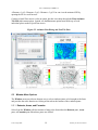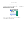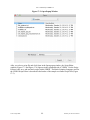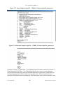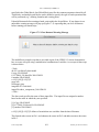
1
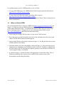
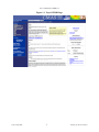
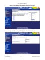
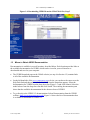
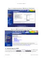
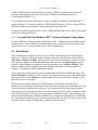
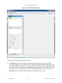
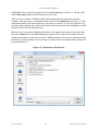
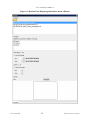
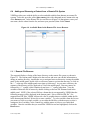
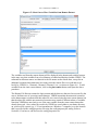
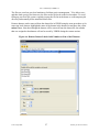
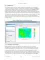
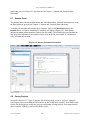
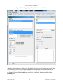
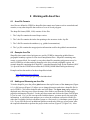
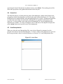
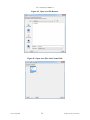
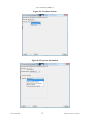
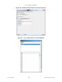
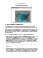
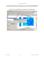
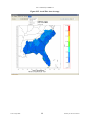
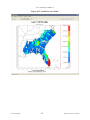
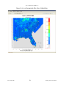
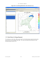
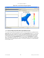
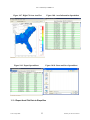
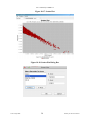
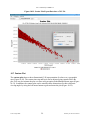
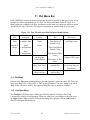
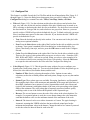
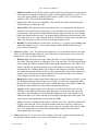
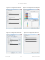
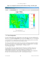
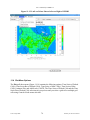
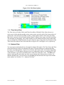
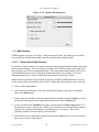
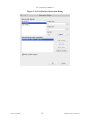
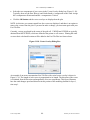
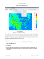
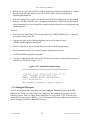
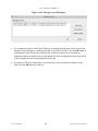
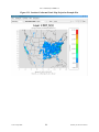
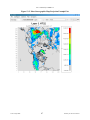
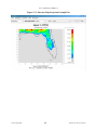
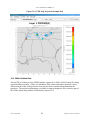
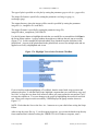
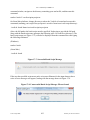
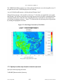
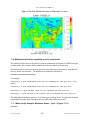
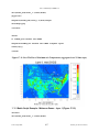
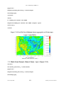
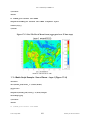
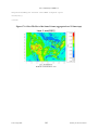
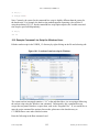
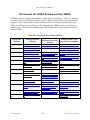
User’s Manual for VERDI 1.5
8 Working with Area Files
8.1
Area File Formats
Area files are defined in VERDI as shapefiles that contain area features such as watersheds and
counties, or any other shapefile that consists of a set of closed polygons.
The shapefile format (ESRI, 1998) consists of four files.
1. The *.shp file contains the actual shape vertices.
2. The *.shx file contains the index data pointing to the structures in the .shp file.
3. The *.dbf file contains the attributes (e.g., gridded concentrations).
4. The *.prj file contains the map projection information used for the gridded concentrations.
8.2
Example Area File
Shapefiles that contain closed polygons are used by VERDI to interpolate gridded data to
geographic boundary regions to create Areal Interpolation Plots. Shapefiles containing state,
county, or census block, for example, or any other shapefile containing polygon areas may be
used in VERDI to calculate and map formulas to the user-selected geographic regions. An
example shapefile containing the 8-digit HUC watershed boundary map for the Southeast (HUC
3) is provided in the VERDI release under the $VERDI_HOME/data/HucRegion directory.
Example on-line data archives for these shapefiles include:
http://datagateway.nrcs.usda.gov
https://www.census.gov/geo/maps-data/index.html
8.3
Adding and Removing an Area File
To load a shapefile, press the yellow plus button at the top left corner of the Areas pane (Figure
8-1). A file browser (Figure 8-2) allows you to change directories and select a shapefile file for
use in VERDI. Click on the shapefile name and click Next. The Open Area popup window is
displayed next, allowing you to select the name of the field to read from the file and supply
projection information if needed. Use the pull-down menu and click on the Name Field (Figure
8-3) to be used. If a *.prj file is not provided with the dataset, you must specify the projection
information. A pull-down menu prompts you to select the coordinate system used in the file –
either the Geographic (lat/lon) coordinate system or a Projected (x/y) coordinate system (Figure
8-4). If you select Projected, an additional pull-down menu asks what type of projection; enter
the required information to perform the project in the text box (Figure 8-5, Figure 8-6). After
UNC–Chapel Hill
34
Institute for the Environment