1
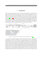
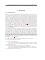
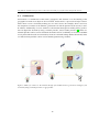
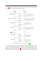
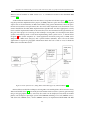
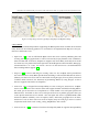
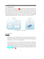
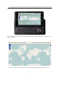
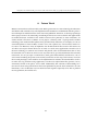
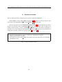
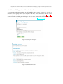
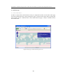
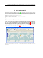
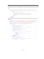
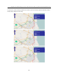
Using WFS-T in combination with geolocation for online transactional editing of geographic features through mobile browsers
on the same platform using GeoServer while MySQL was used as a data storage. For the SMILEX
client, it was developed on Java 2 Micro Edition (J2ME). Moreover, the JSR 179 location API was
implemented to achieve a user position from making use of a GPS receiver on a mobile phone.
The figure 9 below presents an overview of a communication in the SMILEX system. It allows
users not only to ask for spatial information but also to perform transactions (insert, update,
delete) on geographic features through mobile phones.
Figure 9: Prototype Communication Overview [18]
18