1
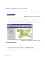
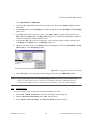
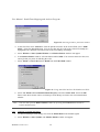
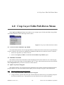
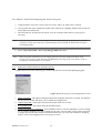
User Manual - South Platte Mapping and Analysis Program
3.2.3
Crop Demo
Agricultural data have been populated using TM (thematic mapper) 25 meter multispectral satellite
images combined with an Indian Remote Sensing (IRS-1C) 5 meter panchromatic (grey scale) to delineate
the field boundaries and determine the crop type for each parcel of land. This data will be improved and
some ground verification will take place as the project progresses.
3.2.4
Ditches, Lake, and Streams for Water District 64 (1:24k)
Digitized from USGS quads by the Colorado Division of Wildlife, Aquatics, provided to IDS by the
Northern Colorado Water Conservancy District.
3.2.5
Division 1 Wells
This theme contains wells identified in Division 1 by the State of Colorado. This theme was developed
with help from the State Engineers Office (SEO) and is populated with legal and physical identifiers when
possible.
3.2.6
Division 1 GPS Wells
As part of this effort the locations of some wells have been updated using Global Positioning System
(GPS) equipment. In some cases the locations have been changed from those in the Division 1 Wells theme.
This information can be used to estimate a more accurate value for Stream Depletion.
3.2.7
Hydrography (1:100k)
United States Department of the Interior Geological Survey (USGS) digital line graphs (DLGs)
hydrography network data were used to populate this theme. This theme contains water features as vectors
at 1:100,000 resolution. These data are grouped by their main attribute function as: rivers; streams; ditches
and canals; aqueducts; wash and ephemeral drains; flumes, siphons, and penstocks; dams and weirs;
tunnels; and undefined water features.
The DLG characterization is obtained from the MAJOR and MINOR attribute definitions assigned by
the USGS (USGS, 1983). This was updated and clipped for the Water Division 1 boundaries by the IDS
Group at Colorado State University. Technical questions and comments can be addressed to the IDS Group
or the USGS at:
Chief, National Mapping Division
U.S. Geological Survey
516 National Center
Reston, Virgina 22092
3.2.8
PLSS (Township, Range, and Section) Themes
This theme describes the Public Land Survey System for eastern Colorado including section, township
and range data obtained from USGS internet site at 30 minute resolution (1:62,000). Data was obtained in
DLG format for over 200 separate tiles covering the northeastern portion of Colorado, the associated
numeric codes were determined and the resulting coverages joined into one seamless coverage according to
the following steps:
1. Transformed original files into ARC/INFO format.
SPMAP Version 1.4.9
10