1
INTREPID User Manual
Library | Help | Top
Multi-scale edge detection wizard (T44a)
2
| Back |
processes for magnetic data. FTG data processing follows the same workflow in this
tool, including upward continuation, point picking maximum gradients, joining the
points into worms, formation of linears, and now the 3D surface clustering algorithm.
WARNING - Whilst Geodetic grids are supported, you can get into more trouble than
it may be worth. Note, we are upwards continuing, assuming a planar or flat world.
The units of upwards continuation are meters. For the Geodetic case, we internally
make these equivalent decimal degrees to follow your wishes. Also, as the points are
located to form the WORMS, the tolerances are stretched. The output projection of
derived datsets follows from the input grid.
A Lambert Conic Conformal projection is often used when a continental or very large
regional extent is involved.
In this chapter:
How to use this chapter
Overview of the Multi-scale edge detection wizard process
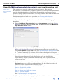
Using the Multi-scale edge detection wizard—overview (interactive only)
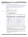
Step 1—Specify input dataset, scalar TMI grid example
Step 2—Pre-process and filter
Step 3—Calculate edge points
Step 4—Group edge points into 'worms'
Step 5 - Calculate linears
Step 7—Export results
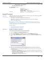
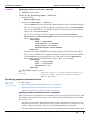
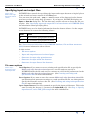
Specifying input and output files
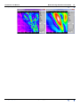
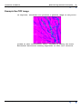
All further options are common to the previous tutorial descriptions. The next
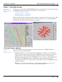
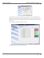
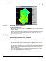
image shows the stacked “worms” for this dataset in the Intrepid Visual tool. The
amplitude field is used to colour code the polylines. The deeper, more important
contacts, are shown in red.
Apply
Exit
Task specification (.job) files
Finding out more about spectral domain operations
Glossary
References
Library | Help | Top
© 2012 Intrepid Geophysics
| Back |