1
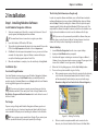
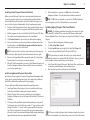
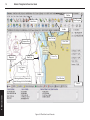
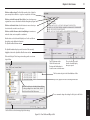
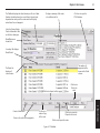
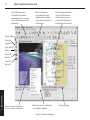
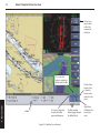
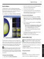
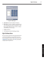
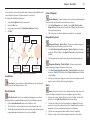
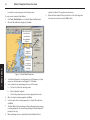
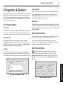
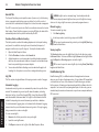
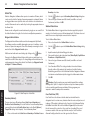
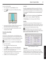
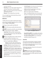
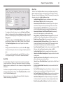
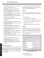
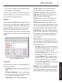
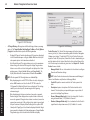
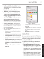
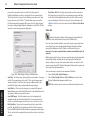
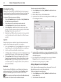
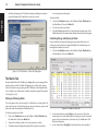
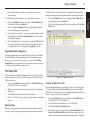
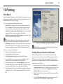
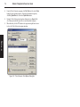
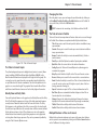
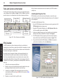
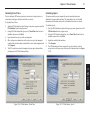
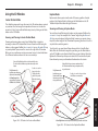
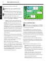
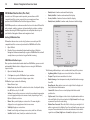
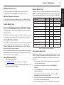
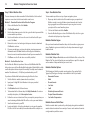
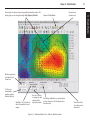
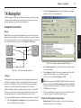
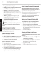
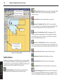
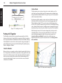
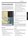
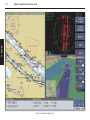
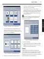
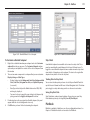
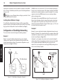
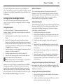
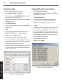
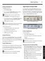
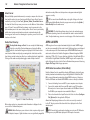
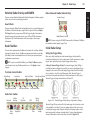
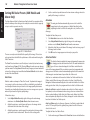
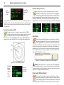
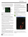
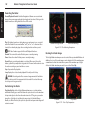
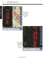
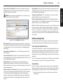
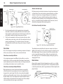
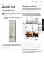
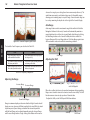
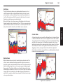
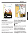
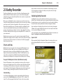
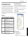
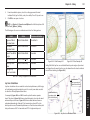
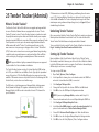
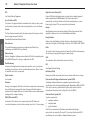
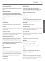
80
Nobeltec® Navigation Software User’s Guide
Tides and Currents on the NavBar
The Tides and Currents as they relate to your vessel or a particular location
can be displayed on the NavBar (see Figure 11.4). The NavBar is a tool that
provides easy access to information such as tide and current predictions.
Tide Information
High/Low Tide
Information
Change Tidal
Station
Current Information
Change Current
Station
Ebb/Flood
Information
Figure 11.4 - Tides & Currents on the NavBar
11 - Tides & Currents
ETA Calculator
Once all tide and current stations have been attached, the ETA Calculator is
ready for use.
Calculating Best Departure Time
ETA Calculation uses the tide and current information connected to your
route to provide you the best and worst departure times as well as estimated
fuel consumption.
To calculate the Best Departure Time:
1. Start the ETA Calculator by right-clicking on any route segment and click
ETA Calculator from the pop-up menu.
2. Using the ETA Calculator dialog box, select Best Departure Time from
the three available options and click Next.
3. Input your estimated average vessel speed and the earliest and latest
dates and times that you would like to depart. Click Compute.
4. The ETA Calculator will now compute your best and worst departure
times and list them in the ETA Calculator window (see Figure 11.5).
5. If you are finished with the ETA Calculator, click Done. If you want to
perform other calculations, click on the Back button.
The ETA Calculator uses tide and current predictions to calculate best
departure times, transit times, required speed and fuel consumption. In order
for the ETA Calculator to work, tide and current stations must be attached to
the various route legs in a created route.
By default, Nobeltec Navigation Software will automatically attach the
nearest tide and the nearest current station to each route leg. Because
this is done automatically using the nearest stations, there may be other
nearby stations that will have a stronger effect on your voyage and on the
calculations. In this instance, you may want to manually attach a station to a
route leg.
1. Turn on the current arrows and tide bars.
2. Move the cursor over the station that you want to attach to the route
leg. Drag and drop the station onto the nearest route leg.
3. A dotted line (see Figure 11.5) should appear between the tide or
current station and the route leg (red dotted line for currents or blue
dotted line for tides).
4. Repeat as necessary for other legs of the route.
Figure 11.5 - ETA Calculator - Best Departure Time